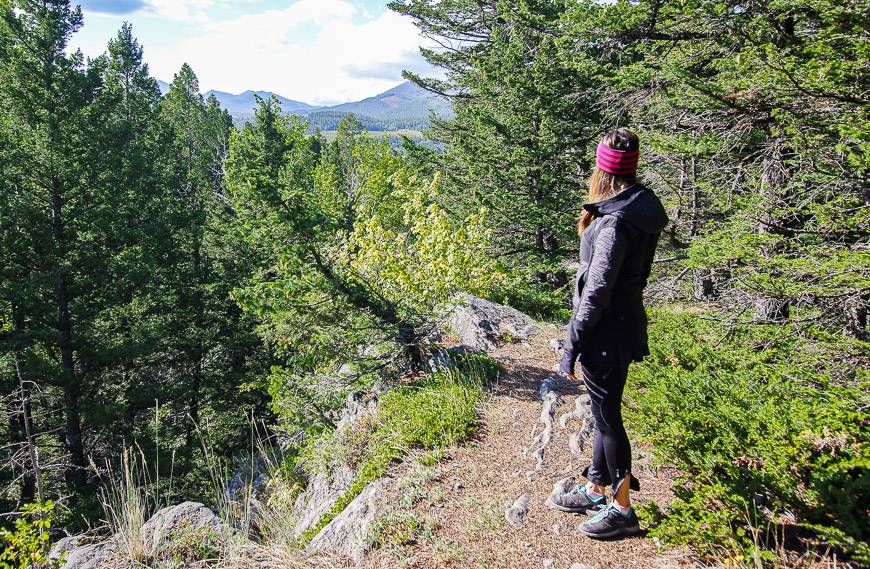
The variety of Crowsnest Pass hikes in southwest Alberta is superb and yet the Crowsnest Pass area does a great job of hiding its special places. For anyone who has regularly made the drive from Calgary or Lethbridge to Fernie, there’s a good chance that all you’ve ever seen of the Crowsnest Pass is a gas station, Tim Hortons, and of course the infamous Frank Slide.
You wouldn’t guess at the hiking treasures it harbours.
But dig beneath the surface, speak with the locals, check out Andrew Nugara’s book – Popular Day Hikes: The Castle and Crowsnest. I ‘ve got a lot of new Crowsnest Pass hikes on my wish list because of his book. The Southern Rockies Trail Guide by Joey Ambrosi is another good one for ideas.
This post includes some affiliate links. If you make a qualifying purchase through one of these links, I will receive a small percentage of the sale at no extra cost to you. Thank you very much for your support.
Location map of the Crowsnest Pass hikes
- Click on the three dots near the top right hand corner to email a copy of the map.
Top Crowsnest Pass hikes summary
Don’t forget: Let someone know what hike you’re doing and your expected time out and pack the 10 hiking essentials.
Bears: Be bear aware. Even if the chance of running into a bear is low, I’d recommend you carry easy to access bear spray. I keep mine in a bear spray holster to avoid accidentally setting it off.
Dogs: Leashed dogs are allowed on all of these hikes, but be sure to carry enough water for them, especially on the Turtle Mountain hike.
Weather: Get a weather forecast for the Crowsnest Pass area before you start the hike. Avoid Turtle Mountain in a thunder storm.
Blisters: If you’re prone to blisters, I recommend Compeed. It’s better for fast healing than anything else I’ve used and worth every penny.
Maps: Backroad Mapbooks puts out detailed maps for the Crowsnest Pass hikes. I also like Organic Maps, an offline hiking app.
Water: Plan to carry plenty of water on all hikes. If you’re running low, use water purification tablets or a collapsible squeeze bottle with a filter like this one from Lifestraw.
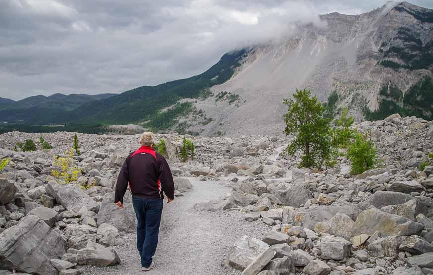
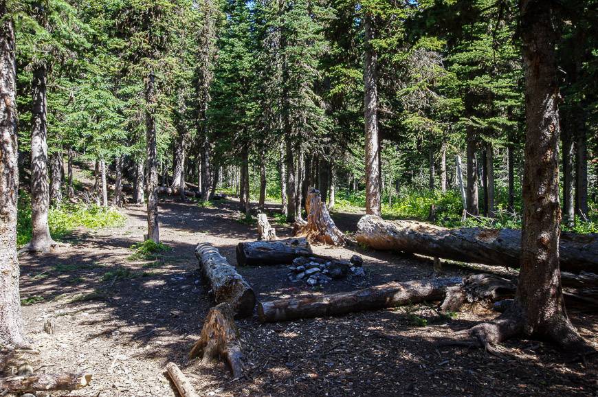
Frank Slide Interpretive Trail hike – one of the historically interesting hikes in the Crowsnest Pass area
Outside of the Frank Slide Interpretive Centre is an easy 1.5 km interpretive trail. It wanders through massive boulders left as the result of the 1903 Frank Slide.
As you hike through the slide area, you’ll likely stand in awe at the sheer scale of destruction – caused in just 90 seconds. The size of the boulders that came tumbling down is something else.
Cough up a dollar for the guidebook. Seventeen stops are described over the 1.5 kilometre long trail. It’s a good way to learn more about the history and geology of the area.

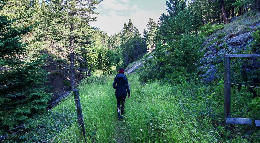
Miner’s Path hike in Coleman
The Miner’s Path, a heritage and nature trail hike in the Crowsnest Pass, is short and sweet and perfect for breaking up a drive along Highway 3. It’s also easy, family-friendly and accessible.
You’ll find the trailhead in Flumerfelt Park at the western end of Coleman, just off 76 Street.
The trail, now called the Miner’s Path was used for almost 50 years by the men working at McGillvary Mine. Every shift up to 200 men trudged up the path – which was a strenuous undertaking before bridges or stairs were added – or when it snowed.
For some miners the hike took as long as 90-minutes one way, depending on where they were living in town.
Walk the trail today and you may have a hard time imagining hundreds of miners carrying lunch buckets and wondering if they’d even return from a day in the mines.
Today the trail begins in the quiet of the woods beside a number of huge Douglas fir trees that are up to 250 years old. It climbs gently beside Nez Pearce Creek up to an intersection over the falls with a set of stairs. If you climb the stairs and follow the trail for another 200 m you will arrive at the McGillvary Mine Site. There are some remnants to be seen.
We chose to continue to Rainbow Falls, about 20 minutes from the trailhead. By the falls are some stairs that beckoned us to explore. Once at the top we continued through fields of grass before crossing the creek on wooden planks.
At the top of a steep hill we turned back in the direction of the trailhead and enjoyed delightful cliff top walking with some peek a boo views to the mountains. In short order we found the stairs and completed the loop. In under 10 minutes we were back at the car.
In reading the guide book it suggests that beyond Rainbow Falls you are on private property. There were no signs – and there were newly built stairs and trails – so decide for yourself whether you should go.
This is a terrific, family friendly hike in the Crowsnest Pass that will take 45 – 90 minutes depending on how many side trails you take and how much time you spend looking for mining structures or enjoying nature.


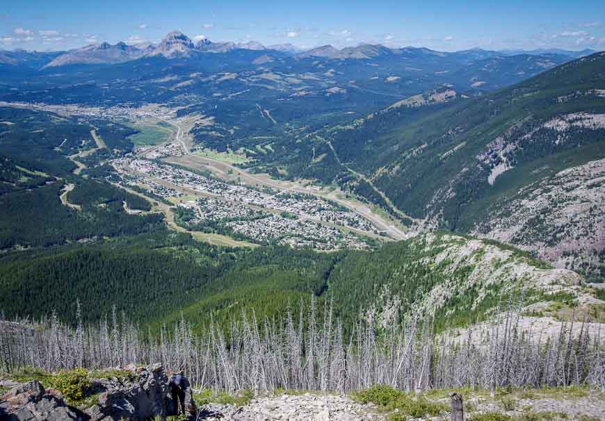
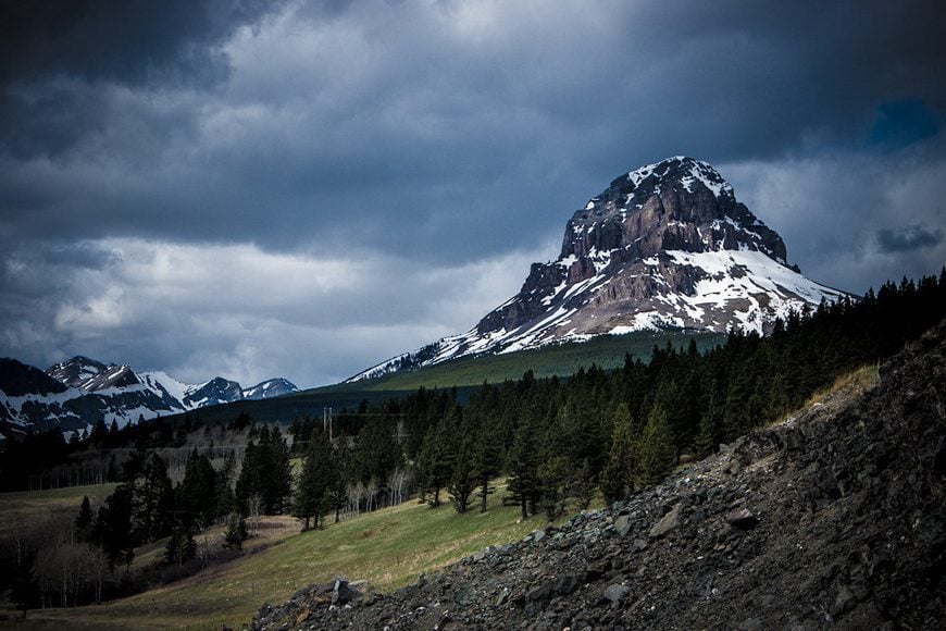
Crowsnest Mountain hike – one of the hard Crowsnest Pass hikes
When you drive west on Highway 3 you can’t help but notice Crowsnest Mountain to the north. Called The Crow by locals, it’s a mountain that requires scrambling skills.
All told it’s an 11.6 km return hike with an elevation gain of 1,040 m. From the summit enjoy spectacular views of the Crowsnest Valley, the High Rock Range to the west, Gould Dome, and Tornado Mountain to the north and the Livingstone Range and Porcupine Hills to the east and northeast.
To get to the trailhead from Highway 3, turn right (north) on Allison Creek/Atlas Road and follow it for 9.7 km. The turnoff is easy to find and its just 5 km west of Coleman. Turn right, continue for 100 m and you’re at the trailhead.
This was one hike on my list for the summer of 2023. A full route description is on the Trailforks website. You should be comfortable with scrambling, scree, exposure and loose rocks to tackle this hike.
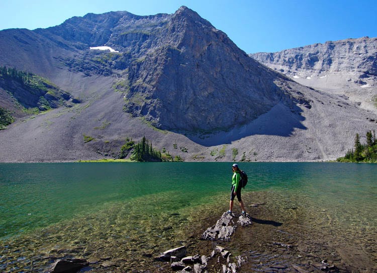
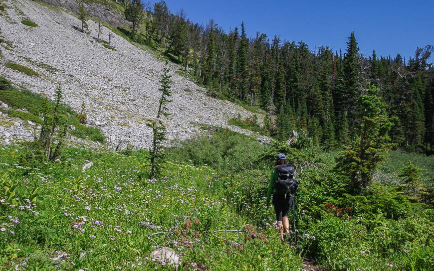
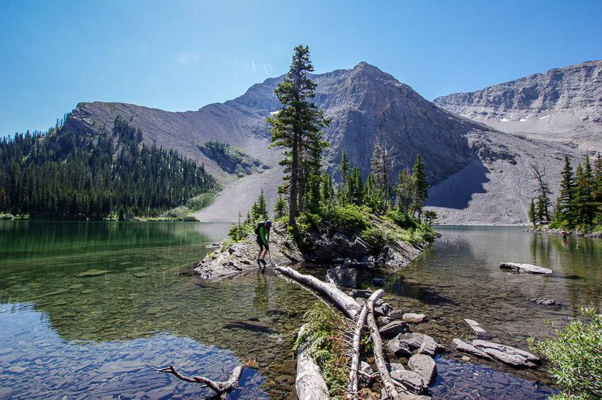
Window Mountain Lake hike in the Crowsnest Pass area
With a glittering blue lake surrounded by mountains on three sides, this is a beautiful summer time hiking destination.
Once you get here you’ll want to spend the day lounging near the water, fishing for rainbow trout, swimming or walking around the entire lake on an easy to follow path. In early August the wildflowers are stunning.
Although it’s only a 2 km one way hike from the trailhead (with a total of 210 metres of elevation gain), not many people actually drive the whole of the final two kilometres.
I was a complete wimp and parked my car on a huge shoulder on the Atlas Road and walked the two kilometres to the trailhead rather than risk bottoming out. (I had a new car and have had a few bad experiences in the past – cue the pierced fuel tank in the middle of nowhere. As an FYI, chewing gum held and got us home via a 7-hour drive.)
Most people seem to drive the first kilometre, park and then walk the second kilometre. You could save yourself a lot of grief if you do this.
The trail itself is extremely steep as you climb a 150 metre escarpment right off the bat. We had some teenagers in front of us who did a lot of whining about the initial part of the hike.
But really, you can dispatch with the steep section very quickly. And then it’s a gradual walk through woods that reminded me more of BC than Alberta until you reach the lake.
There are several primitive campsites on the lake and they’re free. The lake is a popular spot and once you get there you’ll certainly see why.
To get to the Window Mountain Lake trailhead it’s a bit of a drive in from Highway 3. Drive four kilometres past Coleman and look for Allison Creek Road. Turn north and follow it for 4 kilometres on pavement.
Continue straight when the pavement dies on the Atlas Road for a total of 16.5 kilometres from Highway 3. Turn left at that point – if you don’t mind driving over a gully. Continue for 1-2 kilometres depending on what kind of vehicle you have. Alternatively park across from the road in a huge turn-off area. Supposedly this is a logging road so be prepared to get out of the way quickly.


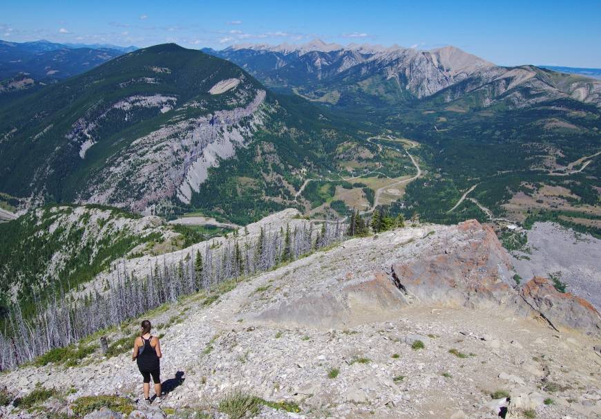
Turtle Mountain hike from Blairmore – one of the tougher Crowsnest Pass hikes
If you want to get your heart racing – for a couple of reasons – do the 3.1 km one way hike to the summit of Turtle Mountain. It is here that Canada’s second largest landslide occurred on April 29, 1903.
Eighty two million tons broke away from the mountain – causing the deaths of about 70 people and burying a huge area which you can see from the top. And it’s expected that at some point another chunk will break away but no one knows when. (There is monitoring equipment in place on the top of the South Peak.)
This is a steep hike that will get your heart rate up in no time, especially at the beginning. But there are points where it moderates and although there is no formally marked trail, it’s popular enough that you can find your way to the top on well-worn trails though if the weather deteriorates you should have good route finding skills.
Near the top you get very close to the precipice. You’ll have to decide whether it’s worth peering over the edge.
There is the option to continue to the South Peak. Although it’s not far, between the down climbing to the saddle, the route-finding through the boulders and the climb up, it can take the better part of an hour one way. We didn’t have another two hours so we turned back.
All in all the Turtle Mountain hike offers incredible views, a workout with 780 m of elevation gain, and the chance to see one of Canada’s biggest landslides from the top.
Finding the trailhead to the Turtle Mountain hike
To get to the trailhead for Turtle Mountain turn onto 133rd Street in Blairmore from Highway 3. Turn left at 18th Avenue, and right on 135th Street.
At the T-intersection with 15th Avenue turn right and continue for a block. Take the dirt road leading left across from the cul-de-sac and follow it for about 400 m. Park at the top of the dip. The trailhead is marked by painted yellow rocks near the base of the cliff, accessed by walking down the dip and then up the short, steep hill on your right.


More Crowsnest Pass hikes to think about
The five hikes described provide a great cross-section of what’s available in the Crowsnest Pass area.
Another popular hike on the tip of everyone’s tongue we spoke with is the 6.2 km one way hike from York Creek Road to the Plane Crash site. That one is at the top of my wish list now, along with 13 km return Livingstone Ridge (South Peak), an advanced hike or scramble.
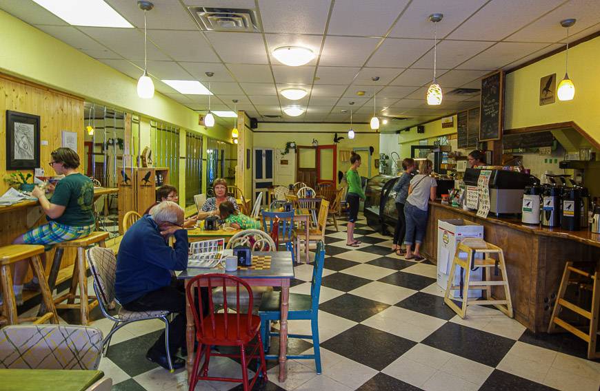
Where to eat post Crowsnest Pass hikes
If you have time at the end of your hike I highly recommend a stop at the Stone’s Throw Cafe at 13019 20th Avenue in Blairmore.
The coffee is great and so are the baked goods. I’ve also had a good meal at the Rum Runner Restaurant and Pub.
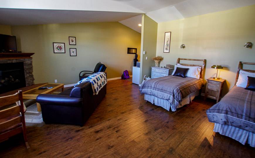
Where to stay in the Crowsnest Pass Area
Check out Country Encounters in Coleman. I stayed for two nights in a well-appointed room and thoroughly enjoyed the great breakfast (and dinner if you plan in advance.)
If you prefer a hotel chain check out Travelodge by Wyndham Blairmore.
Further reading on things to do in southern Alberta
- 10+ Fabulous Hikes in Waterton Lakes National Park
- A Visit to Southern Alberta’s Castle Provincial Park
- 9 Great Things to do in the Crowsnest Pass Area
- Alberta’s Fabulous Table Mountain Hike
- A Visit to Writing on Stone Provincial Park
Click on the photo to bookmark to your Pinterest board.
