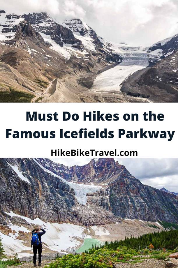
Not only is Alberta’s Icefields Parkway a spectacular stretch of road to drive, it offers quick access to world-class hikes (and backpacking trips) with most trailheads immediately beside the highway. Over its 232 km (the distance between Lake Louise and Jasper) there are roughly 30 hikes or backpacking trips you can do. All are in either Banff or Jasper National Park.
Enjoy one or more of these nine stunning Icefields Parkway hikes. Most of them can be done as a family, perhaps with a little coaxing along the way except perhaps Sunset Lookout. Many take only a few hours so you can easily do a couple of hikes on one of Canada’s most scenic drives from Lake Louise to Jasper.
There are also many multi-day hiking trips that take off from the Icefields Parkway. A few to consider are North Molar Pass and Fish Lakes, Glacier Lake, and the Brazeau Loop.
This post includes some affiliate links. If you make a qualifying purchase through one of these links, I may receive a small percentage of the sale at no extra cost to you. Thank you very much for your support.
Icefields Parkway hikes summary
Permits: You will need a National Parks pass to access any of the Icefields Parkway hikes. You can purchase online or at the entrance gates to the Icefields Parkway.
Bears: Even though I’ve never seen a grizzly bear on any hike, it’s imperative you carry bear spray. I would recommend that you keep it in a bear spray holster so you don’t set it off by mistake.
Map: I highly recommend picking up the Icefields Parkway Waterproof Map and Guide before the start of your trip. It will really help you get oriented.
My top picks: The top Icefields Parkway hikes in my books include Wilcox Pass, Parker Ridge, Nigel Pass, Toe of the Glacier, Helen Lake, Beauty Creek, Sunset Lookout, Sunwapta Falls, and Edith Cavell Meadows.
Location map of the Icefields Parkway hikes
Parker Ridge hike
Distance: 4 km round trip to the saddle
Elevation: 272 m or 892 feet to the saddle
Difficulty: Easy
Time needed: 1 – 2 hours
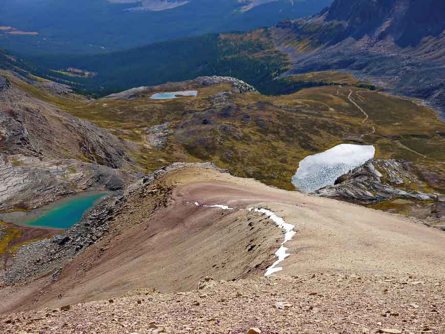
The Parker Ridge hike is one of the most popular Icefields Parkway hikes, so you’ll almost certainly not be alone. The scenic reward for the effort on this 4 km return hike is very high.
Within minutes of leaving the parking lot on the Icefields Parkway, you are treated to expansive views of mountains and the Icefields Parkway looking north. You can even see the Wilcox Pass area (see description below) within minutes of hiking.
Leave the highway noise after you’ve reached the top of the switchbacks and enter a world full of 3,000 m peaks. The hiking is easy now and the views of the Saskatchewan Glacier are nothing short of magnificent.
It’s possible to continue along the trail across a scree-covered slope until it fades into a goat trail. But before you retrace your steps, stand in awe of the tiny emerald-green lake that pulls your eyes downward and marvel at the scene before you.
You can knock off the hike to the saddle in under two hours. There is the option to crest the ridge (most people do not) but that adds another seven kilometres and 268 m of climbing.
Getting to the Parker Ridge Trailhead
The Parker Ridge Trailhead is on the south side of the highway close to the Hilda Creek Hostel. There’s a big parking lot so you won’t have any difficulty finding it. It’s 41 km north of Saskatchewan River Crossing and 9 km south of the Columbia Icefield Discovery Centre.
Recommended read: The Best Hikes in Jasper National Park.
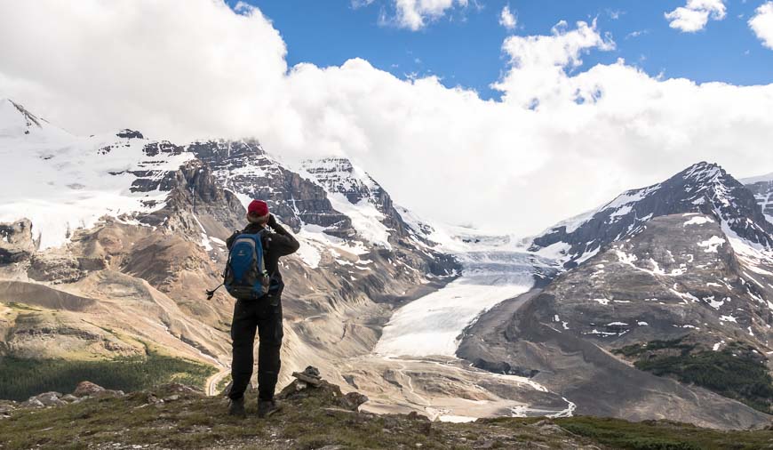
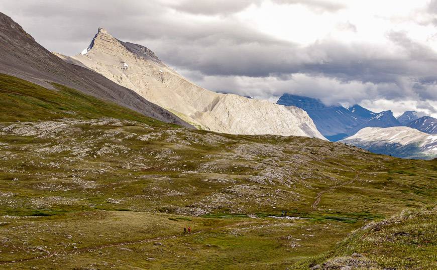
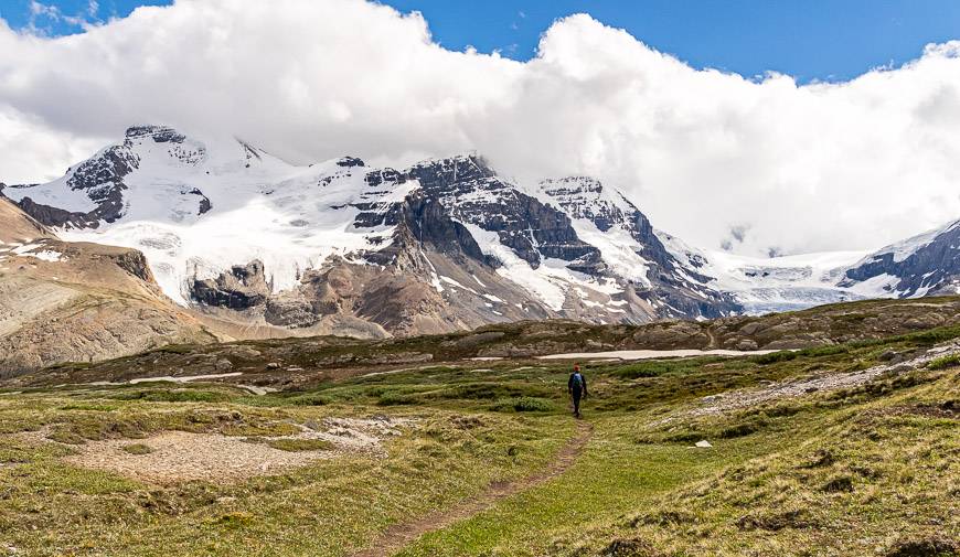
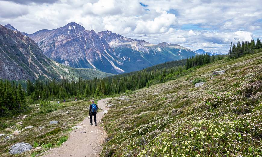
Wilcox Pass hike – One of the premier Icefields Parkway hikes
Distance: 6.8 km (4.2 miles) return to Wilcox Pass, 9.4 km (5.8 miles) return to Wilcox Ridge. There is an option to continue for 7 km beyond the Wilcox Pass summit to descend Tangle Creek and end up back on the Icefields Parkway at Tangle Falls.
Elevation: 335 m or 1,099 feet
Difficulty: Easy
Time needed: 2 – 3 hours return to Wilcox Pass
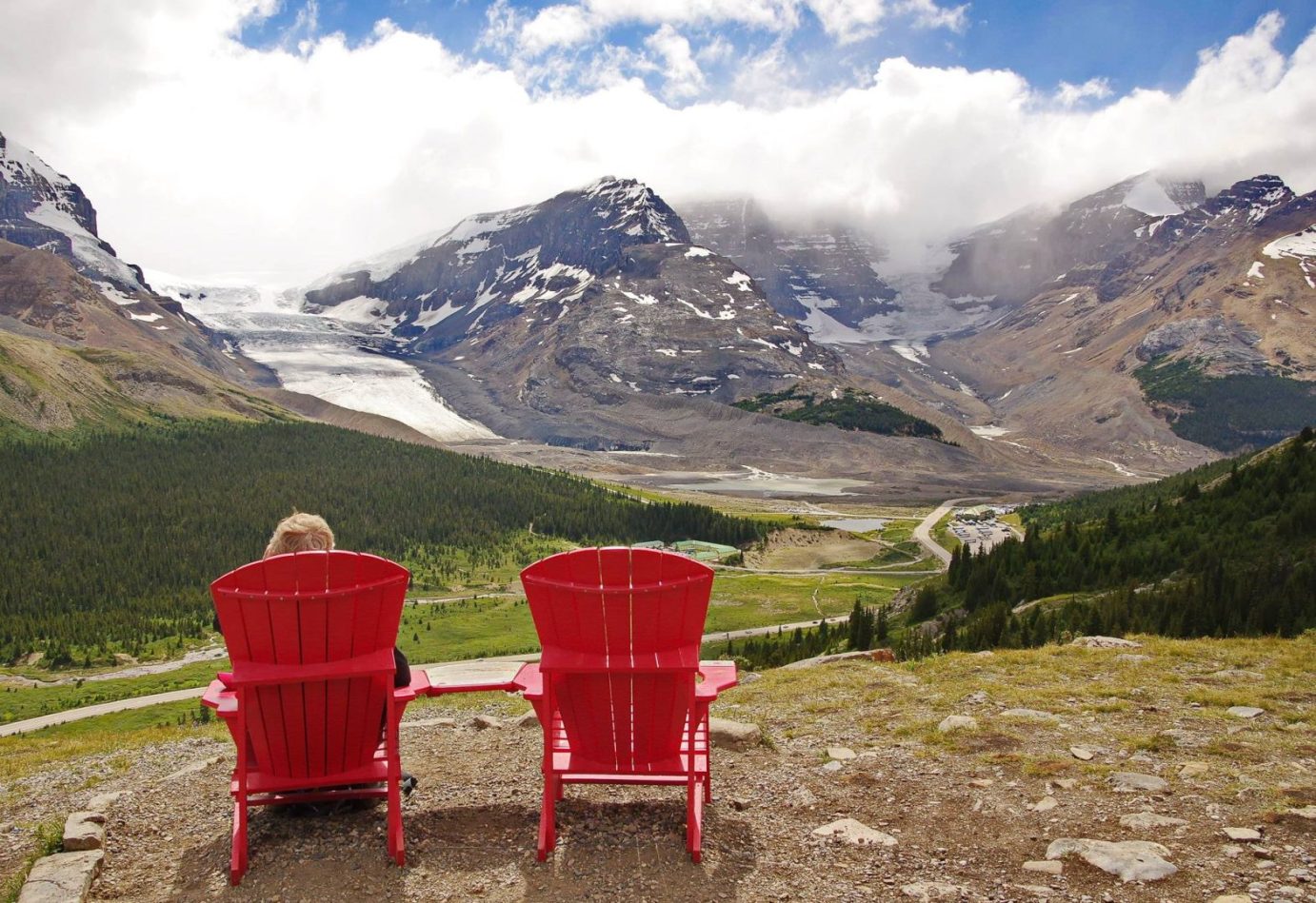
Initially the Wilcox Pass hike is steep (and it will be slippery if it’s wet) but within 15 minutes you pop out of the trees and straight ahead, staring you in the face, is the Athabasca Glacier. That view in itself makes it one of the top Icefields Parkway hikes.
Keep going because in short order you’ll see the red chairs Parks Canada has placed in scenic spots around the country. Sit down and take in the view.
When you’ve had your fill continue upwards until you reach the tussock, flower filled meadows at the 2 km mark. Keep an eye out for bighorn sheep as you continue to saunter across the meadows to the pass.
From the pass you can return; or continue on a trail up to the ridgeline directly above the Icefield Centre for even more magnificent views.
Or continue across the tundra to the Tangle Creek drainage. That trail comes out by the Glacier Skywalk on the Icefields Parkway but getting back can be tricky. You’ll either have to retrace your steps (making it a 22 km hike) or hitchhike back to your vehicle.
Finding the Wilcox Pass Trailhead
The trailhead is on the north side of the Icefields Parkway, just 2.8 km south of the Columbia Icefields Discovery Centre. The Wilcox Creek Campground is just beyond the parking at the trailhead.
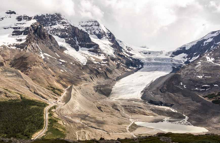
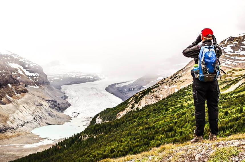
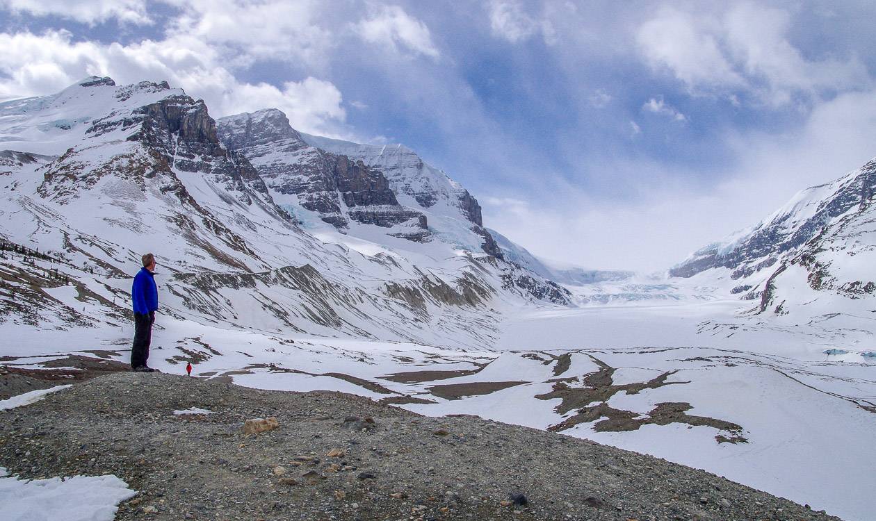
Toe of the Athabasca Glacier hike
Distance: 2.0 km or 1.2 miles return
Elevation gain: 60 m or 197 feet
Difficulty: Easy
Time needed: 45 – 60 minutes
From the kiosk at the corner of the parking lot, cross a footbridge and follow a trail as it winds uphill. The trail steepens as you climb a bench with a view of the glacier. From the highpoint on the trail loop back across a rock slab overlooking Sunwapta Lake to the parking lot.
Finding the trailhead: Take the Road to the Glacier across from the Icefield Centre. Drive 1.0 km to the parking lot.
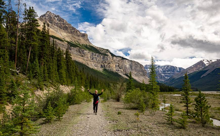
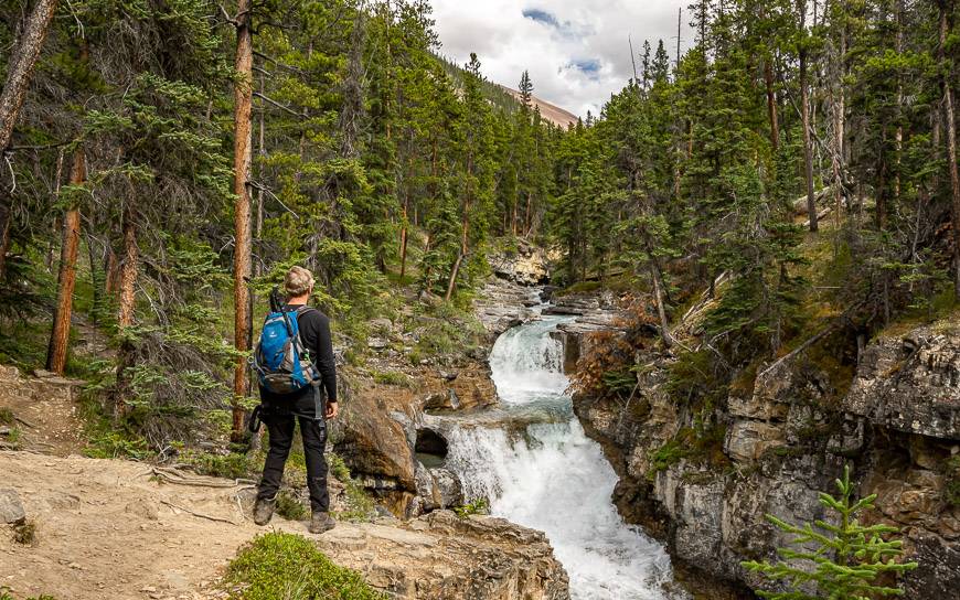
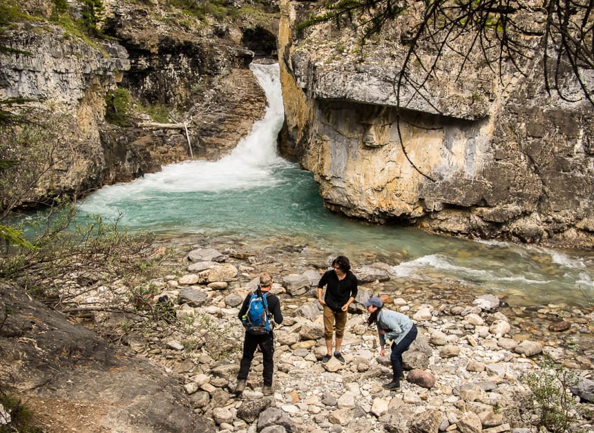
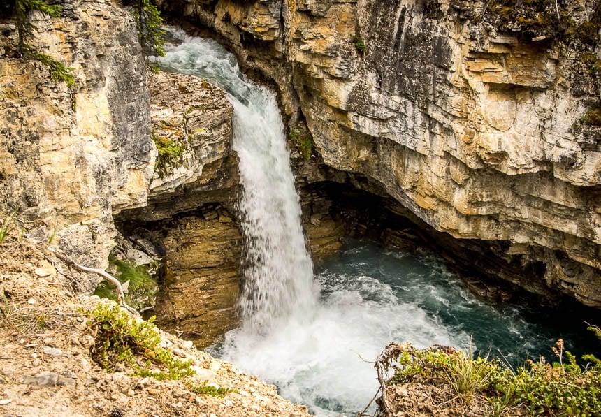
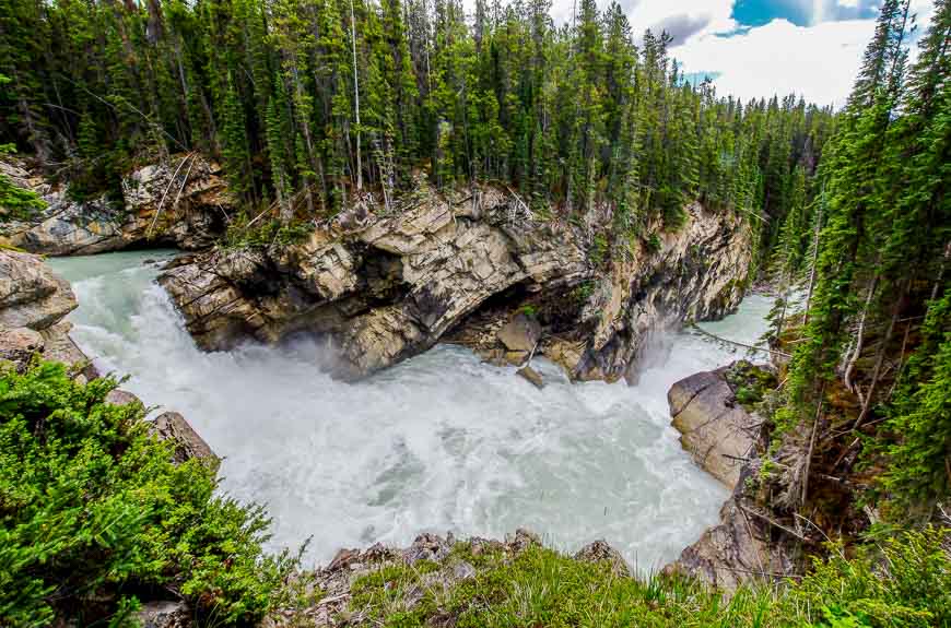
Beauty Creek – one of the little known Icefields Parkway hikes
Distance: 3.6 km (2.2 miles) round trip
Elevation gain: 40 m or 131 feet
Difficulty: Easy
Time needed: 60 – 90 minutes
The Beauty Creek hike was a huge surprise to me. It’s reminiscent of both Johnston and Maligne Canyons, but without the crowds.
John and I saw two people over a couple of hours. Its easy and family-friendly but you will have to watch that your kids don’t get too close to the edge in some places. Pair the hike with a picnic and you’ll have a fantastic half day of fun.
The hike starts off pancake flat along a trail that parallels the Icefield Parkway heading south. Hike through some trees and proceed south (right) along the old highway when you come to a fork. Beauty Creek is reached in another 0.6 km – and then the scenery explodes.
Walk on a well-used trail up the canyon to reach Stanley Falls at the 1.6 km mark. You can still keep going – and in fact the canyon scenery continues to deliver. We turned around when the trail started to disappear into a hill but adventuresome folks will want to take it as far as possible.
Getting to the Beauty Creek Trailhead
This trailhead is not well-marked. Look for a pull-off on the east side of the highway, 15.5 km north of the Columbia Icefield Discovery Centre. There is a hiker sign but nothing that says Beauty Creek.
If you reach the Beauty Creek Hostel on the Icefields Parkway you’ve gone 2 km too far.
Read: The Beauty Creek Hike to Stanley Falls in Alberta
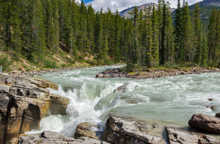
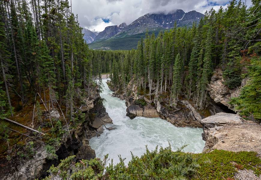
Lower Sunwapta Falls – one of the easy Icefield Parkway hikes
Distance: 3.2 km or 2.0 miles round trip
Elevation gain: 72 m or 236 feet
Difficulty: Easy
Time needed: 1 hour
You won’t avoid people, at least initially as the throngs have come to see Sunwapta Falls, and for good reason. The waterfalls shoot through a narrow cleft with terrifying force so they are an amazing sight to see.
Almost no one continues to Lower Sunwapta Falls, just 1.6 km away. And yet Lower Sunwapta Falls and the trail are also very beautiful.
To find the trail to the Lower Sunwapta Falls, stay on the east side of the river until the pavement ends. Look for a sign and then follow the trail as it leads you gently down through the woods with peek-a-boo canyon views and a couple of excellent lookouts.
The trail peters out into the woods after you reach the last waterfall in the canyon at about the two kilometre mark. It’s a gentle ascent to return to the parking lot.
Look for Sunwapta Falls on the west side of the Icefields Parkway. It’s 55 km south of Jasper and very well signed. Follow the dirt road to the parking lot. The resort is a good place to grab a meal or picnic supplies. And they make a decent latte too.
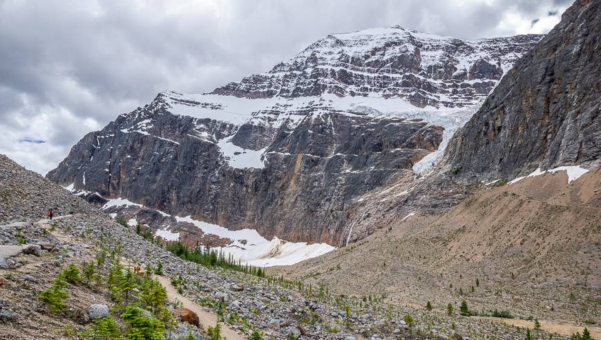
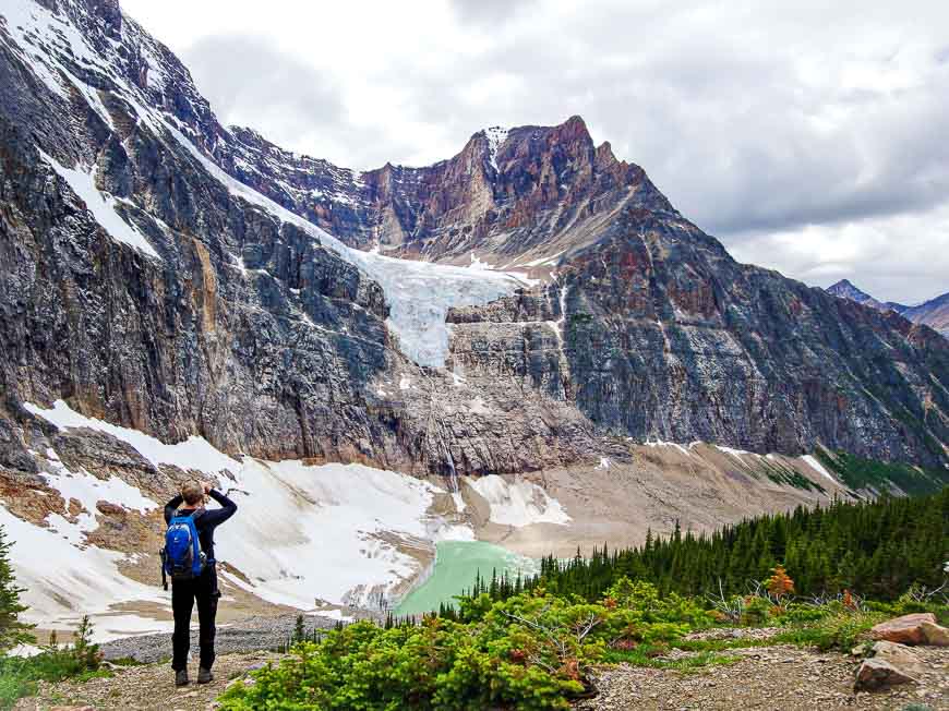
Cavell Meadows – busy but enjoy in-your-face glacier views
Distance: 6.1 km (3.8 mile) loop with additional mileage possible if you add side trails to viewpoints
Elevation gain: 400 m or 1,312 feet
Difficulty: Easy to moderate depending on how much hiking you do
Time needed: Approximately 2 – 2.5 hours round trip
Unless you visit early in the morning or late in the day, you will be sharing the Path of the Glacier and Cavell Meadows trail with lots of people and the occasional marmot.
But in my opinion, this is a must do hike for the fantastic views from different angles of the Angel Glacier tumbling down the north face of Mt. Edith Cavell. Some of the views include the iceberg laden Cavell Pond below Angel Glacier.
The Cavell Meadows hike starts on the Path of the Glacier trail but after 500 m it goes left and climbs a lateral moraine. The trail is steep in places but switchbacks make it manageable.
Make a loop and if you’re visiting in July, you’ll see meadows starting to fill with glacier lilies and globeflowers. Bring a picnic and park yourself at one of the viewpoints. Fill your soul with the views.
Getting to the Edith Cavell Meadows trailhead
From the Icefields Parkway, turn west onto Highway 93A, the road that takes you past Athabasca Falls. (Definitely worth a visit too.) The turnoff is 7.2 km south of Jasper.
Stay on this road for 12.5 km until you reach Mount Edith Cavell Road. Follow it as it winds for 27 km up to the parking lot, located shortly after passing the Tonquin Valley Trailhead. Cross your fingers you don’t have to follow some slow poke on the way up or down.
More hikes on the Icefields Parkway I’d recommend
Three other hikes I’ve done off the Icefields Parkway I’d highly recommend include the hike to Nigel Pass, the hike to the ridge above Helen Lake and the Sunset Pass hike. Bow Falls is also worthwhile.
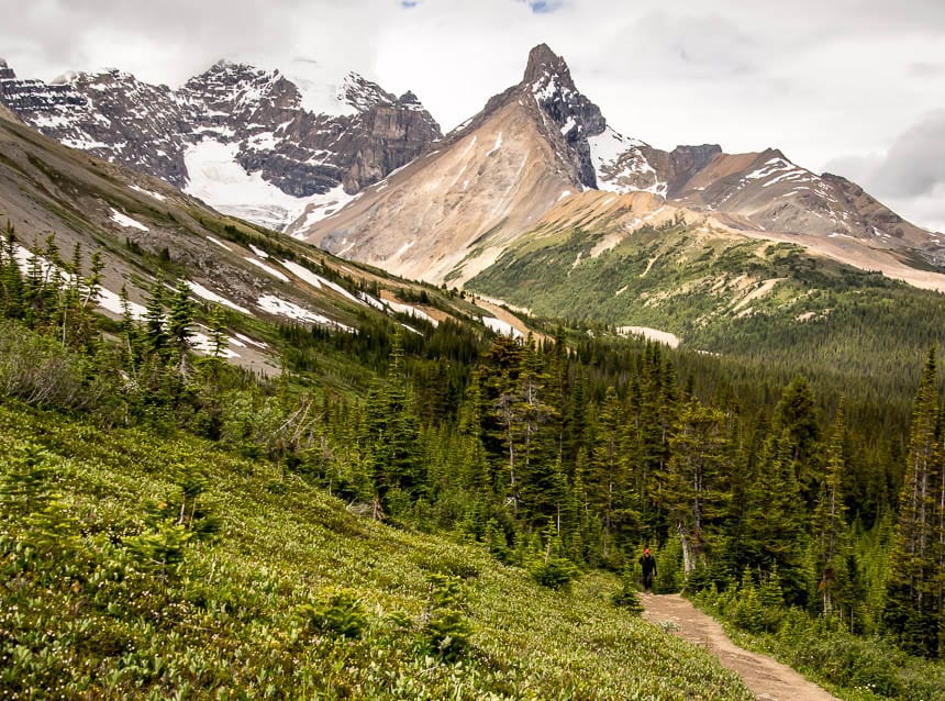
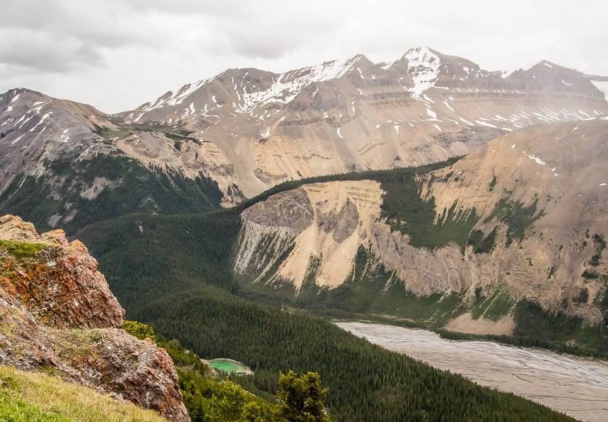
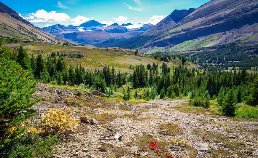
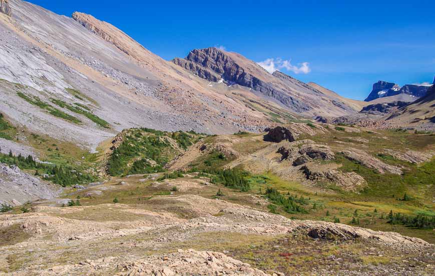
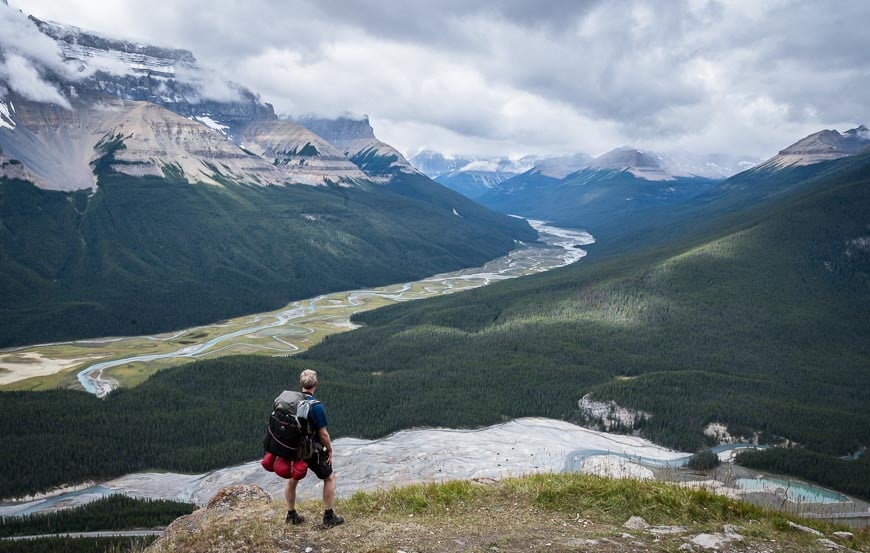
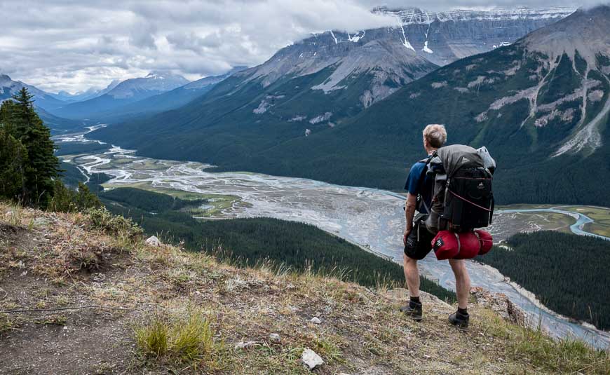
Nigel Pass hike on the Icefields Parkway
Distance: 14.4 km (8.9 miles) round trip
Elevation gain: 365 m or 1,197 feet
Time needed: 4.5 – 6 hours
Level of difficulty: Easy to moderate.
The 14.4 km Nigel Pass hike takes you gradually up to Nigel Pass, an austere lookout that offers great vistas.
Enjoy views down to the Brazeau River, and also over to Parker Ridge and Mt. Saskatchewan. Rock hop across the Brazeau River if you want to continue exploring.
If you turn right (southeast) after crossing the river you can continue to Upper Brazeau Canyon, Cataract Lake and then onto to Cataract Pass. There is wild camping in the White Goat Wilderness Area and no reservations are needed.
If you go left after crossing the Brazeau River you’ll end up on the fabulous Brazeau Loop trail – a multi-day backpacking trip that requires reservations.
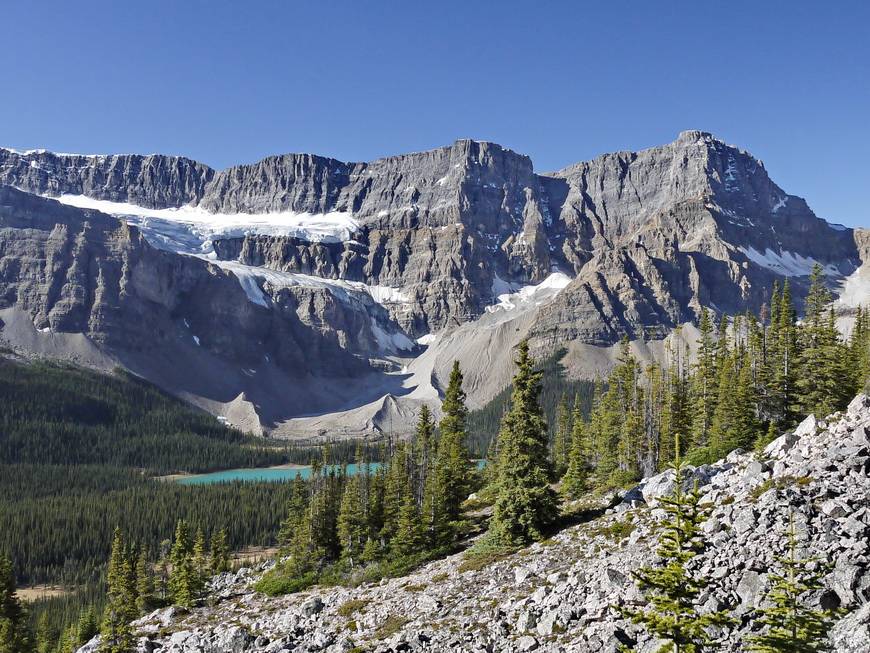
Helen Lake hike – one of the Icefields Parkway hikes that is tops for wildflowers
Distance: 14 km (8.7 miles) return to the ridge above Helen Lake
Elevation: 550 m (1,800 feet) to the ridge, plus an additional 493 m (1,617 feet) to Cirque Peak
Difficulty: Easy for the ridge and moderate to hard for Cirque Peak
Time needed: Approximately 4 hours return for the ridge, 6 hours for Cirque Peak
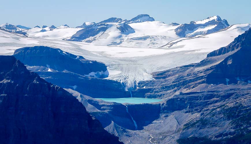
The 14 km return hike to the ridge above Helen Lake has just 550 m of vertical gain. There is the option to climb Cirque Peak. This hike in particular offers stupendous views of Crowfoot Mountain and the Crowfoot Glacier.
In the height of summer, it’s considered to be one of the top wildflower hikes in the Rockies. It’s one of the premier Icefields Parkway hikes.
Sunset Lookout hike
Distance: 8.4 km (5.2 miles) return
Elevation gain: 725 m or 2,380 feet
Difficulty: Moderate – though it is a steep one.
Time needed: 2.5 – 3 hours
The Sunset Lookout hike is not one of the well known Icefields Parkway hikes, perhaps because there isn’t any signage on the highway though there is a decent sized parking lot. This one isn’t as family-friendly as the others as its very steep.
All told it’s a 8.4 km return hike with 686 m of elevation gain. The views from the lookout of the Icefields Parkway and beyond are superb.
Where to stay along the Icefields Parkway
If you’re a camper read this post – Everything you need to know about camping on the Icefields Parkway.
However if you’re after a hotel or motel check out some of these suggestions.
Lake Louise
The Fairmont Chateau Lake Louise enjoys the best views of the lake though it comes with a price. Deer Lodge is a short walk away from Lake Louise. Their updated rooms are great.
Baker Creek by Basecamp offers cozy log cabins or check out the affordable hostel option in Lake Louise.
Saskatchewan River Crossing Area
You have a few choices, mostly hostels. Before you reach Saskatchewan River Crossing there is the option of the Mosquito Creek hostel. The Rampart Creek Wilderness Hostel is just north of Saskatchewan River Crossing. Your final hostel option is Hilda Creek Wilderness Hostel, 42 kilometres north of Saskatchewan River Crossing.
For a motel check out The Crossing Resort especially if you also want to explore the David Thompson Highway.
Sunwapta Falls
Spend a night or two at the Sunwapta Falls Rocky Mountain Lodge about 100 km north of Saskatchewan River Crossing.
The Athabasca Falls hostel is a less expensive option. It’s located 23 km north of Sunwapta Falls.
Columbia Icefields
If you want to start the morning with a glacier view book The Glacier View Lodge at the Icefield Centre or drive 17 kilometres north of the Columbia Icefields to reach the Beauty Creek Hostel.
Jasper
For a great location with a price choose the Fairmont Jasper Park Lodge.
An affordable option is the Maligne Canyon Hostel.
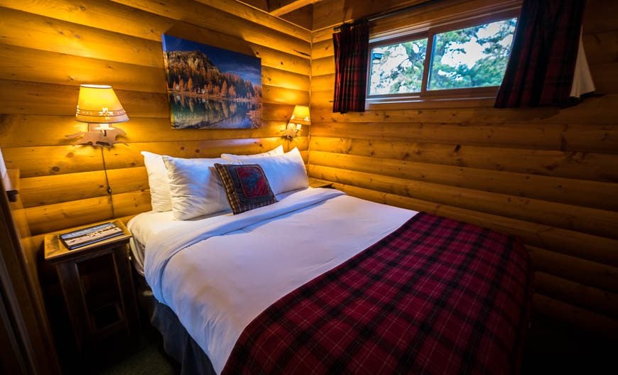
I like the look of The Crimson Jasper though I have never stayed here.
If you want to be on a lake with lots of activities the Pyramid Lake Resort would be an excellent option. But for a main street location in Jasper I think Whistler’s Inn is a great choice.
Click on the photo to bookmark to your Pinterest boards.