Before you even get a whiff of the Long Range Traverse, the premier backpacking trail on Canada’s east coast, you must get a full orientation by staff at the Gros Morne National Park Visitor Center. And you need to be mentally and physically prepared as the Long Range Traverse is no ordinary multi-day hike.
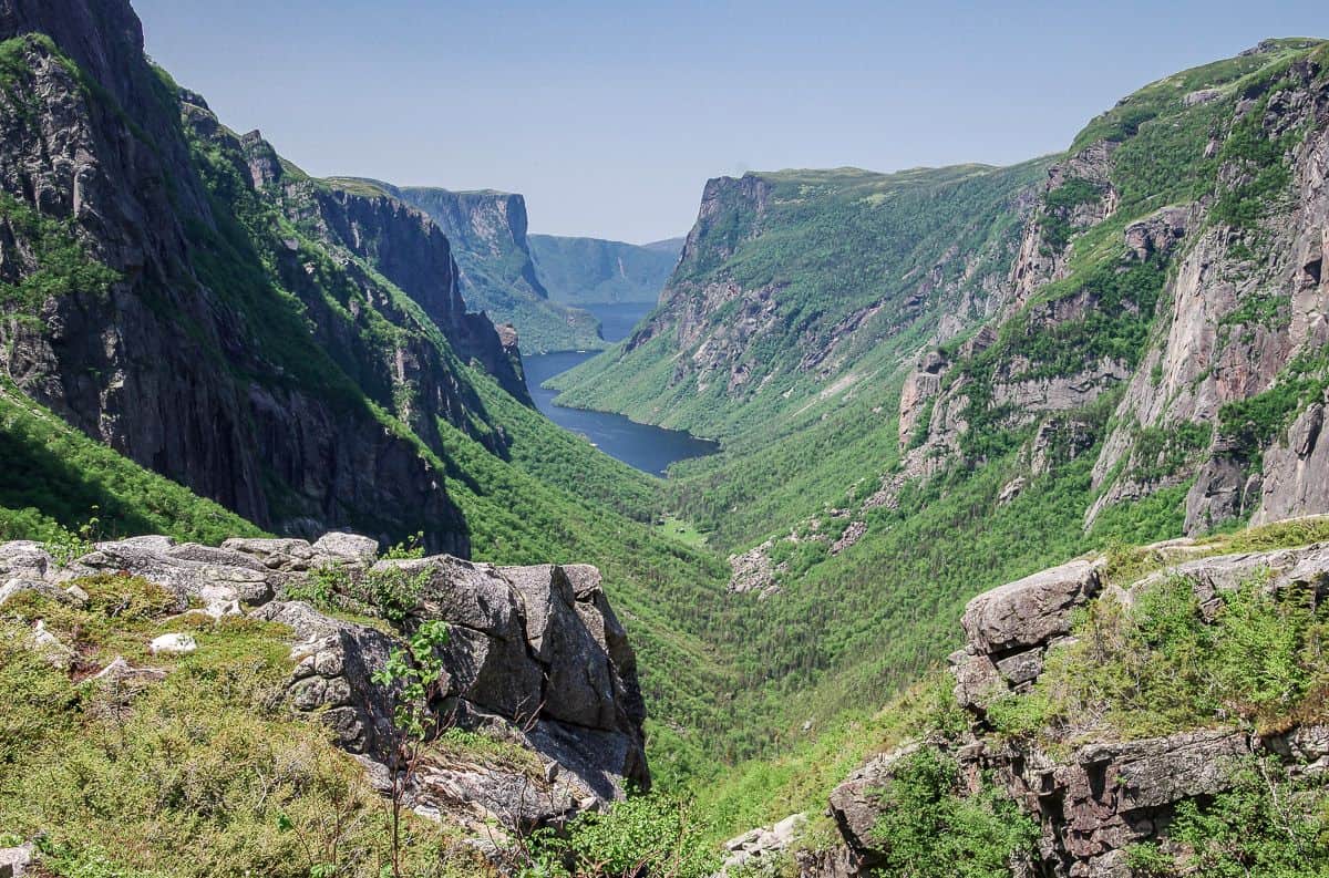
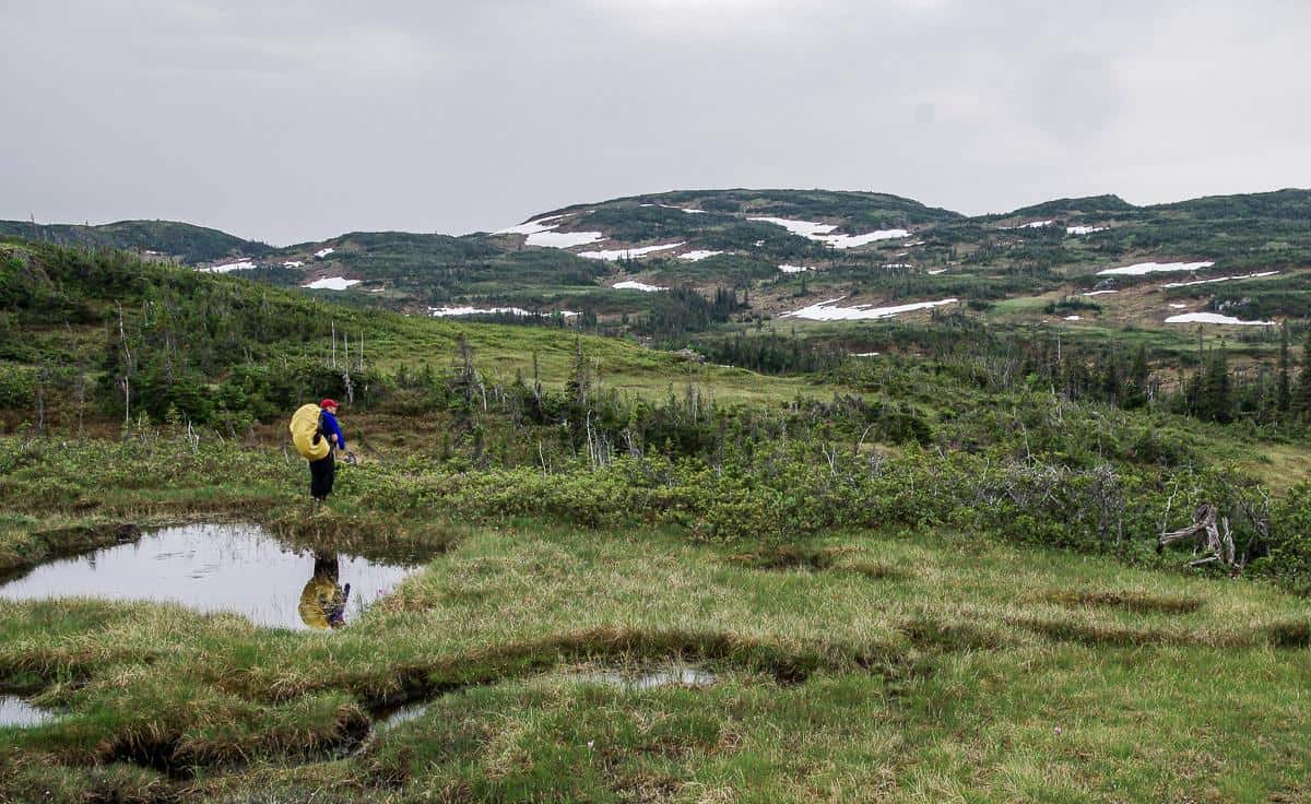
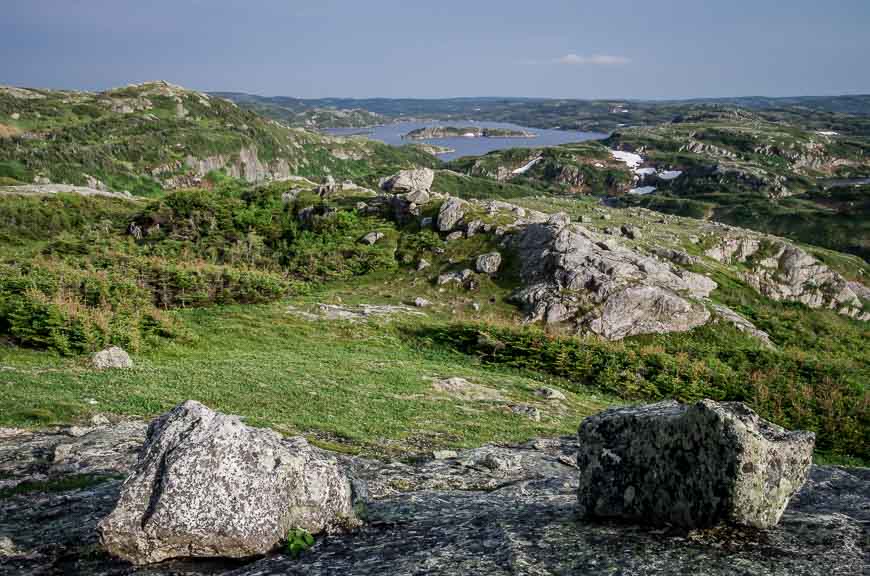
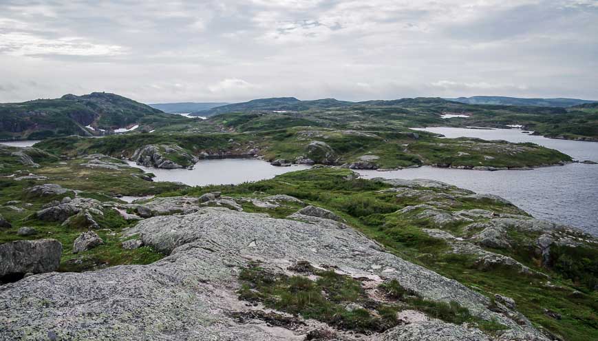
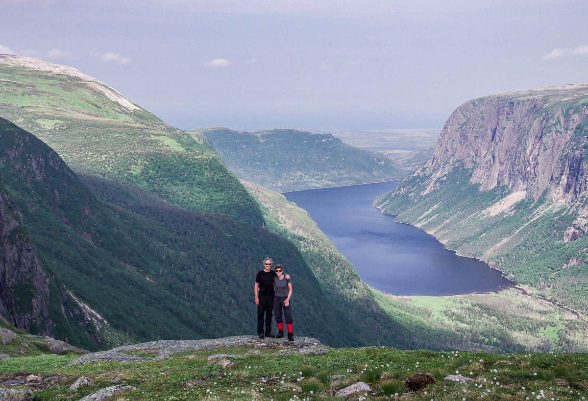
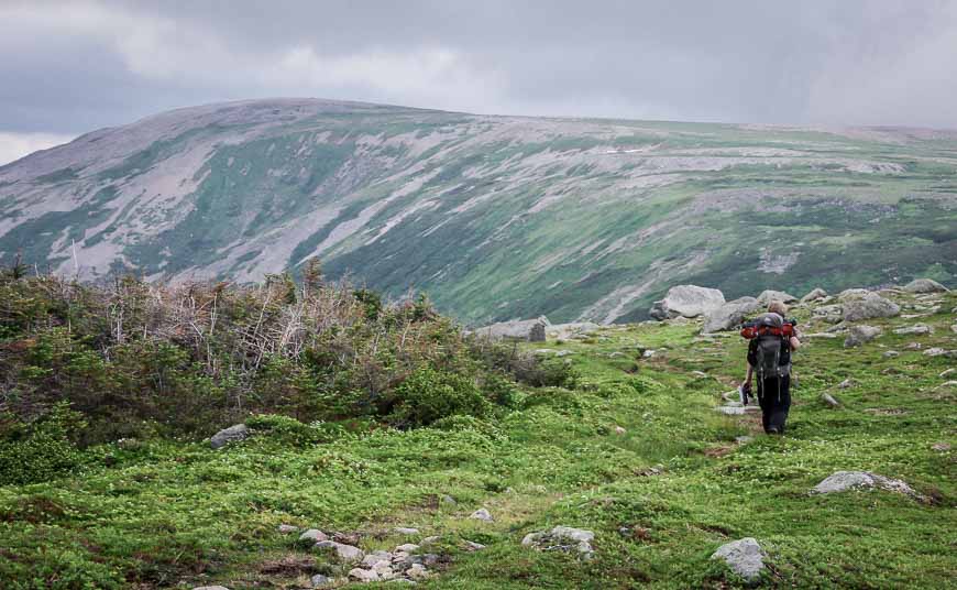
The Long Range Traverse is a three to five-day unmarked wilderness hike through world-class scenery that includes awe-inspiring views of fjords and rock-covered plateaus, rolling hills and numerous lakes, ponds, streams and rivers.
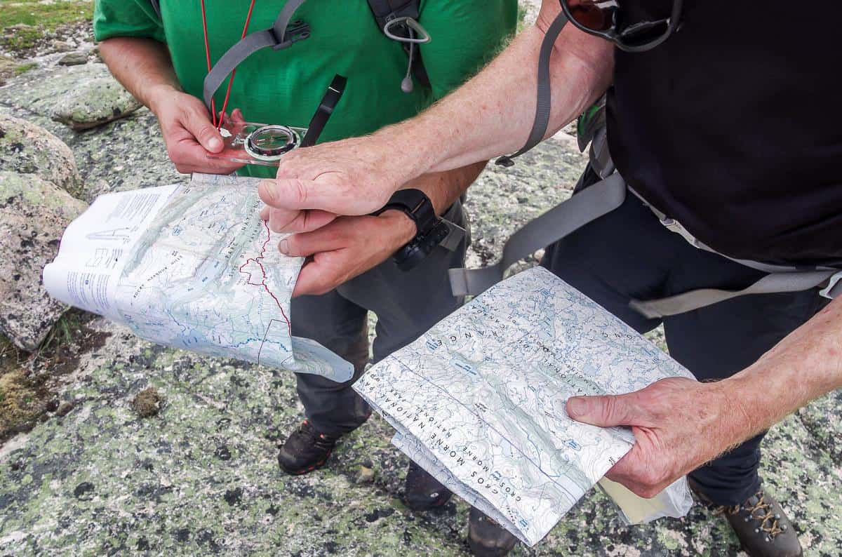
It’s one of the top backpacking trails in Canada – but it lacks the usual signage you’ll find on most of the other long distance hikes in Canada. This is not a hike for the navigationally challenged or those without a lot of hiking experience. But it is one for those looking to test their route finding skills, under sometimes challenging conditions.
If you want to go guided, Bontours, the boat shuttle company, offers two experiences including a day hike to the top of the gorge and back and an overnight hike.
This post includes some affiliate links. If you make a qualifying purchase through one of these links, I will receive a small percentage of the sale at no extra cost to you. Thank you very much for your support.
Long Range Traverse summary
Dates for backpacking: June 28 – September 30
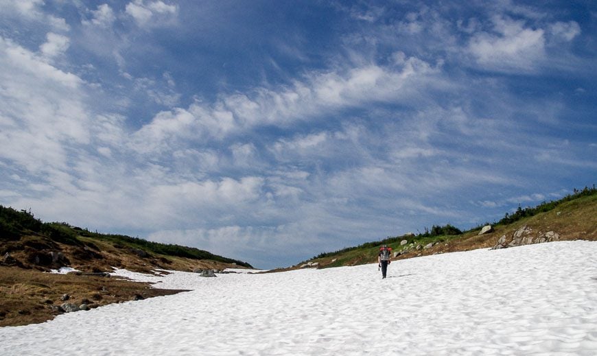
Best time to hike: The peak time to hike the Long Range Traverse is from mid-July until September. There can still be snow on the trail from mid-June until early July.
Trail signage: There are no marked trails, so you need to be very good at navigation.
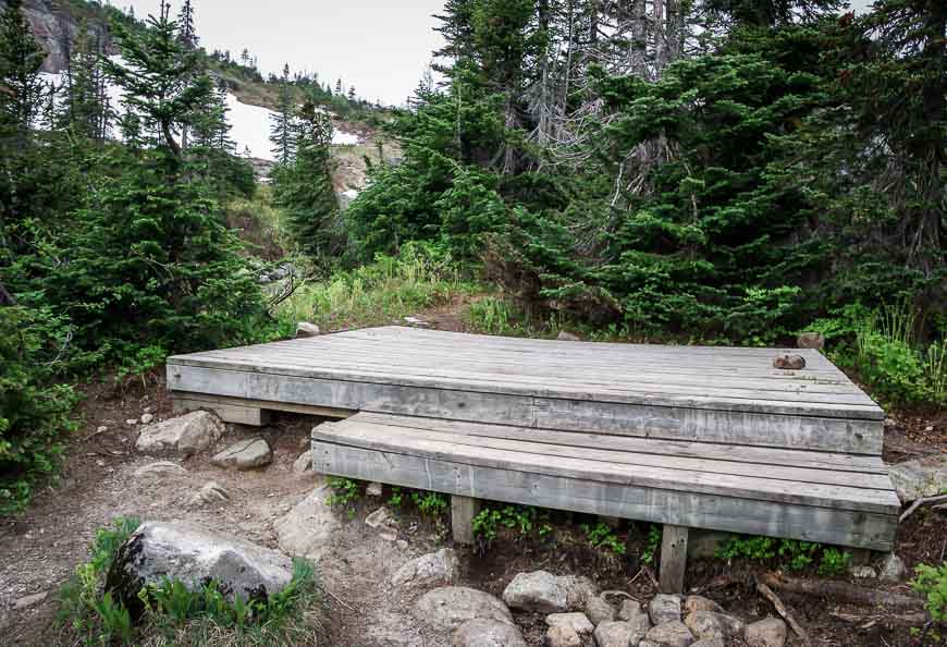
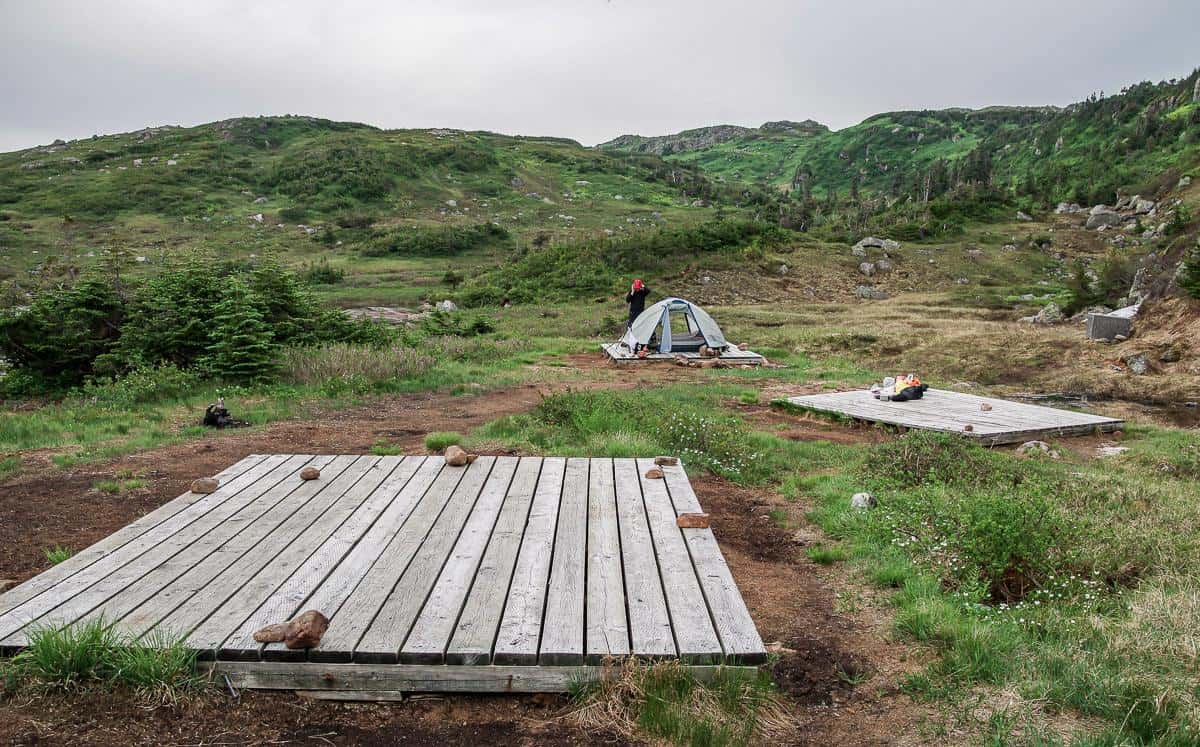
Distance: The Long Range Traverse is 35 km one way. It is typically hiked over 3 – 4 days. There are backcountry campsites with wooden tent platforms along the route.
Optional guided hike: There is the option to do a guided day hike to the top of Western Brook Gorge with Bontours. Allow 7 – 8 hours.
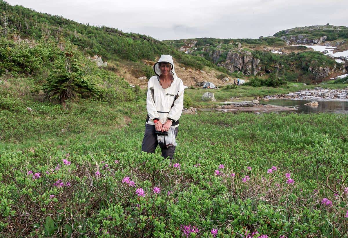
Biting insects: In the summer there are lots of blackflies, so you need to go prepared with a head net and a bug-proof jacket. Insect repellent is a must.
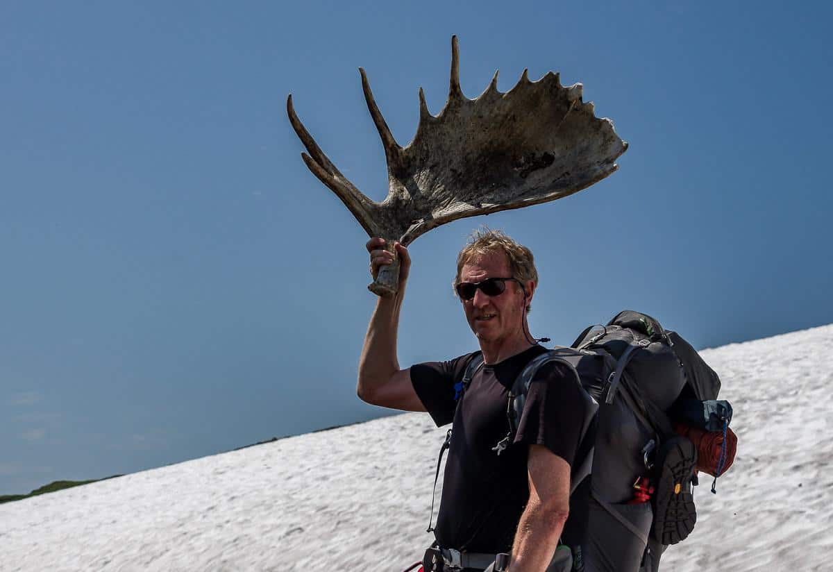
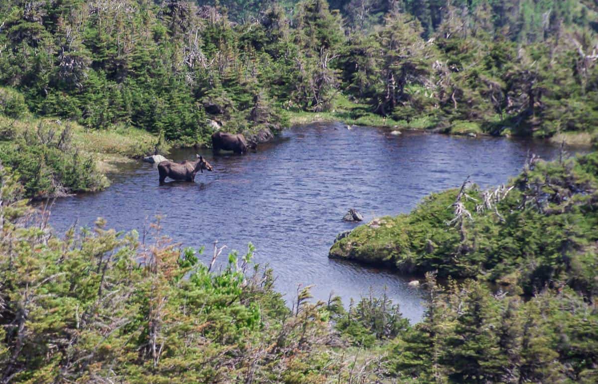
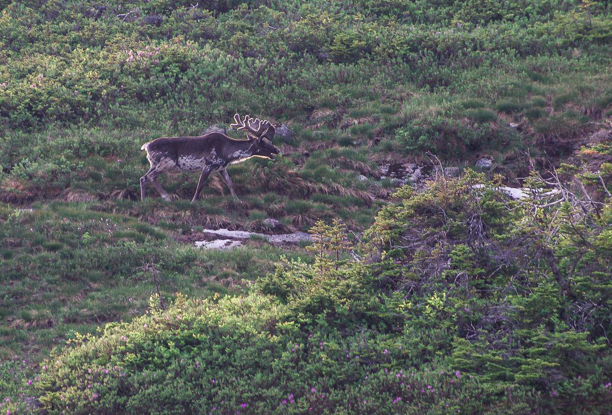
Wildlife: There is a good chance you’ll see black bears, moose and caribou. Keep a clean campsite so you don’t attract bears and on the trail be sure to make noise, especially if you see fresh bear scat. We did see caribou and moose but never a bear. Consider carrying bear spray.
Orientation: There is no longer a navigation test but you must do an orientation so you understand the hazards and rigor of the hike. The orientation is at 2:30 PM the day before you start your hike and you must attend in order to get your backcountry permit.
Please: Practice Leave No Trace principles.
Insider tip: Visit the Gros Morne National Park website for all the details and annual timelines for reservations.
Reservations for the Long Range Traverse
2024 RESERVATIONS: Make reservations starting on February 26, 2024 for the Long Range Traverse by calling 1-709-458-2417 between 8:30 Am and 4:30 PM on a Monday through Friday basis. To keep your reservation, plan to report to the Visitor Centre by 2:30 PM the day before you start your hike for the mandatory orientation.
Note that only three groups with a maximum of four people per group, are allowed to start every day.
Fees for hiking the Long Range Traverse
In 2024, allow for the following fees.
- A possible shuttle to the parking lot to access Western Brook Pond.
- A boat ride to the end of Western Brook Pond.
- Wilderness hiking fee – $112 per person
- Reservation costs – $11.50
- Park pass – will vary depending on how much time you spend in Canada’s national parks – daily pass for an adult in Gros Morne is $11.00 and $9.50 for seniors. You can buy an annual Discovery Pass good for all parks in Canada for $75.25 per adult.
- Gear, food, maps, and any clothing you might need specific to the Long Range Traverse hike.
How to get to the start of the Long Range Traverse
You can either drive your own car or arrange a shuttle to get to the parking lot. Pittman’s Taxi out of Norris Point (709-458-2486) can shuttle you here and you can check to see if they could pick you up at the end as well. Be sure to arrange the shuttle a couple of days ahead of time. We managed to hitchhike back to Rocky Harbour at the end of the hike.
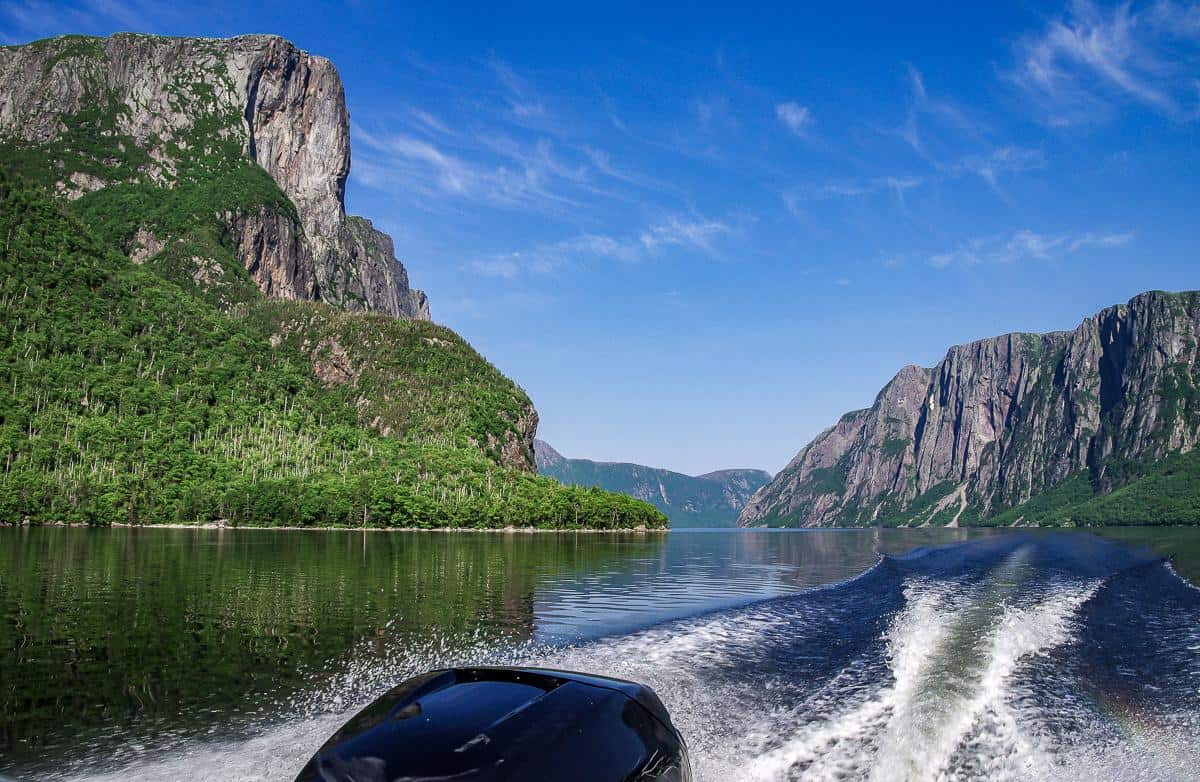
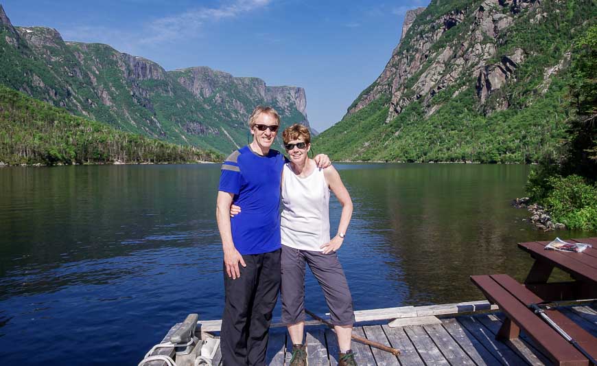
From the parking lot, take the easy 3 km-long trail to the boat dock at Western Brook Pond. From there, you can organize a shuttle with Bontours – if you have enough people – or join a tour group, but that’s the slower option.
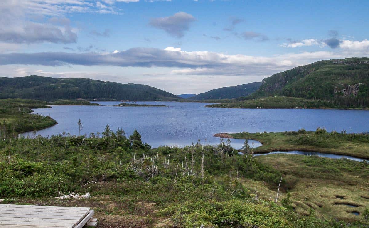
The boat ride is such a highlight, especially on a sunny day when the water sparkles. It took us less than 30 minutes to reach the end of the fjord and the start of the Long Range Traverse. Once the boat pulls away you are good and truly on your own with the way out two to five hiking days away.
Campsites on the Long Range Traverse
The following are the campsites you’ll find along the Long Range Traverse with distances from the dock at the end of Western Brook Pond.
- Little Island Pond campsite – 6.5 km (it’s 2.5 km past the top of Western Brook Gorge)
- Marks Pond – 10.0 km (3.5 m past Little Island Pond campsite)
- Hardings Pond – 14.5 km (4.5 km past Marks Pond)
- Upper Green Island Pond – 21.5 km (7 km past Hardings Pond)
- Ferry Gulch – 26.5 km (5 km past Upper Green Island Pond)
- Gros Morne Trailhead – 34 km (7.5 km from Ferry Gulch)
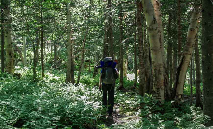
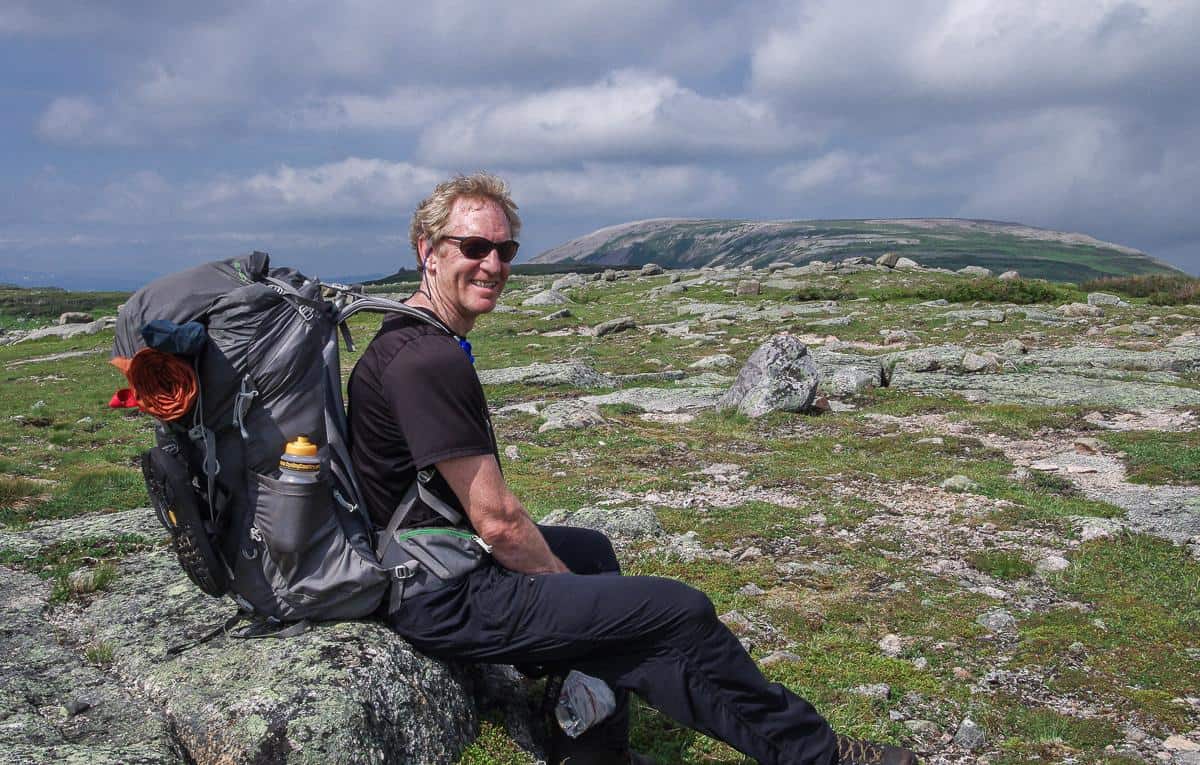
What to take on the Long Range Traverse
Always pack the 10 hiking essentials which includes a first aid kit, sun protection, rain gear, navigation devices and more. If you run into an emergency an In Reach Mini 2 is the thing to have.
Check out this list for packing list for backpacking. Adjust the clothing for a four-day trip. Include the bug jacket if you’re very bug adverse, and insect repellent is a must.
Signage on the Long Range Traverse hike
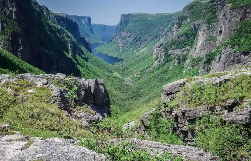
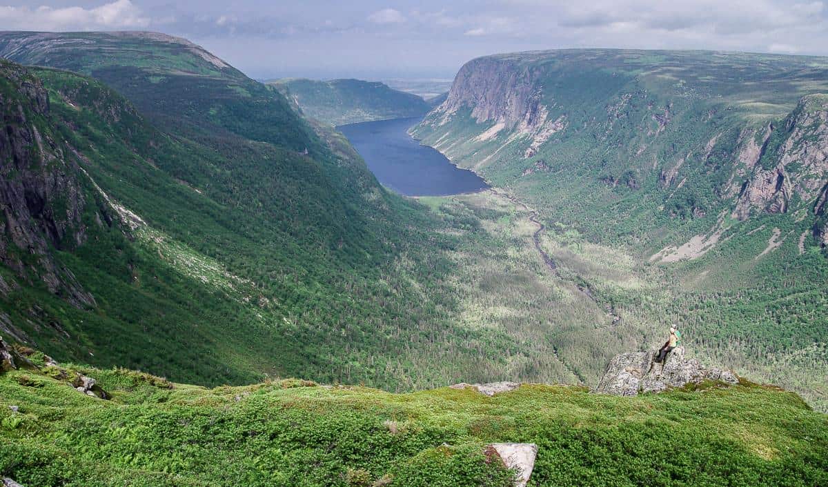
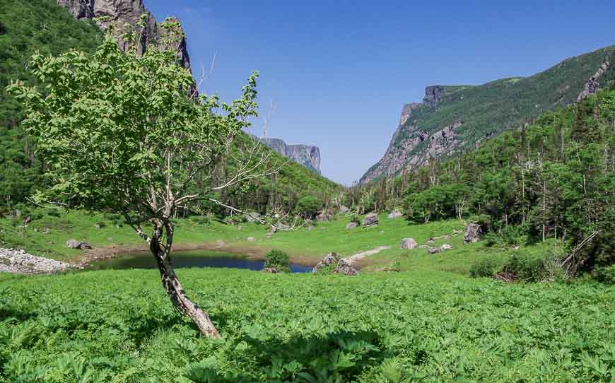
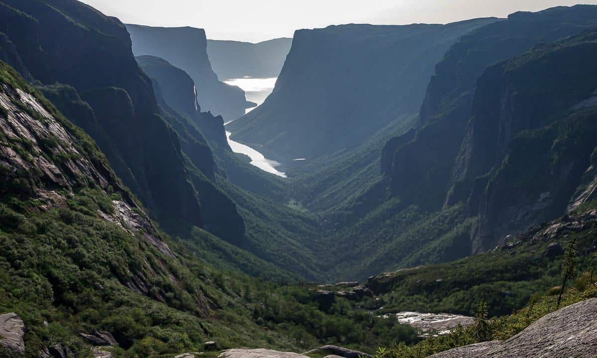
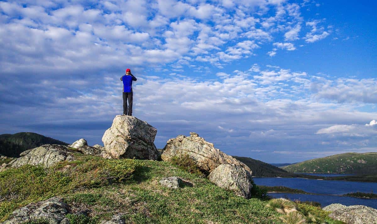
The Long Range Traverse hike is never signed and there is no official trail. Much of what you follow are game trails, but they can take you off course if you’re not paying attention. But on the first day, because of heavier use, there is an obvious route to reach the quintessential view you see in all sorts of Newfoundland and Labrador Tourism brochures – the top of the Western Brook gorge.
Day one on the Long Range Traverse
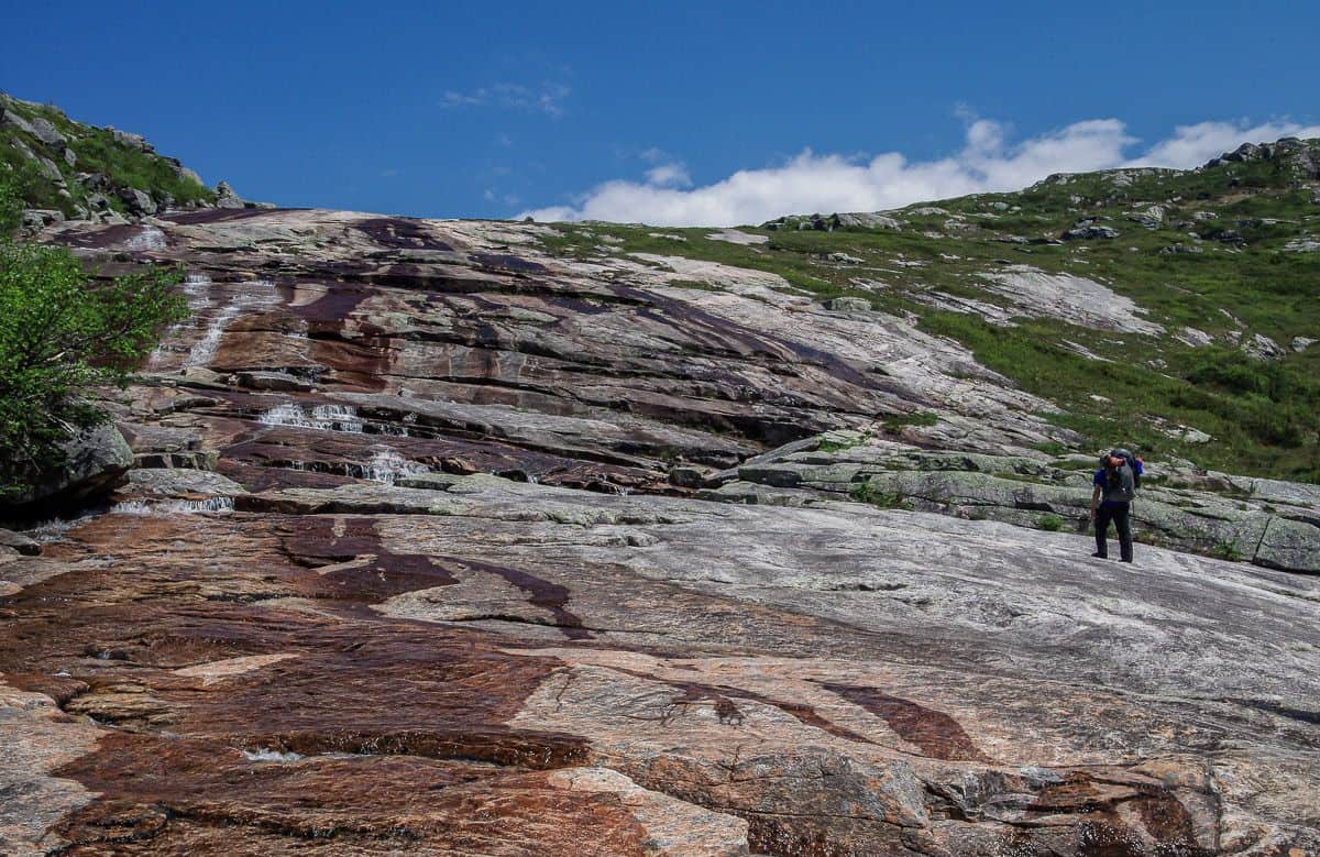
Initially it’s flat, fast hiking on the way to the start of the climb up the Western Brook Pond gorge. Next up is a section filled with house-sized boulders. This can be very slow going and in places there were yawning holes – where you certainly didn’t want to get a leg stuck.
I had to have John pull me up several times and on more than one occasion I was on my hands and knees.
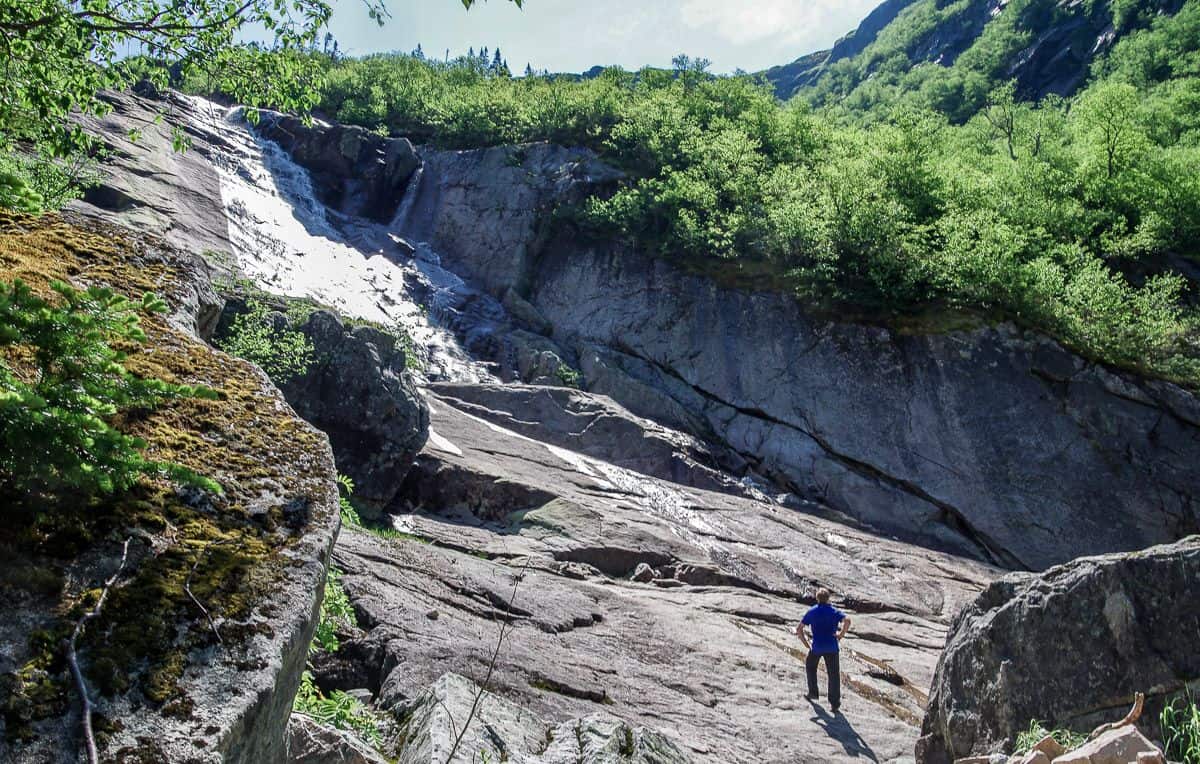
The one word of advice from the park staff is stay right off the waterfall. That wasn’t so hard to do; mind you we had a clear sunny day so navigation was never an issue. The waterfall is a delightful spot for lunch.
Then the climbing begins
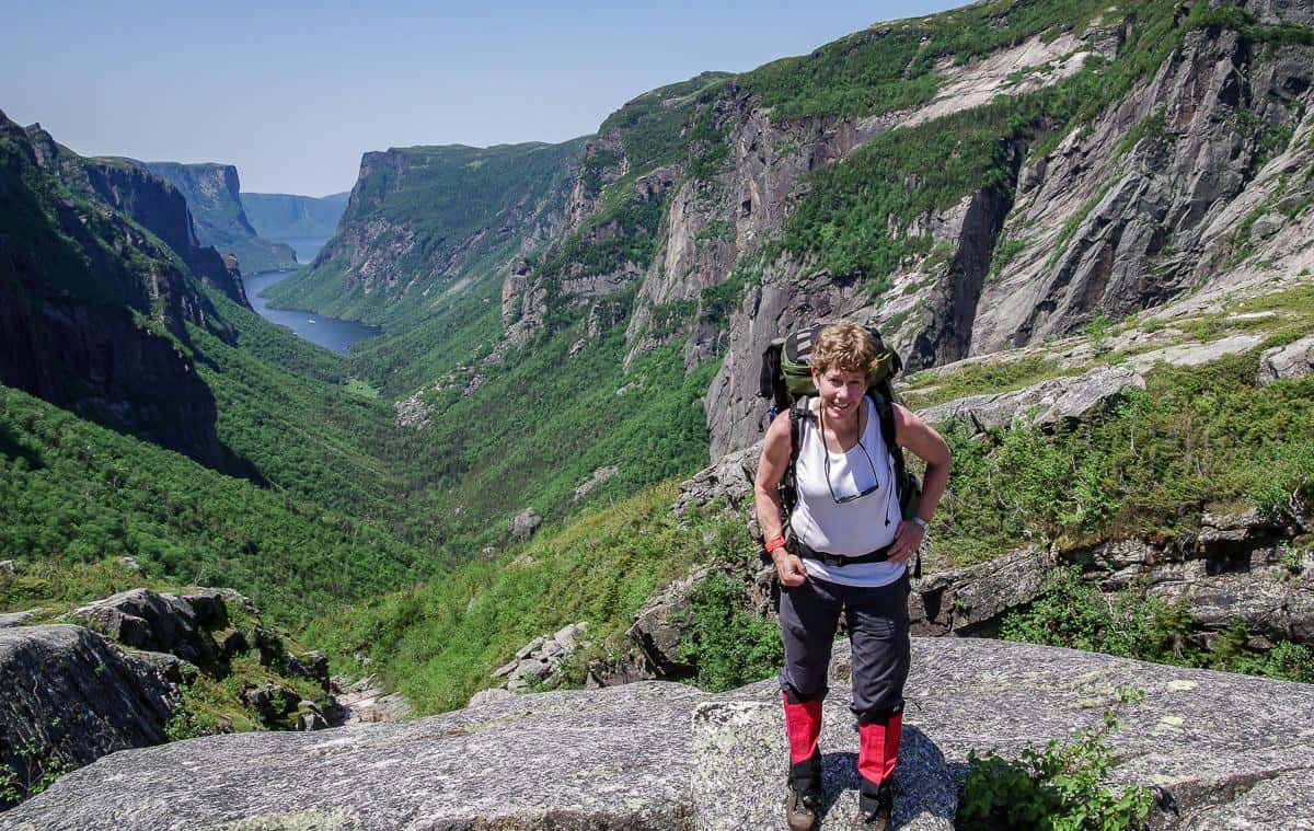
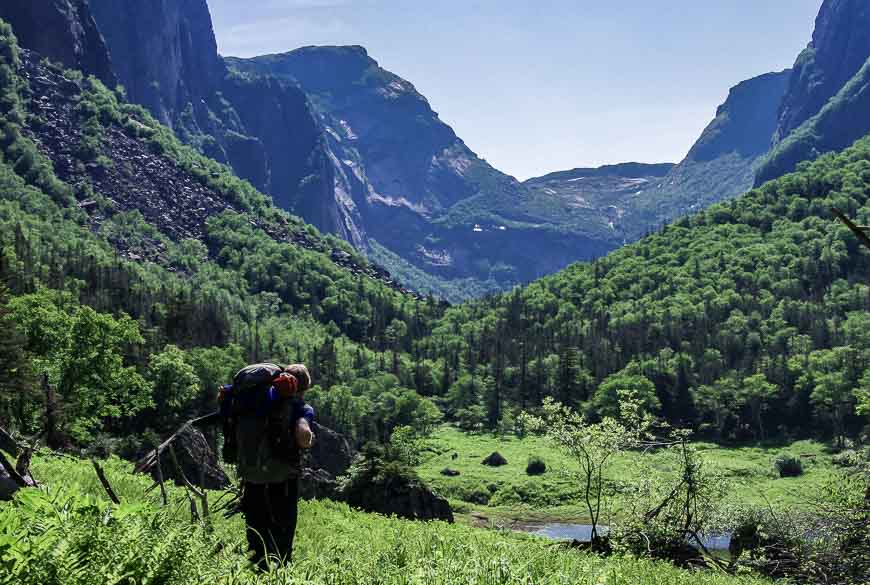
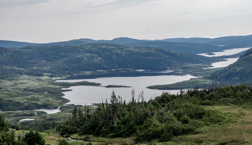
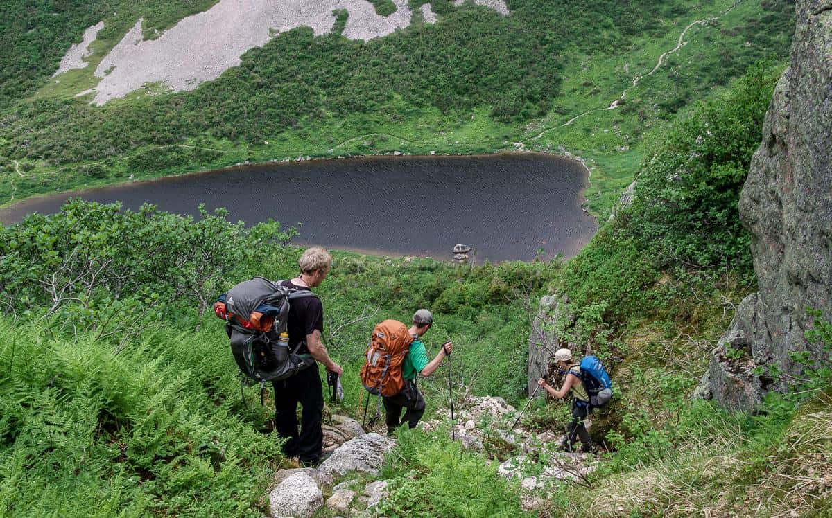
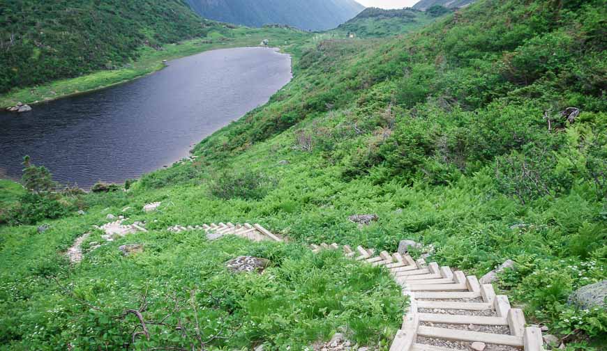
From there the climbing starts in earnest. From the dock to the top of the gorge on the Long Range Traverse, there is a couple of thousand feet of elevation gain – all while carrying a backpack. But in short order, the first of the classic Western Brook Pond views appears in your sights – and that spurs you on.
We marveled at the view part way up the gorge and took plenty of photos before continuing on and up. When you get out of the trees, you’re still not at the top of the gorge. There is more steep climbing ahead, this time with better and better views to reach the “trail” at the top of the waterfall pictured below.
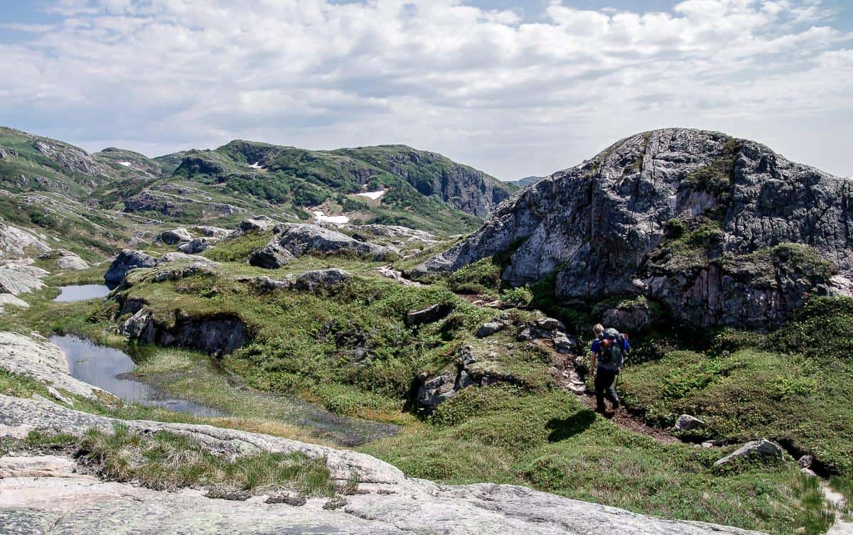
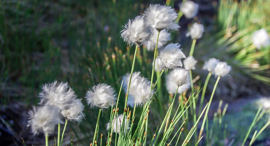
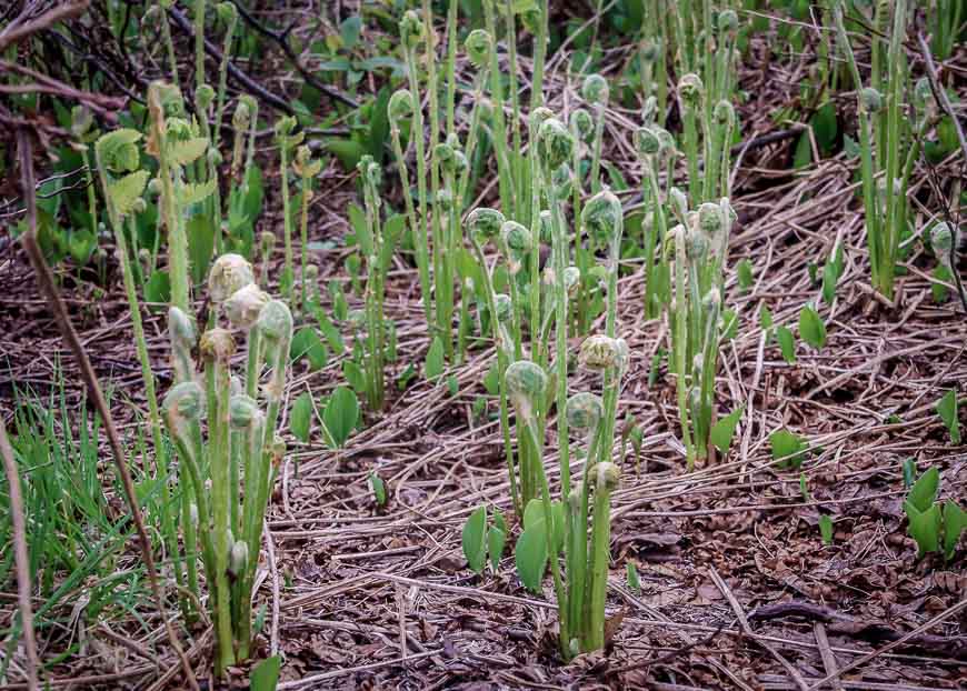
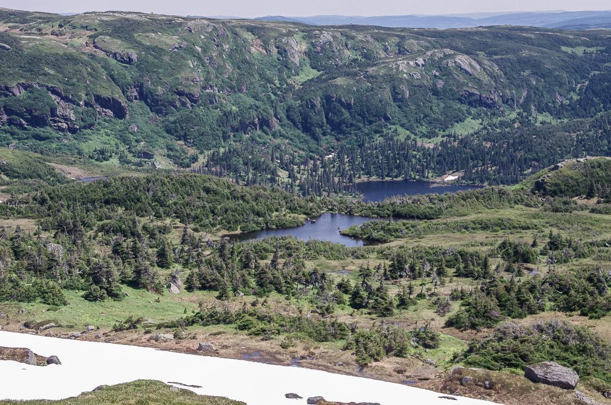
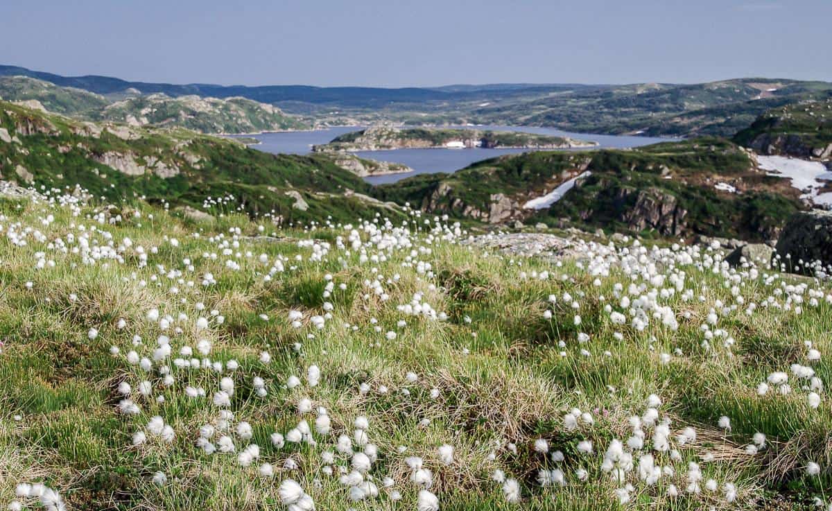
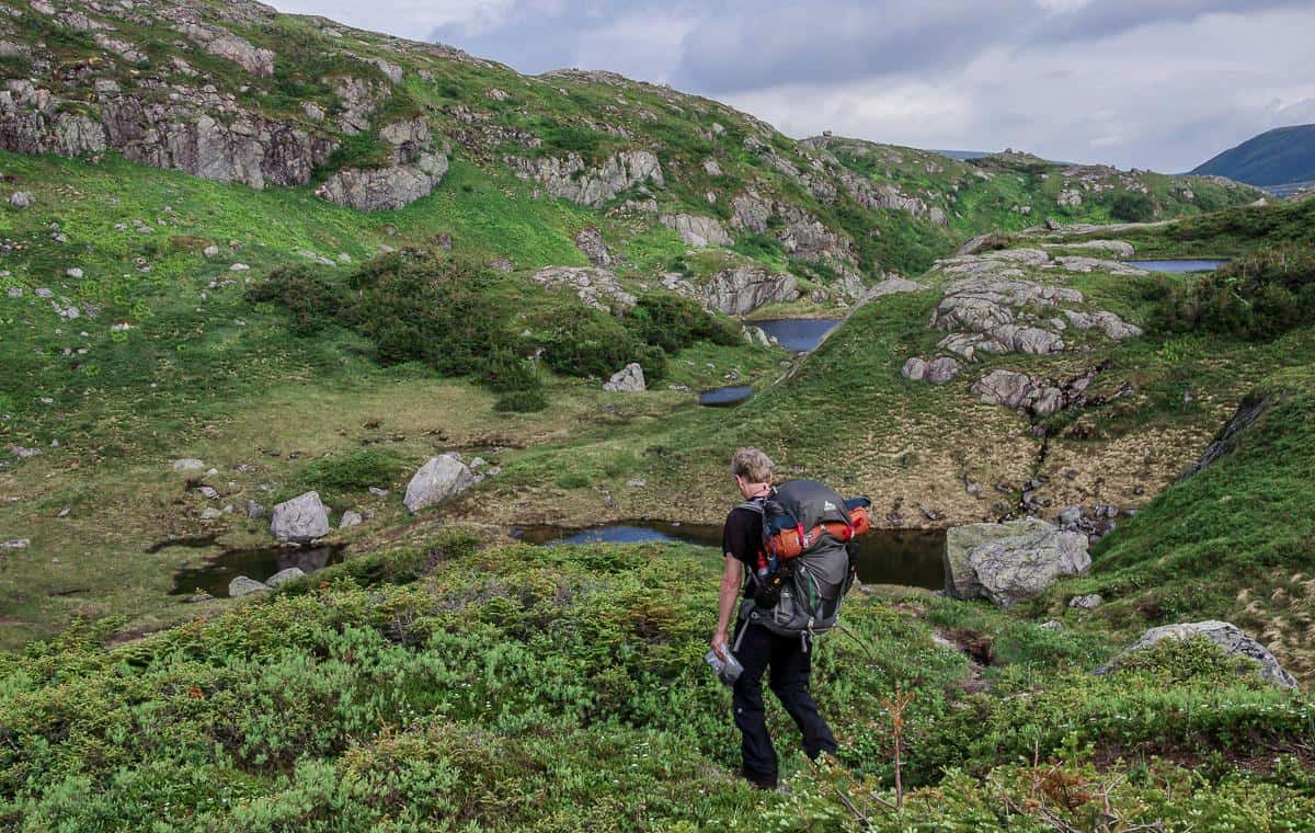
From there, the only way I can describe the hiking is as delightful. The scenery was one of outcrops and small lakes with big time vistas. Scattered clumps of Arctic cotton was a beautiful addition the landscape.
Camping on day one of the Long Range Traverse
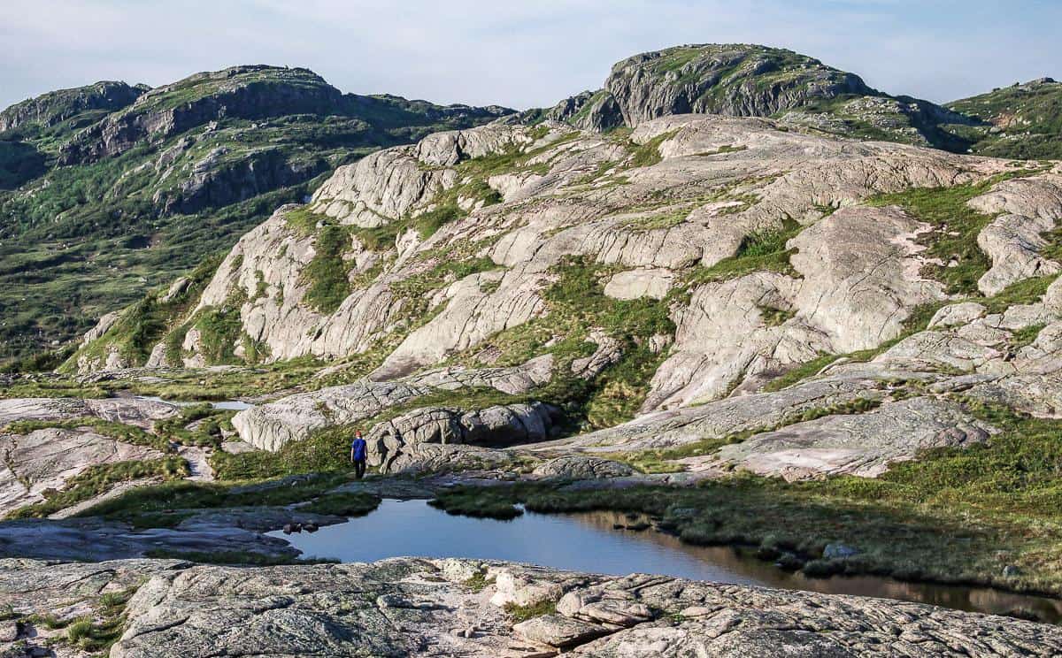
The campsite most people head for on the first day is at Little Island Pond. Its buggy in June and many of its’ tent platforms were destroyed in a storm just before we got there. Because of that, we had permission to camp at the top of the gorge.
It shortened our day, which was fine with me – and where we camped ended up offering one of the best views from any campsite I have ever stayed at. We had the entire place to ourselves. It was absolute magic. And although there were some bugs, they weren’t bad as we had a breeze because we were up high.
The first day, though physically tough and that was partly because of the heat, far exceeded my expectations. And I felt very fortunate that the weather cooperated. Normally you make a reservation well in advance, so you need a dose of luck in this part of the world when it comes to weather.
Day two on the Long Range Traverse
Total time hiking: 5 hours
The second day of hiking on the Long Range Traverse started under slightly cloudy skies with a few rain showers. Thankfully it was the only rain we see at all in four days. The scenery on day one definitely packed more of a punch than day two, but cloudy skies always skew my impression.
We started the second day with a quick descent to the campsite where most people spend night one.
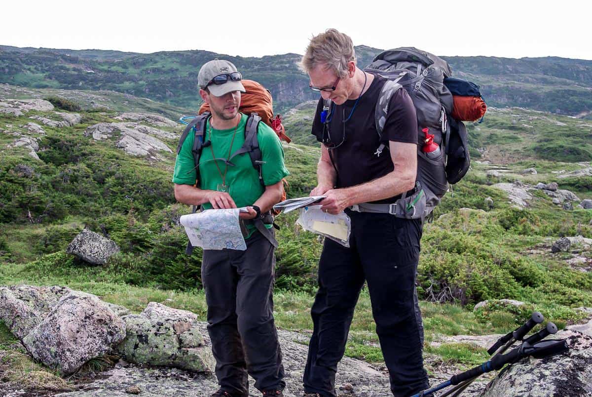
Navigation challenges hiking the Long Range Traverse
From there we ran into one of the few navigation challenges on the whole of the Long Range Traverse, heading in the opposite direction than we should have been, but fortunately only for about 15 minutes.
We followed game trails instead of looking at the map – but never repeated that mistake again.
Showers showed up a few hours into the days hike, but no hard rain. And we never had fog on the entire trip which can make navigation a nightmare.
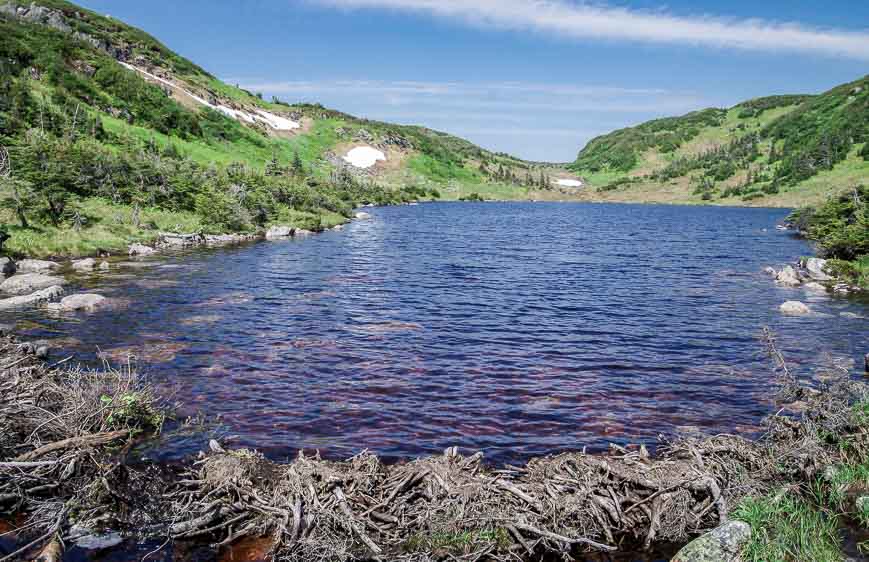
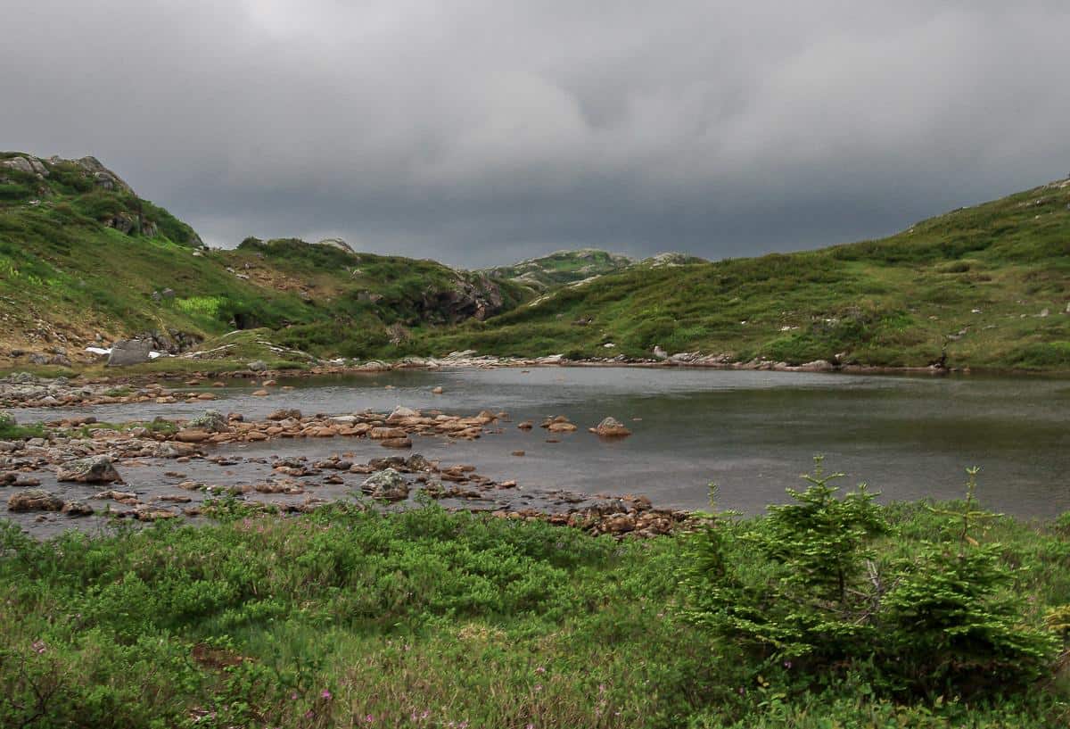
You do have to cross a stream to get by Mark’s Pond. We elected to do it on the east side to save some time. From there it was a climb to the top of a hill, some of it on snow. You could generally follow a trail through here though we did refer often to the map to make sure we reached certain landmarks.
Heading for Hardings Lake
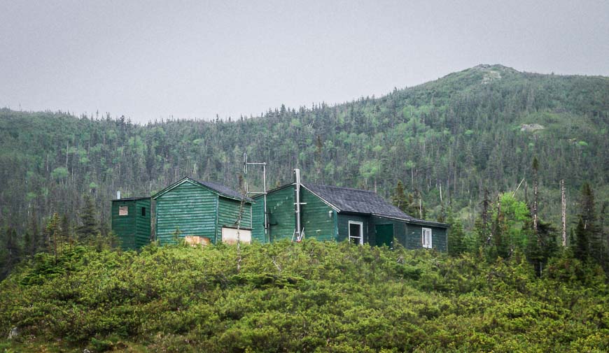
It was a soggy and straightforward hike down towards the warden’s cabin overlooking Hardings Lake. The last part of the hike involved a steep descent.
Along the way we stopped to enjoy numerous bird sightings including blackpoll warblers, white-throated and chipping sparrows, fox sparrows and a greater yellowlegs once we were on the lake. We didn’t see any large animals on day two.
Our campsite on day two was our least favourite
The campsite, a muddy and boggy one, was my least favourite on the Long Range Traverse hike. There are a couple of tent platforms up from the lake that might offer a bit of blackfly relief. A head net would come in handy here – as would bug spray.
As evening rolled around the skies cleared and it actually looked very beautiful. We spent an hour or so after our dinner walking the higher ridges and admiring the views.
Day three on the Long Range Traverse
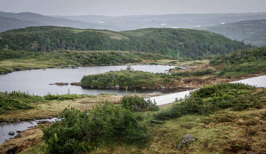
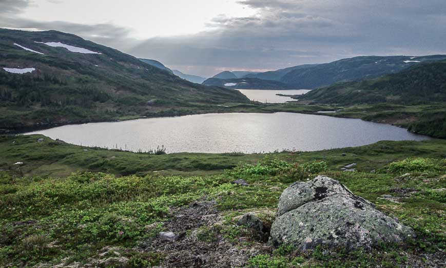
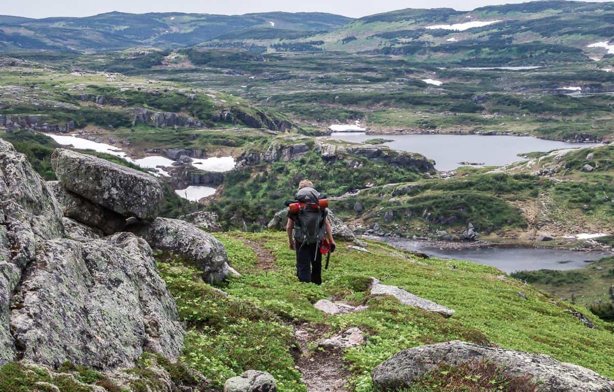
The third day of our Long Range Traverse hiking trip offered a stunning landscape from start to finish. It also produced some navigational challenges though fortunately we never got lost. Two other groups we met in the evening both got off course for a bit. The seven or eight kilometres we hiked took approximately five hours. There was a lot of time spent looking at the map to make sure we didn’t stray off course.
Don’t count on your GPS to lead the way. There are so many hills, valleys and lakes that it’s never a straight line to where you really need to go.
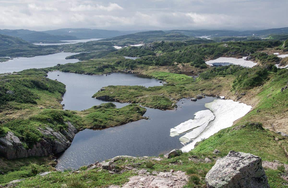
Camping on day three Long Range Traverse
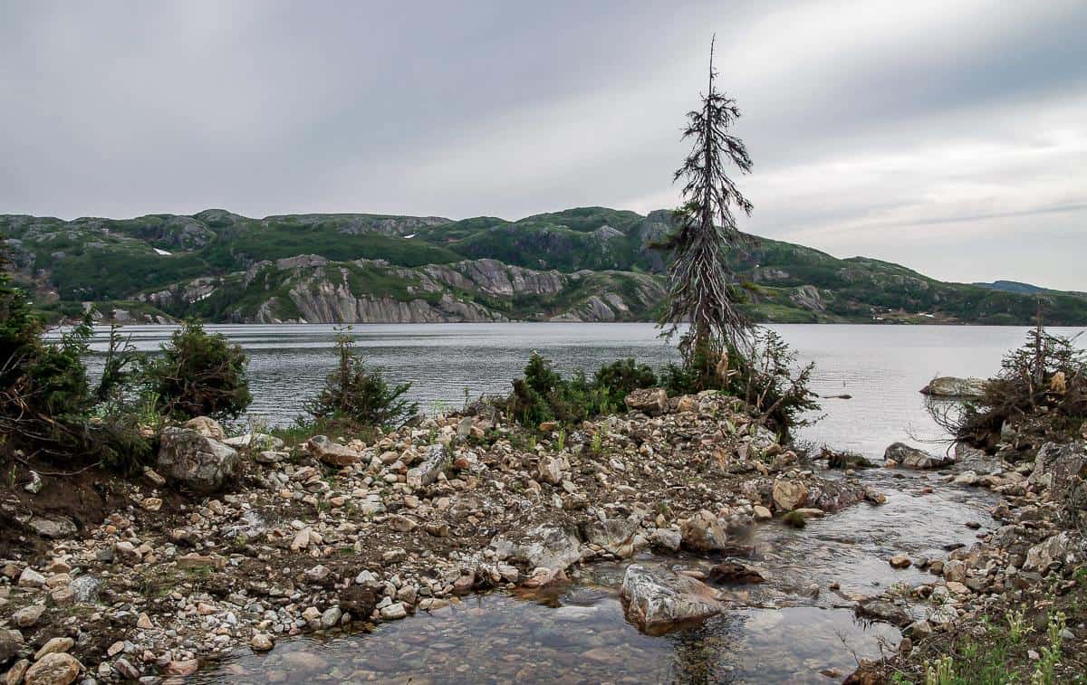
From high above this campsite we spied two new looking tent platforms off in the distance. But once we got to the campsite pictured below, the river seemed too dangerous to cross. We hadn’t actually figured out at the time, that we would have to cross the river eventually to finish the traverse.
If you make it to this campsite, and you want a much nicer campsite that’s only about 10 minutes away, then cross the river (there’s an easy section almost directly in line with our tent) and continue hiking up for a few hundred metres.
As you’re hiking, look for the tent pads on your right. There are only two of them so there’s more privacy as well.
After dinner we spent some time exploring the hills in and around the campsite. Not only were the views sublime, but it was a treat to hike without a thing on our back.
Our third day was a glorious day. In hindsight, we could have made it to the next campsite at Ferry Gulch but it was a treat to explore the nearby hills after dinner.
Day four on the Long Range Traverse
The last day of our four day hike on the Long Range Traverse was the second best for scenery, and that’s saying something considering this hike over-delivers in the beautiful landscape department from start to finish.
Our final day began with a river crossing at our campsite near Green Island Pond. But before we even got going, we enjoyed the sight of a moose checking us out from just across the river.
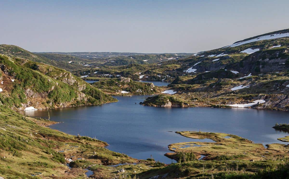
It took us about three hours to get to the Ferry Gulch Campsite, including lots of time for photos at Ten Mile Brook Pond – one of the major highlights on the traverse.
Next up – Gros Morne Mountain
Once we made it down to the Ferry Gulch Campsite we parted ways with the other two backpackers – Jenny and John from New Brunswick.
Instead of continuing to the car, we headed up to the summit of Gros Morne Mountain – so it would be at least four hours before we were back at the campground and heading to the parking lot. Most people don’t do that.
Once you reach the Ferry Gulch campsite, the trail is well marked and obvious. Follow the Gros Morne Mountain trail west to Highway 430. From the campsite it will take you somewhere between 2 – 4 hours to reach the parking lot and the end of the fabulous Long Range Traverse hike.
Where to stay in Rocky Harbour
There are several motels and vacation type homes to stay at in Rocky Harbour. The following are some suggestions.
Wildflowers Country Inn is rated superb. Some rooms have a kitchenette.
The Ocean View Hotel in Rocky Harbour is rated as very good. Some rooms have harbour views and there is a bike rental available.
Further reading on Newfoundland
- Things to Do in St. John’s Newfoundland
- Kayaking in Iceberg Alley, Twillingate, Newfoundland
- What to Do on a Trip to Fogo Island, Newfoundland
- East Coast Trail Hiking Guide
- Hiking the Skerwink Trail near Trinity, Newfoundland
Click on the photo to bookmark to your Pinterest boards.