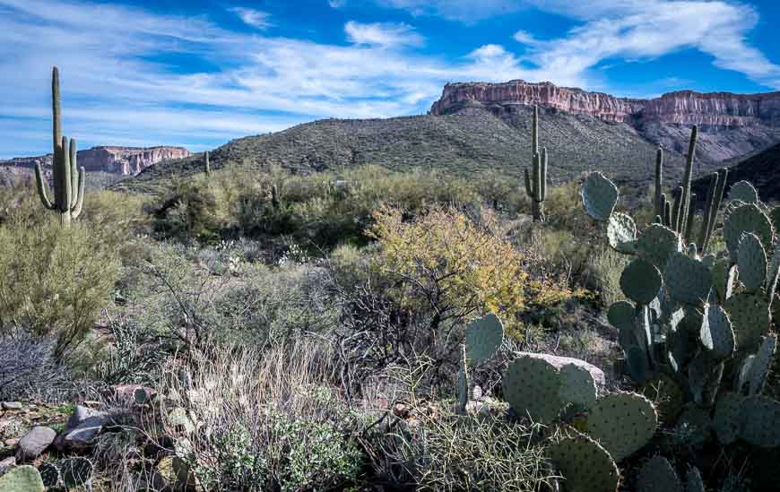
If you want a unique hiking experience, then the Aravaipa Canyon hike needs to go on the must hike list. The canyon, located between Phoenix and Tucson in the Aravaipa Canyon Wilderness, sits in a landscape of soaring cliffs with a beautiful creek flowing through it year-round.
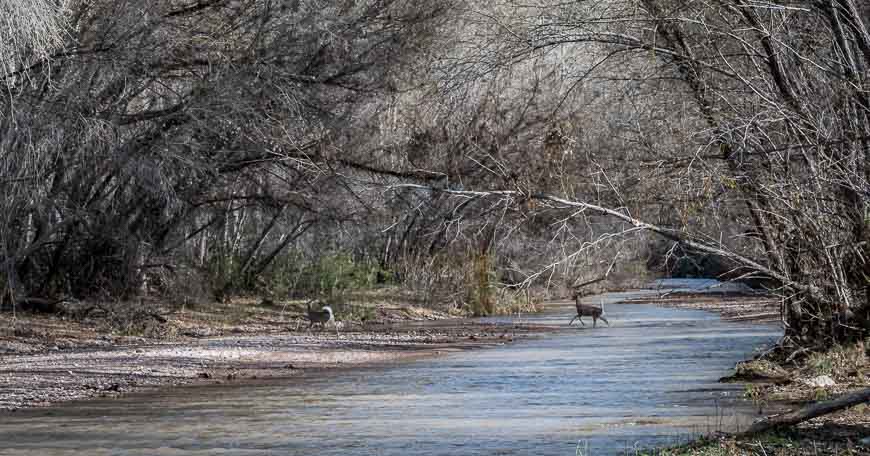
Massive trees, thick riparian vegetation and lots of birds and wildlife make this a one of a kind Arizona experience. Reportedly when the leaves change colours in the fall, the canyon is even more dramatic than what you see in the photos below.
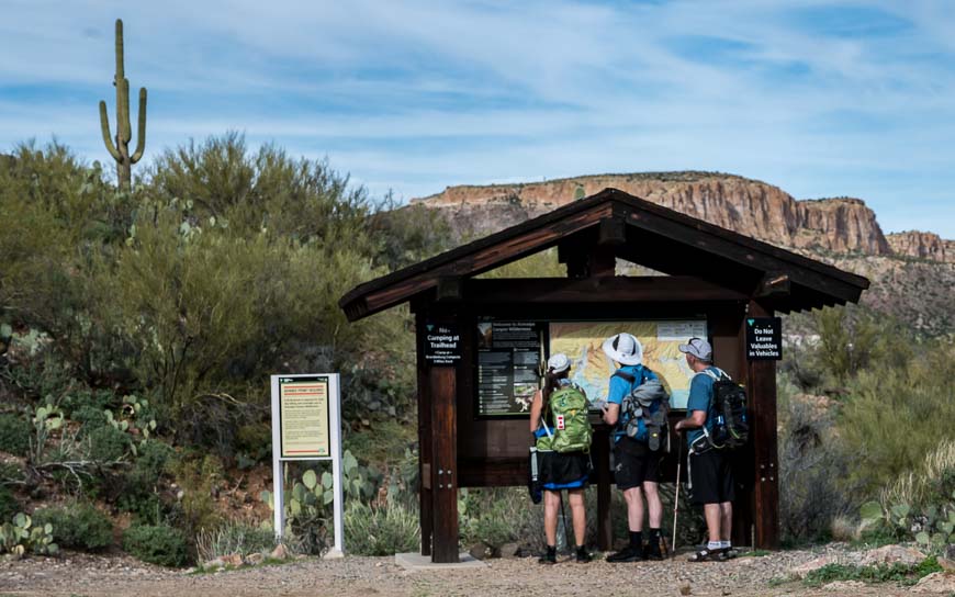
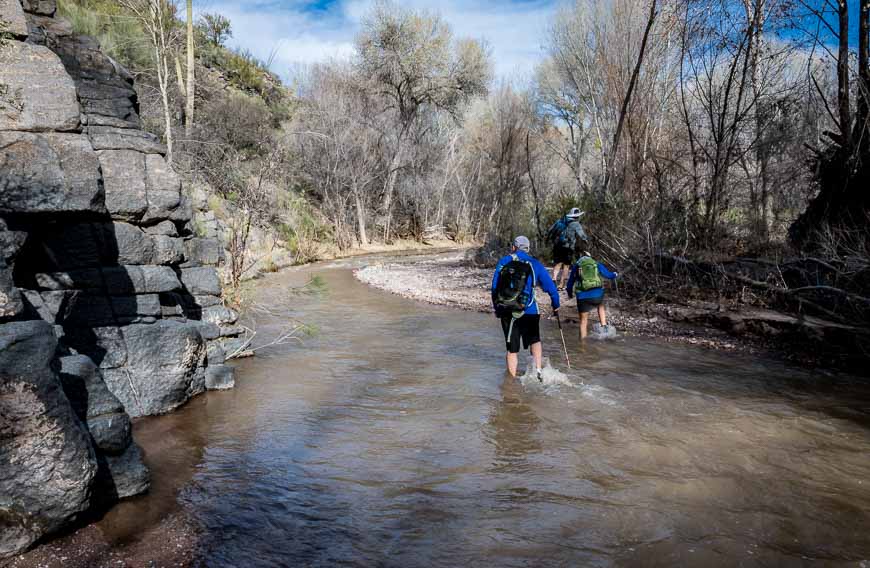
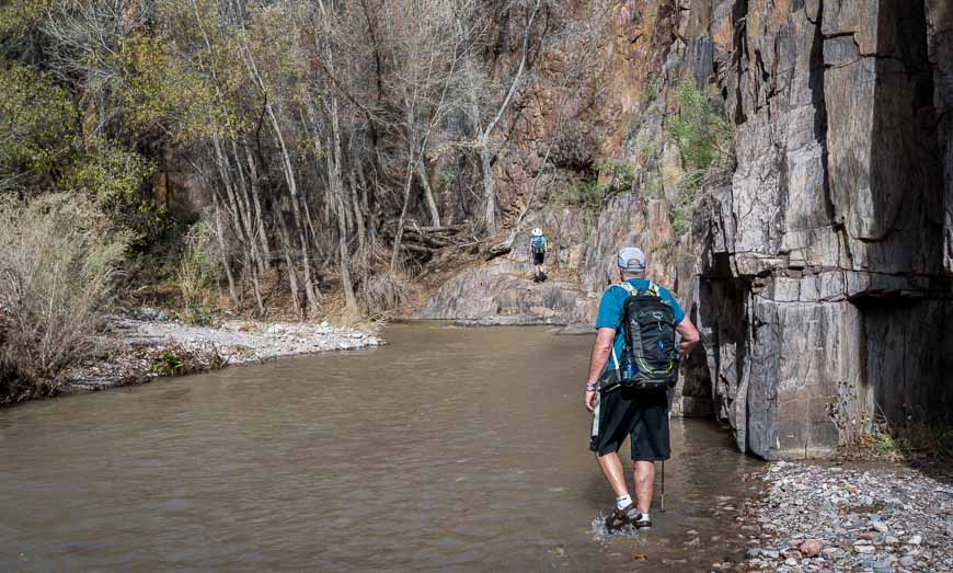
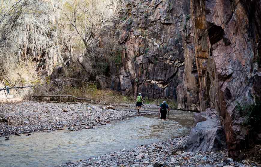
Do not do the Aravaipa Canyon hike if you only like obvious and well-signed hiking trails. Once you hit Aravaipa Creek (12 minutes into the hike from the west trailhead), you can expect to follow a mix of animal and human trails, though sometimes there’s nothing at all.
Throw in frequent creek crossings and what you have is a hike that is fun and way more adventurous than most. Once you get into the rhythm of the trail – after about a mile – you won’t be able to wipe the grin off your face.
If you’re planning to camp along the trail, you won’t find designated campsites though you will find loads of beautiful places to pitch a tent. Just be hyper aware of the forecast, especially in summer when flash floods are more likely to occur.
This post includes some affiliate links. If you make a qualifying purchase through one of these links, I will receive a small percentage of the sale at no extra cost to you. Thank you very much for your support.
Aravaipa Canyon hike description
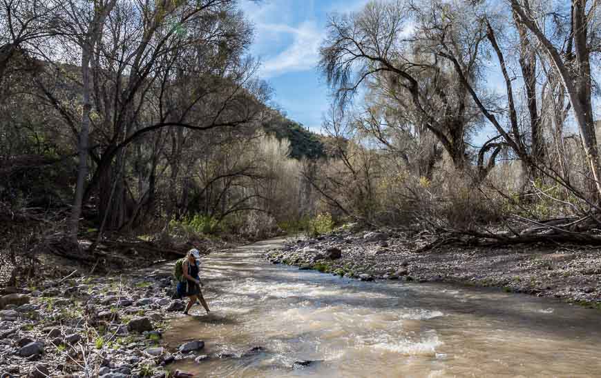
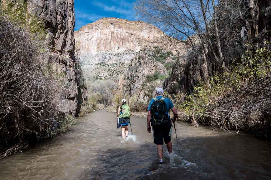
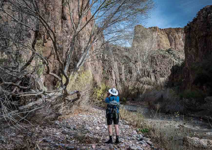
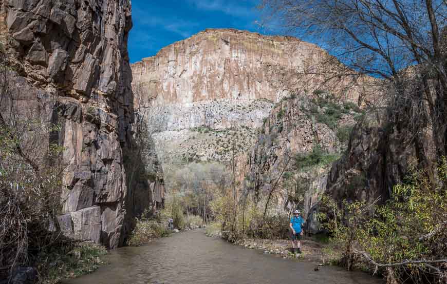
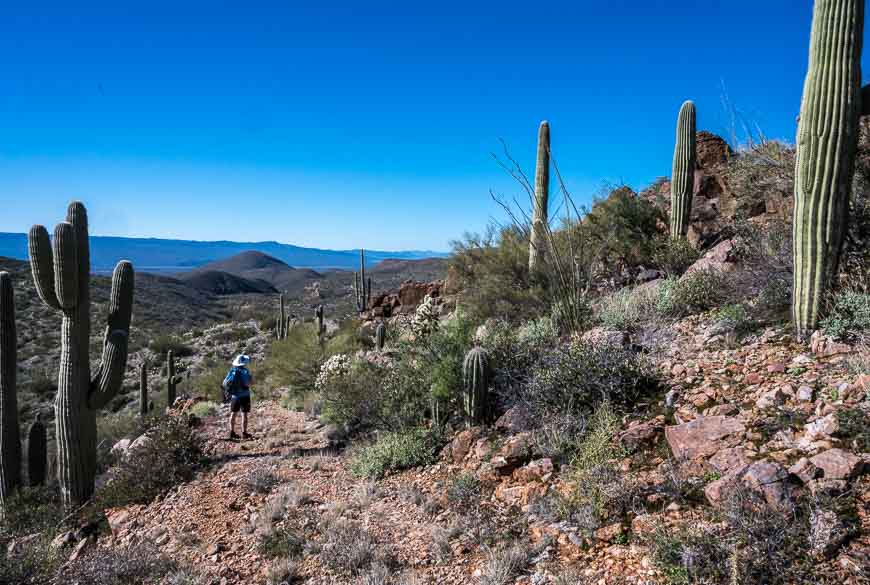
You’re in for a huge treat on the Aravaipa Canyon hike. We only got about three miles into Aravaipa Canyon – appreciating that we had to return the same way. I felt like the scenery just got better and better at every turn. The photos will give you a pretty good idea of what those first three miles look like.
It felt like we were hiking on either narrow trails through sometimes dense vegetation or in the water. In the afternoon, once it had warmed up, we were happy to wade in the creek. (I suspect in summer you’d be happy to hike in the water as much as possible.)
There were a few places where we had to clamber up and over rocks, but if it ever looked dodgy, we simply retreated to the creek.
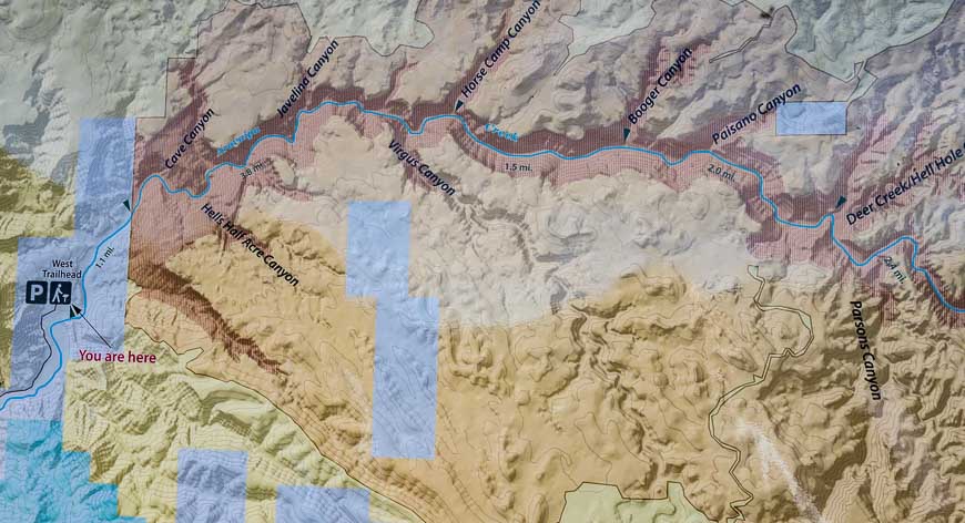
All told the Aravaipa Canyon hike is 12.25 miles one way with an elevation gain of just 430 feet – if you’re hiking from the west trailhead (2,630 feet) to the east trailhead (3,060 feet). That doesn’t sound like much but it would take fit hikers somewhere between 8 – 10 hours to do.
If you’re a nature lover, birder or photographer and you’re keen to explore the side canyons then take one or two nights so you can enjoy the canyon at a leisurely pace.
Read: 12 Safety Tips for Crossing Rivers & Streams
What to take on the Aravaipa Canyon hike
You spend a lot of time in the water, so it’s important you show up prepared.
I’d recommend lightweight hikers with support and a pair of waterproof sandals. Chacos are my go to sandal, though my husband prefers Tevas. I wore a pair of socks in the sandals to prevent chaffing and to help keep my feet warm.
My husband threw on a pair of neoprene booties instead. You wouldn’t need those in the warmer months, but we did the hike in January and the water was COLD!
The other essential is a hiking pole. It’s useful for keeping your balance and for testing water depth, especially when the water is cloudy.
If you’re allergic to bees don’t forget the EpiPen. And I’d suggest including Benadryl in your first-aid kit on this hike. There were two occasions where we heard bees swarming. Fortunately they were high in the trees but I can tell you it wasn’t a pleasant sound. In fact we detoured to avoid them at all costs.
Bring a pair of tweezers in case you have a close-up encounter with a cactus. I also recommend a water filter in case you haven’t carried enough water with you – or you’re camping overnight.
Always take a few extra energy bars and some warm clothing in case you get chilled.
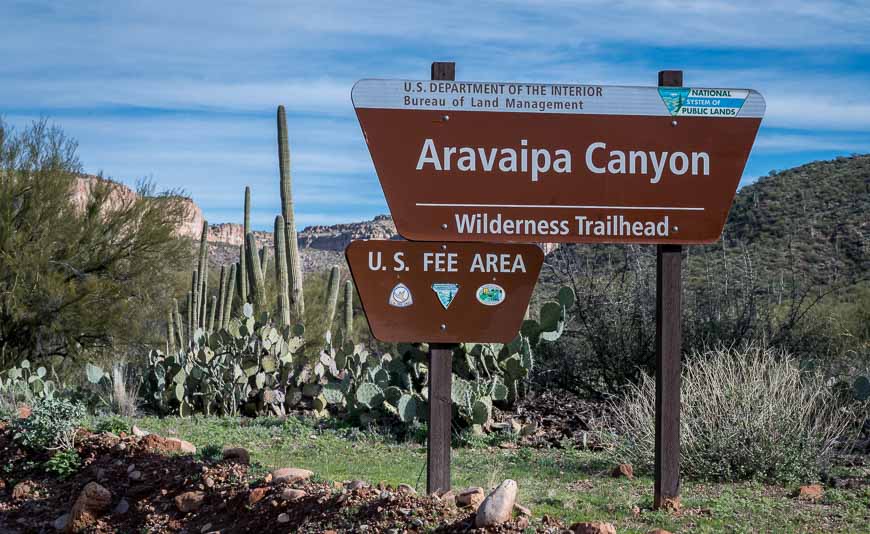
Hiking permits for Aravaipa Canyon
You cannot hike in Aravaipa Canyon without a permit. You can buy a day permit but if you’re planning to hike the whole canyon (and camp) you can get a permit for a maximum of two nights and three days.
Before you buy the permit, you must figure out what trailhead you’re starting at. If you stay at Aravaipa Farms then you’ll be starting at the West Aravaipa Trailhead. A maximum of 30 people a day can enter from the west entrance and 20 people from the east entrance.
We did this hike in January – considered the off-season so it wasn’t hard to get a permit. In fact, we met a couple of hikers who were able to get a cell signal and buy one on the spot at the trailhead. But in high season, that wouldn’t be possible – especially as the Aravaipa Canyon hike is becoming better known.
To organize a permit visit recreation.gov. Click on permits and then search for Aravaipa Canyon Wilderness permits. The cost is $US 5 per person per day plus a $US 6 reservation fee.
Finding the trailheads for the Aravaipa Canyon hike
The West Trailhead
Take Highway 77 south from Winkleman or north from Tucson. From Winkleman drive 10.8 miles south, and turn east onto East Aravaipa Road. Follow it for 12.3 miles to reach the trailhead. Only the first three miles are paved.
You can drive the dirt section of the road with a regular car – but it’s very wiggly. From the Tucson Airport it’s a two hour drive via Highway 77 north.
The East Trailhead for Aravaipa Canyon
According to the government website access is from “Highway 70 between Safford and Bylas on a 46 mile dirt road that has creek crossings without bridges.” Google has a different take so double check this.
They also say that a high clearance vehicle is a necessity because of numerous stream crossings. The road is obviously impassable when flash floods occur. The west trailhead sounds a lot more straightforward!
Location map of the hike
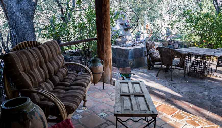
A stay at Aravaipa Farms Orchard and Inn
Our group of four spent four fantastic nights at the Aravaipa Farms Orchard and Inn, just 5 miles from the west entrance to Araivapa Canyon.
I’ve spent a lot of time in Arizona and I was looking for a place with charm that didn’t break the bank. I hadn’t actually clued into the Aravaipa Canyon hike until I visited their website.
One entry in the guest book described the rooms as “rustic chic”. I think that’s a great description but I would also add colourful, comfortable and close to nature. I loved throwing open my door to the sight of orange trees and waking up to the sound of birdsong. While we never took advantage of the indoor and outdoor fireplaces, I thought they were a lovely touch.
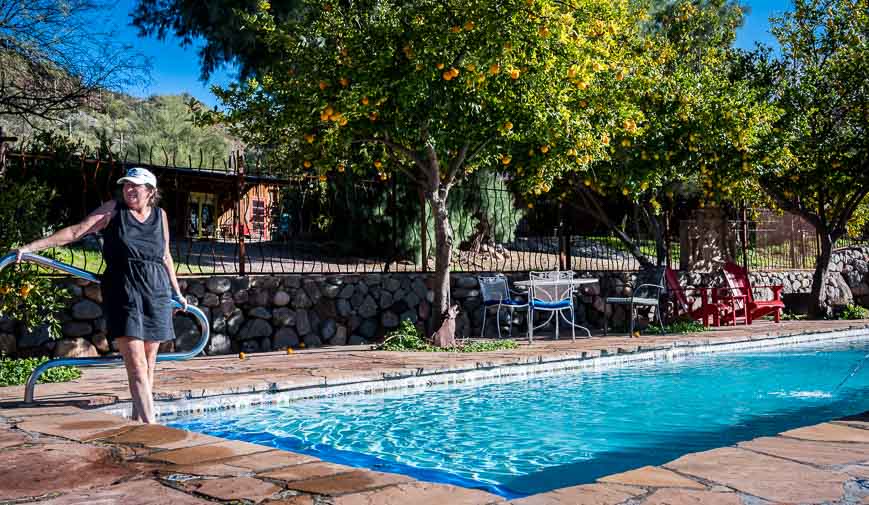
Breakfast comes with the room. For the first few days – because it was a weekday, it was left in our fridge. On the weekend we joined other guests in the main room for home baked granola, yogurt, fresh fruit and omelets. Our rooms also came with a coffee maker and freshly ground coffee.
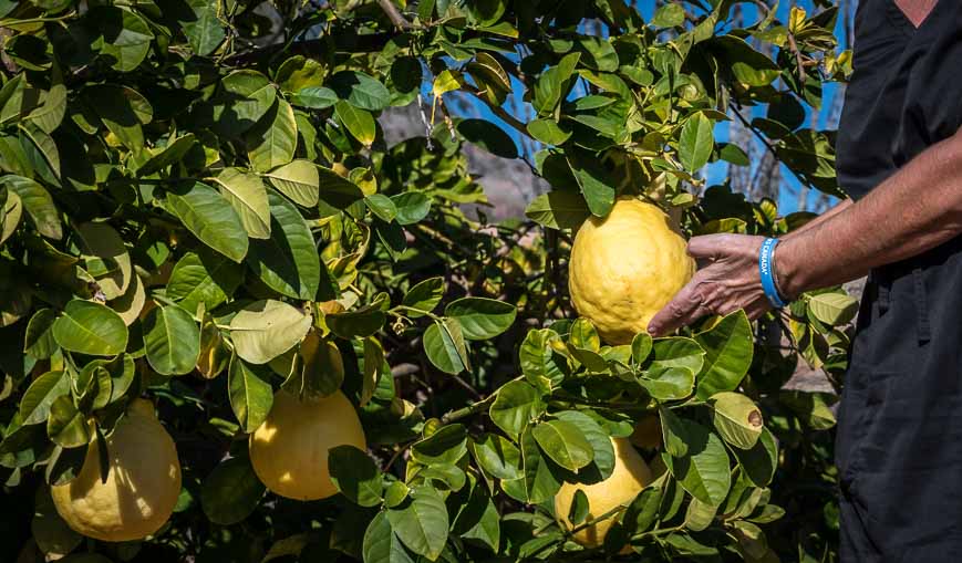
We chose to eat dinner every night in the main dining room. Much of the fresh produce is grown on the property. The orchard is home to apple, peach, pear and plum trees. In addition there are orange, lemon and grapefruit trees so you don’t lack for fresh fruit. And they have a large vegetable garden.
Dinners are three course affairs – and include a salad, main course and dessert. The cook staff are absolutely lovely and accommodating. Because we were there for more than two nights, a packed lunch was provided daily too.
We hiked three times over our visit but left room for R&R that included time by the pool (bloody cold in January), reading, wandering the property, birding and drinking wine with good friends.
The inn is a find. We all loved it and would happily return again. The owners and hosts are extremely hospitable and do everything to make your stay a memorable one.
(Note – this is NOT a sponsored post, but a great experience!)


Other things to do near the Aravaipa Canyon Wilderness
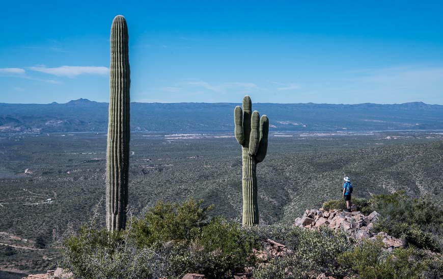
If you stay at Aravaipa Farms Orchard & Inn I highly recommend taking advantage of a couple of the nearby hikes.
The easiest hike to access is right behind the property. It will take you about 75 minutes to bushwack around the cacti to the top of the hill. From there the views are superlative. But be VERY careful around the cacti. We’re still picking small thorns off our shoes and body, five days after leaving.
Brandenburg Mountain hike
The other hike to do is the one up Brandenburg Mountain. We didn’t go all the way to the top. Instead we walked along a seldom-used four-wheel drive track once we got to a point above the cliff band. It was a lovely way to spend about four hours. And it’s only a two mile drive from the turnoff to the inn.
Further reading on things to do in Arizona
- Why you’ll want to do the Hike to Havasu Falls
- The Apache Trail: Arizona’s Most Scenic Drive
- 10 of the Very Best Hikes in Arizona
- A Trip to See the Sandhill Cranes in Arizona
- Soldier Pass Trail and Cave Hike in Sedona
Click on the photo to bookmark to your Pinterest boards.
