The best hike in Big Bend National Park is the South Rim Trail. It’s also been called one of the lower 48’s top one day hikes!
Laurence Parent who wrote the guide Hiking Big Bend National Park says it’s probably the classic hike of Texas and any Texas hiker worth his or her salt will someday try to hike the South Rim.
The South Rim Trail in Big Bend National Park is 6.3 miles one way with an elevation gain of 1,875 feet. He calls it a strenuous hike – whereas I’d call it a moderate hike if you’re a regular hiker. If you’re not, then the elevation might be tough for you.
The South Rim Trail is 13 miles return so you to have to be in reasonable shape, but the difficulty I think lies in attempting it when it is really hot, or if you run out of water.

This post includes some affiliate links. If you make a qualifying purchase through one of these links, I will receive a small percentage of the sale at no extra cost to you. Thank you for very much for your support.
Getting to the start of the South Rim Trail hike in Big Bend
The South Rim Trail hike leaves from the Chisos Basin Trailhead by the Chisos Basin Visitor Center. From Terlingua, it’s an hour’s drive and from Marathon about a 90-minute drive.
There is a large parking lot, but there are also several trailheads that are accessed from here. If it’s a perfect hiking day, get here early to get a parking spot.
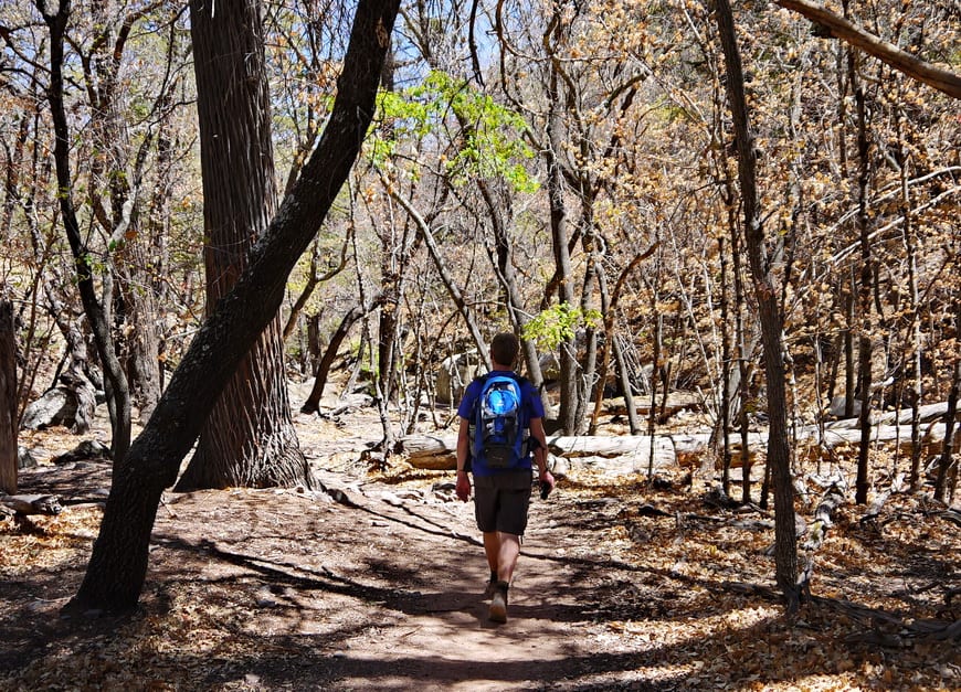
South Rim Trail hike Big Bend National Park
I loved the South Rim trail hike, particularly because you can do it as a loop. It’s less steep to hike to Laguna Meadows and to return via the Pinnacle and Boot Canyon Trails – even though the distances are similar.
If you’re going to do this hike get out of bed early and hit the trail by 7 AM in the warmer months. That way you can be on the rim before it’s too hot. The Laguna Meadow Trail also offers lots of shade on the way up.
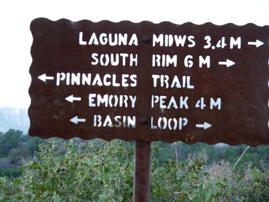
Leave the parking lot at the Chisos Basin trailhead and walk on the paved path to the sign you see in the picture below. Go right on the Laguna Meadow Trail, ignoring the Basin Loop Trail turnoff you see after roughly half a mile.
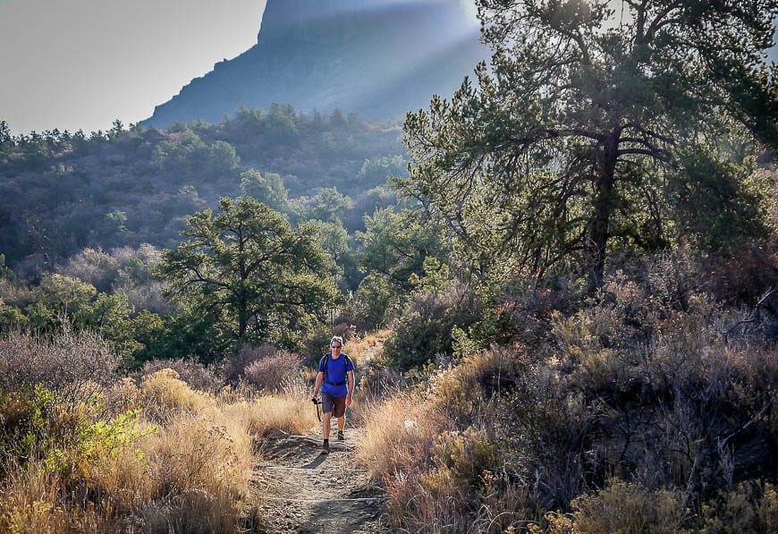
Climb through the woods on a series of switchbacks through forests of pine and cacti. You’ll hear lots of birds.
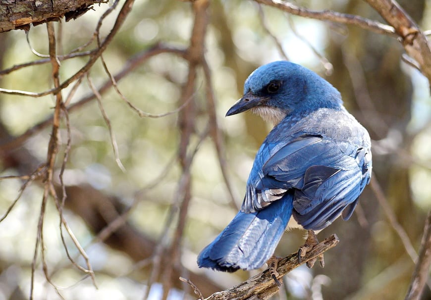
We saw an Acorn woodpecker in this area. When you reach the saddle the grade decreases and in no time a well placed bench appears which offers magnificent views.
You can see another trail heading out across the hills. It’s called Blue Creek and is often done as part of a longer backpacking trip.
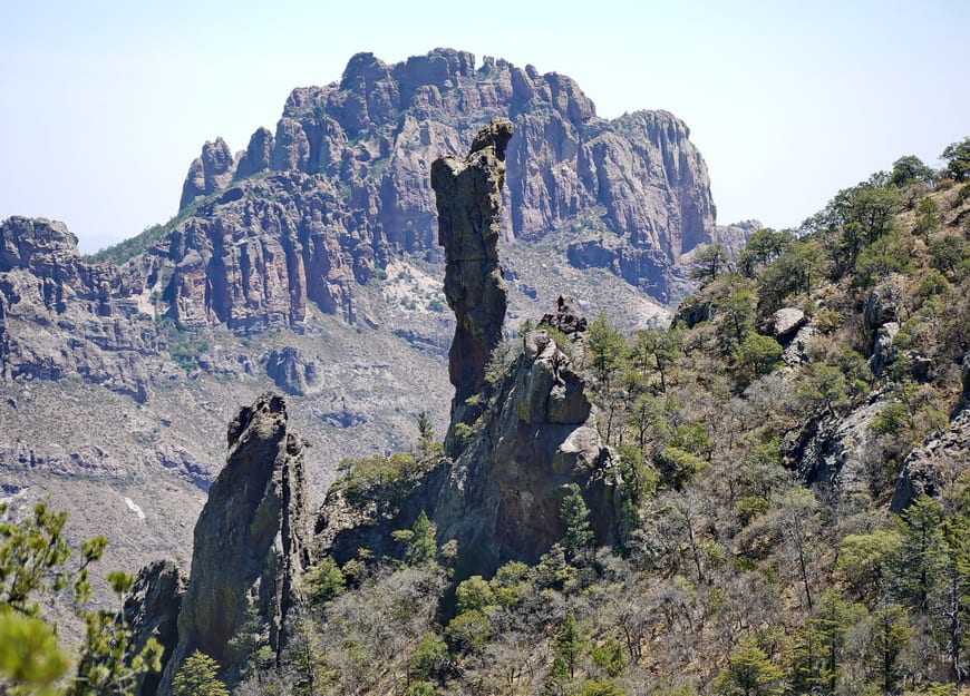
After reaching the Laguna Meadow you gently climb the lower slopes of Emory Peak – the highest mountain in the park.
In under a mile you’ll come to the junction with the Colima Creek Trail. Stay right and continue towards the South Rim. You’ll be there in short order.
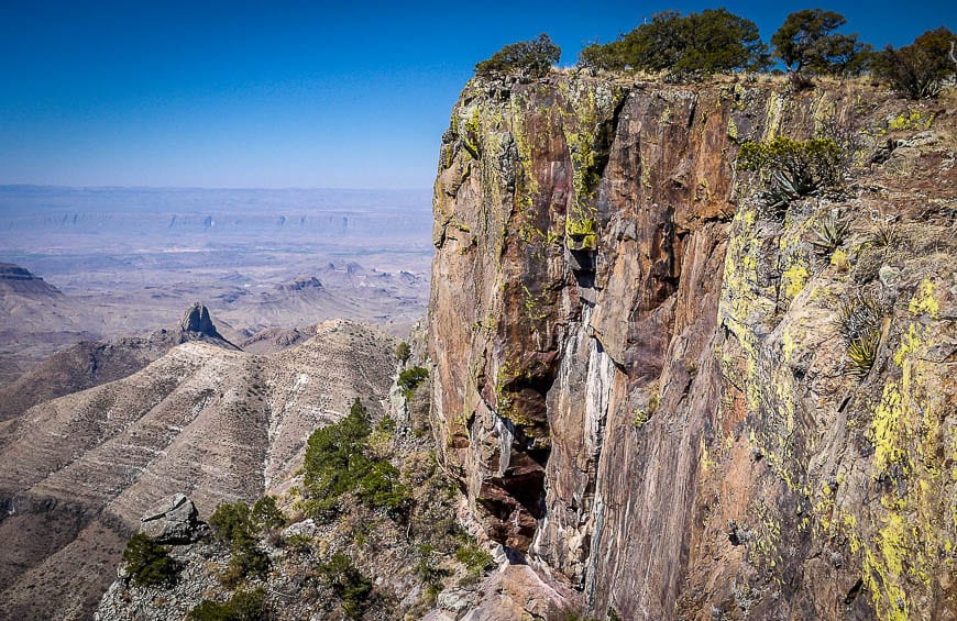
Views are superb – on a clear day. Unfortunately the power plants that were built in Mexico not too far from the park are lacking in pollution control devices. Much of the haze you see is pollution.
The South Rim is a great spot to stop and half lunch. We saw many deer munching away on the flowers right at the edge of the rim. Be careful at the top – you are thousands of feet above the slopes below.


The descent from the South Rim Trail in Big Bend
To descend the South Rim Trail in Big Bend National Park via the Pinnacle and Boot Canyon Trails, continue walking in an easterly direction along the rim.
There are lots more places to stop and take in the views.
If you are feeling very energetic you could add in the 3.3 mile Southeast and Northeast Rim Trails – if the peregrine falcons aren’t nesting. They were when we were there in April so the trail was closed.
On our way down we ran into one of the park rangers coming up on a horse – which would be a lovely way to see this country.
Take the obvious trail down to the left at the junction with the Southeast Rim Trail. Continue hiking through country that looks similar to a lot that I’ve hiked in Colorado – only drier. Eventually you reach Boot Springs where seasonally pools of water can be found.

The option to hike to Emory Peak, Big Bend National Park
Look out to your right for the cowboy boot shaped rock as you continue your descent.
Continue until you reach the junction with the trail to Emory Peak. It’s another 1.6 miles one way from this junction to reach the summit plus another 500 feet of elevation gain.
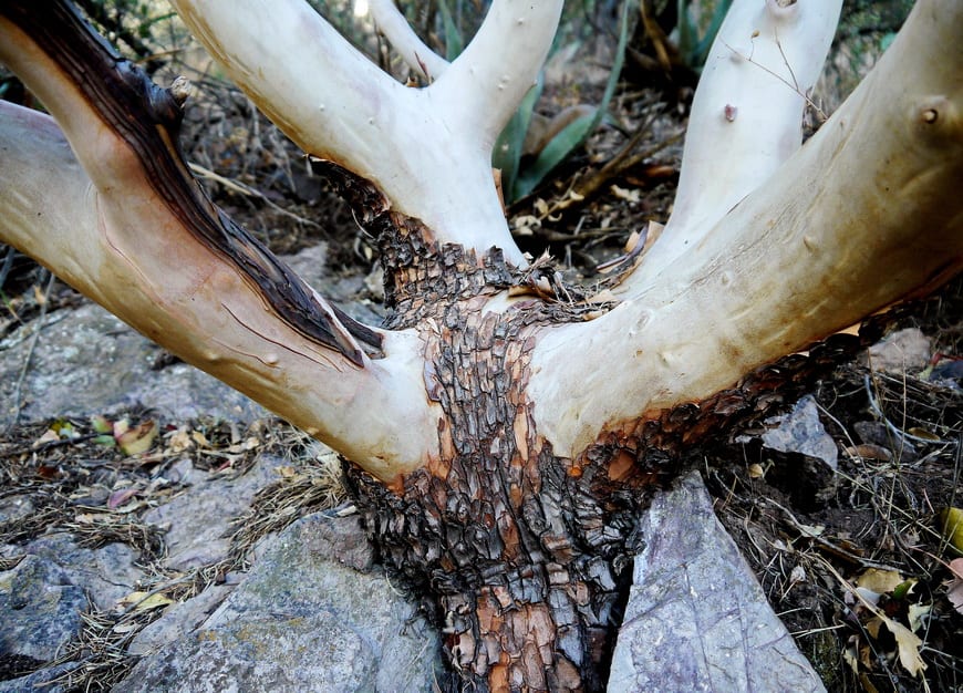
We elected not to go because of the afternoon heat. From the junction with the Emory Peak Trail it is a steep descent on switchbacks – past beautiful Texas madrone trees, oaks and pines.
The last mile is far more gentle – but by then it’s probably much hotter and you’ll probably be like the proverbial horse to the barn – and ready for the cold drinks and ice cream that are available at the trailhead.
Accommodation options near the South Rim Trail
At the Chisos Basin trailhead you’ll find a campground and several lodges. If you want to get an early start on the South Rim Trail hike, think about booking a room at the Chisos Mountain Lodge as it’s right at the trailhead.
If you’re driving to Big Bend National Park in the morning, allow at least an hour from the nearest town.
Useful information for the South Rim Trail in Big Bend National Park
We didn’t see any snakes or wild animals – just lots of birds and some very serious birders who were after the Colima warbler.
Use some common sense on the South Rim trail in Big Bend. Don’t wear sandals, take a light jacket in case the wind blows and carry about a gallon of water per person.
It took us three hours to get to the South Rim and a similar amount of time to descend – particularly because you need to watch your footing.
This South Rim trail in Big Bend takes you through such a range of environments and landscapes that I would definitely recommend it if you make it to Big Bend National Park.
A great resource is Hiking Big Bend National Park: A Guide to the Big Bend Area’s Greatest Hiking Adventures including Big Bend Ranch State Park.
Further reading on hiking in the United States
- Best Hikes Near Kanab, Utah
- 3 Pinkham Notch Hikes You’ll Want to Do in New Hampshire
- Why you’ll want to do the Hike to Havasu Falls in Arizona
- The Iceberg Lake Hike in Glacier National Park, Montana
- The Fay Canyon Trail in Sedona
Click on the photo to bookmark to your Pinterest boards.