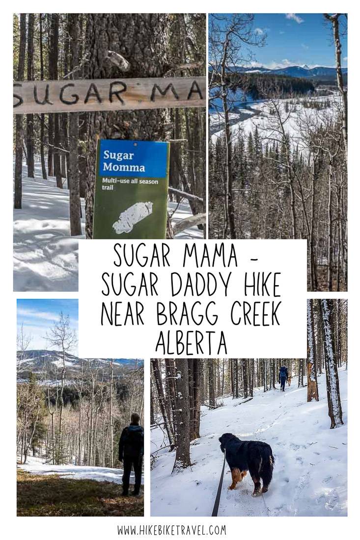
The Sugar Mama hike with the option to loop back on Sugar Daddy is part of a hike that starts at the Allen Bill parking lot off Highway 66 near Bragg Creek, Alberta.
It’s a great shoulder-season or winter hike that delivers a workout because of its length. But I’d give it a pass in the summer (unless you bike it) when you get up into the mountains at higher elevations.
The full loop is just under 14 km long and is made up of short sections of the Elbow, Snagmore, Strange Brew, and Bobcat trails along with 4.0 km on the Sugar Daddy trail and 3.3 kilometres on the Sugar Mama trail. There is an elevation gain of approximately 345 m of the Sugar Mama hike.
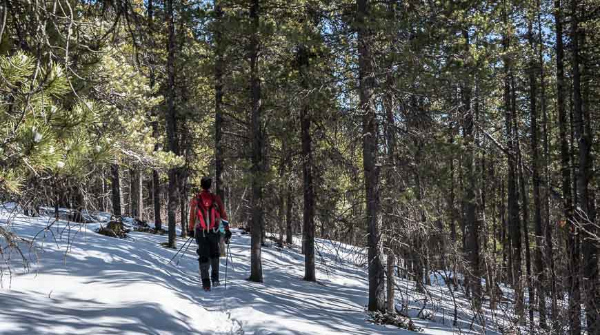
These loop trails are meant to be shared with mountain bikers. Even though the trail was quite icy in early March, there were plenty of bikers, especially on the Strange Brew connector. Be prepared to pull over at a moment’s notice.
This post includes some affiliate links. If you make a qualifying purchase through one of these links, I will receive a small percentage of the sale at no extra cost to you. Thank you very much for your support.
Sugar Mama hike summary
Permit: You will need a Kananaskis Conservation Pass to do the Sugar Mama hike.
Trail report: Check trail conditions before you go.
Don’t forget: Always take the hiking essentials and let someone know what trail you’re hiking and when you’re expected to be back.
Bears: Carry bear spray from March to November. I like to keep mine in a bear spray holster so I don’t set it off accidentally.
Get a workout: When you’re looking for a trail that delivers a moderate workout in winter with no avalanche danger this one is a great choice.
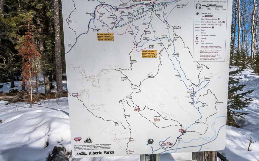
Do it as a loop hike: The Sugar Mama hike is best done as a loop with either Sugar Daddy or part of the Fullerton Loop but there are many permutations to the hike. Decide on the fly as there are good maps with mileages given at the intersections.
Winter gear: If you’re hiking in winter, I highly recommend that you carry traction devices or icers.
Finding the Allen Bill parking lot
From the intersection of Highway 22 and 66 just south of Bragg Creek, drive 9.8 km southwest on Highway 66 to reach the well-signed Fullerton Day Use Area on the north side of the highway.

Sugar Mama hike details
There is signage on the Sugar Mama hike but I still recommend you take a photo of any map you see as it can be a little confusing if it’s your first time in the area.
We tried to do the Sugar Mama hike a few years ago and ended up doing the Fullerton Loop – which fortunately wasn’t a hardship.
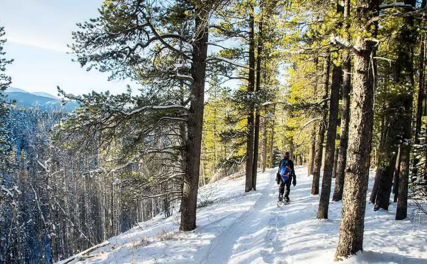
From the Allen Bill Trailhead walk over to the obvious trailhead and hop on the Elbow Trail. Take it to reach the intersection to the Fullerton loop in 1.2 easy kilometres. The Sugar Mama intersection is next, just another 100 – 200 metres long the main trail on the left.
There is a small sign but make sure you take the correct trail as it is a three-way intersection.
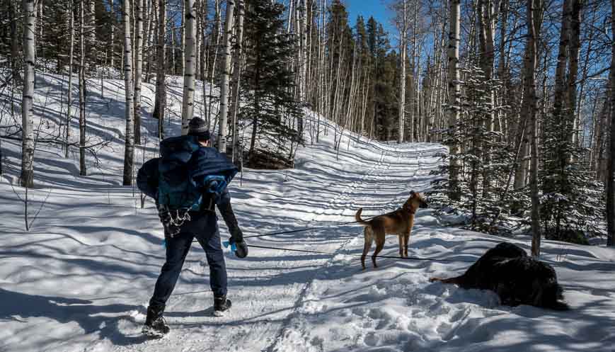
We opted to continue another kilometre or so to reach the Sugar Daddy intersection with the plan to hike the loop in a counter-clockwise direction. Both directions would be fine as the elevation gain (345 metres) is not so dramatic that one way is better than the other.
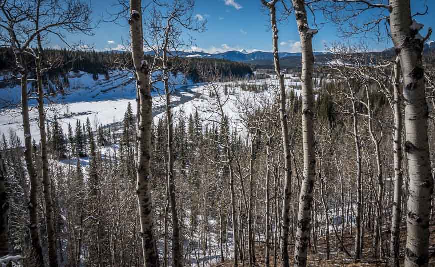
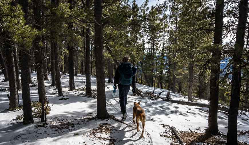
You access the Sugar Daddy trail off of the Snagmore Trail. Although you only hike for about a kilometre on the Snagmore trail, it’s really lovely ridge walking with views of the Elbow River.
Once we were on the Snagmore trail we didn’t see another soul for several hours.

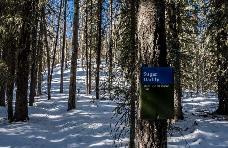
The Sugar Daddy part of the hike
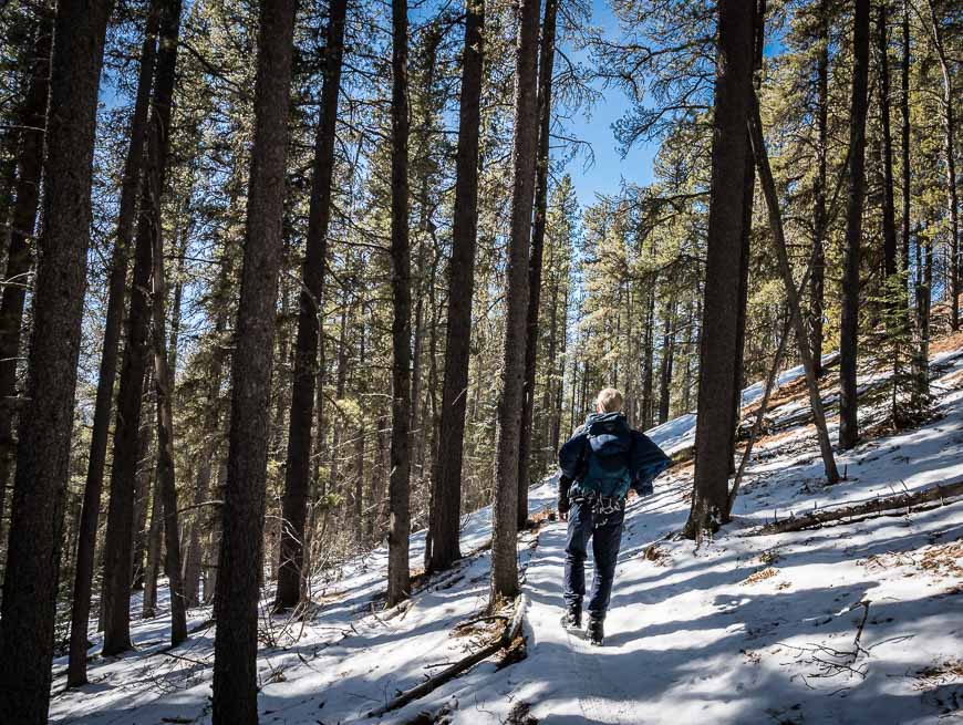
The Sugar Daddy section of trail was the longest – and hardest, but that was only because we opted to do loop counter-clockwise and so did 95% of the climbing on Sugar Daddy.
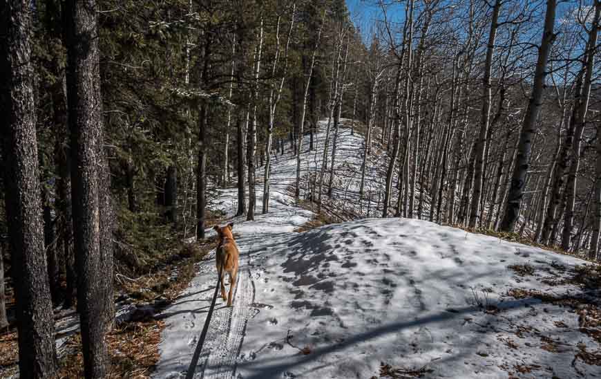
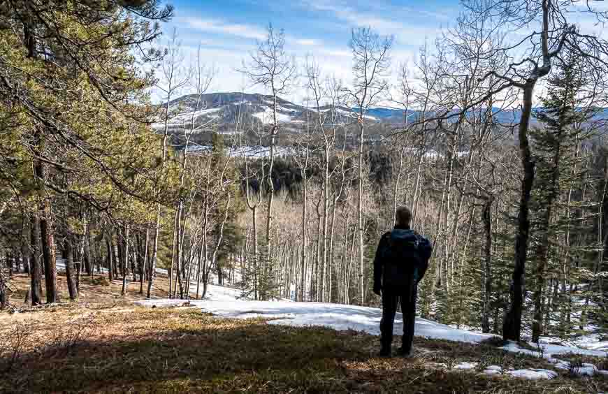
This section of trail was made up of lovely open forest. Just 100 metres shy of the intersection with Strange Brew, we found mostly dry outcropping with a view in the sun for lunch.
Then it was onto Strange Brew which I have snowshoed several times from the West Bragg Creek area; I highly recommend it. But I had never noticed the intersection of the Sugar Daddy trail before. It was more climbing than I expected to reach my favourite viewpoint. And then lovely ridge walking to reach the Bobcat Trail.
The Bobcat – Sugar Mama hike
Once we hit the Bobcat trail, most of the hiking was downhill, so our pace quickened. The dogs bounced back too and seemed to have more energy.
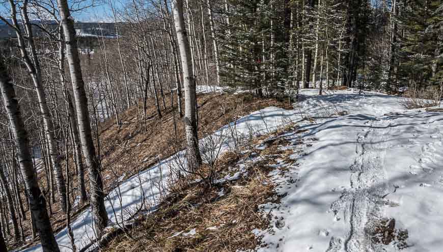
You will eventually find signage on the Bobcat trail for the Sugar Mama trail. It took us about an hour once we were on it to get back to the car. It was more of the same – beautiful open forest, fresh pine scent and no one around.


What to take on the Sugar Mama hike
Carry a large enough day pack to fit extra clothes and food, the 10 hiking essentials, water bottles….I personally like the 30 L size but I always carry a camera and an extra lens.
A seat cushion is a nice treat when you stop. On cold or wet days, it sure beats sitting on a rock.
Hiking poles come in handy on this hike, especially on the descent.
If you’re prone to blisters, I highly recommend Compeed.
Further reading on things to do in the Bragg Creek area
- Canyon Creek Ice Cave Hike Near Bragg Creek
- The Year Round Prairie Mountain Hike near Bragg Creek
- Snowshoeing the West Bragg Creek trails, Alberta
- The Fabulous Forget-Me-Not Ridge Hike
Click on the photo to bookmark to your Pinterest boards.