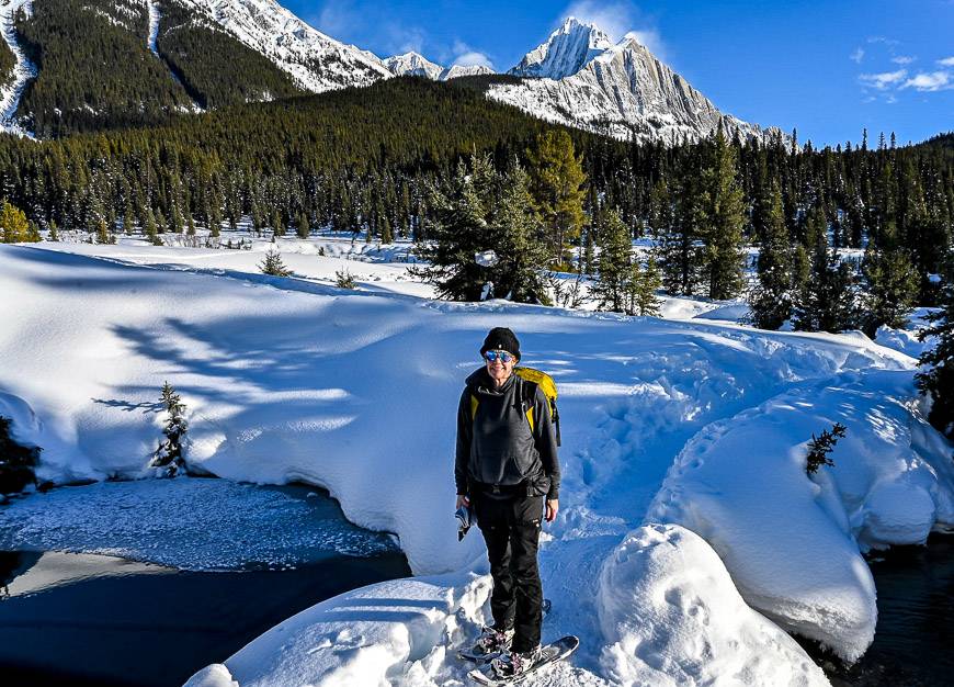
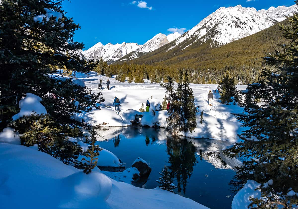
Snowshoeing in Banff National Park is a fun, invigorating way to spend time outdoors in winter. It’s hard to beat rosy cheeks and the glow you get after a few hours outdoors in Mother Nature. In Banff, there are loads of snowshoeing trails to choose from – including some that will get your heart pounding for hours at a time.
Don’t worry about the hard snowshoe trails in Banff if that’s not your thing.
There are plenty of easy, family-friendly options for those of you who just want to break up the day and get out for an hour or two.
Some of the popular Banff snowshoe trails like Tunnel Mountain tend to get packed down quickly so there are times microspikes make more sense than snowshoes. Take both just in case.
This post includes some affiliate links. If you make a qualifying purchase through one of these links, I will receive a small percentage of the sale at no extra cost to you. Thank you very much for your support.
Before you go snowshoeing in Banff
Trail conditions: Check Banff National Park trail reports online for information on Banff snowshoe trails. If you’re in Banff, go to the Visitor Centre for personalized suggestions and maps.
Weather: It’s a good idea to look at the weather forecast before you make the drive to Banff National Park.
Permits: Buy your Parks Canada pass online, at the entrance to Banff National Park or at the Banff Visitor Centre at 224 Banff Avenue.
Go prepared: Carry the 10 essentials along with extra hand warmers, warm clothes and a thermos of something hot to drink.
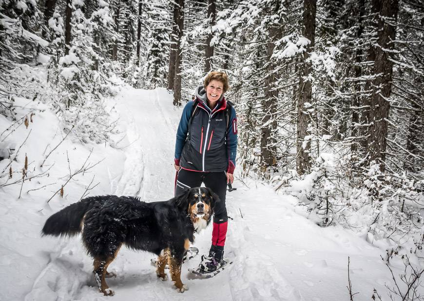
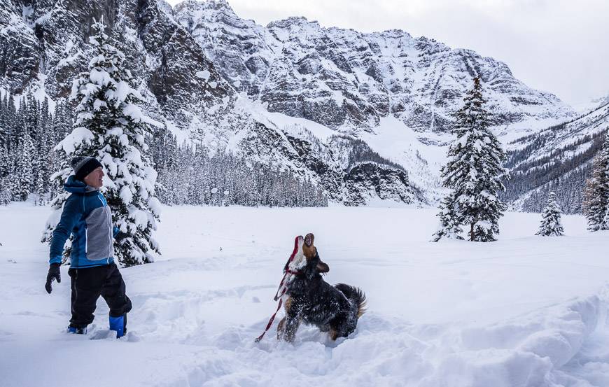
Dogs: You can take your dog on most snowshoeing trails in Banff. Don’t forget extra water and treats for them as well. Some dogs, like our rescue from Mexico, need booties and a coat below a certain temperature.
Avalanche awareness: Avoid avalanche terrain unless you have the background and the right equipment. Check avalanche conditions.
Check road reports: Know how to survive a winter drive as this roads on the way to Banff National Park can be treacherous in winter.

My three favourite snowshoe trails in Banff
- Taylor Lake is a full day outing so it’s one of the harder ones, but never busy and very rewarding.
- Stoney Lookout Loop is perfect if you only have a few hours. Great view of the Bow Valley from the lookout.
- Ink Pots via Moose Mountain – a classic with a gorgeous finish in a large meadow. Can be done in conjunction with a hike up Johnston Canyon to up the wow factor.
Snowshoeing in Banff important information
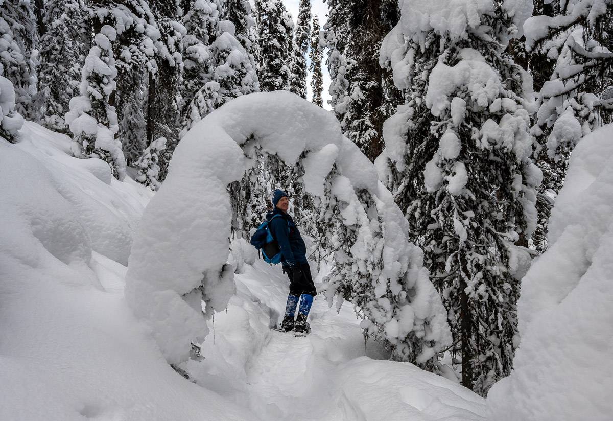
No matter where you end up snowshoeing in Banff National Park, be sure to go prepared. That means taking the right clothing (no cotton) and extra layers if the temperature drops. Take a thermos or two of something hot to drink along with some high energy food. You can burn a lot of calories just trying to stay warm.
Icers
If it hasn’t snowed in a while, I’d also recommend taking a pair of icers or microspikes as you may have to alternate between snowshoes and icers. Poles can also come in handy in deep snow or to help with balnce.
Bears and bear spray
And believe it or not, you should still carry bear spray. We met a fellow during the third week of November who ended up close to a BIG grizzly bear near the Cascade Ponds, off the Lake Minnewanka Road.
Avalanche danger snowshoeing in Banff
Avalanche danger is one of the hazards snowshoeing in the Banff backcountry.
Most of the snowshoeing trails in Banff I’ve mentioned don’t cross avalanche paths – and personally that’s the way I like it. But people can inadvertently get off trail – in whiteout conditions for instance or take a trail with known avalanche danger. If that’s the case you better know what you’re doing. Before you go, check out this avalanche forecast for Banff National Park.
Location map of snowshoe trails in Banff
- Click on the three dots near the top right hand corner to email a copy of the map.
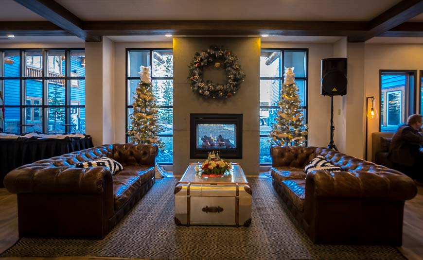
Where to stay in Banff
Banff offers the visitor a wide variety of accommodation options – across the spectrum of price points from inexpensive like the hostel to the expensive but lovely Banff Springs Hotel.
The Banff Alpine Centre Hostel is an affordable way to stay in Banff.
Canalta Lodge is a nice hotel – and great for families in the more affordable category.
The Moose Hotel & Suites is my favourite Banff hotel close to the strip of stores.
The Dorothy Hotel is a new (2022) boutique motel offering simple accommodation.
And everyone knows the iconic, expensive but lovely Fairmont Banff Springs Hotel.
Guided snowshoe tours in Banff
There are guided snowshoe tours in Banff that are a lot of fun. I highly recommend the Snowshoeing on Top of the World Tour that includes a hotel pick up in Banff, a ride on the gondola at Sunshine Village Ski Resort, and stunning Rocky Mountain scenery.
Some other providers include White Mountain Adventures, Banff Tours and Great Divide Nature Interpretation.
Joel Hagen, the guide and owner of Great Divide is an award-winning naturalist and one of the best guides you’ll find in Banff! I did a guided hike with him to Eiffel Lake in the summer a few years back and loved the full experience.
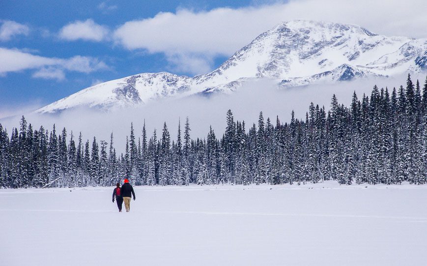
Easy snowshoe trails in Banff National Park
1. Mirror Lake near Lake Louise
Distance and elevation gain: 5.4 km return with a 295 m elevation gain – via the Lake Agnes Trail
Level of difficulty: Easy to moderate
Trailhead location: Look for signage in front of the Fairmont Lake Louise Hotel, near the start of the Lakeshore Trail
Dogs allowed: Yes, on a leash.
This is one of the popular snowshoeing trails in Banff with many people continuing past Mirror Lake to Agnes Lake. But be warned. The trail beyond Mirror Lake is classified as challenging Class 2 terrain for avalanche exposure and travel. I did it one year not appreciating the massive snowfields above me that you can’t see from the trail. Stupid! If you continue – and so many people do – you should have all the appropriate equipment and know-how in avalanche country. Dumb luck doesn’t count for much.
The actual trail to Mirror Lake switchbacks through the trees – offering only a few views. But it’s a good workout and Mirror Lake with the view of the Big Beehive pictured below is very pretty.

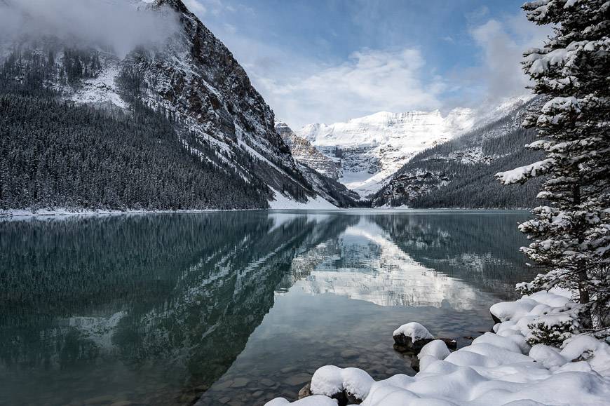
2. Snowshoeing in Banff on the Lake Louise Lakeshore trail
Distance and elevation gain: 4.0 km return with no elevation gain
Level of difficulty: Easy
Trailhead location: In front of the Fairmont Chateau Lake Louise
Dogs allowed: Yes, on a leash
From the front of the Fairmont Chateau Lake Louise, head right and start snowshoeing on the lakeshore trail. Views are beautiful for the full length of the trail. At the end of the lake look for ice climbers on the 100 metre tall frozen waterfall.
Continuing past the end of the lake towards the Plain of Six Glaciers Teahouse takes you into avalanche country. Again, take the proper equipment and know how to safely travel in this terrain. , if you continue.

3. Sunshine Meadows
Distance and elevation gain: Variable depending on the tour
Level of difficulty: Easy
Trailhead location: Sunshine Meadows Parking lot – gondola and contact the guide for meeting location
Dogs allowed: No
While it’s possible to explore Sunshine Meadows on your own, there are some logistics involved just getting into the high country. You would have to pay for a ride up and down the gondola and Standish chairlift at a minimum.
The other alternative is to enjoy a guided, fun winter outing with White Mountain Adventures. I’ve done a few outings with them and have always enjoyed the experience. Sunshine Meadows on a bluebird day is particularly beautiful but if you’re in a winter snowstorm you can get turned around pretty quickly. For people who are navigationally challenged, go with a guide.
Read: The Sunshine Village Snowshoeing Experience
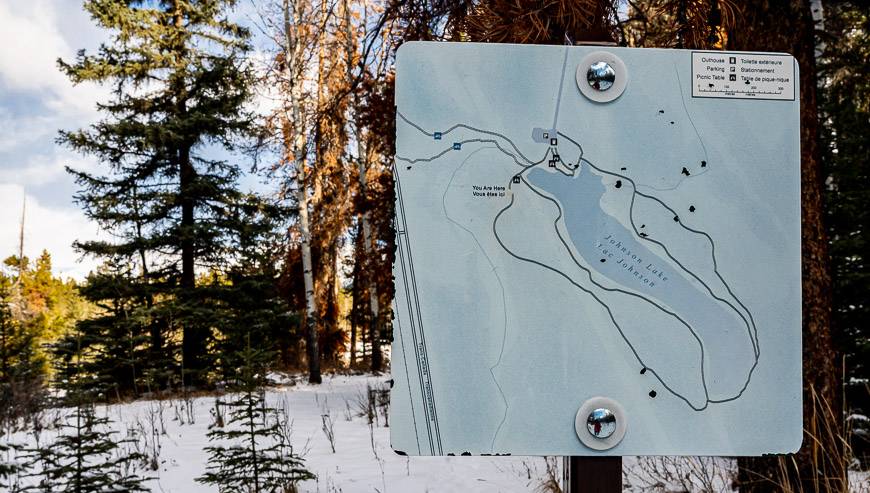
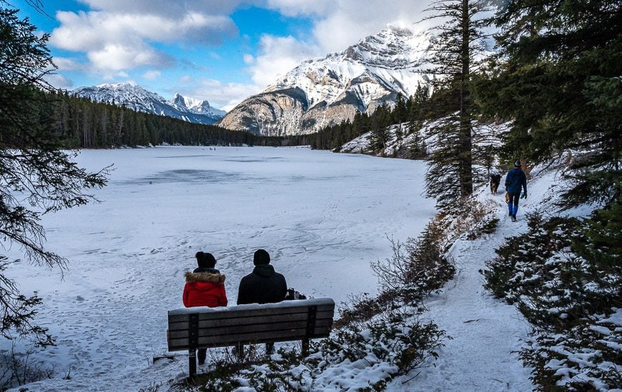
4. Johnson Lake Snowshoe Trail
Distance and elevation gain: 2.8 km loop with minimal elevation loss or gain
Level of difficulty: Easy and family-friendly
Trailhead location: From the Trans Canada highway, take the first Banff exit and stay right to get on Lake Minnewanka Road. There’s lots of signage to get you to Johnson Lake.
Dog-friendly: Yes, on a leash
The trail starts from the Johnson Lake day-use area off the road up to Lake Minnewanka. This is a popular trail for a snowshoe or winter walk as it’s often hard packed snow. Head off in either direction following the lakeside shoreline. At the far end, enjoy superlative views of both Cascade and Rundle Mountains. The east side of the lake is mainly in the trees and underneath a powerline so it’s not nearly as pretty.
This is a good place to go skating afterwards if its safe to do so. There are washrooms adjacent to the large parking lot.
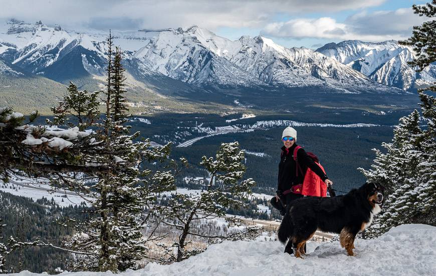
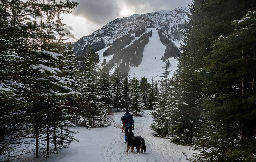
5. Stoney Lookout Loop snowshoe near Mt. Norquay
Distance and elevation gain: 4.8 km loop with 205 m of elevation gain
Level of difficulty: Easy
Location: Pick up the trail just as you enter the Mount Norquay ski area on the right. There is signage and the parking lot attendants seem to know where to point you.
Dog friendly: Yes, on a leash
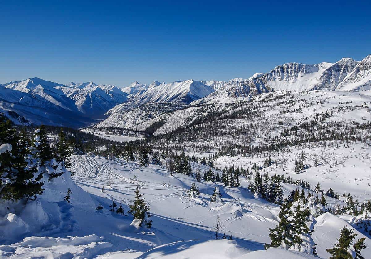
The Upper Stoney loop snowshoe is a great one if you only have a few hours. Its got enough of an elevation gain that you feel like you’ve had a workout. Even though much of the loop is in the forest, it is pretty – and the view from Stoney Lookout is excellent, especially of Cascade Mountain and the Bow Valley.
The loop deposits you by the ski lodge and then it’s just a short walk back to the car. There is also the option to snowshoe up to the lookout and simply retrace your steps. That is the easiest option.
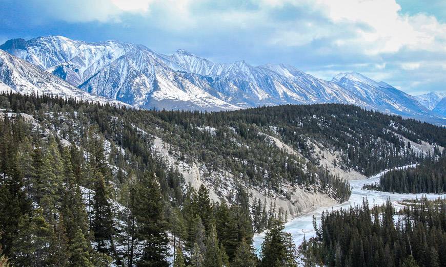
6. Spray River Loop Snowshoe Trail
Distance and elevation gain: 11.2 km for the full loop with 75 m of elevation gain
Level of difficulty: Easy if the snow has been packed down; otherwise moderate
Trailhead location: Continue about 100 metres past the Banff Springs Hotel to a small parking lot.
Dog friendly: Yes, on a leash and be respectful of all on the trail
The Spray River loop is ideal if you want to get out for some exercise. Often, you’ll be hiking, perhaps with cleats and not snowshoeing in Banff as the snow around here never stays around for long. You might also see cross-country skiers and fat bikers.
From the trailhead, follow the Spray River for 5.7 km down to a bridge. You can either retrace your steps at this point or cross the bridge and follow the wide trail back along the river to another bridge. Cross it, climb a short hill, turn right and you’re back at the starting pint. Allow three to four hours. round-trip.
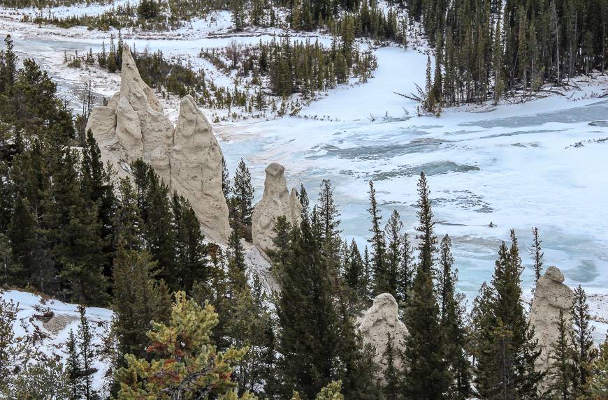
7. Snowshoeing to Hoodoos Viewpoint from Surprise Corner
Distance and elevation gain: 9.2 km return with 115 m elevation gain, 90 m elevation loss
Level of difficulty: Easy to moderate
Trailhead location: Take the second exit into the town of Banff if you’re heading west on the Trans-Canada Highway. Park at Surprise Corner, at the east end of Buffalo Street.
Dogs allowed: Yes, on a leash
You’ll find the trailhead for this outing at Surprise Corner, located at the east end of Buffalo Street. Years ago, we combined this trail with a loop off of Tunnel Mountain Road, just past the Hoodoos Viewpoint and made a full day of it.
Some of the trail is in the trees but there are great long sections where you get some views of the Bow River. Around the Hoodoos Viewpoint the vistas are gorgeous. This is a sunny trail so its often icy. I think you’ll find icers are a better choice than snowshoes unless there has been a fresh dump of snow.
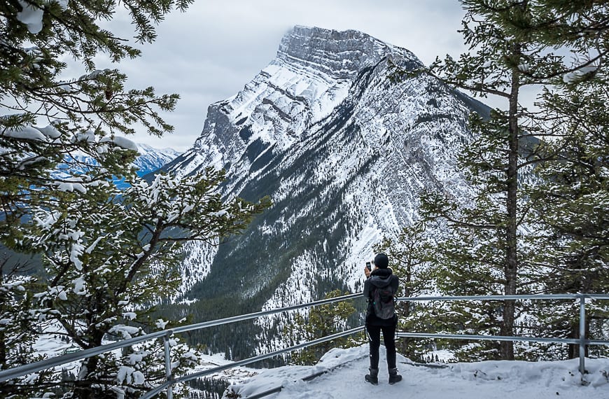
8.Tunnel Mountain
Distance and elevation gain: 4.8 km return with 260 m of elevation gain
Level of difficulty: Easy to moderate depending on your fitness and how much snow there is
Trailhead location: The lower Tunnel Mountain trailhead is on St. Julien Road here.
Dogs allowed: Yes, on a leash
I think of Tunnel Mountain as a great place to go for a winter hike, but after a big dump of fresh snow, it would be one of the top places to snowshoe in Banff.
Its one of the must-do trails in the park for the superlative views you get of Mt. Rundle, the Banff townsite, Mt Norquay and the Bow Valley. If you’ve never been to Banff before, a hike to the summit helps put all the landmarks in perspective. You also get a great view of the Banff Springs Hotel.
Allow 90 minutes to 2 hours to do the round-trip hike or snowshoe.
You can walk to the trailhead from downtown Banff, but you can also drive there in about 5 minutes via Banff Avenue, Wolf Street, Grizzly and St. Julien Road.

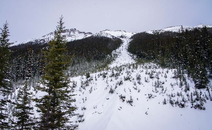
Moderate Snowshoe Tails in Banff
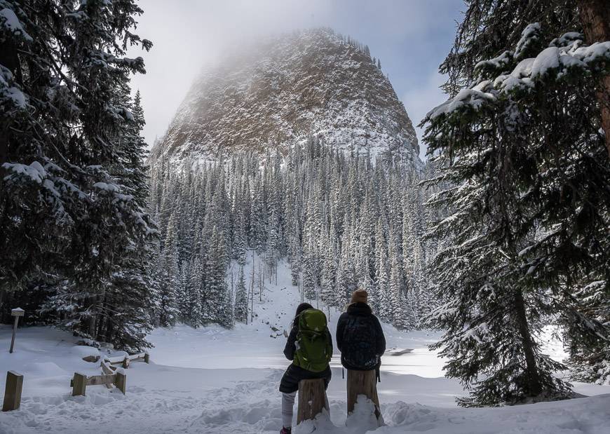
1. Snowshoeing to the Ink Pots via Moose Meadows
Distance and elevation gain: 11.2 km return with 340 m elevation gain and 140 m elevation loss
Elevation gain: Moderate
Trailhead location: The trailhead is located at the Moose Meadows parking lot, about 4.6 km southwest of Castle Junction on Highway 1A.
Dog-friendly: Yes, on a leash
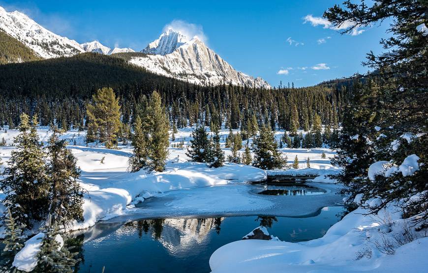
If you snowshoe to the Ink Pots via the Moose Meadows trail in Banff National Park, you won’t have to fight the crowds on the Johnston Canyon Ice Walk. The trail climbs steadily through the forest with little in the way of views until you’re almost at the Ink Pots. There you will find magnificently coloured mineral springs, no matter what the temperature. The setting is quite magical on a bluebird day.
2. Boom Lake Snowshoe Trail
Distance and elevation gain: 10.2 km return with 175 m elevation gain; that doesn’t include any snowshoeing on the lake itself
Level of difficulty: Easy to moderate depending on your fitness level
Trailhead location: The Boom Lake trailhead is on the north side of Highway 93, 7.2 km south of the Trans-Canada Highway – Castle Junction intersection.
Dog friendly: Yes, in theory on a leash but if there are a lot of cross-country skiers, you might want to leave your dog at home
There is a cross-country ski trail to Boom Lake in Banff National Park, so there’s no reason you can’t snowshoe to the lake as long as you stay out of the ski tracks. You’re in the trees all the way to the lake, but once you arrive at the lake it’s very pretty. There is a 600 metre cliff rising above the southern shore along with some lovely frozen icefalls along the northern shore.
Only travel on Boom Lake if it is safe to do so. According to the Weather Network, blue ice should be at least 15 cm thick to be safe to walk on – and 20 cm thick if there is a group of people. There are avalanche paths coming down to the lake which need to be avoided at all costs.
3. Snowshoeing in Banff from Shadow Lake Lodge
Distance and elevation gain: Highly variable
Level of difficulty: Easy to hard depending on where you go from the lodge. It is moderate to difficult to get to the lodge.
Trailhead Location: The Redearth Creek parking lot is located 20 km west of the Banff townsite or 10.5 km east of Castle Junction. It is signed on the Trans-Canada Highway in either direction.
Dogs allowed: They are not permitted at the lodge.
Most people cross-country ski 14 km one way on the Redearth Creek Trail up to Shadow Lake Lodge. Once you’re up at the lodge in Banff National Park, there are lots of snowshoeing opportunities. Head out to Shadow Lake on a flat easy trail or make your way towards Gibbon or Ball Pass.
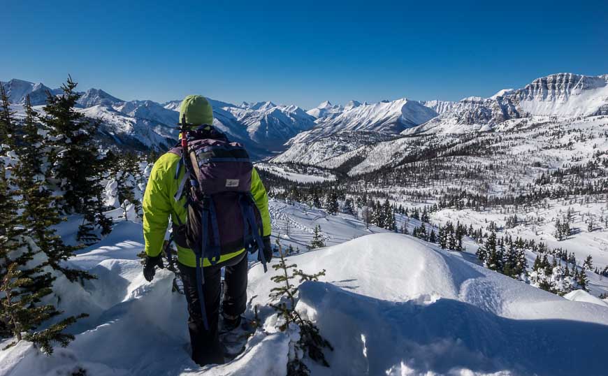
Difficult Snowshoe Trails in Banff
1. Snowshoeing in Banff to Taylor Lake
Distance and elevation gain: 12.6 km return, 585 m elevation gain.
Level of difficulty: Hard because of length and elevation gain.
Trailhead location: The parking lot is located 8 km west of Castle Junction on the west side of the Trans-Canada Highway. It’s signed in either direction.
Dog-friendly: Yes, if your dog can handle snow and the cold.
This is a great trails in Banff for snowshoeing if you’re after a workout. It climbs most of the way to the lake, ending in a scenic hanging valley. Occasionally you’ll see cross-country skiers on the trail. Give them room as it isn’t a wide trail. Allow about 4 – 5 hours depending on how deep the snow is and how many breaks you take.
Note: The trail to O’Brien Lake or Panorama Ridge take you into avalanche terrain and should be avoided unless you’re equipped to travel through avalanche country and you’re savvy about what to do.
2. Bourgeau Lake
Distance and elevation gain: 14.8 km return with 765 m elevation gain if you go all the way to the lake
Level of difficulty: Hard because of elevation gain and length in winter.
Beware: Turn back before you get into avalanche terrain or carry the right avalanche gear and know how to use it.
Bourgeau Lake trailhead: The Bourgeau Lake trailhead is on the Trans-Canada Highway just 2.8 km west of the Sunshine Village turnoff and 44 km from the Lake Louise turnoff. It is signed in both directions on the highway.
Dog-friendly: Yes, on a leash
You won’t find this snowshoe trail in many Banff guides but it’s a good one for a workout if you go as far as the first of the avalanche chutes, about 5.5 km in. We turned back before the lake, as there was just one avalanche zone too many too cross – and even though there wasn’t a lot of snow, I didn’t feel it was worth the risk.
The trail climbs relentlessly to Bourgeau Lake, so it’s a good one for the workout. Views are spotty until you reach the lake. If you do continue all the way to the lake, be sure you’re prepared to travel in avalanche country!

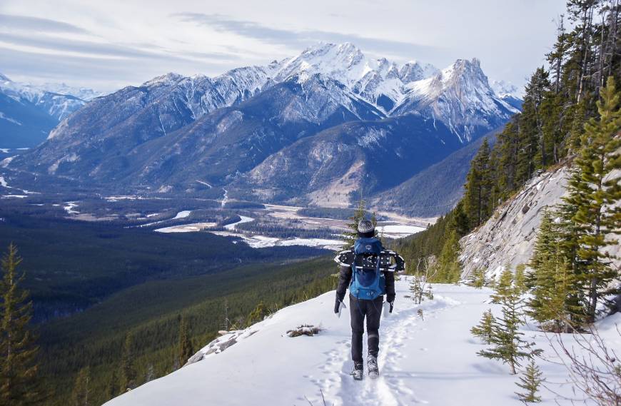
3. Snowshoeing in Banff up Sulphur Mountain via Cosmic Ray Road
Distance and elevation gain: 15.6 km return with 885 m of elevation gain
Level of difficulty: Moderate to difficult depending on whether you have to break trail and because of the elevation gain.
Trailhead location: The trail starts at the Cave and Basin National Historic Site, west of the visitor area.
Dog-friendly: Yes, on a leash but bring extra water as it can be along day.
The snowshoe up Cosmic Ray Road is one of my favourite winter outings in Banff National Park. Not only do you get a good workout because of the distance, you get stellar views for most of its length and chances are you won’t see a soul until you get to the top.
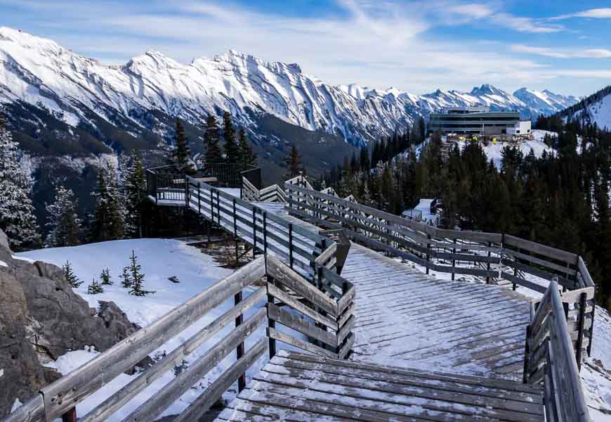
Pick up the Sundance Trail after you pass the Cave and Basin National Historic Site and follow it as it parallels the Bow River for 2.6 km. At that point look for signage and an intersection pointing to the Sulphur Mountain Summit. Take it and follow the long road, switchbacking as you get close to the top – until it reaches the boardwalk. From there you can climb up Sanson Peak.
The descent is way faster but there is the option to pay for a ride down on the Banff Gondola. Then you’d have to taxi, hitchhike or have pre-arranged a shuttle to get back to the Cave and Basin parking lot.
4. “Highline” Trail to Paradise Creek
Distance and elevation gain: 15.2 km return, 235 m elevation gain
Level of difficulty: Hard
Trailhead Location: Lake Louise parking lot but start on the Fairview cross-country ski trail (just not in the tracks)
Dogs allowed: It would be awkward here, so I would recommend leaving dogs behind.
This is a long snowshoe that is quite tough when there’s fresh snow as you’ll likely be doing all the breaking of trail. Don’t expect to see anyone else on it!
We started from the Lake Louise parking lot and paralleled the Fairview cross-country ski trail for the first 4 km or so, breaking trail the whole way so we didn’t annoy the cross-country skiers. At a major intersection you make a sharp right and start following the summer trail. The signage leads you but a map is still helpful.
We were snowshoeing in Banff in late December and didn’t allow enough time to get back in the daylight. Still, what we did was very beautiful.
To return, we picked up snowshoe trail #17 and made our way back to Lake Louise to meet up with the trail going up to the Fairview Lookout. Then it was just minutes to get back to the parking lot.
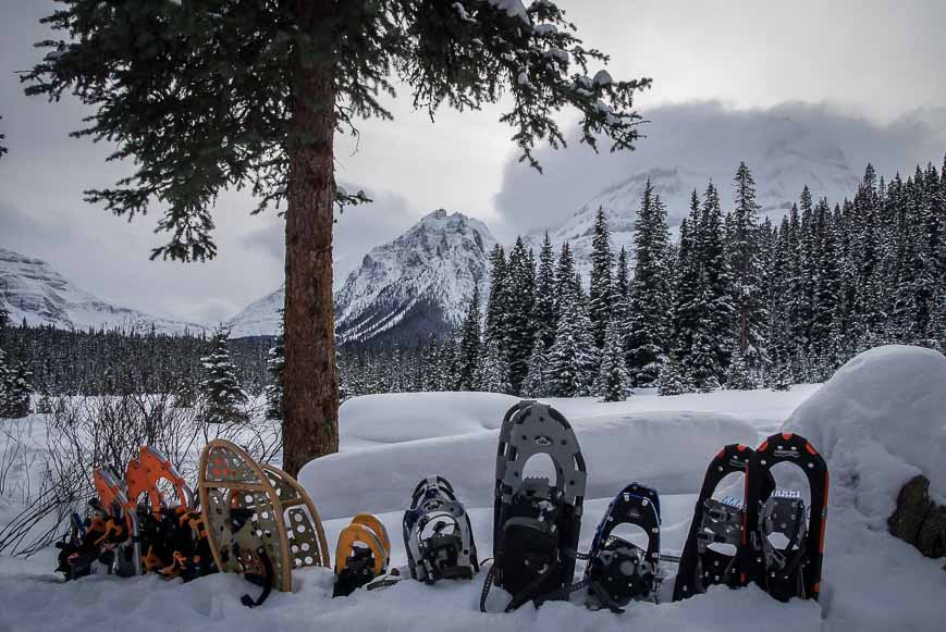
What to take snowshoeing in Banff National Park
You can rent snowshoes but it’s so much easier to go on a last-minute outing if you have your own. Buy some somewhere, anywhere – used or new.
For more ideas on where to go snowshoeing in the Rockies, pick up a 2nd edition copy of Andrew Nugara’s Snowshoeing in the Canadian Rockies.
I’d also recommend buying a good pair of icers like these ones from Kahtoola.
Poles are invaluable for balance. You can buy winter poles but I just use my collapsible hiking poles – and would suggest something like these ones.
Be sure to take some handwarmers, a thermos, some energy bars and an extra pair of warm socks.
Click on the photo to bookmark to your Pinterest boards.
