Hike
Hike
Banff Via Ferrata Experience at Mt. Norquay
Alberta
Mount Kidd Lookout Hike in Kananaskis
Hiking
Southfork Lakes Hike & Camp in Southern Alberta
Multi-Day Hikes
Tips for Backpacking With Kids Under 5
Beginner Hikes
Moderate Hikes
Expert Hikes
Multi-Day Hikes
Day Hikes
Winter Hikes & Ice Walks
Hiking Tips
Hiking Gear
Travel
Travel
Unique Things to Do in Kelowna in Spring, Summer & Fall
Visiting Hoover Dam From Las Vegas
How to Use Nomador to House-Sit Around the World
Canada
USA
Mexico & Central America
South America
Europe
Asia
Africa
To Stay
To Stay
How to Get Campsites Without a Reservation in Alberta
Cozy Log Cabins in Banff to Visit
Dominica Adventures with Wanderlust Caribbean
Hotels & B&B’s
Camping
Glamping
Unique
To Do
To Do
Top Things to Do in St. Pierre
Banff Via Ferrata Experience at Mt. Norquay
10+ Stops to Make on a 2-Day Lacombe County Bike Trip
Hike
Paddling
Nature
Winter Activities
Day Trip Guides
Multi-Day Trip Guides
Gear & Safety
Gear & Safety
2024 Outdoor Lovers Spring Gear Guide
Tips on How to Make Outdoor Gear & Clothing More Sustainable
2023 Outdoor Lovers Holiday Gift Guide
Hiking Gear
Travel Gear
Camping Gear
Packing Guides
Safety Tips & Tricks
Biking
Biking
Biking the Katy Trail in Missouri – A Guide
Goat Creek Trail Bike Ride – Canmore to Banff
Sea To Sky, BC Mountain Bike Adventure
Road Biking
Mountain Biking
Fat Tire Biking
E-Biking
Bike Trips
More
About Leigh
Adventure Guides
Fun Facts
Photo Gallery
My Books
Contact
Work With Me
Subscribe
Generic selectors
Exact matches only
Search in title
Search in content
Post Type Selectors
Search in posts
Search in pages
See all results
0
Maps
Showing all 3 results
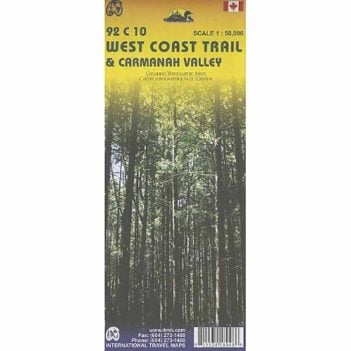
West Coast Trail and Carmanah Valley
$
11.95
Buy product
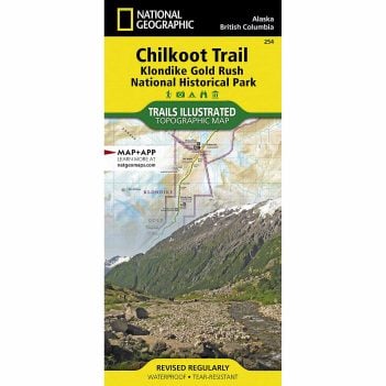
Chilkoot Trail, Klondike Gold Rush NHP: Alaska, USA, British Columbia, Canada
$
19.22
Buy product
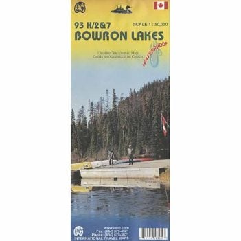
Bowron Lakes Map
$
14.95
Buy product
0
Hike
Beginner Hikes
Moderate Hikes
Expert Hikes
Multi-Day Hikes
Day Hikes
Winter Hikes & Ice Walks
Hiking Tips
Hiking Gear
Travel
Canada
USA
Mexico & Central America
South America
Europe
Asia
Africa
To Stay
Hotels & B&B’s
Camping
Glamping
Unique
To Do
Hike
Paddling
Nature
Winter Activities
Day Trip Guides
Multi-Day Trip Guides
Gear & Safety
Hiking Gear
Travel Gear
Camping Gear
Packing Guides
Safety Tips & Tricks
Biking
Road Biking
Mountain Biking
Fat Tire Biking
E-Biking
Bike Trips
More
About Leigh
Adventure Guides
Fun Facts
Photo Gallery
My Books
Contact
Work With Me
Subscribe
My Cart
Close (×)
0
Your cart is empty
Browse Shop
Generic selectors
Exact matches only
Search in title
Search in content
Post Type Selectors
Search in posts
Search in pages
Start typing to see results or hit ESC to close
See all results
Love to Hike, Bike, & Travel?
Get travel tips & outdoor inspiration by signing up for our monthly newsletter
Go to Appearance > Customize > Subscribe Pop-up to set this up.
0