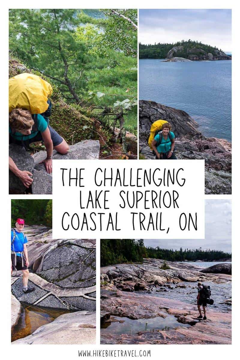
The Challenging Lake Superior Coastal Trail Hike
“The Lake Superior Coastal Trail is more difficult than the Coastal Trail in Pukaskwa National Park” exclaims one of the staff working at the Lake Superior Provincial Park Visitor Centre. I roll my eyes – thinking “as if”. What does she really know?
Now that I’ve hiked a major section of the Lake Superior Coastal Trail over a three day period – and not the most difficult section which is the 20 kilometres from Gargantua to Orphan Lake – I concur with her assessment. And I take back my eye rolling.
This post includes some affiliate links. If you make a purchase via one of these links, I may receive a small commission at no extra cost to you. Thank you very much for your support.
Would you like to save this?
Lake Superior Coastal Trail summary
Distance: 65 km (40.4 miles) one way but lots of options to shorten the hike.
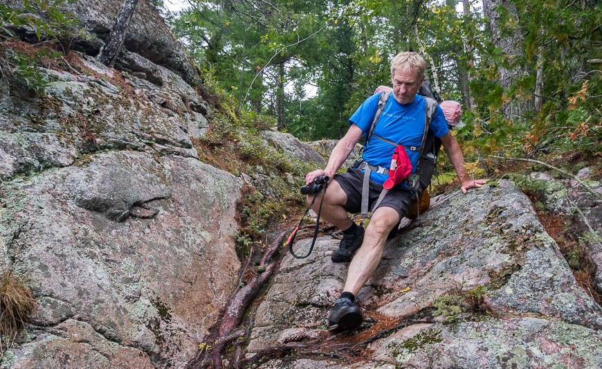
Level of difficulty: Hard to challenging thanks to slippery rocks and boulders along with some steep climbs up big rocks. Think gnarly in places, especially with a backpack.
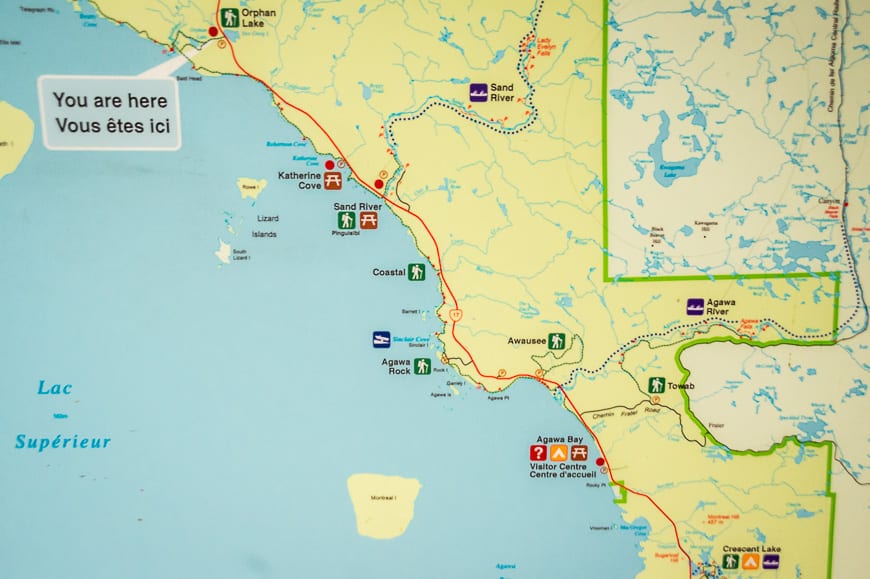
Access points: Multiple location along the length of the trail. The northern access point is via Gargantua Road and the southern one comes out near the Agawa Bay Visitor Centre.
Backcountry permits: Reservations are required for backcountry camping. You can also call 1-888-668-7275. There is a self registration kiosk at Gargantua Harbour in the north.
Time needed: 5 – 6 days for the full Lake Superior Coastal trail but there are lots of options to shorten the hike.
Best time to hike: Late August into early September is ideal. The bugs have dropped off and the temperatures are usually ideal for hiking.
Shuttles: There are two companies providing shuttle services to road access points – U Wanna Cab and Naturally Superior Adventures.
Maps: Available for purchase at Lake Superior Provincial Park Visitor Centre. Download a map of Lake Superior Provincial Park showing the full Lake Superior Coastal trail.
Before you start the hike: Go to the Visitor Centre to get the latest on trail conditions (or closures) and to print your permits.
Guided hikes: None as of 2025. If you’re planning to backpack you should have lots of backcountry experience as the Lake Superior Coastal trail is no place for the novice.
Storing food: There are now food lockers and bear boxes along the trail – but please practice Leave No Trace principles and pack everything out you pack in.
Cell phones: Occasionally there is cell reception along the Lake Superior Coastal Trail – eg. at the Coldwater Campsite. Try periodically at high points or when you’re near the highway.
Gargantua Bay to the Orphan Lake trail
The 18.5 km section of the Lake Superior Coastal trail from Gargantua Bay to the Orphan Lake trailhead is the toughest and not one I have done. My experience starts at the Orphan Bay trailhead.
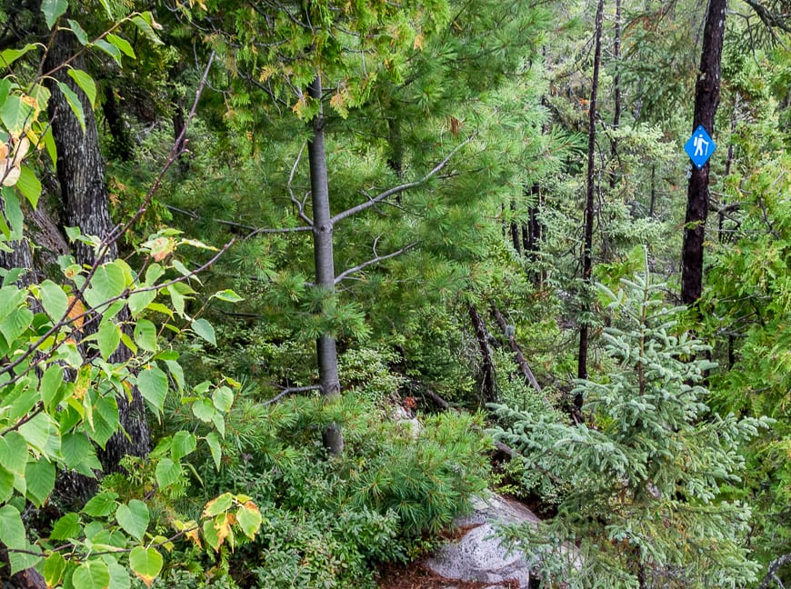
If you are planning to start at Gargantua Bay (accessed via a 14 km dirt road off the highway that will take you 45 minutes to drive), you should know that there are rocky demanding sections and challenging conditions, especially when the rocks are wet – though that’s true of all the rocky sections on the trail.
Unfortunately the Lake Superior Coastal Trail officially starts 8 km north of where the access road comes in at Gargantua Bay. If you don’t care about doing the full end to end hike, you can give it a pass but purists will have a hard time with that. If you hike the 8 km one way you’re rewarded with excellent views from the Devil’s Chair and a lovely campsite at Warp Bay.
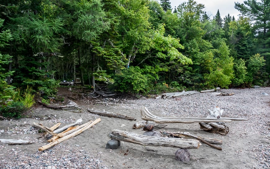
There are campsites over the first easy kilometre starting in Gargantua Harbour and then the steep climbing begins. Try to enjoy the mix of forest and coastal walking as you approach Rhyolite Cove – and a campsite after 5.7 km of hiking. If you got a late start, this is a good place to spend the night.
There is another campsite, Mermaid Lagoon, after a further 1.7 km, 7.4 km from the trailhead. The Buckshot Creek Campsite is next at 10.6 km. It’s tough hiking with lots of elevation gain on and off to reach the Beatty Cove campsite at the 14.4 km point. There are also campsites at Baldhead North, not too far from where the Orphan Lake trail intersects the Coastal Trail.
Sometimes on the Gargantua Bay to Orphan Lake section you won’t be hiking faster than just over a kilometre and hour, so plan accordingly.
Our Lake Superior Coastal Trail experience starting at Orphan Lake Trailhead
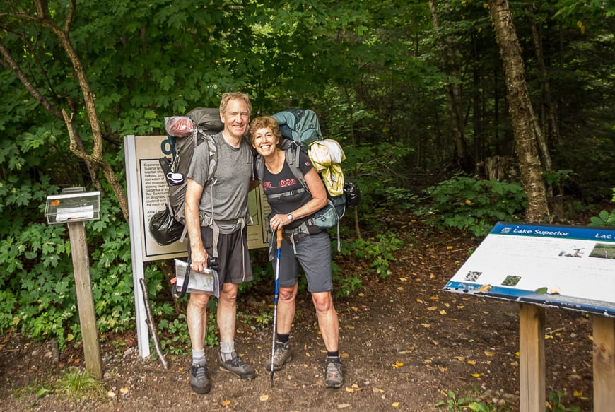
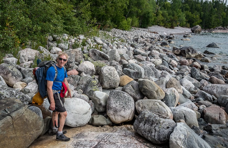
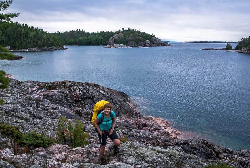
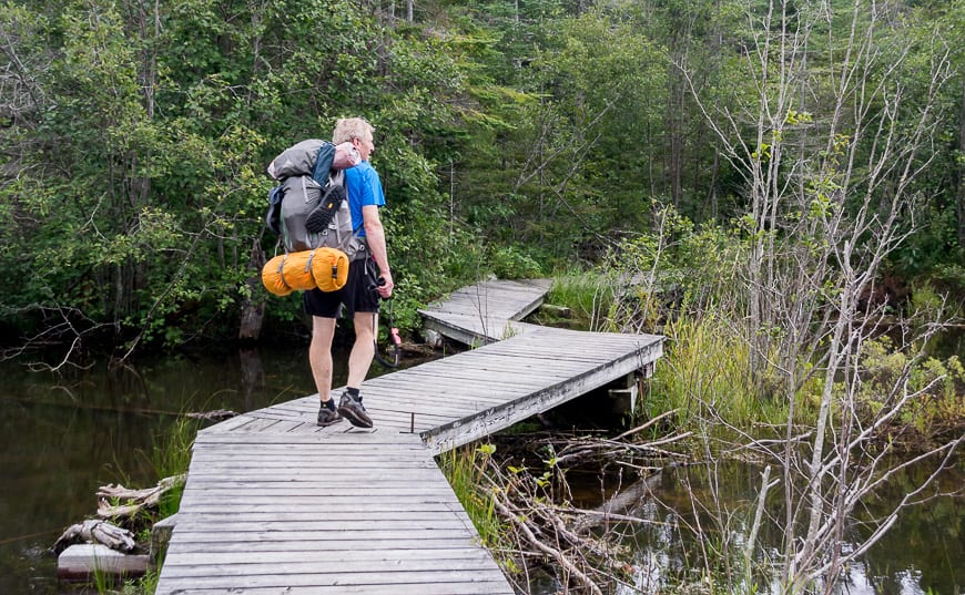
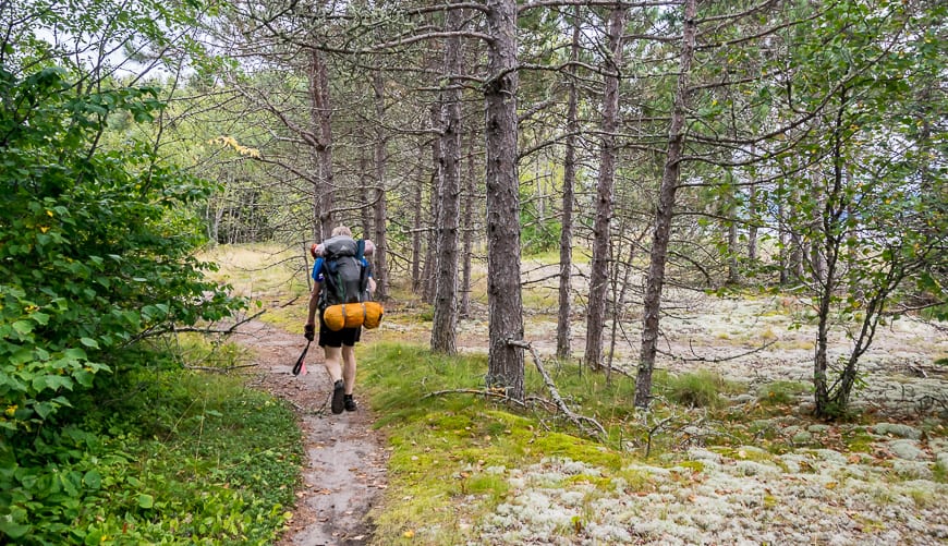
In late August John and I were dropped off with loaded packs at the Orphan Lake Trailhead – one of the numerous entrance points to the Lake Superior Coastal trail.
Over three days we hiked back to the Agawa Bay Visitor Centre, a distance of approximately 33.5 km on the Coastal Trail plus we hiked 4 km on the Orphan Lake trail to reach the Coastal Trail
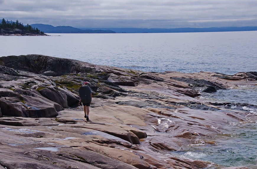
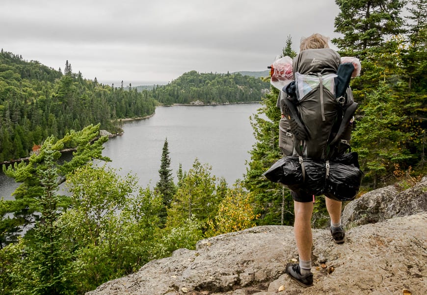
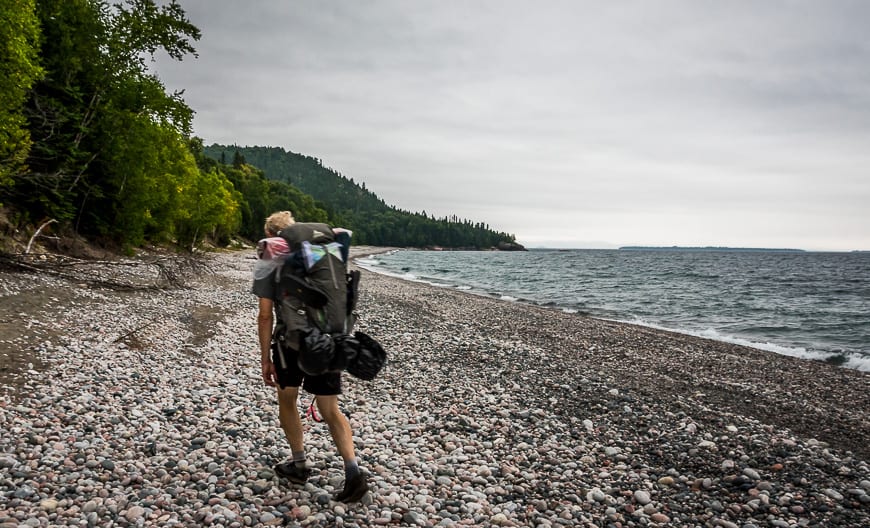
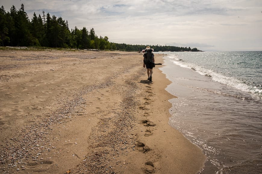
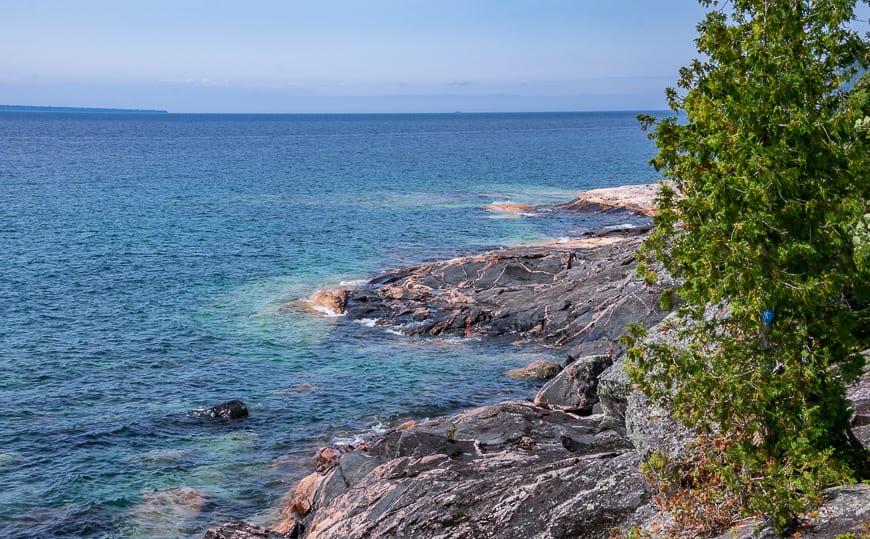
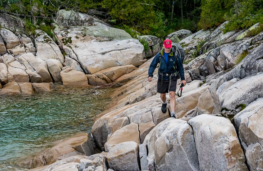
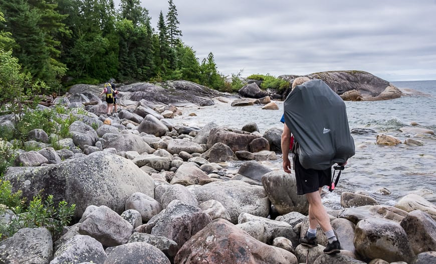
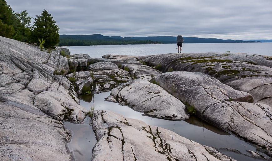
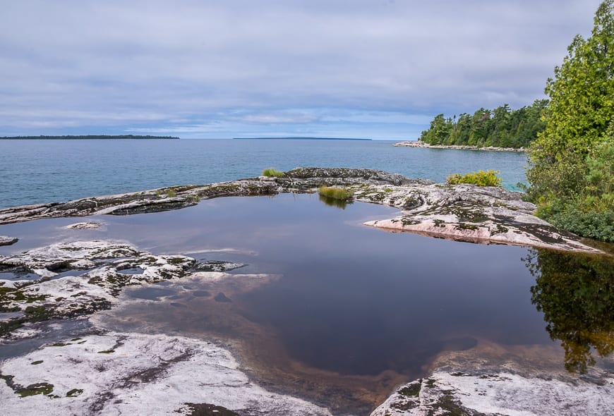
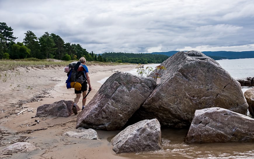
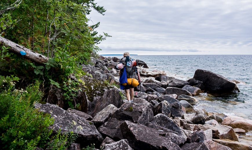
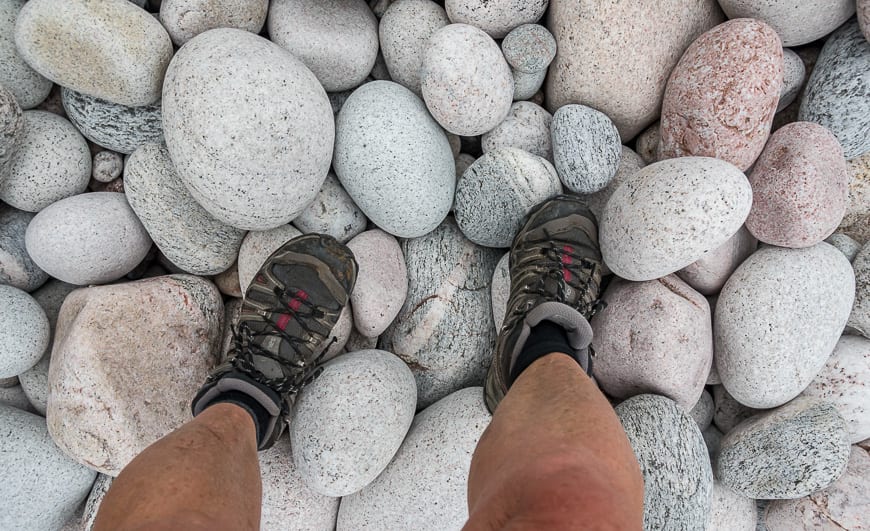
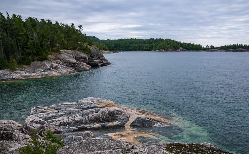
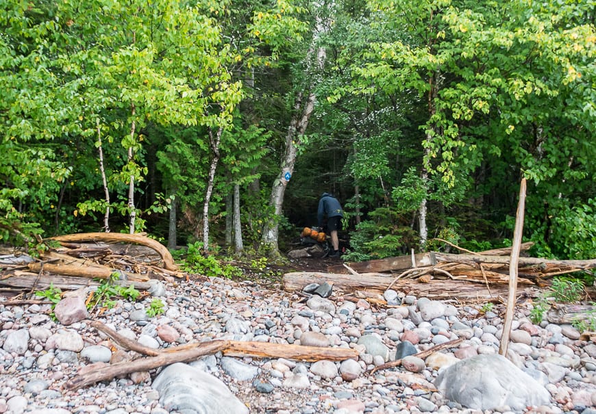
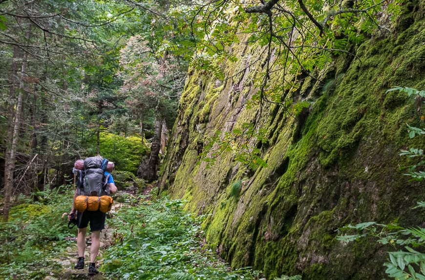
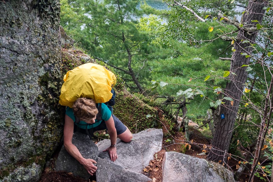
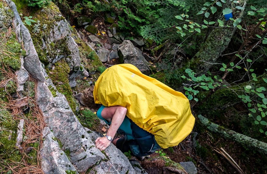
The Lake Superior Coastal Trail offered a lot of variety. We hopped over massive boulders, scrambled up and down slippery lichen-covered rocks, enjoyed phenomenal sections of easy beach walking along with sections of flat rocks alongside Lake Superior.
We heaved ourselves up giant steps via small ledges in the rocks to get off the beach. We ducked our heads to get through cave like sections and at times I had to throw my pack up onto the rock so I wouldn’t lose my balance on an ambitious scramble.
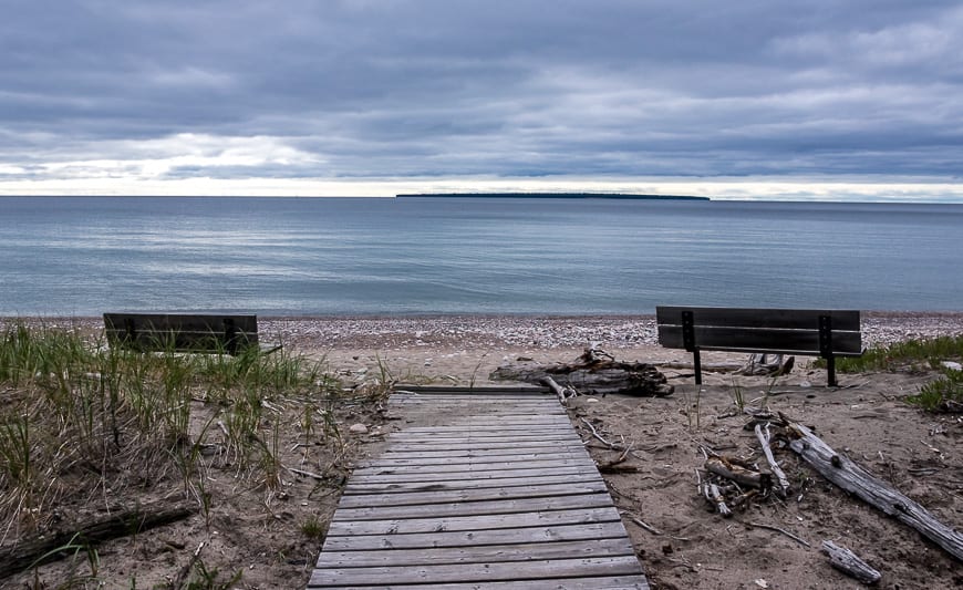
Fortunately at the end of every day there was the prospect of a campsite on the shores of Lake Superior – so a frigid wash-up to remove the day’s salt and sweat was always an option. (Don’t forget a bathing suit in case other people are around.)
Here’s how our 3 days on the Lake Superior Coastal Trail unfolded.
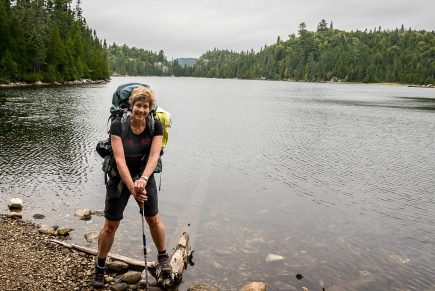
Day 1 – Orphan Lake Trailhead to Robertson Cove (about 11 km in 4 hours)
At the end of the first day as we lounged on the beach at a truly fabulous campsite overlooking Robertson Cove I felt smug. In four hours we had knocked off 11 km and quite frankly they didn’t seem very hard.
We enjoyed the longest beach walk along with the highest climb on the entire trail – interspersed with some scrambling over bedrock and boulders.
The Orphan Lake section had delivered some beautiful views with quick hiking except on the descent. I figured if we really wanted to, we could knock the rest of the Coastal Trail off in one long day.
Was I ever wrong! Over the next couple of days the hike was both physically and mentally tiring. You really had to concentrate on where to put your foot, almost every step of the way.
And then on our first night I was kept awake for hours listening to rain beat our tent while lightening crackled overhead. That meant that the undergrowth the next day would be wet and soak us in short order. What fun!
Day 2 – Robertson Cove to a campsite north of Sinclair Cove (Approximately 16 km and 7-7.5 hours of hiking)
After spending an inordinately long time picking my way through slippery massive boulders at the start of the day, I started to wonder if this trail was going to kick my butt.
Fortunately once we reached Katherine Cove (another place with road access) the hiking got easier.
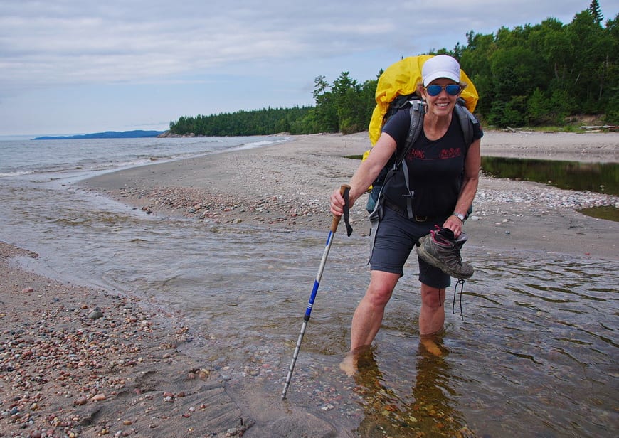
In fairly short order we knocked off another 3 km, putting us at Sand River. Here you actually have to walk along the highway for a short stretch so you can get across the river.
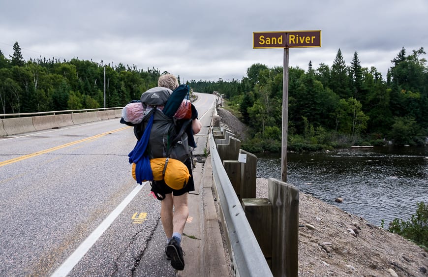
Sand River to Barrett River hike
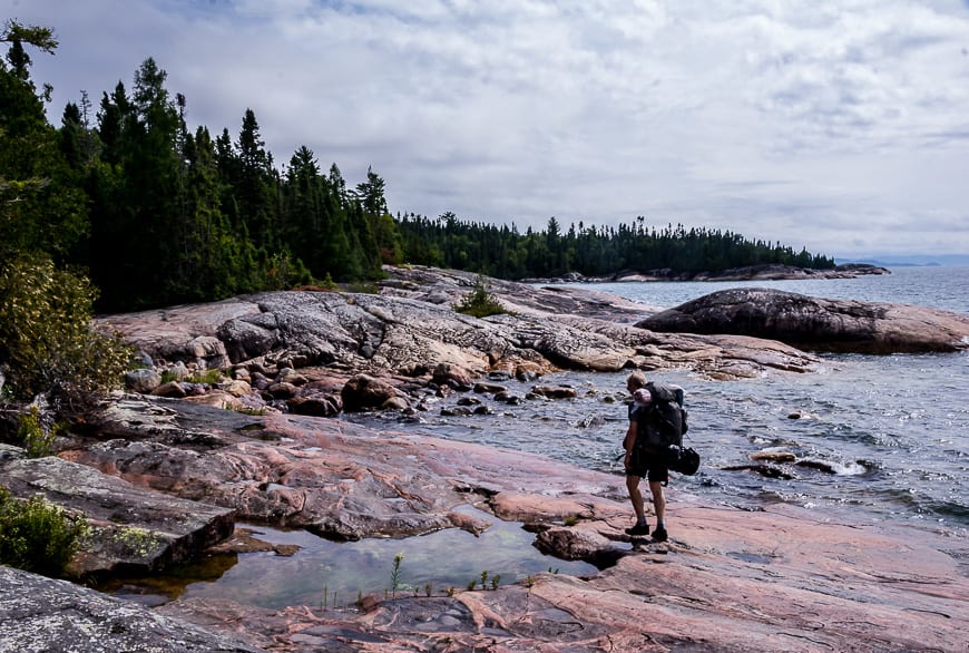
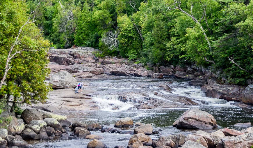
From Sand River to Barrett River – a distance of 5 km, the hiking is a mix of everything you find on the Lake Superior Coastal trail – beach walking, boulder hopping, and inland treks over large swaths of outcrop followed usually but steep descents.
There are three campsites along the beach and in hindsight they are the best choices if you’re okay with a very long day on the last day.
The 5.5 km section from Barrett River to Sinclair Cove is marked by rugged terrain that is often spectacular but trickier and slower going to hike. There are lots of cobble beaches followed by jaunts inland. At the end of the day this feels like it’s being repeated ad nauseum.
Although there were some short sections of easy hiking, most of the day got our full attention. By 5:15 PM when we stopped, I was bagged – and a little disappointed with our campsite.
There was almost no level ground so a tree blocked part of the doorway to my side of the tent. As there had been little clearing done, the woods here were dark. However, there was a nice stream with a pool 50 m away that beat jumping into the very wavy and frigid Lake Superior.
Day 3 – North of Sinclair Cove – Agawa Bay Visitor Centre (about 16 km, 7 hours)
It wasn’t until we reached Sinclair Cove with its big sign that we realized that where we thought we had camped on the second night and the reality of where we camped were two different things. That was a little depressing as it meant at least a few more hours than we had figured on the Lake Superior Coastal Trail.
It took us a solid hour to do just over a kilometre after leaving our campsite – an indication of just how rugged the terrain is.
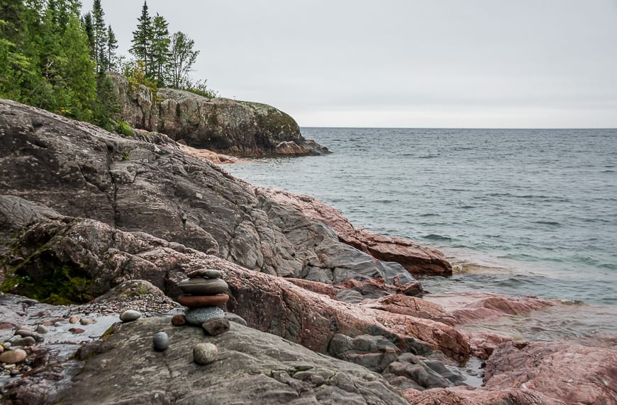
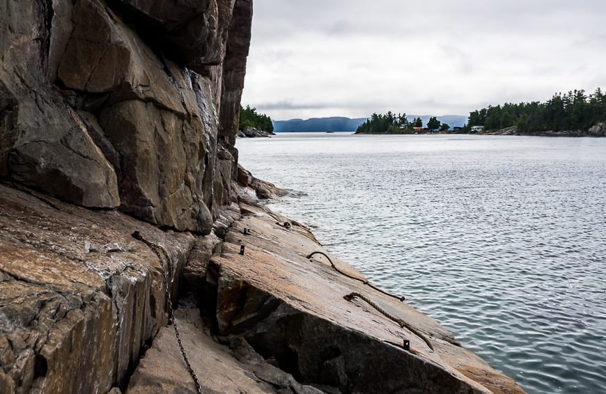
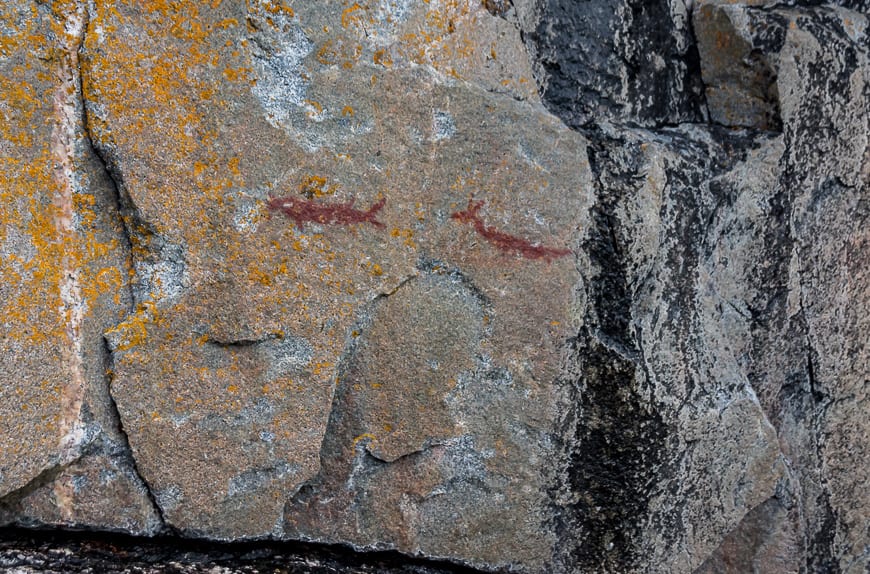
Pictograhs at Sinclair Cove
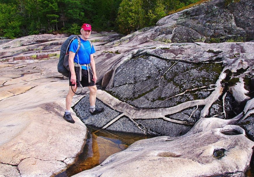
At Sinclair Cove you can take a worthwhile short detour to see the pictographs – which we did but we didn’t dare go out on the rock as our boots had no purchase whatsoever and people have drowned here.
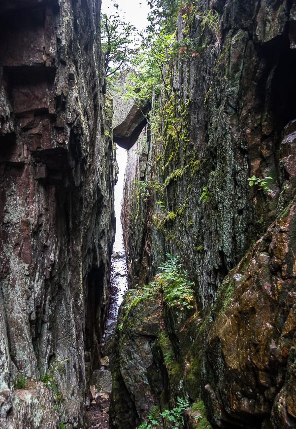
After that detour the trail became incredibly interesting, weaving through massive boulders that had actually formed what looked like caves. While interesting it was very slow going. Steps up the rock were huge and on a couple of occasions the only way I could get up was without my pack.
Once you get through this section, its generally easier hiking with plenty of lovely woods walking. You do have to cross the Agawa River – and again it is via the highway. Once you’re back on the trail in the woods, it’s flat and easy walking all the way through to the Agawa Bay Visitor Centre.
Synopsis of the Lake Superior Coastal Trail
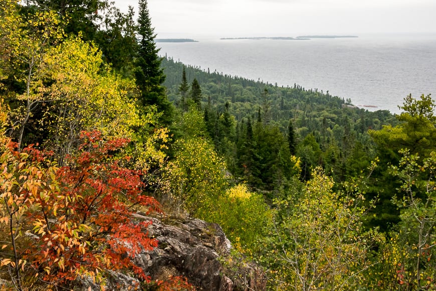
In hindsight I wish we’d had time to do the Gargantua to Orphan Lake section of the Coastal Trail. It’s supposed to be the prettiest part of the entire trail – even though I thought what we did and saw was fantastic. I HIGHLY recommend backpacking this trail but be prepared!
That means it shouldn’t be the first hike of the season. You should be in reasonable physical shape, pack for the wilderness (even though there are many places where you can bail), carry a good map, and the other 10 essentials. Always let someone know your route and your planned finish date.
Hiking in the fall is actually a fabulous time to do it. Even though the mornings start getting colder, you don’t get the bugs and the fall colours make an appearance around mid-September.
Check out Lake Superior Provincial Park website for more information and ideas of where to hike.
Campsite reservations
As of 2021 you need campsite reservations. These can be booked online up to 5 months before you go through Ontario Parks.
Shuttle service on the Lake Superior Trail
Figuring out the logistics on this trip can be a challenge. Lake Superior Adventures now offers a shuttle service which makes all the difference.
Check out this page for drop-off locations and their pricing.
Some items I’d recommend you take on this multi-day
You’ll be backcountry camping on the Lake Superior Coastal Trail. Be sure to test out any new equipment beforehand and have a look at your old gear to make sure there aren’t any glaring problems.
Some of the things I’d recommend include the following:
Water treatment tablets as they’re fast and lightweight.
A lightweight camping pillow so you get a good night’s sleep.
Compression sacks for your bulky items are hugely helpful. I always use them for my sleeping bag now.
Compeed for blisters – way better for fast healing than anything else I’ve used.
If you have a gear failure on the trail, these gear patches can save the day.
The one piece of warm clothing that always comes with me that will last you a decade is the Patagonia down sweater. I personally like the one with the hood. They are ideal for cold nights in camp.
Further reading about hikes in northern Ontario
Check out my blogs on hiking the Coastal Trail in nearby Pukaskwa National Park to give you a feel of what can go wrong. You might especially like Day 2 on the Coastal Trail in Pukaskwa.
In Lake Superior Provincial Park I also recommend the full day hike to see Agawa Falls.
Near Thunder Bay, I highly recommend the Top of the Giant Hike – offering incredible views over Lake Superior.
For great maps and detailed information I highly recommend that you visit the Voyageur Trail website.
Click on the photo below to bookmark to your Pinterest board.
Thank you to Ontario Parks for helping a great deal with this trip and to Ontario Travel for getting me there.


Great write up of this and the Pukaskwa trail as well. After reading both your reports I read the Pukaskwa as sounding harder – did you ultimately decide which one you found tougher?
Hi CJ, We didn’t do the hardest section of the Lake Superior Coastal Trail so based on what we did and what we missed I’d vote it as harder – but both are fantastic!!
Wonderful post! Love your Alberta stuff as well. I’m wondering how this hike compares to some of the backcountry hikes in the Rockies, like Skyline or Tonquin.
@Moe I’m doing Tonquin in a month. I’d call it harder than the Skyline Trail – those coastal hikes look easier than they ever are.
Thanks for sharing your experience! I was wondering what you opinion is on bringing a dog on the trail. We are hoping to hike the coastal trail with our lab but wonder if some of the sections might be too steep and rocky. Thanks!
@MS Dogs should be fine – they are usually more sure footed than humans.
Hey Dave, check out Naturally Superior Adventures on Facebook. They’ve posted a video of the river crossing, and it should answer all of your questions.
@Ryan – Thank you!!
Thanks for sharing your trip. Great photos! I am curious which rivers you used the highway to cross, and if it was necessary…? The highway is currently down to one lane at the Barrett River and no pedestrian traffic is allowed across the bridge. Did you use the highway there? I’ve heard that it may be possible to cross at the mouth by I haven’t seen any pictures of the Barrett River to confirm. Any info would be helpful… planning to do this next week.
@Dave I would contact Lake Superior Provincial Park OR Ontario Parks directly for info. Thinking back to the river, I thought the mouth was too wide to wade. Then I went back to my map and enlarged it but don’t want to give bad info. I’ve gone through my photos but don’t see any walking on the highway. I know you’d like more than I can offer but my experience with Ontario Parks is that they are helpful.
There is an excellent book too – the Voyageur Trail Guidebook which has very detailed maps.
Me again Dave – found the section in a photo of the book – description says “It turns E down a razorback rock ridge and descends to the Barrett River Beach. Trail follows the beach for its length, 800m, turning E to the bridge over the Barrett River at Highway 17. Maybe you can hitchhike across the river – it would be a super short ride. Make up a sign beforehand???
Great write up, thanks! I’m looking at doing the same trip in late July and wondering what sort of presence from biting insect I can expect. I’m a crazy magnet for them and I swell up like the Michelin man. I imagine along the shore would be ok but is much of the trail in the woods? Also, how present is the noise from the highway?
@Christian I did the hike in late August so bugs weren’t an issue. But based on what I’ve seen a little further up the coast in Pukaskwa National Park, I would go prepared with a bug net and some sort of bug juice with DEET. We weren’t inland a lot but on the last day I do remember many kms of forest walking. I have heard light coloured clothing is better too.
Highway noise was really never an issue except for those few minutes you have to walk the highway. I’ll be curious to hear if more people hike the trail this summer as they try and stay close to home.
Have a great trip!
Nice pictures. I would love to also see pictures of your campsites. I have learned a lot from seeing how others set up, as well as seeing their gear. On a 4-week kayak trip on the canals of England my son & I discovered dozens of ways to set up our tarp between the tents, so we could cook or just sit in our folding chairs when the weather did what it often does in England.
Another hike suggestion. Twillingate NFLD. Phenomenal coastline. We circled both Islands, spending 2 gorgeous weeks. Icebergs, whales, cliffs, amazing beach campsites with epic campfires… And then there are the most incredibly friendly people in the world – really!
@Geoff – great idea and heading to Patagonia so will take the campsite photo suggestion to heart. I’ve been to Twillingate but only had a day – and it was one of the most memorable ones. Thanks for the great comment.
Good for you and thanks for sharing your trek. You pushed through many kilometers in a short time. We have done the trail many times but take in much more slowly.
@Marko Really loved the scenery and we had to move fast unfortunately as we were short on time.