Yates Mountain Hike via Prairie View Trail
The Yates Mountain hike in Kananaskis, also known as the Barrier Lake Fire Lookout hike, can be an over-the-top busy hike on a sunny weekend from May through October. But if you pick a weekday or do the Yates Mountain hike in winter, you may enjoy a bit of solitude.
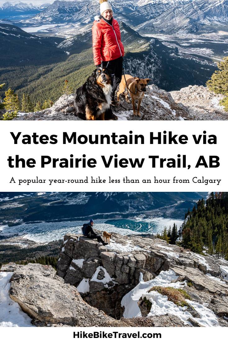
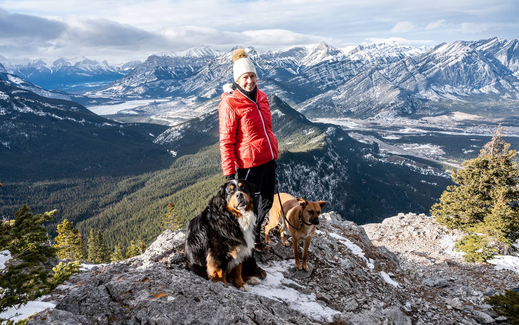
The hike, which switchbacks up an old forestry road for about 5 kilometres, won’t wow you until you break out of the trees. But then magic happens, and you’re met with a panoramic view of Barrier Lake and Mount Baldy.
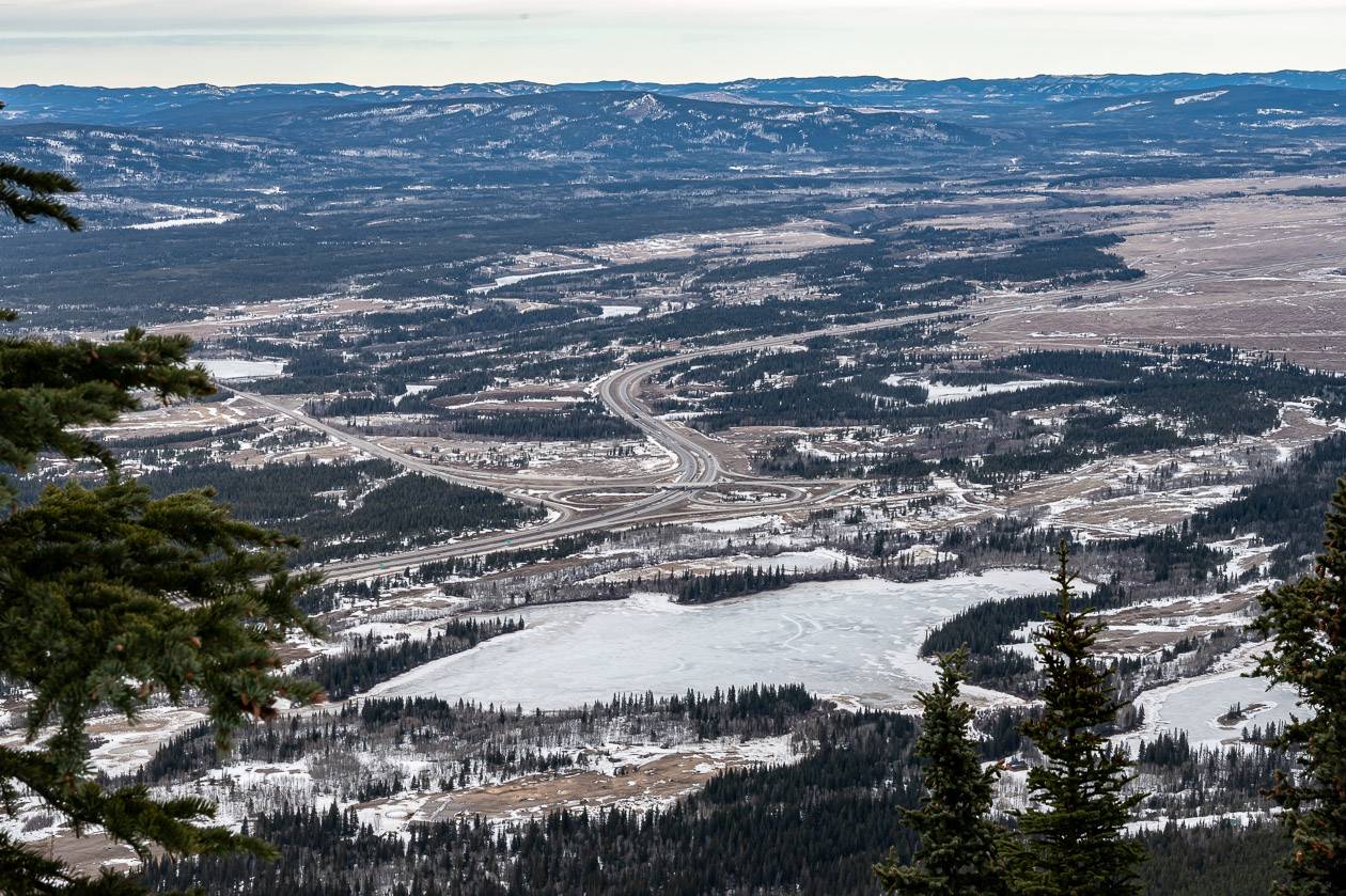
And it gets better if you’re prepared to hike steeply to the summit of Yates Mountain. There you’ll see the working Barrier Lake Fire Lookout in addition to a bird’s eye view of Mount Yamnuska and the peaks lining the Trans-Canada Highway as you look west towards Canmore.
This post includes some affiliate links. If you make a qualifying purchase through one of these links, I will receive a small percentage of the sale at no extra cost to you. Thank you very much for your support.
Yates Mountain hike details
Length: It’s approximately a 12.5 km or 7.8 mile out and back hike. Once you get to the Prairie View Lookout, it’s a short, steep 0.7 km one-way hike with 125 m (410 feet) of elevation gain to reach the Barrier Lake Fire Lookout.
Difficulty: Moderate.
Elevation gain: Approximately 550 m or 1,804 feet. Yates Mountains tops out at 1,996 m or 6,549 feet.
Time needed: Allow 3 – 4.5 hours for the return up and back hike to Yates Mountain. Add another 1 – 1.5 hours if you return via Jewell Pass, instead of the way you came up.
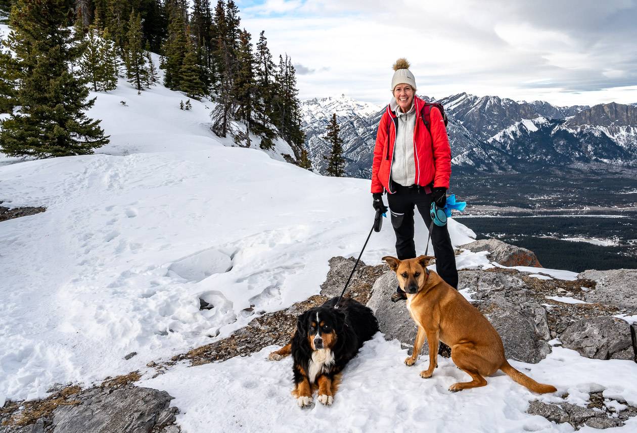
Dogs: Permitted on a leash. On hot days, be sure to take lots of water for them.
Permits needed: You will need a Kananaskis Conservation Pass to hike Yates Mountain. Purchase online or at the Kananaskis Visitor Information Centre located along Highway 40 as you drive south towards Barrier Lake. Passes are $15 for a day-use permit or $90 for a year, good for two vehicles at the same address.
Map for the hike: Gem Trek Canmore and Kananaskis Village. If you prefer a hiking app, I recommend Organic Maps.
For trail updates and closures: Check the trail reports before you go for the Prairie View Trail.
Don’t forget: Although this is a busy trail, it’s still bear country. Pack the bear spray and make sure it’s easy to access. I like a bear spray holster so I don’t inadvertently set it off.

Would you like to save this?
Why you want to do the Yates Mountain hike
The top four reasons for doing the Yates Mountain hike are:
- Impressive, far reaching views of the Bow Valley just past the Barrier Lake Fire Lookout.
- Visiting a fire lookout is always a cool thing to do.
- The view from Prairie View Lookout is a perennial crowd pleaser.
- Great exercise – especially in winter when there are fewer options.
Yates Mountain trailhead location
You might see the line of cars pulled over along Highway 40 before you see the road turning into the Barrier Lake parking lot.
The road to the parking lot is about 9 km south of the Trans-Canada Highway-Highway 40 intersection and just 2.2 km south of the Kananaskis Visitor Information Centre.
If you haven’t got your Kananaskis Conservation Pass, stop in at the Visitor Centre (clean washrooms, running water, and knowledgeable staff too) and buy one or risk a significant fine.
The trailhead for Yates Mountain starts at the Barrier Lake parking area.
There is a map of the Yates Mountain hike (take a photo so you have an easy reference) and more washrooms at the parking lot.
Yates Mountain via Prairie View Trail description
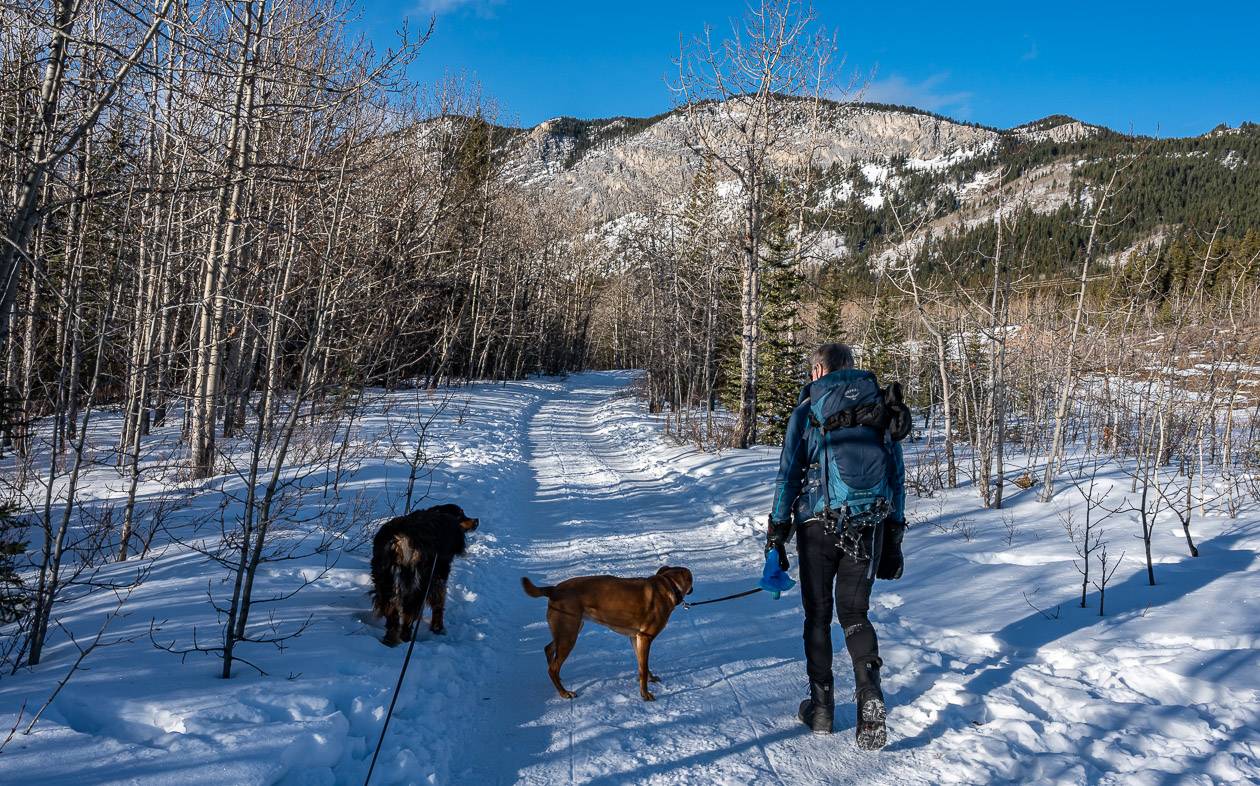
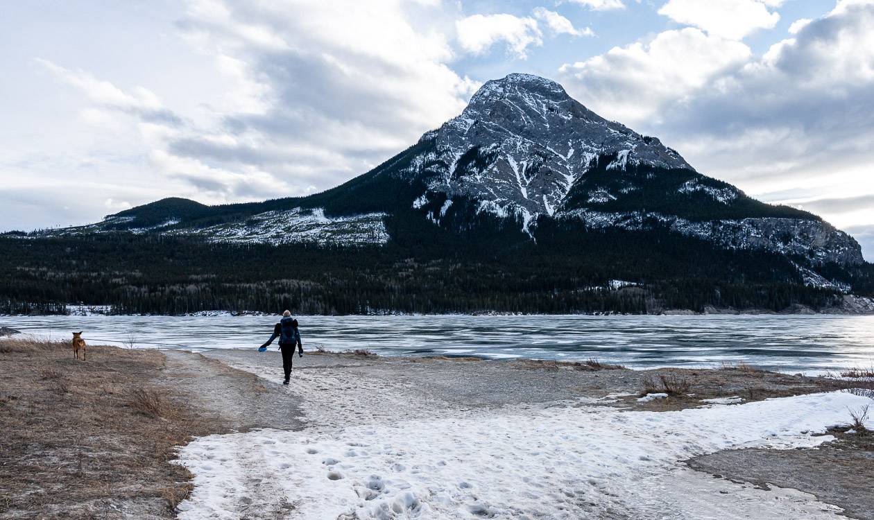
The start of the Yates Mountain hike is not impressive. From the parking lot head for the Barrier Dam – enjoying pretty Barrier Lake and mountain views to the west.
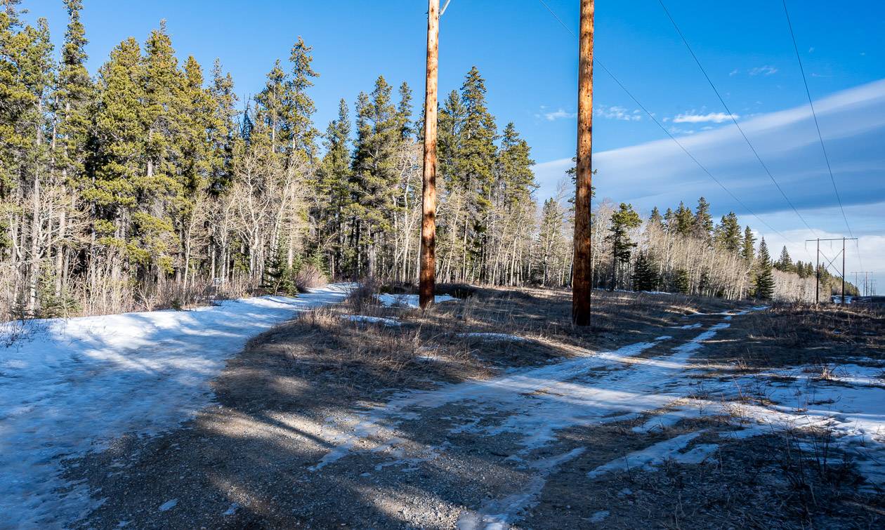
This section of the hike is often windy so bundle up if its winter. At 1.1 km cross a bike trail running northeast – southwest but continue straight for another 0.5 km. You’ll reach an intersection here under the power lines with a location map. Take the left fork onto the Prairie View Trail.
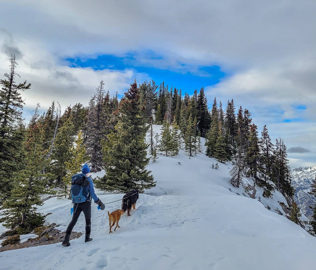
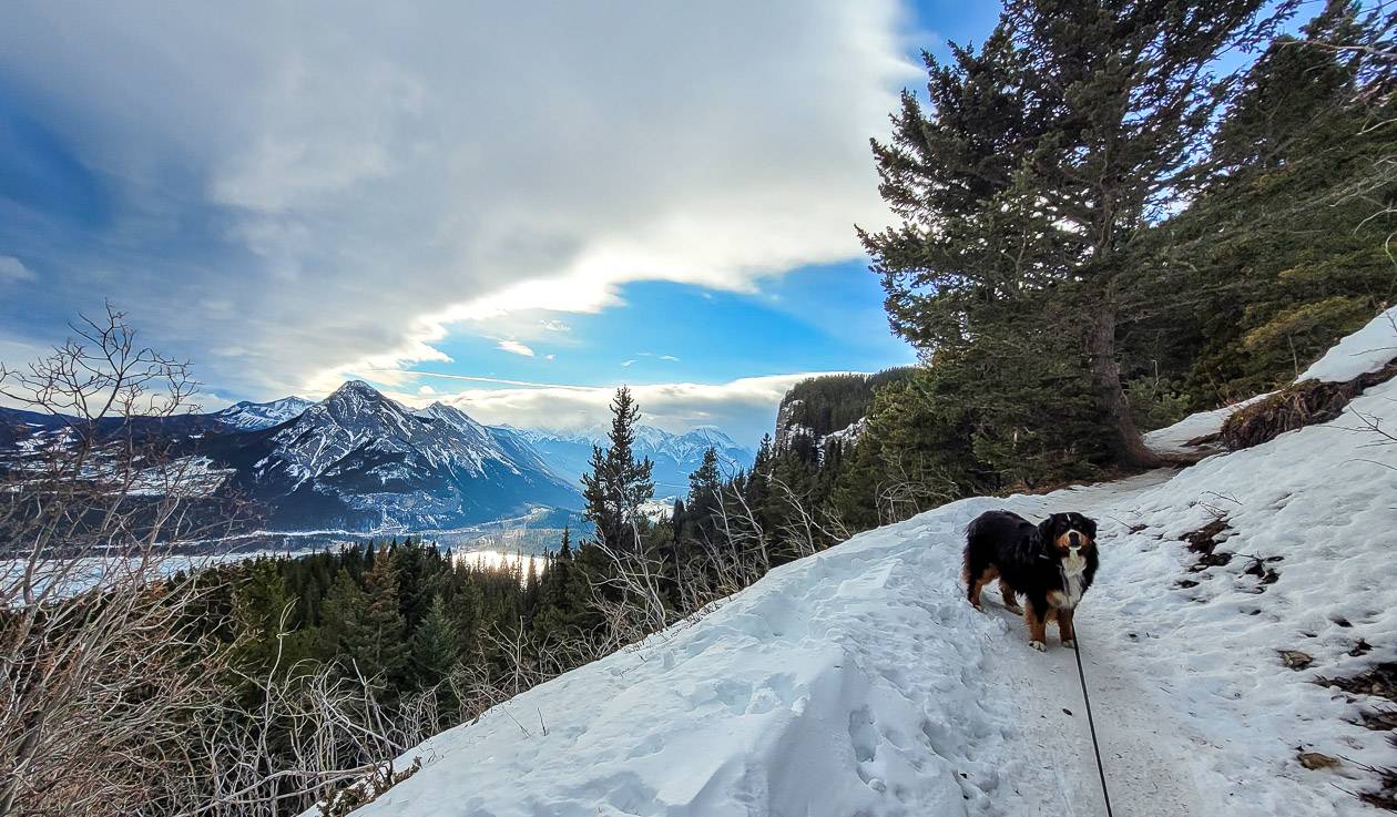
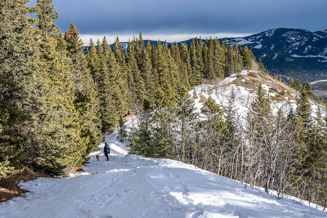
Start gaining elevation as you switchback up through the forest. You may be sharing the trail with mountain bikers, so be ready to quickly step aside – even in winter.
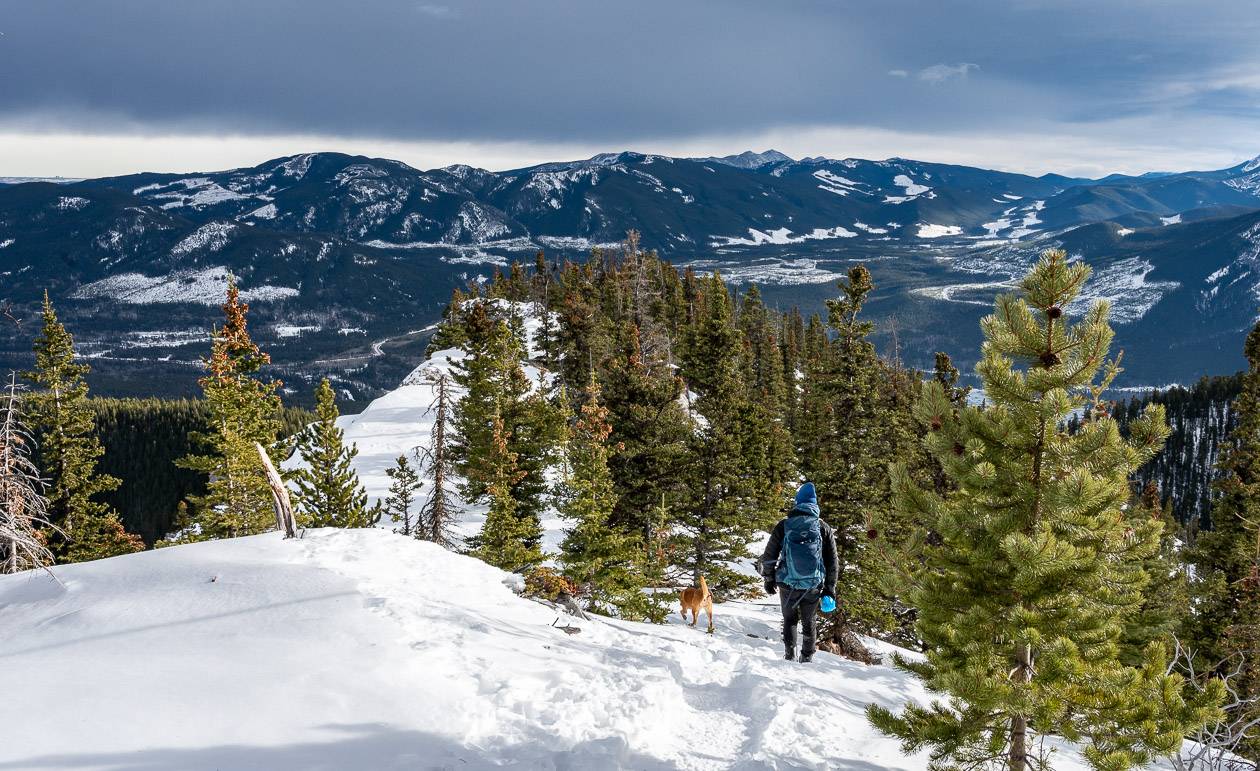
After climbing for 2.0 km, you’ll make a hard left and start hiking along McConnell Ridge. It’s steep, then flatter as you reach an opening in the trees – and then very steep as you climb up a narrow trail through the rocks. There are some big steps here but no exposure and there are lots of trees to hold onto.
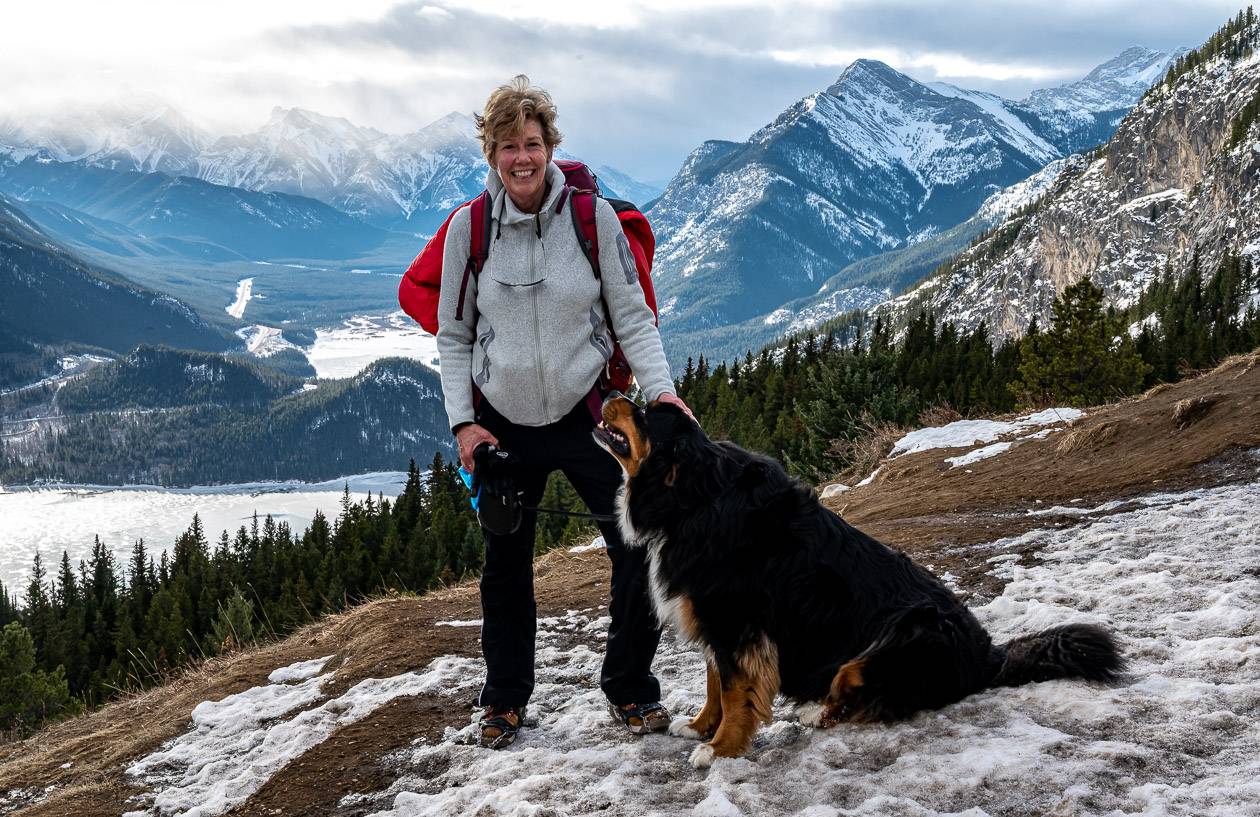
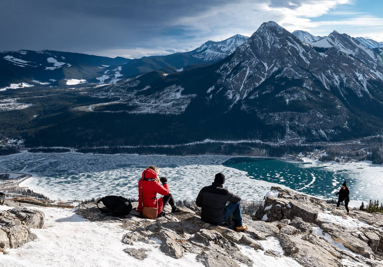
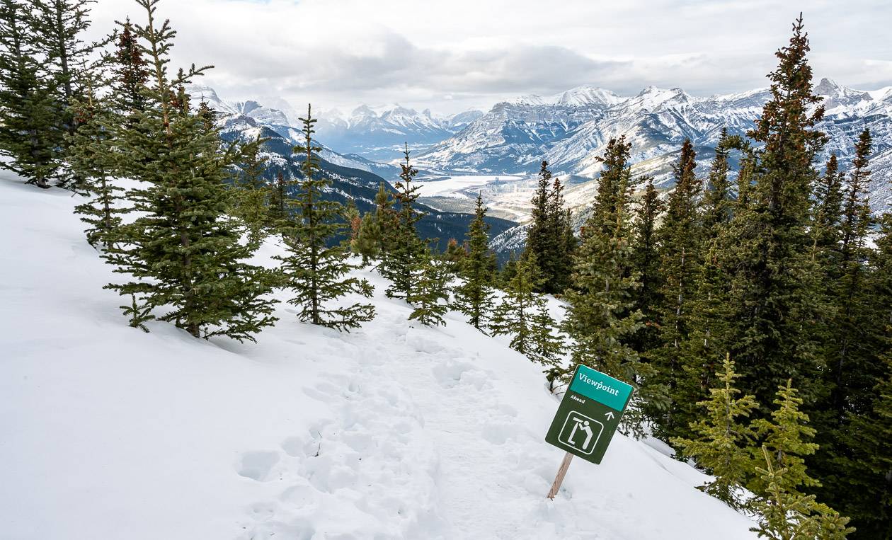
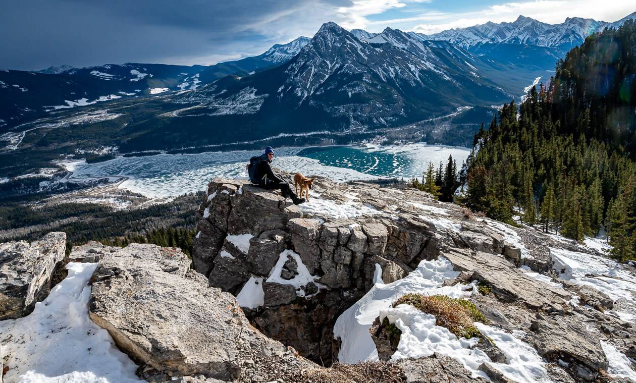
Pop out on flat ground and head left for superb views of Barrier Lake and Baldy Mountain. The Prairie View Lookout is a popular place to stop and have lunch.
Prairie View Lookout to the summit of Yates Mountain
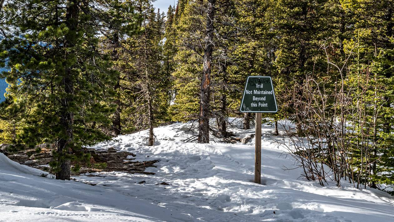
From the viewpoint look for the sign that says unmaintained trail. Follow it through the trees, and turn right in a matter of metres to pick up the trail to Yates Mountain.
It may be short, but it is steep. I think it’s probably an easier winter hike because it’s soft underfoot and you don’t have to worry about twisting an ankle on a rock. We didn’t see any flagging tape – simply the trail which was easy to follow in winter.
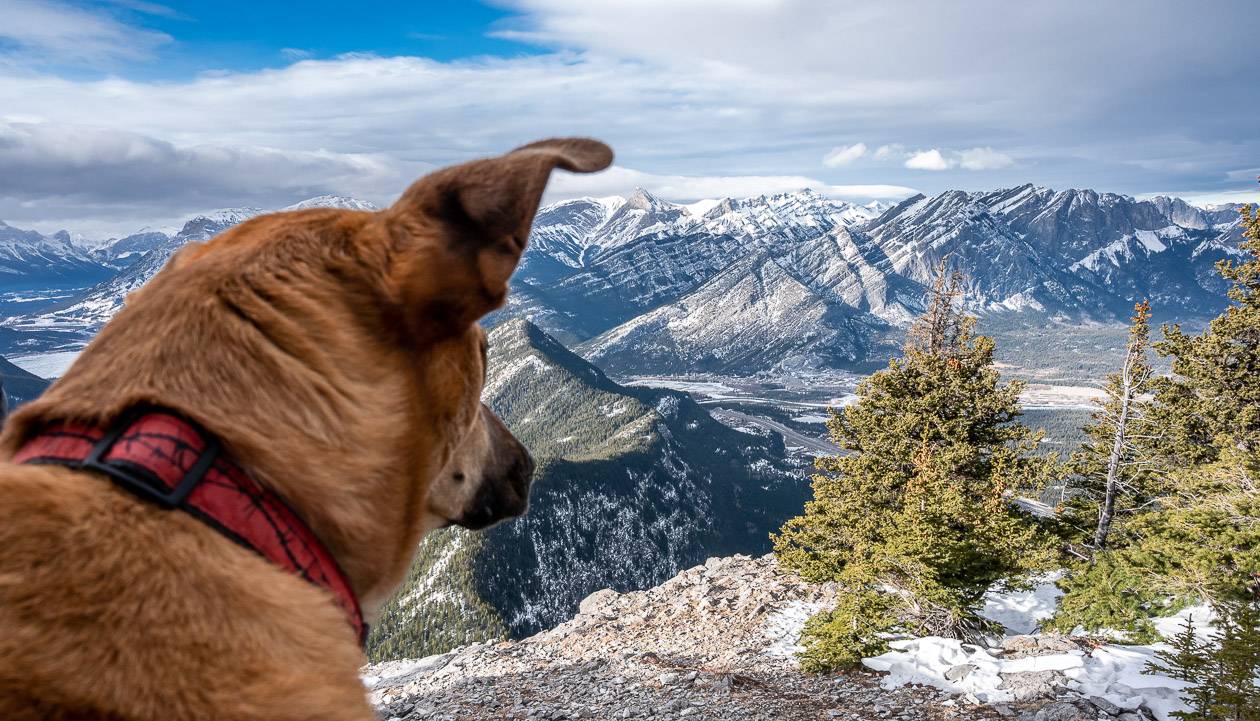
There are some stellar views along the edge on the way up. In fact, it was interesting to look down at so many little lakes.
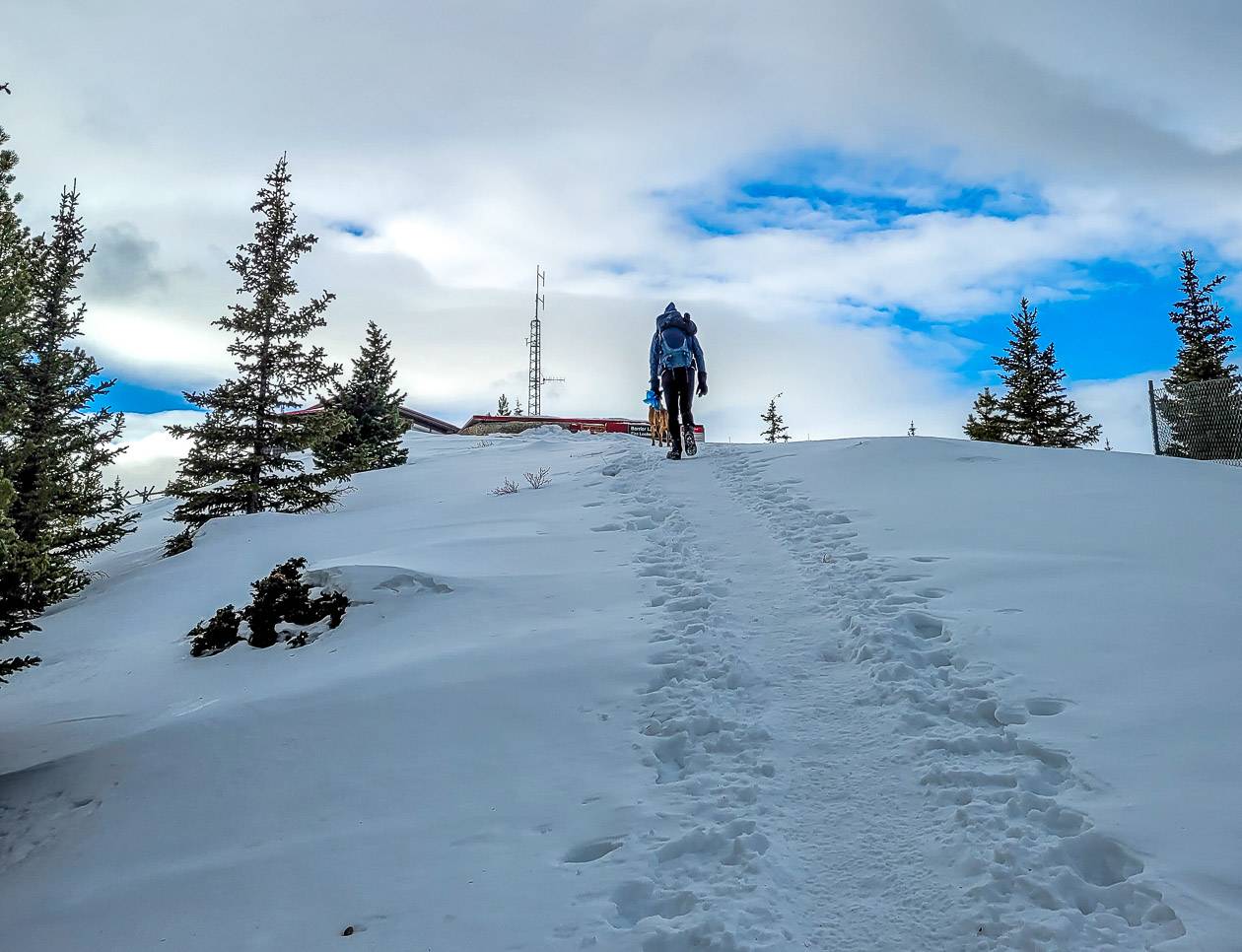
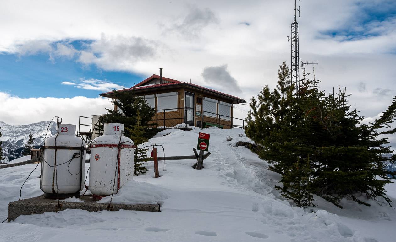
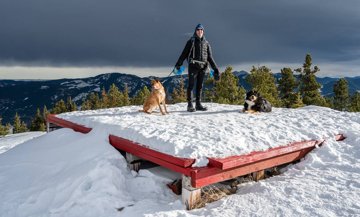
On the final approach you’ll see a helicopter landing pad and then the Barrier Lake Fire Lookout – which is a residence in the summer so be sure to respect the privacy of the human smoke detector.
There is also a sign below the lookout that points you in the direction of a trail that is well worth doing. Take it for a 100 m or so to reach another great lookout – this time of the Bow River Valley looking west towards Canmore.
The Barrier Lake Fire Lookout
If you know where to look, you can see the Barrier Lake Fire Lookout from Scott Lake Hill on the Trans- Canada Highway. Keep an eye out for it next time you do the drive.
There are a couple of picnic tables for the use of hikers below the Barrier Lake fire lookout but the outhouse at the summit is out of bounds to the public.
The location of the current lookout is called “Tokyapebi ipa“in Stoney, meaning lookout point for Blackfeet. I am sure there is a long history to this lookout!
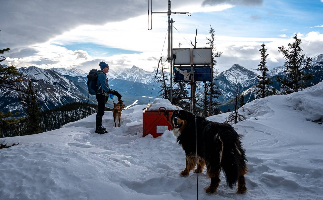
Our lunch spot on Yates Mountain
We continued to the viewpoint about 100 metre west of the sign below and had the rocks to ourselves. I’d recommend this minor addition to the hike as the views are superb.
The descent from Yates Mountain
Retrace your steps down the mountain to return to the Prairie View Lookout Trail. From there you can continue down to the parking lot (which is what most people do) or continue west on the Prairie View – Jewell Pass trail combo – which I’d highly recommend.
However, I haven’t done it in winter, so you’ll have to make a judgement call on whether it’s safe to hike when there is lots of snow. Certainly, it’s a great loop to do in summer and fall.
If you hike Yates Mountain (Barrier Lake Fire Lookout) in winter
Yates Mountain is a great winter hike but it can be icy and snowy. I’d recommend wearing or at least packing leg gaiters to keep the snow out of your boots. Depending on conditions you might find microspikes useful. I’ve been on sections of the trail up to the Prairie View Lookout that were slippery. Many people like hiking poles in winter for balance.
If there has been a fresh snowfall, check with the Visitor Centre before attempting. I’d recommend taking snowshoes if there’s a lot of snow on the ground.
In winter, Yates Mountain can be a cold, windy place. Don’t forget to pack extra layers including a down jacket, extra mitts, and a warm winter hat.
Recommended reading: What to Wear in Canada on a -20C Day
Where to stay near the mountain
There is lots of car-camping in Kananaskis -and there’s a surprising amount that is first come, first served.
Recommended reading: A Complete Guide to Camping in Kananaskis
If you want a roof over your head, the Kananaskis Wilderness Hostel is nearby as is an upscale hotel – the Kananaskis Mountain Lodge in Kananaskis Village.
Interested in more hiking in Kananaskis??
Some of the nearby hikes I’ve thoroughly enjoyed
- Ribbon Falls Hike in Kananaskis Country
- Hiking in Kananaskis: The Wasootch Ridge Trail
- The Centennial Ridge – Mount Allan Hike in Kananaskis
Off the Smith Dorrien Road (still in Kananaskis) there are more amazing hikes
- Windtower Hike in Spray Lakes Provincial Park
- The Headwall Lakes Hike in Kananaskis Country
- The Hike to Burstall Pass in Kananaskis Country
Click on the photo to bookmark to your Pinterest boards.