The Wasootch Ridge Trail in Elbow Sheep Wildland Provincial Park (part of Kananaskis Country) is one of the great early season hikes in Alberta. People start hiking the ridge sometime in May and continue through to late October, with the occasional hardcore hiker doing it in the winter.
It’s a favourite hike for people in the Calgary – Canmore corridor as it’s close by and delivers knock out views. It’s a fun ridge walk but as with many hikes along Highway 40, it’s a steep one.
I hiked the Wasootch Ridge trail in mid-May in a year where the snow disappeared quickly. That’s going to vary every year so use some common-sense if you want hike early in the season.
Not comfortable hiking on snow? Wait a few weeks and it will be gone. I always recommend microspikes and poles for early season hikes.
Summary of the Wasootch Ridge trail hike
Distance: 11 km (6.8 miles) round-trip to the trail’s end cairn but there is an option to continue for another kilometre but the difficulty increases dramatically.
Elevation gain: Approximately 762 metres or 2,500 feet. If you scramble up the peak you will gain 1,010 metres or 3,315 feet.
Time needed: 4 – 6 hours for the return hike.
Level of difficulty: Moderate to difficult depending on your hiking experience and fitness. Challenging to Wasootch Peak.
Dogs: Allowed on a leash. Pack out their poop.
Trailhead location: Wasootch Day Use Area off Highway 40.
Type of trail: Out and back hike
Permit: Be sure to purchase a Kananaskis Conservation pass before starting the hike.
Camping: None allowed. Read 10+ Backpacking Trips in Kananaskis if you’re interested in backcountry camping.
Map: Gem Trek Canmore & Kananaskis Village
Ticks: When you finish your hike, of after you get home, check you body for ticks.
Don’t forget: This hike is in the mountains so the weather can change in a heartbeat. Always go prepared with the hiking essentials. Take lots of water as the sun beats down on you and there are no water sources along the trail
Bears: Wasootch Ridge is a popular hike so the chances of running into a bear are slim during peak hours. But I would still recommend carrying bear spray.
Trail conditions: Before you go, check out the Alberta Parks trail report.
Elevation of cairn at the end: 2,130 m (6,986 feet)
This post includes some affiliate links. If you make a qualifying purchase through one of these links, I will receive a small percentage of the sale at no extra cost to you. Thank you very much for your support.
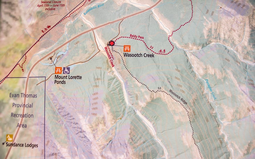
Wasootch Ridge trail location
The Wasootch Ridge hike is a fantastic outing. For starters the trailhead is only about an hour’s drive from downtown Calgary. And it’s a hike that delivers views within 20 minutes of hitting the trail.
The ridge is a popular one on the weekend (we saw at least 50 people) so for those of you nervous of bears, it would be a good choice. But no matter where you go in the mountains always carry bear spray – and have it readily accessible.
Wasootch Ridge is an unofficial trail
The Wasootch Ridge trail like many in Kananaskis Country is labeled an unofficial trail meaning there are no signs (even at the trailhead) and no markers along its length. Most unofficial trails are still well-traveled and generally easy to follow. A good map and notes from guidebooks or websites also comes in handy.
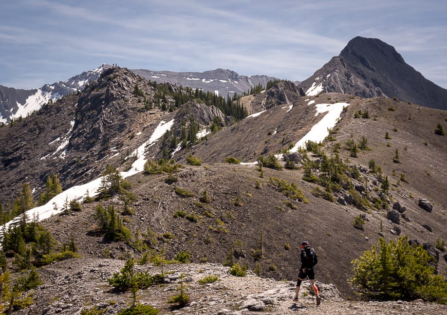
Wasootch Ridge is a lumpy walk with lots of up and down, even after you’ve gained the main ridge line. That’s part of what makes the hike so interesting.
Wasootch Ridge hike description
The hike starts off steeply on a trail full of small pebbles and stones – the kind that lead to skidding, ankle twisting falls on the descent. But going up is fine, especially so once you get into a rhythm with your breathing.
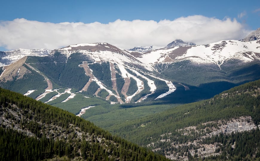
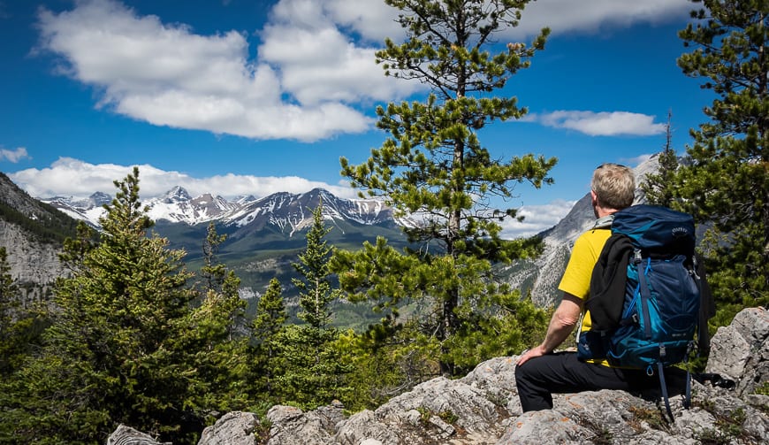
The initial steep part lasts for the better part of 20 minutes. When you pop out on the ridge the views stretching from Nakiska Ski Resort over to Barrier Lake are stupendous.
The next bit of hiking is lovely; it’s mostly in the woods and best of all its flat. But then there’s a second rise to contend with – though it’s not as steep as the initial section. Killer views will take your mind off your pounding heart, until you gain the ridge, and see how far off the main peak still looks.
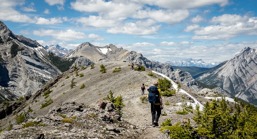
Continue along the ridge, climbing up and then back down again for a total of five times. There is one short section that requires your full attention on a ledge above a small cliff. You won’t die if you fall here; it’s actually a snap with lots of handholds, a tree branch and no shortage of places to plant your feet. You’ll be through it in about 10 seconds.
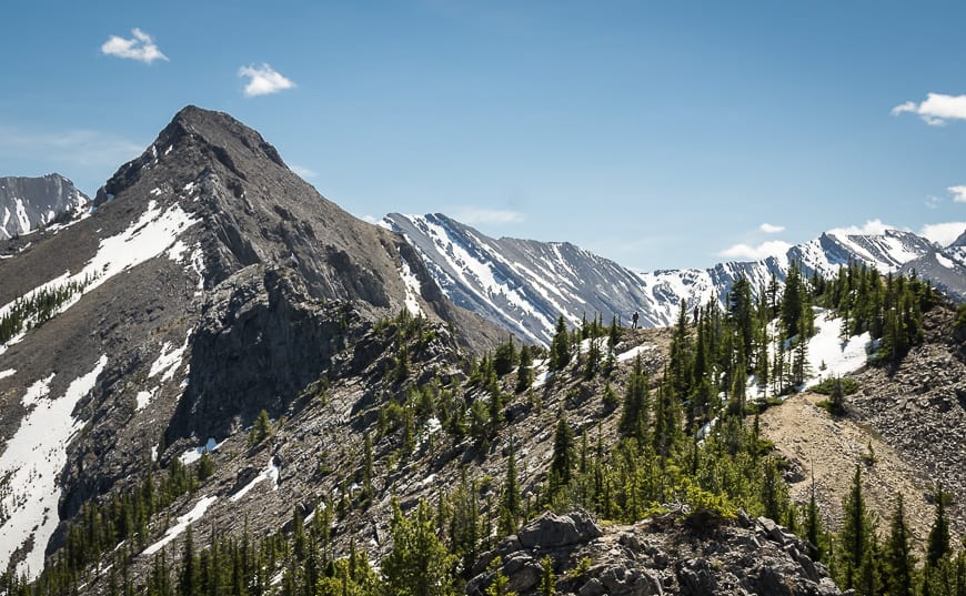
There are a couple more uphill sections punctuated with short flatter sections with the last one being the longest. Arrive at a large open area marked with a cairn.
From the parking lot to this point it’s 5.3 km with a vertical gain of 762 m (2,500 feet). This is one of the popular turn-around spots.
The other is the stubby knob with people on it in the photo below. Most people do not actually summit the peak located in the back right hand corner in the photo.
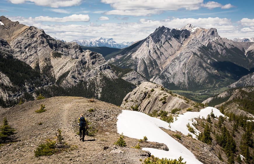
To go to the notch or not?
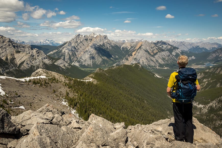
We stopped for lunch near the cairn and contemplated our options. It’s another 1.6 km to the true summit but from the cairn that distance can take anywhere from one to two hours depending on your hiking and navigation ability.
There’s scrambling involved and if you don’t choose your route wisely as described by Gillean Daffern in her book – Kananaskis Country Trail Guide look out. Here’s what she says: “scramblers who continue along the ridge crest at this point nearly always come unglued at the notch.” Take heed.
We elected to hike to the next knob and enjoy the views from there. We also hadn’t brought enough water (big mistake on a hot day) so after enjoying the view it was simply a matter of retracing our steps, to the car. The downhill was fine though slow going on the pebbly steep sections. Some people might like poles here.
All told it took us five hours to do the return hike up the ridge with breaks.

When can you hike Wasootch Ridge?
Most people hike the Wasootch Ridge trail from May till October but it can be done year round IF you have the skill set and you go prepared.
You can see images on Instagram from winter hikes, and it looks beautiful BUT you have to know what you’re doing. When there is snow on the ground, microspikes are a necessity and some people might like hiking poles.

Wasootch Ridge Trailhead location
From the Trans-Canada Highway follow Highway 40 south for 17 km. Turn left onto the road signed for Wasootch with a picnic table on the sign. Drive 0.7 km to the end of the road and park.
You’d think with a big parking lot and a large sign that finding the trailhead would be easy. But it’s not and I know we weren’t the only ones that headed off in the wrong direction initially.
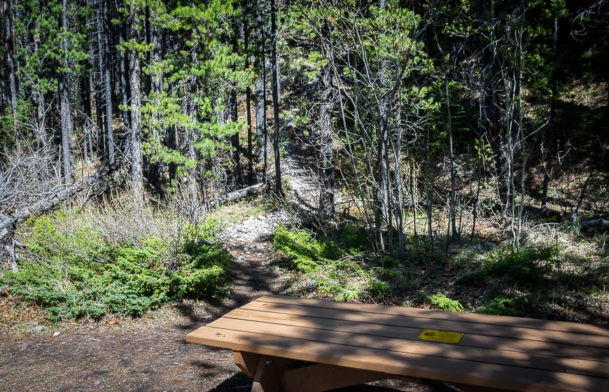
Do not head up Wasootch Creek on the flat path. Look for the sign that says Wasootch Creek, A Change in Climate. Head off into the woods behind the sign looking for a picnic table. You’ll see the trail heading up immediately behind the table.
Hiking Wasootch ridge with dogs
Dogs are allowed on the Wasootch Ridge trail but they must be on a leash. Fines are severe and no warnings are given.
On this particular hike there isn’t any water so carry lots for your dog. You can read about what you need to know to hike in the mountains in my piece in Avenue Magazine here.
Location map for Wasootch Ridge
Where can you stay close to the trail?
There is lots of camping along Highway 40. Read A Complete Guide to Camping in Kananaskis for ideas. Information is also included on what campgrounds are first come, first served.
There are two other options for overnight stays in the immediate area: the Kananaskis Mountain Lodge with its outdoor Nordic spa close to Nakiska Ski Resort and the Kananaskis Wilderness Hostel near the Ribbon Creek Trails. It’s got a nice common area and a choice of private or dorm style rooms.
Check prices and availability for tipis and trappers tents at Sundance by Basecamp near the turnoff to Nakiska Ski Resort.
Other Kananaskis hikes you might enjoy
- McGillivray Canyon Hike near Canmore
- The Chester Lake Hike in Alberta (+ Three Lakes Valley)
- The Pocaterra Ridge Hike in Kananaskis Country
- The Fabulous Forget-Me-Not Ridge Hike in Kananaskis Country
- The Hike to Burstall Pass in Kananaskis Country
- Blackshale Suspension Bridge Hike, Kananaskis
Click on the photo to bookmark to Pinterest.