Chester Lake Hike & Three Lakes Valley
The Chester Lake hike is one of the classics you must do in Kananaskis Country. It’s been called the most popular trail in Kananaskis Country – and yet on the summer weekend I hiked it, the parking lot was far less busy than the one that offers access to Black Prince Cirque and Galatea Lakes. That may be a function of the distance from Calgary but I must say I was pleasantly surprised.
This post includes some affiliate links. If you make a purchase via one of these links, I will receive a small commission at no extra cost to you. Thank you very much for your support.

Would you like to save this?
Chester Lake hike summary
Distance: 9.0 km return or 5.6 miles. It’s 13.5 km (or 7.4 miles) to the third lake in Three Lakes Valley.
Elevation gain: 315 m or 1,033 feet to Chester Lake. It’s 555 m (1,820 feet) if you go to the end of Three Lakes Valley.
Time needed: 3 – 4 hours for the return hike to Chester Lake – but add 1 – 2 hours if you continue up to the third lake in the Three Lakes Valley.
Level of difficulty: Easy if you’re a regular hiker.
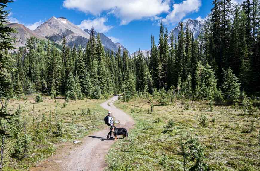
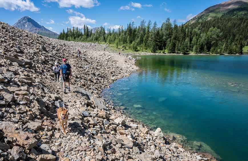
Dogs allowed: Yes, on a leash.
Best time to hike to Chester Lake: July until mid-October. It’s a great larch hike.
Chester Lake elevation: 2,220 m (7,282 feet)
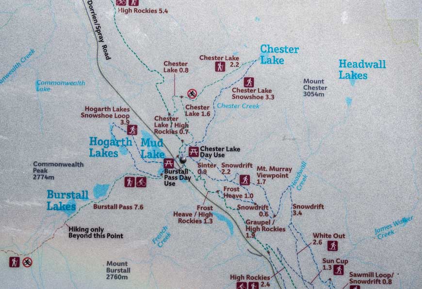
Map: Gem Trek – Kananaskis Lakes
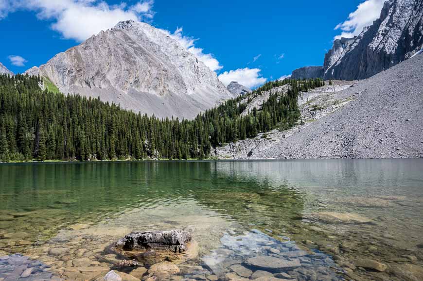
Type of terrain: The hike to Chester Lake is one of the premier hikes in Kananaskis Country. The trail travels through a mixed forest of pine and larch, through meadows to arrive at a scenic lake beneath towering mountain peaks.
Trail conditions: Be sure to check any trail advisories related to the Chester Lake hike before you go – especially as bear closures can happen to a trail at any time.
Closure: There is an annual seasonal trail closure from May 1 – June 29th to allow the trail to dry and prevent damage.
Permit: You need a Kananaskis Conservation Pass to hike here.
Winter visit: Chester Lake is also a fine destination on snowshoes starting sometime in November.
Why you want to do this hike
Chester Lake itself is gorgeous. The meadows you meet on the Chester Lake hike are fine in summer – but dazzling in September when the larches put on their fall show. There are lovely places along the shore of Chester Lake to picnic, fish, swim or just plop. We saw a family that had carried in their SUP – so apparently that’s an option too.
The hike to Chester Lake is easy enough that an active child can do it or an adult who only hikes occasionally. So pack up your family – and take a bathing suit, especially if it’s a hot day.
Although Chester Lake is the final destination for most hikers there is the option to continue up the Three Lakes Valley. I highly recommend doing that but you’ll need to allow an additional 2 – 3 hours of hiking time. That option adds another 240 m of climbing over an additional 4.5 km round-trip.
Chester Lake hike description
The Chester Lake hike is easy to follow. The trail starts near the washrooms in the northeast corner of the parking lot. You’ll see a giant sign with the trail to Chester Lake clearly marked.
Hike up the gravel road staying left at all intersections. The intersections are either signed or obvious. Do look out for spruce grouse along the road. On the couple of times I’ve hiked to Chester Lake, I’ve seen them along the road, most recently with two little grouselets (not a real word I know).
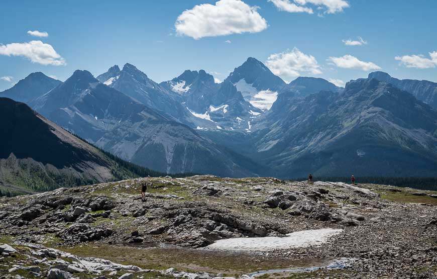
Look back occasionally as there are some great mountain views.
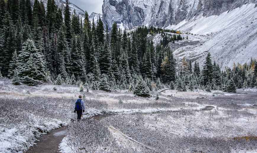
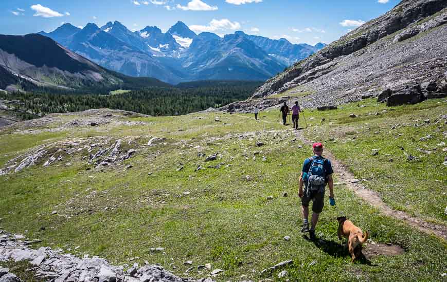
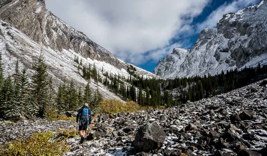
After hiking for about 40 minutes, the road-size trail narrows and in short order you reach a meadow. From here on the trail moderates though certain family members accuse me of lying. At the 2.7 km point there’s a short descent to reach a large meadow. Then it’s in and out of the trees a few more times before you reach the large meadow below Mt. Chester.
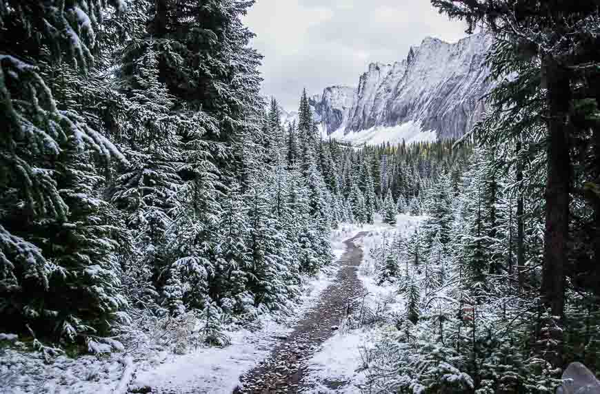
In the fall this part of the Chester Lake hike – alternating between trees and meadows is far more beautiful than in the summer because of the fall colours. Add a dusting of snow and it’s a notch or two more beautiful again.
When you reach Chester Lake you can cross a small bridge that will allow you to hike around the lake in a counter-clockwise direction. There are some nice picnic spots in the trees here. (Please pack out your garbage from lunch!!)
If you head left you’ll soon reach an intersection with the trail that takes you up to Elephant Rocks and the Three Lakes Valley. (See the description below.)


Chester Lake to Three Lakes Valley hike
The Three Lakes Valley hike is a great addition to the Chester Lake hike.
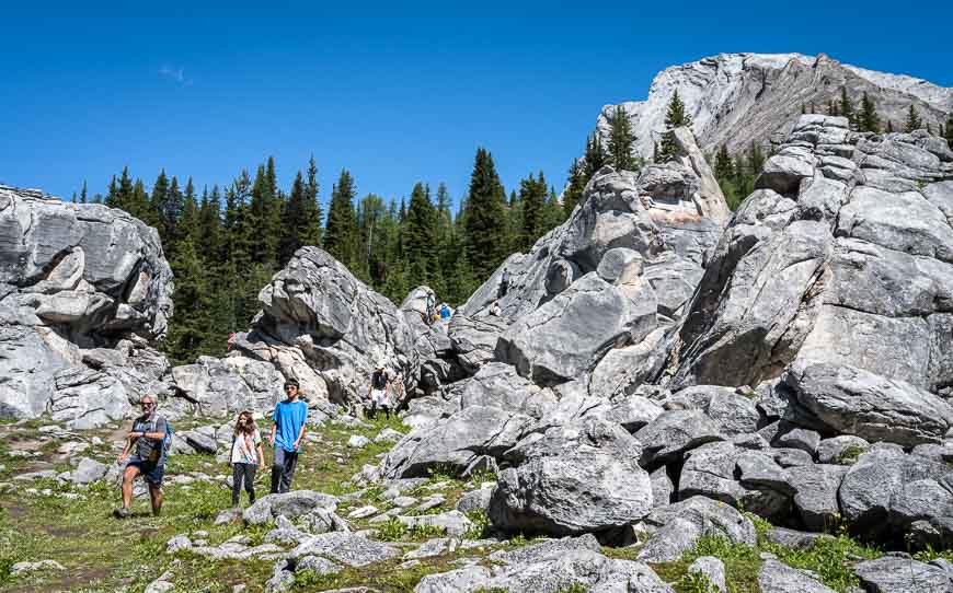
To get to the Three Lakes Valley take the trail that follows the west shore of Chester Lake. In very short order (about 60 m) look for a spur trail heading up into the woods. Hike through dense woods for 5 to 8 minutes to reach giant boulders that some people call the Elephant Rocks. This is a popular spot for lunch and bouldering. If you have kids be sure to do the side-trip at least this far.
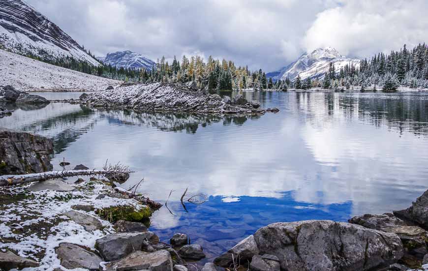
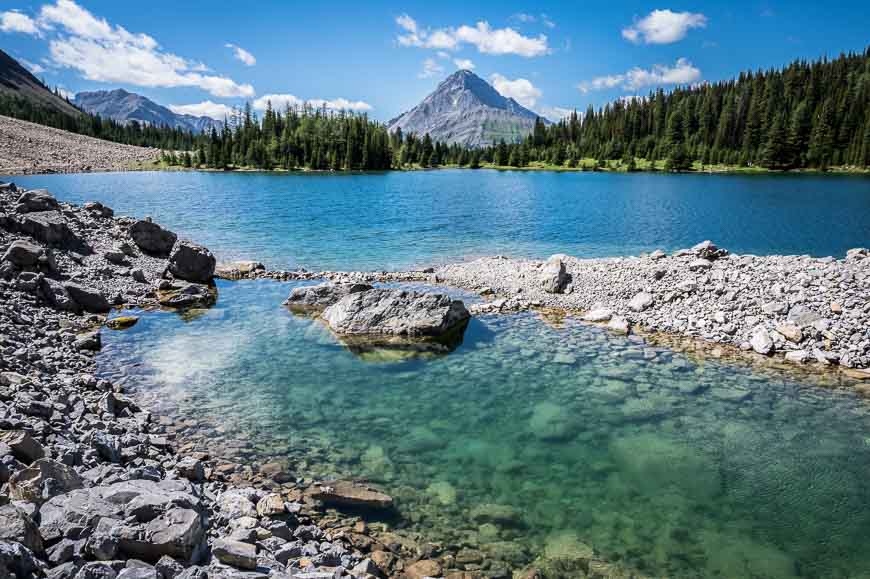
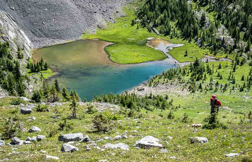
Stay left of the boulders and follow the well-worn trail for 5 to 10 minutes to reach a beautiful, wildflower-filled basin. This is where we saw the masses of mophead flowers. Ascend the rocky steps and in another five minutes reach the first lake at 2,287 m (7,503 feet).
These are actually tarns – mountain lakes formed in a cirque by a glacier – and reportedly the first lake is the prettiest. It’s also one where you might want to cool off on a hot summer’s day.
We had one family member who was not interested in going all the way to the second and third lakes. Out of respect for leaving her by the first lake to be bitten by flies, we regretfully turned back a kilometre before reaching the second lake at 2,410 m (7,907 feet) of elevation.
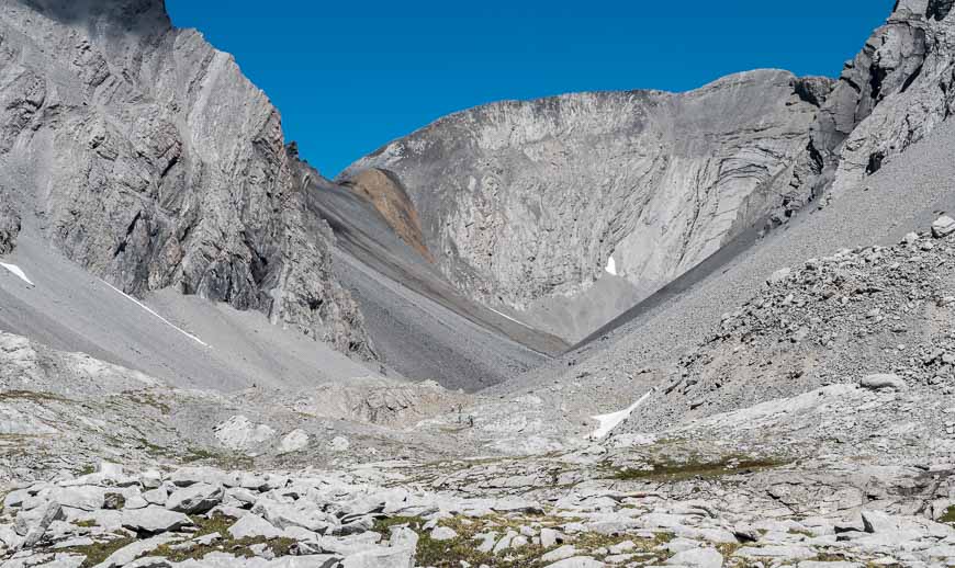
The hiking after the ascent above the first lake isn’t hard from what we saw – but it is rocky. I’d say you need a solid 30 minutes one way to get to the second lake though I might be off by a bit.
The third lake (elevation 2,460 m or 8,071 feet) is reportedly dry at times but still a worthy destination, especially in the austere surroundings with Mt. Galatea lording over it. We did speak with one group of hikers who said they saw a large number of rams at the third lake.
Hike back to Chester Lake by retracing your steps all the way to the parking lot.

Other options from the Chester Lake trailhead
The 13.6 km hike to Headwall Lakes is a fantastic one. From there it’s possible to continue to Fortress Mountain via a moderate scramble though you need a full day to do it.
Where is the Chester Lake trailhead?
The trailhead to Chester Lake is very easy to find. On Google maps you’ll find it here.
From Calgary I usually find it easiest to drive via Highway 40 rather than through Canmore.
From the Trans-Canada Highway drive 50 km south on Highway 40 from to reach the Kananaskis Lakes Trail. Turn right (southwest) and then right again in another 2.2 km onto the unpaved Smith Dorrien Trail. (Highway 742). Continue for another 20 km to reach the large signed parking lot on the right – directly across from the Burstall day-use area.
In Canmore take Three Sisters Drive to the Smith Dorrien Spray Trail. At the Canmore Nordic Centre zero your odometer and continue for 41.5 km on the Smith Dorrien Spray Trail to reach the Chester Lake parking lot on your left. Be prepared for a lot of dust.
Where to stay in Kananaskis Country
If you’re interested in car-camping read A Complete Guide to Camping in Kananaskis. There are a couple of campgrounds near the Chester Lake hike.
If you’re looking for a more upscale experience I highly recommend a stay at nearby Mount Engadine Lodge or at Kananaskis Mountain Lodge.
If it’s a roof over your head that you want, then the Kananaskis Wilderness Hostel is a great choice.
Click on the photo to bookmark to your Pinterest boards.


Sometimes we all need a little reminder that there’s no such thing as a bad mountain bike ride, and that life really is better on a mountain bike. A bad day on a mountain bike always beats a good day in the office.
Leonila A. Dalanta
Assistant Media Manager
PhamilyPC.tk
Such a fabulous hike. I wasn’t aware of the extension to Three Lakes Valley, although I might be like your family member and sit out the extension. Give me some bug spray and I’ll wait and gaze at those glorious views happily.
Hi Sue,
It was the first time we’d hiked Chester Lake in the summer and have to say I prefer the hike in the fall even though it’s still pretty – and the Three Lakes Valley is a must next time you go up there!