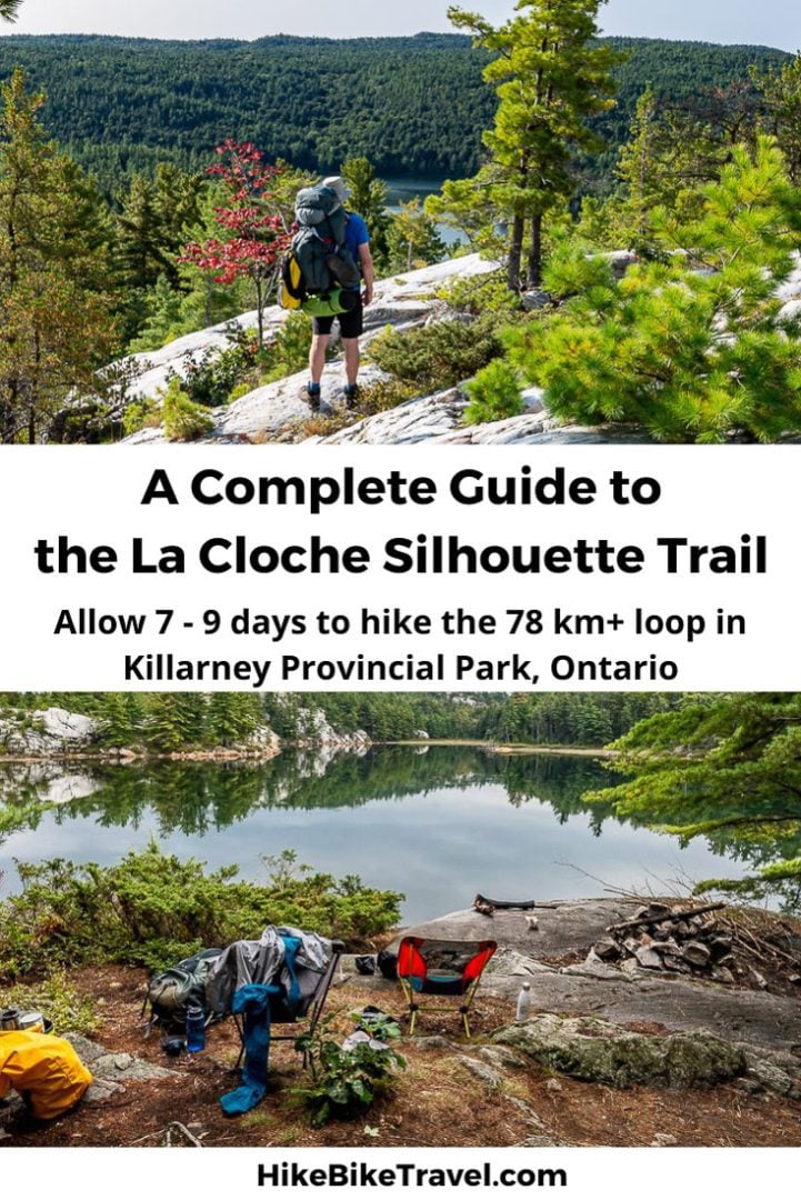
The 78-kilometre La Cloche Silhouette Trail in Ontario’s Killarney Provincial Park is a loop hike that is typically done over seven to nine days.
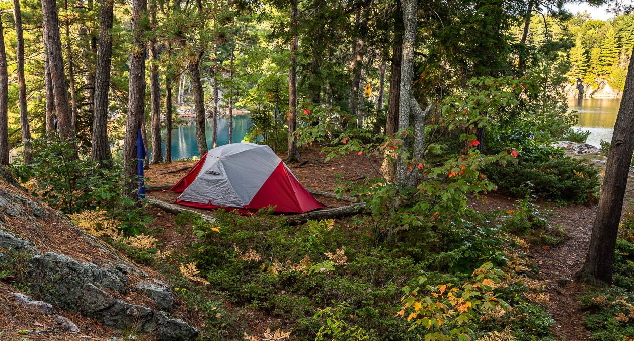
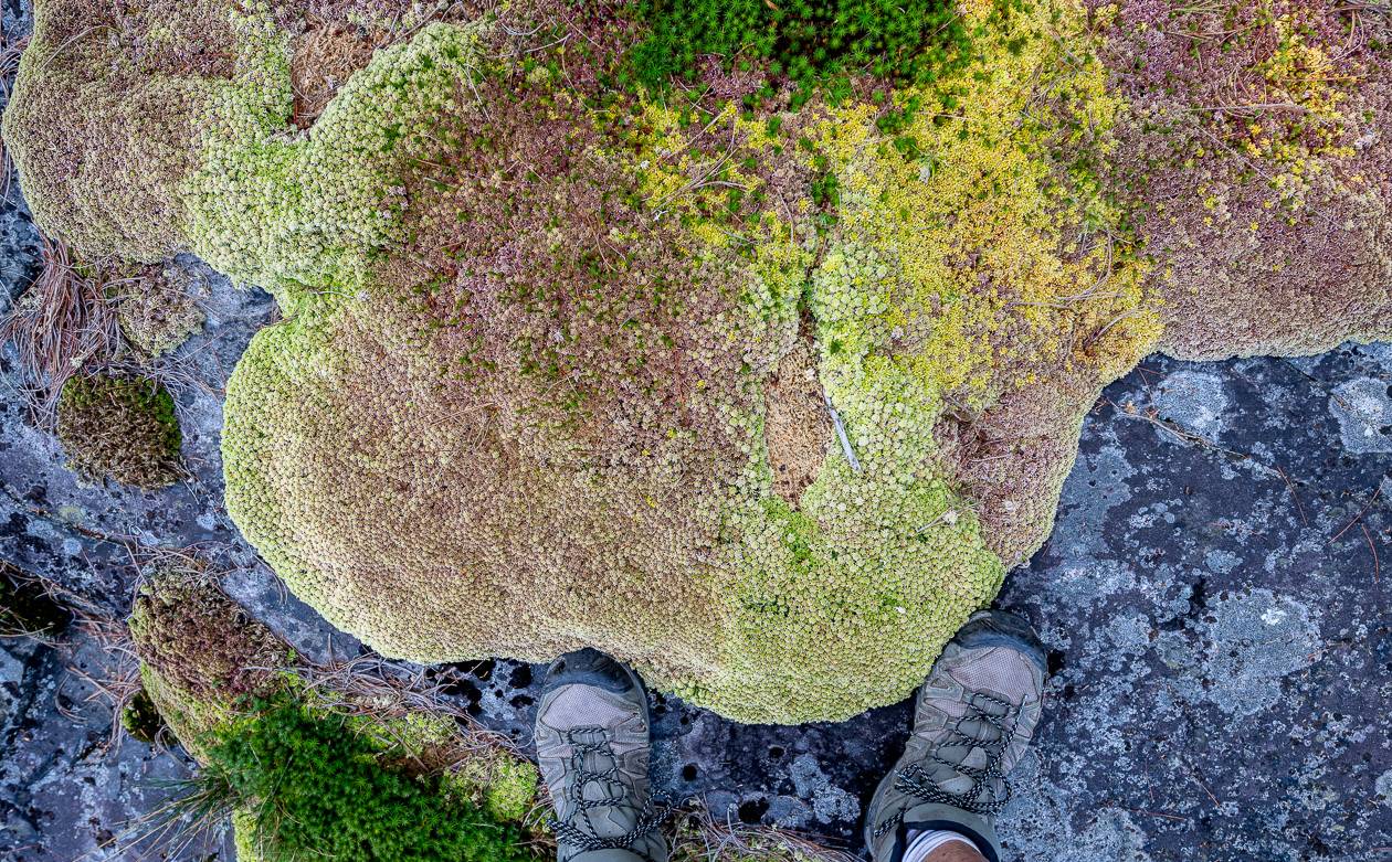
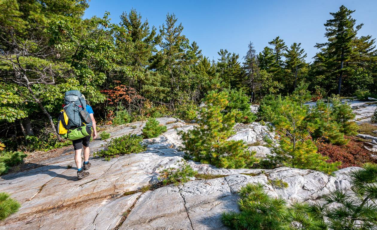
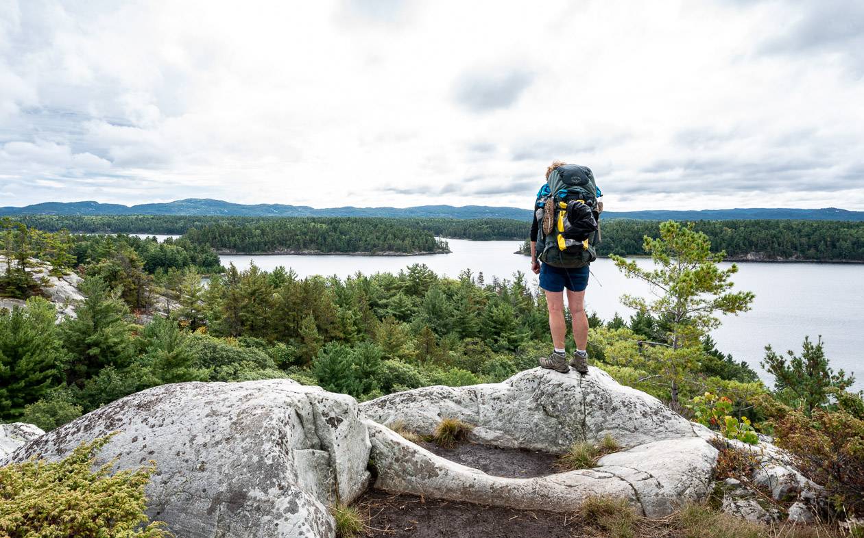
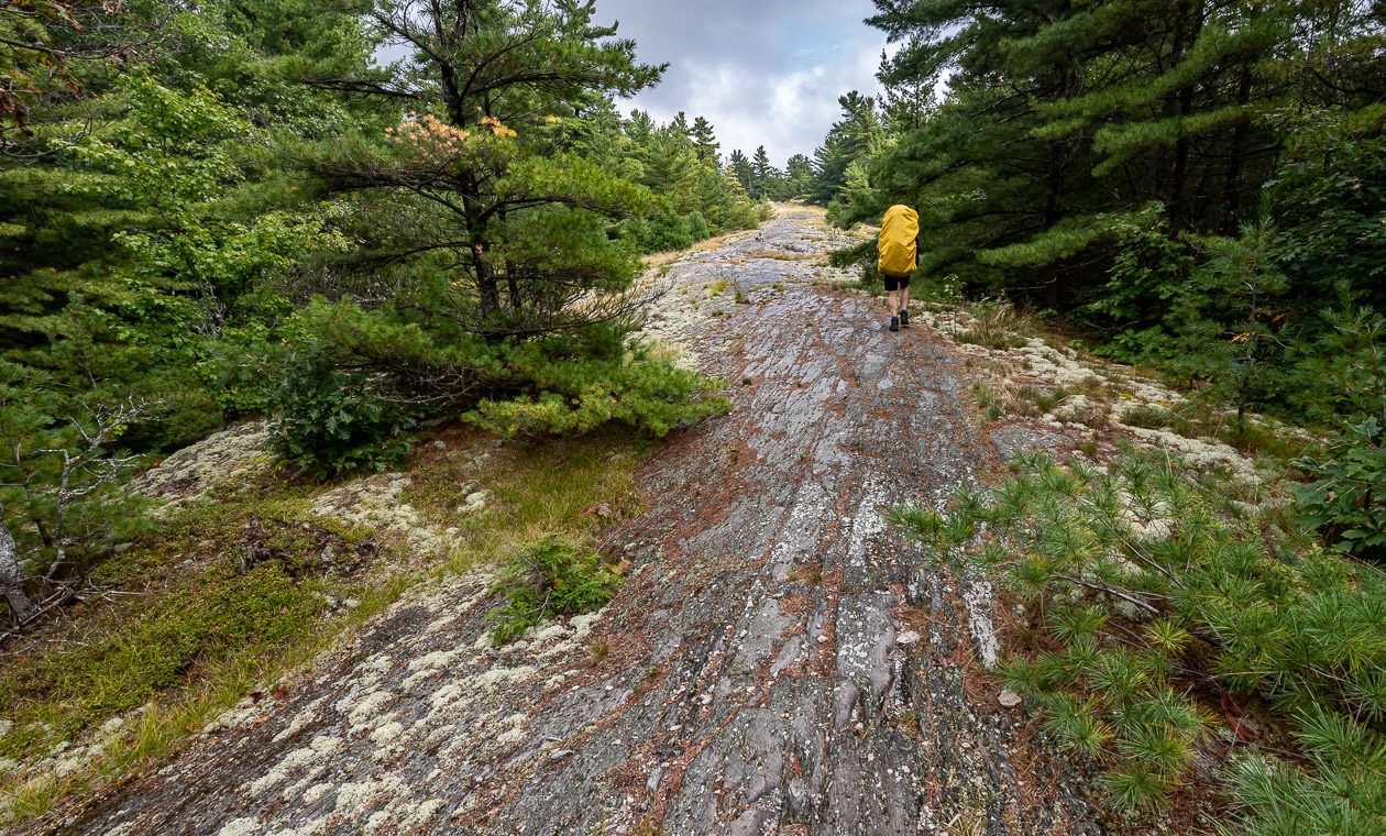
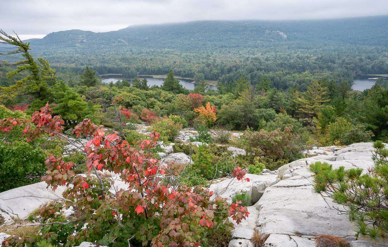
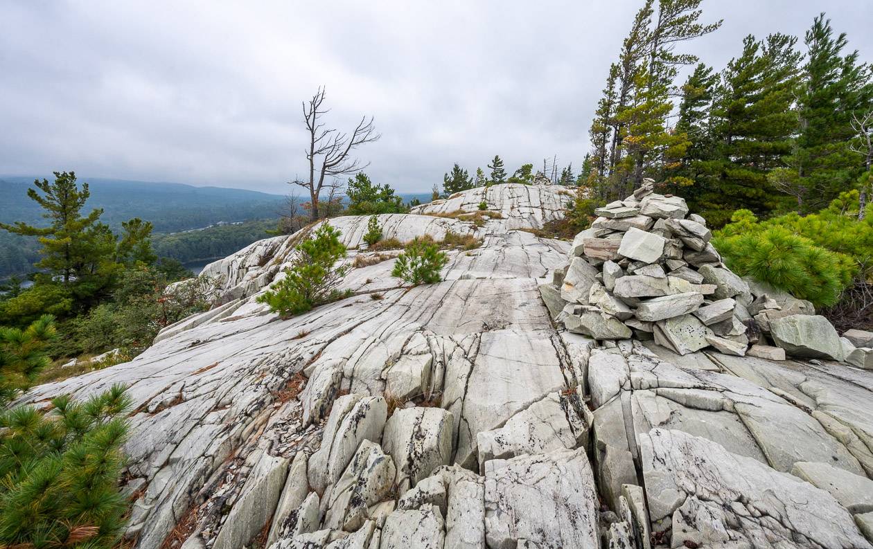
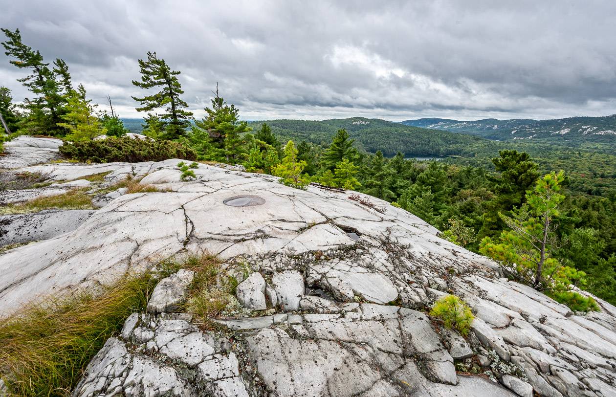
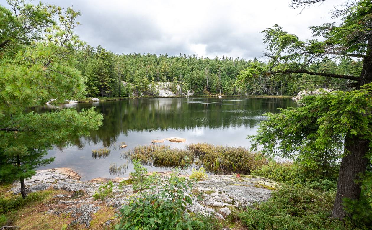
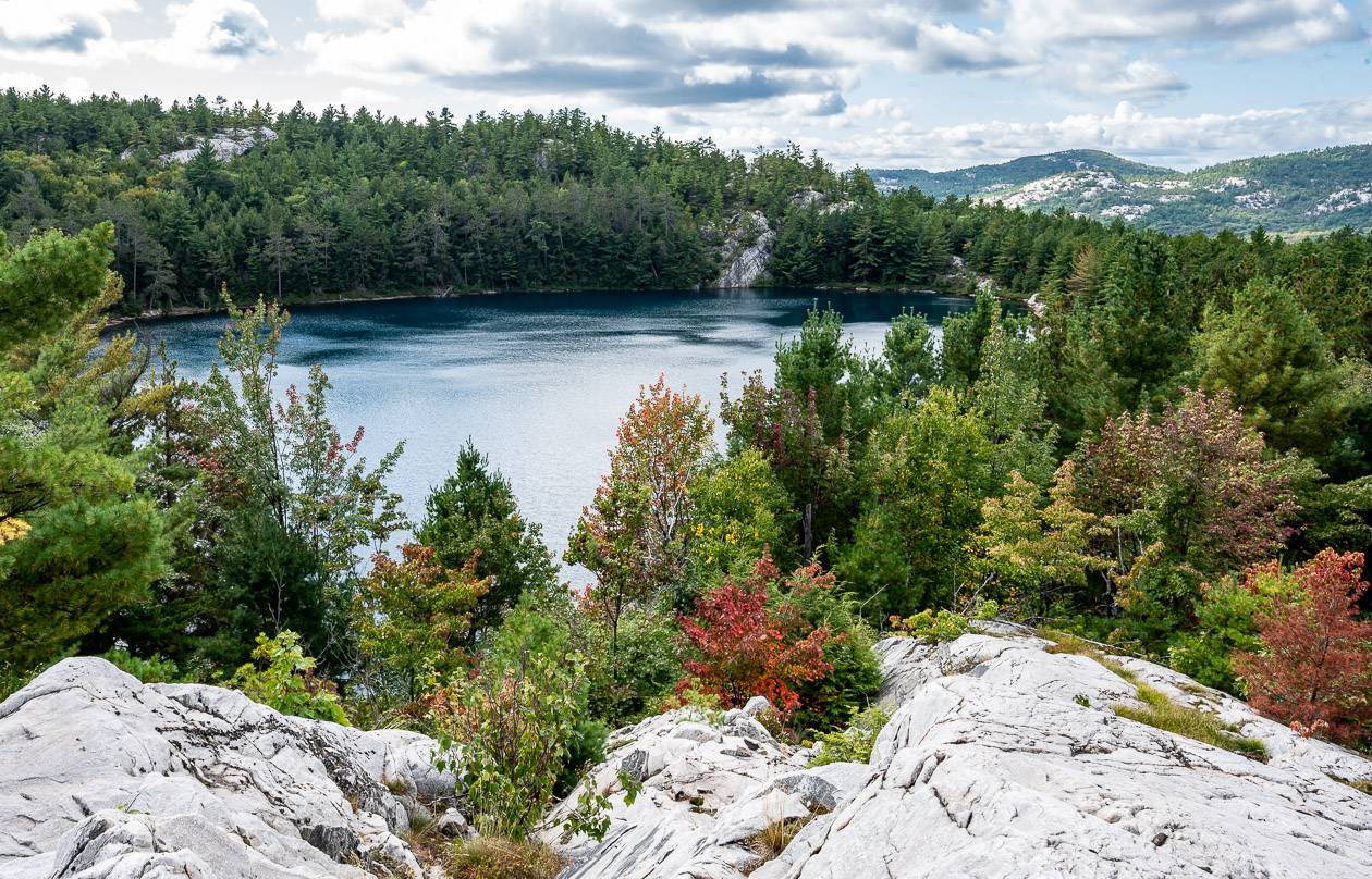
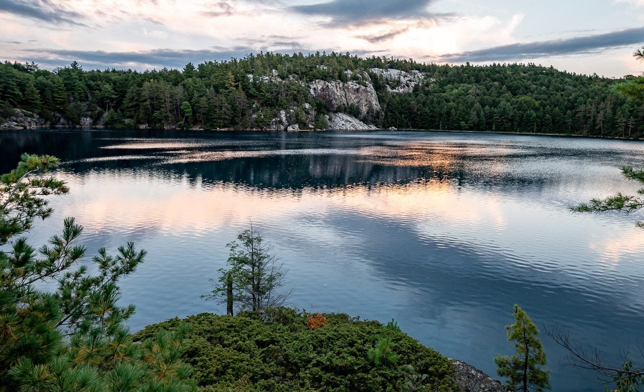
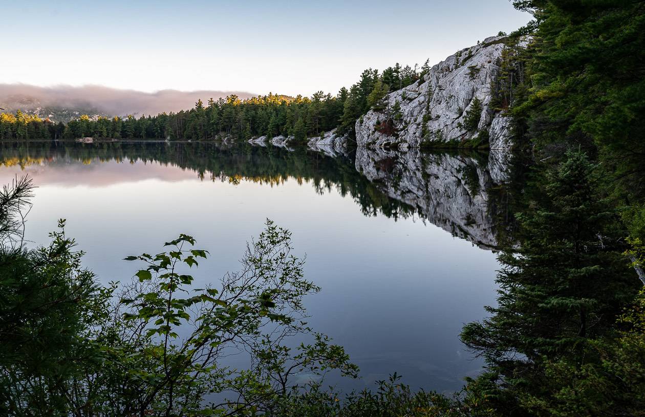
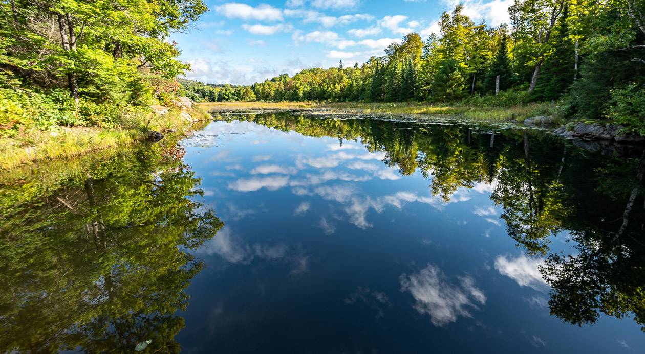
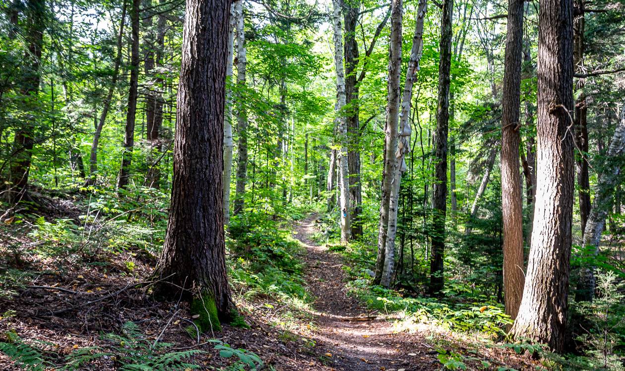
It takes you through a beautiful landscape that includes pretty, crystal-clear lakes, stunning sections of open forest, and over white quartzite ridges that offer picturesque views of the La Cloche Mountain Range.
The trail is dedicated to the memory of The Group of Seven artist, Franklin Carmichael (1890-1945) and is named for his painting La Cloche Silhouette.
This post includes some affiliate links. If you make a qualifying purchase through one of these links, I will receive a small percentage of the sale at no extra cost to you. Thank you very much for your support.
La Cloche Silhouette Trail summary
Distance: The La Cloche Silhouette Trail is a 78 km loop that starts at the main campground at George Lake and includes the return hike up Silver Mountain. You will end up hiking more than that – if you book any campsites off the main trail.
Opening times: The La Cloche Silhouette trail is open year round. In late fall, winter, and early spring it’s only recommended that experienced hikers, who are well prepared for the elements, attempt the trail.
Elevation gain: No matter which direction you hike the trail in, the elevation gain is about 2,800 metres (9,186 feet) though this is a very rough estimate.
Direction to hike: The hike can be done in either direction though I would recommend clockwise because of the dicey section near the waterfall that is easier to ascend then descend, and so that you don’t have to climb through “The Crack” with a full pack. The most popular direction to hike is clockwise.
Number of people: Approximately 1,000 – 1,400 people hike the La Cloche Silhouette trail every year.
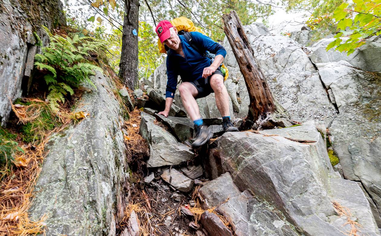
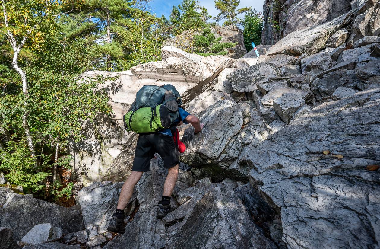
Level of difficulty: The hike is rated as challenging though there are many easy to moderate sections. The most technical section is “The Crack”. It is reached on day one of the hike if you do in counterclockwise direction and on the last day if you hike it clockwise.
Time needed: Allow 7 – 9 days to do the full loop hike. The record for completing the hike is 9 hours, 25 minutes, and 45 seconds by Eric Batty. We met three guys trying to do it in less than 24 hours – and I thought that was impressive.
Reservations: Make a reservation up to five months in advance of your arrival date. Reservations can be made online or via phone at 1-888-ONT-PARK (1-888-668-7275). The Ontario Parks Call Reservation service is open 14 hours a day from 7 AM until 9 PM, every day but Christmas and New Year’s Day.
Dogs: Dogs are permitted on a leash, but they too should be in good shape. And they’ll need a lot of calories, so you’ll have to be able to carry enough food for them as well.
Highlights on the La Cloche Silhouette Trail
- Long quartzite ridges with beautiful white pines and glorious views
- Crystal clear – sometimes turquoise-coloured lakes that are fantastic for swimming in the warm-weather months
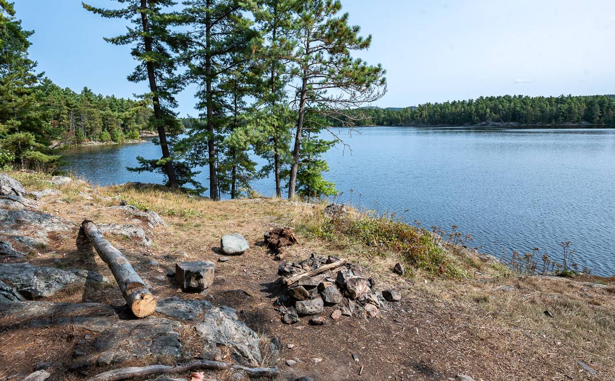
- Private campsites: how often you have a whole lake to yourself?
- The ability to have a campfire if fire bans aren’t in place
- Testing yourself physically over a week
- Being unplugged – though you can get a cell signal on the ridges if you choose
- Time to reflect and enjoy the moment without a thousand other distractions
How many days should I allow to do the full La Cloche Silhouette Trail?
Most people should plan on a seven-to-nine day hike. You can read reports about people who do it faster – but you’ll miss out on the full experience as you’ll be so focussed on getting to the campsite that you really don’t have time to take in the beauty of the landscape.
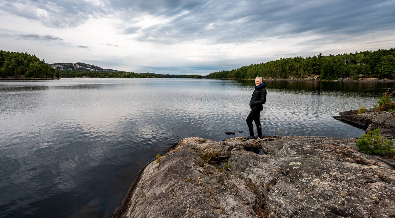
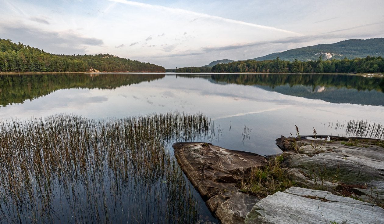
Enjoying the lake and the views after a good day of hiking was one of the highlights of our trip.
Can I hike the La Cloche Silhouette Trail solo?
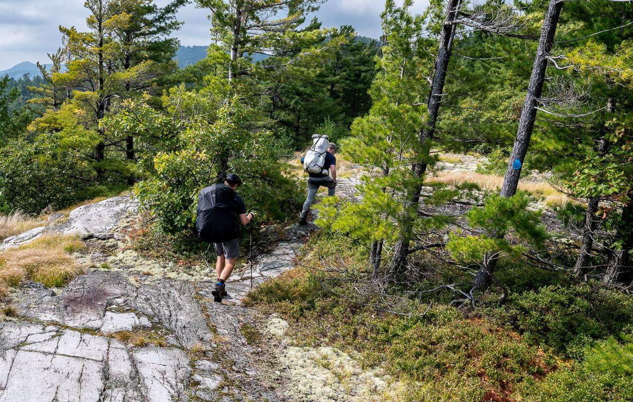
We saw about a half dozen men ranging from early 20’s to early 70’s doing the hike alone. It’s very doable but you should be a competent hiker before you set out. This trail is not one for first-time backpackers.
The La Cloche Silhouette Trail is very different from backpacking trails I’ve hiked in the Rockies.
If I book a backcountry campground in Banff National Park for example, I can almost always expect to be sharing it with others. There are very few campsites in the park that only have one tent pad.
On this trail, almost without fail, you get the entire campsite and a lake to yourself. That’s great if you’re a couple or in a small group – but if you’re going solo, don’t expect any trail camaraderie in the evenings. I also found that we only ran into between 2 – 6 people a day, except for the last day when we hiked ‘The Crack’ section of the trail. On two days, we saw nobody. Think about that before you commit to going solo.
How many campsites are there and where are they located?
I counted 29 campsites on the topo map so even though there seem to be a lot to choose from, you really must plan how far you want to hike everyday – and what is manageable for your group.
Buy a map ahead of time through Friends of Killarney Provincial Park so you can see the location of all campsites – and map out your route. Ever square on the map is 1 km by 1 km so you can figure out approximate mileages.
Campsites are located at the following places with approximate distances from the George Lake Campground. I’m not 100% sure that the distances from the main trail to the campground are included and sometimes those are substantial.
- H1 (Lumsden Lake)- km 2
- H2 (Lumsden Lake) – km 3
- H3/H4 (Acid Lake) – km 4
- H5/H6(Cave Lake) – km 7
- H7 (Topaz Lake) – km 9
- H8 (Three Narrows Lake) – km 14
- H16 (Three Narrows lake) – km 16
- H17 (Three Narrows Lake) – km 20
- H18/H19 (Three Narrows lake) km 22
- H20 (Three Narrows lake) km 25
- H59 (detour off the main route) km 25
- H21 (Three Narrows Lake) km 28
- H22 (Moose Pass) km 32
- H31/H32 (Shigaug Lake) km 38
- H33 (Little Mountain Lake) km 39
- H34 (David Lake) km 45
- H35 (Boundary Lake) km 45
- H37/H38 (Silver Lake) km 51
- H45/H46 (Bunnyrabbit Lake) km 56
- H47 (Heaven Lake) km 58
- H48 (Proulx Lake) km 62
- H49 (Little Superior Lake) km 62
- H50 (Sealey’s Lake) km 68
- H51/H52 (Wagon Road Lake) km 71
- H53 (Little Sheguiandah) km 72
- H54 (A.Y. Jackson Lake) km 73
Where we camped on the La Cloche Silhouette Trail
We did the following and I think it worked out really well though our third day was a long one – Topaz Lake (H7), Three Narrows Lake (19), Shigaug Lake (H32), Boundary Lake (H35), Silver Lake (H37) and my favourite, Proulx Lake (H48).
There is a longer day to day description below with photos.
Can you go swimming?
Swimming is a wonderful way to cool down after a hot hike. Just be aware that some lake access is very steep and most of the campsites we visited had sharp dropoffs.
One lake we stayed at, Silver Lake – was very low and the shoreline was muddy and very unappealing for swimming. There were a few others like that we saw.
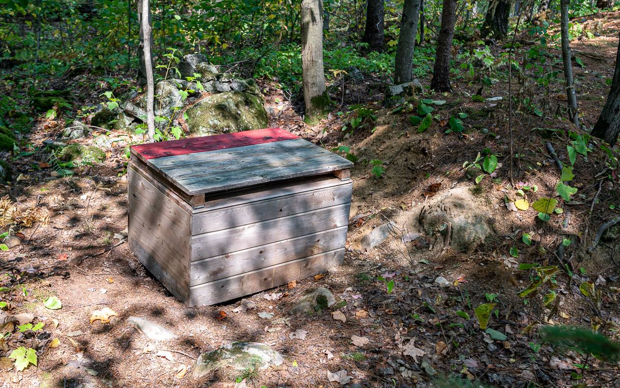
Are there toilets?
At every campsite on the La Cloche Silhouette Trail you’ll find signage pointing to a pit toilet.
At some campsites, the hike to the toilet is considerable but at least you’ll have privacy. Don’t forget toilet paper and hand sanitizer.
What animals will you see on the hike?
There are black bears in Killarney Provincial Park, but we only saw dried scat twice early on in the hike. Moose poop was visible on lots of occasions, but we never saw a fresh moose track.
We did see loads of red squirrels and chipmunks – including one that was eating a live frog.
Bird life was decent. We saw ruffed grouse on many occasions along with lots of loons, back-capped chickadees, juncos, and blue jays.
We saw the occasional merganser, hermit thrush, and eastern wood peewee. We heard pileated woodpeckers several times and at night we went to sleep listening to the barred owl – singing “Who cooks for you?” on two occasions.
Do’s and don’ts along the La Cloche Silhouette trail
Pack out what you pack in. Leave the campsite in better shape than you found it and remember to follow leave no trace principles. I did find the trail to be almost garbage free. I saw a few bar wrappers and a couple of campfires had bits of garbage in them, but that was it.
Treat all water.
Do not take any cans or glass bottles into the park.
Camping is only permitted at designated campsites. Never set up your tent at a vacant campsite unless you are a registered user.
Use cookstoves for cooking and the designated campfire pit only if a campfire ban is not in place. Collect small pieces of wood only. At one spot we found fresh branches cut and lined up by the fire pit. What a waste.
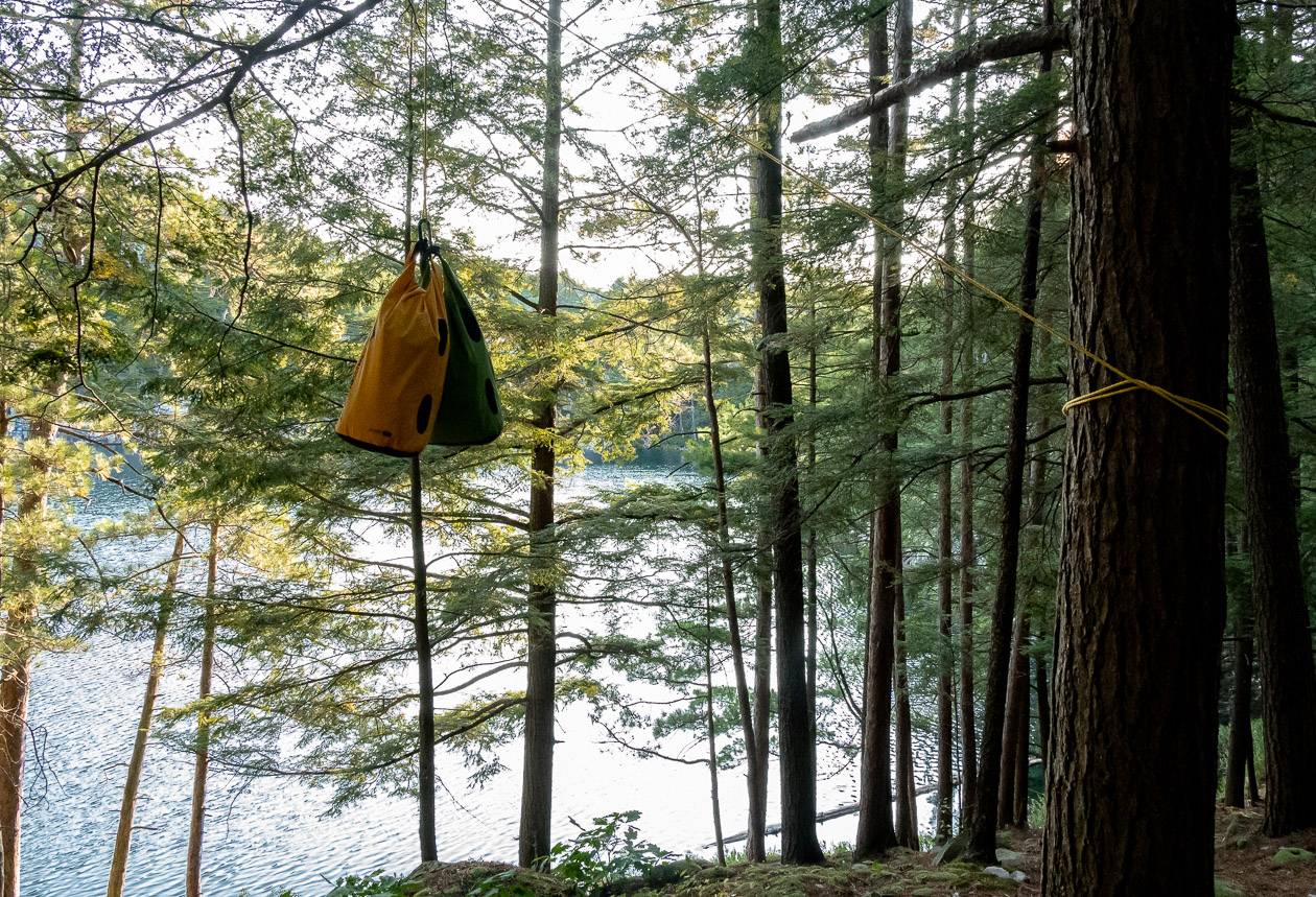
Hang all your food so be sure to bring waterproof bags, a length of rope and several carabiners.
Our day-to-day experience on the La Cloche Silhouette Trail
Day 1 – Parking lot at George Lake to Topaz Lake (Campsite H7)
Number of kilometres hiked: 9 km (Parking lot to H7)
Time we took: 4 hours with a few short breaks
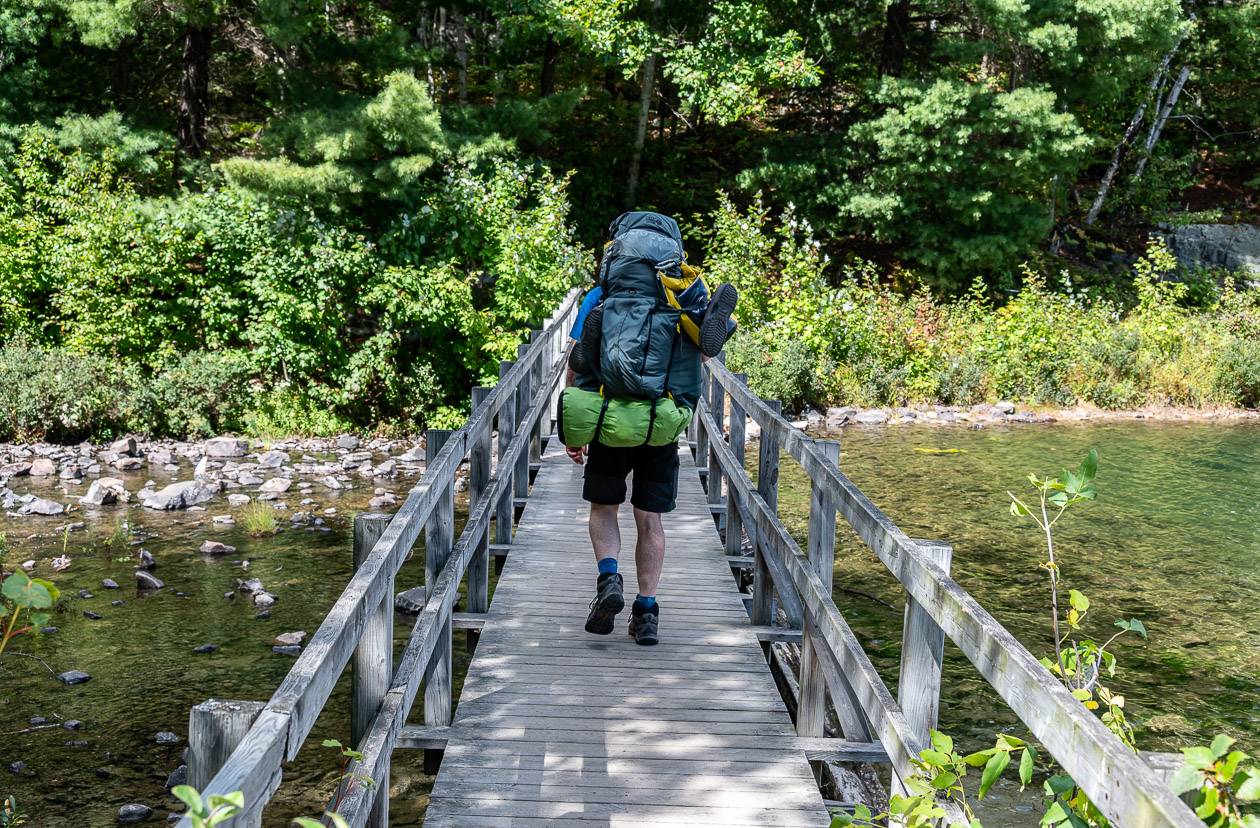
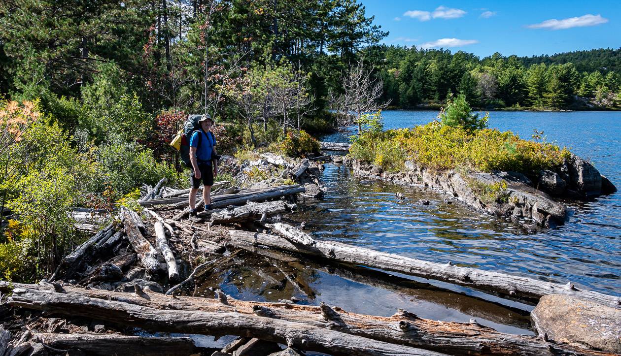
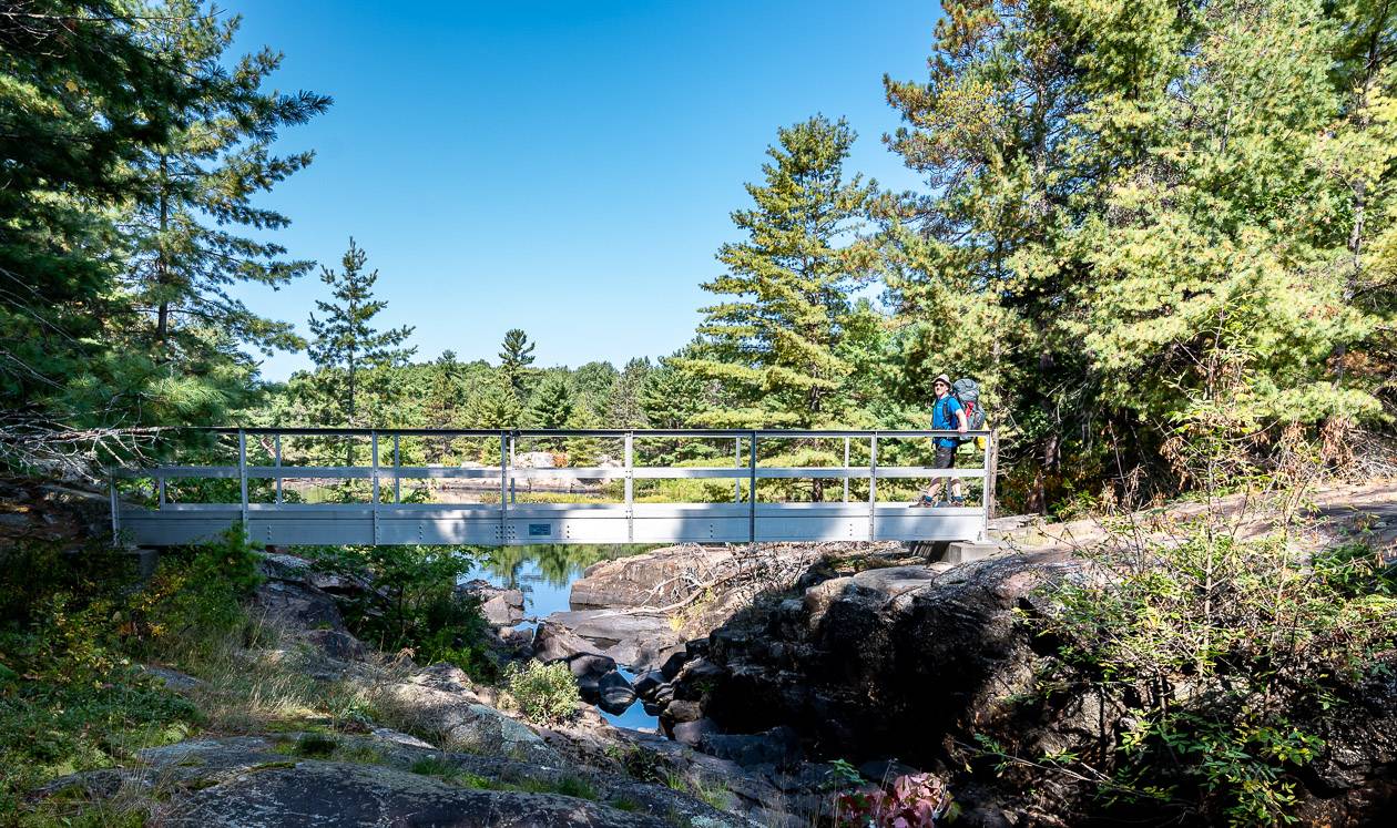
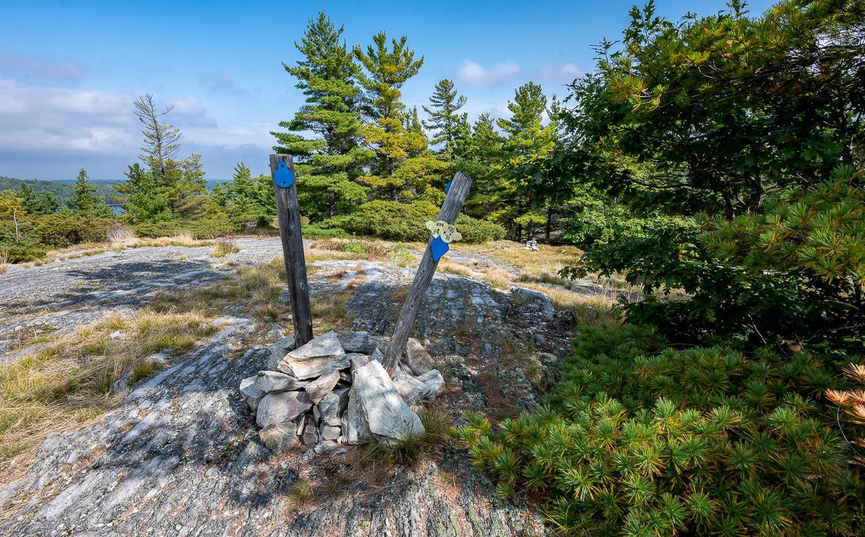
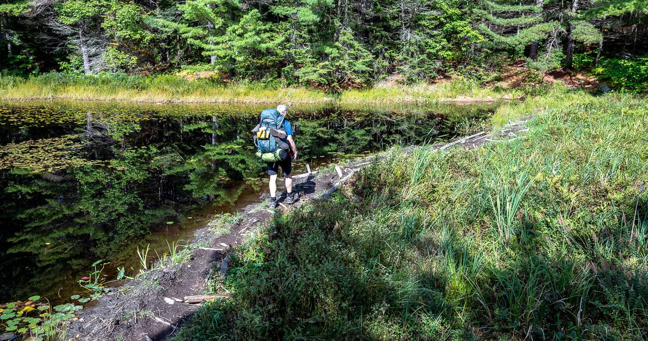
There is a parking lot at the west end of George Lake. From there you cross a bridge, turn left and look for blue markers, indicating the La Cloche Silhouette Trail. They point in the general direction you should be hiking.
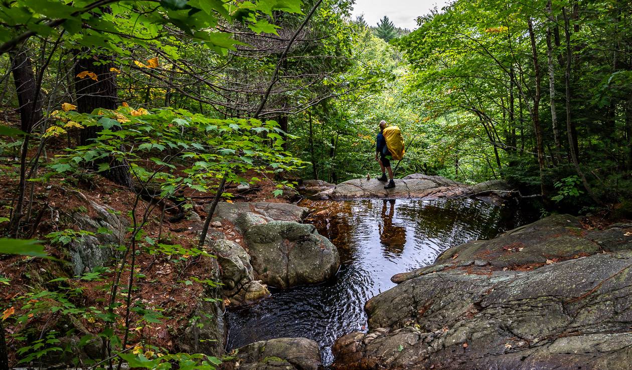
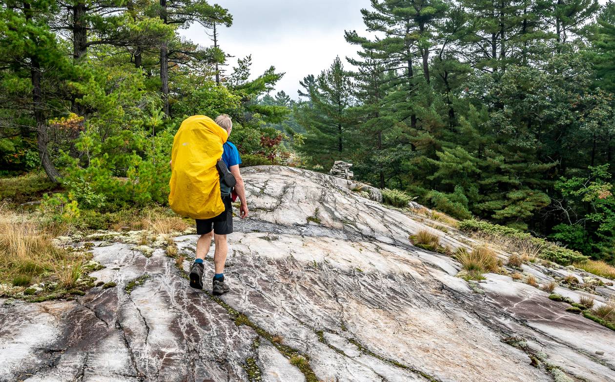
Highlights on this section include pretty forest hiking, a beaver dam crossing, and a submerged bridge crossing thanks to another beaver dam. Pass a cottage – perhaps grandfathered into the park, to continue up a hill – the steepest portage route in the park, looking for yellow markers on the left indicating the H7 Topaz Lake campsite.
Be sure you follow the yellow markers to the campground – and don’t go off course and end up on a skinny trail at the top of a cliff like we did. We quickly learned you need to follow the yellow markers to get to any campsite off the main trail.

Day 2 – Topaz Lake to Threenarrows Lake (H19)
Number of kilometres: 13 km (H7 -to H19)
Time we took: 6 hours and 20 minutes with several long breaks
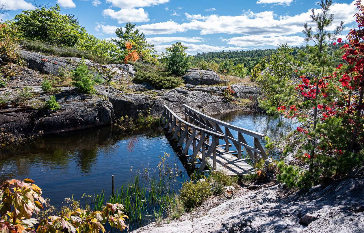
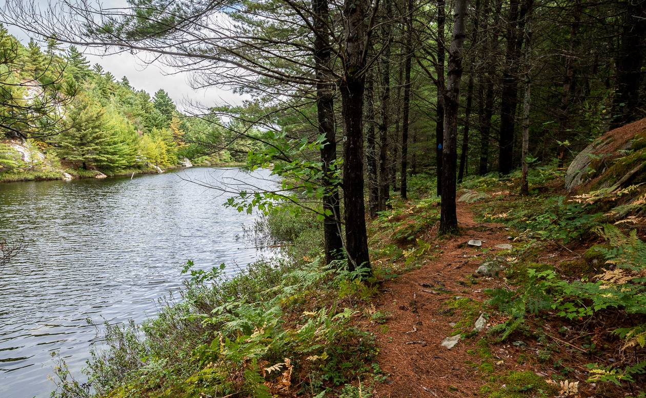
There first few hours of the hike took us up one side of Kirk Creek, over a bridge by a pretty pond, and then down the other side – all easy walking in the forest.
In another few kilometres we reached H16 – a nice campsite on a quiet section of Three Narrows Lake. From there we hiked in the forest for quite a long time with minor changes in elevation. Our campsite at Three Narrows Lake required about a 15-minute walk in – but it was worth it. We both enjoyed the views and the easy access to the lake.
It rained hard most of the night but by morning it had cleared up. We had rain on four of six nights, light showers on one, and no rain at all the last night.
Day 3 – Three Narrows Lake to Shigaug Lake (H32)
Number of kilometres: 16 km (H19 – H32)
Time we took: 8 hours and 20 minutes with many stops but still a long, hard day
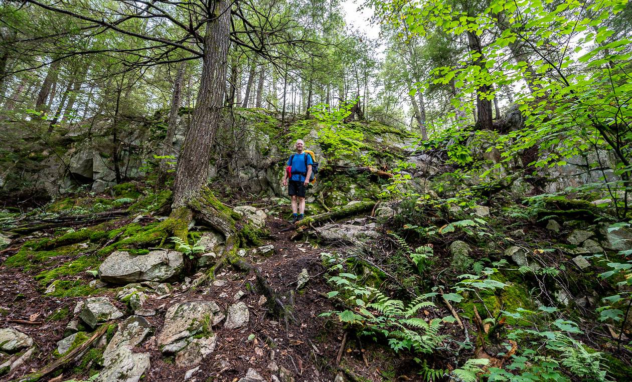
The third day on the trail was our longest and hardest. Most of it was in the forest with easy sections early on, followed by many steep ups and downs.
There is a pretty waterfall that will get your attention since you must hike up beside it on very slick rock. I think it would be much harder to descend. Take your time here. There is another VERY steep descent where you really need to watch your foot placement.
Somewhere in here, John stepped on a small rock that took him out. He ended up with his pack landing on top of him, and a cracked rib.
The section along the three small lakes near H22 and H23 was a delight – and a very pretty area. I liked the look of the H22 campsite. From there it was still about 5 km to Shigaug Lake, but fortunately a couple of kilometres were very easy. The lake itself is a standout – and worth the 20-minute walk in, at least in hindsight.
Day 4 – Shigaug Lake to Boundary Lake (H35)
Number of kilometres: 7 km (H32 – H35)
Time we took: 4 hours, 50 minutes
We woke to dense fog over Shigaug Lake but fortunately as the day progressed, the fog lifted, and the sun came out.
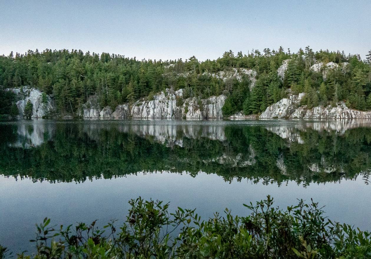
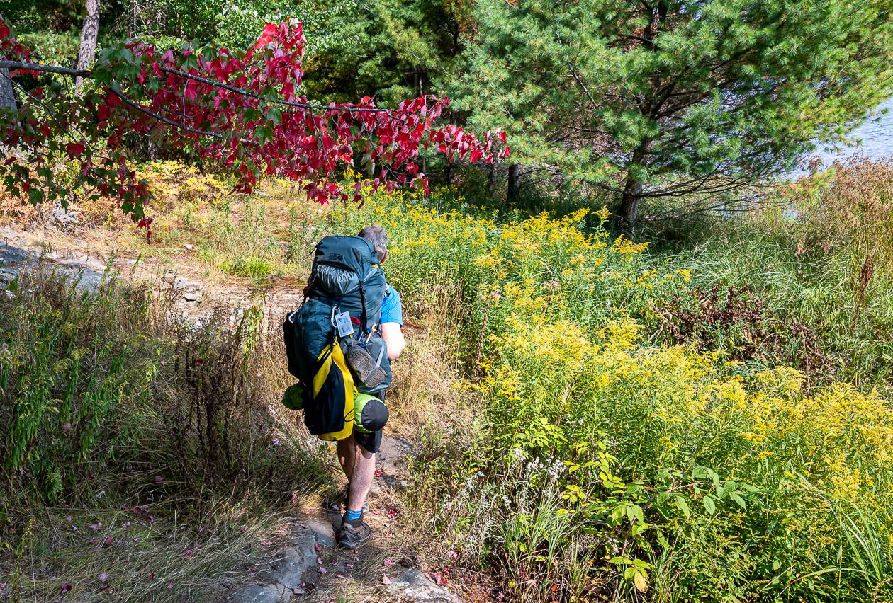
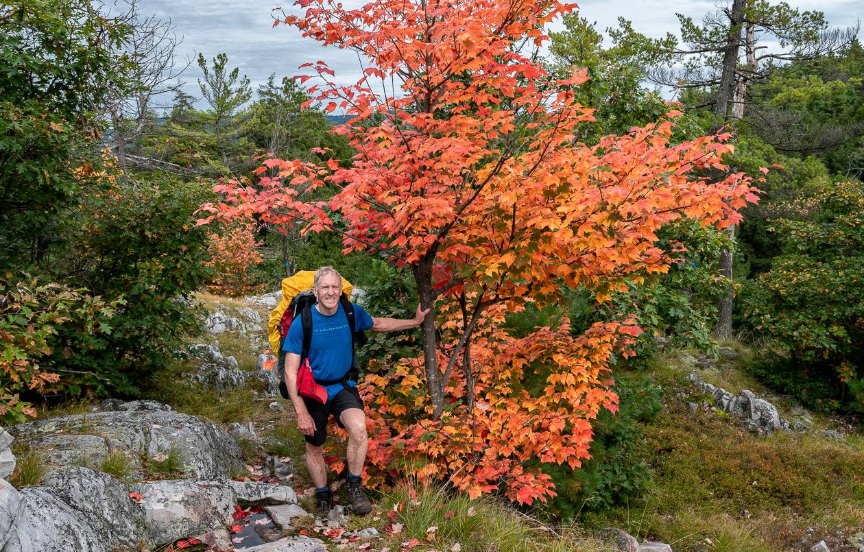
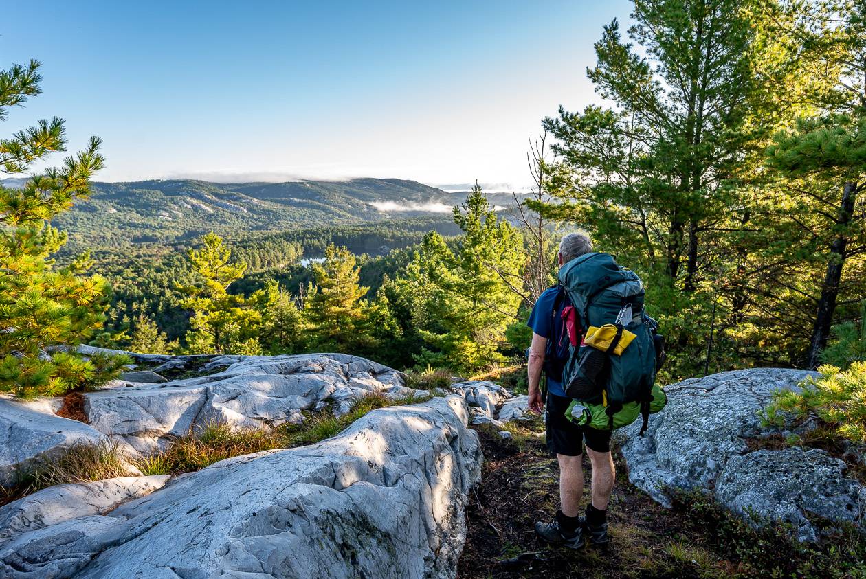
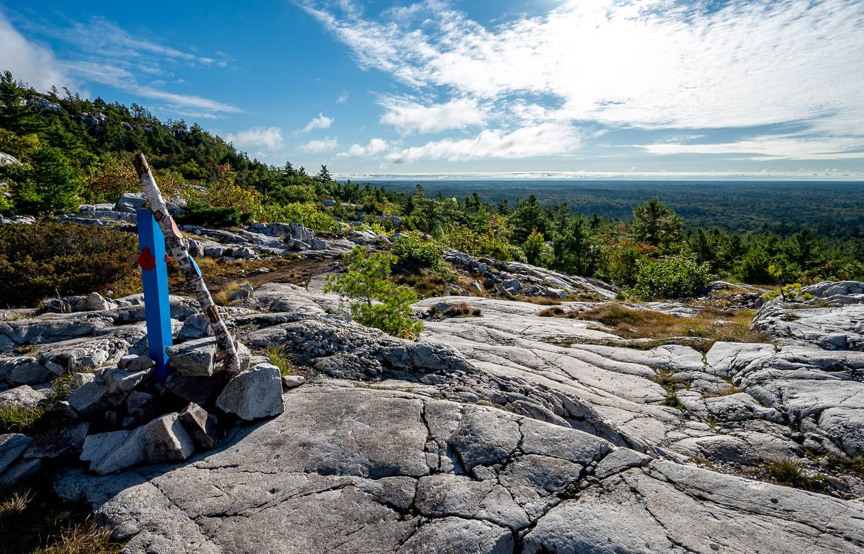
The day alternated between lovely walking on quartzite ridges (sometimes very slippery) and forest sections. It was literally up and down all day. The ridges usually offered great views – and blasts of fall colour were common.
The hike into the Boundary Lake/H35 campsite was a long one, and the better part of a kilometre. Your other option in the area – H34 also features a long approach. We both loved the Boundary Lake campsite – lots of bird life and easy water access.
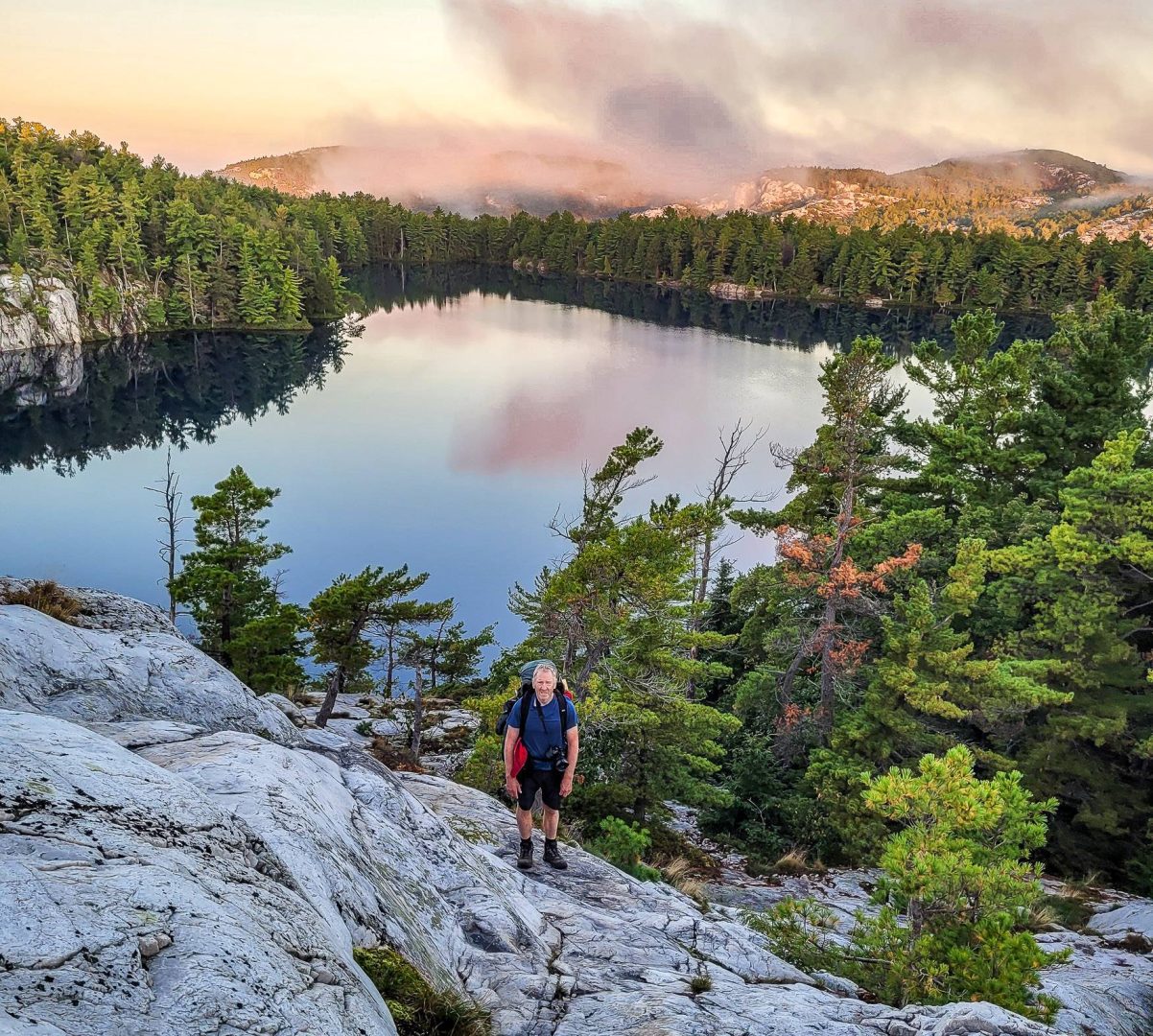
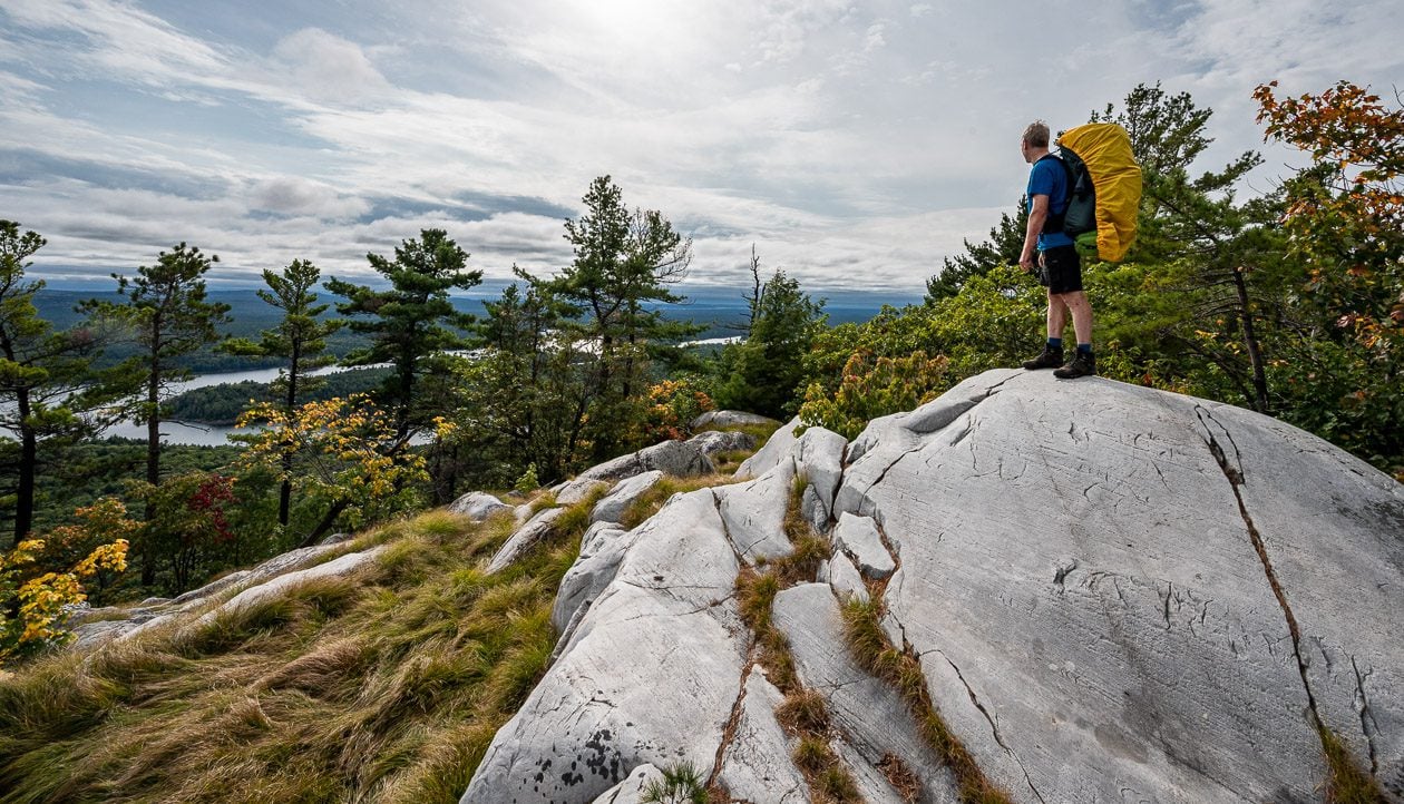
Day 5 – Boundary Lake to Silver Lake (H37)
Number of kilometres: 6 km + extra for the hike up Silver Peak (H35 – H37)
Time we took: 5 hours and 20 minutes including a climb up Silver Peak
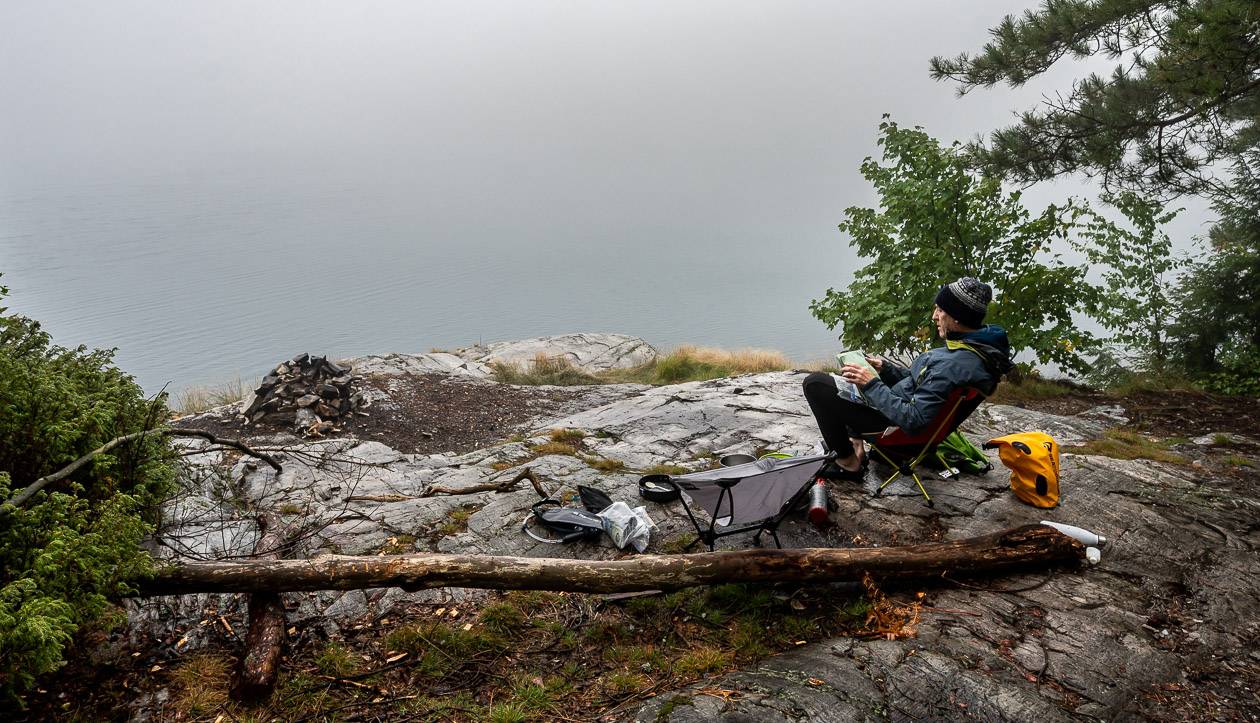
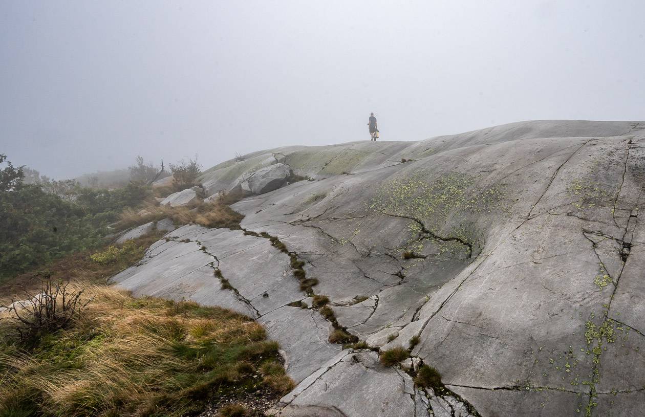
It threatened rain all day, but it never happened. However, as you can see in the photo below, the visibility over Silver Peak was non-existent, but still we decided to do it in the hope it would clear when we got to the top. It did not.
The hike to the turnoff to Silver Peak involved lots of ridge walking with views across to Boundary and David Lakes. It was lovely.
We decided at the well-marked turnoff to Silver Peak that we would hike it – or we would have been in camp too early. It is a moderate to steep trail that will take you between 40 minutes and an hour to climb. The red markers we followed disappeared at the peak but someone had drawn arrows in the dirt, so we followed them to the top. It would be easy to get turned around in the fog.
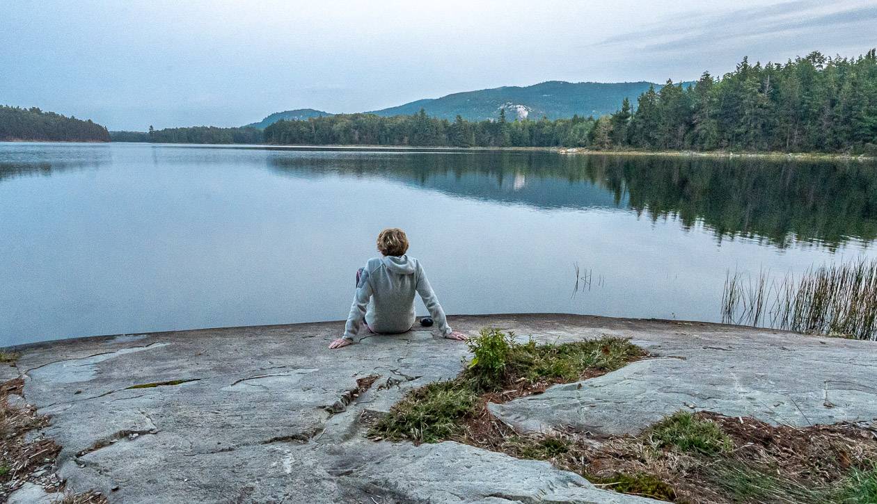
After that side trip, we hiked one of the easiest sections of the La Cloche Silhouette trail. The trail takes you on what looks like an old, flat road through the forest for a few kilometres. A sharp turn south and a bit more up and down had us at Silver Lake in no time.
It’s in a pretty setting but I wasn’t a fan of the lake or the campsite. It’s the only campsite where we could see another person – and he grunted a lot. The lake was shallow and slimy, so it was hard to get fresh water. And the toilet was VERY close to the campsite, so if you were part of a group, you wouldn’t have any privacy.
Day 6 – Silver Lake to Proulx Lake (H48)
Number of kilometres hiked: 11 km (H37 – H48)
Time we took: 6 hours, 15 minutes with breaks
One look at the topo map over breakfast and I knew we were in for five plus hours of up, down, up, down, and repeat on the La Cloche Silhouette Trail.
Don’t get me wrong. It’s a beautiful hike, but there’s a surprising amount of vertical so we sweated profusely. After Heaven Lake (and lovely campsite H47) we flew down a portage trail, then climbed steeply to reach a beautiful setting high above Shingwak Lake.
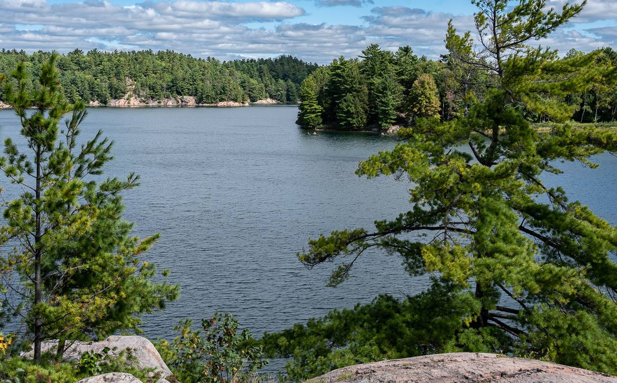
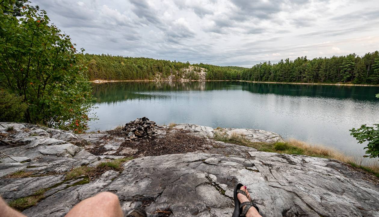
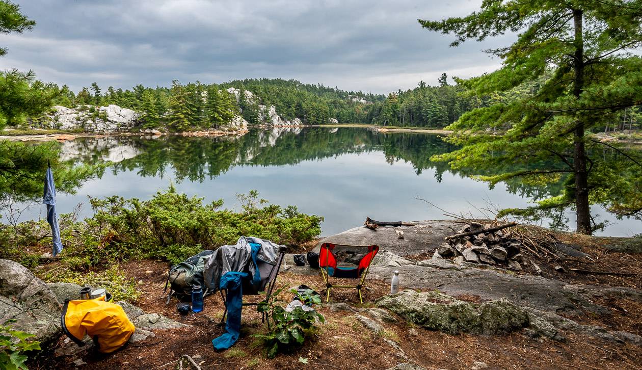
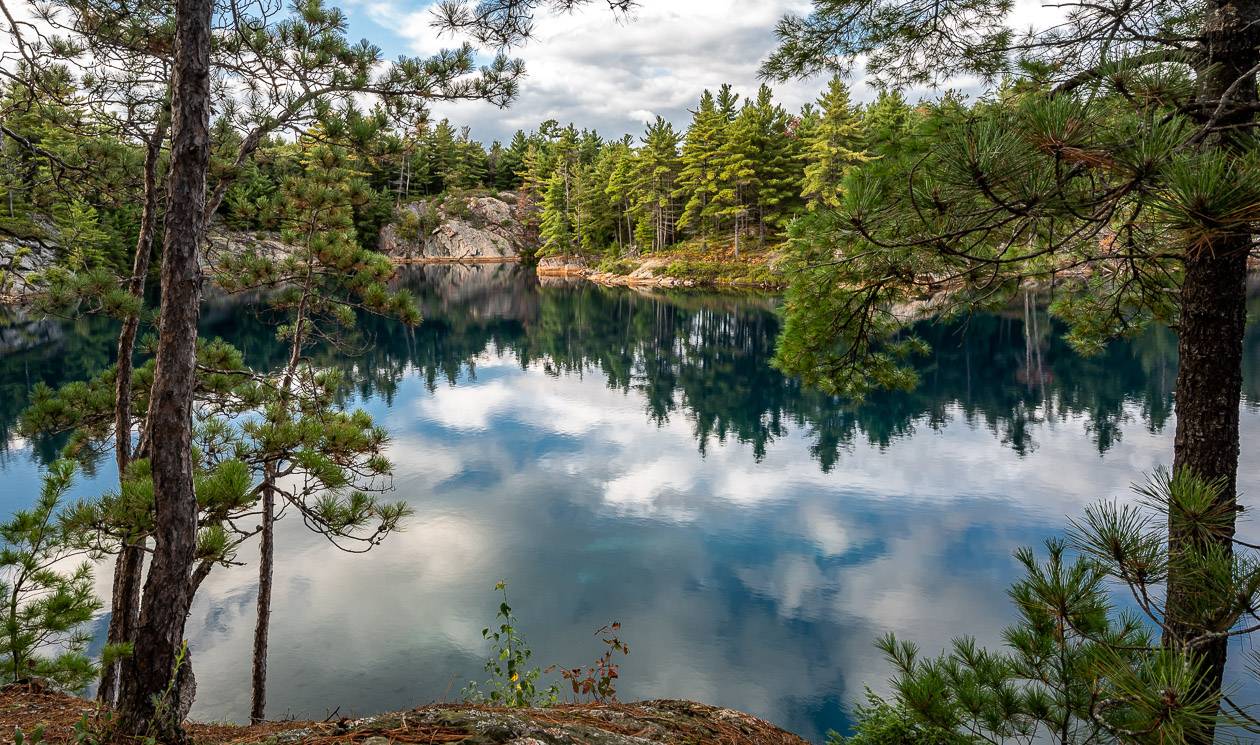
Our campsite was another few kilometres away, but the hiking went quickly. And Proulx Lake was a total delight.
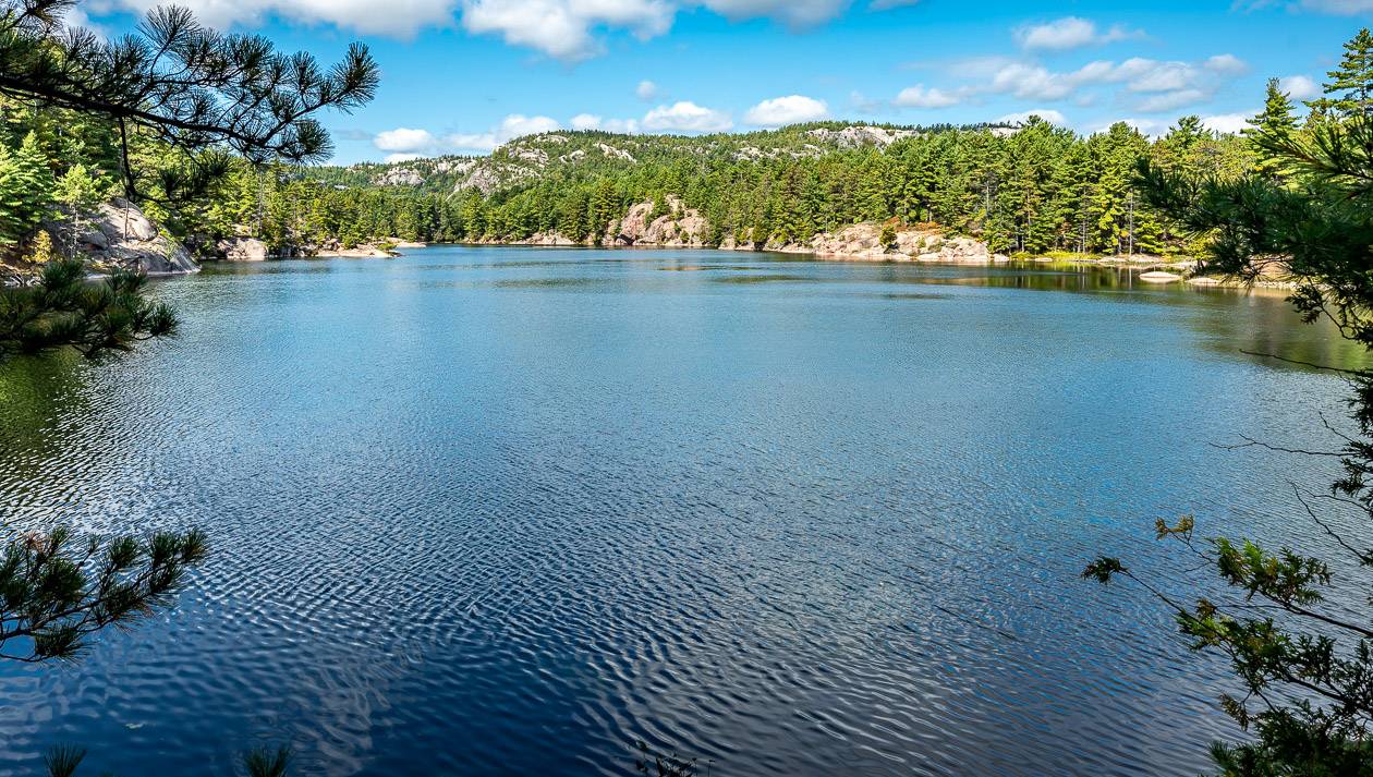
The colour of Proulx Lake would give Lake Louise a run for the money. It is an otherworldly turquoise blue that changes colours depending on how much light it gets.
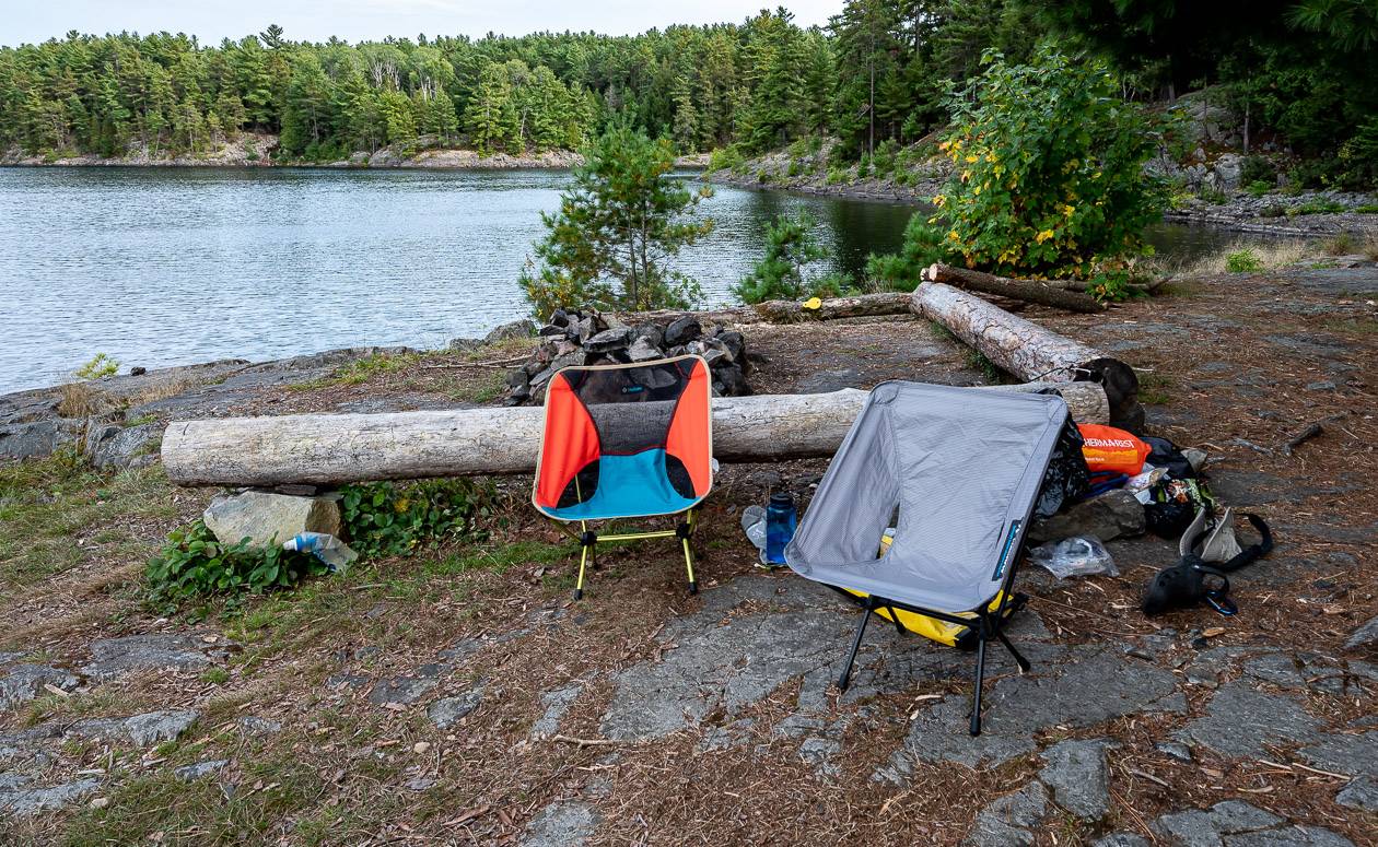
Our campsite – a real beauty – was the place to watch the sun set on the quartzite cliffs. Of any of the campsites on the trail, this is the one you want to snag!! Getting water is the only issue – just don’t fall in as there is an immediate dropoff.
Day 7 – Proulx Lake to the parking lot via “The Crack”
Number of kilometres hiked: 12 km (H48 – parking lot) with lots of looking around for the right parking lot!
Time we took: 6 hours
From the Proulx Lake campsite to the bottom of “The Crack” – a famous, challenging, and popular day hike, the hiking was sublime.
Again, it was a mix of forest walking interspersed with stunning stretches along the quartzite ridges. It was particularly beautiful because we started at 7AM and watched the light change as we got closer to The Crack. The view over Little Superior Lake was sublime.
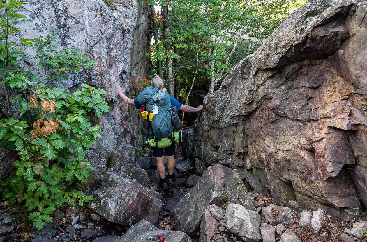
We reached The Crack without really appreciating it at first. Suddenly the rock dropped away, and we could see trail markers through a large cleft in the rock below.
We admired the view on top – especially looking out to the Georgian Bay, and then started the descent. It’s tricky hiking, especially with a pack on your back. We didn’t want to make any wrong moves, so we just took our time, downclimbing in places as it felt safer. We had the whole Crack to ourselves so there was no one chomping at the bit, wondering what was taking so long.
After you’re through the tough section, the rest of the hike to George Lake is easy. And busy.
Suddenly we were bumping into people, primarily out on a day hike. It felt strange to see so many people at once. Once at the turnoff to George Lake and the rest of the La Cloche Silhouette Trail – just past Kakakise Lake, it was just the two of us again.
Most of the rest of the hiking was easy – but because of that, I wasn’t paying attention and slid on a root and landed with a loud thump hard on the ground. Now I had matching bruises on both hips.
We never had any problems route finding until we got to the George Lake campground.
Then we had to try and find our car – which you’d think would be easy but there was no signage at the trail directing us there, so we spent 30 minutes wandering through campsites, taking what we thought were shortcuts until we finally got to a place that looked familiar.
Ten minutes later we were heading for Parry Sound – and a latte and piece of cake followed by a drive to Pearson Airport at rush hour. It felt like an abrupt ending to what had been a wonderful hike.
What to pack on the La Cloche Silhouette Trail
Packing light is always smart as you’ll have a more comfortable hike. A rule of thumb is that your backpack shouldn’t weigh more than 20% of your weight.
I’d say that John and I break that rule every time – but we’re also comfortable carrying the weight. At the end of the hike, I thought about what we carried and what we used and based on that I would suggest the following.
Clothing
- 6 -7 pairs quick dry underwear
- 3 pairs of hiking socks + one pair for at camp that are clean and dry
- a raincoat and rain pants (only wore the rain pants for about 2 hours but on a cold, windy day they’d be a necessity)
- one merino wool long sleeved shirt
- two quick-dry t-shirts
- one pair of hiking shorts or long pants (the zip off variety work well)
- bathing suit
- one pair well-broken in hiking boots
- one pair camp shoes or sandals (I love my Crocs)
- one down jacket (I like the Patagonia down sweater hoody)
- one warm hat + one baseball style cap
- one pair of gloves
- one fleece
Gear
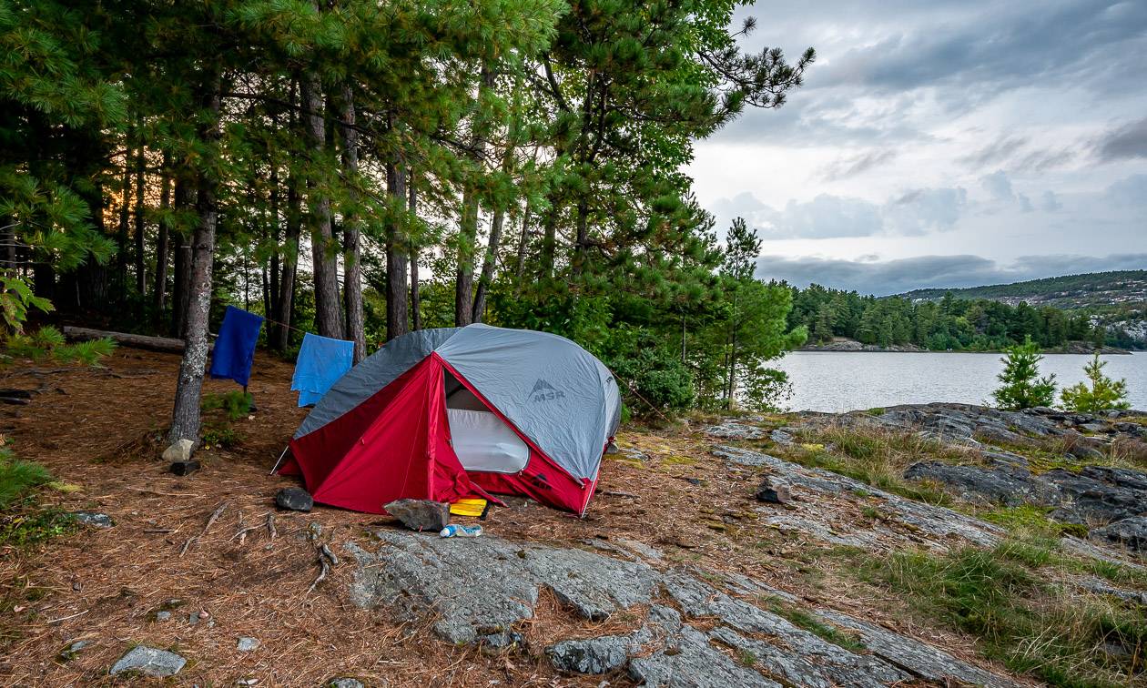
- one tent and fly (We love our MSR Elixir 3-person tent)
- sleeping bag and sleeping pad
- a length of rope + 2 carabiners + waterproof bags for hanging food
- water filter
- water bottle (we just used one each but we had a lightweight packable water bottle with a filter we could fill at every lake we passed)
- cooking stove (I like the MSR WhisperLite)+ fuel + lighters (take several) + fire starter
- pot, pan, mug, bowl, utensils, pot scrubber, dish towel, biodegradable soap
- first aid kit
- compass or GPS or InReach Mini
- cellphone (works on ridges)
- toilet paper and hand sanitizer
- waterproof map case
- drybags
- headlamp
- Gear Aid tape – in case you rip your tent, jacket, sleeping bag…
Optional
- camera
- reading material
- camp chairs
- hiking poles (we didn’t use, but many people will want these but be sure to bring the collapsible ones)
- a small axe or saw
- tarp
- insect repellent with DEET if you actually want it to work
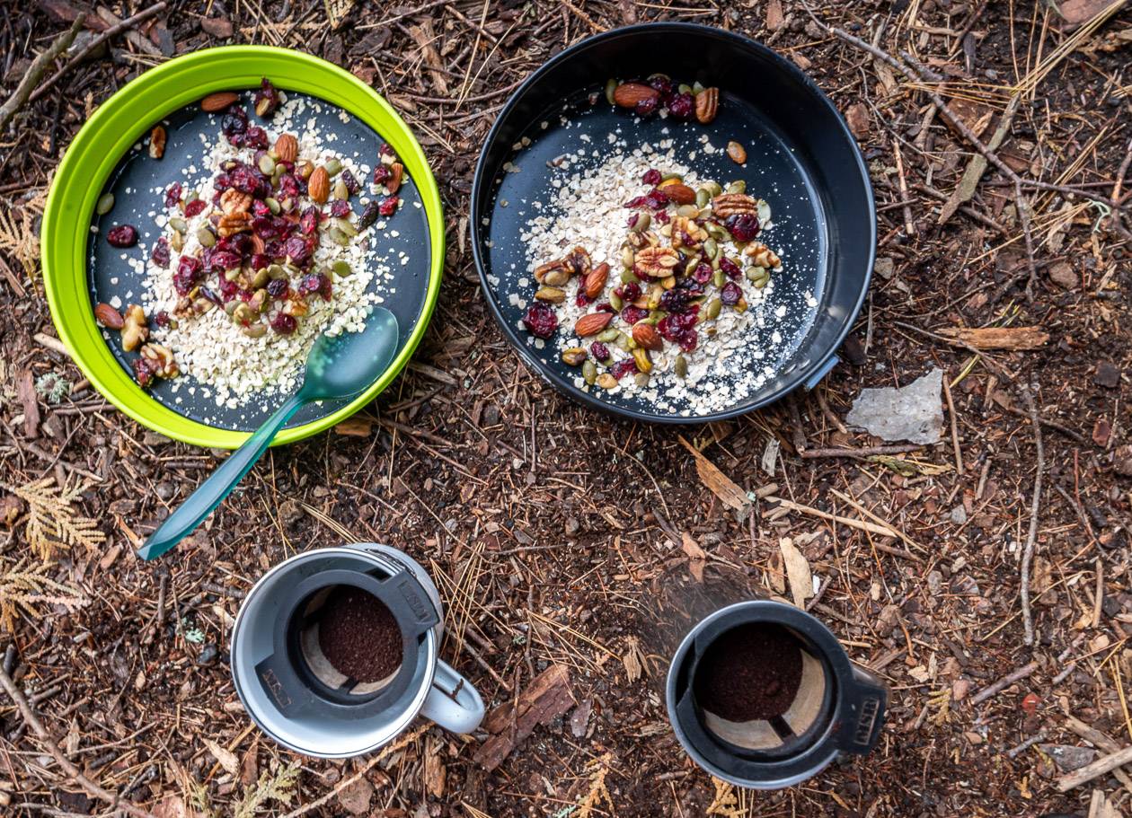
Food
You are going to burn a lot of calories on this hike – likely in the order of 2,000 – 4,000 per day. If you don’t want the hassle of meal planning, nearby Killarney Outfitters will look after everything. Just decide from their menu and voilá.
Food is personal. Some people eat for pleasure (me) while others eat for fuel only. Be sure to bring lots of high calorie foods, a variety of energy and protein bars, dried fruit, mixed nuts, hard cheese, and any other favourites.
We brought four dehydrated meals I’d cooked and dried at home and loaded up with other food in Parry Sound. I forgot the pasta for the spaghetti sauce but found Naan bread grilled in olive oil was a wonderful backup. Be flexible in your thinking.
Be sure to organize your food so you don’t spend time going through every bag. Pull out snacks in the morning you plan to eat that day – and make sure you have a bag that’s easy to access dedicated to garbage.
Further reading on backpacking trips in Canada
- The Abes and Essens Lake Trail Hike, Bon Echo Provincial Park
- Coast to Coast – Canada’s Long Distance Hiking Trails
- Nootka Trail Hike: A Complete Guide & Trip Report
- East Coast Trail Hiking Guide
- 10 Beginner Backpacking Trips in the Canadian Rockies
- 10 of the Most Scenic Backpacking Trips in Canada
Disclosure: Thank you to Ontario Parks and Travel Ontario for getting me to the park and hosting me at the campgrounds. It is an exceptional hike any serious hiker will want to do.
Click on the photo to bookmark to your Pinterest boards.