2025 East Coast Trail Hiking Guide
“Newfoundland’s East Coast Trail is a national treasure” declares Jackie Petrie, an expert on Newfoundland and Labrador dogs and friend of Elke Dettmer, one of our B&B hosts. She adds that “you can make the East Coast Trail experience into whatever you want it to be – whether it’s simply a few hours of easy walking on a path, a day hike or the full trail over two to three weeks.”
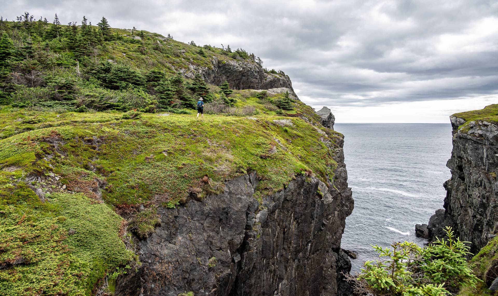
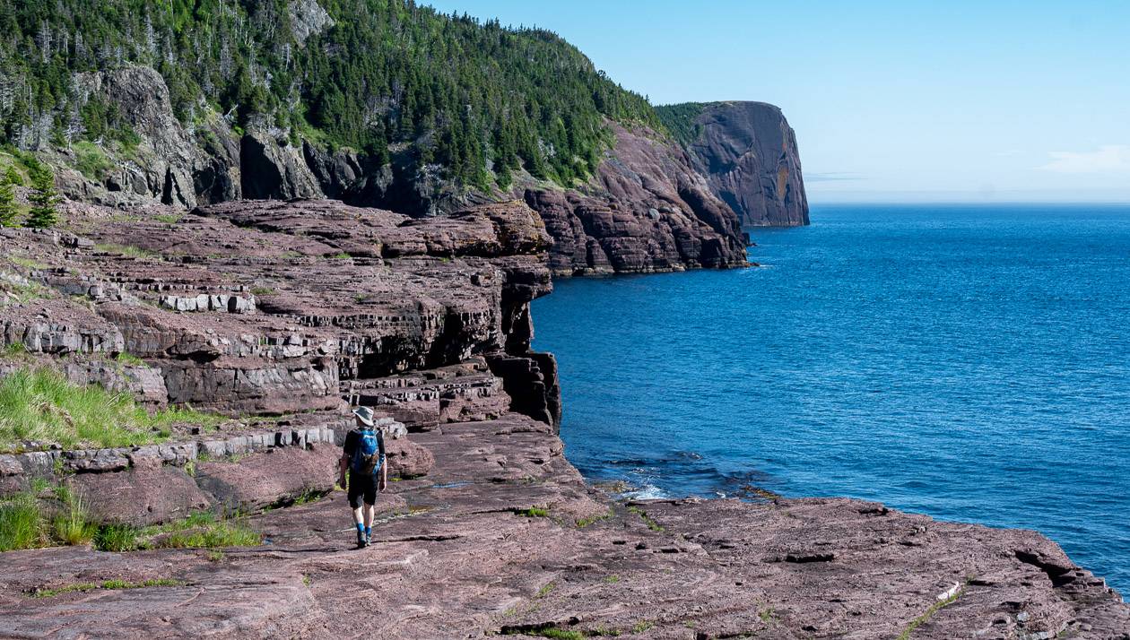
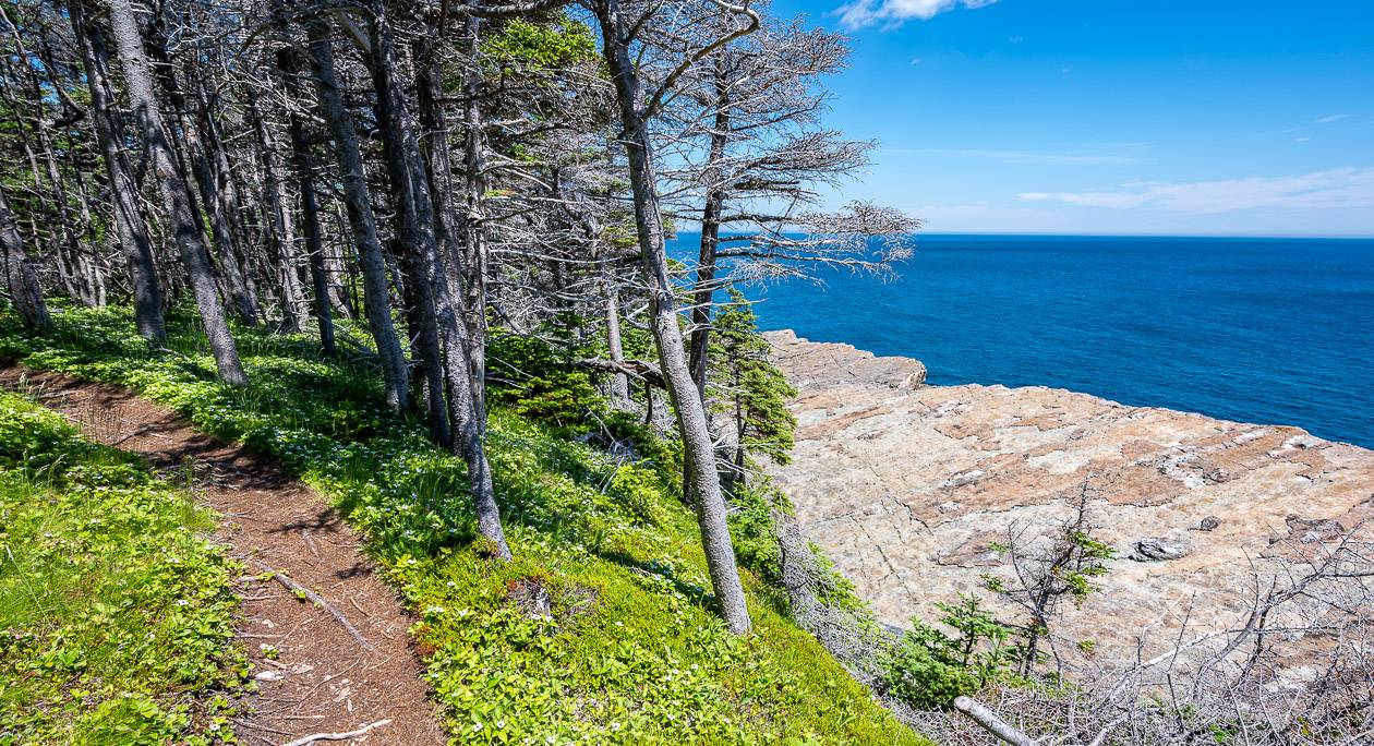
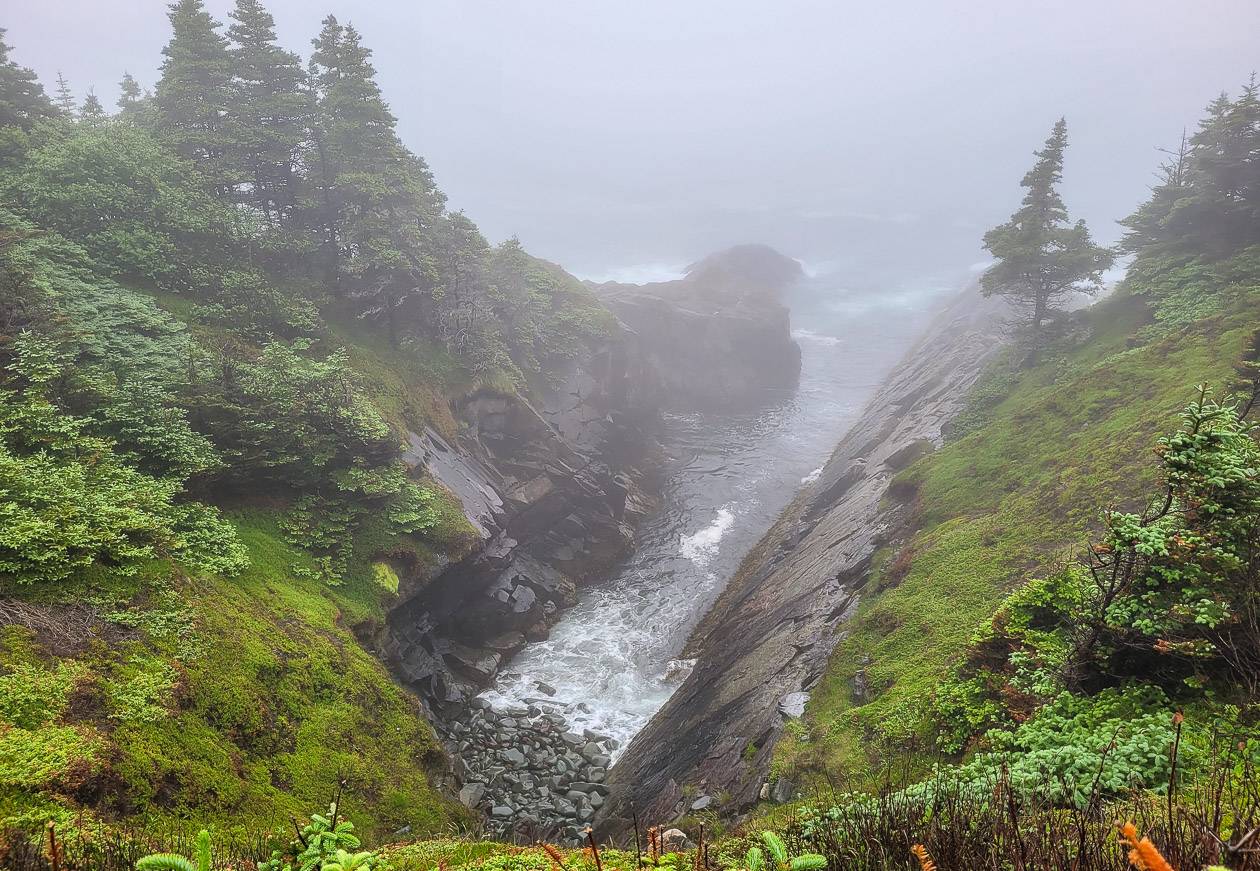
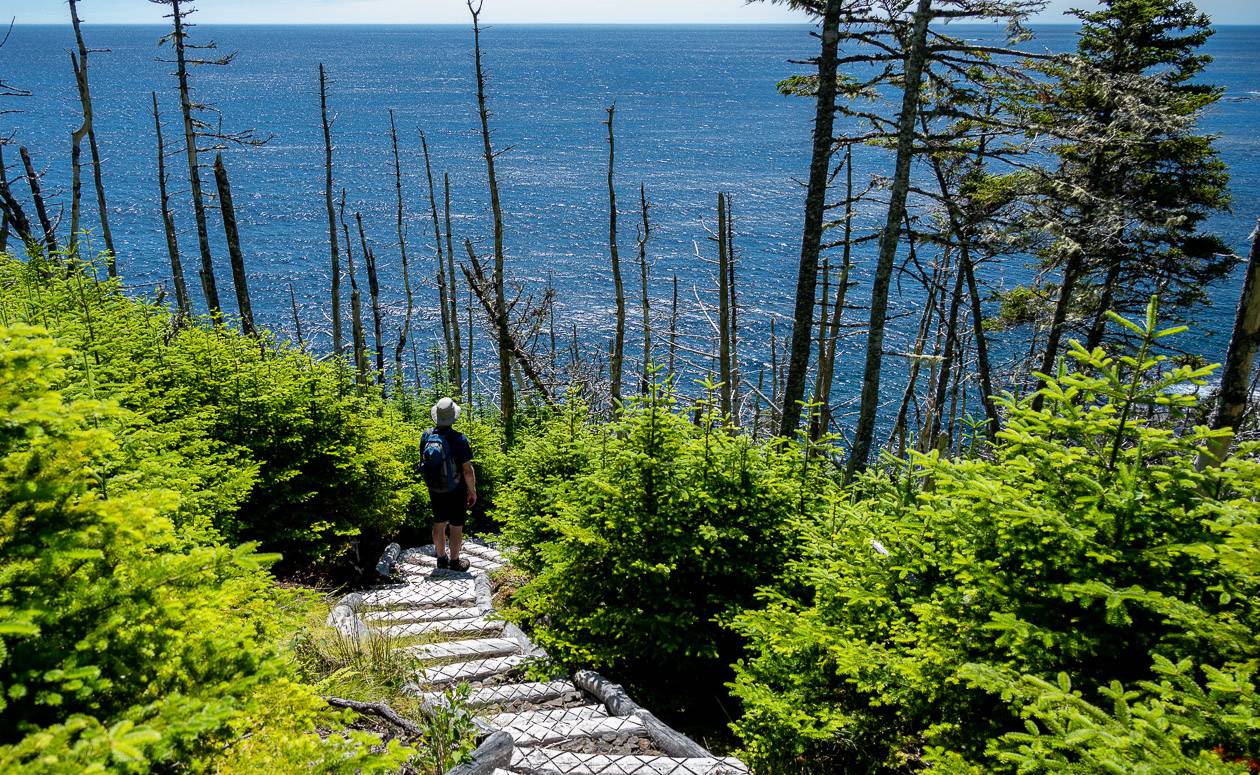
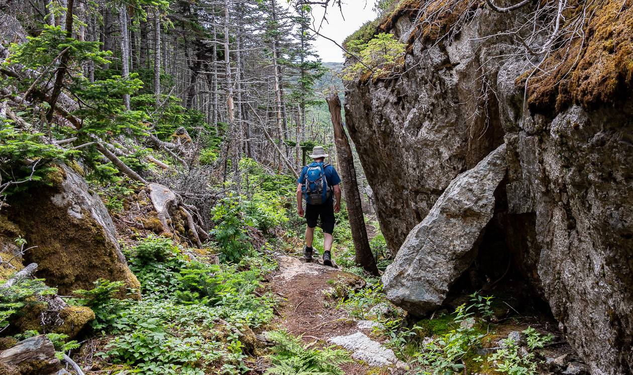
The East Coast Trail weaves along the eastern edge of the Avalon Peninsula, connecting 30 historic communities along the way from Topsail Beach to Cappahayden. It’s both a coastal hike and a woodland hike.
There are times you literally spend hours hiking alongside the north Atlantic Ocean but there are others, especially on the southern sections, where you spend much of the day in the woods.
John and I had plans to hike as much of the 336-kilometre trail as we could, but once on the trail we nixed any idea of doing 30-kilometre days and opted for 15 – 20 km days so we could savour the experience.
Over 10 hiking days, John and I were able to complete 11 sections of the trail. I’d done two sections previously (the Sugarloaf Path and the Spurwink Island Path) – but there are still 12 sections we missed, including three new ones that take you 52 km from Topsail Beach to Cape St. Francis. They are much rougher than other sections and are best done as a backpacking trip.
The East Coast Trail ranks right up there with the best Canada has to offer. Unlike the West Coast Trail on Vancouver Island, reservations and permits aren’t needed to hike. But, if you are planning to visit in summer, you will need to book accommodation in advance.
There aren’t many thru hikers, so getting a campsite, unless there is a massive group, should never be an issue. (More details on accommodation below.)
If you have thoughts about driving to trailheads, banish those thoughts – and forget about renting a car. It’s hard to do and expensive. Try to organize dropoffs with B&B hosts – or taxis if need be.

Would you like to save this?
Before you go
I highly recommend ordering the detailed East Coast Trail maps from the East Coast Trail Association website. The maps are full of great information about the trail – but there are other details including where to park at each trailhead, the date, place, and name of the shipwrecks that literally dot the coast of Newfoundland along with the location of ruins, churches, fishing traps, buildings, houses, and even raptor sites.
The one thing the maps don’t show is how much elevation gain and loss you encounter on each section – so if that’s important to you, use an app or wear a watch with an altimeter.
The other useful bit of information they offer is the location of the community walk. The East Coast Trail is a mix of trail linked with roadside walks through the communities to reach the next trailhead. On the map from the ECT Association, full directions on how to move from trailhead to trailhead on foot are included.
The maps are waterproof – and after a couple of weeks of carrying them around, mine still look brand new.
Where to stay on the East Coast Trail
The East Coast Trail can be a bit of a logistical nightmare if you’re trying to do the whole thing by yourself without camping. If you plan to camp, scroll down to the camping section.
I had zero interest in camping on this trail. I had seen one of the heavily wooded campsites on the Spurwink Island Path before, and decided I needed the next step up in luxury.
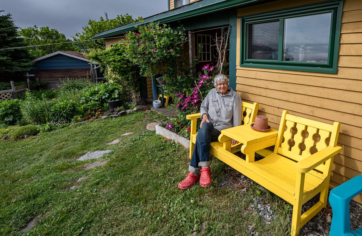
In the winter I started researching and figured I’d end up booking a lot of B&B’s along the route. That is in fact what happened – and I’m so glad it did. Staying in a B&B and meeting local Newfoundlanders is a fun and not-to-be-missed experience. You get a window into a family’s life – and a great deal of local knowledge you’d never get staying in a hotel.
The hosts drive you to and from the trailheads (or one of their family members gets roped in) so you learn about the family history along with a fun dose of local history. All are amazing storytellers.
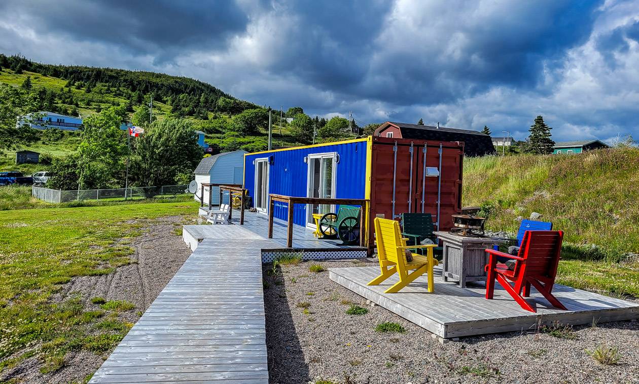
We booked through Sharon with Belle Maison Dine and Dream. She’s a force to be reckoned with and knows the trail, and seemingly everyone around for 100 km, along with the area like the back of her hand. (She grew up here in a music loving family.)
She is also an amazing self-taught gourmet cook so you can expect incredible meals every night and a well-stocked kitchen/eating area to make your own breakfasts and lunches. She has some unique accommodation options including RV’s and a refurbished container. You won’t want to leave.
As of 2024
As of 2024, Sharon’s B&B is the only one that will include a drive and pick up to trailheads at the southern end of the East Coast Trail. Sharon works with Great Canadian Trails and if you sign up with them, you can experience some other sections of the East Coast Trail.
Unfortunately, the two other women we stayed with have retired though Elke (see below) still runs a B&B – and is conveniently situated near the north end of the trail. Sharon is hoping to have a few other B&B’s on board in 2025, so you can have the sort of experience we had – where you’re driven every morning to a trailhead and picked up at the end of the day.


Pouch Cove
In Pouch Cove we stayed with Elke Dettmer at Points East Guesthouse. Elke was an accommodating host driving us everywhere, but in 2024 you can only book the B&B experience with her, though I’m sure she would share her considerable knowledge of the area.
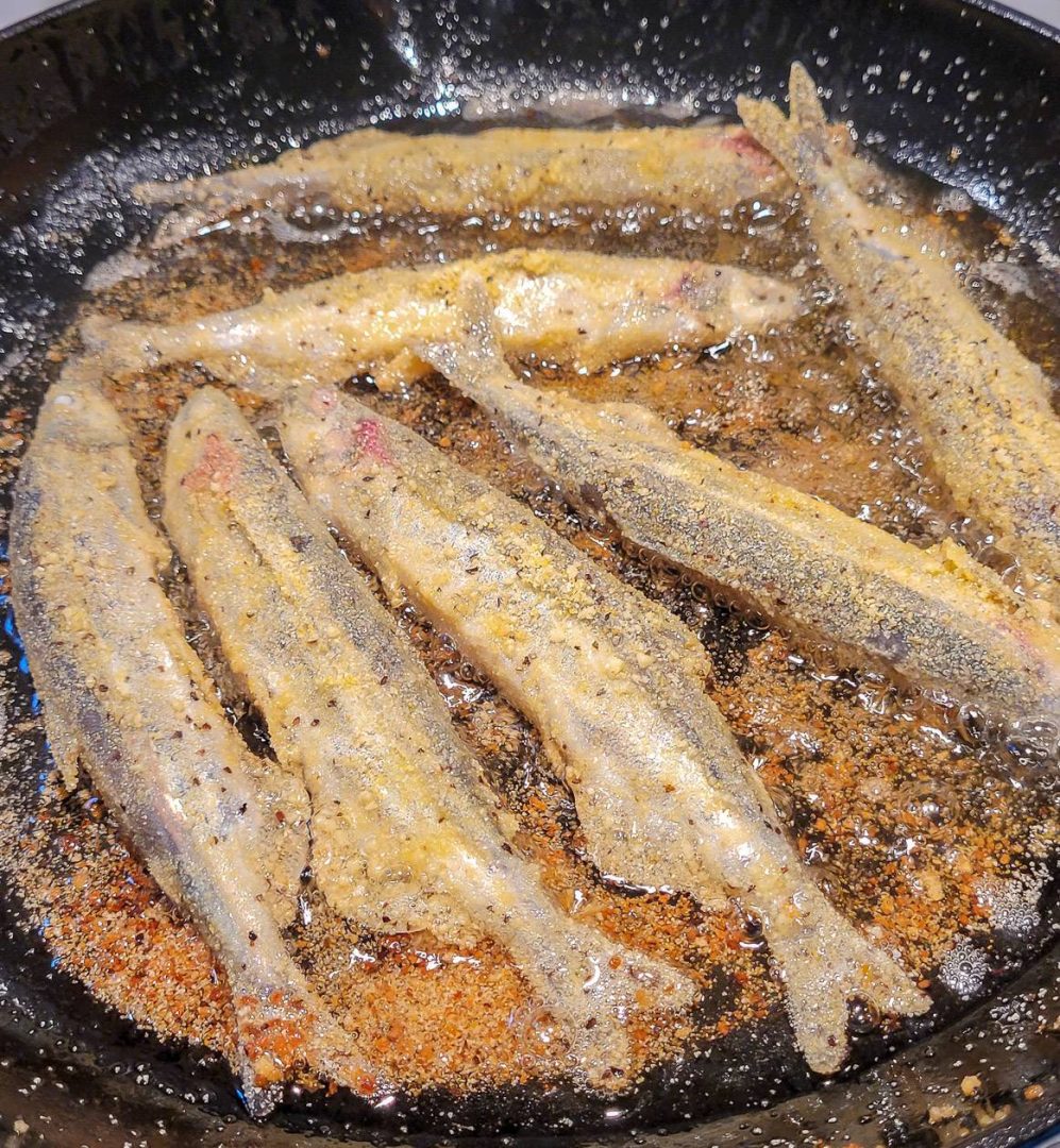
She has a beautiful property with cozy rooms overlooking the ocean and lots of farm-fresh food. We got the full Newfoundland experience with her – eating freshly picked-off-the-beach capelin, dining on cod au gratin and fresh turnip greens (delicious) and bringing in interesting people to meet.
Petty Cove
In Petty Cove we stayed with Mary Ridgely and her family at Wild Roses B&B. We got the full family experience with daughters, daughter-in-laws, granddaughters, and sons. Unfortunately for hikers, Mary has retired.
It was great fun to be embraced by the family and to be sent home with a copy of the family cookbook so I can make Dump Cake and Peese Porridge – amazingly delicious split pea puree that was served with the whole turkey dinner one night.

Camping on the East Coast Trail
Described are all sections of the East Coast Trail – along with the logistics of getting to the trailheads. If there is camping available, I’ve noted that as well as any other useful information.
There is wild camping available along the East Coast Trail though it’s not encouraged. If you do camp on private land ask for permission – and be very respectful and practice Leave No Trace principals.
If you really want to do the whole trail, without any help from B&B’s, count on backpacking and resupplying in small communities like Pouch Cove and Petty Harbour as well as St. John’s along the way.
Noted are the paths that have campsites on them. There aren’t many – but they are on sections that are remote, so their locations make sense. Count on packing a stove as no fires are permitted.
The campsites on the East Coast Trail are as follows. They are all well labeled on the East Coast Trail maps.
- Motion Path (12.7 km from the Petty Harbour TH)
- Spout Path (5.3 km from the Shoal Bay Road TH)
- Flamber Head Path (8.5 km from the La Manche Village TH)
- Cape Broyle Head Path (7.2 km from the Cape Broyle TH)
- Spurwink Island Path (11.2 km from the Aquaforte TH).
Pack as lightly as possible as these are rugged trails. I would suggest taking a tarp. The only people I saw thru hiking were solo women – as it is a trail where women feel safe.

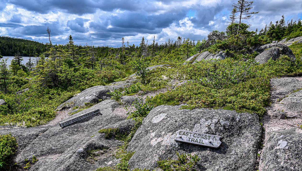
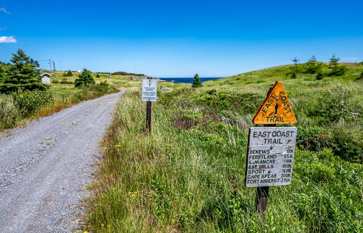
How do you know if you’re on the East Coast Trail?
Signage is excellent along the trail and at every trailhead you’ll see a set of signs like the ones in the second photo below. If you don’t see them, you’re not on the trail.

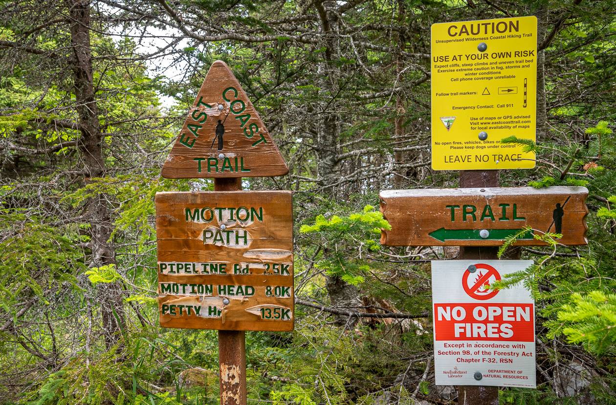
Go prepared
***Check path advisories before you head out.***
Always carry the 10 hiking essentials, even with a great weather forecast.
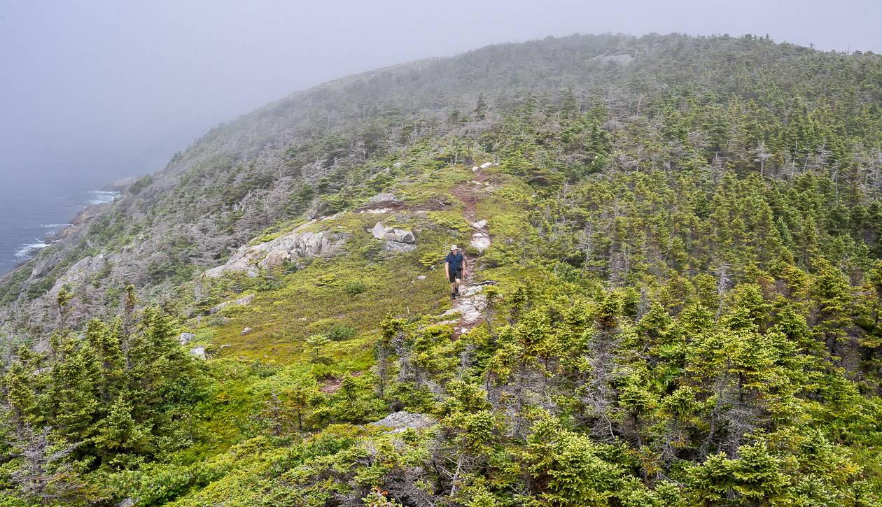
John and I enjoyed perfect summer weather on nine of our 10 hiking days – though that would be considered unusual. Even so, there were times that the winds were ferocious and the temperature nosedived.
In inclement weather, you could get into hypothermia conditions in short order. So, pack layers, and no matter what the forecast says, carry good full body rain gear. A ball cap or sun hat is essential too.
I would suggest taking hiking poles if you’re ever unsteady on your feet or you’re trying to save your knees.
Bug spray wasn’t necessary because of the wind but I’d pack it anyway.
For those unseasonably warm days, carry a water filter or water purification drops so you can fill up water bottles along the way.
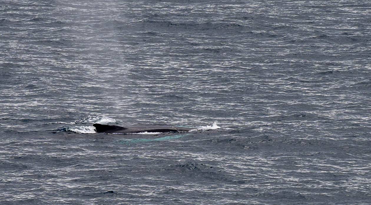
Bears were not an issue at any time in the area. The birding and whale watching is great, so I’d suggest including a pair of binoculars.
Beware of rocks and logs when wet. Wear hiking boots with a good tread to handle slippery surfaces.
Some parts of the East Coast Trail can be hiked in winter, conditions permitting. Again, check up to date reports before heading out.

East Coast Trail sections described from north to south
Described are all sections of the East Coast Trail. The trail sections are described from north to south and the three new sections on the west of the peninsula are described at the end as they aren’t nearly so popular….yet.
How we strung the sections together
By no means did we hike each section in a row. In fact our B&B hosts would suggest we hike some sections based on the weather or how many other people they were driving that day.
Occasionally we hiked one section after another but unless you’re camping and you’re a thru hiker, hike whatever section(s) work for you. They are all surprisingly different and I don’t think you lose anything on this trail by hiking them in a random order.
Trails that you could access via a taxi from St. John’s (and a walk back to the city)
Sugarloaf, Deadman’s Bay, and Cape Spear
Trails you can access with Sharon and Belle Maison
Brigus Head, Cape Broyle Head, Caplin Bay, Sounding Hills, Spurwink Island, Bear Cove Point, Island Meadow
For the rest of the paths
Befriend a local. Spend a lot on taxis.
And then
Go have fun hiking. This is truly one of Canada’s top long distance hiking trails – and most of the sections will blow you away with their beauty.
Biscan Cove Path, north end of the East Coast Trail
Start/end: Biscan Cove/Pouch Cove trailheads
Distance: 7.0 km
Difficulty: Moderate to difficult
Campground: No
Time needed: 2 – 4 hours
Highlights: There’s a viewpoint overlooking Horrid Gulch where a brave man – Alfred Moore, back in 1875, agreed to be lowered repeatedly 80 metres by rope to rescue passengers and crew from the schooner Water Witch.
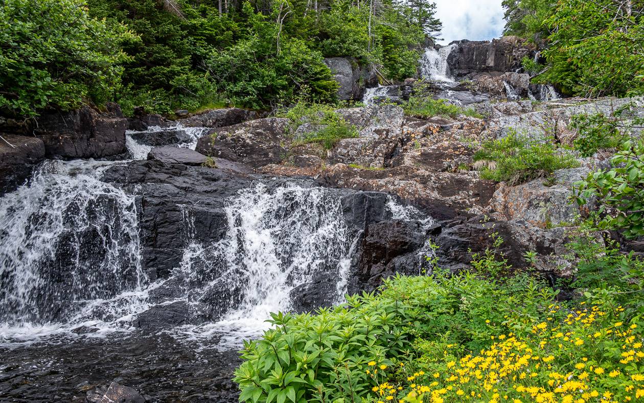
The trail is a beautiful though rugged mix of woods walking with some exciting sections of coastline. Stop at Freshwater River to take in the view of a waterfall and sea ledges.
We did this as an out and back hike, choosing to return along the road, though and secretly hoping to hitchhike back to Pouch Cove. According to trip notes, there are many berry picking trails that connect the road to the East Coast Trail – so you may get waylaid eating in berry season.
If you have the time and inclination, you can hike a section of the White Horse Path – which you pick up at Cape. St. Francis. I think even 15 minutes is worthwhile as it immediately feels more rugged and off the beaten path.
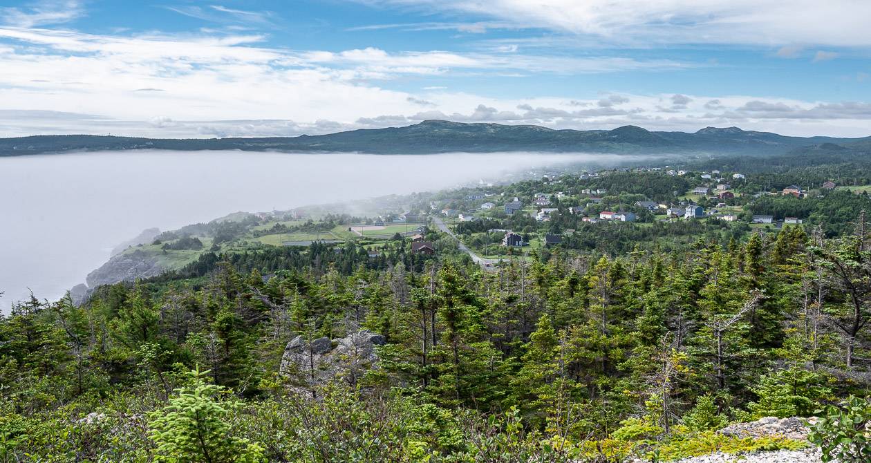


Stiles Cove Path, East Coast Trail
Start/End: Pouch Cove/Flatrock trailheads
Distance: 15.1 km
Difficulty: Moderate
Campground: None on the trail
Time needed: 5 – 7 hours
Highlights/Experience: This was one of my favourite days. There was tremendous variety along the trail and some lovely long sections of hiking along the coast with jaw-dropping views.
Highlights include the coastal views from Red Head, gorgeous Stiles Cove, waterfalls at Big River and Stiles Cove, sea caves, lovely sea ledges (great for a lunch stop), and a beach at Shoe Cove.


Father Troy’s Trail, East Coast Trail
Start/end: Flatrock/Torbay trailheads
Distance: 8.9 km + 0.7 km side trails
Difficulty: Easy
Campground: No
Time needed: 2 – 4 hours
Experience/Highlights: Lovely walking on The Beamer – which in spring is to be avoided because of nesting gulls.
The cliffs along the trail are dramatic and one in particular is home to a kittiwake colony.

Silver Mine Head, East Coast Trail
Start/end: Torbay/Outer Cove trailhead
Distance: 3.8 km + 0.1 km side trail + 1.8 km community walk
Difficulty: Easy
Campground: Not on the trail
Time needed: 2 hours + 0.5 hours for community walk
Highlights/Experience: We started at Middle Cove because of parking logistics. The hiking was interesting right off the bat as it was still caplin season so you could see them in the water and dead along the beach.
People come here to collect them – both for eating and for fertilizer. Lots of bird life around too. Some exceptionally easy, lovely walking towards Torbay right beside the coast with wonderful views.


Cobblers Path, East Coast Trail
Start/end: Outer Cove/Logy Bay trailheads
Distance: 5.0 km + 1.6 km side trails
Difficulty: Moderate
Campground: No
Time needed: 2 – 3 hours
Highlights: Excellent views from Torbay Point and Redcliff Head. Look for the remains of a WWII battery and the ruins of a cold war tracking station.
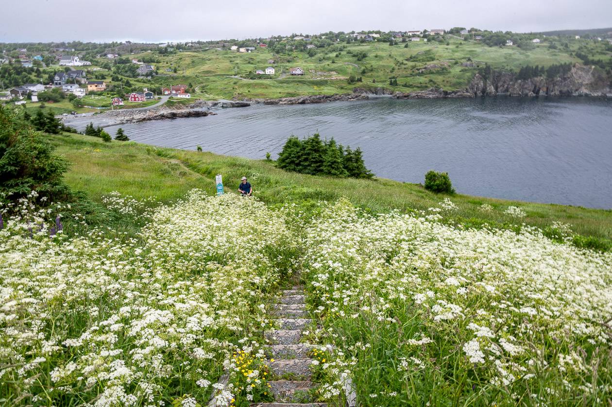
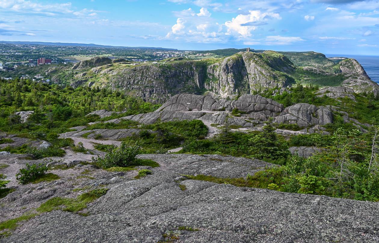
Sugarloaf Path, East Coast Trail
Start/end: Logy Bay/Fort Amherst
Distance: 8.8 km
Difficulty: Moderate to difficult
Campground: No
Time needed: 3 -5 hours
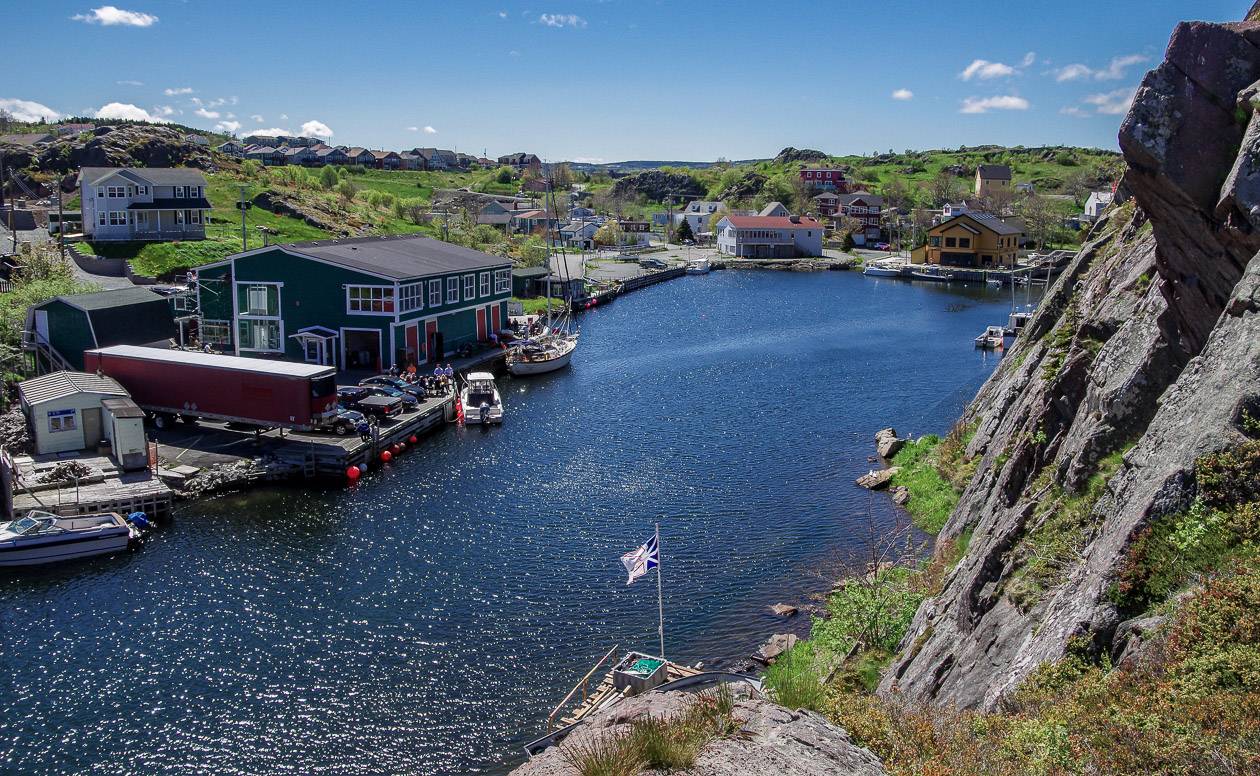
Highlights/Experience: I did this section of the East Coast Trail in 2014 – and after hiking it, I knew I wanted to come back for more.
There are great views, icebergs in season, lots of sea bird life and of course the beautiful descent into quaint Quidi Vidi Village.
For more information and photos read my post about hiking the Sugarloaf Path.

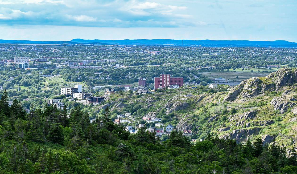
Deadmans Bay, East Coast Trail
Start/end: Fort Amherst/Blackhead trailheads
Distance: 10.5 km
Difficulty: Moderate to difficult
Campground: Not on the trail
Time needed: 4 – 7 hours
Highlights/Experience: This section of the East Coast Trail was an unexpected delight. The trail separating Freshwater Bay from the ocean – which has been washed out under storm conditions is fun to hike.
And the section from Duck Pond to Fort Amherst is delightful – beautiful outcrop, numerous ponds, some used for swimming and then superb views of Signal Hill, Cabot Tower, and The Sugarloaf.
We walked back to St. John’s, which took over an hour – but it did provide a great view of St. John’s Harbour and the colourful homes on the south side of Signal Hill.


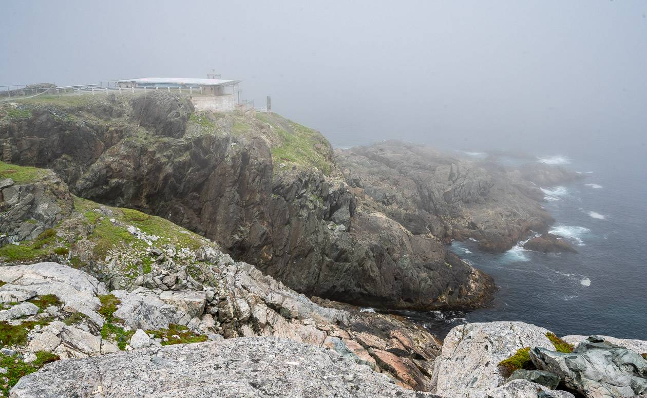
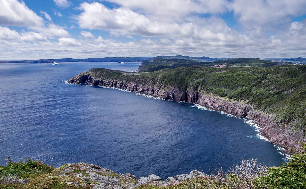
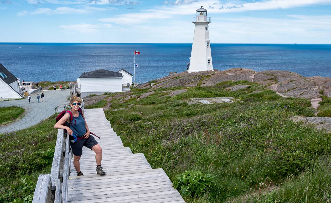
Cape Spear Path, East Coast Trail
Start/end: Blackhead/Petty Harbour trailheads
Distance: 15.4 km + 1.8 km side trails
Difficulty: Moderate
Campground: Not on trail
Time needed: 5 – 7 hours
Highlights/Experience: We started in Maddox Cove and hiked north past a kittiwake colony at Deep Cove.
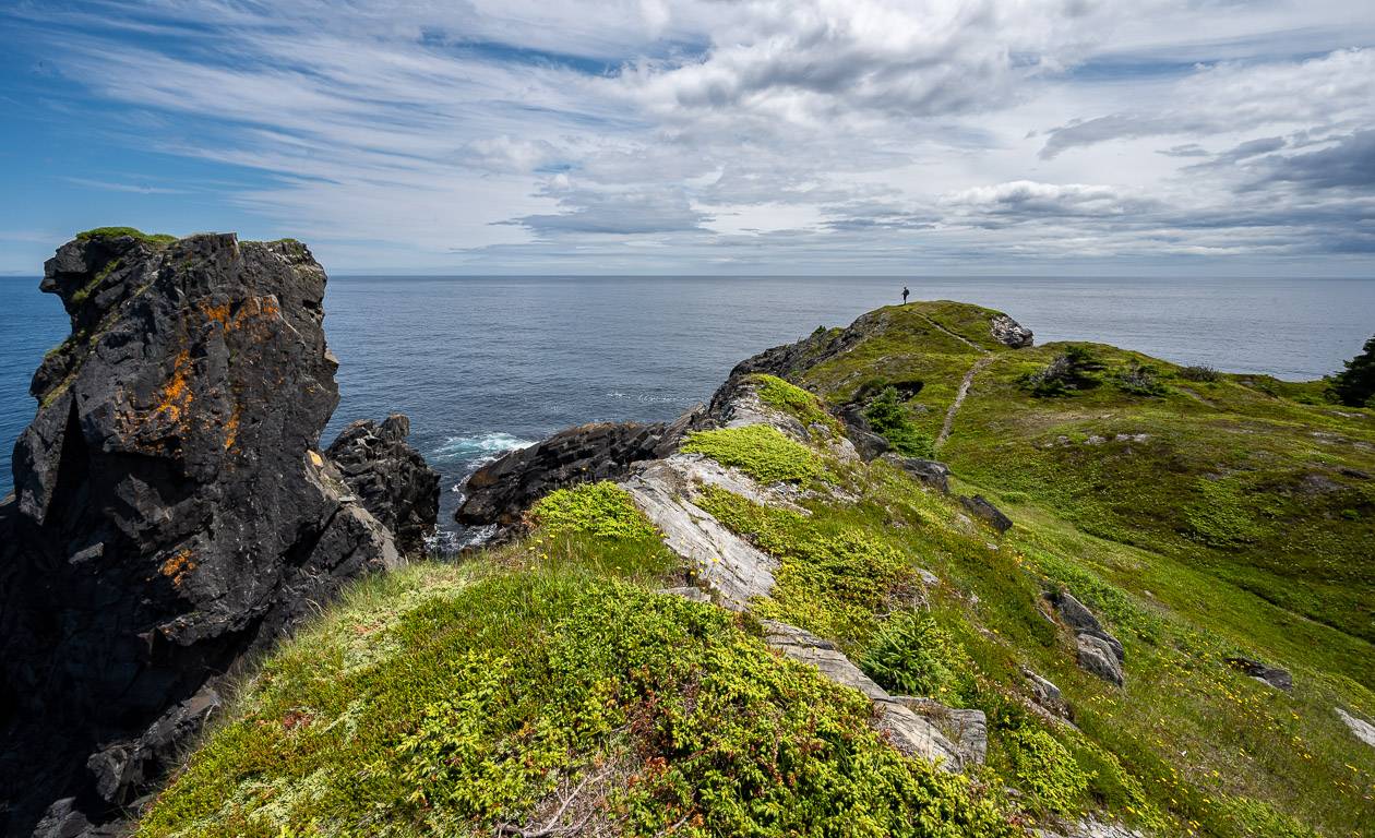
Most of the trail traveled through open countryside, often close to the ocean so there was plenty of good stuff to see – sea caves, coves, whales, seabirds and of course the restored Cape Spear Lighthouse near the easternmost point in Newfoundland.
You can take a tour of the Lightkeeper’s Cottage and then continue onto the rougher section of trail to Blackhead.


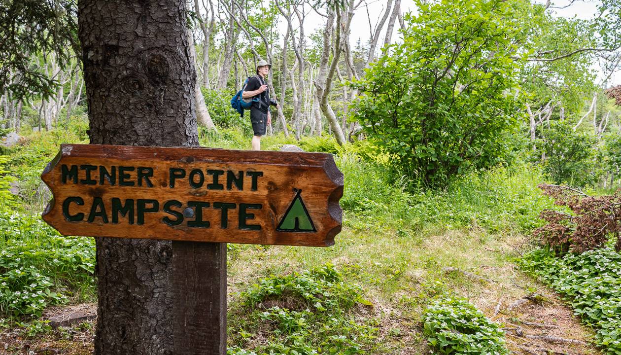
Motion Path, East Coast Trail
Start/end: Petty Harbour/Shoal Bay Road trailheads
Distance: 13.8 km + 6.3 km walk in or out from the Shoal Bay Road parking lot
Difficulty: Moderate to difficult
Campground: Yes – the Miners Point Campsite
Time needed: 5 – 8 hours
Highlights/Experience: The only detraction to this hike is the 6.3 km walk in or walk out to reach the Shoal Bay Road parking lot.
Otherwise, this hike is a gem. Walk beside the coast for a good portion of the hike, often right beside sea cliffs. The climb up to the Heart’s Point Ridge goes quickly – and the walking up on top is easy and marvelous.
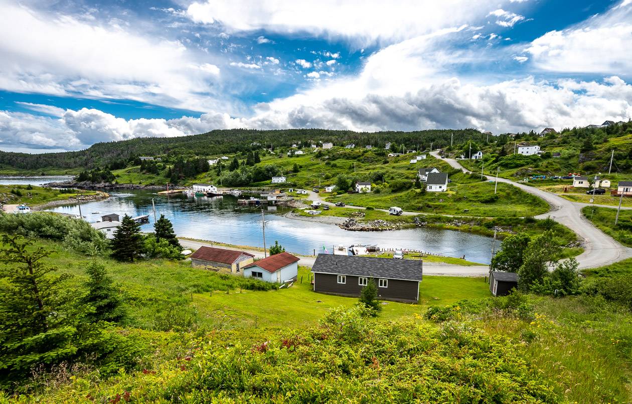
Hike on wild barrens past a couple of ponds to Motion Head. Along the way, keep an eye out for waves, whales, seabirds and the abandoned settlement and waterfalls at Shoal Bay. It is a delightful day – one of the top three we did. And ending in pretty Petty Harbour, home to Alan Doyle from the band, Great Big Sea is a treat. It’s a good place to get a drink and a bite to eat.


Spout Path
Start/end: Shoal Bay Road/Bay Bulls trailhead
Distance: 16.2 km + 6.3 km walk in via the Shoal Bay Road
Difficulty: Strenuous
Campground: Yes – Little Bald Head Campsite offers 11 sites, many of them on platforms
Time needed: 6 – 9 hours
Highlight/Experience: Highlights include a “sea-driven, freshwater geyser called the Spout (best in bring and fall when river overflow water runs into the blowhole), high cliffs, sea stacks, otters at Queens River feeding on mussel beds, a birch forest, abandoned settlements at Freshwater and Gunridge, and a lighthouse at North Head.
Note that there is no bailout on the path and limited to no cell service so once you start, you’re committed.
Mickleens Path, East Coast Trail
Start/end: Bay Bulls/Witless Bay trailheads
Distance: 7.2 km
Difficulty: Easy to moderate
Campground: None on this path
Time needed: 2 – 4 hours
Highlights/Experience: Beautiful walking in the woods alternating with remarkable vantage points of sea stacks and offshore islands. Under clear conditions you should be able to see whales and sea birds.
In the fall, the wave action is reportedly dramatic along this section of coast.


Beaches Path, East Coast Trail
Start/end: Witless Bay/Mobile trailheads
Distance: 7.1 km
Difficulty: Easy
Campground: No
Time needed: 2 – 3 hours
Highlights/Experience: Follow the coastline on a gentle path winding through woods, meadowland, and heath. At many points you will be able to visit cobblestone beaches. On this hike, beachcombing along with whale watching and seabird viewing are popular. Look up to spot an eagle’s nest at Herring Cove.
There is a seasonal puffin and petrel patrol in the Witless Bay area due to its proximity to Gull Island where 70,000 pairs of Atlantic puffins nest along with half a million pairs of storm petrels. When the birds fledge, they often get disoriented and are rescued nightly. Petrels must be launched by hand as they can’t take off without help. Puffins are banded when they are found.
Tinkers Point Path, East Coast Trail
Start/end: Mobile/Tors Cove trailheads
Distance: 5.0 km
Difficulty: Easy
Campground: Not on the trail
Time needed: 2 – 3 hours
Highlights/Experience: Popular with families, this hike offers varied and sheltered forest walking, a gentle shoreline, beach access at four points, pocket beaches and island views.
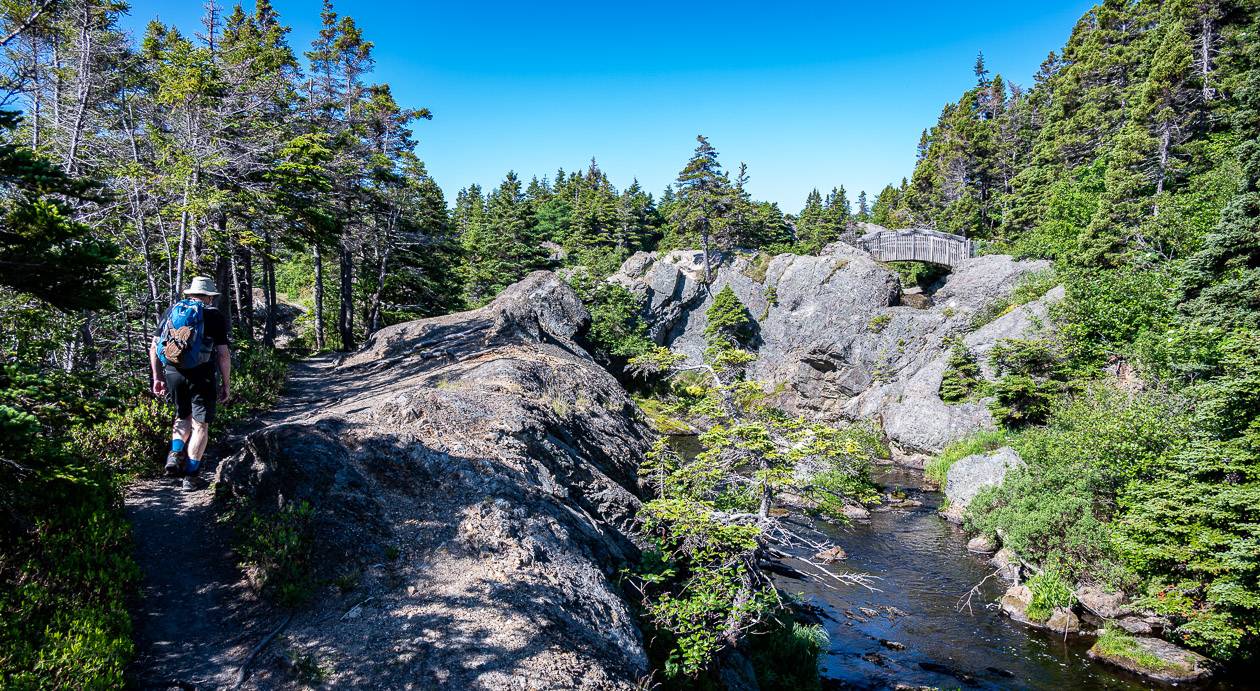
La Manche Village Path, East Coast Trail
Start/end: Tors Cove/La Manche Village trailheads
Distance: 6.4 km + 1.4 km via an access road to the trailhead
Difficulty: Easy
Campground: Available at La Manche Provincial Park by reservation
Time needed: 2 – 3 hours
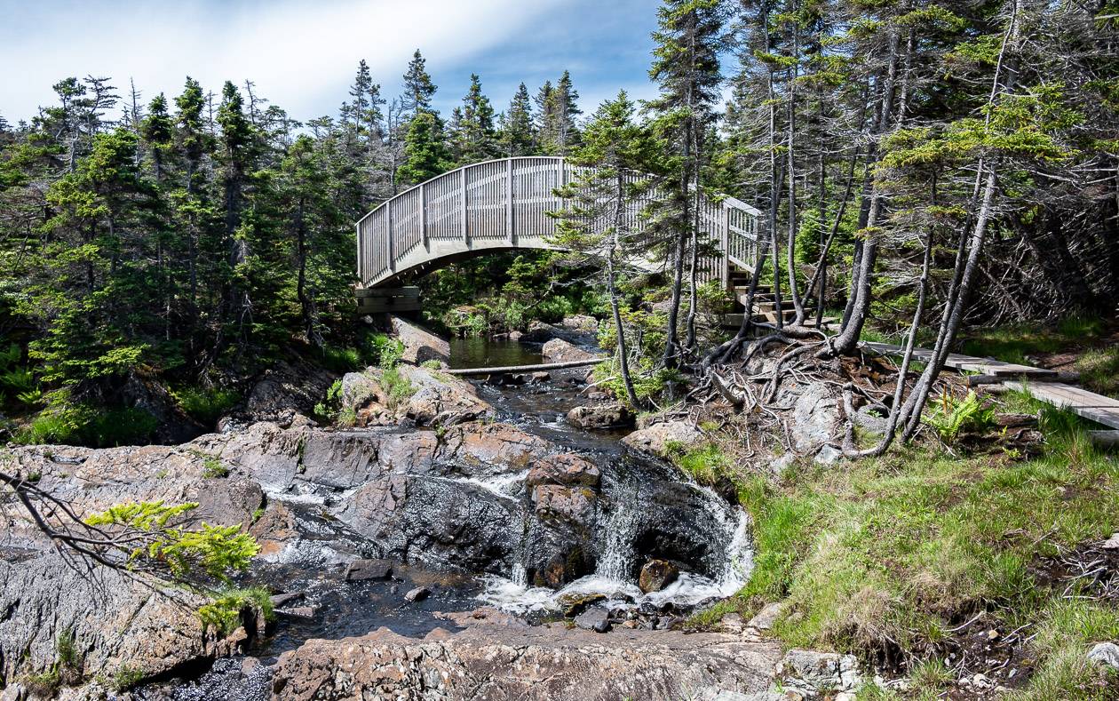
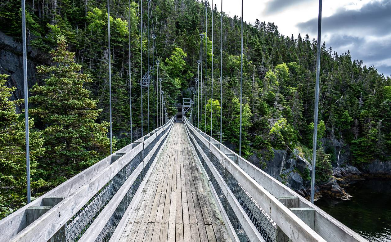
Highlights/Experience: Highlights include otters at Crockers Island, nesting puffins on Pee Pee Island across from Capelin Cove, the suspension bridge, a sand beach at Doctor’s Cove and the abandoned settlement of La Manche Village.
If you have time, you can arrange whale-watching tours out of Bauline East.

Flamber Head Path – one of my favourite sections on the East Coast Trail
Start/end: La Manche Village/Brigus South trailheads
Distance: 11.5 km + 1.4 km on an access trail
Difficulty: Moderate to difficult
Campground: Yes at Roaring Cove Campground
Time needed: 5 – 8 hours
Highlight/Experience: You can’t miss the La Manche suspension bridge, even if its officially on the La Manche Village Path.
Other highlights include the beautiful waterfall at Freshwater Bay, a fantastic headland at Cape Neddick, the view from Flamber Head along with fantastic coastal views of cliffs, rock, and coves. This is an amazing hike, even though a good section of it is in the woods.


Brigus Head Path, East Coast Trail
Start/end: Brigus South/Cape Broyle trailheads
Distance: 6.4 km
Difficulty: Moderate
Campground: Not on this section
Time needed: 2 – 3 hours
Highlight/Experience: Highlights along the trail include pretty Brigus South, a side trail to visit Turtle Island and tall cliffs around Brigus Head. Exercise caution if you plan to visit Herring Cove Beach.
Tar Cove with its cobblestone beach can also be visited. In June and July look for finback, minke and humpback whales circling Brigus Bight to trap caplin.
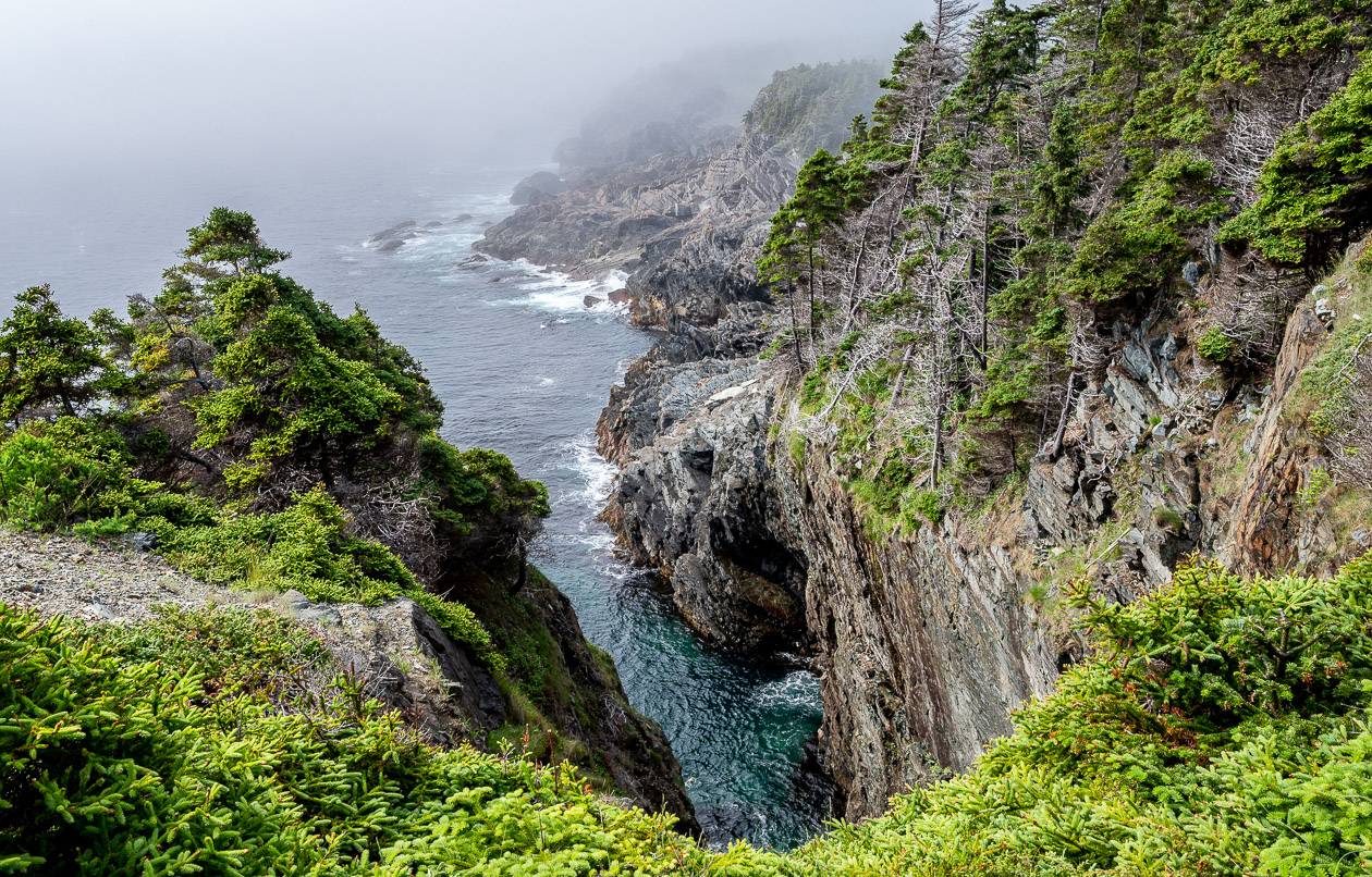
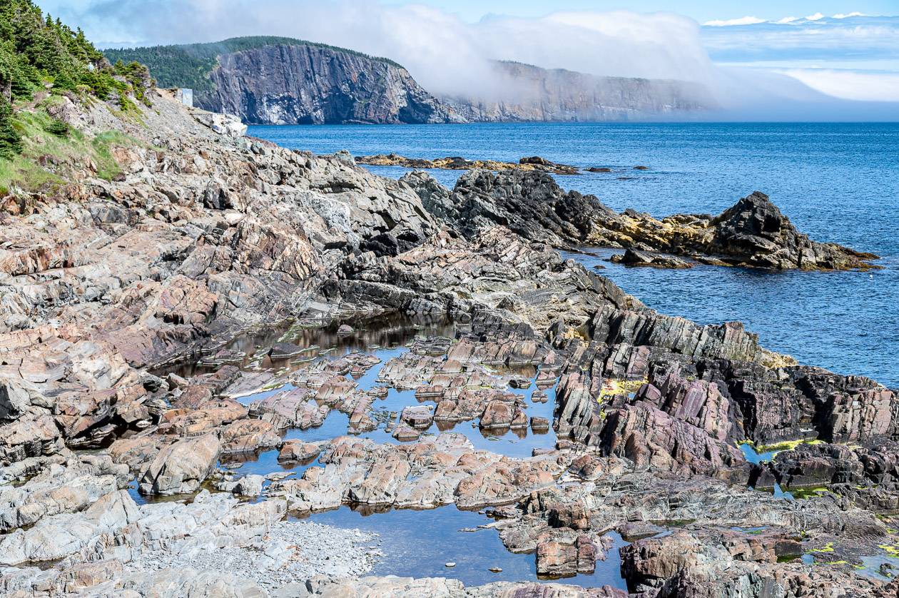
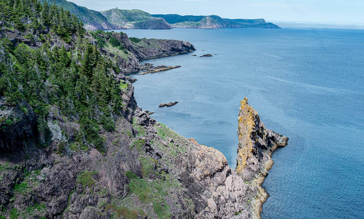
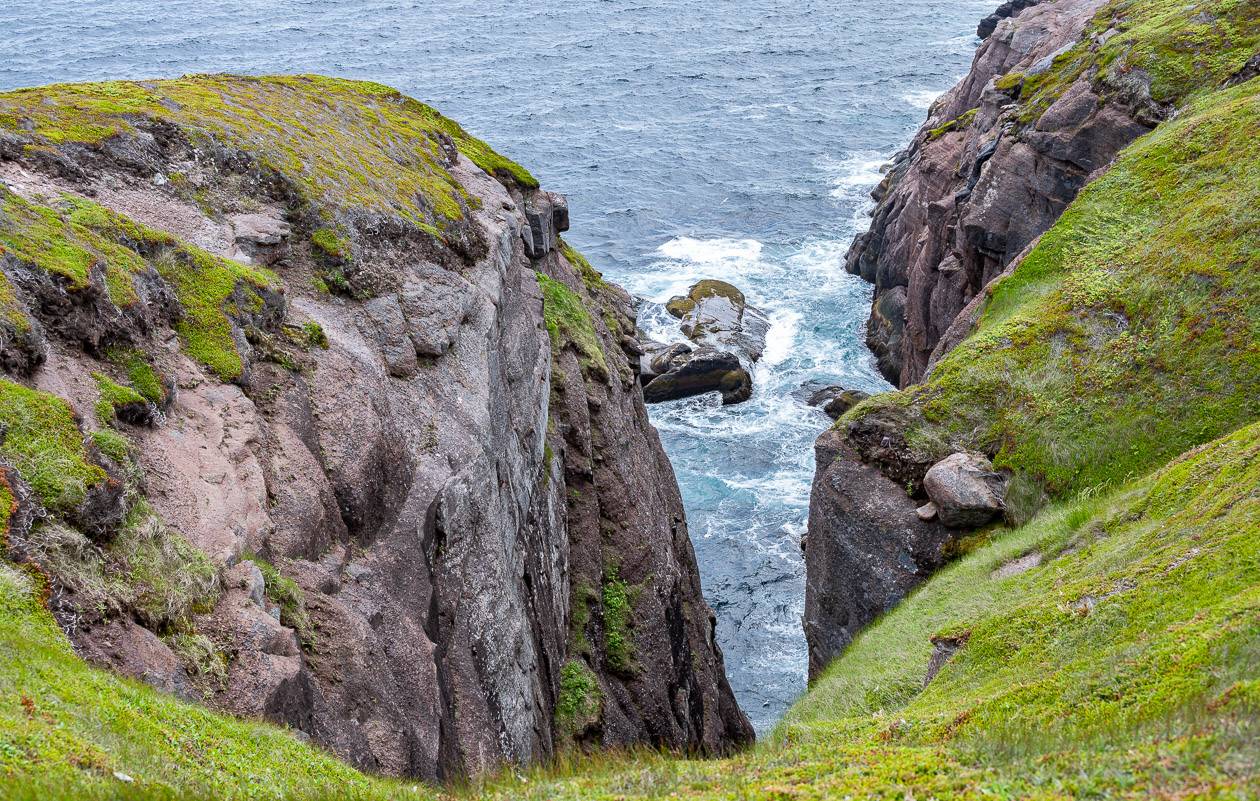
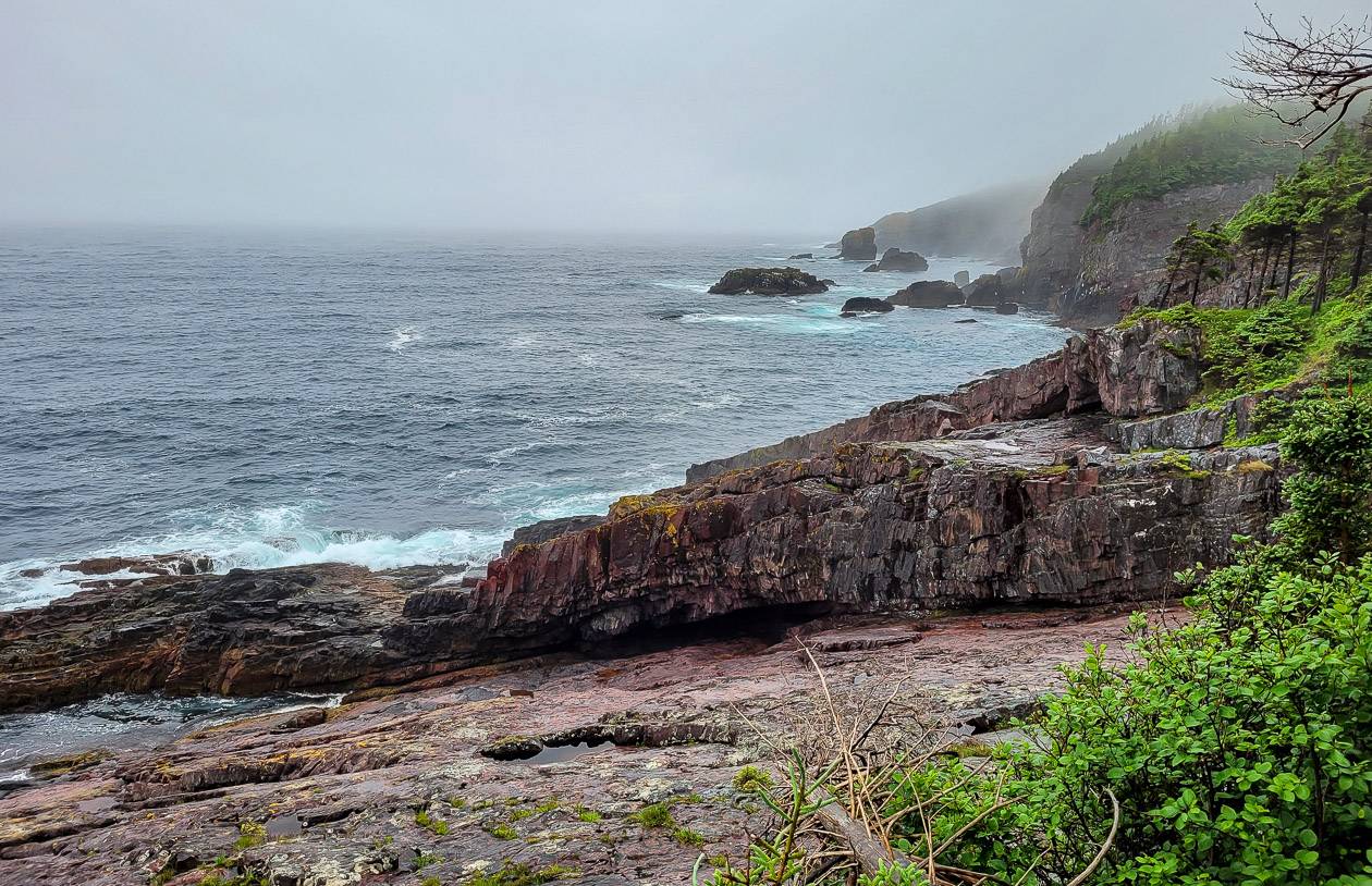
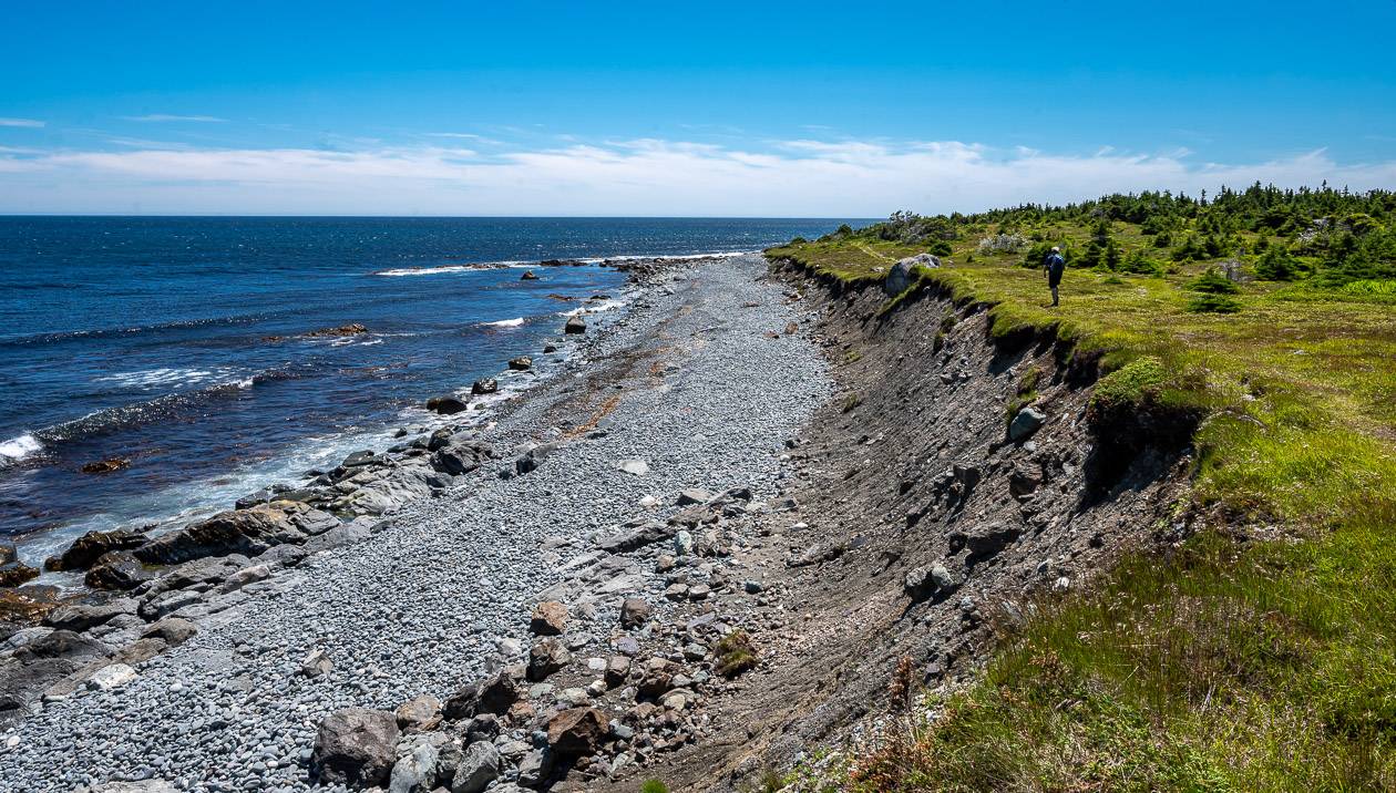
Cape Broyle Head Path, East Coast Trail
Start/end: Cape Broyle/Calvert trailheads
Distance: 19.4 km + 0.7 km side trails
Difficulty: Strenuous
Campground: Yes – Long Will Campsite, 7.2 km in from the Cape Broyle trailhead.
Time needed: 6 – 10 hours
Experience/Highlights: This was our best day for whale watching but it came with a price.
We spent most of the day in the woods, and while pleasant enough, there wasn’t much in the way of views unless we took the side trail to the top of a headland. Then the views exploded.
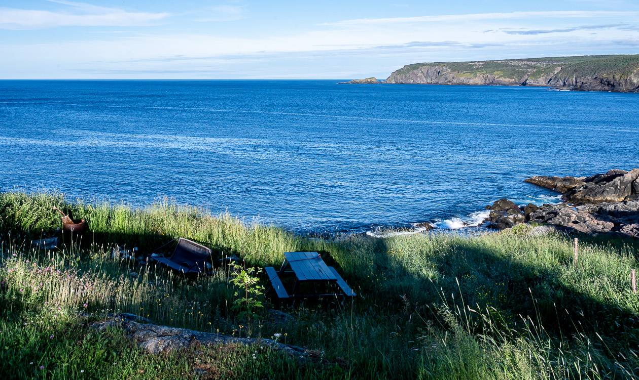
The area around Gentleman’s Cove and Lance Cove (pictured below) were particularly lovely as was the section from Cold Harbour south to the Calvert Trailhead. Try to set aside some time to visit Lance Cove – perhaps enjoying lunch on the sandy beach.


Caplin Bay Path, East Coast Trail
Start/end: Calvert/ Ferryland trailheads
Distance: 5.6 km
Difficulty: Easy to moderate
Campground: Not on this section
Time needed: 2- 3 hours
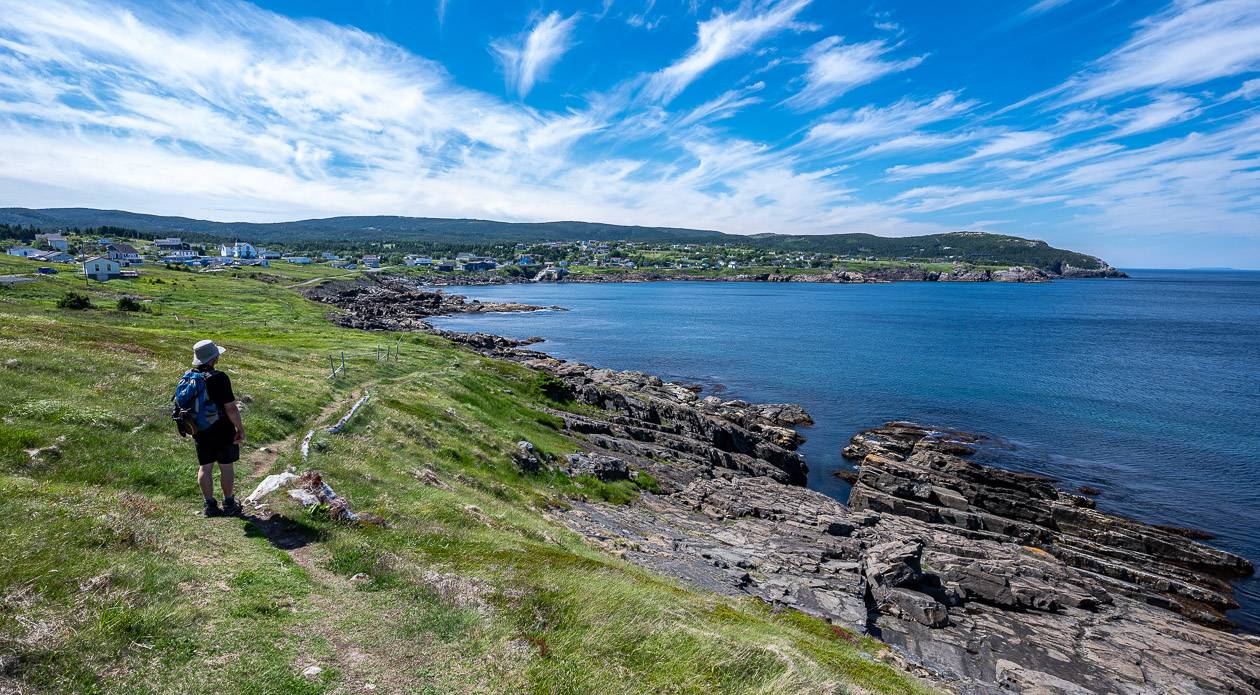
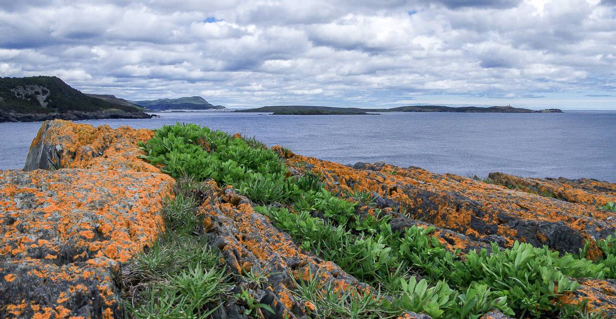
Highlight/Experience: Look for lots of shorebirds including guillemots, cormorants and loons, cobblestone beaches, offshore islands and scenic pocket coves. The path is close to the Ferryland Lighthouse, and the Colony of Avalon.

Sounding Hills Path
Start/end: Ferryland/Aquaforte trailheads
Distance: 8.4 km
Difficulty: Easy to moderate
Campground: No
Time needed: 2 – 3 hours
Highlights/Experience: This is one of the busier sections of the East Coast Trail as its so accessible and there is lots to see.
Combine it with a visit to the Colony of Avalon site and the interpretation centre. The trail offers cobblestone beaches, views of offshore rocks and islands, a great viewpoint from the summit of Sounding Hills, waterfalls, and fjord views from Howlett Point.
Spurwink Island Path, East Coast Trail
Start/end: Aquaforte/Kingman’s Cove trailhead
Distance: 20.4 km + 1.9 km of possible side trails
Difficulty: Difficult
Campground: Yes near Big Gallows Cove
Time needed: 7 – 10 hours
Experience: It’s a long day with a not so inspiring section in the woods but once you pass South Head on the way to Port Kirwan the hiking gets way more interesting.
The Berry Arch is a highlight and a few other rocky beach stops makes it very worthwhile. Read my full description of the Spurwink Island Path.


Bear Cove Point Path
Start/end: Kingman’s Cove/Renews trailhead
Distance: 11.9 km
Difficulty: Moderate
Campground: No
Time needed: 4 – 6 hours
Highlights/Experience: Pass abandoned settlements at Lance Cove, Trixs Cove (home to 19 people) and Blacksmith (home to 21 people). Check out the lighthouse at Bear Cove Point.
Look for jagged sea stacks at Southern Cove. Breeding terns can sometimes be seen in the Renews Estuary. Just before The Mount, an 18th century gun battery, there is the Nun’s Bathing Place, reportedly a “hidden gulch favoured by the Presentation Sisters.“
Island Meadow Path, East Coast Trail
Start/end: Renews/Cappahayden
Distance: 10.1 km
Difficulty: Moderate
Campground: None
Time needed: 3 – 5 hours; it took us four hours with stops
Highlights/Experience: I was pleasantly surprised by the amount of variety on the hike.
The first 4 – 5 km of the hike are quite wet but they still offer viewpoints and excellent birdwatching. Around Little Point there are ledges that get scoured by waves and ice every winter. There are also cobble beaches you can access that make a great lunch spot. Enjoy all the bird activity across at Renews Island.
When you reach Bear Cove you have to walk on the highway for a short distance before re-entering the woods.
Once you’re out of the woods again, the walking is divine along the coast, though on cold days it could be bone chilling.


Long Shore Path
Trailhead location: Topsail Beach/Portugal Cove trailheads
Distance: 17.2 km
Difficulty: Moderate to difficult
Campground: None on this section
Time needed: 6 – 8 hours
Highlight/Experience: This is one of three paths on the west side of the Avalon Peninsula that are still a work in progress.
There will be slope scrambles aided by ropes. There are some beach areas including Horse Cove, Beachy Cove and Topsail Beach Rotary Park. Expect wonderful views from Beachy Cove Hill and Greyman’s Beard.
Piccos Ridge Path
Start/end: Portugal Cove/Bauline trailheads
Distance: 14.5 km + 0.2 km side trails
Difficulty: Strenuous
Campground: No
Time needed: 7 -9 hours
Highlights/Experience: The trail is still a work in progress with stairs, boardwalks and bridges yet to be completed.
Gloves are suggested for use with rope climbs. Blast Hole Ponds Brook can be hard to cross after a heavy rain. Don’t forget hiking poles. Much of the trail is is high and exposed so in bad weather, windchill, rain, frost and slippery conditions are all possible.
White Horse Path
Start/end: Bauline/Biscan Cove trailheads
Distance: 18.8 km + 1.5 km of side trails
Difficulty: Strenuous
Campground: There is the new Patch Brook wilderness campsite with five tent platforms.
Time needed: 8 – 10 hours
Highlights/Experience: Trail work is ongoing so don’t expect everything to be completed – including boardwalks and stairs.
According to CBC, the White Horse Path, has been named the “hardest path” on the East Coast Trail with 18.8 km of rugged, strenuous hiking from Bauline to Cape St. Francis with lots of up and down. Much of the trail is high and exposed so you need to be particularly aware of the weather.


East Coast Trail hiking map (approximate locations)
Further reading on hiking in Newfoundland
- Hiking the Skerwink Trail near Trinity, Newfoundland
- A Hike to the Summit of Gros Morne Mountain
- Hiking the Alexander Murray Trail in King’s Point
- Backpacking the Long Range Traverse
- The North Head Trail Hike in St. John’s
Click on the photo to bookmark to your Pinterest boards.


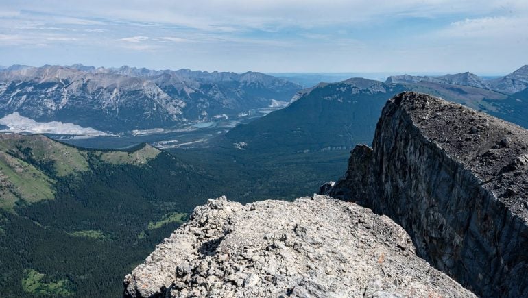
Epic views, pure adventure!