Windtower Hike in Spray Lakes Provincial Park
I have looked up at Windtower for years – both from West Wind Pass on a chilly, windy day and from the Smith Dorrien Trail from the comfort of my car. I finally did the Windtower hike on a hazy, warm August day.
It wasn’t as hard as I expected and the Windtower trail was more obvious than I thought it would be. On the summit, I was blown away by the views. If you’re a keen hiker, and you don’t mind some scree, I would highly recommend the Windtower hike.
This post includes some affiliate links. If you make a qualifying purchase through one of these links, I will receive a small percentage of the sale at no extra cost to you. Thank you very much for your support.
Windtower hike details
Why do it: A double whammy of a hike as you knock off West Wind Pass and Windtower – with its astounding views of the Spray Lakes, Canmore, and the Bow Valley.
Distance: 9.8 km (6.1 miles) round trip
Elevation gain: 988 metres (3,241 feet)
Difficulty: Moderate to expert. There are a couple of easy scrambling sections.
Time needed: 5.5 – 7 hours for the return Windtower hike depending on your fitness level and how sure-footed you are on steep terrain.
Best time to hike: June 15 – early October
Location: Spray Valley Provincial Park
Dogs allowed: Yes, on a leash but on a hot day this hike wouldn’t be a good idea as there is NO water
Map needed: Gem Trek Canmore and Kananaskis Village or on Amazon.
Crowd levels: You won’t see many people.
Wow factor: High. This is one of the top hikes in Kananaskis.
Don’t forget: Pack layers as its usually very windy on the summit – so it can be quite cold. This is one hike where hiking poles are very helpful for the descent.
Before you go: Normally I would encourage you to check trail reports but as the trail is unofficial, there is never anything online. There is no route signage on the Windtower hike either.
Dogs: Allowed on a leash but on hot days, I’d recommend leaving them at home.
Animals: Look for marmots and mountains goats on the hike to Windtower.
Permits: Don’t forget to purchase your Kananaskis Conservation Pass.
Parking: Plan ahead as it isn’t signed.
Weather: Check the weather forecast before you do the Windtower hike. It’s no place to get caught in a storm.
Don’t forget: The hiking essentials including lots of water. Also, be sure to tell someone where you’re going and when you expect to be back.
Would you like to save this?
Windtower hike description
Cross the road and begin a steep ascent towards West Wind Pass. Be sure to stick to the right trail as there are a couple of junctions. At the first intersection (pictured below) stay right. There is a marker on the tree which helps. Left is the High Rockies Trail.
Further on up there is another trail that heads left for the Rimwall – a far more difficult hike. That intersection is marked with a small cairn. Again, stay right for the pass.


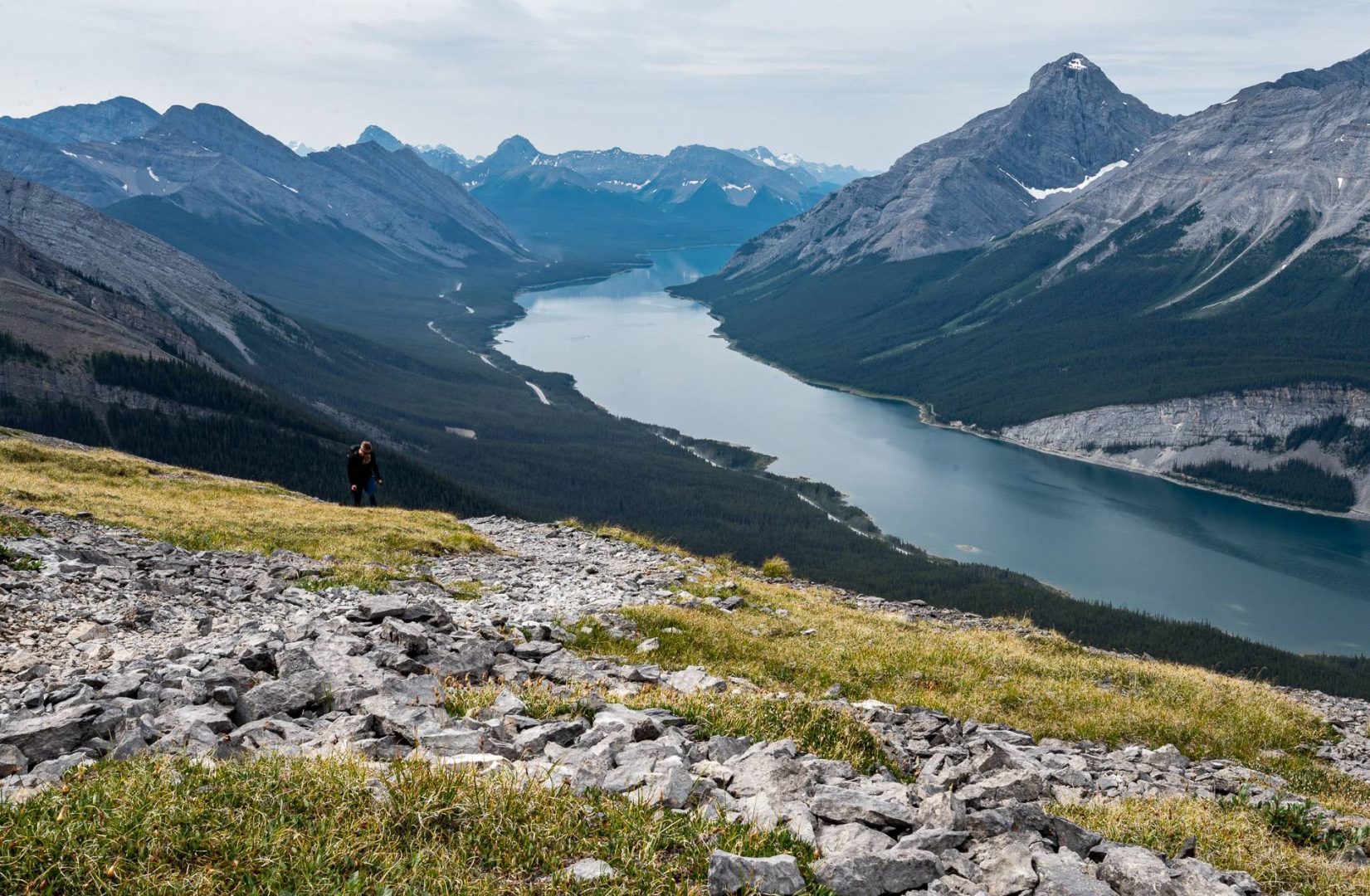
There is a lot of trail braiding on the way up to the pass, but if you follow what looks like the main trail, you will break out of the trees and reach West Wind Pass at the 2.1 km mark. You will have climbed 378 metres at that point, but you have another 610 metres to go!
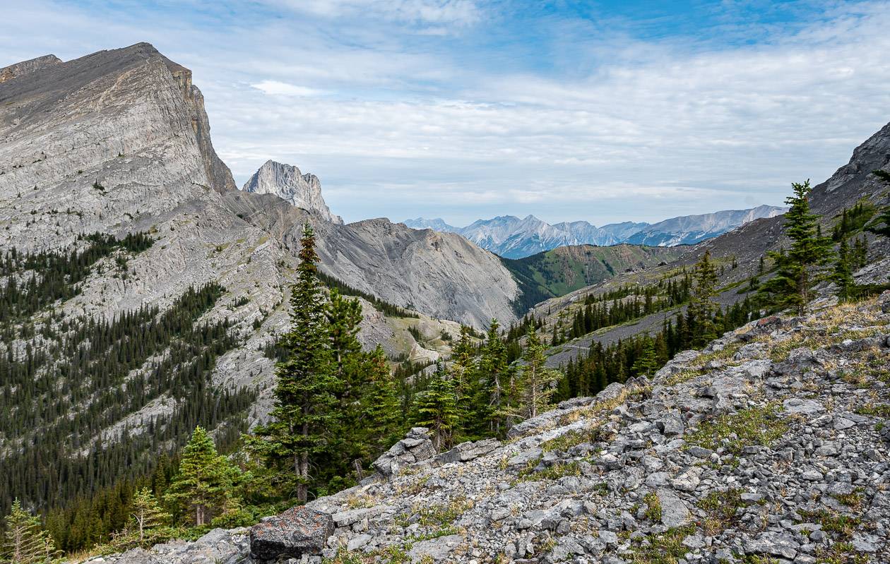
If you haven’t been to West Wind Pass before, it’s worth hiking a few hundred metres more. At the pass look into Wind Valley. Then look up. The pass sits between the Rimwall (on your left or to the northwest) and Windtower on your right or to the east.
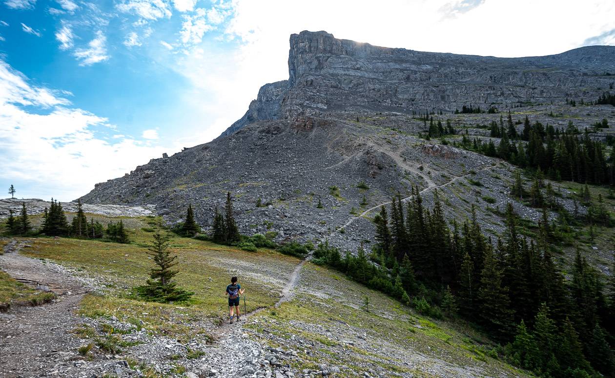
You’ll see the trail curving east to the Windtower (4 photos below) and then start climbing. I found the trail to be an obvious one. There were a couple of cairns around, but the trail is boot-beaten enough that if you’re paying attention, you shouldn’t have any trouble.
The initial hike up Windtower is at a gentle grade but it does entail a couple of short, easy scrambles up some rocks. You should literally be able to do them in 30 seconds or less. You shouldn’t be struggling – and if you are, you’re likely off course.

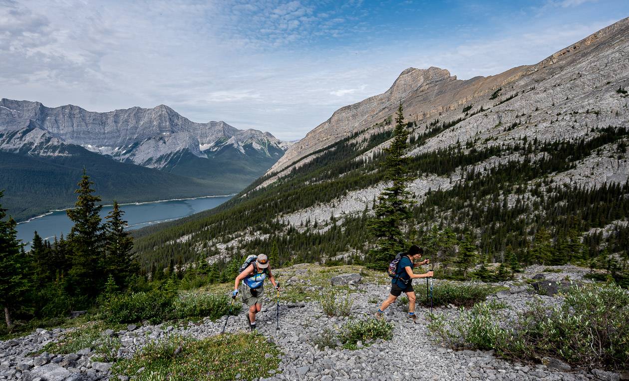
After 50 or 60 minutes of hiking, you’ll head left or east. The general direction is steeply up towards Mount Lougheed. When you stop to catch your breath, look around as the views of the Spray Lakes Reservoir are superlative.
At a certain point – and it’s obvious, the trail turns and heads north towards Windtower through bootbeaten scree. The grade does moderate for a while and then zigzags up the final hump to Windtower.
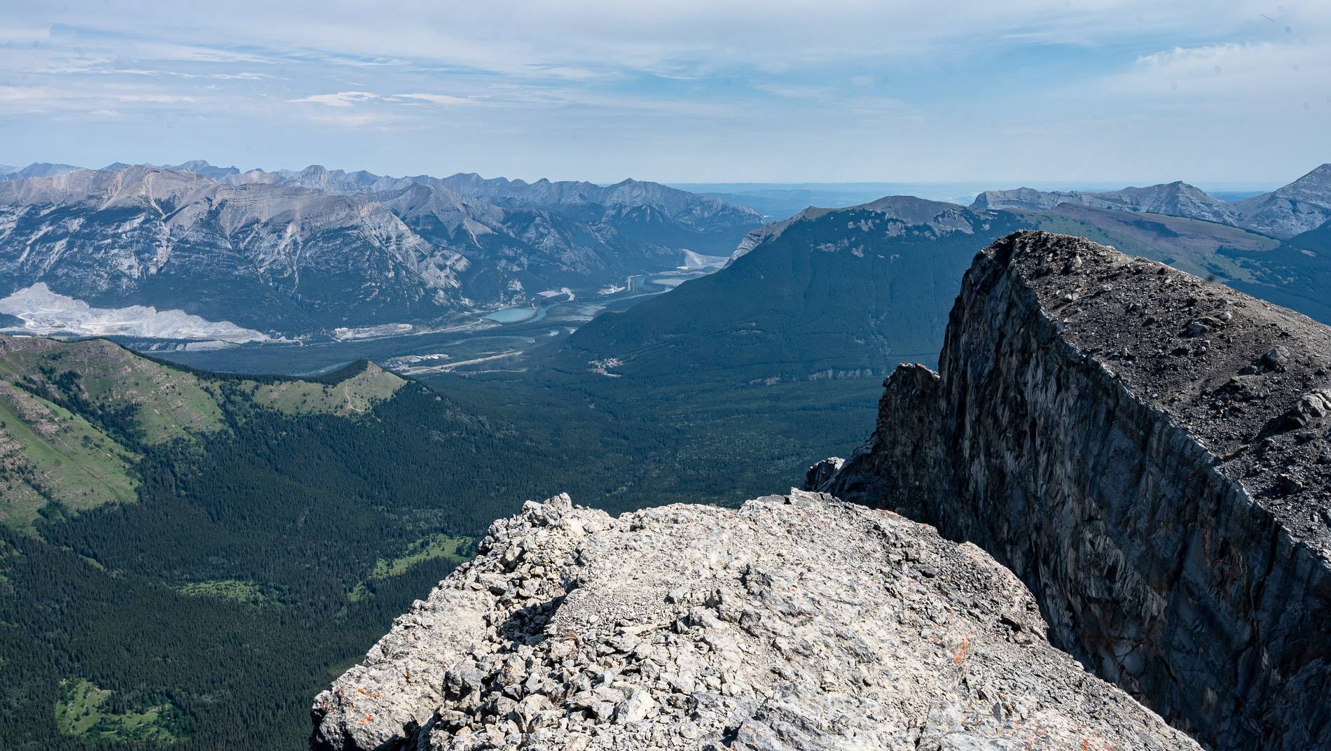
We were very lucky as there was no wind on the summit though there are a couple of wind breaks on top. Have a wander around the small summit – admiring the views of Canmore, the Bow Valley, and the Wind Ridge Trail far below.
Look across to the Rimwall – and decide if that kind of steep hiking is for you. And after enjoying lunch with a view, retrace your steps.


The descent off Windtower
I was not looking forward to the descent on the Windtower hike, especially as I hadn’t brought poles with me. (And I almost always do!)
However, it was not nearly so bad because you can boot step through most of the scree – without feeling like you were going to slide out of control. You might want short boot gaiters here, to keep the rocks out.
The one section of scree that was hardpacked and slippery with ball bearing-sized pebbles was fine with a borrowed pole. In fact, I got through it without even knowing it.
Once you’re back in the trees, it’s easy going, save for a few short, very easy scrambly sections. We were down from the summit of Windtower and at the car in about 2.5 hours.


Finding the trailhead for the Windtower hike
The crux of the hike to Windtower can be finding the trailhead. The fine folks at Alberta Parks don’t make it easy.
Drive through Canmore to reach the Canmore Nordic Centre. Zero your odometer here. Drive 18.5 km to park in a pullout on the right or west side of the highway, just before Spurling Creek. You will almost always see other cars here.
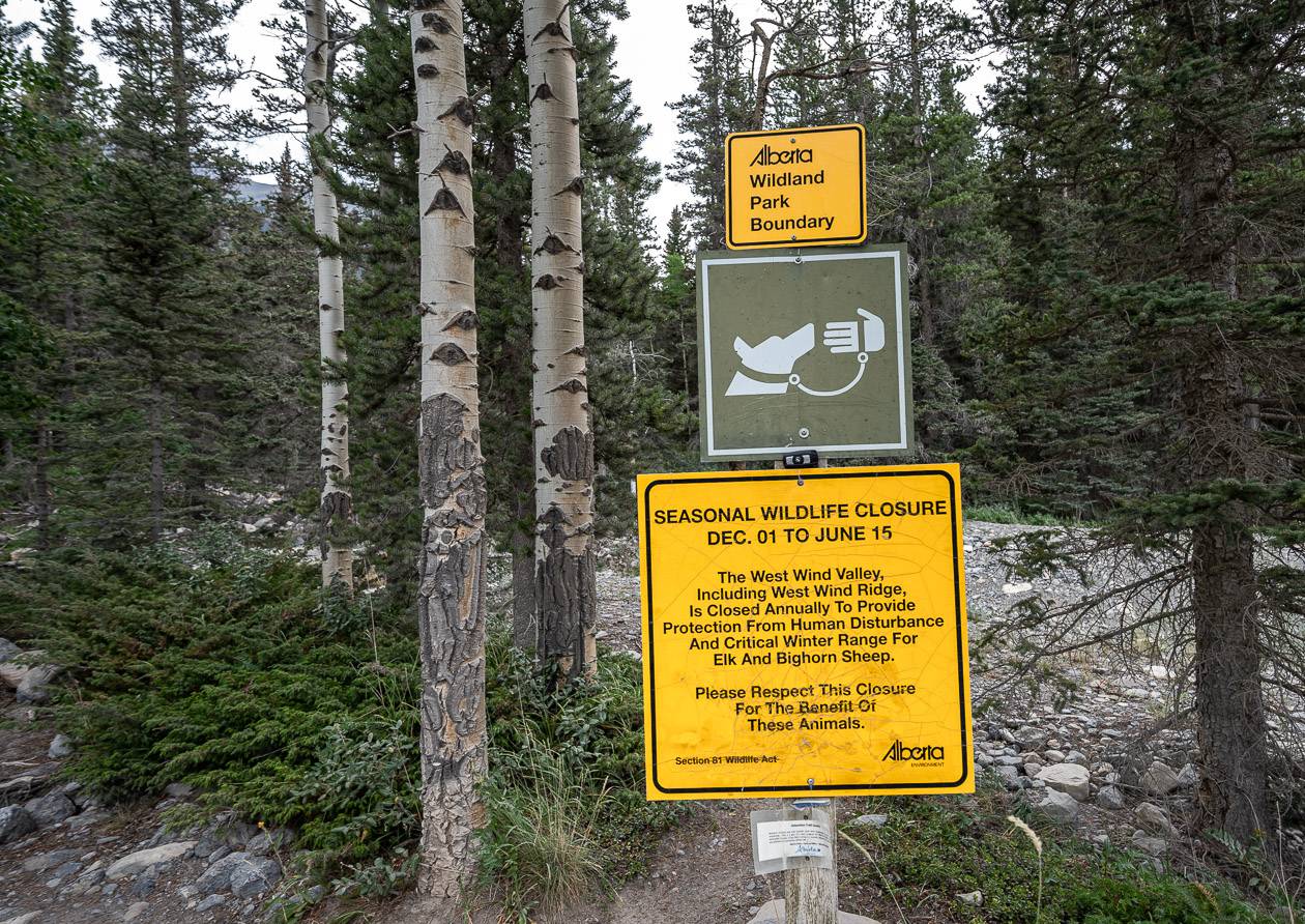
The trail to Windtower starts across the highway. It’s obvious and there is signage telling you about annual closures though it refers to West Wind Ridge and West Wind Valley.
There are no facilities to speak of at the parking lot. But there is a lot of toilet paper in the woods. Please don’t be that person and instead practice Leave No Trace principles.
Further reading on Alberta hikes
- The Wind Ridge Trail (Look down on it from the summit of Windtower.)
- The Fabulous Tent Ridge Hike in Kananaskis
- 12 Kananaskis Trail Hikes in Alberta With a View
- Easy Kananaskis Hikes Everyone Will Love
- 18 of the Best Banff Hikes You Can Do in a Day
- Blackshale Suspension Bridge Hike, Kananaskis
Click on the photo to bookmark to your Pinterest boards.