
Wind Ridge Trail Hike Near Dead Man’s Flats
If you live in the Calgary – Canmore corridor or you’re on your way to Banff National Park, I highly recommend a stop at Dead Man’s Flats to hike the Wind Ridge Trail. It’s a fantastic day hike – though steep – that takes you up to a beautiful wildflower-filled meadow and then onto Wind Ridge.
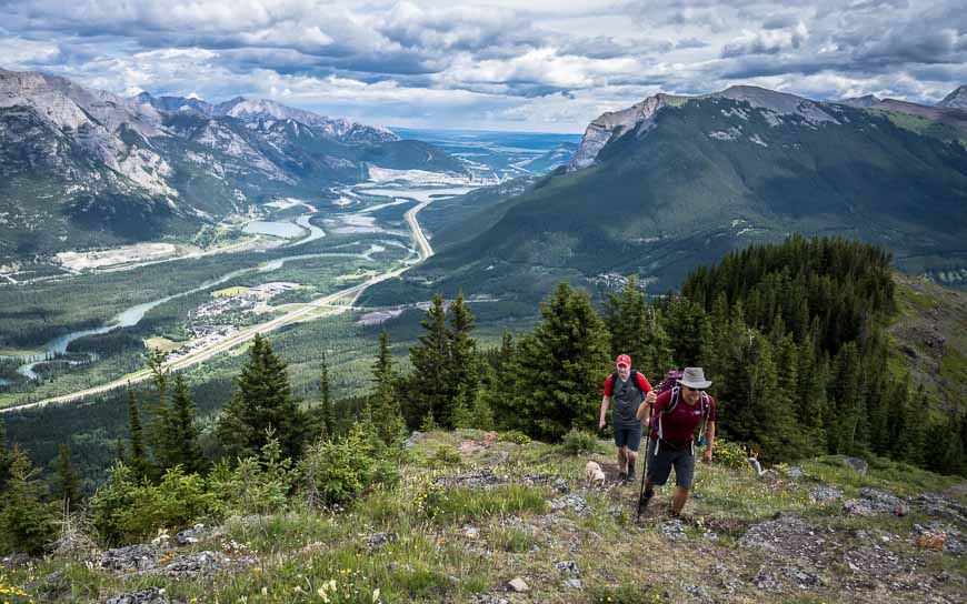
Enjoy superlative views the minute you’re out of the trees. It’s not a hike for everybody as it is difficult, but most hikers can at least enjoy the scene at Windy Viewpoint.
The Wind Ridge trail hike is easy to confuse with the West Wind Pass hike. The Wind Ridge trail is accessed from the Trans-Canada Highway by Dead Man’s Flats while West Wind Pass (and Windtower) are accessed off the Smith-Dorrien Highway, above Canmore.
However, you will be able to see both West Wind Pass and Windtower on this hike.
This post includes some affiliate links. If you make a qualifying purchase through one of these links, I will receive a small percentage of the sale at no extra cost to you. Thank you for your support.

Would you like to save this?
Wind Ridge hike summary
Distance: 12.8 km (8.0 miles) return
Elevation gain: Approximately 860 m or 2,822 feet
Level of difficulty: Difficult because of the steepness of the trail and the scrambling move required.
Time needed: Allow 4 – 6 hours to do the return hike, depending if you go all the way to the end of Wind Ridge Trail.
Option for an easier hike: There is the option to do an up and back hike to Windy Viewpoint, a distance of 10.8 km (6.7 miles) return with 400 metres (1.312 feet) of elevation gain.
Dogs: Permitted on a leash. Large dogs (and their owners) in particular may have a tough time with the scrambling section.
Permit: You will need a Kananaskis Conservation pass to hike the Wind Ridge trail.
Closures: Parts of the Wind Ridge trail is closed from December 1 until June 15 each year to protect winter range habitat of elk and bighorn sheep. Maps at the trailhead illustrate the closure well.
Trail conditions: Check the Wind Ridge trail report before you go – though it’s really for the Windy Viewpoint.
Bears: Don’t forget the bear spray – and be sure it’s easily accessible and not in the back of your pack. I like to carry mine in a holster so I don’t accidentally set it off.
Water: Carry lots of water as once you head up the fire road there isn’t any. If you’ve got a dog with you, carry extra for them too. I have become a fan of water bottles for dogs as they waste less water – an important factor on a long hike.
Map: The topographical map for this hike is Gem Trek Canmore and Kananaskis Village- I also like Organic Maps – an offline hiking app.
Don’t forget: Let someone know where you are hiking, practice Leave No Trace principles and always pack the hiking essentials.

Wind Ridge trailhead location
If you’re driving from Calgary take the Trans-Canada Highway to Dead Man’s Flats – exit 98. Turn right on 2nd Street, right again on 2nd Avenue and cross the highway. It becomes George Biggy Sr. Road. Follow it to the parking lot at the end of the road, just beyond Banff Gate Mountain Resort. It’s about a one hour’s drive from Calgary.
If you’re coming from Canmore you can get off at Dead Man’s Flats (exit 98) and then immediately turn right onto George Biggy Sr. Road. Continue as above. It’s a 12-minute drive.


Before you start the Wind Ridge hike, be mindful of the fact that there is a short – two-move scramble required.
It’s not hard unless you have a large dog you’re trying to take up with you, in which case you’re better off doing the alternate route – though it’s bloody steep. I think the alternate route is worse to descend than ascend. After descending it, half of our group wish they’d just retraced their steps via a short down climb on the rock face. See the photos below in the blog.
Before you do the Wind Ridge trail, I highly recommend taking a look at the scenic high point on the ridge showcased in Pink Floyd’s music video – Learning to Fly. I also understand via the blogger at On-Top.ca that the ridge has seen a grand piano on it for a performance by Canadian pianist Frank Mills.
What you should know about the Wind Ridge trail before you go
The parking for this hike is also used for the hike up Centennial Ridge (not the usual route), Skogan Pass (a fun cross-country ski) and a hike up Pigeon Mountain.
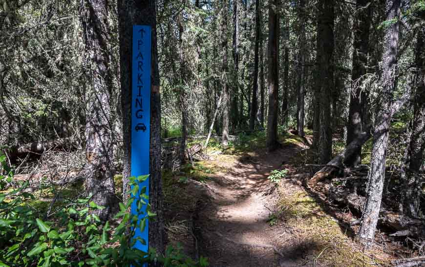
You can see where you’re headed from the parking lot if you take the time to get oriented. Pick up the trail at the far end of the parking lot in the trees. You will see a notice-board with a map.
Wind Ridge trail description
We did the Wind Ridge trail as a group of five – my husband John and my son Matthew along with two blogger friends – Gemma and JR from Off Track Travel.
Even with some nasty biting flies in the middle of the hike, we all enjoyed the trail immensely. The views are impressive for a hike so close to Calgary.
The trail is in great shape with signage at key intersections. Overall you can expect route-finding to be easy.
Enjoy an easy stroll for the first 4 km of the Wind Ridge hike as you make your way through a thick forest full of moss and edged by wildflowers like Indian paintbrush. The trail starts off flat, dips down to Pigeon Creek, weaves through the forest, crossing three bridges in total. You’ll also cross Wind Creek and West Wind Creek.
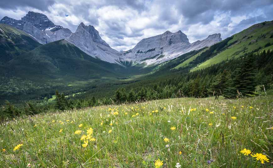
Ultimately you end up on an old fire road that boasts some beautiful wildflowers and views if you care to look back. It ends at treeline, 5 km into the Wind Ridge Trail hike, in a gorgeous alpine meadow with beautiful views and reams of wildflowers.
For many people, the meadows are their turnaround point – but that’s okay as you still get amazing views of Mount Lougheed, Wind Tower, The Rimwall and Wind Mountain. This is a great spot to enjoy a picnic lunch.
Note that there is a steady elevation gain up the old logging road, but that the bulk of the elevation gain for the day really starts at the meadows!

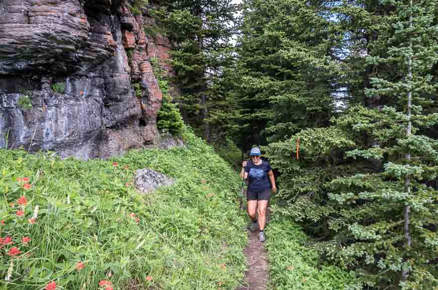
The rest of the hike is on the Wind Ridge trail and while not maintained, it is easy to follow. Hike steeply up through the meadows to reach the crux of the hike at the first major rock band you come across.
If the short scrambling section up the rockband looks too unpleasant to you (or you have a large dog), look out for a bypass trail on your right, marked by a piece of flagging tape in the trees.
The bypass trail contours below the rock band before heading take-your-breath-away steeply into the trees on Wind Ridge’s north aspect.


After the rock band there is still some climbing to do but it goes quickly and in short order you’ll be standing on the ridge top.
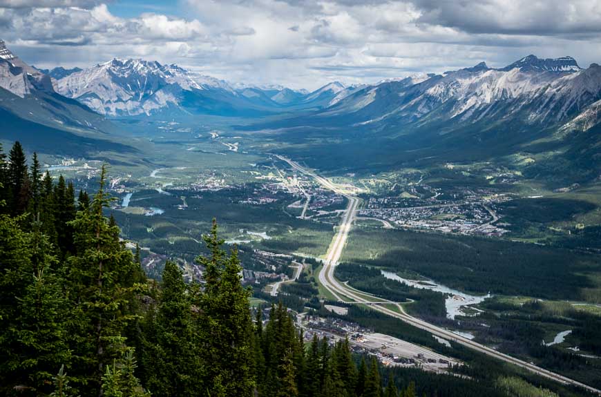
Continue along the ridge – enjoying the flat sections as you head for the summit marked by a cairn. Views of Canmore and the Bow Valley corridor are especially good through here.
From the summit you can enjoy big mountain views of Mount Allan, Wind Mountain, Mount Lougheed, the Windtower, West Wind Pass, Rimwall Summit, the Orphan and the Three Sisters (Faith, Hope and Charity Peaks) – going from left to right.


Descent from the Wind Ridge
The return hike down the Wind Ridge trail is tough going as it’s one of the steepest trails you’ll encounter in the Rockies.
To leave Wind Ridge itself you can either return the way you came up – repeating the scrambling move in reverse, or take the super steep side trail down, which is what we did. Note the photo showing the flagging and indicating the trail down.
It is very steep, so take your time as it only takes one bad move to twist an ankle. Once you’re through this section, you’ll still have to contour steeply down through the alpine meadows, so again take your time – and enjoy the incredible unimpeded mountain scenery.
Once you hit the fire road, you’ll be at the parking lot in short order.


Where to stay near the Wind Ridge Trail
The closest place to stay – The Banff Gate Mountain Resort is just a minute’s drive from the parking lot.
Canmore, just a short drive away, has options for all budgets.
The Basecamp Resorts (a self-check-in hotel) is an excellent choice if you want to be able to cook a meal or two. They have a great hot tub with a view.
For an upscale experience check out the Malcolm Hotel. For the opposite end of the spectrum the Canmore Downtown Hostel should fit the bill.
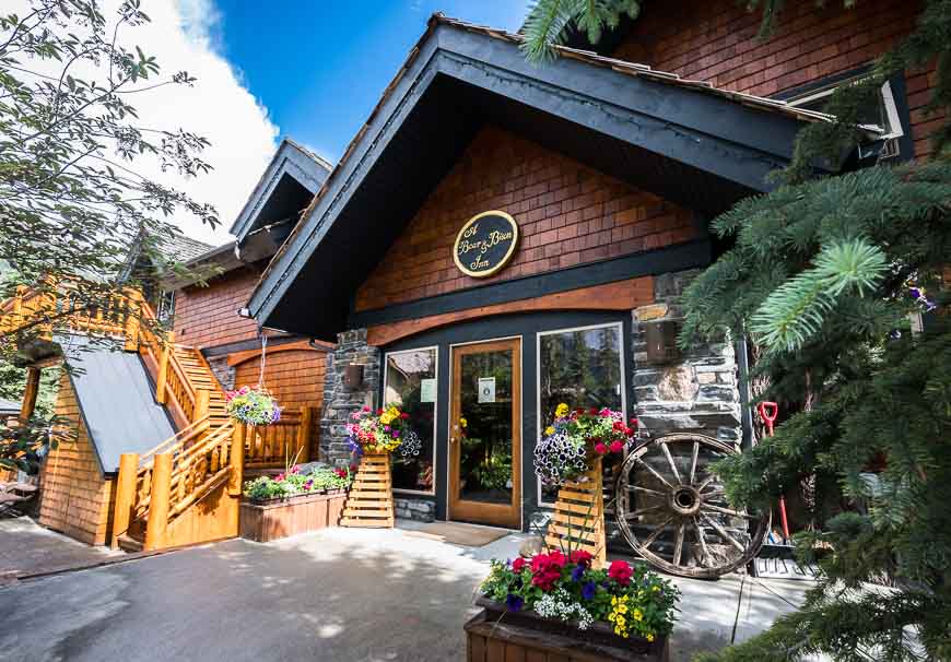
For a B&B option in Canmore I have enjoyed a few stays at A Bear and Bison Country Inn.
What I’d take on the hike up Wind Ridge
For a comfortable lunch – especially if you have to sit on rocks or if it’s wet, I swear by my inflatable seat cushion.
Don’t forget the insect repellent – especially for the windless days.
Collapsible hiking poles come in really handy on the descent. I like the carbon poles for their weight.
A folding pocket guide to Alberta’s trees and wildflowers is a great addition considering the number of wildflowers you’ll encounter.
Take a buff for the wind, especially if it’s a cool day.
On this hike you’ll want layers in case it’s windy and chilly at the top. The Patagonia Down Sweater Hoody is my go to – and it’s a lightweight choice.
Further reading on hikes and bike rides in the Canmore area
- 9 Canmore Hikes that Offer Great Views
- Cycling the Banff Legacy Trail from Canmore to Banff
- Biking Alberta’s Goat Creek Trail from Canmore to Banff
- BEST Kananaskis Hikes for Mountain Lovers
- Test Your Mettle on the EEOR Hike near Canmore
Click on the photo to bookmark to your Pinterest boards.


