BEST Kananaskis Hikes for Mountain Lovers
Alberta’s Kananaskis Country has grown in popularity over the last few years. People are discovering that the hiking is on par with what you’ll find in nearby Banff National Park. The best Kananaskis hikes described below are literally found all over Kananaskis Country – an area encompassing six provincial parks and three wildland provincial parks in an area covering 4,000 square kilometres.
There is a wealth of hiking for every level of hiker – much of which I’ve written about in previous blogs. Easy Kananaskis hikes everyone will love is covered in this blog.
But I wanted to showcase what I think are the best Kananaskis hikes – ones that really speak to me and leave me feeling like I’ve had a memorable hiking day.
That’s not to say that I haven’t missed a few. There are three that come to mind – which have been on my wish list for ages including Mist Mountain, Mist Ridge, and the Birdwood Traverse. I’m saving them for the perfect blue sky day – with no risk of thunderstorms or smoke marring the view.
Permits: What’s changed in Kananaskis is that you now need to purchase a Kananaskis Conservation Pass. I buy a yearly one for $90, but you can buy daily passes too.
Go prepared: When you’re hiking in the mountains carry the 10 hiking essentials.
Bears: Carry bear spray – that is accessible and know how to use it. Be careful with it too – as I know of four incidents in the last year where its been set off inadvertently.
Trail conditions: Be sure to check trail reports for the latest information, especially with regards to closures.
Dogs: Permitted on all trails described below on a leash.
Please: Practice Leave No Trace principles when you’re doing one of the best Kananaskis hikes.
If you’re rather head out on overnight backpacking trips in Kananaskis check out these 10+ backpacking options that will appeal to first timers through to those of you who love an airy ridge walk.
This post includes some affiliate links. If you make a qualifying purchase through one of these links, I will receive a small percentage of the sale at no extra cost to you. Thank you very much for your support.
Location map of the best Kananaskis hikes
Described below are 18 of the best hikes in Kananaskis – all personally tested!
1. Mt. Burke hike
John and I did the Mt. Burke hike in mid-April when there was lots of snow still on the ground. It is a wonderful early season hike – that tests your winter conditioning program or lack thereof. There’s a long stretch of hiking in the trees but once you clear them, the views are fantastic and hence why I think it’s one of the best Kananaskis hikes.
If you do the hike under snowy conditions, be sure to pack a pair of microspikes and poles for the one airy section.
Round-trip: 16.0 km (9.9 miles) plus 1.0 km (0.6 mi) return to the parking lot and back if you hike it before May 15
Elevation gain: 918 m (3012 feet) round trip
Summit elevation: 2541 m (8333 feet)
Time needed: 5 – 7 hours – We did it in 5.5 hours, 3 hours up and 2.5 hours down.
Map: Gem Trek Highwood and Cataract Creek, Kananaskis Country
Would you like to save this?
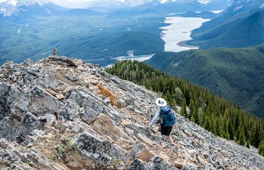
2. South Lawson Peak hike
The South End of Lawson hike delivers some excellent views of the Kananaskis Lakes once you clear the trees. The trail is steep initially but does level out.
Near the end of the hike there’s some easy scrambling (no real exposure) and some lovely spots to enjoy a lunch on the top. I have seen photos of people doing the hike in spring with some snow on it – but you should be a confident hiker to do that.
You could in theory bike the first 1.2 km and lock up your bike by the dam. At the end of the hike you’d appreciate the quick hike out.
Round-trip: 7.0 km
Elevation gain: 762 m (2,500 foot) round trip
Summit elevation: 2393 m (7850 feet)
Time needed: 4 – 5 hours
Map: Gem Trek Kananaskis Lakes
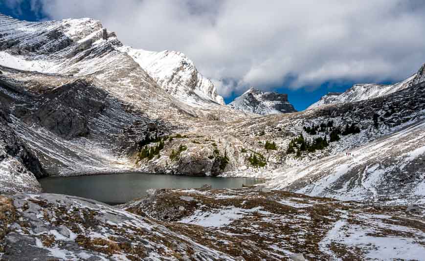
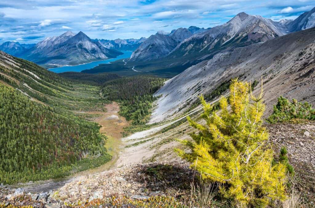
3. Headwall Lakes hike – one of the best hikes in Kananaskis that people don’t know about
The Headwall Lakes hike shares the same parking lot as that used for the Chester Lake hike but that’s where the similarities end. The hike up to Headwall Lakes sees a fraction of the traffic – and the hike itself is a degree or two more difficult than the one to Chester Lake.
John and I did it on a fall day after the first snowfall. The hike starts off on logging roads, but once you leave them it gets interesting. We didn’t have any route- finding issues as the trail is boot-beaten.
There is some steep climbing after you pass a rockslide, but there are lots of trees and handholds to help you move upwards. Once you get to the top of the headwall, the way forward is obvious. It’s a beautiful but desolate environment around the lakes – so different from what you experience on the Chester Lake trail.
There is the option to climb Fortress Mountain – or head over a col via some route finding and down to Chester Lake and out.
Round trip distance: 14 km to upper Headwall Lake
Difficulty: Moderate
Elevation gain: 430 m (1410 feet)
Upper lake elevation: 2340 m (7675 feet)
Time needed: 5 – 6 hours
Map: Gem Trek – Kananaskis Lakes
4. Ptarmigan Cirque hike – one of the best Kananaskis hikes to take out of town guests
The hike to Ptarmigan Cirque starts from the top of Highwood Pass, so you’re up high to start the hike. I think this is a great one to take your out-of-town guests on, especially those who only want a half day outing.
From the parking lot, there’s a well-marked trail that leads you to a highway crossing. Once you’re on the other side of the road, there is some climbing, the steepest on the loop. But there are also views and wildflowers. Reach an intersection – and stay left. You’ll return to it on the way back.
The higher you go the more intersecting it gets. Enjoy high alpine meadows, excellent mountain views and a waterfall.
Round trip distance: 4.5 km loop
Difficulty: Easy
Elevation gain: 214 m (702 feet)
Highpoint: 2420 m (7938 feet)
Time needed: 1.5 – 2.5 hours
Map: Gem Trek – Kananaskis Lakes
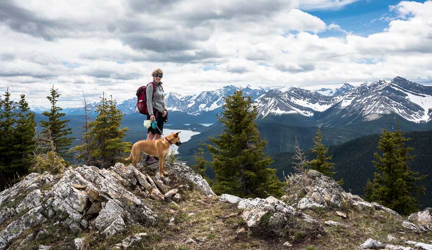
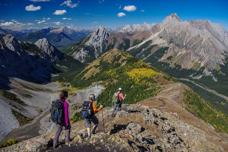
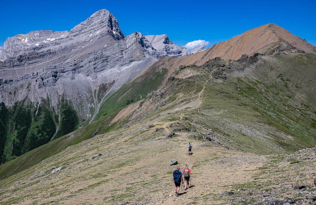
5. Pocaterra Ridge hike
Hands down the Pocaterra Ridge hike is my favourite to do in the fall when the larches are at their peak. This is one gorgeous, fun hike to do – but organize a car shuttle so you can savour the experience and hike it one way only.
The hike starts from Highwood Pass and follows unmarked trails to get to the turnoff to Pocaterra Ridge. There’s one climb there and then four minor summits or bumps along the ridge. The first one is the hardest and then it’s easy going with gorgeous vistas every which way you turn.
One way distance: 9.3 km (5.8 miles)
Difficulty: Moderate
Elevation gain: 550 m (1804 feet) and an 875 m loss (2870 feet)
Highpoint: 2670 m (8758 feet)
Time needed: 5 – 6 hours
Map: Gem Trek – Kananaskis Lakes
6. Opal Ridge South Hike
This hike to Opal Ridge South is challenging and not for anyone who hasn’t hiked on scree before.
There’s also a lot of vertical but the rewards are fantastic. I found there to be so much variety on this hike – with beautiful grassy sections, a truly fantastic ridge walk and unbelievable mountain views.
The hike starts behind the gas station across from the turn-off to Fortress Mountain. The first part of the hike isn’t inspiring as its beneath hydro lines, but the minute you start climbing it gets better – with views of the Kananaskis Lakes. Poles come in handy!
One way distance: 8.0 km (5.0 miles)
Difficulty: Hard
Elevation gain: 1012 m (3320 feet)
Highpoint: 2597 m (8720 feet)
Time needed: 4.5 – 6 hours
Map: Gem Trek – Kananaskis Lakes
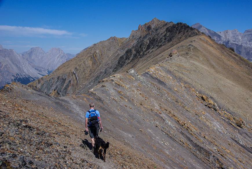
7. Grizzly Ridge hike – one of the least busy of the best hikes in Kananaskis
The Grizzly Ridge hike (sometimes called Grizzly Peak) is another favourite of mine – and again one that isn’t very busy. The hike follows the same trail as you take to Pocaterra Ridge, but you turn left at a cairn before you reach the start of the climb up Pocaterra Ridge.
Climb talus slopes to reach Grizzly Col – a popular turn around place for many. Then continue up a steepish section on boulders to reach the ridge. The way forward from there is obvious. The final climb to the high point on the ridge is a very short scramble. The views from up here are delicious.
One way distance: 9.6 km (6.0 miles)
Difficulty: Moderate to hard
Elevation gain: 518 m (1699 feet) to Grizzly Col plus 165 m (541 feet) to the top of Grizzly Ridge
Highpoint: 2770 m (9090 feet)
Time needed: 4.5 – 6 hours
Map: Gem Trek – Kananaskis Lakes
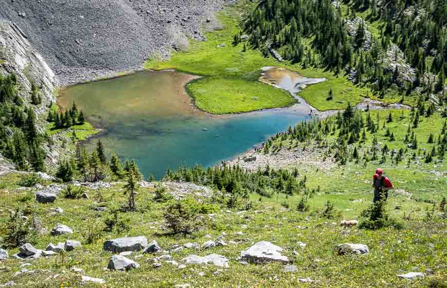
8. Chester Lake and Three Lakes Valley hike
Chester Lake is a popular destination once it opens after June 30th. For a minimal amount of hiking effort, you are treated to expansive meadows, a beautiful lake, and the possibility of going higher – up to the Three Lakes Valley. If you’ve got the time, I highly recommend doing it.
The route up to the Three Lakes Valley take you past Elephant Rocks. Then its up past masses of mophead flowers to reach the first of three lakes. Keep going, knowing that the third lake may have dried up my summer’s end. Mountain goats frequent this area too.
Round trip distance: 9 km (5.6 miles) to Chester Lake; 13.5 km (7.4 miles) to the third lake
Elevation gain: 315 m (1030 feet) to Chester Lake; 555 m (1820 feet) to the third lake
Difficulty: Easy to moderate
Time needed: 3 – 4 hours for Chester, 4 – 6 hours for third lake
Chester Lake elevation: 2220 m (7282 feet)
Map: Gem Trek – Kananaskis Lakes
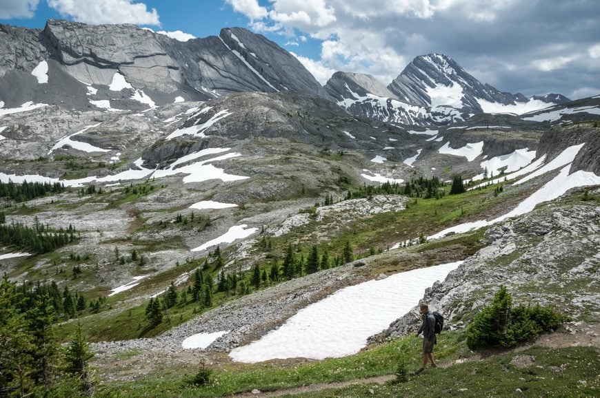
9. Burstall Pass hike
The Burstall Pass hike starts across the road from Chester Lake. It’s got its own parking area. The first few kilometres are along a road with woods all around.
When the road becomes a trail you’re almost at the floodplain – and you might want to put some water sandals on here to make the walking easier.
The floodplain is wettest in early summer, so there’s a high probability of getting a soaker.
The climbing starts after the floodplain but it’s always gradual. In no time you’re in subalpine meadows. When you reach Burstall Pass, there are options to continue to Snow Peak, the Birdwood Traverse, or the Palliser Trail.
Round trip distance: 15 km (9.3miles)
Elevation gain: 480 m (1574 feet)
Difficulty: Easy
Time needed: 5 – 7 hours
Burstall Pass elevation: 2380 m (7806 feet)
Map: Gem Trek – Kananaskis Lakes
10. Buller Pass hike
The Buller Pass hike starts off in beautiful woods and climbs gently to reach a waterfall. Then if you’re around for larch season, you head through several stands of larches before beginning the ascent to treeline.
From the pass you look down to Ribbon Lake – where you can camp, and across to Guinn Pass, often accessed via the Galatea Lakes trail. From Buller Pass you can also do a loop and knock off North Buller Pass.
Round trip distance: 14.8 km (9.2 miles)
Elevation gain: 670 m (2,198 feet)
Difficulty: Moderate
Time needed: 4 -6 hours
Buller Pass elevation: 2470 m (8104 feet)
Map: Gem Trek Canmore & Kananaskis Village
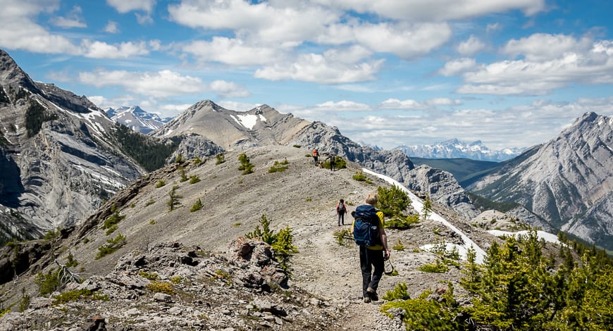
11. Tent Ridge hike – one of the hard but exceptional Kananaskis hikes
One of the best Kananaskis hikes hands down is Tent Ridge. Over about two thirds of its length, enjoy superlative mountain views from above treeline. Unfortunately, the Tent Ridge hike is not for everyone. There is some exposure, albeit not for long, in addition to some light scrambling. If you’re comfortable with that, you’ll be in hiking heaven.
To enjoy Tent Ridge you really want a great weather window. Compared to most of the Kananaskis hikes described, you are particularly vulnerable to summer thunderstorms on the ridge. Be sure to pick a day with a good weather forecast and get an early start.
Round trip distance: 10.6 km loop best done in a clockwise direction.
Elevation gain: 780 m or 2,560 feet.
Difficulty: Hard
Time needed: 5 – 6 hours
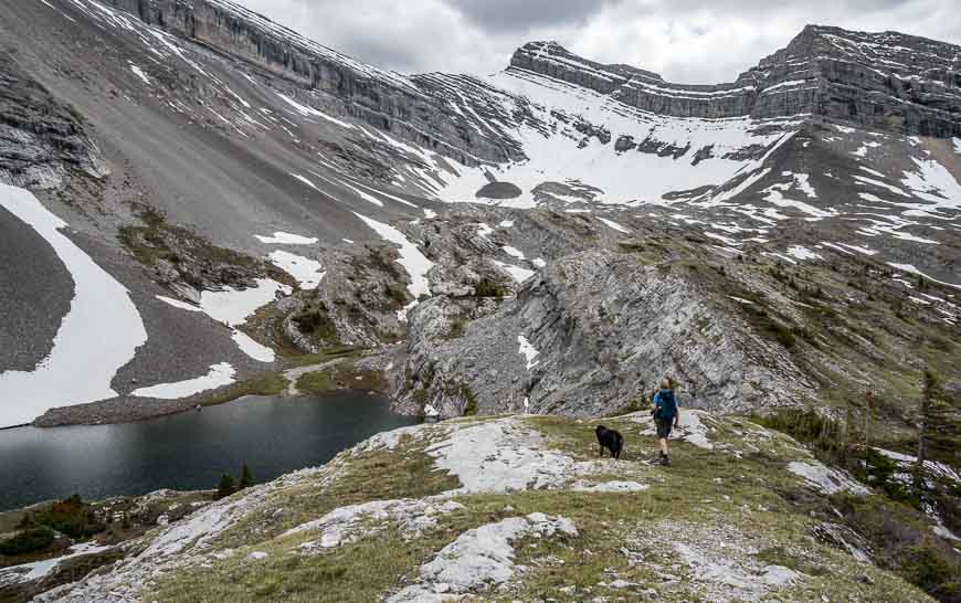
12. Sparrowhawk Tarns hike – one of the best Kananaskis hikes but route-finding can be an issue
The hike to the Sparrowhawk Tarns is lovely – but you do need a map or good directions to stay on the trail – at least initially.
After crossing the High Rockies Trail, continue up on an obvious trail. When you see a well-defined split in the trail go right. Otherwise, you’ll end up climbing the much more difficult Read’s Ridge.
Clear the forest, go right again, and pick your way up through a boulder field on a mostly obvious trail. We found it much easier coming down. If you pick the right route, you won’t have to use your hands – unless it is to steady yourself.
The boulder field climbs three ridges in total – and delivers you out by the first tarn. From here you can decide how much exploring you want to do – and retrace your steps to return to the parking lot.
Round trip distance: 10.4 km (6.5 miles)
Elevation gain: 720 m (2,362 feet)
Difficulty: Moderate
Time needed: 4 – 5 hours
Buller Pass elevation: 2400 m (7874 feet)
Map: Gem Trek Canmore & Kananaskis Village
13. Ha Ling Peak hike – one of the popular Kananaskis hikes
Ha Ling Peak is a super popular hike – but it’s not an easy one. Trail improvements have helped, but it’s one where there’s a lot of vertical over a short distance so you may be sucking wind if you haven’t hiked in a while.
It climbs a lot but with the addition of viewpoints, there are places to pull off the trail, sit back and enjoy the mountain scenery.
The final slog to the summit rewards with truly fantastic views of the Bow Valley – and Canmore below. Be careful at the top with cornices and rocks. There may be climbers below – or like last year a couple of hikers venturing out on a cornice. That was not the smartest things to do!
Round trip distance: 5.4 km (3.3 miles)
Elevation gain: 741 m (2,434 feet)
Difficulty: Moderate
Time needed: 2 – 4.5 hours depending on your fitness level and how much time you spend on top
Ha Ling Peak summit: 2407 m (7897 feet)
Map: Gem Trek Canmore & Kananaskis Village
14. Galatea Lakes hike
It’s a straightforward hike to Galatea Lake by way of Lillian Lake. The trailhead is signed and easy to find. It’s about 20 km south of Barrier Lake.
The really good hiking starts at Lillian Lake – though on the way up there are some good peek a boo views. You must climb 183 metres to reach the Galatea Lakes, but the fantastic views certainly will keep you moving. For people who have more juice in their legs there is the option to hike up to Guinn Pass.
Annual closure: The hike is closed every year from May 1 until late June.
Round trip distance: 17 km (10.5 miles) to upper Galatea Lake overlook
Elevation gain: 733 m (2,404feet)
Difficulty: Moderate
Time needed: 5 – 6.5 hours
Upper Galatea Lake Overlook elevation: 2240 m (7347feet)
Map: Gem Trek Canmore & Kananaskis Village
15. Centennial Ridge – Mt. Allan hike
I did the Centennial Ridge hike as a one-way outing starting at Ribbon Creek and finishing at Dead Man’s Flats. It was an epic kind of day – but a grand one too and well deserving of the best hikes in Kananaskis moniker.
Most people do an out and back hike, which makes the logistics way easier. It’s one of the best Kananaskis hikes for elevation gain and views.
Once you’ve found the trail (almost the crux of the hike) then you’re in for a treat once you get out of the trees. The Olympic Summit, the Mushroom Garden, some fun downclimbing all add to the experience of the hike. Views on this, the highest trail in the Rockies, are spectacular. Allow a full day to do the hike – and try to pick a day without any thunderstorms in the forecast as you’re very exposed up high.
Round trip distance as an out and back – and not descending to Dead Man’s Flats: 14.6 km (9 miles)
Elevation gain: 1,347 m (4418 feet)
Difficulty: Hard
Time needed: 7- 10 hours
Mt. Allan summit: 2819 m (9246 feet)
Map: Gem Trek Canmore & Kananaskis Village
16. Wasootch Ridge hike
The hike up Wasootch Ridge is a great early-season one as its snow free earlier than most. Access is easy – just an hour’s drive from Calgary near the turnoff to the Nakiska Ski Resort. It took us a while to find the trail (described in the link to my blog) but after we did it was straight-forward.
This is a take your breath away kind of hike because of how steep it is. Fortunately, after the first big push it modulates so its off and on steep as you climb the various bumps along the ridge. While it’s possible if you’re good at scrambling to climb the peak, most people turn back at the cairn.
Round trip distance: 11 km (6.8 miles)
Elevation gain: 1010 m (3315 feet)
Difficulty: Moderate
Time needed: 4 – 6 hours
Elevation of cairn at the end: 2130 m (6986 feet)
Map: Gem Trek Canmore & Kananaskis Village
17. King Creek Ridge Hike
If you like to be challenged, do the King Creek Ridge hike. It’s bloody steep all the way up to the ridge. This part of the hike isn’t for the novice. But once on the ridge, the hiking is positively glorious.
It’s one of the best hikes in Kananaskis as it offers a fabulous ridge walk that goes for about a kilometre, providing stupendous views in very direction. We did the hike in early June and found it to be snow free, save for the odd patch along the ridge in the shade. Some people hike it in winter, but you have to know what you’re doing and go very prepared with microspikes and warm clothing.
Round trip distance: 6.1 km (3.8 miles)
Elevation gain: 729 m (2390 feet)
Difficulty: Hard
Time needed: 4 – 5 hours
Pass elevation: 2580 m (8462 feet)
Map: Gem Trek Kananaskis Lakes
18. Piper Pass hike
The Piper Pass hike is not well known and yet it’s one of the best Kananaskis hikes. John and I did it as a day hike from the Tombstone Campground, but with an early start its totally doable from the parking lot on Highway 40. There is no signage on the trail but once you find it, the way forward is obvious.
There are a couple of easy stream and river crossings, a jaunt through a meadow and then some easy hiking on a gentle grade through the forest to arrive in the sub-alpine. Once you’re there, the views are expansive and the sense of space huge.
In short order, you see Piper Pass off in the distance beyond a giant boulder. Enjoy the wildflowers as you make your way over to the one final climb – a hot one so take lots of water on this hike.
Total distance from the trailhead on Highway 40: 24 km or 14.2 km return from the Tombstone Campground
Elevation gain: 617 m (2024 feet) from the parking lot
Time needed: 7-8 hours as a day-hike; allow 5-6 hours return from the Tombstone Campground
Pass elevation: 2580 m (8462 feet)
Map: Gem Trek Kananaskis Lakes
What to take on the best Kananaskis hikes
There are a few things I’d recommend, some for pleasure and some for comfort.
For wildflower aficionados, I’d recommend Popular Wildflowers of Alberta and the Canadian Rockies on the hike.
Take a sun hat in summer and lots of sunscreen. Don’t forget to pack extra high energy or protein bars.
I like to take water purification tablets in case I run out of water and need a drink before I reach the car.
And to make the lunch time stop more comfortable on any of the best Kananaskis hikes, I’m a big fan of inflatable seat cushions.
Would you prefer to go backpacking in Kananaskis?
I have done all the backpacking trips described below in Kananaskis Country. The hardest was the Northover Traverse and the easiest one that’s perfect for families was Elbow Lake.
- Northover Ridge Loop Hike in Kananaskis
- The Hike to Three Isle Lake & South Kananaskis Pass
- North to South Kananaskis Pass Hike via Turbine Canyon
- Little Elbow Hike to Mount Romulus Campground
- Tombstone Lakes Hike & Camping Trip in Kananaskis
Click on the photo to bookmark to your Pinterest boards.