10+ Must Do Backpacking Trips in Kananaskis Country
The Rocky Mountain National Parks including Banff, Jasper, Yoho and Kootenay are not the only places with mind-blowing backpacking experiences in the Canadian Rockies. Head to Kananaskis Country and check out this range of amazing backpacking trips that will appeal to everyone from first time backpackers to families to seasoned backpackers who are comfortable on airy ridge hikes like the Northover Traverse.
For those of us that live in the Calgary – Canmore corridor, most of the trailheads are just 60 to 90 minutes away. And many of the campsites you’ll want to book are easier to score than the ones in national parks. Most too have been revamped and offer better facilities than the national parks. A case in point is the awful Baker Lake campground in Banff National Park. You won’t find many like it when you’re on one of the backpacking trips in Kananaskis Country.
I have done all of the backpacking trips in Kananaskis described below. Campsites can be booked 90 days out – and most open between May 15 and June 15th and stay open until sometime in October.
You might also like: 10+Best Backpacking Trips in Banff National Park
This post includes some affiliate links. If you make a qualifying purchase through one of these links, I will receive a small percentage of the sale at no extra cost to you. Thank you very much for your support.
Would you like to save this?
Summary of the must do overnight backpacking trips in Kananaskis Country
Best time to hike: The best time to do most of the backpacking trips in Kananaskis (save for the lower elevation ones in Elbow Sheep Wildland Provincial Park) is from late June until September. Snow often sticks around into late June and early July, so go prepared with warm clothes, especially after the sun goes down.
Dogs: Permitted on a leash though not recommended on the Northover Traverse. There are good water sources on most hikes, but it’s always a good idea to carry extra water for them.
Bears: Carry fast to access bear spray and make lots of noise especially if you see fresh bear scat. We have seen steaming bear scat on the hike out from Elk Lakes and heard a grizzly in the woods near the headwall on the way to Three Isle Lake. Be sure to use the bear lockers and keep a clean camp. More tips on staying safe in bear country in this post.
Permit: You will need a Kananaskis Conservation Pass to do any of the backpacking trips in Kananaskis Country. If you’re planning to hike more than six times in a year in Kananaskis Country, consider purchasing the yearly pass for $90, good for two vehicles at the same address. A day pass is $15 for one vehicle.
Don’t forget: Be sure to tell someone where you are going, follow Leave No Trace principles and pack the hiking essentials.
Trail reports: As trail conditions can change on short notice, be sure to check out Alberta Parks trail reports.
Remember: You are responsible for your own safety. Go prepared with the right gear and know how on all backpacking trips in Kananaskis.
Heading to British Columbia? You might like 21 Best Backpacking Trips in BC

Booking campsites in Kananaskis Country
You can make online reservations for backcountry campgrounds 90 days in advance of your visit. For example, on March 5 reservations are booking up to June 3rd.
If you’re having trouble getting backcountry reservations – particularly at the more popular campsites, then check out either Campnab or Schnerp. Both companies continuously scan for cancellations and then let you know instantly if the one you’re after has opened up.

Location map of the must-do backpacking trips in Kananaskis Country
Backpacking trips in Elbow-Sheep Wildland Provincial Park, Kananaskis
Tombstones Lakes hike from Elbow Lake Day-Use Area
Trailhead: Two options – Elbow Lake Day-use area parking lot on Highway 40 and the Big Elbow Trail/Little Elbow Trail from Little Elbow Trailhead parking off Highway 66.
Campground location: Lat: 50.675607 Long: -114.973031
Opening dates: June 15 – November 30
Distance: 7.3 km one way from Elbow Lake, and 30.7 km from the Little Elbow trailhead.
Elevation gain: 125 m from Elbow Lake, or 650 m from Little Elbow trailhead.
Level of difficulty: Easy from the Elbow Lake Day-use area and hard from the Little Elbow trailhead because of the distance.
Map: Gem Trek Kananaskis Lakes map
Facilities: 11 campsites, pit/vault toilets, bear lockers, sitting area with benches, picnic type tables, firewood and firepits.
Side trips from the campground: Rae Lake hike, detour to Edworthy Falls, and Piper Pass hike
Experience: It’s a beautiful hike and an easy one to reach the Tombstone Lakes campground from Highway 40. After a short but steep climb to Elbow Lake, follow a gently rolling road with beautiful views to a T-junction at the end of the road. Go left and descend before following a road-like trail across the Elbow River Bridge. In just a few minutes reach the spacious and well-appointed campground in the woods.
I highly recommend the detour to Edworthy Falls – a great place for lunch on a hot day. The final descent to the falls is a steep one – so be careful.
After claiming a campsite and setting up your tent continue for 75 – 90 minutes (return) up to stunning Tombstone Lake. It’s also the perfect after dinner hike.


Mount Romulus
Trailhead: Little Elbow trailhead parking
Campground location: Lat: 50.761820 Long: -114.988820
Opening dates: May 15 – November 30
Distance: 11.9 km one way
Elevation gain: 175 m
Level of difficulty: Easy
Map: Gem Trek Kananaskis Lakes map
Facilities: 10 campsites, secure food storage, pit/vault toilets, firewood and firepits, hitching rails.
Side trips from the campground: It’s 8.8 km one way to Tombstone Lakes or you can make a loop and stay at Big Elbow Campground one night. You could also do a day hike to Talus Lakes.
Experience: It’s an easy stroll primarily along a fire road with the Elbow River running roughly parallel to it. This backpacking trip combines well with Big Elbow and is a great introduction to backpacking. And it’s a pretty hike too – with a mix of forest, river, and mountain views.

The hike to Big Elbow Campground
Trailhead: Little Elbow trailhead parking
Campground location: Lat:50.723768 Long: -114.859643
Opening dates: May 15 – November 30
Distance: 8.3 km
Elevation gain: Approximately 172 m
Level of difficulty: Easy
Facilities: 10 campsites, secure food storage, pit/vault toilets, firewood and firepits, hitching rails.
Map: Gem Trek Bragg Creek and Sheep Valley
Side trips from the campground: It’s 12.2 km one way to Tombstone Lakes or make a loop and stay at Romulus Campground the second night.
Experience: It’s a scenic easy hike via an old access road to the Big Elbow Campground – and you won’t find a lot of elevation gain. Enjoy views of Banded Peak and Threepoint Mountain. There is also a backcountry equestrian campground nearby.


Backpacking trips in Don Getty Wildland Provincial Park, Kananaskis Country
Backpacking to Carnarvon Lake
Trailhead: Cat Creek Recreation Area
Approximate campground location: Lat: 50.373552 Long: -114.812488
Opening dates: Once the snow has left and you can ford the Highwood River – usually in mid-late July until mid-September.
Distance: 10.2 km one way.
Elevation gain: 857 m
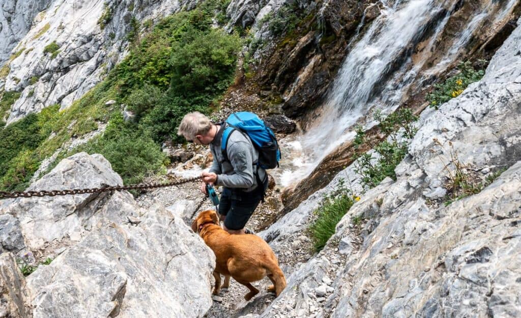
Level of difficulty: Easy to the chain section and then very difficult up the face for some.
Facilities: None. No reservations are required. Up to 20 campers have stayed the night here. Use existing flat spots. Bring a bear resistant ursack and hang your food.
Map: Gem Trek Highwood & Cataract Creek
Side trips from the campground: Mount Strachan, Mount Muir, and Carnarvon Peak on the way up Mount MacLaren.
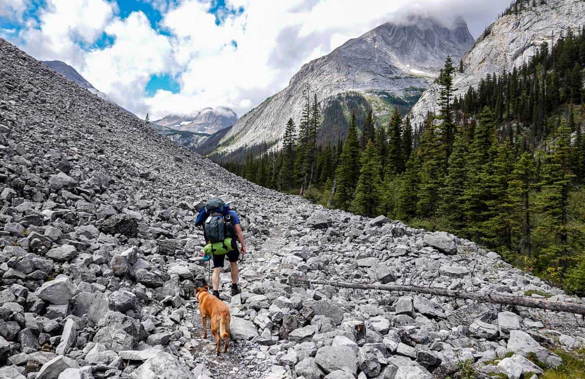
Experience: You can do a long day hike up to Carnarvon Lake though most people backpack in for a night or two. Take the Highwood River crossing seriously and don’t go too early in the season as the water will be cold, deep and fast. We went the end of July and had no problems whatsoever.
The chain sections isn’t hard if you’ve done that sort of thing, but many people will be uncomfortable. I wouldn’t recommend taking your dog. Carnarvon Lake itself is a beauty – and has been called by some the most beautiful lake in Kananaskis. You’ll have to be the judge.
Backpacking trips in Peter Lougheed Provincial Park, Kananaskis Country
Backpacking to Elbow Lake
Trailhead: Elbow Pass Day Use Area off Highway 40 (accessible from June 15 – November 30th)
Campground location: Lat: 50.637443 Long: -115.009242
Opening dates: June 15 – November 30
Distance: 1.3 km one way
Elevation gain: 125 m
Level of difficulty: Easy and family friendly.
Facilities: 15 campsites, pit/vault toilets, bear lockers, sitting area with benches, picnic type tables, firewood, fire pits
Map: Gem Trek Kananaskis Lakes map
Side trips from the campground: Rae Glacier, Edworthy Falls, Piper Pass, Rae Lake
Experience: This is one of the easiest backpacking trips in Kananaskis and a great one to do with younger kids. It’s a short though steep walk through the woods up from the parking lot beside Highway 40 to reach the Elbow Lake Campground. Fast hikers will be there in 20 minutes but it you’ve got little people it might take an hour. Once up at the campground there’s lots of exploring to do around the emerald green lake.

Point Campground
Trailhead: North Interlakes Day Use Area
Campground location: Lat:50.627449 Long: -115.178892
Opening dates: Open year round
Distance: 3.4 km one way
Elevation gain: 25 m
Level of difficulty: Easy and family friendly.
Facilities: 20 campsites, pit/vault toilets, bear lockers, sitting area with benches, picnic type tables, firepits, firewood available.
Map: Gem Trek Kananaskis Lakes map
Side trips from the campground: Forks Campground, Rawson Lake
Experience: You can hike or paddle over the Point Campground. It’s a easy hike, but if the wind picks up like it did for us, it can be a tough paddle even for the short distance.
There are two trails that head to the Point Campground – parallel to each other, all starting beside the dam. One is higher and offers some views while the other keeps you closer to the water. It’s only about an hour’s hike to reach the turnoff to the Point Campground. Have a good look around as some of the campsites are particularly private with some nice water views.

Backpacking to the Forks Campground in Kananaskis Country
Trailhead: North Interlakes Day-use Area
Campground location: Lat: 50.634741 Long: -115.232454
Opening dates: June 15 – November 30th
Distance: 7.3 km one way
Elevation gain: 100 m
Level of difficulty: Easy
Facilities: 20 campsites, bear lockers, pit/vault toilets, benches, picnic tables.
Map: Gem Trek Kananaskis Lakes map
Side trips from the campground: Three Isle Lake, Turbine Canyon, Point Campground
Experience: I think the Forks Campground makes a fine backpacking destination in itself – especially for families with kids that are in the 8 – 12-year age range.
The trail is well signed from its start at the North Interlakes Day-use area. The trail is scenic too, passing the Palliser rockslide and a rockslide at the base of Mount Lyautey. There are several creek and river crossings including Invincible Creek and the Kananaskis River. The last part of the hike on the way to the Forks Campground includes numerous boardwalk sections.
Turbine Canyon – North Kananaskis Pass
Trailhead: North Interlakes Day-Use Area
Campground location: Lat:50.686718 Long: -115.275096
Opening dates: June 24 – November 30
Distance: 15.1 km one way
Elevation gain: 525 metres
Level of difficulty: Moderate
Map: Gem Trek Kananaskis Lakes map
Facilities: 15 campsites, pit/vault toilets, bear lockers, sitting area with benches, picnic type tables, but no fires allowed.
Side trips from the campground: Haig Glacier, North Kananaskis Pass – or part of a loop that includes Beatty Lake, South Kananaskis Pass and Three Isle Lake.
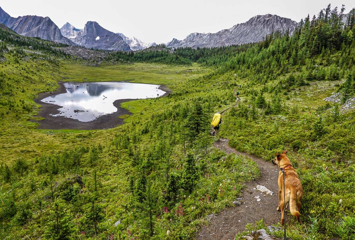
Experience: From the Forks Campground start climbing, steeply at times to reach swaths of larches at treeline. The extensive larch section would be magnificent in fall.
Continue up via switchbacks to reach a saddle overlooking Putnik Pond. From here the grade moderates as you make your way north towards Lawson Lake – and ultimately the Turbine Canyon Campground. Enjoy beautiful mountain views, streams, and meadows along the part of the hike. Tent sites are scattered throughout the forest north of Maude Creek.

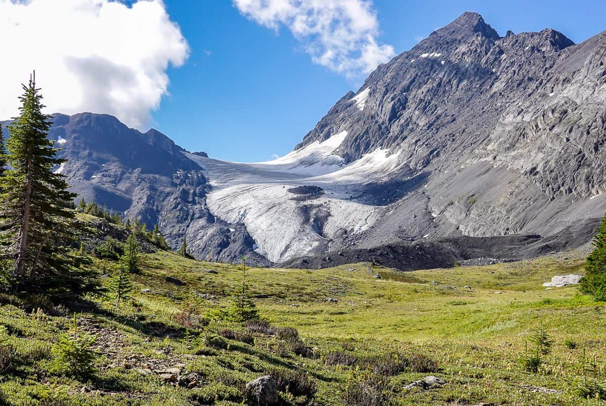
Three Isle Lake – one of the harder backpacking trips in Kananaskis
Trailhead: North Interlakes Day-use Area
Campground location: Lat:50.630093 Long: -115.267343
Opening dates: June 24 – November 30
Distance: 10.3 km one way
Elevation gain: 500 m
Level of difficulty: Hard because of the steep elevation gain on the headwall.
Map: Gem Trek Kananaskis Lakes map
Facilities: 16 campsites scattered across two separate loops, pit/vault toilets, bear lockers, picnic type tables. No fires here.
Side trips from the campground: South Kananaskis Pass and Beatty Lake in BC would be good choices.
Experience: It’s an easy hike to reach the Forks Campground, a good place to enjoy lunch and refill water bottles. From there the next few kilometres are still easy, though there is some elevation gain. It’s the steep headwall that makes Three Isle Lakes a tough hike, especially while wearing a backpack. Enjoy far-reaching views before continuing up at a lesser grade to reach the first of the campsites in the forest. The next set of campsites are another half a kilometre away – and don’t appear from my few visits to be as well-used.
If you elect to do the Northover Traverse, you will want to stay here either the first night or after you’ve descended from the ridge.


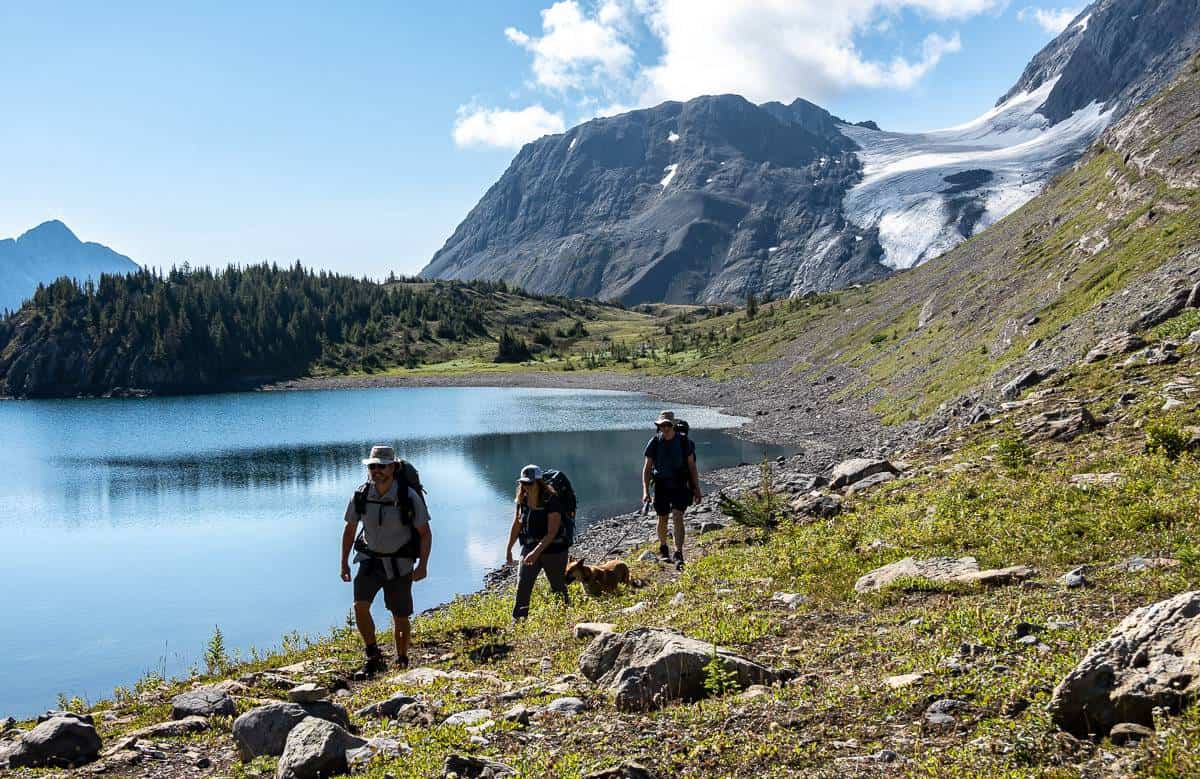
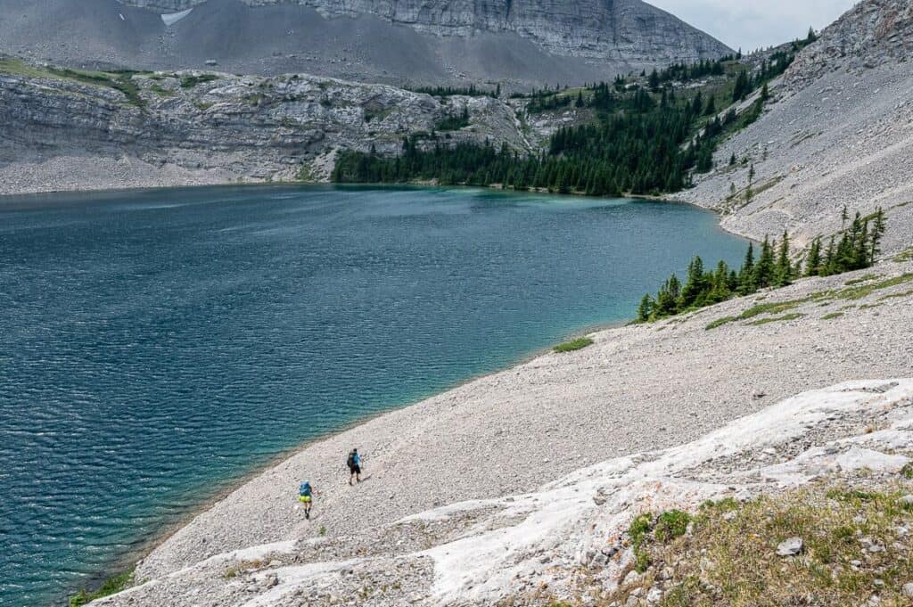
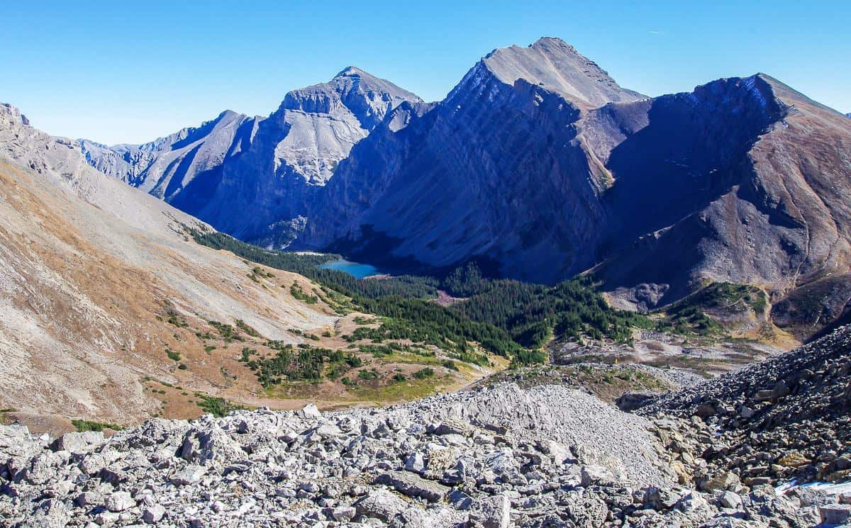
Northover Traverse via Aster Lake (and Three Isle Lake Campgrounds)
Trailhead: Upper Kananaskis Day-use area
Campsite location for Aster Lake: Lat: 50.580097 Long: -115.204170
Opening dates: June 24 – November 30 but the Northover Traverse is best done in August and early September. You want the snow to be gone!
Distance: 10.8 km one way to the Aster Lake Campground via an unmaintained trail as part of a 33.7 km loop.
Elevation gain: 550 m – and 1,180 m in total on the Northover Ridge loop.
Level of difficulty: Hard with exposure. Do not do in bad weather especially thunderstorms.
Map: Gem Trek Kananaskis Lakes map
Facilities: 6 campsites at Aster Lake, pit/vault toilets, secure food storage. No fires permitted. Great campsite. Very scenic.
Side trips from the campground: None
Experience: I backpacked the Northover Loop in Kananaskis in early August 2024. I was told by someone who runs the trail every year to head for Aster Lake first though I saw lots of people doing it the other way. There’s some massive exposure on the ascent on the east wall of the lower scree slopes of the west face of Mt. Sarrail Ridge. And Northover Ridge itself is shoulder width wide for long stretches, so its no place for people without loads of hiking experience.
It is a magnificent trip for seasoned hikers with incredible and world-class mountain views, especially on the ridge.
The snow needs to be gone for it to be safe to either ascend to Aster Lake or descend from it.


Lillian Lake backpacking
Trailhead: Galatea Day-use Area on Highway 40.
Campsite location: Lat:50.863738 Long: -115.252657
Opening dates: June 29 – November 30
Distance: 6.0 km one way
Elevation gain: 475 m
Level of difficulty: Easy to moderate.
Map: Gem Trek Canmore and Kananaskis Village
Facilities: 17 campsites including some that are raised tent platforms, pit/vault toilets, bear lockers, sitting area with benches, picnic type tables, firewood, fire pits.
Side trips from the campground: Galatea Lakes and Guinn Pass. In theory even Ribbon Lake.
Experience: The backpacking trip to Lillian Lake in Kananaskis Country is one of the easier ones – but it is less interesting hiking until you reach Lillian Lake. It’s a straightforward trail that begins after you cross the suspension bridge over the Kananaskis River. There are numerous small bridges you must cross – all in the forest with some occasional great peak-a-boo view.
Once you reach Lillian Lake the scenery gets much more interesting. The lake is a great overnight destination as it allows you to explore the beautiful Galatea Lakes and Guinn Pass without a heavy backpack.

Elk Lakes and Petain Basin in Elk Lakes Park, BC
Trailhead: Elk Pass trailhead parking lot in Peter Lougheed Provincial Park
Opening dates: Year round
Distance: 9.2 km to Lower Elk Lake Campground in British Columbia.
Elevation gain: 185 m to Upper Elk Lake (followed by an easy descent to Lower Elk Lake)
Level of difficulty: Easy
Cost: First come, first served camping. You can register online or self-register in Elk Lakes Park. Bring cash – small bills. It’s $5 per night per person.
Map: Gem Trek Kananaskis Lakes map
Facilities: 10 wilderness campsites though there seemed to be more like 15 – 20 campsites when I was there, pit toilets, food cache, fire rings, benches
Side trips from the campground: Petain Falls and Petain Basin (a full day hike), Viewpoint Trail, Fox Lake Trail.
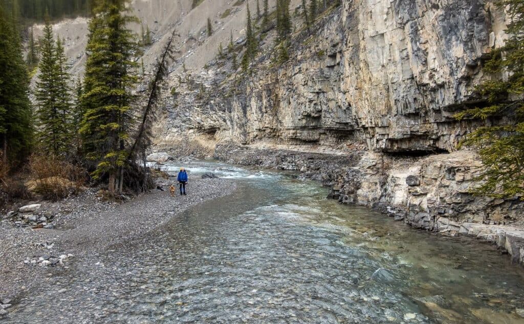
Experience: Of all the backpacking trips described, this is the only one that starts in Kananaskis Country but ends at a campsite in British Columbia. From the Elk Pass parking lot follow Powerline Road, cross over Fox Creek, and continue towards Elk Pass on the BC-Alberta border.
At the border we headed for Fox Lake and from there it’s only 3.5 km, mostly downhill to reach a signed T-junction pointing to the campground one km distant. The Elk Lakes are beautiful as is the hike to Petain Falls.
The campground is first come, first served and most people drive up from Sparwood and the enjoy a super easy walk in. Get there in plenty of time to nab a campsite.


Backpacking trips in Spray Valley Provincial Park, Kananaskis Country
Ribbon Falls
Trailhead: Ribbon Creek Day-use area in Evan Thomas Provincial Precreation Area
Campsite location: Lat:50.892203 Long: -115.229125
Opening dates: June 15 – November 30
Distance: 10.4 km one way (longer than what the Alberta Parks website suggests)
Elevation gain: 375 m
Level of difficulty: Easy
Map: Gem Trek Canmore and Kananaskis Village
Facilities: 10 campsites, pit/vault toilets, near lockers, sitting area with benches, picnic type tables, firewood, and fire pits.
Side trips from the campground: Ribbon Falls, Ribbon Lake
Experience: This is one of the longer backpacking trips in Kananaskis – but it’s still an easy one as there isn’t much elevation gain. It’s a great one to do on a hot day as you parallel the river, so there are lots of opportunities for you and your dog to cool off.
From the parking lot at Ribbon Creek, you simply follow Ribbon Creek, crossing 7 or 8 bridges as you make your way up Ribbon Valley. You will pass a turnoff to Memorial Lakes – a worthwhile hike – and another one where you can wild camp near the first of the lakes in Bow Valley Wildland Provincial Park.
If you’re feeling adventurous you could do the 2 km one way side trip to Ribbon Lake – but there’s a steep chain section you’ll have to negotiate.


Ribbon Lake
Trailhead: Ribbon Creek Day-use area in Evan Thomas Provincial Recreation Area or from Galatea Lakes or alternatively from Buller Pass.
Campsite location: Lat:50.886506 Long: -115.248081
Opening dates: June 24 – November 30
Noteworthy: There is a very steep section with chains to help with the climb between Ribbon Falls and Ribbon Lake. If you want to avoid this, choose one of the other access trails.
Distance: 10.8 km one way from both the Ribbon Creek trail and the Galatea Day-use area OR 10.1 km or from the Buller Mountain Day-use Area via the Buller Pass Trail.
Elevation gain: 625 m from the Ribbon Creek trail, 870 m from the Galatea Day-use parking lot, 670 m via Buller Mountain Day-use area.
Level of difficulty: Moderate to difficult
Map: Gem Trek Canmore and Kananaskis Village
Facilities: 20 campsites, pit/vault toilets, bear lockers, sitting area with benches, picnic type tables, firepits and firewood.
Side trips from the campground: Guinn Pass, Ribbon Falls – depending on what your entry point is.
Experience: Ribbon Lake, located high above Ribbon Creek, offers outstanding views of the surrounding peaks. It’s an easier one to snag a reservation as it’s one of the tougher backpacking trips in Kananaskis.
If you don’t want to do the steep chain section after Ribbon Falls, then you’ll have to come in via Galatea Lakes and Guinn Pass which will get your heartrate up or via Buller Pass, the easiest of the three options.
Backpacking trips in Bow Valley Provincial Park, Kananaskis Country
Jewell Bay Backcountry Campground
Trailhead: Barrier Dam Day-use area
Campsite location: Lat: 51.023576 Long: -115.082083
Opening dates: June 16 – April 14 (closed for elk movement for two months)
Distance: 3.9 km
Elevation gain: Minimal.
Level of difficulty: Easy
Maps: Gem Trek Canmore and Kananaskis Village
Facilities: 11 campsites, pit/vault toilets, bear lockers, sitting area with benches, picnic type tables, firewood, fire pits, hitching rails and horse corrals.
Side trips from the campground: Prairie View – Jewell Pass and Yates Mountain (Barrier Lake Fire Lookout).
Experience: The pretty Jewell Bay backcountry campground located on the northwest shore of Barrier Lake can be accessed on foot via the Stoney Trail from the Barrier Dam Day-use Area, by bike or even by boat.
The campsite is very close to the trail that comes down from Jewell Pass. The hike to get to the campsite may not be as wild and pretty as others, but it’s another great one for families and the lake is usually an alluring turquoise- blue.


What to take on backpacking trips in Kananaskis Country
Consider carrying a Garmin InReach Mini in case you ever run into trouble.
Even in the middle of summer I would recommend packing a down sweater like this one from Patagonia.
You’ll need sunscreen and insect repellent on many of the hikes in summer.
I suggest carrying a gear repair patch kit in case anything ever goes wrong with your tent, sleeping mat, coat, etc.
Don’t forget a sun hat with a brim and a bandana that you can soak in cold water to cool off.
Carry water purifying tablets and if you’re with a group consider having someone carry a gravity water filter.
Click on the photo to bookmark your Pinterest boards.


