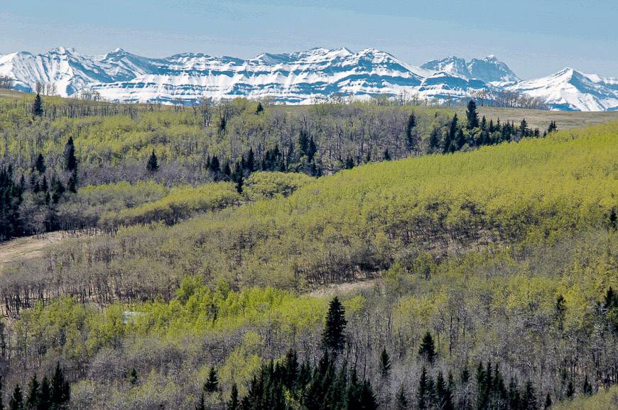
Looking for some new Alberta hikes that not everyone knows about? Over the years, I have explored some of the less well-known areas of the province and discovered numerous Alberta hikes that aren’t very popular – yet.
On some, I’ve barely seen a soul and on others there’s been moderate traffic. While a couple of these Alberta hikes aren’t as drop-dead gorgeous as the popular ones you’ll find in the Lake Louise area or even Kananaskis Country, they’re still worthy of your time.
I’ve come away delighted with my new Alberta hikes finds and hope you enjoy exploring some of the less well-loved areas of Alberta. Before you head off on any hike, check trail reports for closures. Be sure to take the 10 hiking essentials on all hikes. And don’t forget the bear spray, even on a late season hike.
This post includes some affiliate links. If you make a qualifying purchase through one of these links, I will receive a small percentage of the sale at no extra cost to you. Thank you very much for your support.
Approximate location of 12 lesser known Alberta hikes
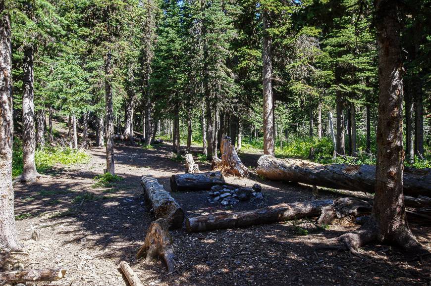
1. Alberta hikes in Kananaskis Country: Edworthy Falls
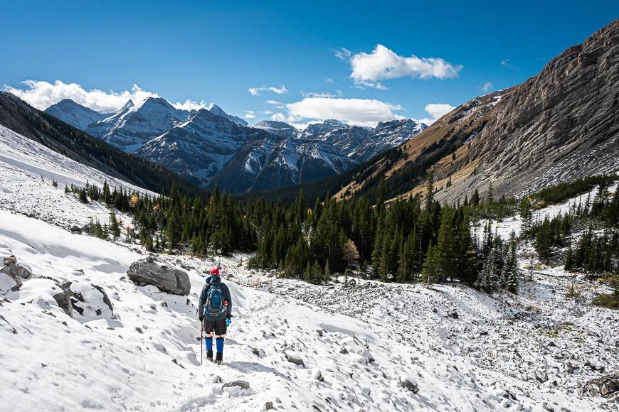
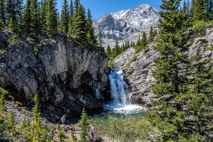
The hike to Edworthy Falls is one of the Alberta hikes that can only be done between June 15th and November 30th when the road to Highwood Pass (Highway 40) is open. Park at the trailhead for Elbow Lake. After the stiff 30 – 40-minute hike up to the lake, the rest of the 9.7 km return hike is easy, especially as there is only 175 m of elevation gain in total.
To continue to Edworthy Falls, follow the trail on the left or west side of Elbow Lake. Cross a bridge over the outlet stream, 600 m past the Elbow Lake Campground and go left on an old road (Big Elbow Trail) for a further 2.4 km. The landscape in this section is incredibly beautiful. I found myself always wanting to see what was around the next corner.
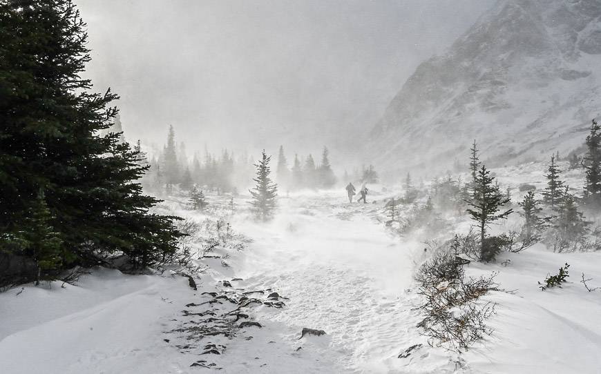
When we did the hike in November, it was easy to find the side-trail to the falls because of the unusually large number of hikers. Look for flagging in the bushes and a small cairn on your left, just after crossing a meadow.
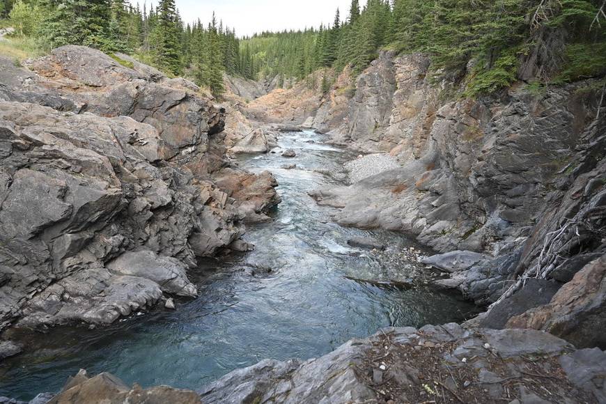
There’s a narrow and obvious trail into the trees with stellar views of the falls. Be warned though. It’s a steep descent to the base of Edworthy Falls. If there’s snow and ice, I highly recommend that youwear icers.
Edworthy Falls plunges 20 m into a pool of turquoise-coloured water. It was frozen when we were there in November.
You can continue past the turnoff to the falls on an obvious trail. In the summer, Tombstone Campground run by Alberta Parks is less than a kilometre away – and you will have passed the kid-friendly Elbow Lake Campground when you reach Elbow Lake. Both are popular so reserve 90 days in advance of your desired date.
Two other excellent Alberta hikes in the area are Rae Lake and Piper Pass.
2. Alberta hikes near Calgary – Ann and Sandy Cross Conservation Area>
The Ann and Sandy Cross Conservation Area is a year-round destination easily accessed from south Calgary. The conservation area protects 4,800 acres of rolling foothills thanks to a large donation beginning in 1987 by Sandy Cross, the son of one of the four founders of the Calgary Stampede. As of January 1, 2020, you do have to pay $10 to park your car. Dogs are not allowed.
You’ll find 20 km of hiking trails (they can be used for snowshoeing in winter BUT not cross-country skiing), most of which are family friendly. Good choices include the 4.8 km Fescue Trail, the 8.6 km Paradise Trail and the 2.2 km Mountain Lookout Trail.
The hiking trails take you through swaths of native fescue grassland, past stands of aspen trees. Over 400 plant types have been identified on the property. It’s also home to a robust population of animals including black bear, elk, moose – and even cougars so don’t forget the bear spray.
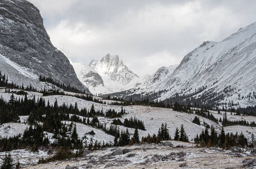
3. Dyson Falls hike, Sheep River Provincial Park
The Dyson Falls hike is a pretty one in spring when the wildflowers make an appearance or in fall when the trees burst into colour. The 9 km out and back hike starts at the Indian Oils parking lot west of Turner Valley. There are washrooms here.
Start by crossing the bridge over beautiful Tiger Jaw Falls. The views down the canyon are fantastic. as you can see in the photo below. After the bridge, take the first left and follow an old logging road as it gently climbs for 300 m. It’s mostly a non-descript hike along the road – but in some seasons you’ll see wildflowers and buffaloberries. Arrive at Dyson Falls in about 75 minutes.
Dyson Falls are in a pretty location – and the perfect spot for a snack or picnic. Retrace your steps to the parking lot. Allow 2.5 – 3 hours for the return hike. As Alberta hikes go, this one is great for families.


4. Alberta Hikes: Whaleback Ridge hike off the Cowboy Trail
Don’t hike the Whaleback Ridge if you need signed trails and washrooms. There are trails but you must have a nose for navigation to enjoy your time here. However, if you love exploring and hiking new areas with hardly a soul around, then it’s definitely worth doing. As Bill Corbett, (author ofDay Trips from Calgary) says “the Whaleback is Canada’s largest and healthiest montane landscape, characterized by a relatively dry climate and a patchwork of grassy slopes and dense forest.”
To get to the “trailhead” look for a pullout 4 km south of Secondary Road 520 and 30 km from the junction of Highway 22 (the Cowboy Highway) and Secondary Road 533.
You’ll find a more detailed though I admit still somewhat vague route description in this post – Hiking the Whaleback Ridge off the Cowboy Trail.
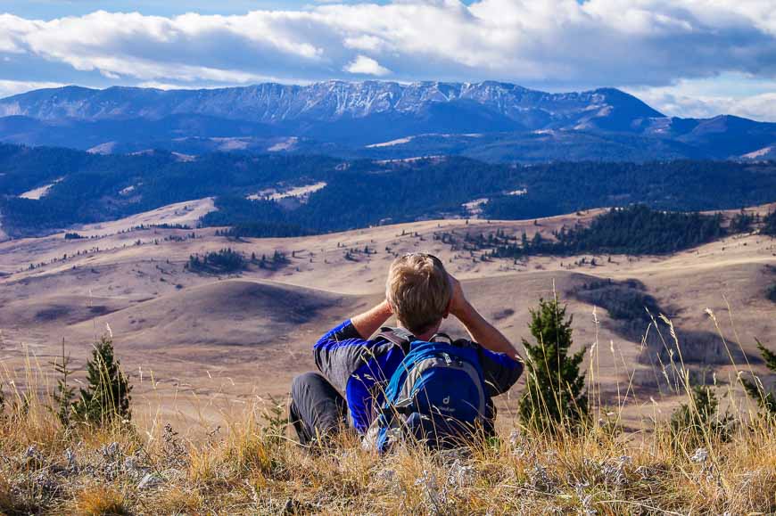
Once you hike up to the 30 km long Whaleback Ridge, enjoy superb views of the Bob Creek Valley and the foothills of the Rocky Mountains. Take bear spray as the area is home to wolves, grizzly bears, cougars, and a large herd of elk.
This is one of the Alberta hikes that will appeal to adventurous people who like route finding.


5. Alberta hikes: Window Mountain Lake in Alberta’s Crowsnest Pass area
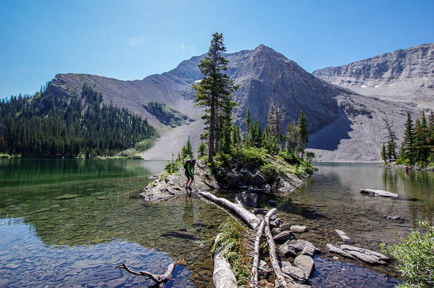
The hike to Window Mountain Lake, set in a spectacular rocky amphitheatre, is a beauty in summer. On arrival at the lake – after all of an hour of hiking, relax at a primitive campsite (first come, first served), go for a swim, fish or walk around the entire lake on an easy-to-follow trail. Come August, the wildflowers are outstanding.
It’s one of the easier Alberta hikes save for the initial steep 150 m climb. All told it’s only 4 km return with a mere 210 m of elevation gain. You may have to hike a bit further if you don’t have a high clearance vehicle.
Access is via Allison Creek Road, 4 km west of Coleman. Take it until it becomes Atlas Road – and stay on it for another 13.7 km. Then look for a road entering from the left – Window Mountain Lake Road. It can be rough, especially after the first kilometre. We parked at the junction and walked an extra 2 km to the trailhead, but most people drive at least a km up the road.
Read: 5 Best Crowsnest Pass Hikes
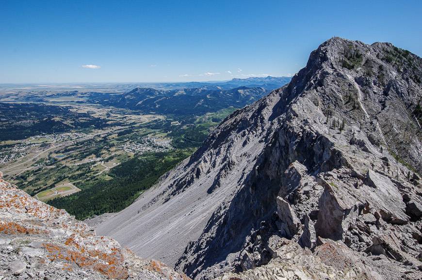
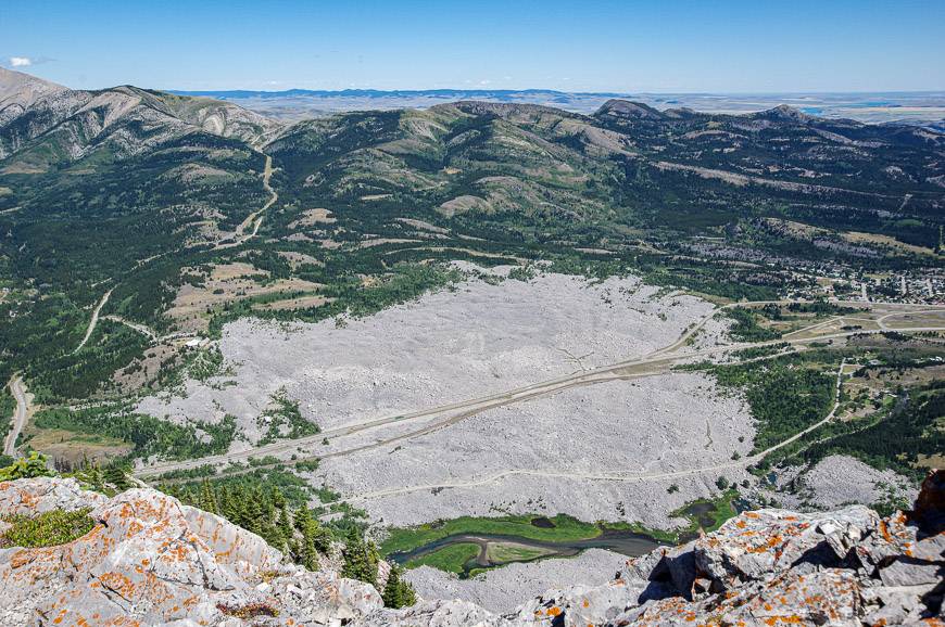
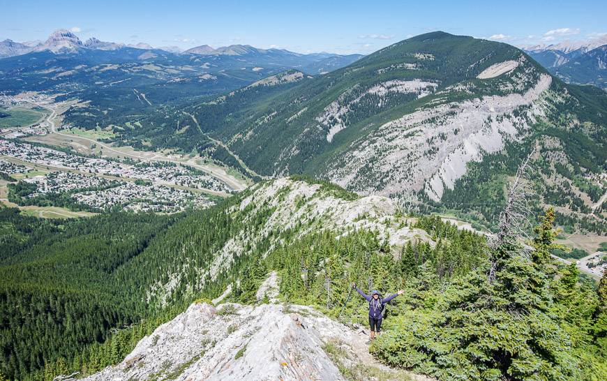
6. Turtle Mountain hike, Crowsnest Pass
Hike Turtle Mountain in the Crowsnest Pass area if you want to see where the Frank Slide, Canada’s second largest landslide started. It’s 3.1 km one way with an elevation gain of 780 m.
It’s one of the steeper Alberta hikes, particularly at the start of it but there are several points along its length where it moderates. The trail isn’t formally marked but it’s obvious – at least when the weather is clear. There is the option to scramble through broken rock to South Peak, the high point on Turtle Mountain. But to do it requires about an hour each way, even though it looks close.
Once at the top looking down to the highway, you may feel a certain tension. At some point the mountain is expected to be part of another landslide, but at least there’s monitoring equipment in place that should provide a warning.
The trailhead for Turtle Mountain is accessed via Blairmore off of Highway 3. Turn onto 133rd Street in Blairmore, then left at 18th Avenue, and right on 135th Street. At the T-intersection with 15th Avenue turn right again and continue for a block. Finally take the dirt road leading left across from the cul-de-sac and follow it for about 400 m. Park at the top of the dip. It will take only about 5 minutes after you’ve left the highway.
The trailhead is marked by painted yellow rocks near the base of the cliff. It is accessed by walking down the dip and then up the short, steep hill on your right.
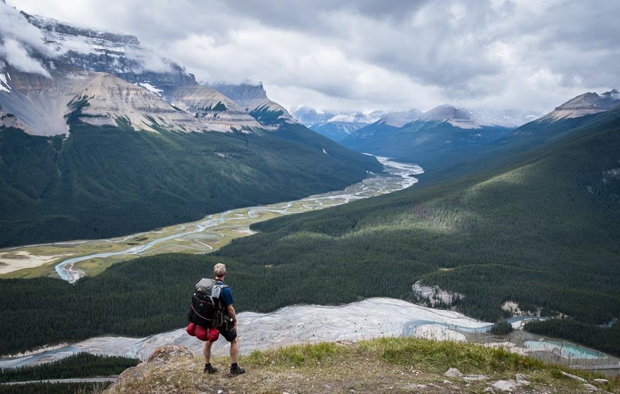
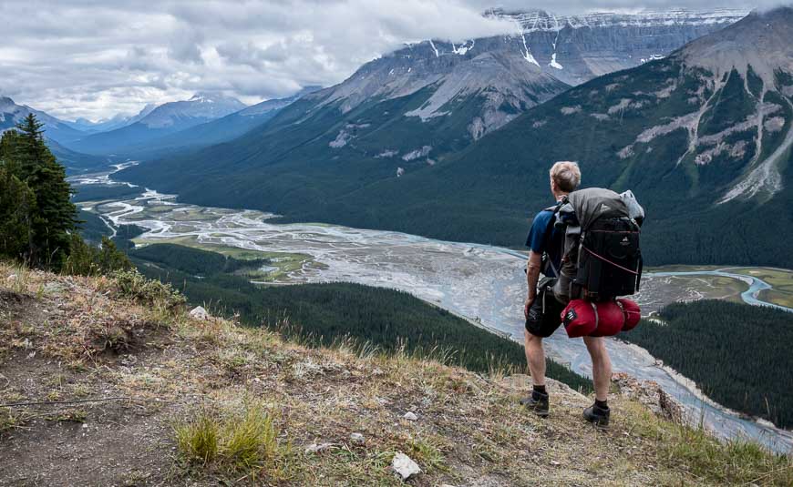
7. Alberta hikes: Sunset Lookout hike in Banff National Park
The hike to Sunset Lookout is 4.5 km long with an elevation gain of 553 m one way. It’s one of the best Alberta hikes for views!
At the 2.9 km mark, 370 m up from the parking lot you reach a signed junction. Another way of knowing you’re getting to the turnoff is to count switchbacks – all 35 of them! Go left. From there, the trail climbs a further 183 m over 1.6 km. The reward is the view at the very end of the hike.
The vistas up and down the North Saskatchewan River along Icefields Parkway are glorious. And if you’re like us, you won’t have to share them with anyone. We didn’t see a single soul on the hike!
The trailhead isn’t signed on Highway 93 but you’ll find it here on Google maps. From Saskatchewan River Crossing, the parking lot is about 16.4 km north along the Icefields Parkway.
Read: Sunset Pass and Sunset Lookout Hike on the Icefields Parkway
8. Wind Ridge Pass hike – one of the lesser-known Alberta hikes
The Wind Ridge Pass trail is an excellent choice if you live in Calgary since access is via Dead Man’s Flats, before you even reach Canmore.
It’s a workout – 13.9 km return with 775 m of elevation gain – and some of that is bloody steep. It will take you 4 – 6 hours in total if you go all the way to the end of the ridge. I recommend doing that for the panoramic vistas.
The trail is gaining in popularity but it’s still quieter than many close to Calgary. A lot of people stop short of the one tricky section that requires a 30 second scramble. Fortunately, the views are still pretty darned good.
If you check out my blog post on the hike – The Wind Ridge Trail near Dead Mans’s Flats, you’ll also find a link to an inspiring Pink Floyd music video, taken on the ridge along with full details of the hike.


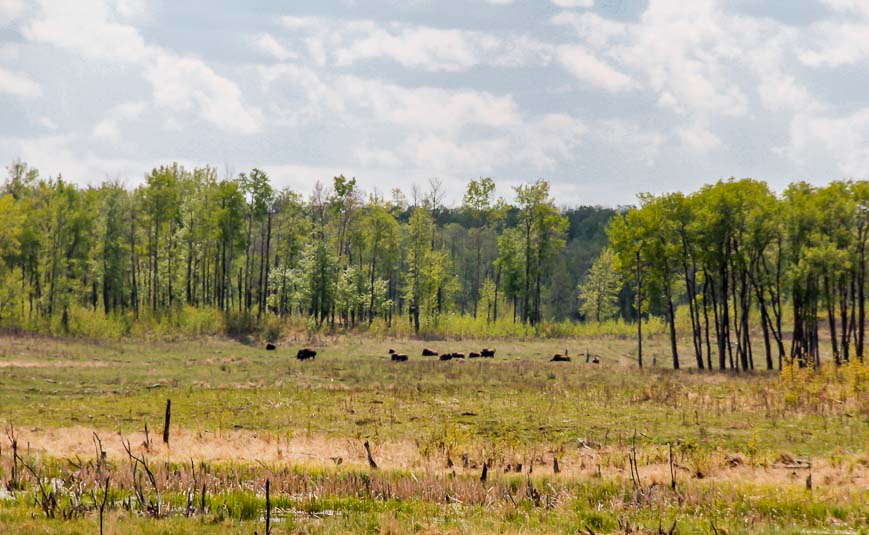
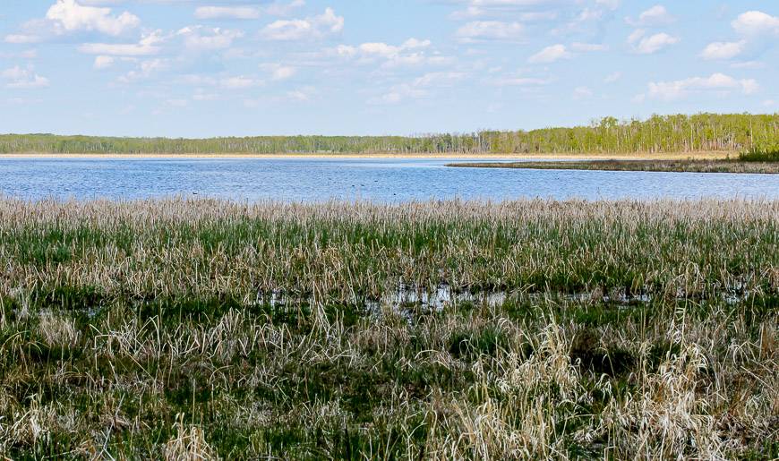
9. Wood Bison Trail hike in Elk Island National Park
The 15.6 km Wood Bison Trail is accessed from the Yellowhead Highway, directly across the road from the South Entrance leading to the Visitor’s Centre at Elk Island National Park.
It’s a full day hike on the Wood Bison Trail – but worth it as it’s the only trail in the park that allows you to see wood bison, the larger and less common subspecies of bison. The trail is also reportedly an excellent one for seeing moose and elk.
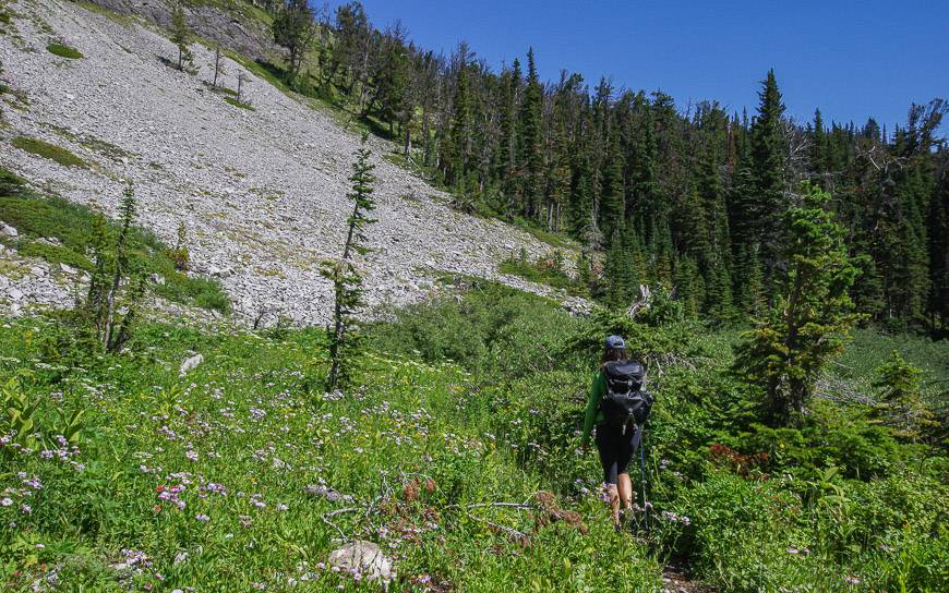
The trail starts in lush aspen forest that is absolutely loaded with wildflowers come spring. Even though the hiking is easy, as it’s mostly on flat, grassy trails, it is a long loop, so be prepared to commit to at least a four-hour hike. The trail takes you past Flyingshot Lake where you should be able to view waterfowl.
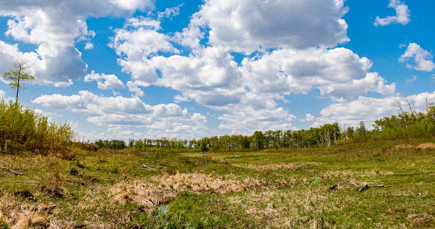
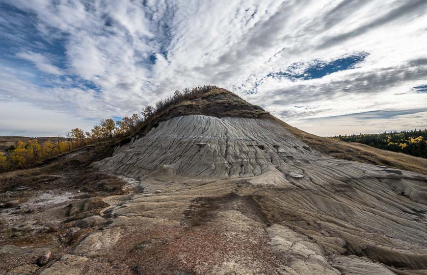
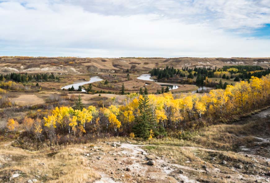
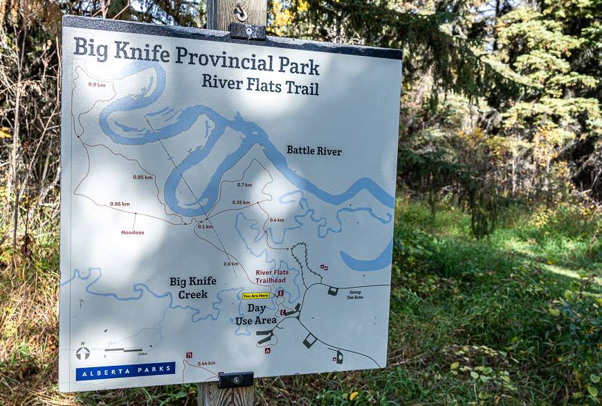
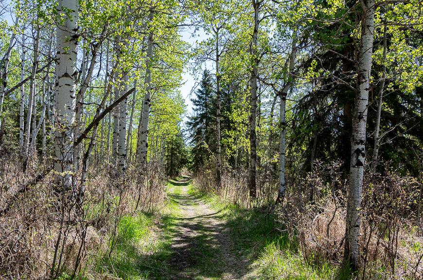
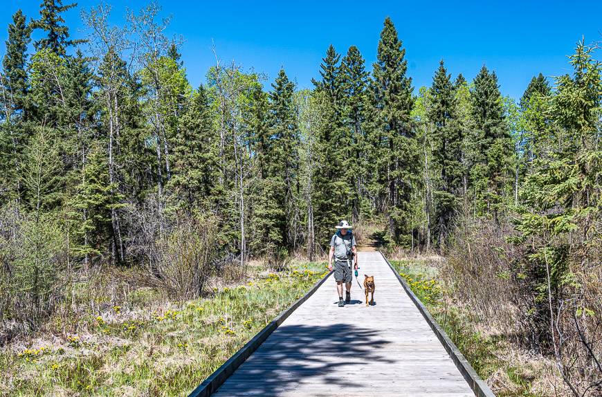
10. Alberta hikes: The Trails in Big Knife Provincial Park
Located in the Battle River Valley in east central Alberta, northeast of Stettler, Big Knife Provincial Park is not on the radar of many people, judging from my visit one beautiful day in September. The park is home to a variety of landscapes including a stretch along the Battle River and some uniquely beautiful badlands called the Big Knife Hoodoos.
There are two areas of the park that are ideal for hiking. The 4.5 km Lowland Trail takes you along the river and up to the hoodoos. From there you get some lovely vistas.
The other hike – call the Highland Trail, is 6 km in length and slightly more difficult with some steeper sections – but nothing compared to what you’d encounter on a mountain hike. At the top of the hills, enjoy panoramic views of the Battle River Valley.
If you visit outside of the summer, especially on a weekday, you might have the whole park to yourself. Be sure to take bear spray and make noise as there are bears and moose along with coyotes, mule deer, white-tailed deer and red fox. If you’re after off-the-beaten path Alberta hikes, you’ll sure find it here.
This is another park where you can go cross-country skiing in the winter.

11. Alberta hikes – The J.J. Collett Natural Area hike near Lacombe
Located 30 minutes north of Red Deer near the hamlet of Morningside, the JJ Collett Area beckons nature lovers who are looking for easy Alberta hikes on well-marked trails. Looping through the 635-acre natural area are 18 km of trails. You can hike a multitude of loops, never retracing your steps. The hike won’t wow you like the mountains, but trails are snow-free early and its a very pleasant way to spend a day.
Wander through mixed forest, meadows, wetlands, and grasslands – stopping at well-placed benches or at one of the three gazebos for a picnic – or shelter on a stormy day.
The JJ Collett Area was sold by the Collett family to the Alberta government with the stipulation that it be preserved as a natural area. Visit to see 300 species of vascular plants, 100 bird species, 20 species of butterflies and an amazing 250 species of moths.
Note that in winter you can cross-country ski on the trails.
Recommended reading: Top Things to Do in Lacombe, Alberta


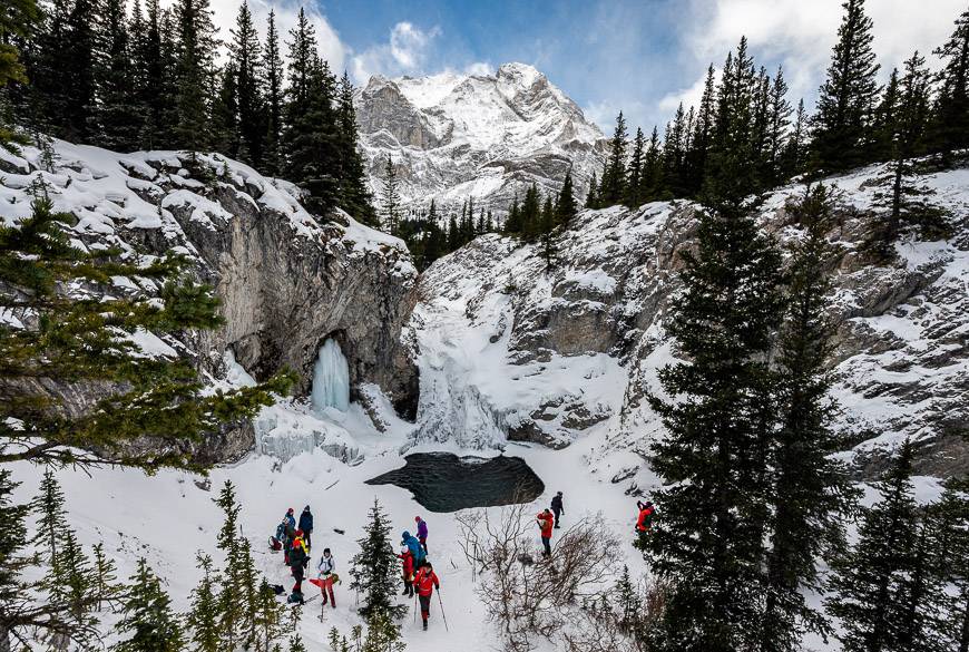
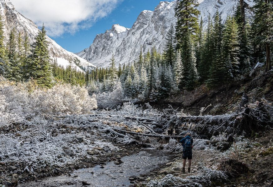
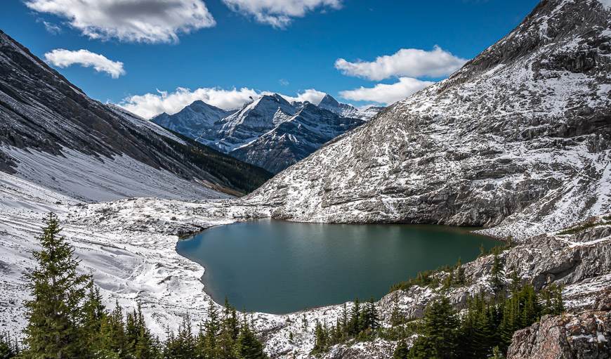
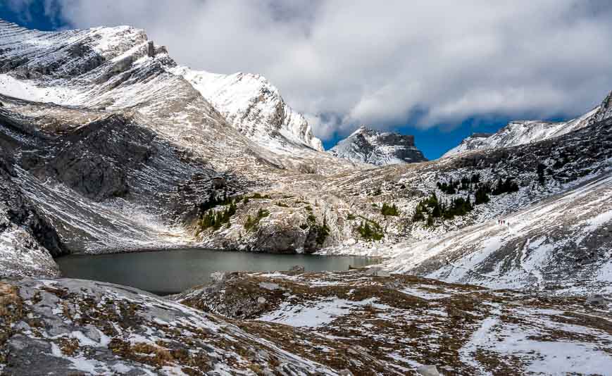
12. Headwall Lakes in Kananaskis Country
The pretty 14 km return hike to the Headwall Lakes in Kananaskis shares the same trailhead as the Chester Lake hike but its wilder & far less busy with perhaps 10% of the hikers that you’d see on the Chester Lake hike. The trail is more difficult as there are some narrow, steep sections – but nothing that would be out of the ordinary for a regular day hiker.
Over the 430 m the trail gains, you are taken from the forest into a desolate alpine environment, home to two beautiful lakes. There is also the option to explore beyond the second lake, or even climb Fortress Mountain. Allow roughly 5 – 6 hours to get to the second of the Headwall Lakes, and back to the trailhead. This is one of the exceptional Alberta hikes in the mountains not many people know about.
Read: The Headwall Lakes Hike in Kananaskis Country
What I take with me on most Alberta hikes
I like theinflatable seat cushionespecially when lunch is on cold rocks and snow!
Hiking polescome in handy especially on steep sections. Buy quality and consider weight. The lighter, the better in my opinion.
I alwaystake a buff, as it’s multi-functional. It’s particularly useful on a windy day to keep your hair out of your eyes.
Once the snow starts falling,gaiters are invaluable– cue the Edworthy Falls hike.
If it’s a chilly fall hike,a thermoswith something hot to drink is a welcome addition.
More reading on backpacking trips in Alberta
- 10+ Must Do Backpacking Trips in Kananaskis Country
- A 3 Day Backpacking Trip that Includes Egypt Lake, Banff National Park
- Brazeau Loop Trail Hike in Jasper National Park
- Sawback Trail Hike: Johnston Creek to Baker Lake
- Tonquin Valley Hiking Guide – What You Need to Know
Click on the photo to bookmark to your Pinterest boards.
