
The Piper Pass hike in Kananaskis Country’s Elbow-Sheep Wildland Provincial Park is fantastic. It exceeded all expectations in that it was easier and more beautiful than I thought it would be – and it was devoid of people.
It’s one of a number of hikes you can do from the Elbow Pass Day-Use area and I think it’s the prettiest of the lot. You can do it as a long day hike from Highway 40 – or as a shorter day hike from the Tombstone Campground which is what we did as part of a multi-night stay.
In Kananaskis Country as many of you know, numerous trails are unofficial and lacking in any kind of signage. The Piper Pass hike is on one such trail.
It is marked simply by a cairn at the side of the trail that ultimately takes you to the Tombstone Campground and onto the Tombstone Lakes. Once you’re on it, the rest of the route is straightforward, despite the fact you have to make one easy river and stream crossing.
This post includes some affiliate links. If you make a qualifying purchase through one of these links, I will receive a small percentage of the sale at no extra cost to you. Thank you very much for your support.
Piper Pass hike summary
Distance: From the parking lot on Highway 40 it’s 24 km (14.9 miles) return but it’s only 14.2 km (8.8 miles) return from the Tombstone Campground.
Elevation gain: 617 m (2,024 feet) from the Elbow Lake Day-use Area parking lot.
Time needed: Allow 7 – 8 hours as a day hike from the parking lot, and 5 – 6 hours from the Tombstone Campground
Level of difficulty: Moderate from the campground, and difficult from the parking lot, only because of the distance. There is nothing technically difficult about the Piper Pass hike.
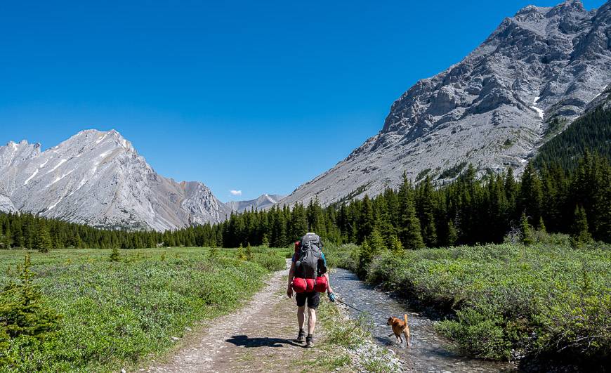
Dogs: Permitted if leashed.
Bears: You will be hiking in bear country, so carry a can of easy to access bear spray.
Trail report: Check the Kananaskis Trail report before you go.
Permits: To avoid large fines, be sure to purchase a Kananaskis Conservation Pass.
Maps: Gem Trek Kananaskis Lakes or Organic Maps if you want an offline hiking app.
When can you hike Piper Pass? The Elbow Lake Day Use Area is accessed off of a section of Highway 40 that is closed seasonally from December 1 – June 14th. You could in theory bike to the trailhead but you’d have to be in amazing shape to do the bike ride and the hike in a day. Be aware of snowpack levels before you start to hike. We did this hike in late June and the snow was basically gone. In other summers, you’ll need to wait till sometime in July.
Piper Pass hike route description
The Piper Pass hike starts at the Elbow Pass Day-use area on Highway 40, 62 km south of the Trans-Canada Highway or 5.1 km north of Highwood Pass. On busy weekends you’ll be directed to park along the highway. Don’t be dissuaded by the number of people and cars. Most people stop at Elbow Lake.
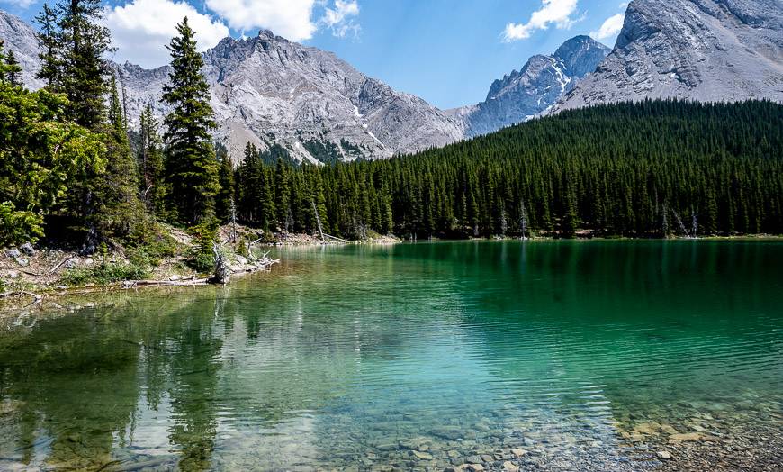
Head up the steep road for 1.3 km to reach Elbow Lake. Follow the trail around the west shore of the emerald-green, crystal clear lake. When you get to the north end of the lake, look for a log over a creeklet. Cross it and go left. Follow the trail (though it’s more road like) for a total mileage of about 3.8 km past the lake.
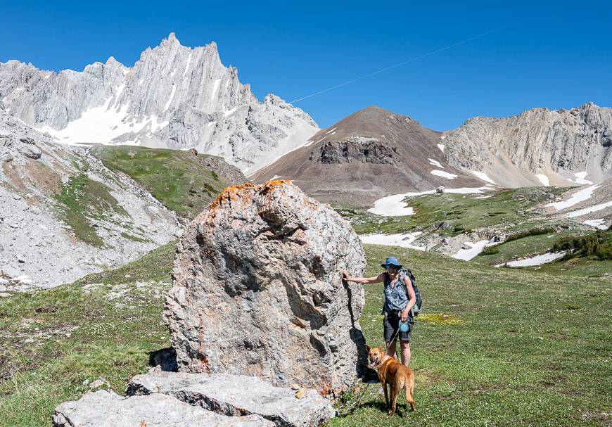
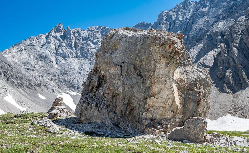
Along the way, you’ll pass a large rock on the left with writing on it. That trail will take you on a short but worthwhile detour to Edworthy Falls. After the falls detour, you’ve got another 1.4 km to reach the intersection with the Piper Pass Trail. It’s on the left and is marked by a cairn – see photo below. There’s another cairn on your right, just 100 m up but that trail leads to Rae Lake.


Route description from the start of the Piper Pass trail to Piper Pass
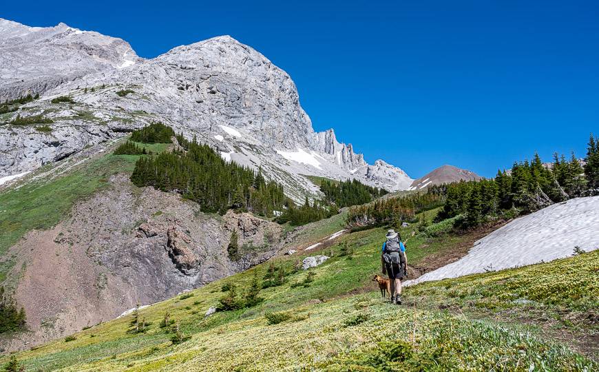
Once you’re on the Piper Pass trail, it’s very straightforward. You’ll be hiking on it for the next 5.0 km to the top of Piper Pass.
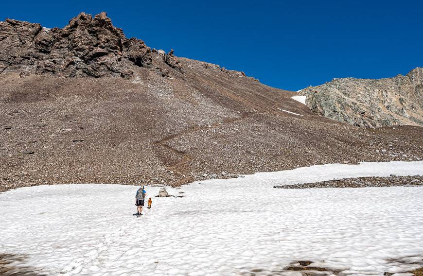
Descend to the Elbow River and cross it. A pair of water shoes come in handy here – as do hiking poles.
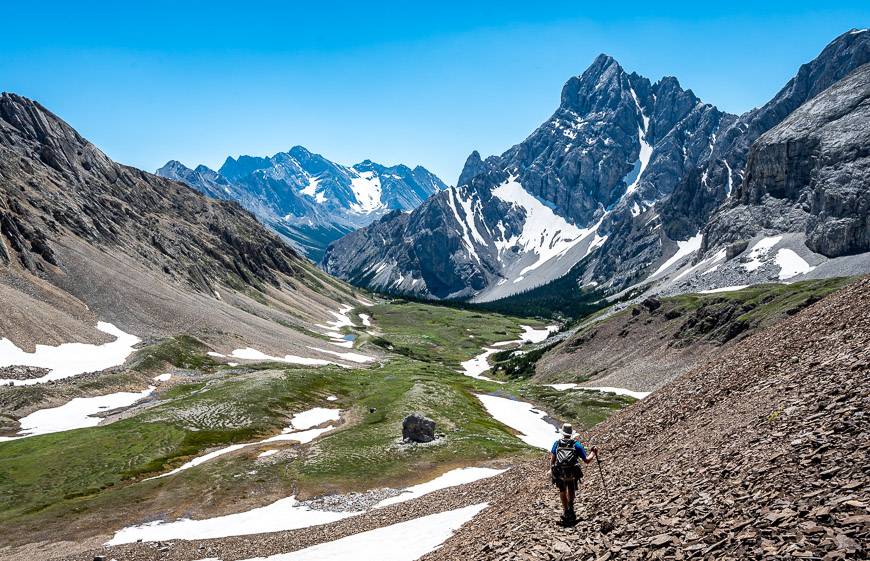
Climb out of the gorge and hike through trees to reach Piper Creek. Ford it. Then follow the Piper Pass trail as it heads for Piper Creek Canyon. Although the trail steadily climbs through the trees, it’s at a moderate rate with the odd great view.
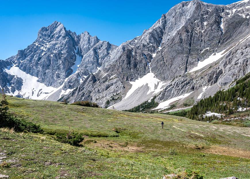
After approximately 30 minutes, reach wildflower-studded subalpine meadows. I saw lots of alpine forget-me-not (my favourite high alpine flower), yarrow, and enough other wildflowers that I wish I had carried a copy of my wildflower guide with me. This is a stunning section so take your time and enjoy it.
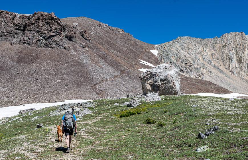
The way forward once you clear the trees is obvious even though the trail comes and goes. Basically, you’re heading for the giant boulder at the bottom of the dark-coloured scree slope off in the distance.
Climb the talus slope on a boot-beaten trail. It will take you 20 – 30 minutes to get from the giant boulder to the pass. Piper Pass is an an elevation of 2,580 m or 8,465 feet. It’s an excellent place to survey the mountains. Elpoca Mountain (3,029 m) is the big one you’ll see if you look back in the direction you came from.
Retrace your steps to the main trail. Go right to return to your car at Elbow Pass Day-use area and left to head to Tombstone Campground.


A few things to take on the Piper Pass hike
We didn’t so much as see bear scat but I’d still recommend carrying a can of easy to access bear spray.
If it’s a hot day, you might want somewater purification tabletsso you can refill water bottles and drink safely.
Don’t forget the hiking essentials, awarm coat– because it is the mountains – and a ball cap orwide brim sun hat.
Where to stay before of after the hike in Kananaskis
There are lots of camping options in Peter Lougheed Provincial Park. Check out my complete guide to car-camping in Kananaskis for ideas on where to spend a night or two.
For a hostel, try theKananaskis Wilderness Hostelnear the Ribbon Creek parking lot.
For upscale options check outMount Engadine LodgeorKananaskis Mountain Lodge.

Location map of the hike
Further reading on hiking in Kananaskis
- Rae Lake, Kananaskis – A Beautiful Little Known Hike
- Ribbon Falls Hike in Kananaskis Country
- The Headwall Lakes Hike in Kananaskis Country
- The Grizzly Ridge Hike in Kananaskis Country
- Porcupine Ridge Hike in Kananaskis
Click on the photo to bookmark to your Pinterest boards.
