One of the best hikes I’ve done in Kananaskis Country is the one to the summit of Grizzly Ridge via Grizzly Col from the trailhead at Highwood Pass. (In Gillean Daffern’s book it’s called Grizzly Peak but there is another shorter Grizzly Peak that begins on the north bank of Ripple Rock Creek on Hwy 40.)
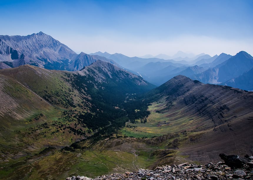
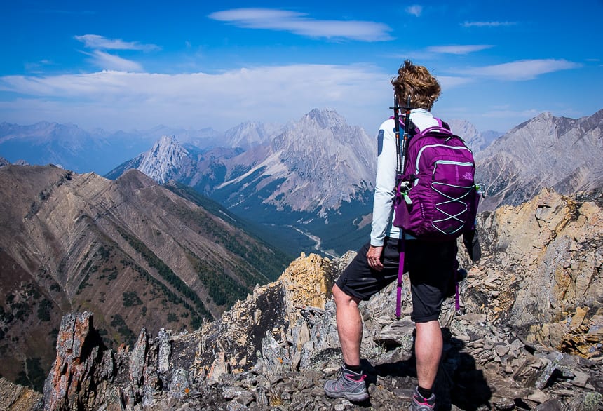
The 360 degree views from the top are outstanding. Even though the Grizzly Ridge trail isn’t signed at all, it’s obvious once you know what you’re looking for. If you’ve ever done the Pocaterra Ridge hike, you’ll have no problem finding the turnoff.
This post includes some affiliate links. If you make a qualifying purchase through one of these links, I will receive a small percentage of the sale at no extra cost to you. Thank you for your support.
Grizzly Ridge hike summary
Permit: You need a Kananaskis Conservation pass to do the Grizzly Ridge hike. The cost is $15 for one car per day and $90 for an annual pass – but that registers two cars if they are at the same address.
Distance: It’s 4.0 km one way to Grizzly Col from Highwood Pass and another 0.8 km to Grizzly Ridge for a return hike of 9.6 km or 6.0 miles.
Elevation gain: There is an elevation gain of 518 m (1,699 feet) to reach the col and another 165 m (541 feet) to reach the summit of Grizzly Ridge.
High Point: The high point of the trail is at 2,770 m or 9,090 feet.
Level of difficulty: I’d rate the trail as moderate with some exposure in the last few minutes of hiking.
Time needed: Allow 4.5 – 6 hours to do the return hike. Budget for extra time around the col and/or the summit to take in the views.
Cell service: None.
Bears: Don’t forget bear spray (that’s quick to access) and extra water as there aren’t many opportunities to refill water bottles along the way.
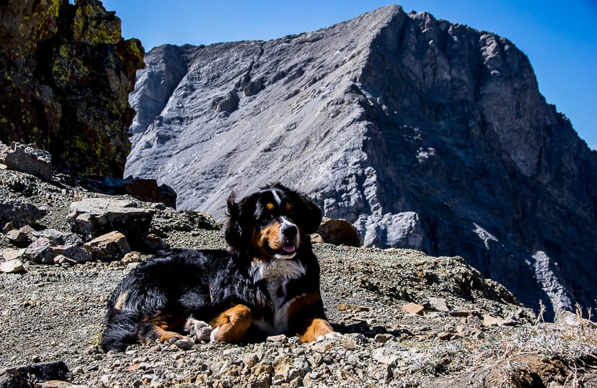
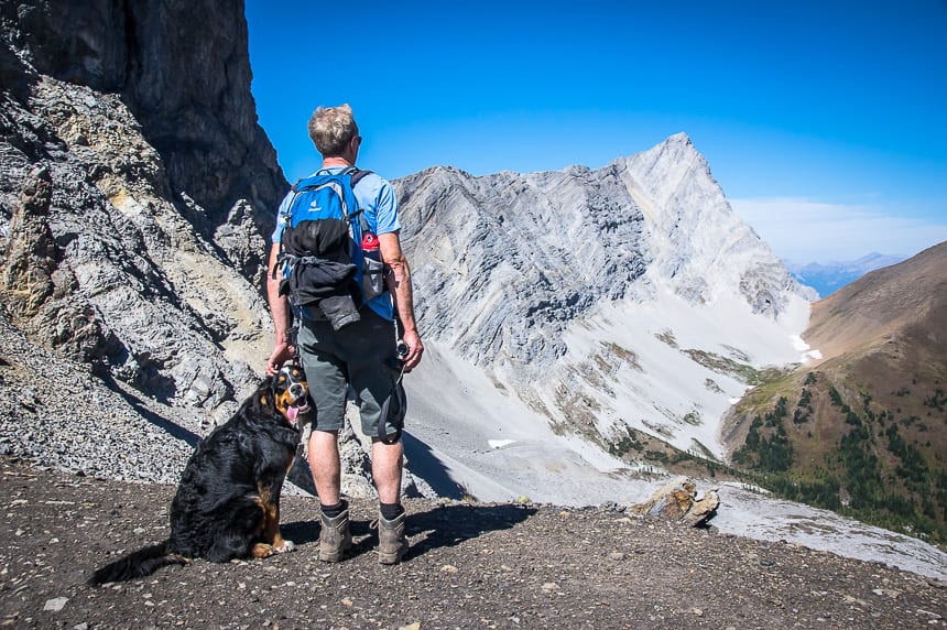
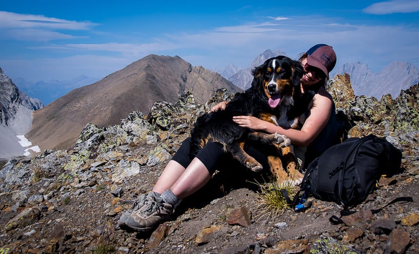
Dogs: Allowed on a leash but bring water for them.
Map: The map for this hike is Gem Trek – Kananaskis Lakes. You might also like Organic Maps, an offline hiking app.
Don’t forget: Let someone know where you are going, practice Leave No Trace principles and always pack the hiking essentials.
Grizzly Ridge trail location in Kananaskis
Park at the Highwood Pass parking lot in Peter Lougheed Provincial Park in Kananaskis Country.
Note that the road over Highwood Pass is closed from December 1 – June 14th. There is a washroom here and a well-signed trail to Ptarmigan Cirque.
Grizzly Ridge hike description
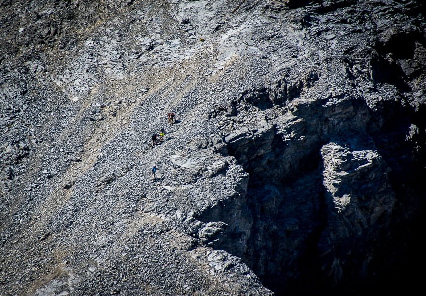
Finding the trail at the start of the hike is the crux of it as the scramble on the summit ridge isn’t as daunting as it looks from afar.
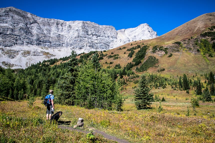
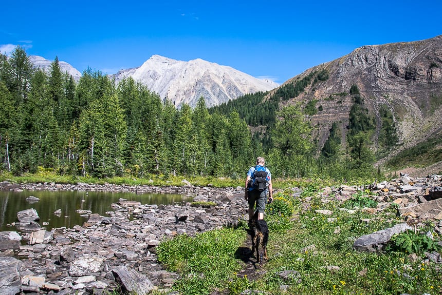
From the Highwood Pass parking lot start on the same trail that hikers take to reach Ptarmigan Cirque. After you’ve hiked all of a few hundred metres from the parking lot, turn left onto an unsigned trail that runs through a muddy section heading for the woods. Before you start, look up and off in the distance you can see Pocaterra Ridge. That is the general direction you need to go.
Stay on the trail as it crosses a creek, picking your way across muddy sections. Don’t take any trails to the left early in the hike. You need to pass Pocaterra Tarn before you start even thinking of turning off.
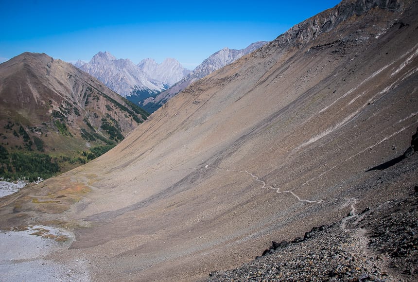
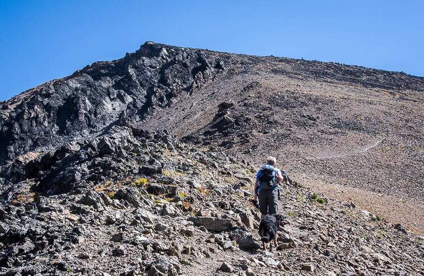
The trail is undulating initially and then it starts to climb, though only moderately. Cross avalanche slopes filled with wildflowers. Definitely make some noise through here. So far I have never seen so much as bear scat in the area but grizzlies are known to hang out around Highwood Pass.
Continue on the obvious, well-trodden trail to Pocaterra Tarn. Remain on the trail until you see the rocks in the photo below and then turn left. (It’s not a big pile of rocks but the trail looks substantial. If you go right you’ll end up heading for Pocaterra Ridge.)
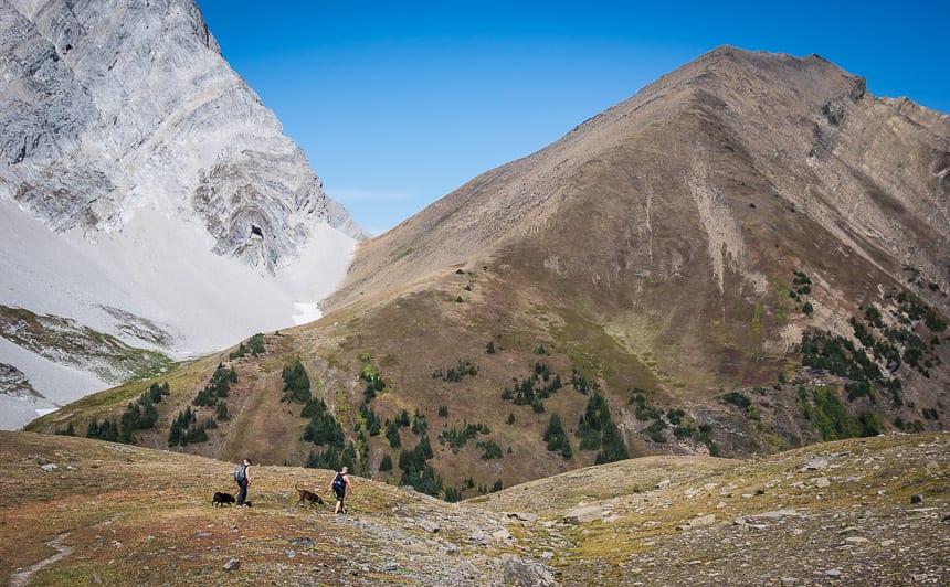
From the turnoff head up through trees and onto a grassy slope. You’ll be able to see the first summit along the Pocaterra Ridge trail. Continue up on the well-defined trail that becomes very scree-like the higher you go.
It gets hot through here with all the black rock. Catch your breath at Grizzly Col and take in the view before continuing up towards the ridge. You may see some people scrambling up the very steep Mt. Tyrwhitt on the right.
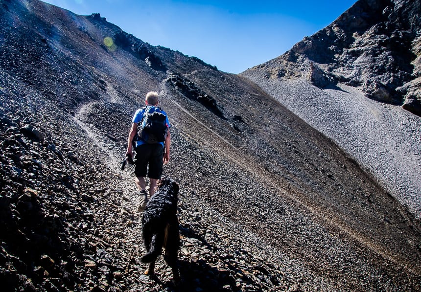
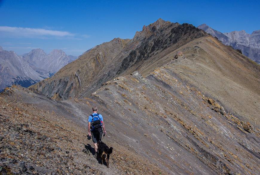
Grizzly Col to the ridge
The hike up from Grizzly Col to Grizzly Ridge is short – perhaps 15 minutes at most. Once you reach the ridge turn left and follow the well-traveled trail, enjoying phenomenal views along the way.
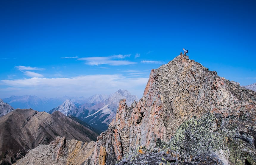
At the very end of Grizzly Ridge, there is a short scramble up and along a very rocky section for the last 100 metres or so.
Fortunately, there are lots of handholds and it’s really not so difficult but it might play with your head. The reward on the summit are views stretching for miles in all directions. Return to the ridge for a well earned picnic lunch.

Things to take on the Grizzly Ridge hike
I love my almost weightless seat cushion as its makes a lunch time stop that much more comfortable.
I like using hiking poles especially when I’m in steep terrain – and that’s what you’ll find on many sections of the hike.
I always carry rain gear despite what the forecast might suggest. I also find a ball cap or brim hat with a chin strap invaluable in the rain or on a hot, in-your -face sunny day.
I like to pack a buff. It’s a multi-purpose piece of cloth with a hundred uses yet it takes up almost no room.
Where to stay nearby
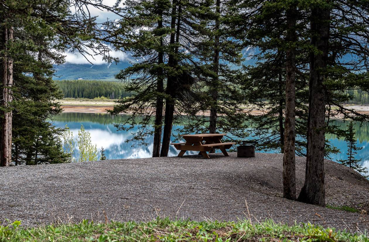
Enjoy some great camping in Peter Lougheed Provincial Park. Fortunately some of it is first come, first served but availability on a weekend will be tough.
Recommended reading: A Complete Guide to Camping in Kananaskis
Your other options include the lovely but pricey Mount Engadine Lodge located just off the Smith Dorrien Road.
Near the Ribbon Creek trails is the Wilderness Hostel and in Kananaskis Village there is the more upscale Kananaskis Mountain Lodge.
More hikes you might like to try nearby
- The Fabulous Arethusa Cirque Hike in Kananaskis
- Piper Pass Hike – A Gorgeous Trail in Kananaskis
- South End of Lawson Hike in Kananaskis
- Rae Lake in Kananaskis – A Beautiful Little Known Hike
- The Elbow Lake – Rae Glacier Hike, Kananaskis Country
Click on the photo to bookmark to your Pinterest boards.