The Rae Lake hike in Kananaskis Country, specifically in Elbow-Sheep Wildland Provincial Park, flies under the radar. Part of the reason is that it is an unofficial trail, and it isn’t signed. A cairn at the side of the trail can be seen when you’re heading to the Tombstone Backcountry Campground, but you’d have to be looking for it and know that it takes to Rae Lake. Once you’re on the Rae Lake trail, its boot-beaten and easy to follow.
We did the Rae Lake Kananaskis hike as part of a 3-day backpacking trip to the Tombstone Backcountry Campground. We also included hikes to Piper Pass and the Tombstone Lakes. Rae Lake can also be done as a 17.2 kilometre out and back hike from the Elbow Pass Day-use area.
This post includes some affiliate links. If you make a qualifying purchase through one of these links, I will receive a small percentage of the sale at no extra cost to you. Thank you very much for your support.

- Click on the three dots in the top right hand corner to email a copy of the map.
Rae Lake hike in Kananaskis summary
Distance: 17.2 km (10.7 miles) round trip
Elevation gain: 432 m or 1,417 feet
Time needed: 5 – 7 hours for the return hike
Level of difficulty: Moderate because of the distance.
Best time to hike: Late June until the snow flies sometime in mid-October
Dogs: Permitted but they must be on a leash.
Trail report: Check the Kananaskis Trail report before you go – if only to get updates on the trails in the immediate area.
Permit: Be sure to purchase a Kananaskis Conservation Pass. A single vehicle entry is $15 but if you plan on visiting Kananaskis Country more than six times in a year.
Camping: Random camping is allowed but unlike others before you, please leave no trace. You might want to readHow to Shit in the Woodsby Bill McKibben.
Map: The map for the hike isGem Trek Kananaskis Lakes(The route makes perfect sense when you see it laid out on the map.)
Bears: Keep bear spray handy. We never so much as saw scat over three days of hiking in the area but you never know.
Don’t forget: Always pack the hiking essentials.
Finding the Rae Lake trailhead
The trailhead is the same one that is used for Elbow Lake. It is located on Highway 40, 62 km south of the Trans-Canada Highway and just 5.1 km north of Highwood Pass. This stretch of highway is only open from June 15 until December 1 every year.
The parking lot can get very busy, especially on weekends. We ended up parking on the highway – and were able to safely leave our car there for two nights.
- Click on the three dots in the top right hand corner to email a copy of the map.
The Rae Lake hike to the cairns
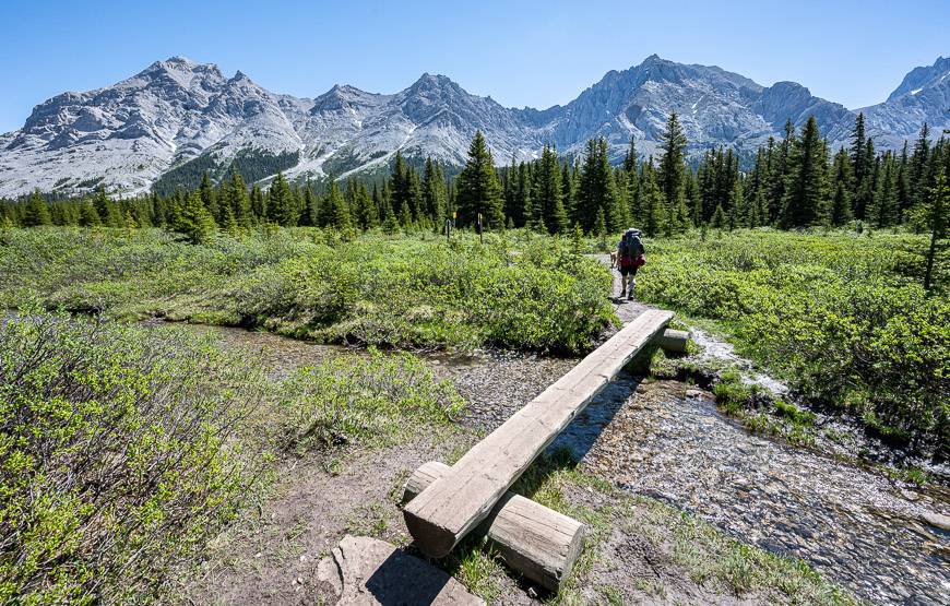
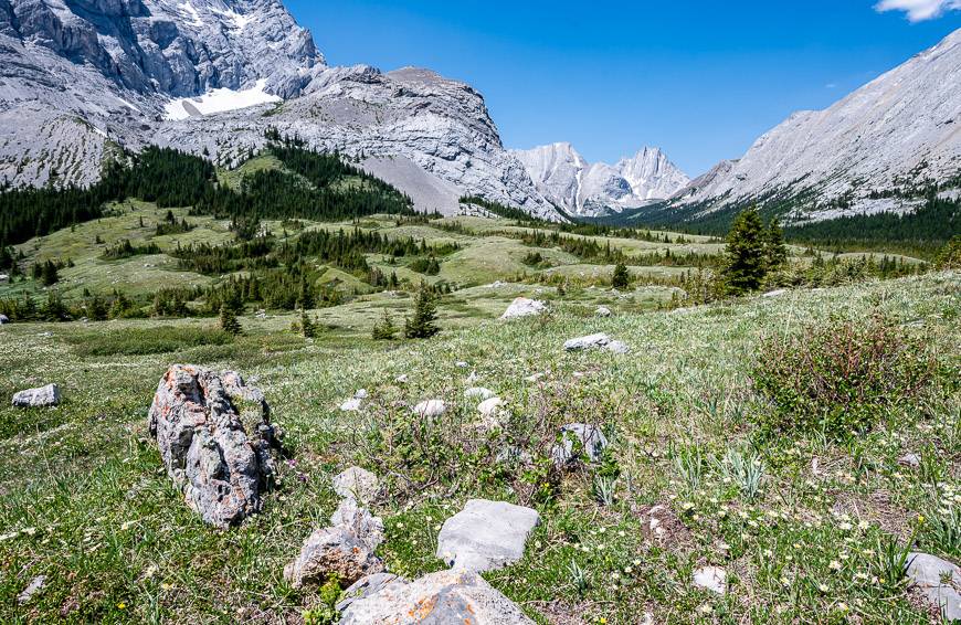
Hike up to Elbow Lake from the Elbow Pass Day-use area. Follow the trail along the west shore of the lake to reach a creeklet with a log over it. Stay left and continue up a road (watch out for mountain bikers) into a beautiful meadow with gorgeous views.
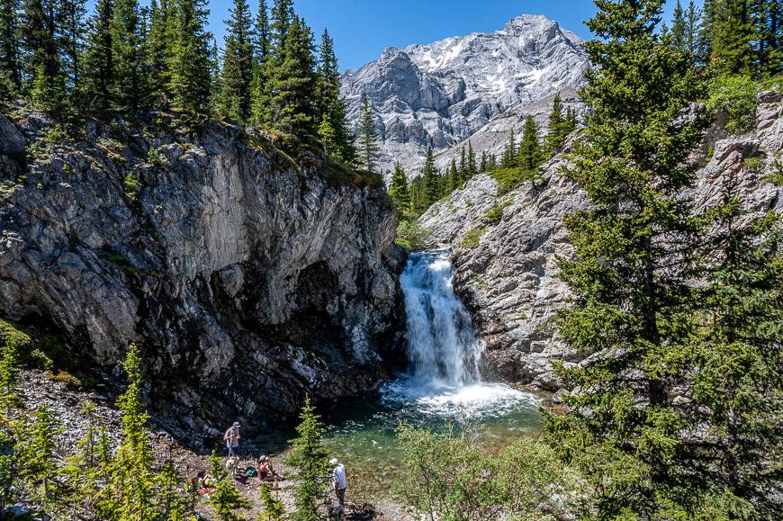
At the 4.3 km mark, you’ll be able to see into Piper Creek Canyon. On route you’ll pass some stones that mark a short spur trail to Edworthy Falls. The falls are worth a short side trip.
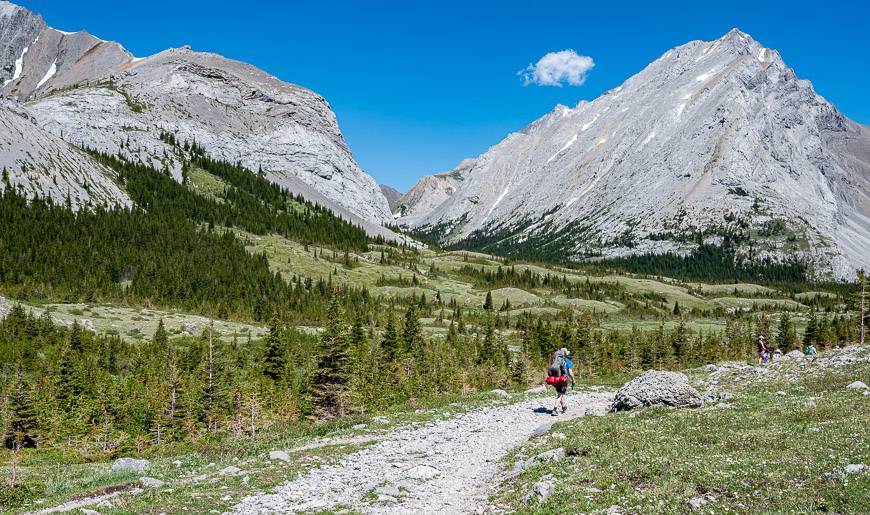
In another kilometre look for cairns on the left-hand side of the road marking the trail to Piper Pass. Fifty paces later look for cairns on the right-hand side of the road – as you’re heading northeast. It marks one of the hiking routes into Rae Lake, Kananaskis. From there the trail to the lake is obvious though never expect to see a sign.
The photos in this blog illustrate a clockwise loop to Rae Lake that starts at the cairns, turns right at the Sheep River Valley Trail, goes up to Rae Lake and then descends via a narrow trail to come out on the road coming up from Elbow Lake. But you don’t have to do a loop.
You could turn right at the first cairns and simply do and out and back hike to Rae Lake.
Directions from the top of the Elbow River Road Trail to Rae Lake
We did the Rae Lake hike from the Tombstone Backcountry Campground. We had to retrace our steps from the campground to reach the sign seen in the photo below. That intersection is at the end of the road coming up from Elbow Lake. As you face the sign you can see that you go left to the campground and right to continue on the Sheep River Valley Road-Trail that will lead you towards Rae Lake.
We hiked up the Sheep River Valley Road-Trail for 0.8 km. At that point there is a hairpin turn and if you look closely on the right you would see a cairn. (If you were trying to do a loop from the other direction, you would turn left here and follow the trail for 0.5 km to meet up with the trail you originally took up to Rae Lake.)
At the hairpin turn we stayed left on the road and followed it for a further 1.1 km. Keep your eyes open for a cairn on the right just before a culvert. At the cairn head right into the trees on an obvious trail and follow it as it climbs for 1.4 km to reach Rae Lake. The Rae Creek Gorge will be on your left all the way up to the lake. It’s quite a lovely section of hiking and the grade is moderate.


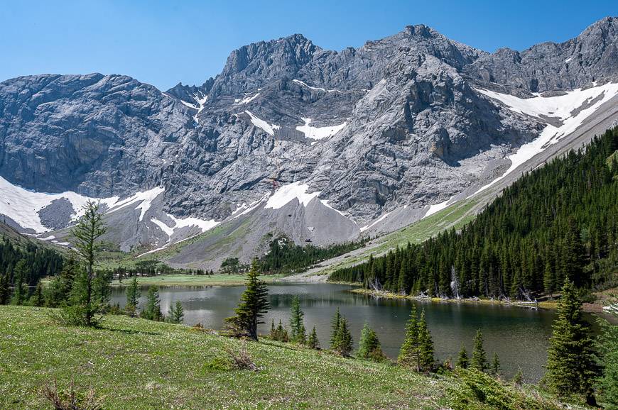
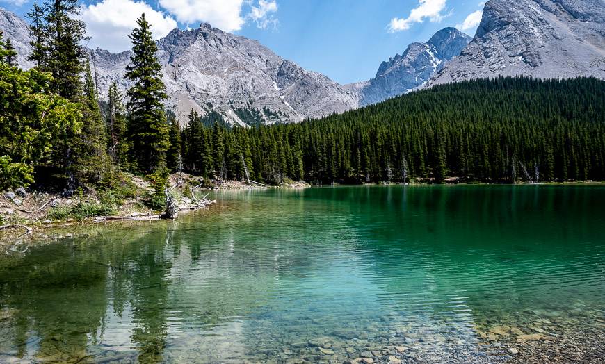
Rae Lake
Rae Lake sits in a tranquil and very beautiful setting below the north end of Mount Rae, east of Tombstone Pass. The few people that visit do so primarily as a day hike. But there has been obvious camping near the outlet.
Random camping is allowed here because it’s in Elbow-Sheep Wildland Provincial Park. If you do camp, pack out what you pack in and leave no trace – something others have obviously not done. You could also camp in the meadows beyond the lake – and the hike to get water would be doable.
In the fall, enjoy the larch trees in all their glory near the lake.

Rae Lake hike to Elbow Lake to the parking lot on Highway 40
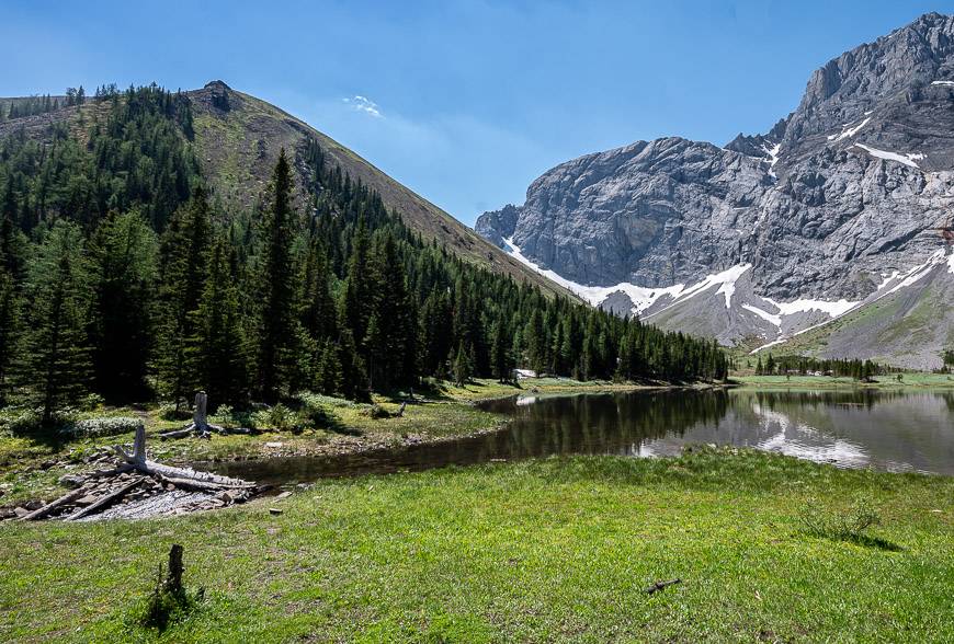
John and I thoroughly enjoyed the descent from Rae Lake in Kananaskis through meadows, grassy sections, and open forest to reach the road-trail coming up from Elbow Lake. I found the trail to be well-used and always obvious.
When we reached the road-trail, we simply turned left and followed it for 5.3 km back to the car.
It was 36°C in the afternoon in late June, so we made a beeline for cold drinks and ice cream at the gas station at Fortress Mountain on Highway 40. It was way too hot for our comfort but at least there weren’t many biting insects.


A few things you might find useful on the hike
- Don’t forgetthe sunscreenand apply it often.
- Take waterpurification tablets or dropsso you don’t run out of potable water on hot days.
- Asun hatis essential.
- Carrybear spray in a holster. I hear more reports of harm cause by inadvertently setting off the spray than I hear about run ins with bears.
- Some of you will wanthiking poles. Choose lightweight ones that collapse and can be stored on your pack.
- AGarmin InReach Miniis a great addition to your hiking tool kit if you ever run into trouble.
If you want to stay near Rae Lake
If you don’t want to backpack up to the Tombstone Lakes, you’ll find plenty of places to camp nearby. There is the option to book a night at Elbow Lake Campground – and it’s a lovely one and only 30 – 40 minutes walk in from the highway.
Recommended reading: A Complete Guide to Camping in Kananaskis
Off of highway 40, you can also book a night in theKananaskis Wilderness Hostelor the more upscale Kananaskis Mountain Lodge.
Sundance by Basecampis another option near the Nakiska Ski Area. Stay in trappers tents or teepees.
Further reading on hikes along Highway 40
- BEST Kananaskis Hikes for Mountain Lovers
- The King Creek Ridge Hike in Kananaskis Country
- Kananaskis Hikes: Opal Ridge South
- The Centennial Ridge – Mount Allan Hike in Kananaskis
- Easy Kananaskis Hikes Everyone Will Love
Click on the photo to bookmark to your Pinterest boards.
