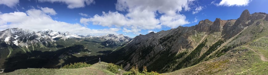
If you’re looking for a Kananaskis hike that deliver big time on mountain views, be sure to include the steep hike up Opal Ridge South. The hike is full of surprises – the good kind – especially after you get through a steep, rather nasty section of scree.
I did the Opal Ridge South hike in mid-June when it was free of snow. I wouldn’t recommend it before its snow-free unless you’ve got experience climbing on snow. It’s not great on a wet day either, so aim for one of Alberta’s bluebird days.
This post includes some affiliate links. If you make a qualifying purchase through one of these links, I will receive a small percentage of the sale at no extra cost to you. Thank you very much for your support.
Opal Ridge South hike summary
Permits: Be sure you’ve purchased a Kananaskis Conservation Pass before you start hiking. Price per vehicle is $15/day or $90 for a year for two vehicles at the same address.
Type of hike: Out and back.
Distance: Approximately 8 km (5 miles) return.
Elevation gain: 1,012 m (3,320 feet)
Time needed: Allow 4 – 6 hours to do the return hike.
Level of difficulty: I’d rate the trail as difficult – and definitely not for someone who hasn’t experience on steep scree.
Best time to do the Opal Ridge South hike: June until October.
Dogs: Allowed on leash.
Bears: I always bring quick to access bear spray just in case.
Trail conditions: Visit the Kananaskis website for up to date information on trails or check in at the Kananaskis Visitor Information Centre.
Route signage: None as it’s not an official trail (like many in Kananaskis.)
Go prepared: Take the 10 hiking essentials. Avoid hiking Opal Ridge South in wet or icy conditions.
After the hike: Post hike, buy an ice cream or cold drink at the Fortress gas station.
Opal Ridge South hike description
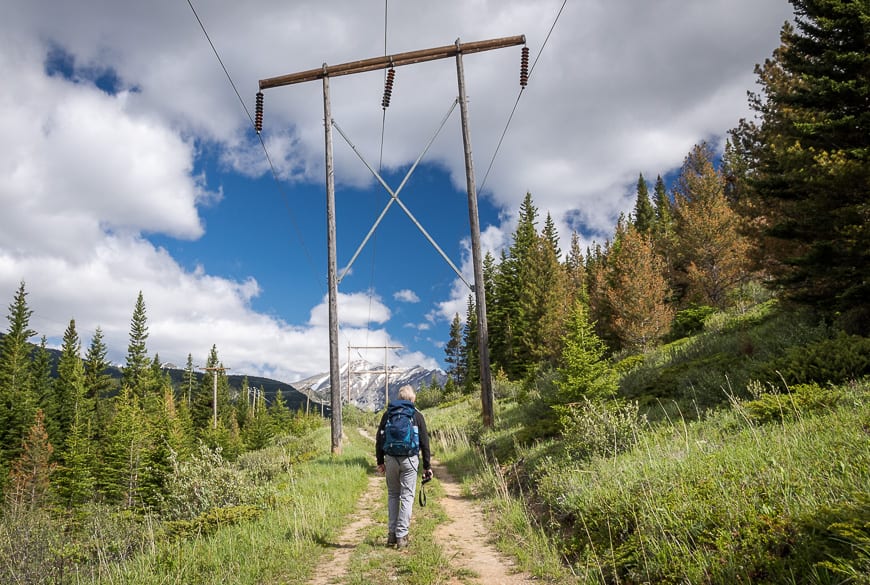
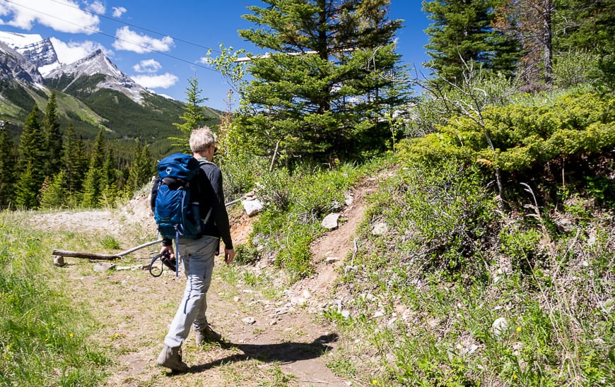
Start at the north end of the parking lot at the Fortress gas station across from the Fortress Mountain turn-off on Highway 40. Hike up a small creek – on either side – to reach a road with a powerline overhead. It’s ugly for the next 10 minutes but it’s mostly flat so enjoy the warm-up before you start a stiff climb.
After crossing a small creek, look for a trail about 20 metres later on the right (unmarked) heading steeply up. There are also arrows made of stones lying on the ground pointing to the trail. You’ll be in the trees for about the next 20 minutes so make lots of noise to scare off any bears.
Read: Tips for Staying Safe in Bear Country
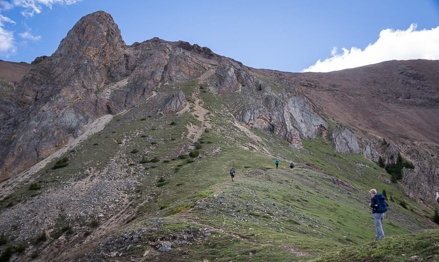
When the trail moves out of the trees you get great views looking south along Highway 40. From here continue up on one of the myriad of trails created by hikers over time looking for a way through rockbands.
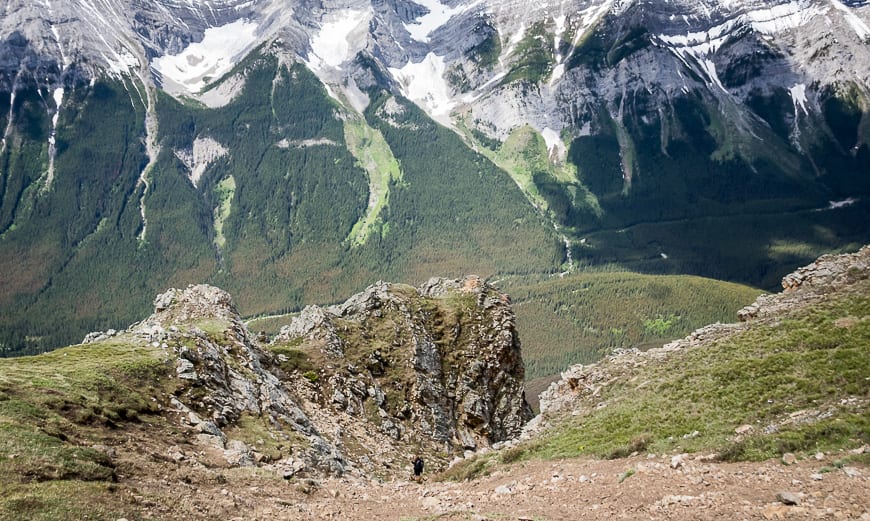
There is no wrong trail to take but some are steeper than other. It took us 75 minutes from leaving the car to get to the top of the scree section.
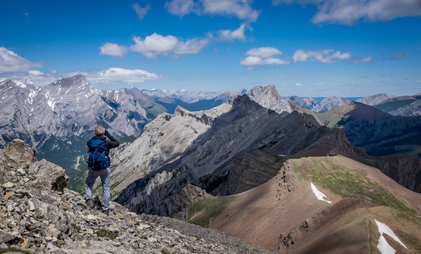
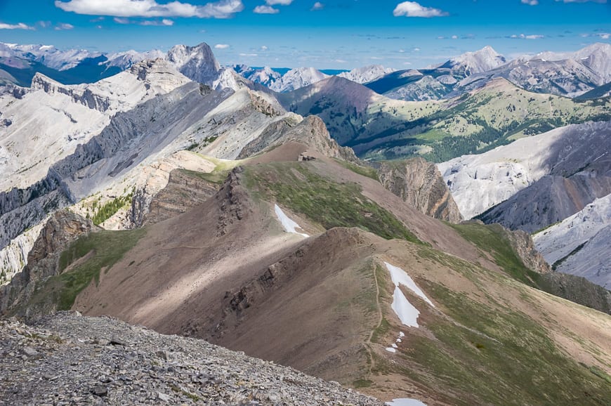
Arrive at a large cairn and then continue on a much easier trail for 10 minutes (at the most) to reach a grassy top from which the views are nothing short of surprising. Enjoy the in your face mountain before continuing up grassy slopes, a delight after all the scree.
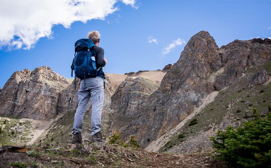
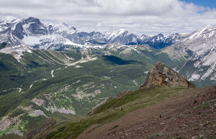
Continue on the obvious trail that isn’t as hard as it looks through the rockbands in the photo below. From the top of the rockband it’s a quick, easy walk on a good trail to reach the low point on the ridge.

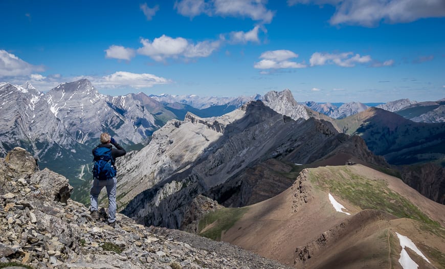
Superb hiking once you’re on Opal Ridge South
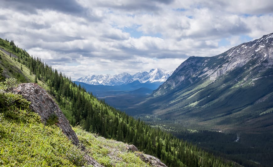
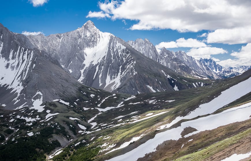
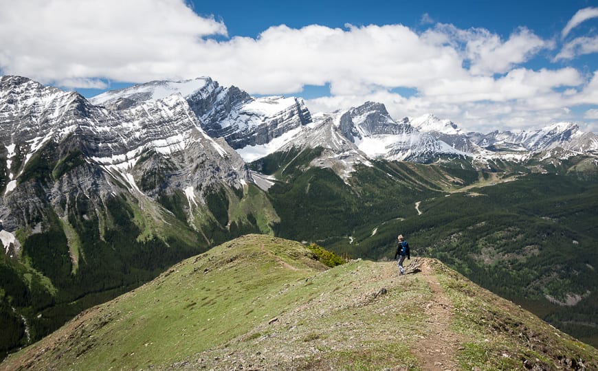
On the ridge, peer into the valley hidden from the highway. It looks wild, lonely and very beautiful. Keep your eye out for bighorn sheep here. We saw their dung and they are known to frequent this area.
We also saw marmots and a Clark’s nutcracker just below the ridge. It’s another 1.5 km to reach the ridge crest from the low point on the ridge but you’ll find the hiking to be some of the easiest of the day.
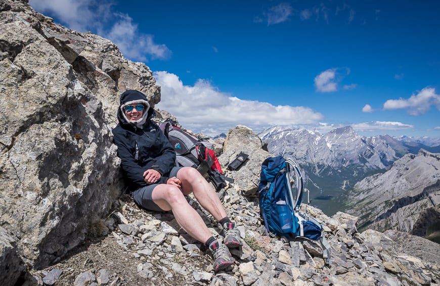
Don’t forget to dress in layers and bring warm clothes
There’s a small wind break at the top of Opal Ridge and you can tuck in behind some other rocks if it’s blowing really hard.
I’m never shy about offering advice when it comes to hiking and being prepared for a hike in the mountains. It would seem that I need to take my own advice. The wind pounded us for a good stretch of this hike and the temperature, despite sunny appearances was close to freezing.
I had long pants but I did forgeta warm hatandgloves. Thankfully my husband had brought two pairs. Not only did they keep my hands warm but they helped prevent cuts on the descent through the scree. My other go to piece of clothing is Patagonia’sdown sweater with a hood. It packs into almost nothing but it sure is warm.
If you go when there is snow be sure to takemicrospikesand anice axe– and know how to use it.
If you have an emergency, or you need help with navigation, it’s a good idea to have aGarmin InReach Mini.

The descent from Opal Ridge South
I always prefer the going up to the coming down and really wasn’t looking forward to the steep scree.
It turned out to be easier than expected but the rocks on these mountains are really sharp so for safety’s sake, wear gloves so you don’t beat up your hands on the descent.
All told it took us 5.25 hours, including lunch to do the return hike. It’s approximately 8 km return with 1,012 m of elevation gain. Be prepared for sore legs the next day as I find you tense up on steep descents. Even my arms were sore from hanging onto trees and rocks on the way down.
If you bring your dog, take lots of water. I wouldn’t call this a particularly family-friendly hike unless you’re out hiking every weekend on a variety of terrain.
Where to stay near Opal Ridge
Interested in car-camping in Kananaskis? Then read A Complete Guide to Camping in Kananaskis .
There are two options for overnight stays in the immediate area: theKananaskis Mountain Lodgewith the fabulous Nordic spa out the back door and theKananaskis Wilderness Hostelnear the Ribbon Creek Trails. It’s got a nice common area and a choice of private or dorm style rooms.
Trailhead location of Opal Ridge South
More reading on Kananaskis hikes
- BEST Kananaskis Hikes for Mountain Lovers
- The Pocaterra Ridge Hike in Kananaskis
- Piper Pass Hike – A Gorgeous Trail in Kananaskis
- The Hike to Burstall Pass in Kananaskis Country
- Windtower Hike in Spray Lakes Provincial Park
Click on the photo below to share to Pinterest.