Ribbon Falls Hike, Kananaskis Country
If you love a good waterfall hike, then put the Ribbon Falls hike in Kananaskis Country on your must do list. John and I chose to do it in late May – as many of Alberta’s mountain hikes are still snowbound.
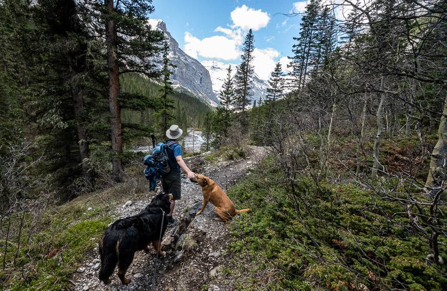
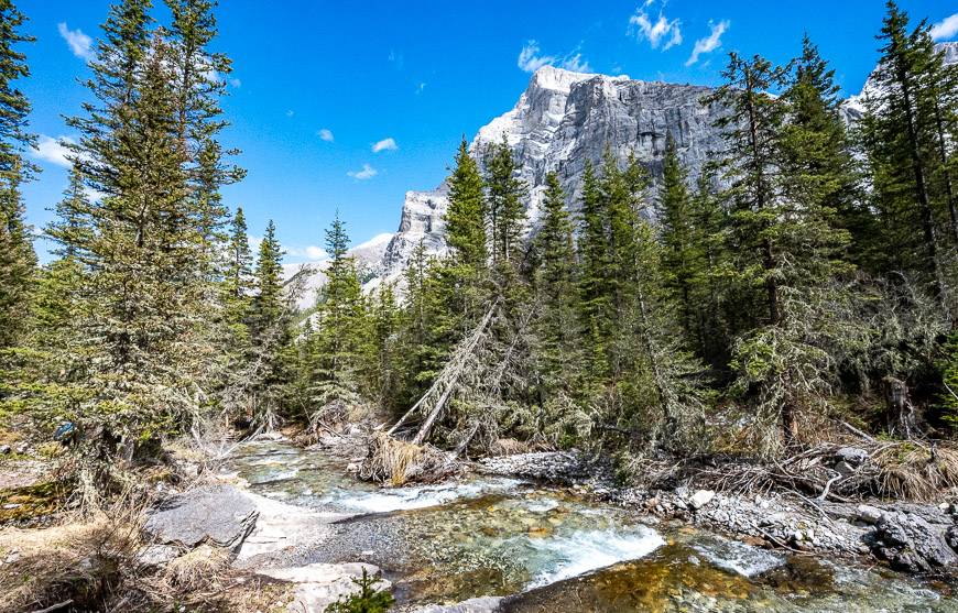
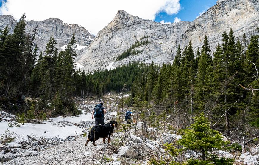
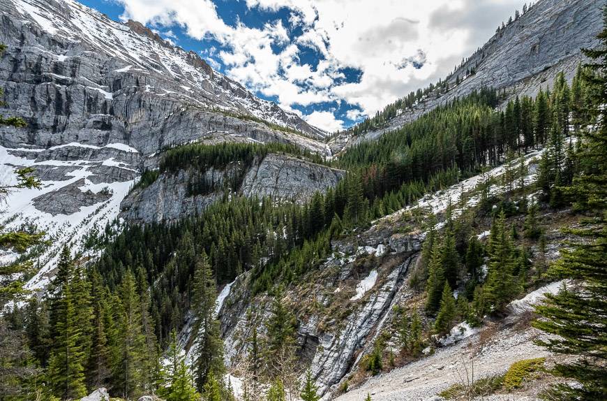
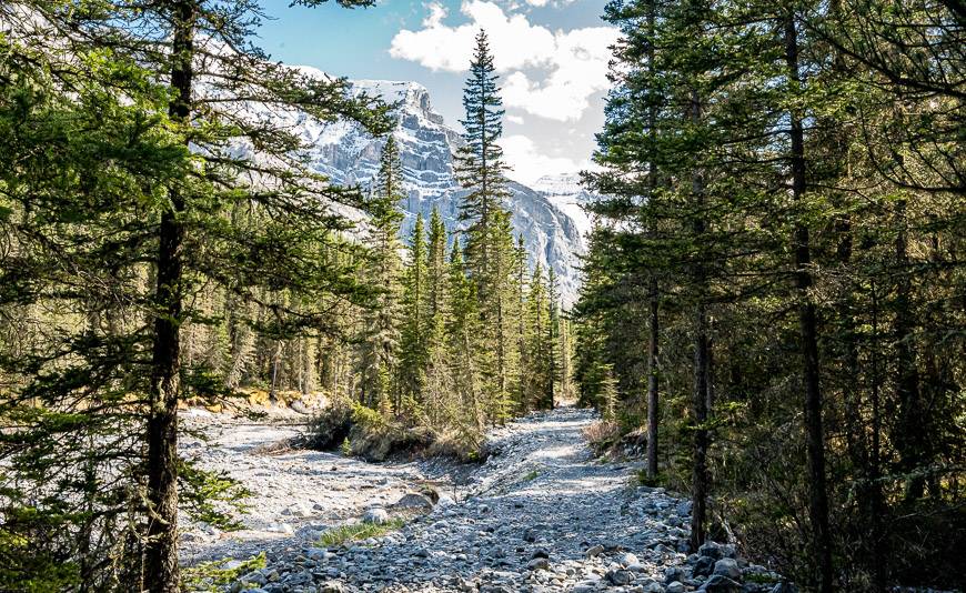
It was a great choice from a couple of perspectives. It’s a good warm-up to get in shape for harder hikes with more elevation gain. And the hike to the falls is far more beautiful and worthwhile than I figured it would be. It follows a spectacular valley hemmed in on either side by Mount Kidd to the southeast and Mount Bogart to the northwest.
This post includes some affiliate links. If you make a qualifying purchase through one of these links, I will receive a small percentage of the sale at no extra cost to you. Thank you very much for your support.
Would you like to save this?
Ribbon Falls hike in Kananaskis summary
Distance: 20.8 km (12.9 miles) return
Elevation gain: 447 metres (1,467 feet) if you go about 10 minutes beyond the falls. (Signage and Alberta Parks website info do not correspond.)
Time needed: 6 – 8 hours for the return hike.
Level of difficulty: Moderate, only because of its length. If you’re a regular hiker, you’ll find it to be easy.
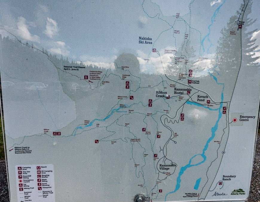
Trailhead: The Ribbon Falls hike starts at the Ribbon Creek Day-Use Area
Best time to hike: The Ribbon Falls hike is ideal from mid-late May (depending on snow levels) until mid-October.
Backcountry campsite: Yes, one near Ribbon Falls and one above the falls at Ribbon Lake.
Permit: Be sure to purchase a Kananaskis Conservation Pass before starting your hike.
Trail updates: Check the Alberta Parks trail report before you go.
Bears: You are hiking in bear country, so don’t forget the bear spray. It should be easily accessible and not stuffed in the back of your pack.
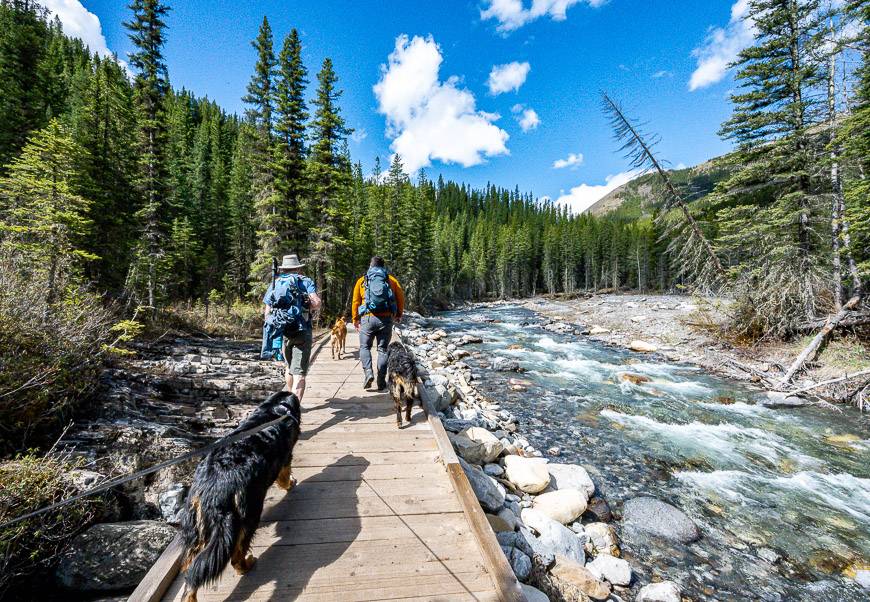
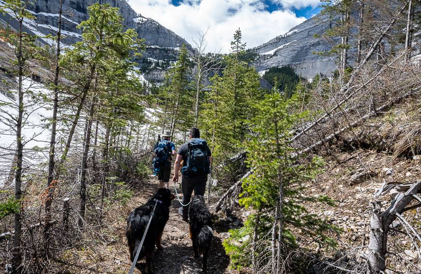
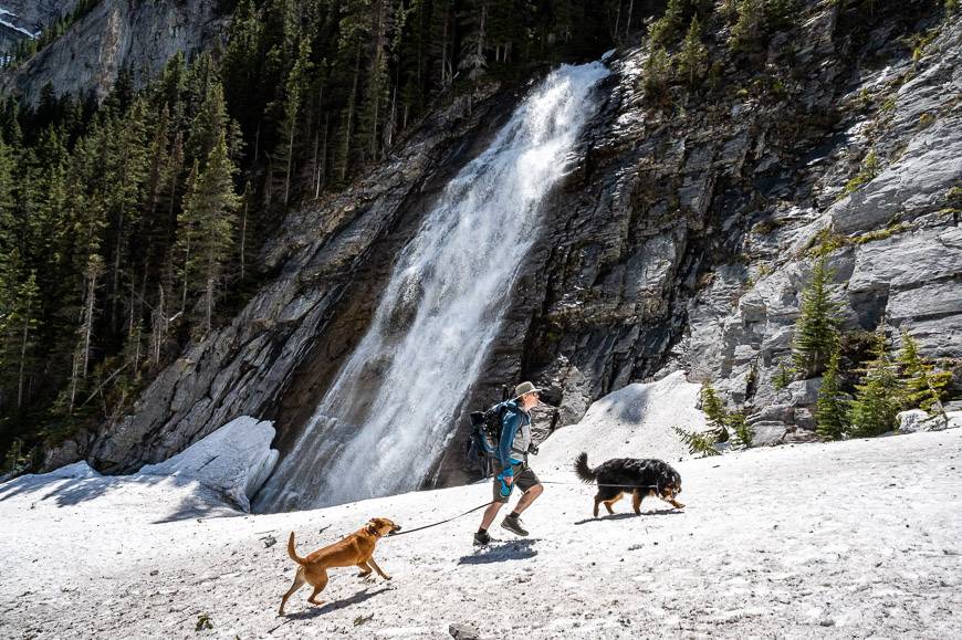
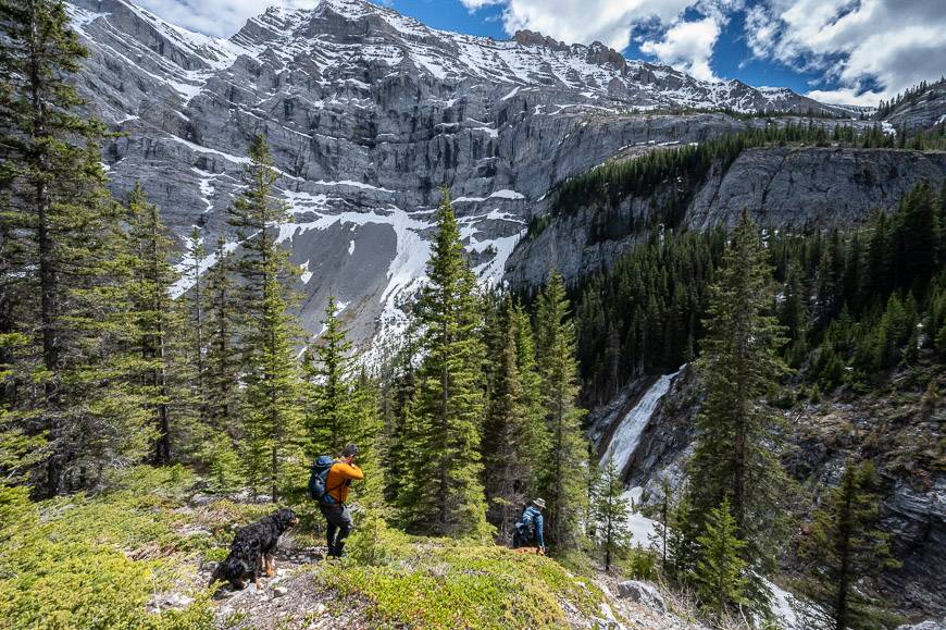
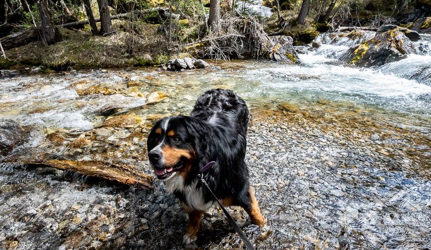
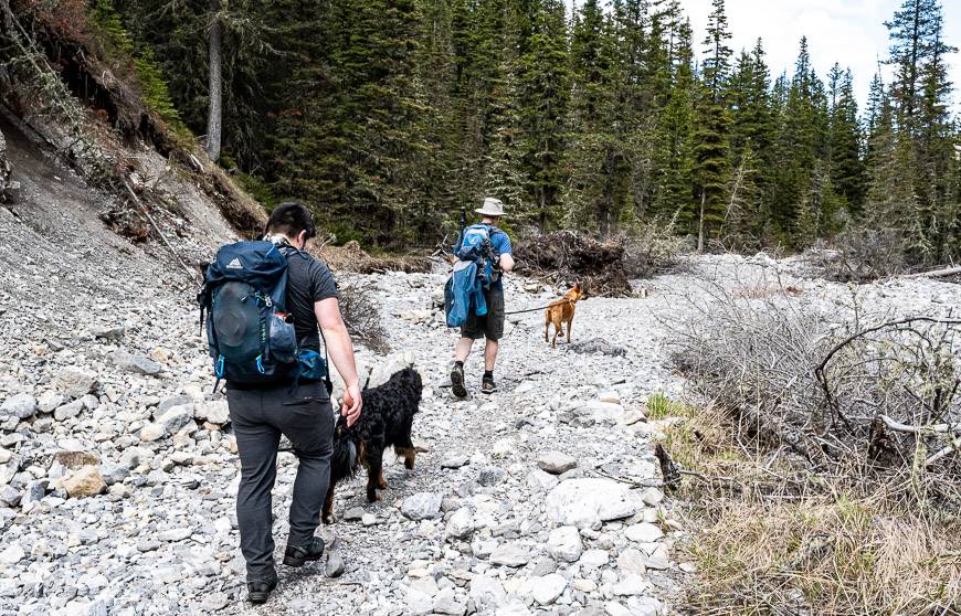
Dogs: Allowed on a leash – and there is lots of water on the hike.
Ribbon Falls hike description
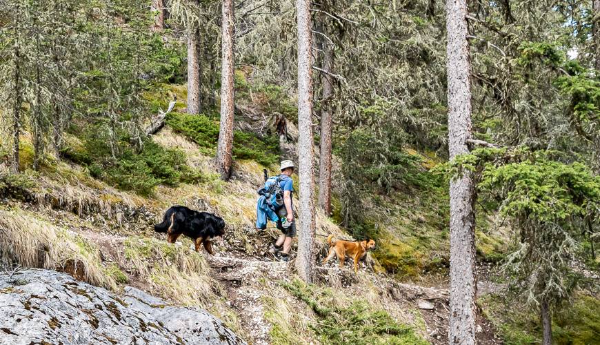
From the parking lot head off on an obvious trail that follows Ribbon Creek. Over the first few kilometres on the Ribbon Falls hike you cross Ribbon Creek seven or eight times via bridges constructed after the 2013 flood.
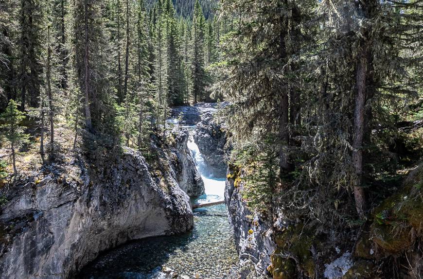
There are lovely sections where you get close to waterfalls and pools of crystal- clear water. On a hot day these will beckon. The forested sections are mossy – and offer plenty of peek-a-boo views to keep you going.
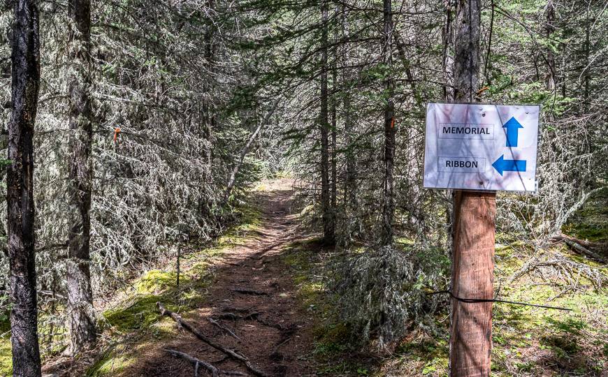
At about the 4 km mark, just over an hour into your hike, you’ll pass a trail heading right. That one takes you to the pretty Memorial Lakes – but it’s a degree or two more difficult.
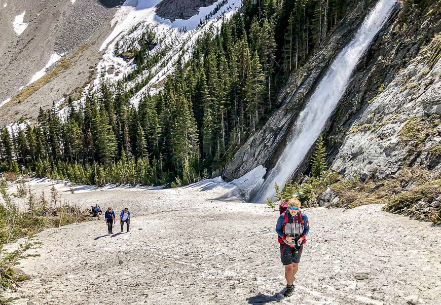
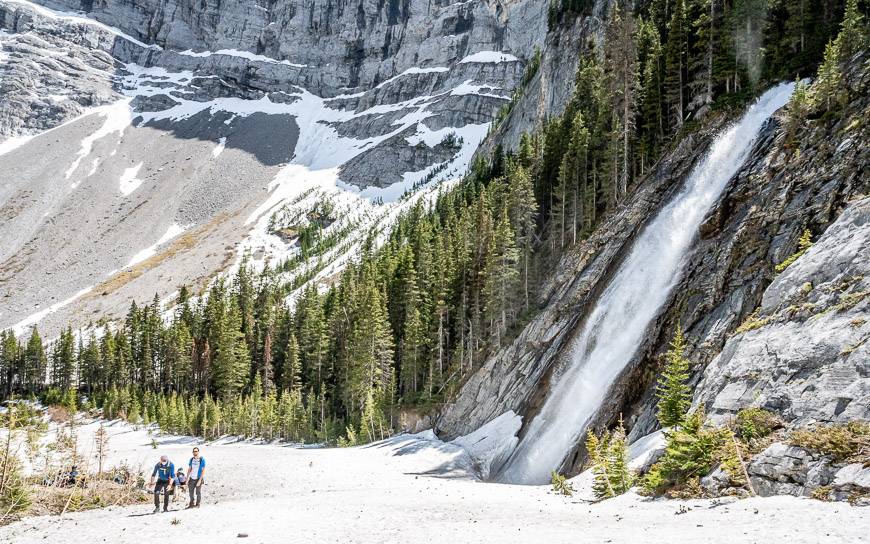
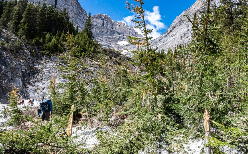
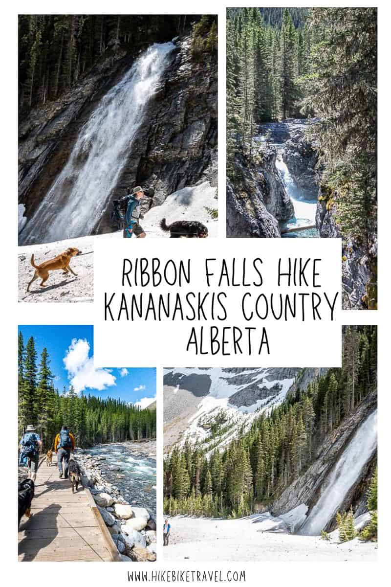
Continue heading up the Ribbon Valley to reach the Ribbon Falls backcountry campground. Ribbon Falls is a further 5 minutes away. I think you’ll find the falls to be take-your-breath-away beautiful, at least on a blue sky day. The falls are in a stunning setting, best appreciated by climbing the steep trail for about 5 minutes to get the bigger picture of where it sits in the landscape.
I’d say count on a minimum of 3 to 4 hours each way depending on your group’s pace. It’s a full day hike – and one where you’re likely to encounter a lot of people.
From the end of the Ribbon Falls hike, it’s another 2.0 km to reach Ribbon Lake – the site of another backcountry campsite. But to get there you must use steel cables and rungs to get up a couple of very steep sections. If you’re afraid of heights, give it a pass. Getting down the cliffs on a wet day can be particularly challenging. You can also access Ribbon Lake via the Buller Pass or Guinn Pass trails.
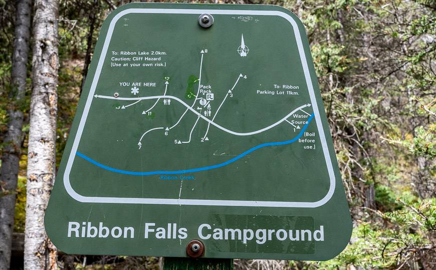
Camping at the Ribbon Falls Campground
There is quite a nice backcountry campground just before you reach Ribbon Falls. Most of the campsites are within earshot of the falls. The actual campground is about 9.5 km (5.9 miles) from the trailhead.
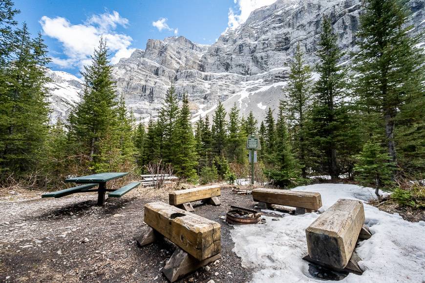
The campsite features 10 sites – most with privacy, along with bear lockers, picnic tables, and benches. The campsite is typically open from mid-June until the end of November. Note that after the 4 km mark on the hike, you are into avalanche terrain, once the snow starts to fall.
Even though there is a firepit, you are not allowed to cut any wood so add that to the must hump into the campsite list, especially when you know it’s going to be a cold night. One of those long burning logs you can buy in a grocery store might do the trick quite nicely.
It is a popular campsite as it’s also a good base to explore Ribbon Lake. But to get there, you do have to negotiate a cliff face with steel cables and rungs – so don’t plan on taking your dog if you’re planning to hike there. (The chains were replaced in summer 2022.)
To book a campsite visit Alberta Parks.
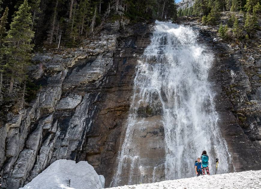
Ribbon Falls
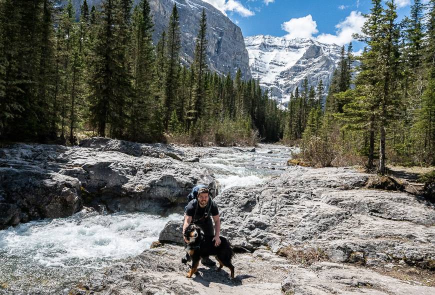
The first view of Ribbon Falls exceeded all expectations. I certainly didn’t expect to see falls of this size – in as beautiful a setting.
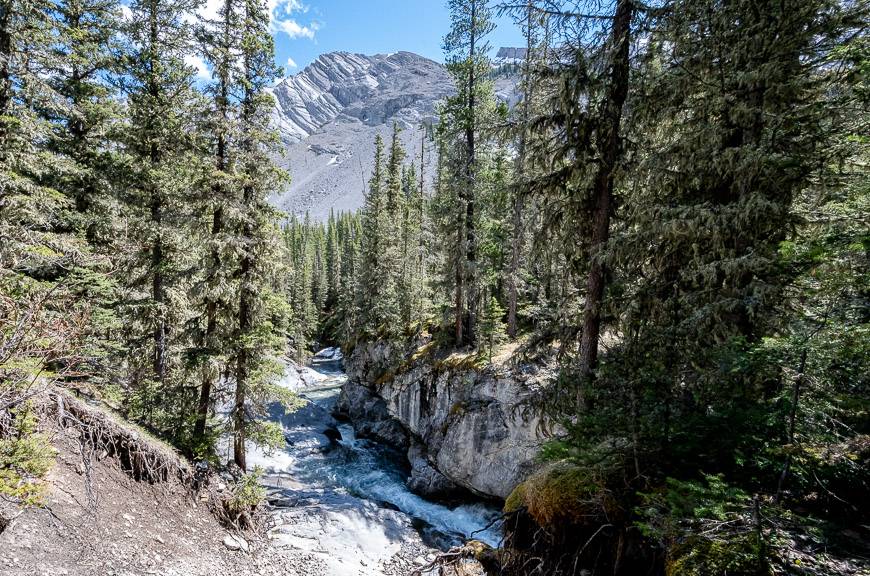
The water from Ribbon Falls originates from Ribbon Lake. It flows over several headwalls, as you can see in the fourth photo below, to end at a 25 metre sheer drop over a rock face. It’s far more impressive than I expected. I highly recommend climbing the steep trail for the slightly improved view of the falls above Ribbon Falls.
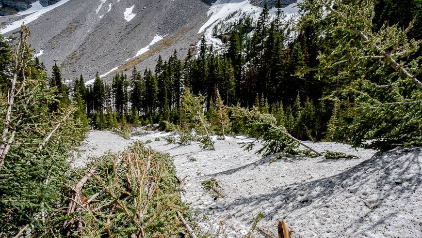
When we hiked to the falls in late May, there were remnants of a massive avalanche that I understand occurred in the last month. When you get a bit higher – as if you were heading for the steel cables/rungs section, you can appreciate where all the snow comes from. It was a sobering reminder of the power of an avalanche as trees were snapped like toothpicks.
The hike back to the trailhead
The Ribbon Falls hike is an out and back affair, so the scenery doesn’t change. The light does though, and you see things differently on the return. I quite enjoyed it until the last few kilometres when my feet were tired and just wanted to be in sandals.
Finding the trailhead for Ribbon Falls
From the intersection of the Trans-Canada Highway and Highway 40 S, the trailhead for the Ribbon Falls hike is about 24.5 km and a 20-minute drive away.
Go south on Highway 40 for 22.8 km and turn right (west) onto Mt Allan Drive. Continue for 850 metres. Take your first left onto Centennial Drive. Drive 250 m and turn right onto Ribbon Creek Road (you’ll pass the Kananaskis Hostel) and continue to the large parking lot.
The hike starts from the western end of the parking lot beside Ribbon Creek. There is signage. At the trailhead there are also washrooms and garbage cans. This parking lot is also the starting point for the fantastic but long and hard Centennial Ridge – Mount Allan hike.
Location map
A few things to pack for the Ribbon Falls hike
Take bear spray in an easy to access bear spray holster.
I love looking at maps and find paper maps to be invaluable, perhaps a sign of my age. For this area pick up a copy of Gem Treks Canmore and Kananaskis Village.
Our friend Thomas who came with us ran out of water and it wasn’t even a hot day. So don’t forget a water filter like the collapsible one made by Katadyn or purification tablets so you don’t cramp up from dehydration. And take some energy-protein bars as it’s a long hike so you’ll need a boost for the final hour.
Thomas also had a new pair of hiking boots and ended up with one blister at the end. Consider taking a pair of lightweight socks (Darn Tough are excellent) you can change into especially if you typically wear heavier ones. Take Compeed – a product I swear by for blisters. It’s expensive but worth every penny as it speeds up healing time.
Where to stay near the Ribbon Falls hike
If you’re not interested in lugging a backpack to the Ribbon Falls campsite, there are some options nearby.
If it’s car-camping you’re interested in read A Complete Guide to Camping in Kananaskis.
You’ll pass the Kananaskis Wilderness Hostel on the drive into the trailhead.
If you’d like a nearby glamping experience in teepees or trapper’s tents, check out Sundance by Basecamp.
In Kananaskis Village, just five minutes from the trailhead is the Kananaskis Mountain Lodge – and the Kananaskis Nordic Spa – but you’ll have to reserve well in advance if you want to enjoy it.
Further reading on hiking and kayaking in Alberta
- Easy Kananaskis Hikes Everyone Will Love
- Raspberry Ridge Hike in Alberta
- 7 Bragg Creek Hikes along Highway 66
- 18 of the Best Banff Hikes You Can Do in a Day
- Kayaking Upper Kananaskis Lake to the Point Campground
Click on the photo to bookmark to your Pinterest boards.


Hi,
Thanks for posting all of this useful information and great pics. I was wondering if there was an alternate route to get to the falls for dogs? Is it impossible to get up the cliff with chains with a medium sized dog?
Thanks
Hi Gerry, The hike to Ribbon Falls is fine for dogs -but Ribbon Lake from Ribbon Falls can be problematic though we did hear of people taking their dogs up the chains. I wouldn’t personally do it. You can also access Ribbon Lake via Buller Pass or Galatea Lakes – Guinn Pass.