I enjoy exploring areas in Alberta that are new to me – and usually as it turns out, less well known and therefore less busy for hiking. As much as I love the workout and the views up Ha Ling Peak for instance, I prefer trails, like the Raspberry Ridge hike with far fewer people.
Near the Highwood Junction area, there are a handful of hikes that are ideal in spring and fall when the mountains are still too snow-covered to safely ascend – at least for most people.
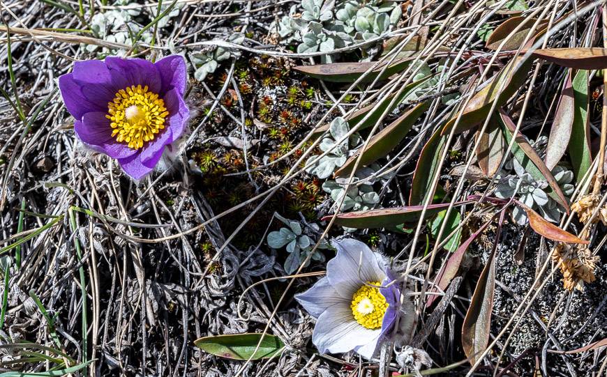
The Raspberry Ridge hike is one I would highly recommend by mid-May if the snow is mostly gone. In summer I prefer to be higher in the mountains but this one fits the bill very well as an early season hike.
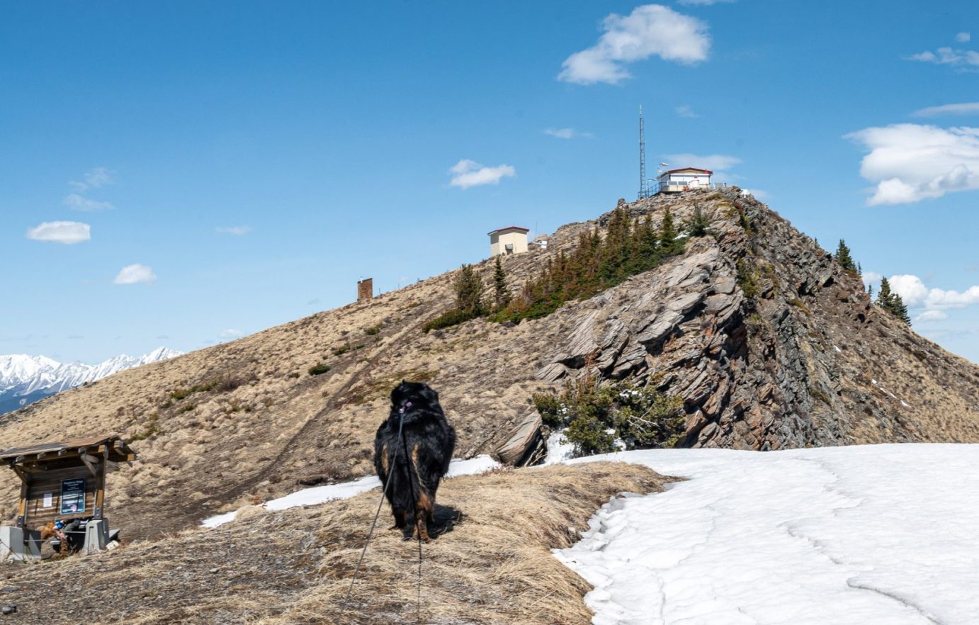
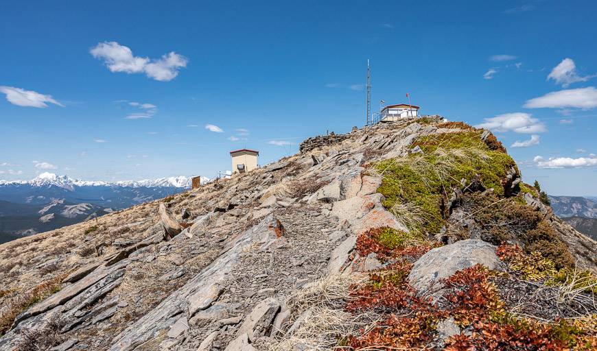
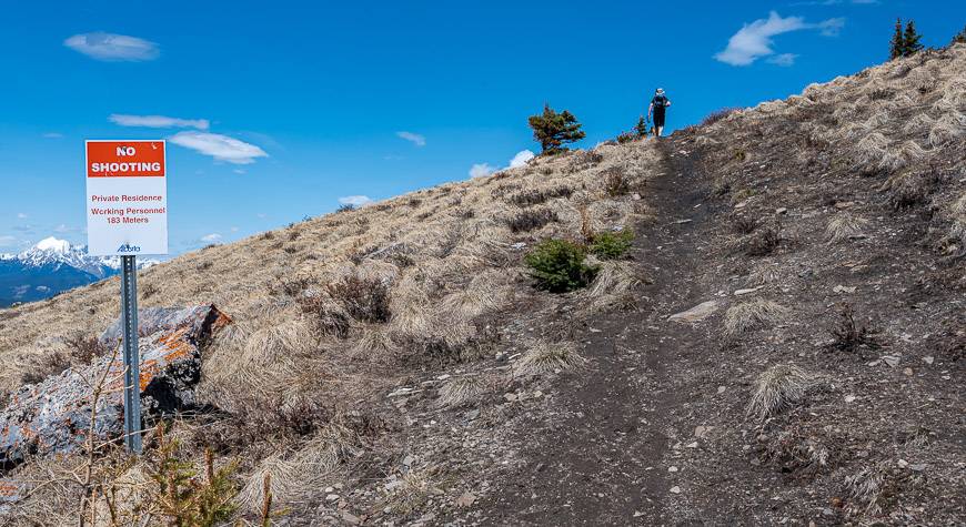
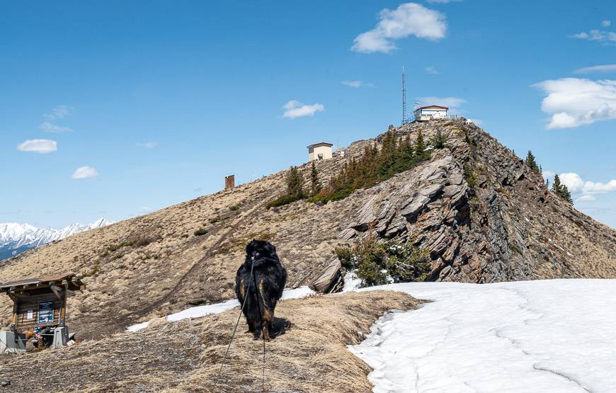
Access for the hike is off Highway 940, south of Highwood Junction. The hike takes you up to a ridge that ends at a working fire tower/private residence that is off-limits to the public.
This post includes some affiliate links. If you make a qualifying purchase through one of these links, I will receive a small percentage of the sale at no extra cost to you. Thank you very much for your support.
Raspberry Ridge hike summary
Distance: 9 km (5.6 mi) return
Elevation gain: 653 m (2,152 feet)
Level of difficulty: Moderate
Time needed: 3 – 4.5 hours
Best time to hike: Mid-May if snow levels aren’t high until October.
Type of hike: You can do an out and back hike or one that looks a little like a lollipop that adds just over 1 km in each direction. It takes you slightly to the left of the ridge, rather than straight up and offers better views for longer.
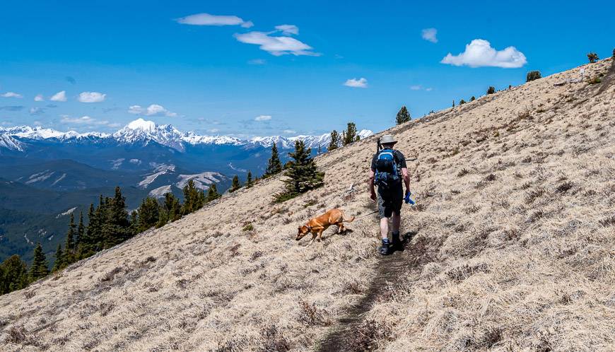
Dogs allowed: Yes, on a leash.
Bears: Carry easy to access bear spray just in case you meet one. I like to use abear spray holster–so I don’t set it off accidentally.
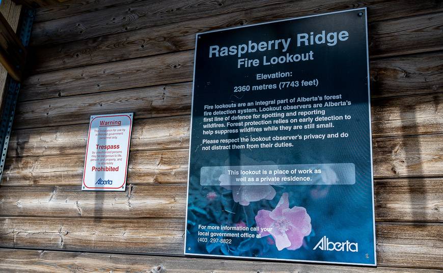
Elevation of the Raspberry Ridge Fire Lookout: 2,360 m or 7,741 feet
Permits: Be sure to purchase a Kananaskis Conservation Pass before you begin the hike.
Map: Gem Treks – Highwood & Cataract Creek map. Pour over it from the comfort of your couch for lots of other hiking ideas. For an offline hiking app, I recommend Organic Maps.
Raspberry Ridge hike details and warning
Raspberry Ridge is a 9 km round-trip hike with 653 m of elevation gain – if you take the steep shortcut up and down – which is what we did. There is the option to moderate the intensity of the climb via switchbacks – and that would make it an 11.8 km hike.
According to the map, you could do it as a 13.6 km hike, avoiding the straight up and down steep section altogether. The advantage of the longer route is more time on the ridge.
That would obviously be a distinct disadvantage in a storm. Be sure to keep an eye on the weather, especially as the chance of a lightening storm in the Alberta foothills is high. In fact, it gets top marks as one of four places in all of Canada where lightening strikes are common.
Finding the start of the trail
If you’re planning to hike Raspberry Ridge before June 15th when the road over Highwood Pass is closed, you have one main choice in how to get to the trailhead.
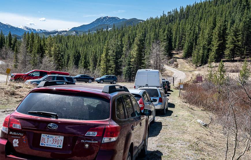
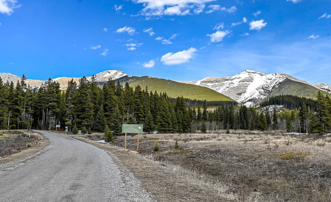
Drive to Longview and turn west onto Highway 541. Take it to reach Highwood Junction and the intersection of Highway 40, 541 and 940. Turn left or south onto Highway 940 – a dirt road that gets extremely dusty.
Follow it for 11.4 km to reach a large pullout on the west side of the highway beside a gate as pictured below. There are no garbage cans or facilities so be sure to pack out everything.
As of May 1, Highway 532 opens up. You can pick it up from Highway 22, just north of the Chain Lakes Reservoir. If you drive west, it will meet Highway 40 going south to the Crowsnest Pass and Highway 940 going north to the Raspberry Ridge trailhead. I have never driven it, but suspect it’s a dirt road. It is closed annually from December 1 – April 30th.
Raspberry Ridge hike location map
- Click on the three dots near the top right hand corner to email a copy of the map.
Raspberry Ridge hike description
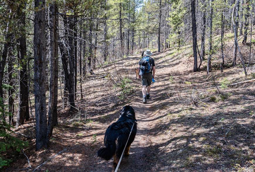
From the parking lot, walk past the gate where there is a three-way intersection of sorts. To start the Raspberry Ridge hike you want the middle route up the grassy trail into the trees, immediately right of the road pictured above the map.
There is another road that takes a hard right that you can’t see in the photo but don’t take it. Of course, there isn’t a sign to be seen, but there is some flagging tape in the trees on both sides of the grassy trail you want to take.
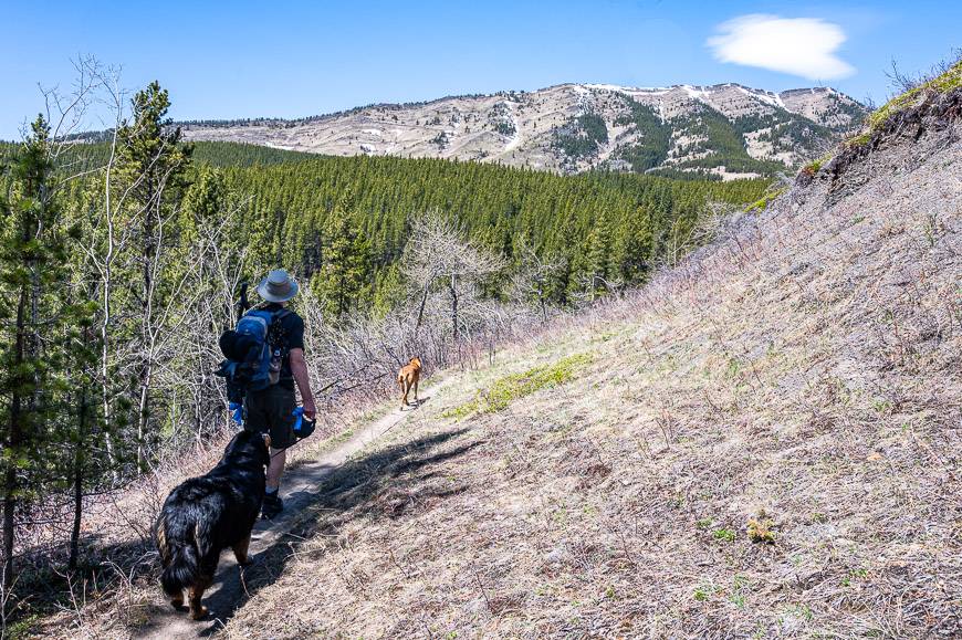
Follow the trail past remnants of snow to a Y-junction. Go right as it curves west and then north through a section of pine trees that smells divine. Before you drop down to a stream gulley, you’ll be able to see Raspberry Ridge and even the lookout on the skyline.
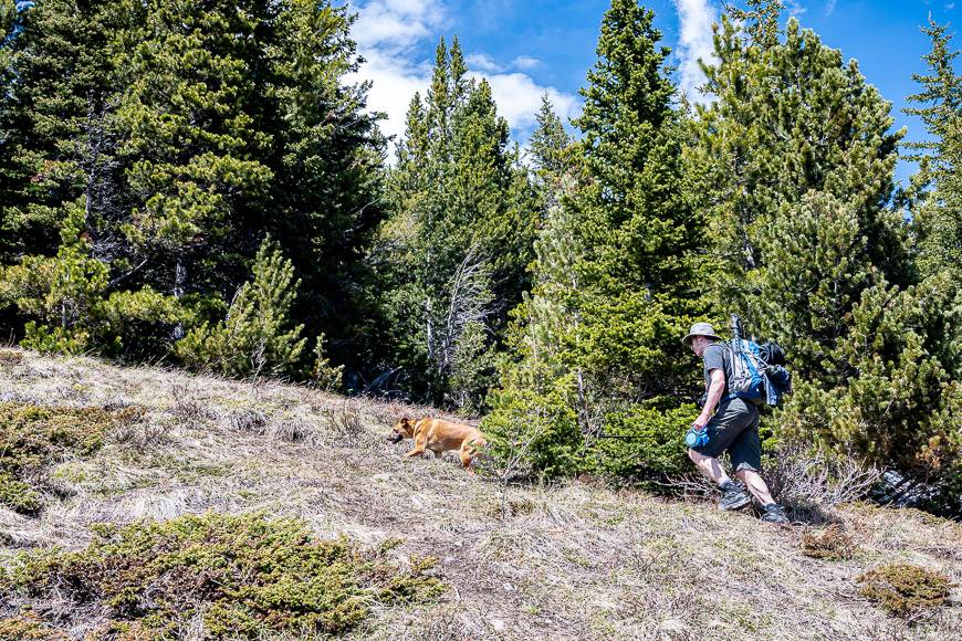
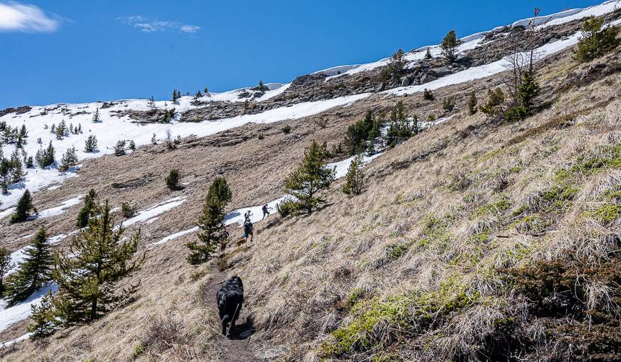
From the gulley, climb steeply for a minute and then continue on a gentle trail in an NNW direction. Look for a fork marked by a cairn about an hour into the Raspberry Ridge hike. Go right and start climbing more steeply.
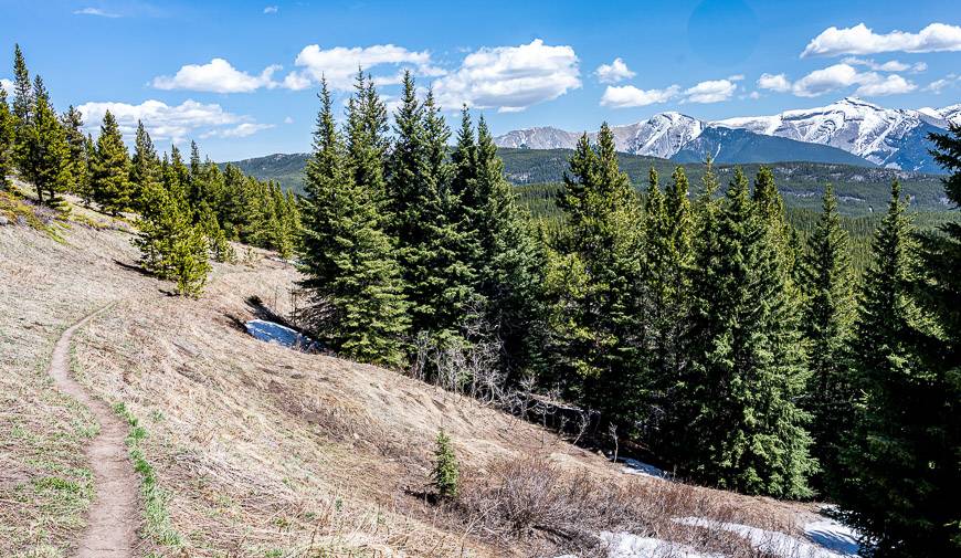
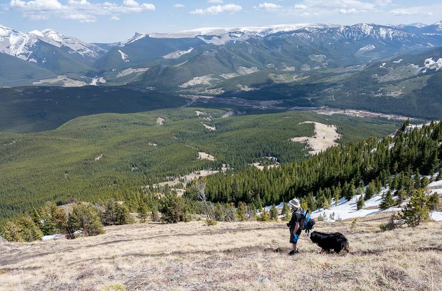
In no time you reach a small promontory with excellent views across to the aptly named Plateau Mountain as well as Mt. Burke.
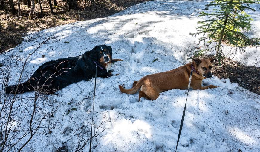
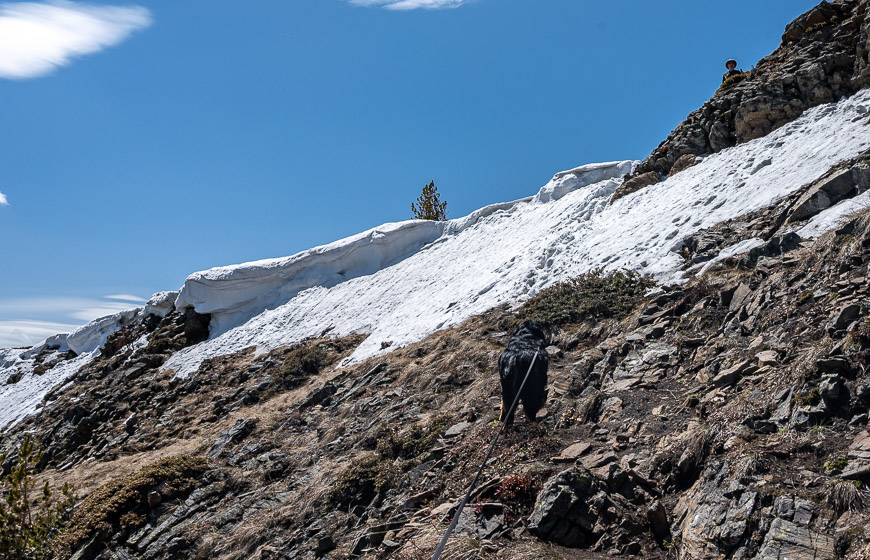
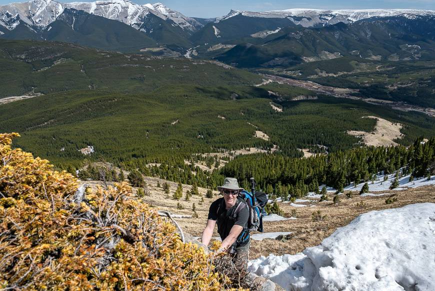
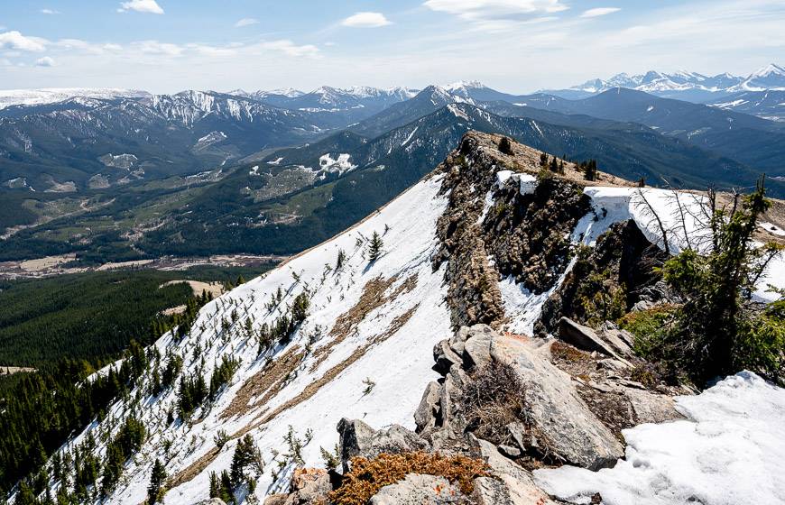
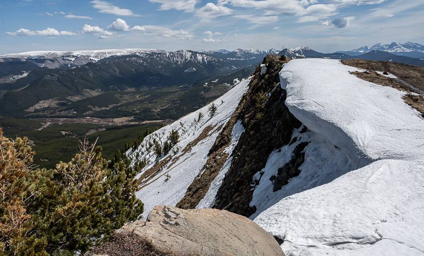
Continue on an upward trajectory with the odd switchback to mitigate the grade. To crest Raspberry Ridge in spring, you’re going to have to climb through a short section of steep snow.
People have boot-kicked steps and there are rocks to hold onto, so you’ll be through it in 30 seconds. If it’s too early in the season this may have to be your turnaround point.
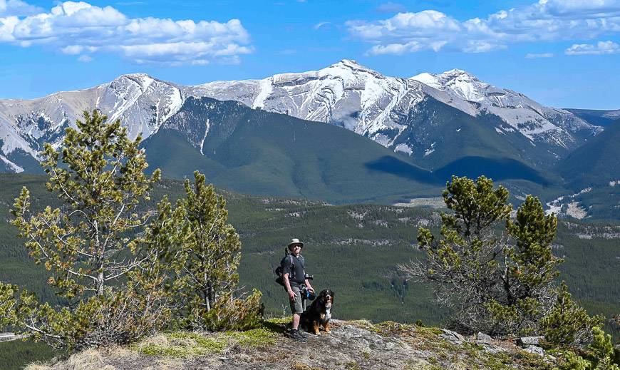
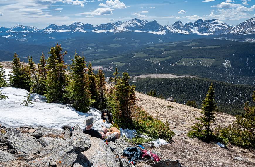
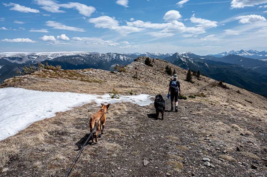
Turn right on the ridge crest and follow it for about 5 minutes as it climbs gently to reach a sign saying Raspberry Ridge and a picnic table. We continued up a little further to find some rock slabs to sit on for lunch but were respectful of the fencing around the Raspberry Ridge Fire Lookout itself.
If you climb to the edge, you’ll get some amazing views down the length of the ridge. From our lunch spot it was easy to pick out the Mist Mountain massif to the NNW. Our total hiking time to our lunch stop was 1.75 hours – and that included too-numerous-to-count snow stops so the dogs could keep cool.
We retraced our steps to return and were back at the car in 1.5 hours. The photos below will give you a good idea of what to expect. We met probably a dozen people, and everyone was doing the route I have described.
The descent from Raspberry Ridge
The descent from Raspberry Ridge was fast, taking just 1.5 hours. But there is an option to add a kilometre and do a slightly easier route down that isn’t as steep. In summer, keep an eye on storms and take the fastest way down if there’s a threat.
Where to stay nearby
The Cataract Creek Campground is only 1.7 km south of the Raspberry Ridge Trailhead. If you want to make a weekend of hiking in the area, this would be a good place to base yourself. There are more than 100 unserviced sites ($31/night) suitable for tents and some RVs.
Campsites are available on a first come-first served basis starting May 18, 2023 until September 4th, 2023. From the campground you can hike up Mt. Burke – a steep but very worthwhile hike with amazing views – and another that is a good one early in the season.
For more details read: A Complete Guide to Camping in Kananaskis
A few useful things for the Raspberry Ridge hike
This hike can get hot. Take lots of water, sunscreen, and asun hat with a brim.
Now that I’ve used one, I’d recommend taking adog water bottle. It works like a charm.
Don’t forget the bear spray in aneasy to access holster.
For those wet days or if you want a comfortable seat at lunch time, pack aninflatable seat cushion.
Looking for more spring hikes in Alberta?
- The Porcupine Ridge hike in Kananaskis
- Heart Mountain Hike near Canmore
- The Wasootch Ridge Trail
- Aylmer Lookout Hike in Banff National Park
- The Easy Mesa Butte Hike near Millarville, Alberta
Click on the photo to bookmark to your Pinterest boards.
