The Ha Ling Peak hike is a fantastic experience if you’re looking for a great workout in the mountains that doesn’t eat up the entire day. Ha Ling Peak is an imposing, inaccessible looking mountain from any vantage point in Canmore, but the reality once you’re on the hiking trail is very different.
There’s a route up that doesn’t require any technical ability – though it will be a good test of your physical conditioning.
This post includes some affiliate links. If you make a purchase via one of these links, I will receive a small commission at no extra cost to you. Thank you very much for your support.
Ha Ling Peak hike summary
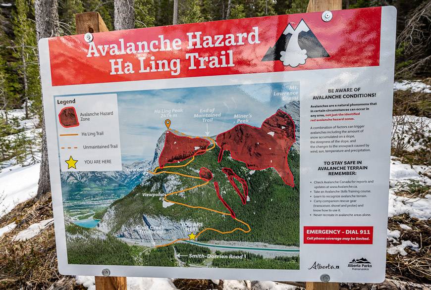
Distance: 3.9 km to the summit or 7.8 km round trip. The first 3.5 km on the Ha Ling trail is maintained to the saddle. The final 400 m is on an unmaintained trail that is composed of loose rock.
Elevation gain: 810 metres or 2,657 feet. The final 400 m climbs 103 m or 338 feet – so the grade is steep!
Level of difficulty: Moderate if you hike a lot – up to expert if you don’t.
Time needed: Allow 3 – 5 hours to do the return hike. It’s a great half day hike. If it’s a beautiful day, allow up to an hour on top to enjoy the view.
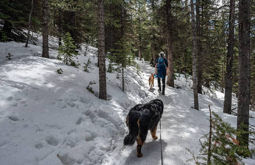
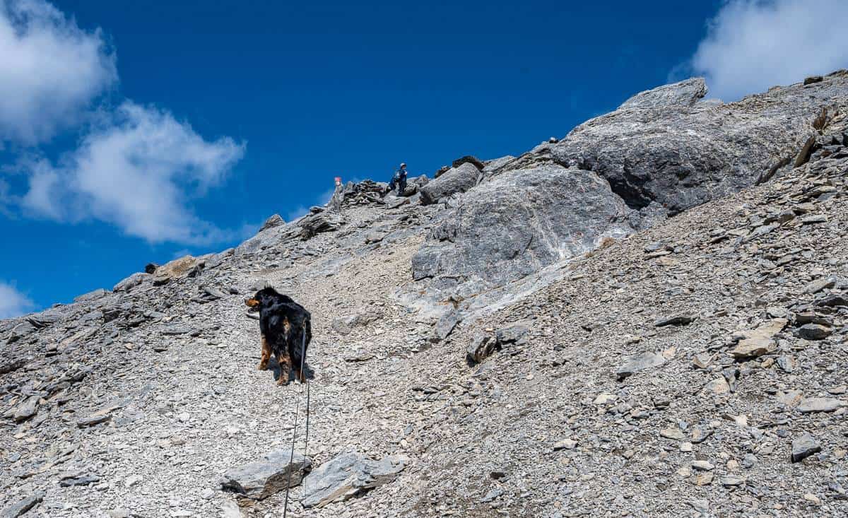
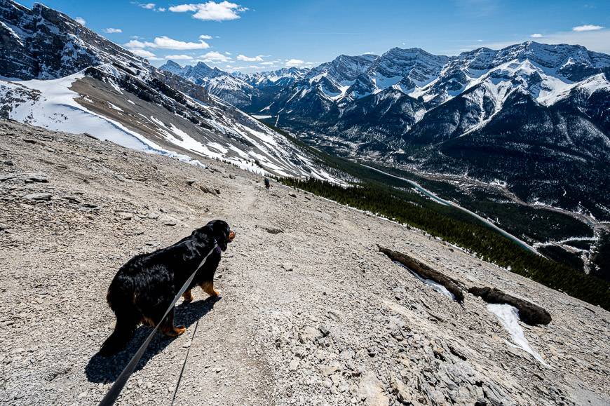
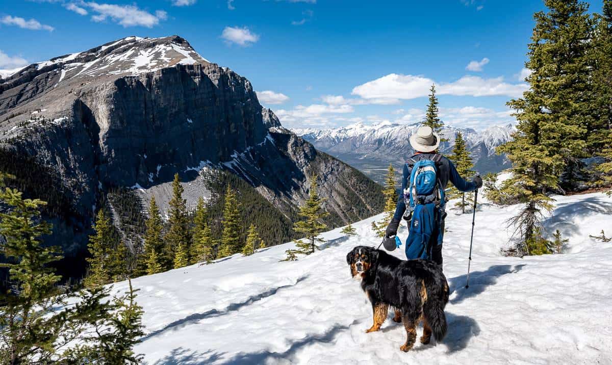
Dogs allowed: Yes, on a leash. If it’s a hot day, take extra water and treats for them.
Trail conditions: Always check the Alberta Parks trail report. Good news. The Goat Creek trailhead reopened in February 2023.
Winter is a possibility: The hike up Ha Ling Peak can be done in winter if you have the skillset. However, there is avalanche danger – and it’s well marked on the maps. You’ll have to use your better judgement.
Summit elevation: Ha Ling Peak elevation is 2,408 m or 7,900 feet.
Facilities: There are washrooms at the Goat Creek parking lot.
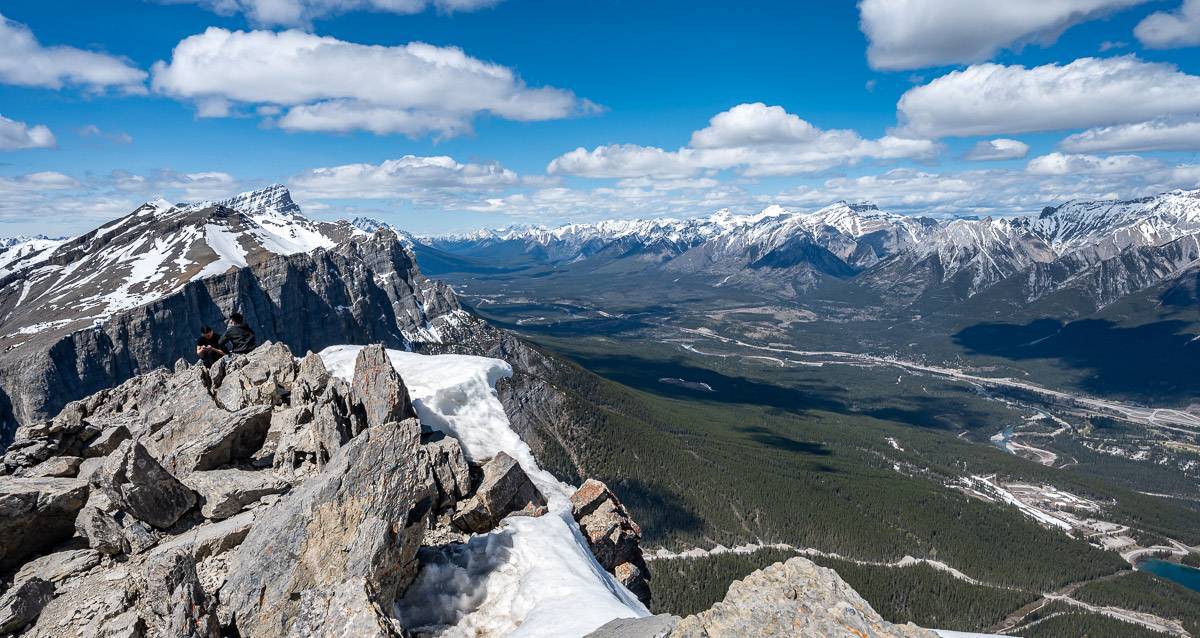
Hiking options: The Miner’s Peak hike is a great add-on to the Ha Ling Peak hike. It’s accessible from the saddle on Ha Ling. Look over and you’ll often see people on it.
What are the views and highlights along the Ha Ling Peak trail?
There are two formalized viewpoints on the way up Ha Ling Peak.
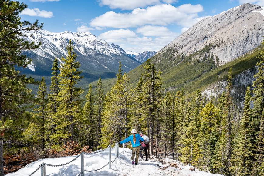
When you reach the first viewpoint, located at the bend after the second long switchback, you’ll find plenty of rocks to sit on. Take advantage of them, catch your breath and have a snack. Enjoy in your face views of Mount Rundle – and EEOR (the east end of Rundle – the mountain you see in front of you).
The first viewpoint is approximately at a third of the way up the hike. If you’re suffering physically at this point – you should know that from here the hike gets harder and steeper. For some of you, it will be a good place to turn around.
There is a second viewpoint after two more long switchbacks. You’ll have to take a short spur trail to get to it – and that’s well worth doing.
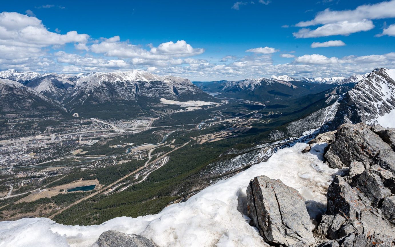
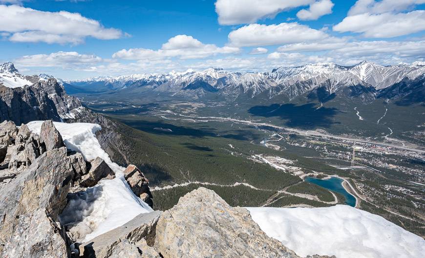
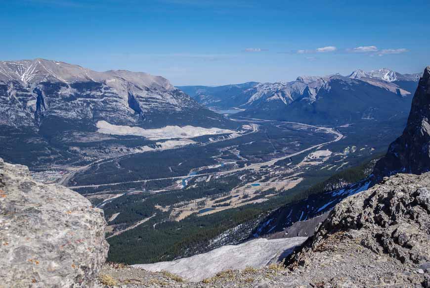
The higher you climb, the better the views. It’s not till you top out on the summit of Ha Ling Peak that you get the superlative views of Canmore and the valley.

Special tips for the Ha Ling Peak hike
Permits: Don’t forget to purchase a Kananaskis Conservation Pass before you go. The fine is considerable if you don’t have one.
Best time to hike: This is a busy hike so the best time to do it is first thing in the morning or later in the afternoon – if it’s in summer and you have lots of daylight left.
Hiking poles: Poles come in really handy as do microspikes when the snow is around. Don’t forget to bring a wind-proof warm jacket for the top.
Food and water: You’ll burn loads of calories – and lose a lot of water on the Ha Ling Peak hike , especially on a hot summer’s day. Carry at least 2 L of water and several high protein bars to give you an energy boost.
Weather: It can change quickly in the mountains. Check the weather forecast before you go. If there is a high probability of a thunderstorm, give it a pass.
Don’t forget: As always, tell someone where you’re going and when you’re due back. Carry the hiking essentials – and please follow Leave No Trace principles.
Location map for the Ha Ling Peak hike
Alternative hikes to Ha Ling Peak
I love Ha Ling Peak for the workout I get and the fantastic views from the summit. Fortunately, there are lots of hikes near Canmore that offer a similar experience, but you might have to drive a little further. Other suggestions include:
- The Wind Ridge Trail near Dead Man’s Flats, Alberta
- West Wind Pass Hike – Kananaskis Country
- Windtower Hike in Spray Lakes Provincial Park
- Sparrowhawk Tarns Hike near Canmore
- Pigeon Mountain Hike near Canmore
Is Ha Ling Peak a difficult hike?
The Ha Ling Peak hike is not difficult in the sense that there are no fancy mountaineering moves required. But you may be sucking wind, especially if it’s the first hike of the season.
I was happy I’d been doing sets of stairs through the winter. Otherwise the 810 m (2,657 feet) elevation gain would have knocked the stuffing out of me. Even with a decent workout schedule my thigh muscles were telling me that they’ve been well used, especially on the summit push.
The hike up the peak is not a long one – just 3.5 km one way to the saddle from the parking lot and other 0.4 km to the summit for a total of 3.9 km one way. It took us just under two hours to get to the summit – and that included a few short stops, including one to put on“icers”in the snowy – icy – muddy section.
The first part of the Ha Ling Peak hike
Before they did the upgrade to the Ha Ling Trail, the first part of the hike reminded me a bit of Vancouver’s Grouse Grind. You used to head up steeply over roots and through the trees with nary a view and no break on the grade for at least 30 minutes. Now the trail is wide – and in good shape with only the odd root to deal with.
But when it opens up at the first viewpoint, it’s impressive. And the mountain views just get better and better the higher you go.
Once you hit the snow and ice – even in May, the grade moderates but without “icers” it can be a little challenging – though very doable since most people we saw didn’t have more than hiking boots on. We were told on more than one occasion that we were very smart to have brought the right equipment.
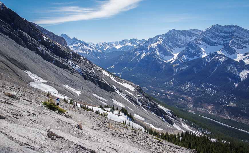
Be prepared for snow, ice, steep stairs, scree and rock – depending on the season
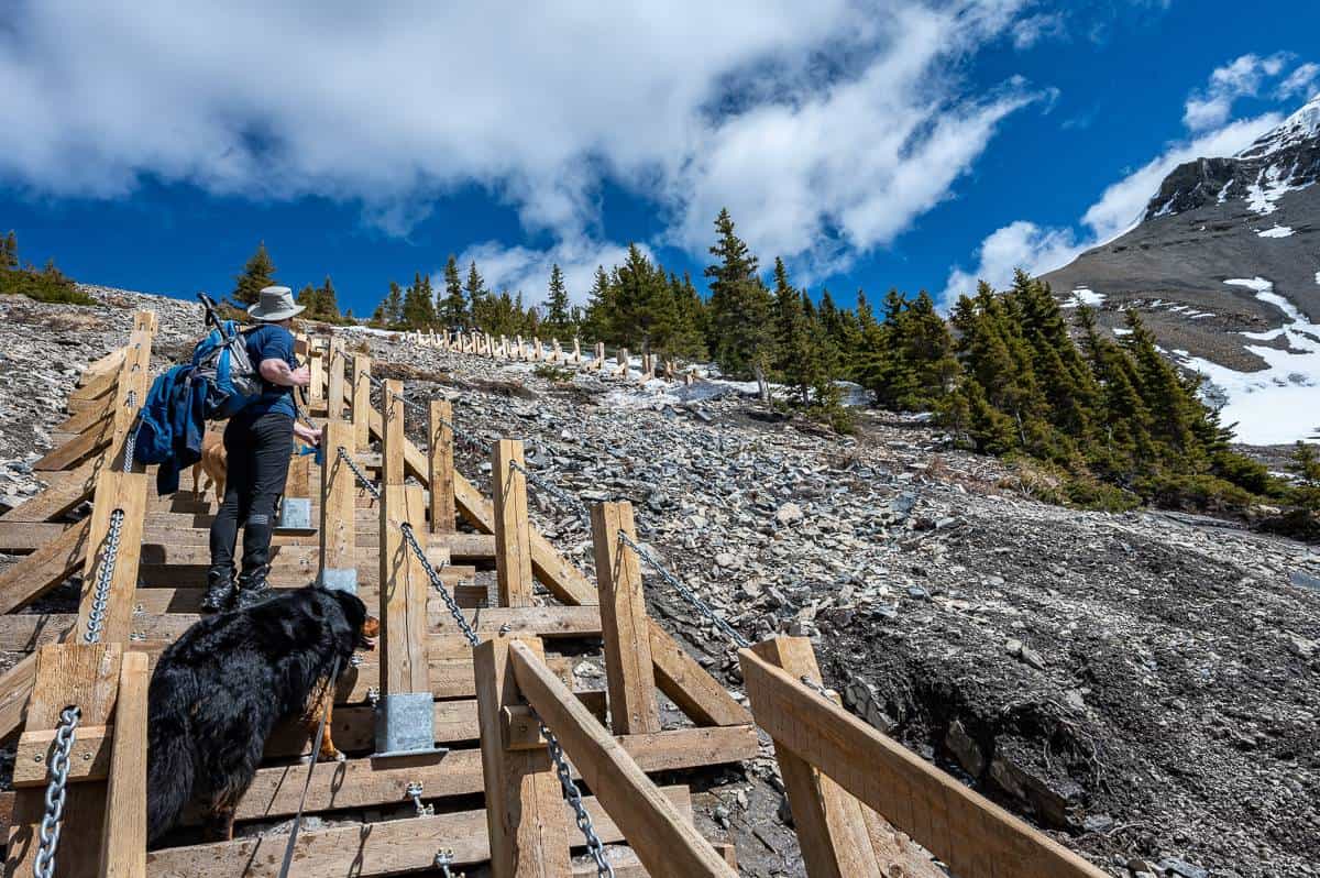
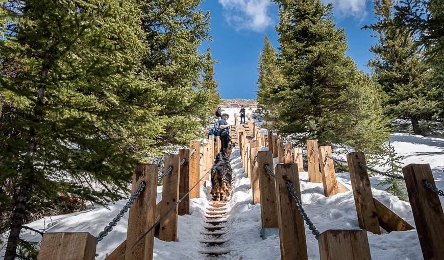
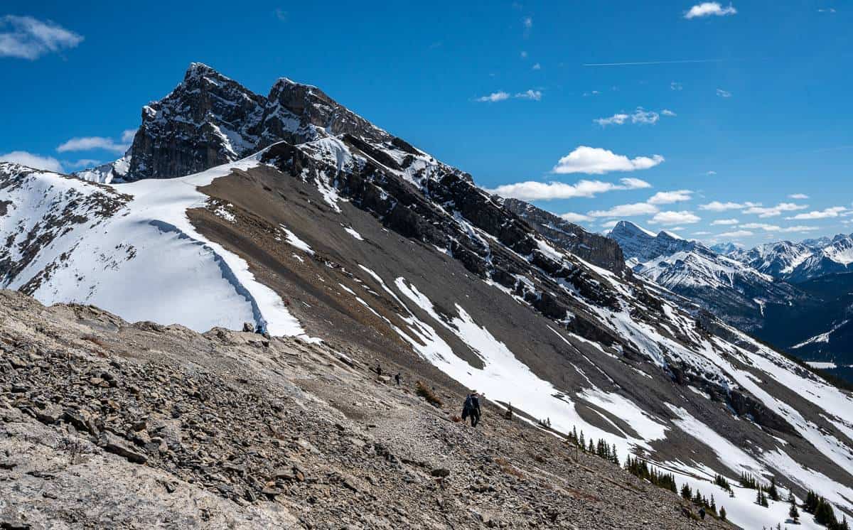
After the snow and ice you’ll have some steep sets of stairs to deal with before getting into scree and rock.
Be patient as the stairs are awkward for some, and if there is a lot of snow around, only one set of stairs typically gets used so you may have to wait a minute to go up or down.
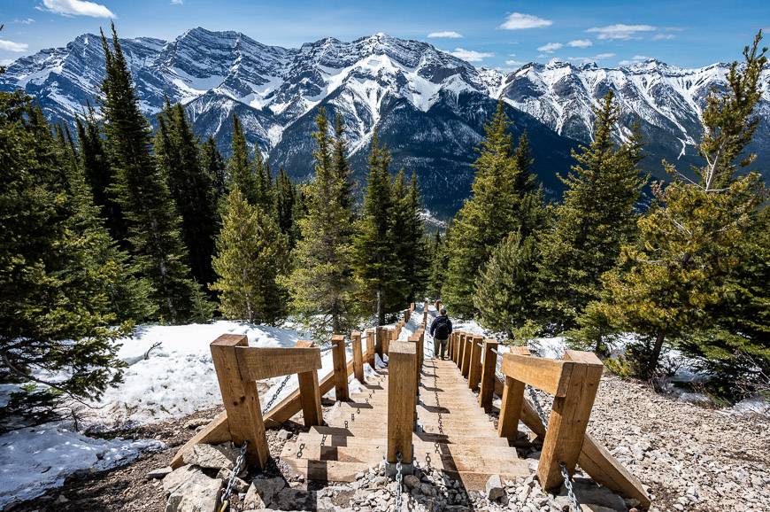
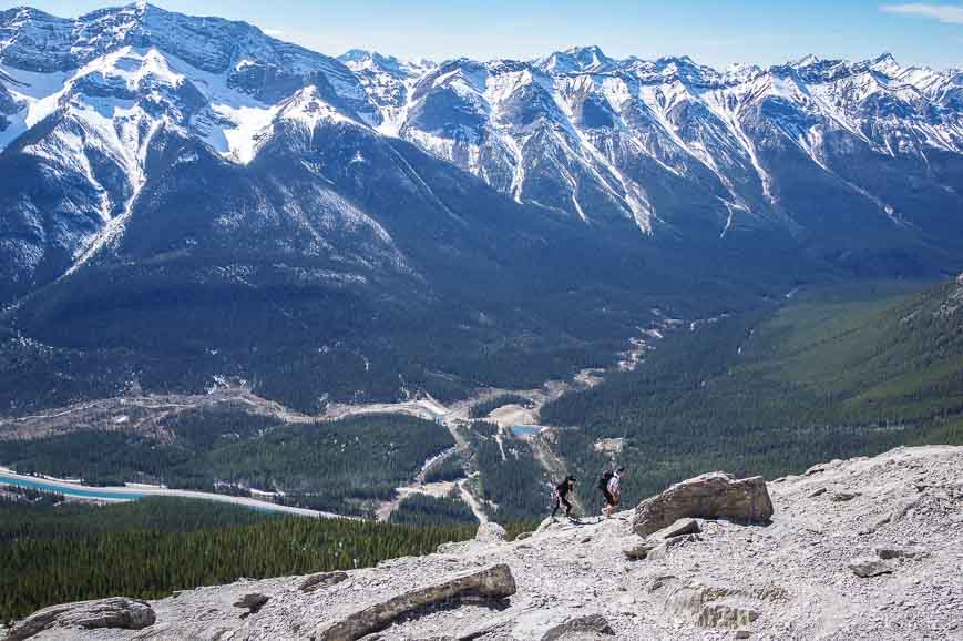
When you finish with the stairs you are into the rock and scree for another 400 metres. The trail is pretty obvious though there are several choices. Be careful where you place a foot so you don’t dislodge any rocks. This section took us about 20 – 25 minutes to climb. I kept stopping just to take in the views.
On a warm Sunday in April, masses of people looked like ants on this part of the mountain. Be especially careful with so many people around that you don’t dislodge any rocks – and if you do be sure to yell – ROCK.
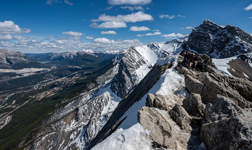
The summit of Ha Ling Peak
Although the summit of Ha Ling Peak is very airy, with some hair-raising drop-offs along the edge, you’ll have no problem finding a safe place to sit. The views are spectacular no matter where you park yourself. Take heed of the signs asking you to avoid dislodging any rocks over the top as climbers could be on the mountain immediately below.
On my most recent ascent of the mountain, my husband had to yell at a couple of novice hikers not to climb onto the snow cornice. Please don’t do that. Instagram fame is not worth your safety.
The descent
I’m never a fan of descents on scree, so I go slowly. Sure-footed people will dispatch with this part of the descent quickly. Once back in the trees I found it much easier to move quickly.
Finding the Ha Ling Peak trailhead
From downtown Canmore follow signs pointing to the Canmore Nordic Centre. Turn west off the Three Sisters Parkway onto Highway 742 – also called the Smith Dorrien Road. From the Canmore Nordic Centre it’s a 10 minute, 5.3 km drive to the trailhead at the Goat Creek Day Use Area.
The parking lot is on the right (west) side of the road if you’re driving up from Canmore. But to get to the actual trailhead you’ll have to cross the Smith Dorrien Road and walk up the service road to the canal – a distance of about 50 m.
Cross the canal on the concrete bridge and look for the sign saying Ha Ling Peak. Start the hike by heading up into the woods. Take note of the avalanche areas – and if there is any snowpack, avoid altogether or go prepared with all the right avalanche gear.
Things to take on the Ha Ling Peak hike
Take lots of water on this hike, especially on a warm, sunny day. If you’ve brought your dog, carry extra water for them as well. Don’t forget thesunscreenand some warm clothes for the top.
If it’s early in the season and there is lingering snow, a pair of Yactrax or othericer deviceswill make both the ascent and descent easier.
I always like to have a paper map – not only for the hike but for future hikes so a copy ofGem Treks Canmore and Kananaskis Village would be useful. It’s waterproof.
Hiking poles can help save your knees on the descent. A pair ofcollapsible lightweight polesare ideal.
Ha Ling Peak trail upgrades
The trail up Ha Ling Peak reopened in summer 2019 after 16 months of upgrades. The new trail is now longer with a slightly different shape that will make it safer for a larger number of hikers. Two viewpoints were added along with rails and cable ladders – where according to the Calgary Herald – “the grade couldn’t be reduced.”
A quieter, harder alternative to the Ha Ling Peak hike
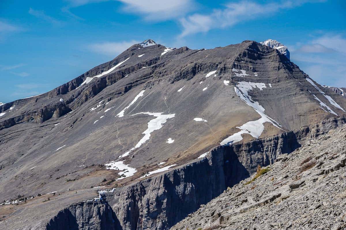
If you want a hike that sees a lot fewer people but starts from a trailhead across the road, do EEOR (East End of Rundle). It’s a bigger workout with an elevation gain of 900 m (2,952 feet). Near the top there is a little scrambling – and not everyone will be comfortable here.
Even if you get to the scrambling section and turn back, you can enjoy some truly outstanding views. You can see the trail in the photo below.
Other ideas for great spring mountain hikes in Alberta
The bottom line is that Ha Ling is getting crazy busy, especially on sunny spring and summer weekends. If you’re still keen to do it, consider early or late in the day or better yet on a weekday. That will take pressure off the parking lot too.
A great spring hike that will give you a workout is Mount Burke. Come late May, Castle Mountain Lookout is a good choice as is Heart Mountain.
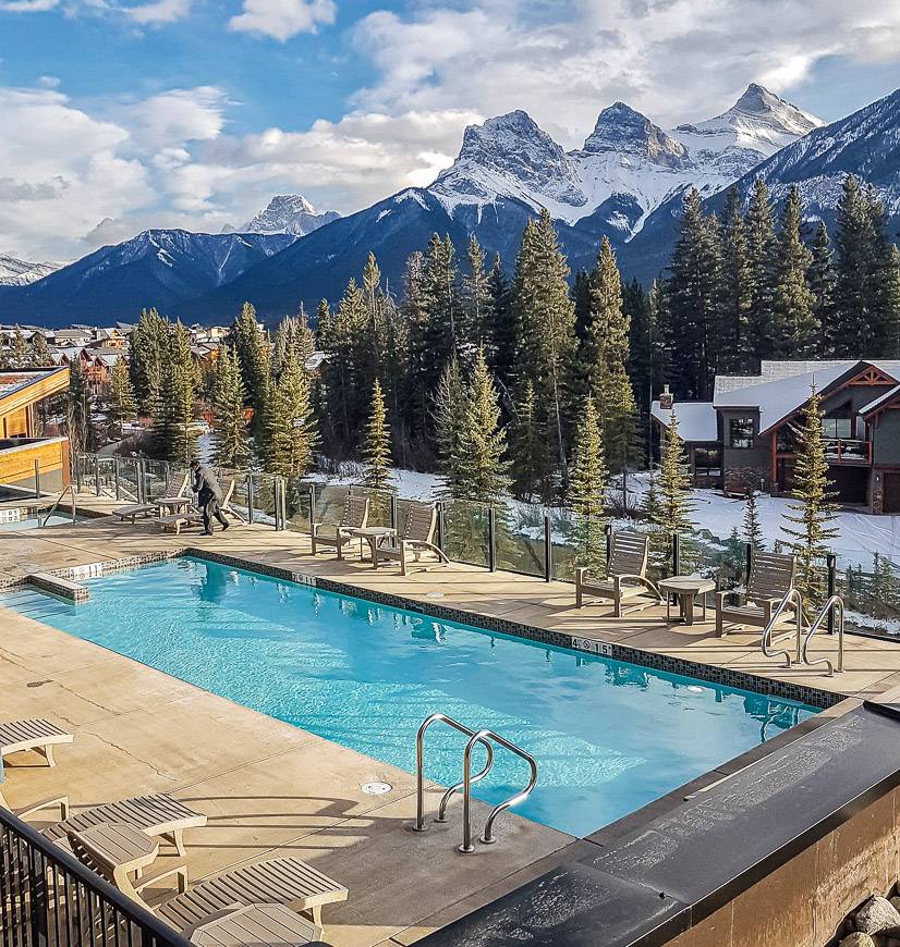
Where to stay near Canmore
If you’re into car-camping read: A Complete Guide to Camping in Kananaskis.
You’ll find everything in Canmore from hostels to B&B’s to high end accommodation. Here are a few suggestions across a range of price points.
- A Bear and Bison Country Inn if you’re after a B&B type of experience.
- TheCanmore Hostelis a great choice for those on a budget.
- For a splurge try theMalcolm Hotel.
- Interested in doing your own cooking and laundry? TheBasecamp Resorts Self Check Inshould do the trick.
Click on the photo to bookmark to your Pinterest boards.
