If you’re a serious hiker and you’ve spent a lot of time in Alberta’s Kananaskis Country, chances are high that you’ve heard about or considered doing the North to South Kananaskis Pass hike via Turbine Canyon, Beatty Lake, and Three Isle Lake.
I have thought about the hike for years, but worried about the route finding on the trail. Fortunately, it wasn’t an issue at all. Over the years enough people have hiked between North and South Kananaskis Pass that the trail is boot-beaten and either dead simple to find or in places where it’s overgrown, the way forward is obvious.
There is no signage on the trail once you leave Turbine Canyon Campground heading to North Kananaskis Pass or Three Isle Lake heading to South Kananaskis Pass. With a hiking app like Organic Maps, and a good topo map to keep you oriented, experienced hikers should not have a problem, but this is not a hike for novices.
You can do the hike in either direction but as you’ll see below, if you read the post, I recommend doing it from North to South Kananaskis Pass. I was tired at the end of every day, but I’m happy we did it as three day hike. If you wanted something epic, you could add on an out and back on the Northover Traverse from Three Isle Lake.
The North to South Kananaskis hike is exceptional – and on par with many backpacking trips in Banff and Jasper National Parks.
If you stay at Beatty Lake and Turbine Canyon Campgrounds, you’ll have more leeway in dates – and you should be able to book last minute (Turbine Canyon had 3 of 15 spots taken on a beautiful July weekend!) when you know there’s a good weather window.
This post includes some affiliate links. If you make a qualifying purchase through one of these links, I will receive a small percentage of the sale at no extra cost to you. Thank you very much for your support.
North to South Kananaskis Pass via Turbine Canyon summary
Distance: Approximately 40 km (25 miles), primarily as a loop hike with an out and back section from the parking lot to the Forks Campground.
Elevation gain/loss: Approximately +1,426 m (4,678 feet)/-1,370 m (4,495 feet)
Best time to hike: Mid-July until sometime in September. There is a long stretch filled with larches on the final few kilometres to Turbine Canyon Campground. They would be magnificent come mid to late September.
Time needed: Two nights and three days or three nights and four days for an easier experience.
Difficulty: Hard
Backcountry campgrounds: Yes, including the Forks Campground, Turbine Canyon Campground, Beatty Lake Campground, and Three Isle Lake Campground.
Dogs: Permitted on a leash.
Permit: You need a Kananaskis Conservation Pass to do the North to South Kananaskis Pass hike.
Bears: You’re in bear country so always carry an easy to access can of bear spray. I recommend keeping it in abear spray holsterso you don’t accidentally set it off.
Backcountry campgrounds: You can make online reservations for backcountry campgrounds 90 days in advance of your visit.
Please: Practice Leave No Trace principles. Be sure to let someone know where you’re going and when you are due back.
Trail conditions: Before you head out on any of the North to South Kananaskis Pass hike, check the trail reports for closures on the trails you’ll be hiking. All it takes is a bear moving into the area, and a trail can be closed for the short term.
Trailhead location for the North to South Kananaskis Pass hike
You’ll find lots of parking and washrooms for the North to South Kananaskis hike at the North Interlakes Day Use Area in Peter Lougheed Provincial Park.
To get there take the Trans-Canada Highway to Highway 40. Drive south for 50 km. Turn right or southwest right (if you’re coming from the Trans-Canada) onto Kananaskis Lakes Trail.
Stay on the paved Kananaskis Lakes Trail. (Ignore the turnoff on your right onto the Smith Dorrien Trail.)
Pass the turnoff to the Canyon Creek Campground, William Watson Lodge and Boulton Creek. (But go here after your hike if you want cold drinks and ice cream!) Do not take a left towards the Upper Kananaskis Day Use Area. Instead, continue past the turnoff to the Interlakes Campground to reach the North Interlakes Day Use Area, basically at the end of the road.
From the turnoff at Highway 40, it’s approximately 15 km to the parking lot.
If you’re driving north on Highway 40 from Highwood Pass, the only thing you need to do differently is turn left onto the Kananaskis Lakes Trail by the winter gate.

Backpacking itinerary options for the North Kananaskis – South Kananaskis Pass hike
There are lots of options for the North to South Kananaskis Pass hike. You could hike it in the other direction from South Kananaskis Pass to North Kananaskis Pass but there are three reasons for not doing that.
- The climb up the headwall to Three Isle Lake Campground with a loaded backpack is physically taxing.
- I think the hike down the steep scree slope after Beatty Lake is harder than the hike up – unless it is stinking hot and you’re out of water.
- The hike up to North Kananaskis Pass is long and very steep.
We elected to backpack the 48 km North to South Kananaskis Pass hike over two nights and three days, but you could add a night, especially if you’re coming from afar.
It’s not difficult to get a reservation for Turbine Canyon Campground, but Three Isle Lake Campground is more popular and therefore harder. That’s the beauty of a night at the Beatty Lake campground. It’s also free and first come, first served. There are 4 tent sites and another couple of tents could be squeezed in if necessary.
There are four options if you’re hiking from North to South Kananaskis Pass.
Itinerary 1: Turbine Canyon Campground – Beatty Lake Campground – parking lot (this is described below)
Itinerary 2: Forks Campground – Turbine Canyon Campground – Beatty Lake campground – parking lot
Itinerary 3: Turbine Canyon Campground – Three Isle Lake Campground – parking lot
Itinerary 4: Forks Campground – Turbine Canyon Campground – Three Island Lake campground – parking lot
There are also four options if you choose to hike from South to North Kananaskis Pass.
Itinerary 1: Forks Campground – Beatty Lake Campground – Turbine Canyon Campground – parking lot
Itinerary 2: Forks Campground – Three Isle Lake Campground – Turbine Canyon campground – parking lot
Itinerary 3: Three Isle Lake Campground – Turbine Canyon Campground – parking lot
Itinerary 4: Beatty Lake Campground – Turbine Canyon Campground – parking lot
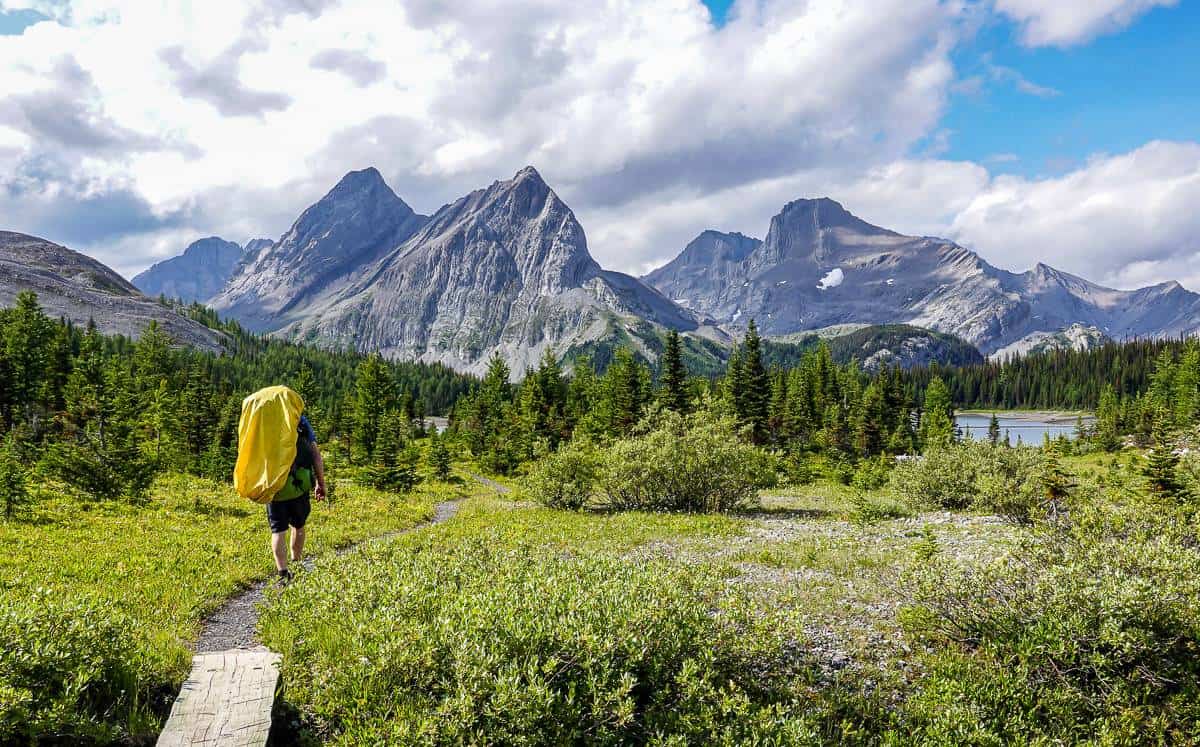
Day 1 on the North to South Kananaskis Pass hike: North Interlakes Day Use Area to Turbine Canyon Campground
Distance: 15.0 km (9.3 miles) one way
Approximate elevation gain: 525 m or 1,722 feet
Time we took: Approximately 6.5 hours with a lunch stop and a long stop at the Forks Campground
Leave the parking lot via a footbridge over the spillway. Turn left onto an old road. Pass the turnoff to Mt Indefatigable – a trail you should no longer hike as it has been decommissioned to protect grizzly habitat.
When there’s an intersection, stay right on the upper trail. If you ever plan to hike the Upper Kananaskis Lakes Circuit, the lower trail is a great choice as a day hike.
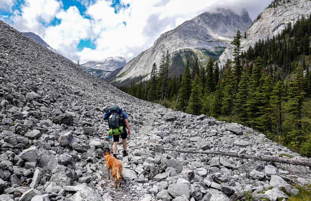
At the next intersection, 2.2 km into the hike, keep right and follow the rocky road beneath steep slopes. Continue, passing the Palliser rockslide. Reach a bridge over Invincible Creek, 3.8 km into the hike.
Continue through old forest to reach a bridge over the Kananaskis River at the 5.8 km mark. Skirt another rockslide at the base of Mount Lyautey and then enjoy mostly flat and easy hiking to the Forks Campground.


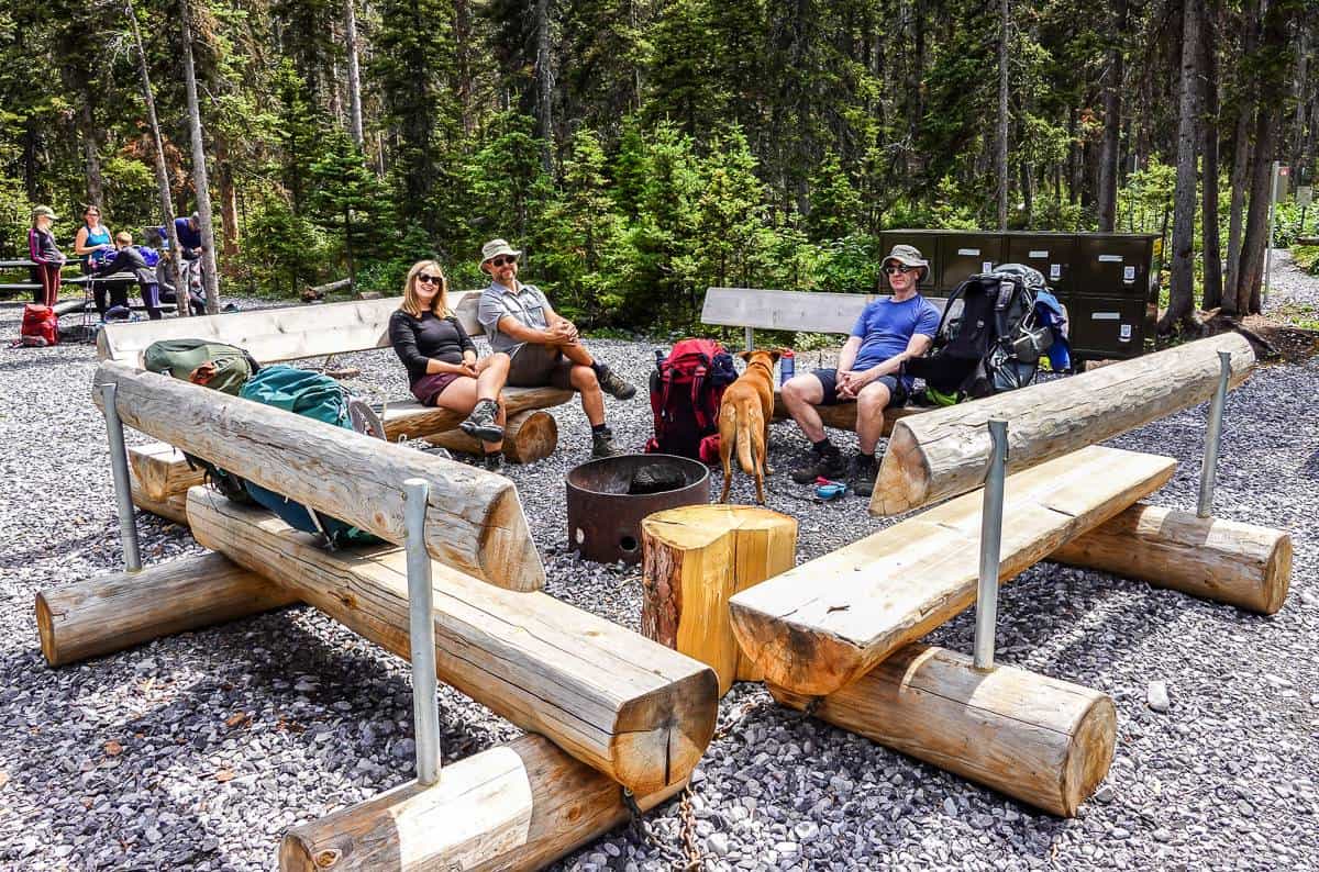
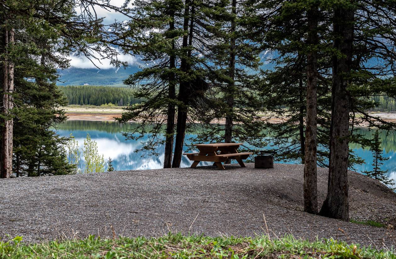
Arrival at the Forks Campground
Reach the Forks Campground at 7.2 km. It’s a good place to stop for a break. It’s right on the river, so you can refill water bottles. There are numerous picnic tables and benches around a fire pit. There is also a pit toilet.
Continuing to Turbine Canyon Campground
Hike past the Forks Campground towards Three Isle Lake. You’ll find the trail to Turbine Canyon a few hundred metres along from the Forks Campground. Turn right. You have about 7.7 km to go.
The trail parallels the west bank of the Kananaskis River for about 1.2 km. Then, there is a steep ascent via switchbacks but at least there are some views of Mount Lyautey to the south. When you are back in the forest, look for larches. There are lots of them on the way to Turbine Canyon campground.
The way forward is always obvious.


Putnik Pond is a pretty sight, and worthy of a short break. It’s about 4.3 km from the Forks Campground. For the next 1.7 km enjoy subalpine meadows and the larch forest on the way to Lawson Lake. Beyond Lawson Lake look up to the twin summits of Mount Maude.
Pass a ranger cabin near the north end of Lawson Lake and a 100 m later cross a bridge over Maude Creek to reach the newly revamped Turbine Canyon campground.


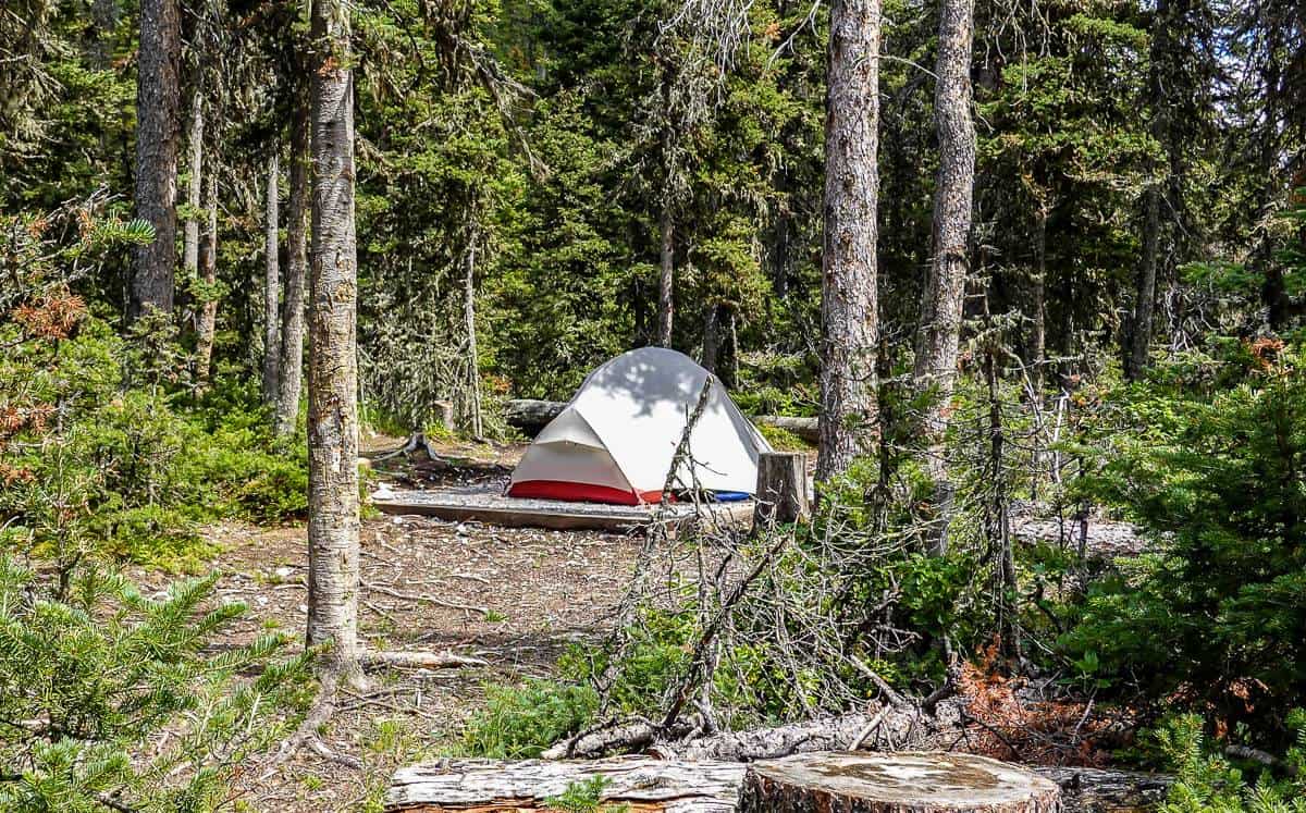
Turbine Canyon Campground
The Turbine Canyon campground is large and spread out. Some campsites have wood chips while others have wooden platforms for tents.
There are 15 campsites, bear lockers, pit toilets, metal picnic tables (bring aninflatable seat cushionto keep your backside warm), but no fires are permitted. You can easily get water from Maude Brook.
This campground holds snow longer than most. One year we had booked it in early July but there was still about 2 metres of snow on the ground according to a report we got. Unless it’s a light snow year, I’d hold off booking till around mid-July. It’s also chilly at this campground.
Even in late July we wore adown jacketat night and in the morning – and knocked ice off the picnic tables.
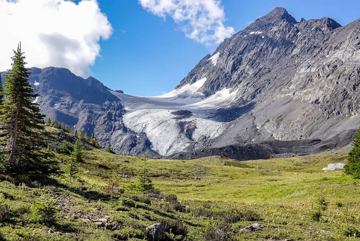
From Turbine Canyon there is a popular 2.8 km one way hike to the Haig Glacier, used as a summer ski camp. Many people will stay at Turbine Canyon for two nights, hiking to both Haig Glacier and North Kananaskis Pass before retracing their steps to the Forks Campground and out.

Day 2: Turbine Canyon Campground – North Kananaskis Pass – Beatty Lake Campground
Distance: 2.2 km (1.4 miles) to North Kananaskis Pass plus approximately 8.4 km (5.2 miles) to Beatty Lake Campground
Approximate elevation gain: Ascent of 770 m (2,526 feet) and a 760 m (2,493 feet) descent
North Kananaskis Pass elevation: 2,368 m
Time we took: Approximately 9 – 9.5 hours with breaks.
Be prepared for a long, difficult but rewarding day of hiking from Turbine Canyon Campground to Beatty Lake.
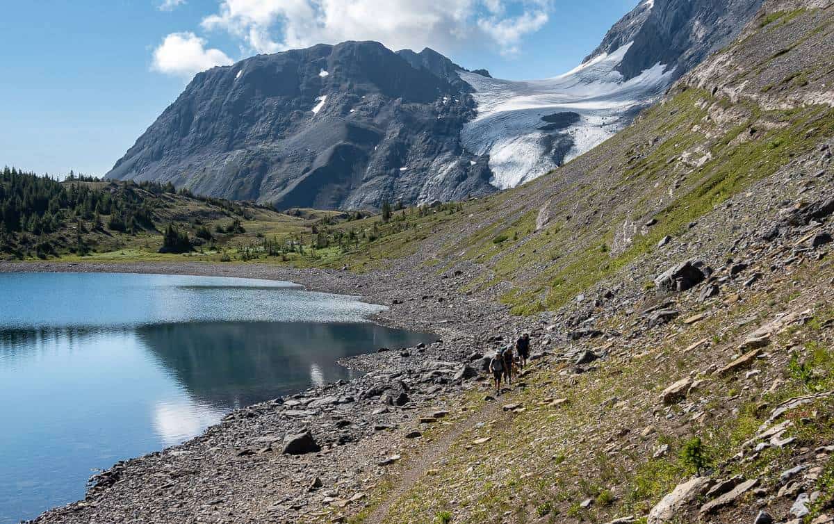
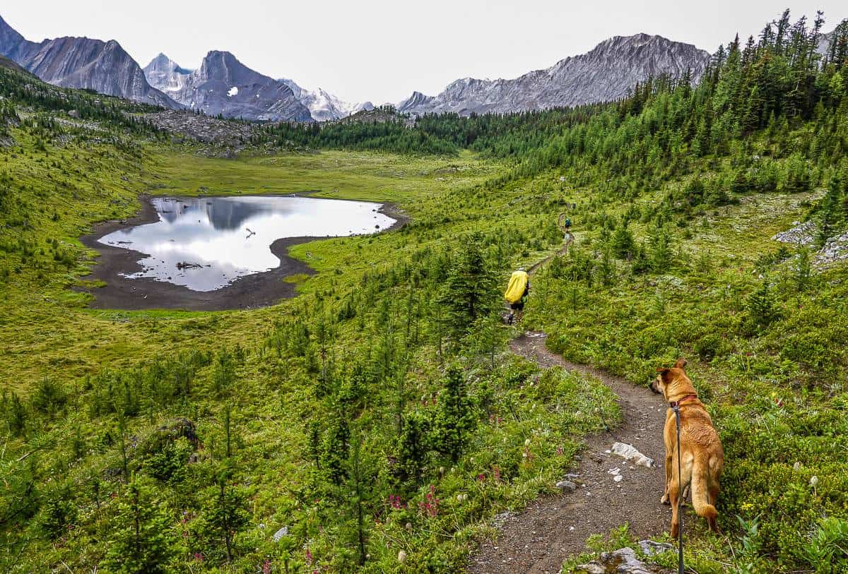
The first part of the day’s hike starts off easily enough. There is a 170 m elevation gain over 2.2 km to reach gorgeous Maude Lake, and North Kananaskis Pass. Mount Beatty Glacier looks close enough to touch!
The trail wanders through the campground and not alongside Maude Brook as we originally thought. Once you leave the campground, the trail is completely obvious and lovely. Take some time around Maude Lake as it’s a beauty. We did notice many grizzly bear diggings in this area, so be alert.
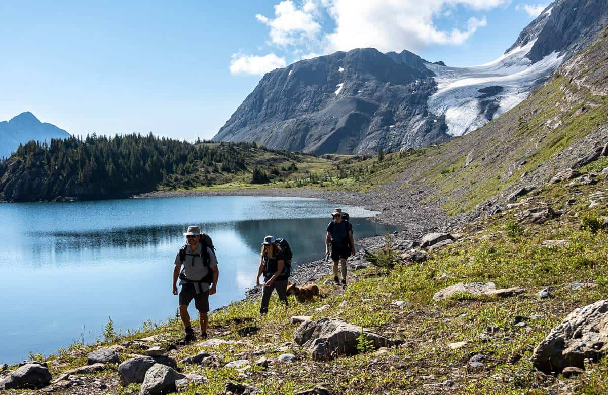

On the other side of North Kananaskis Pass there is an expansive view of Mount Queen Elizabeth and Mount King Albert.
Once you start descending, you won’t look up very often as it’s steep and you really need to watch your foot placement.
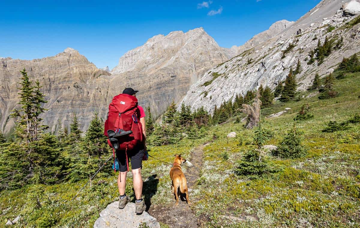
This part of the hike is part of the Great Divide Trail – as was the first day’s hike. Although there is no signage, it is boot-beaten and obvious. There are a few locations where it’s overgrown but jut plow through and it will open up. Ultimately, it’s 4.4 km from North Kananaskis Pass to the second crossing of Le Roy Creek.


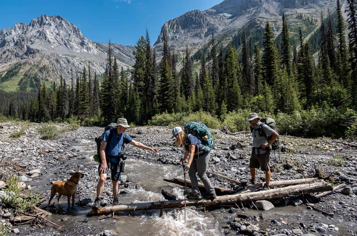
Le Roy Creek crossings
There are two main crossings of north-south running Le Roy Creek. Follow Le Roy Creek very closely for about 1.5 km before the trail drops down to reach a wider, deeper section of the creek.
There’s an intersection marked with flagging tape where you’ll go left and be at the creek in 5 metres. (The Great Divide Trail continues towards the Palliser River.)
At the larger stream crossing I’d recommend switching into water shoes or sandals – but before you do look right and across the creek to locate a large cairn. There is also flagging tape. That’s where you’ll start up on an unmaintained trail towards Beatty Lake and South Kananaskis Pass.


After a break for lunch, we started up on the next section of trail. It was quite steep initially and thick with vegetation as you can see in the photo below. But it’s obvious and never once did we lose the trail.
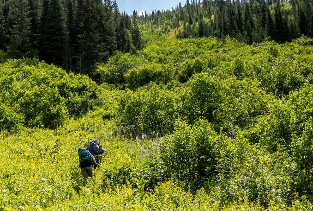
Eventually the trail towards South Kananaskis Pass heads in a more easterly direction and you start to leave the trees.
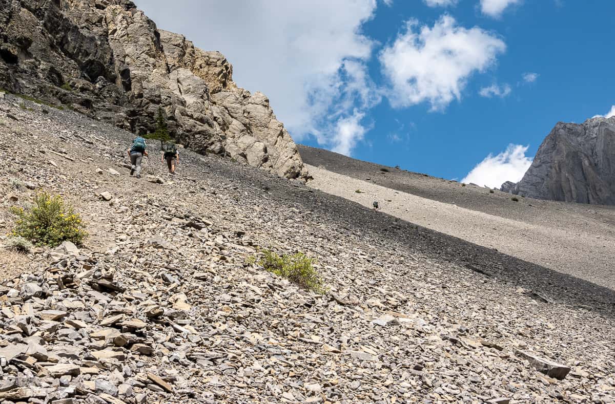
We stopped at Beauty Creek so we could refill water bottles before starting the steep ascent on scree up towards Beatty Lake. Look out for a blue tarn in the forest to the south of the main trail.
Although it’s a slog, I loved the scree section as the vistas were great – and I knew once we reached the top, we’d almost be at Beatty Lake. It was on the scree section that we ran into five other people including a couple of runners doing the whole loop in a day!
From the top of the scree slope you still have another 15 – 20 minutes of hiking to reach the Beatty Lake Campground. It’s not hard, but at the end of a tough day, the distance feels longer than it should.

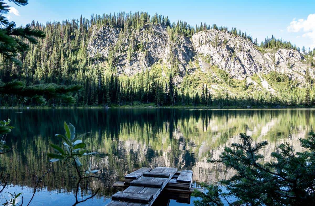
Beatty Lake Campsite in Height of the Rockies Provincial Park, BC
The Beatty Lake Campground is small and intimate with just four first come- first served campsites.
There are bear lockers close to the eating area and a pit toilet a short distance up a trail. The lake is a beauty and very refreshing to wash up in at the end of a sweaty, hot hike.
From Beatty Lake – there is a 1.1 km one way hike up to Beatty Col should you have the energy. We did not.


Day 3 on the North to South Kananaskis Pass hike: Beatty Lake Campground – Three Isle Lake – parking lot
Distance: 14.3 km or 8.9 miles.
Elevation gain: 131 m (430 feet) to South Kananaskis Pass and a 610 m (2,001 feet) elevation loss.
South Kananaskis Pass elevation: 2,306 m.
Time needed: About 6 hours with breaks and stops
The last days hike was the easiest. It’s a gradual 2.0 km climb on a scenic trail from Beatty Lake to South Kananaskis Pass. From there is a quick downhill to reach Three Isle Lake though the campground is 2.1 km from South Kananaskis Pass.
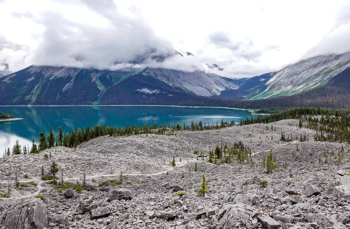
Three Isle Lake is not at its best in mid-summer when lake levels have dropped. When we did a backpacking trip to Three Isle Lake two years ago, the lake was much higher and there was a lot of snow on the peaks.


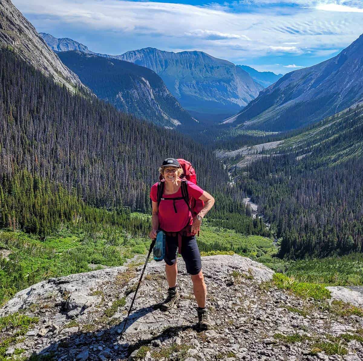
From the Three Isle Lake Campground, there’s a short bit of uphill and then a flattish section before you drop down off the headwall. The views from here of the valley are superb. Once off the headwall, keep an eye out for grizzlies over the next kilometre as they love this area.
After you cross a bridged creek, you’re only about 1.5 km from the Forks Campground – and the hiking is easy. Once you’re at the campground you’re on familiar territory and you’ll be back at the car in about 2.5 hours.
The tough among you may even have a frigid swim in Upper Kanananskis Lake to loosen the muscles. Our group just made a beeline for ice cream cones at the nearby Boulton Creek Trading Post.


A few things worth taking on the hike
I highly recommend taking a paper map – for trip planning purposes and especially if you’re considering the hike between Three Isle Lake and Turbine Canyon campgrounds over North and South Kananaskis Passes. TheGem Trek Kananaskis Lakes Mapis the one to get.
For the nature lover who wants to learn the names of wildflowers, the compactPopular Wildflowers of Alberta & the Canadian Rockiesis a smart choice.
For unexpected gear fails on a trip,Gear Aid Tenacious Tape Repairis the way to go. It will fix sleeping pads, rain pants, down jackets, tent flies, tarps and more.
If you’re not a big fan of backpacking because of uncomfortable nights in a tent, consider investing in adeluxe pillowthat weighs next to nothing.
In case of emergency it’s well worth carrying theInReach Mini– but know how to use it and make sure you’ve signed up for a plan.
Where to stay the night before the hike
It’s about an hour and 50-minute drive from Calgary to the trailhead. If you’re staying at the Forks Campground, you can afford to get a late start as it just takes a few hours to hike there. But if you’re going to Three Isle Lake or Turbine Canyon Campgrounds, then you might want to stay close by the night before.
There is lots of car-camping available, with much of it first come, first served. Check out my post – A Complete Guide to Camping in Kananaskis.
If you’re after a nice meal and a hot shower before you start camping, there is the option to book theKananaskis Mountain Lodgein Kananaskis Village.
TheKananaskis Wilderness Hostelis also an option.
If you’re coming from Canmore, and you are after the B&B experience, check outA Bear and Bison Country Inn. The Alpine Club of Canada also runs ahostel in Canmore.
Additional backpacking trips in BC and Alberta you’d probably enjoy
- The Elk Lakes – Petain Basin Hike in British Columbia (one option allows for a start in Peter Lougheed Provincial Park)
- The Brazeau Loop Trail in Jasper National Park
- Sawback Trail Hike: Johnston Creek to Baker Lake
- Sunset Pass – Sunset Lookout Backpack – Icefields Parkway
- Tombstone Lakes Hike & Camping Trip in Kananaskis
Click on the photo to bookmark to your Pinterest boards.
