Prairie View Trail – Jewell Pass Hike
The Prairie View Trail – Jewell Pass hike in Kananaskis Country is a good choice in the shoulder season when you want to get outside but don’t want to commit to a long drive. It takes less than an hour to get to the trailhead from Calgary.
The Prairie View Trail hike is a very popular one. It’s definitely not one of the prettier hikes in Kananaskis Country but in the off-season when you just want to get out, I think it’s an excellent choice. And its way more interesting if you do the Prairie View Trail – Jewell Pass hike combo as described below.
This post includes some affiliate links. If you make a qualifying purchase through one of these links, I will receive a small percentage of the sale at no extra cost to you. Thank you very much for your support.
Would you like to save this?
Prairie View Trail – Jewell Pass hike summary
Distance: The total km if done as a loop to include Jewell Pass is 13.5 km or 8.4 miles. Compare that to the 9.8 km (6.1 miles) return hike if you just do an out and back on the Prairie View trail.
Elevation gain: 421 m or 1,381 feet of elevation gain
Level of difficulty: Moderate
Time needed: 4 – 5.5 hours.
Dogs: Allowed on a leash.
Bears: Even though I’ve never so much as seen bear scat on the trail, I would recommend carrying a can of bear spray you can easily access. Keep it safe in abear spray holster.
Permits: Be sure you have purchased a Kananaskis Conservation pass.
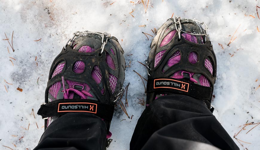
Weather: Not only can the Prairie View trail be snowy by mid-October, it can hold the snow well into May. Don’t forget the icers and a pair of poles plus some warm clothes just in case.
Don’t forget: Pack the 10 hiking essentials. Let someone know where you are going and when you’re due back.
Trail conditions: For more information on trail conditions in Kananaskis Country visit their website or visit the Kananaskis Visitor Information Centre on the drive to the trailhead.
Prairie View Trail – Jewel Pass hike description
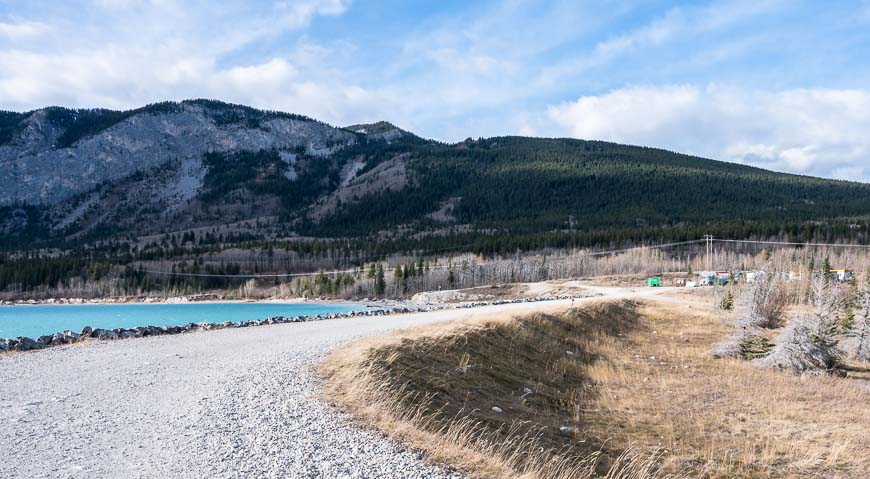
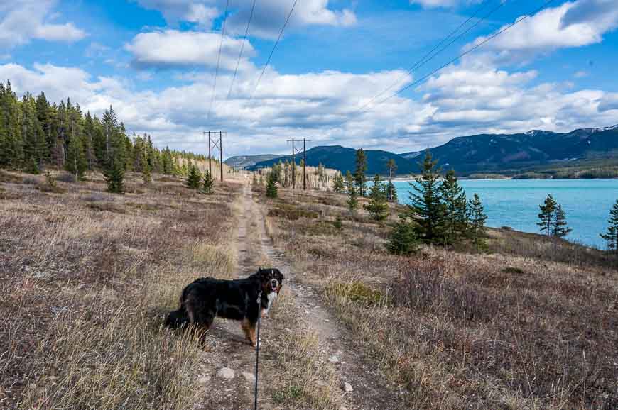
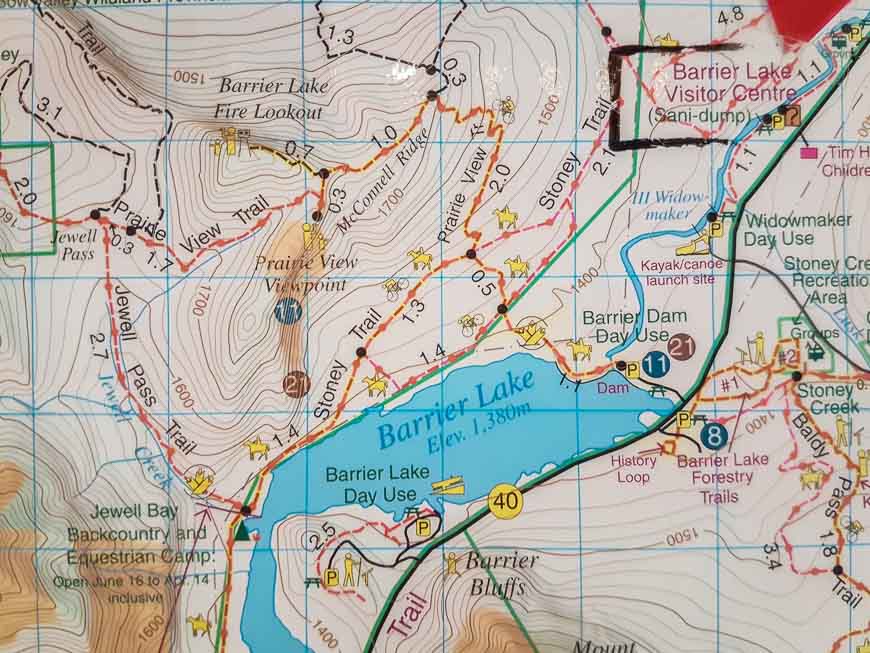
After you’ve parked your car head for the gravel road that crosses the Barrier Lake Dam. This is not the prettiest part of the hike! Cross under a powerline and continue up either the road or the trail. If you stick to the trail you’ll come to a bench with a bit of a view at the top of a small hill.
There is an intersection here. If you go left you’ll end up heading for the Jewell Pass trail. At the end of the day you end up returning to this spot if you do the hike as a loop.
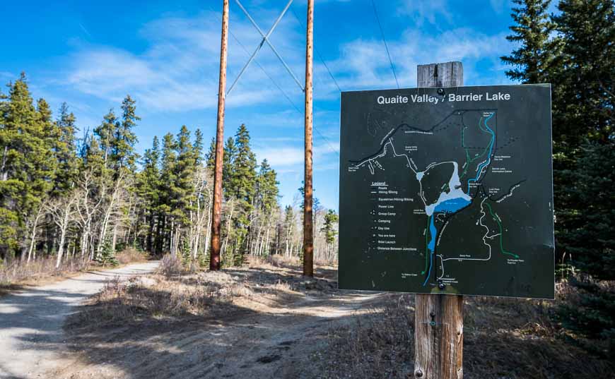
When you see the sign in the photo below and the two hydro poles go left. Follow the road. Stay left again at the next intersection and then start switch-backing up the hill, climbing a total of 421 m. An old trail also climbs the hill, but it’s been covered with brush to prevent people from walking on it.
The last couple of sections in the trees were icy and snow covered in mid-October so icers come in very helpful.
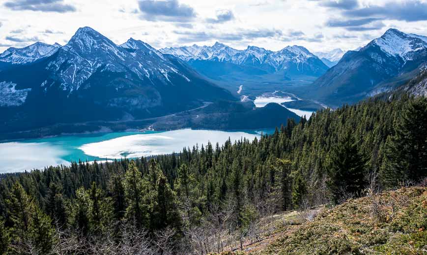
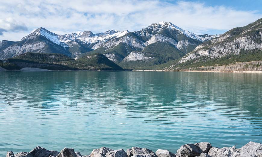
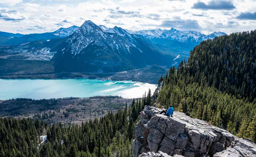
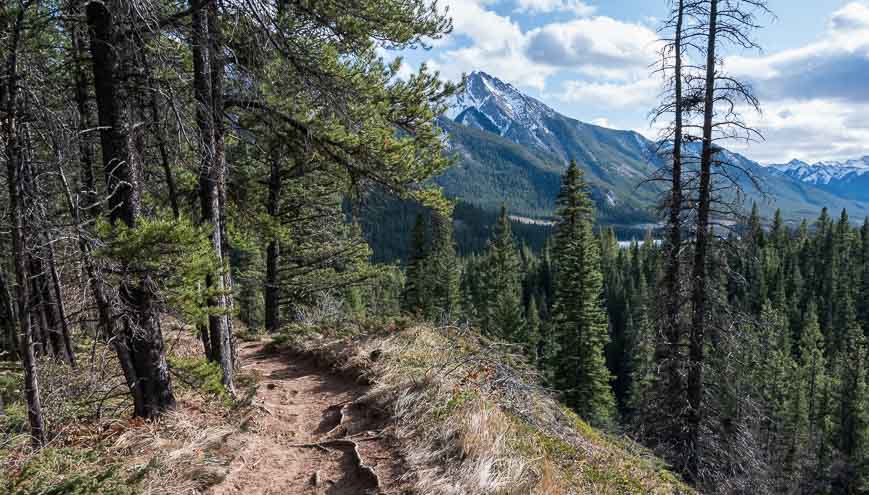
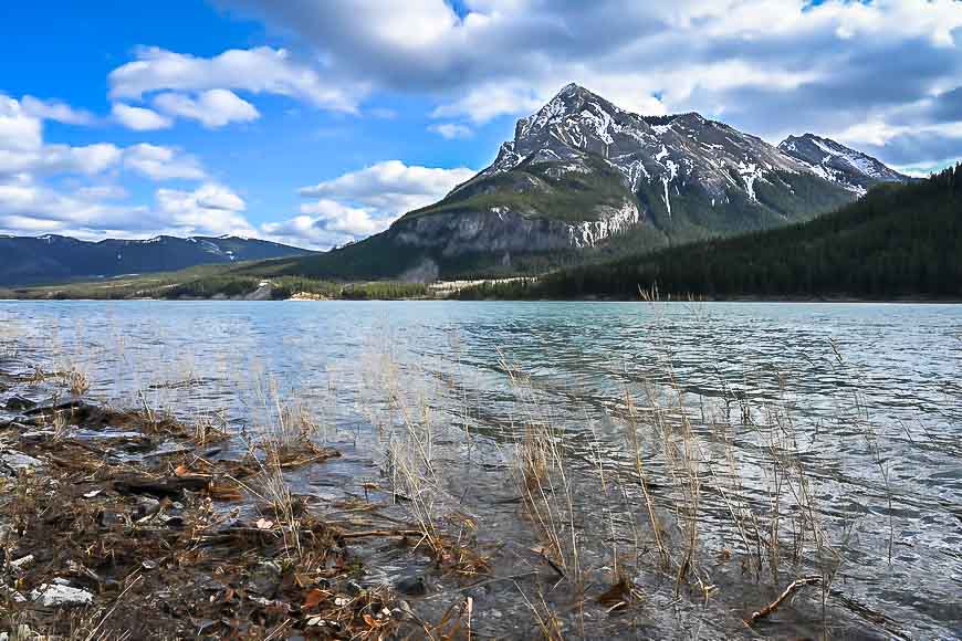
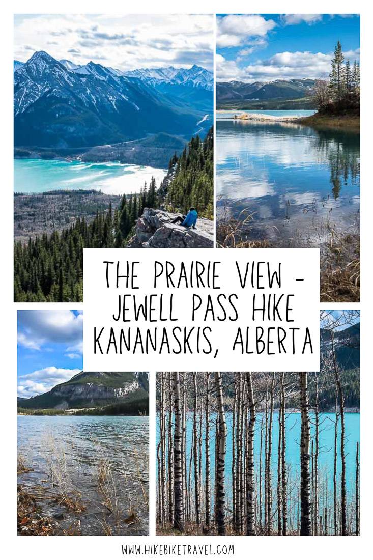
When you pop out of the trees in a meadow, the view of Barrier Lake is quite spectacular.
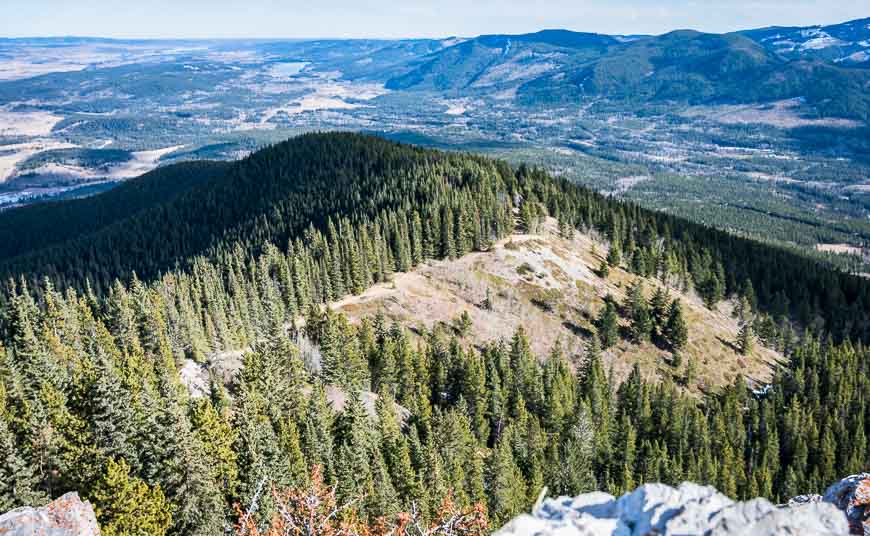
Continue on the obvious trail along the ridge you can see in the photo below until you reach a short, steep section. There are a couple of routes up and they both end up at the same point. Continue to the high point on the Prairie View trail for superlative views of both Barrier Lake and Mount Baldy.
McConnell Ridge to Jewell Pass hike
Most people do the return Prairie View hike to the trailhead by retracing their steps from the high point on the McConnell Ridge. But you can descend McConnell Ridge to Jewell Pass and end up on Stoney Trail beside Barrier Lake. It makes for a more interesting hike but longer hike if you do this.
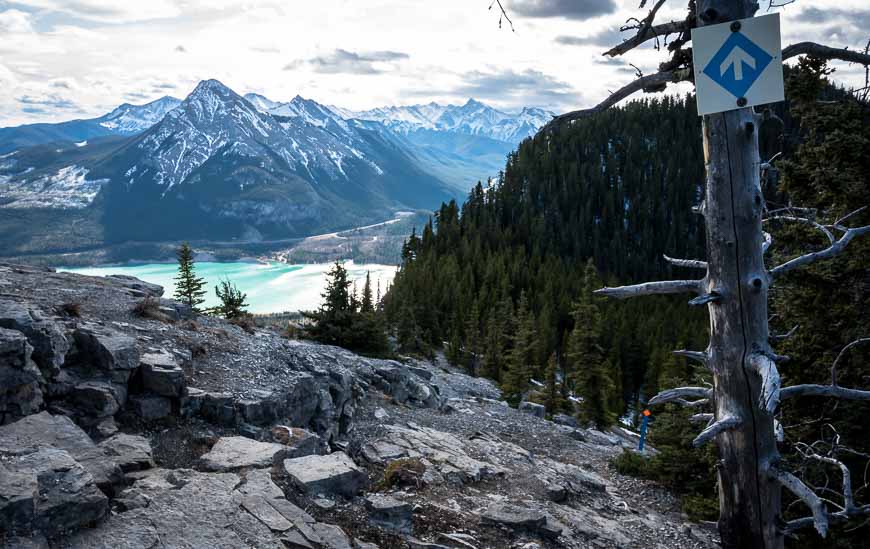
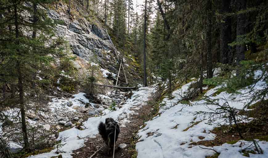
You’ll see an arrow pointing down the ridge. Follow it to the low point and then turn right into the trees. In mid-October there was plenty of snow and ice for many kilometres so I reiterate – don’t forget the icers. Some people mightlike polesthrough here too.
Shop: I swear by myHillsound icers. They are also good in town on icy days when you have to walk your dog.
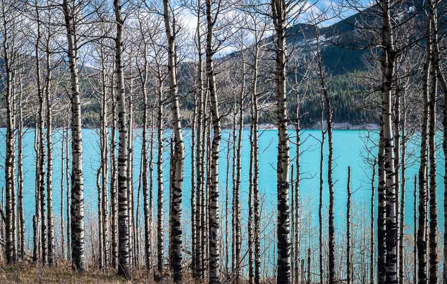
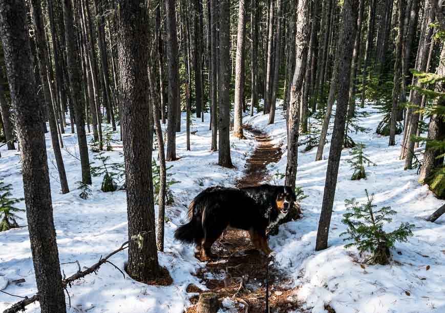
The hiking through the trees was quite lovely. I had the woods to myself on a sunny Sunday for most of the way to Barrier Lake.
The descent from the Prairie View Trail is gradual. It eventually curves around to reach a signed junction. Go left to stay on the Jewell Pass trail, right if you want to go to Quaite Valley.
If you do the Quaite Valley trail, hike 3.8 km to end up beside the Trans-Canada Highway. (There is the option to descend 3.6 km, then go left (west) and continue 2.9 km to reach the Heart Creek Day Use Area.)
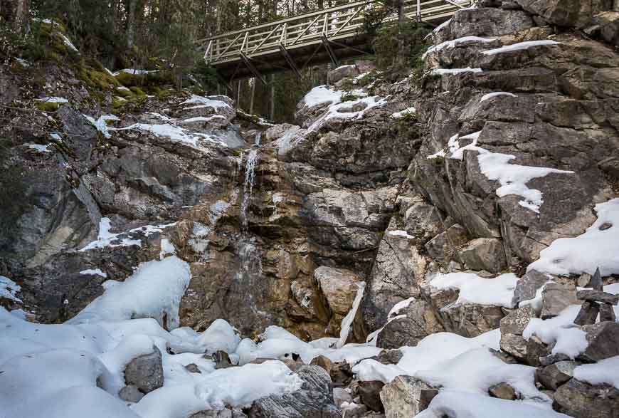
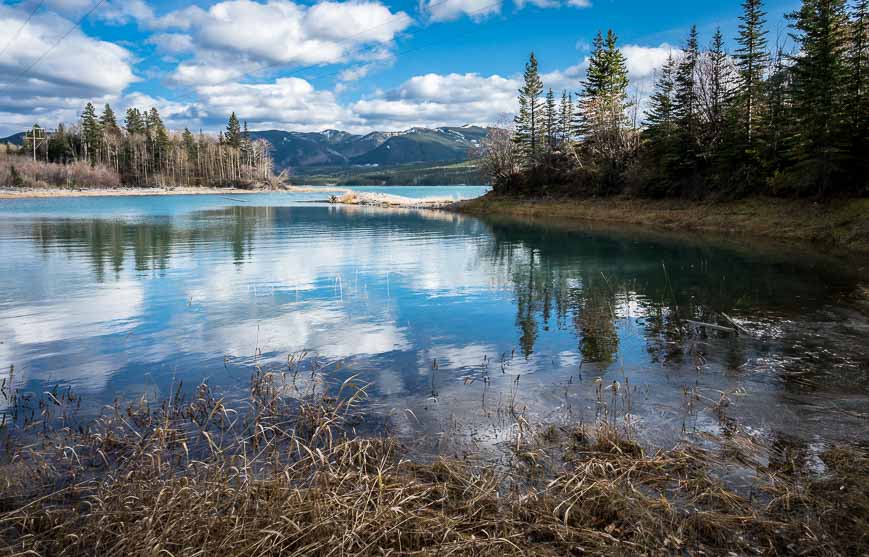
I stayed on the Jewell Pass trail – following it down to Barrier Lake over a distance of 2.7 km. Once at Barrier Lake, turn left and follow the Stoney Trail back to the intersection at the start of the Prairie View hike. Turn right to take the trail to continue across the dam – and voila – you’re finished.
All told the Prairie View – Jewell Pass trail hike is 13.5 km long if you do the loop. If you do and out and back to the high point on the Prairie View trail the hike is 9.8 km. There is 421 m of elevation gain.
Where to stay near the Prairie View trailhead
There are numerous camping and even a glamping option in Kananaskis so you might like A Complete Guide to Camping in Kananaskis .
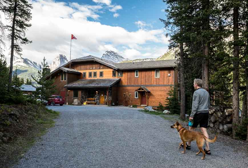
Nearby you can book a night at theKananaskis Wilderness Hostel.
There are two options that are higher end – theKananaskis Mountain Lodge(home to the Kananaskis Nordic Spa) andMount Engadine Lodge– located in the heart of world-class hiking.
Finding the Prairie View trailhead
Take Highway 40 south from the Trans-Canada Highway and drive approximately 9 km to reach the Prairie View Trail parking area by the Barrier Dam Day Use Area. It’s just 2.5 km south of the Barrier Lake Visitor Information Centre on the west side of the highway.
More reading about great hikes in the shoulder season
- The Galatea Lakes Hike in Kananaskis, Alberta
- The Horton Hill Hike in Kananaskis
- The Sulphur Mountain Hike in Banff National Park
- The Hike to Rockbound Lake, Banff National Park
- 5 Early Season Mountain Hikes near Calgary
Click on the photo to bookmark to your Pinterest boards.


Amazing views…