
Geraldine Lakes Hike, Jasper National Park
The Geraldine Lakes trail hike in Jasper National Park isn’t nearly as popular as other Jasper hikes – probably because it entails a drive up a fire road and the difficulty of the trail likely puts many people off.
The hike to Geraldine Lakes is easy as far as the first lake, but the best views don’t kick in until you’re near the higher of the two waterfalls. At that point the level of difficulty rises dramatically.
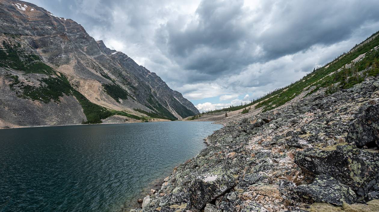
The Geraldine Lakes trail doesn’t gain a lot of elevation, but when it does, it’s tough going. The reward is a beautiful view down the valley and the stark landscape around the second Geraldine Lake.
There isn’t a formal hiking trail past the Geraldine Lake campsite but according to Kathy and Craig Copeland, authors of Don’t Waste Your Time in the Canadian Rockies, “the third and fourth lakes are ethereal sights; pools of deep teal liquid detained in emerald meadows.”
This post includes some affiliate links. If you make a qualifying purchase through one of these links, I will receive a small percentage of the sale at no extra cost to you. Thank you very much for your support.
Geraldine Lakes hike and backpack details
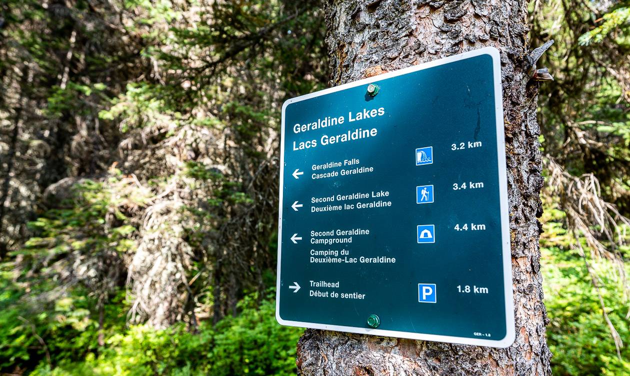
Distance round trip: 4.0 km to the first lake; 10.5 km to the second lake; 13.0 km to the fourth Geraldine Lake
Elevation gain: 127 m (417 feet) to the first lake, 407 m (1,335 feet) to the second lake; 497 m (1,631 feet) to the fourth lake
Difficulty: Difficult to the second lake and challenging to the third and fourth lakes
Time needed: 4 – 6 hours return to the second of the Geraldine Lakes – with the higher figure related to going as far as the campground. Do the Geraldine Lakes hike as an overnight backpacking trip if you want to hike to the third and fourth lakes.
Options: The Geraldine Lakes hike can be done as a day trip or as an overnight backpacking adventure.
Best time to hike: June once the snow has gone until September
Location: The trailhead is at the end of the Geraldine Fire Road which is 1.1 km from Athabasca Falls via Highway 93A.
Dogs allowed: Yes, on a leash but it would be challenging for some to get through the boulder field on route to the campground.
Map needed: Gem Trek Jasper & Maligne Lake
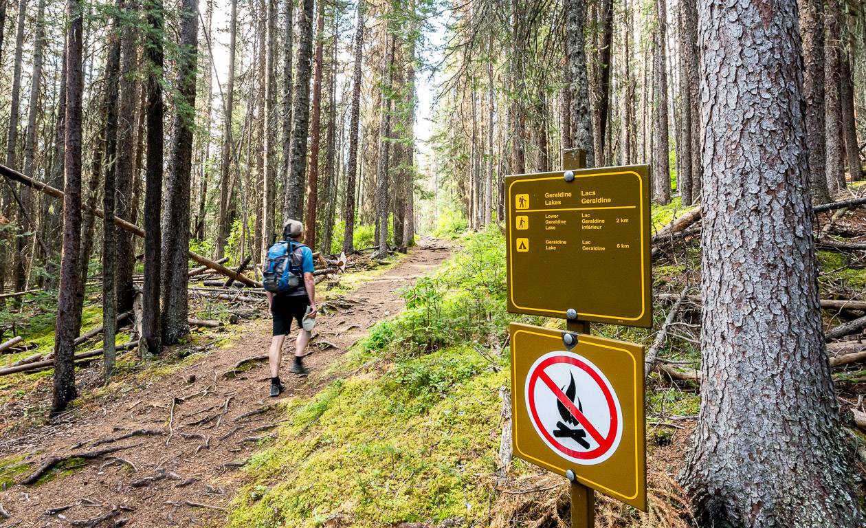
Camping: You can reserve a backcountry campsite online. This is not a backpacking trip for novice hikers. Hammocks are not permitted. Campfires aren’t allowed. Reservations open January 29, 2025 at 8 AM MT.
Don’t forget: Easy to access bear spray and the 10 hiking essentials.
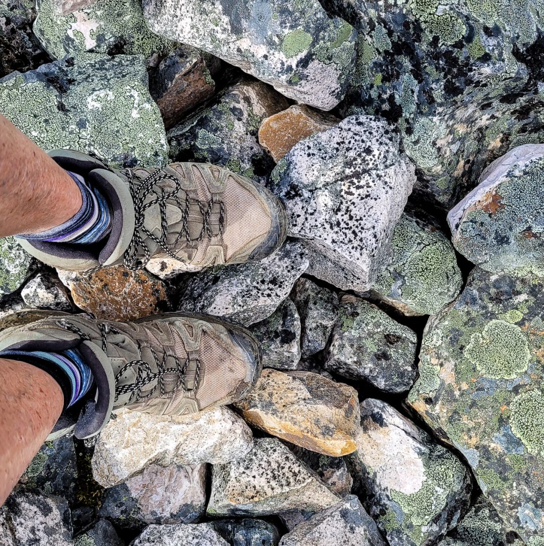
Before you go: Check the weather forecast if you’re planning to hike to the Geraldine Lakes campground. The boulder field can be tough going especially when wet.
Four lakes: Four Geraldine Lakes can be explored but most people don’t get past the second one. The first is easy to get to, the second is on the difficult side and the third and fourth Geraldine Lakes are a challenge as you’ll have to make your own trail.
Road access: Access is via the dirt Geraldine Fire Road near Athabasca Falls. It was fine in our Subaru Outback, but I wouldn’t want to drive it in a very low clearance car.
Beware of wet boulders: The hike along the second Geraldine Lake through the boulders to the campsite is difficult. If the rock is wet, it’s especially hazardous. Many people turn around at the crest above the second lake. You can still enjoy a wonderful view from there.

Would you like to save this?
Getting to the trailhead
From the Icefields Parkway (Highway 93) take the Athabasca Falls exit onto Highway 93A. Continue 1.1 km past the Athabasca Falls parking lot to reach the signed Geraldine Fire Road.
Drive 5.5 km up an often narrow and sometimes rough dirt rough road to the parking lot at the end. You’ll pass the trailhead for the Fryatt Valley trail 2.0 km up the road. It was easily done in our Subaru Outback.
Geraldine Lakes hike route description
At the Geraldine Lakes trailhead, you can’t miss the trail sign and the wide, well-marked trail.
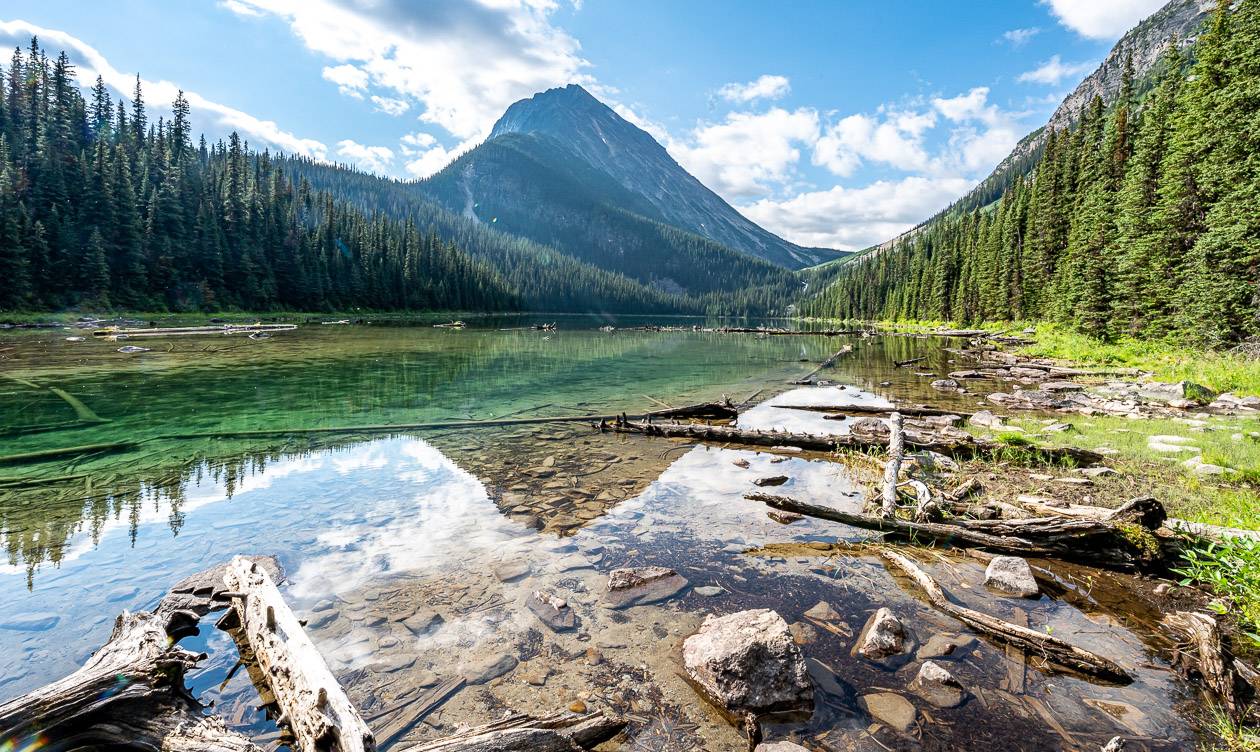
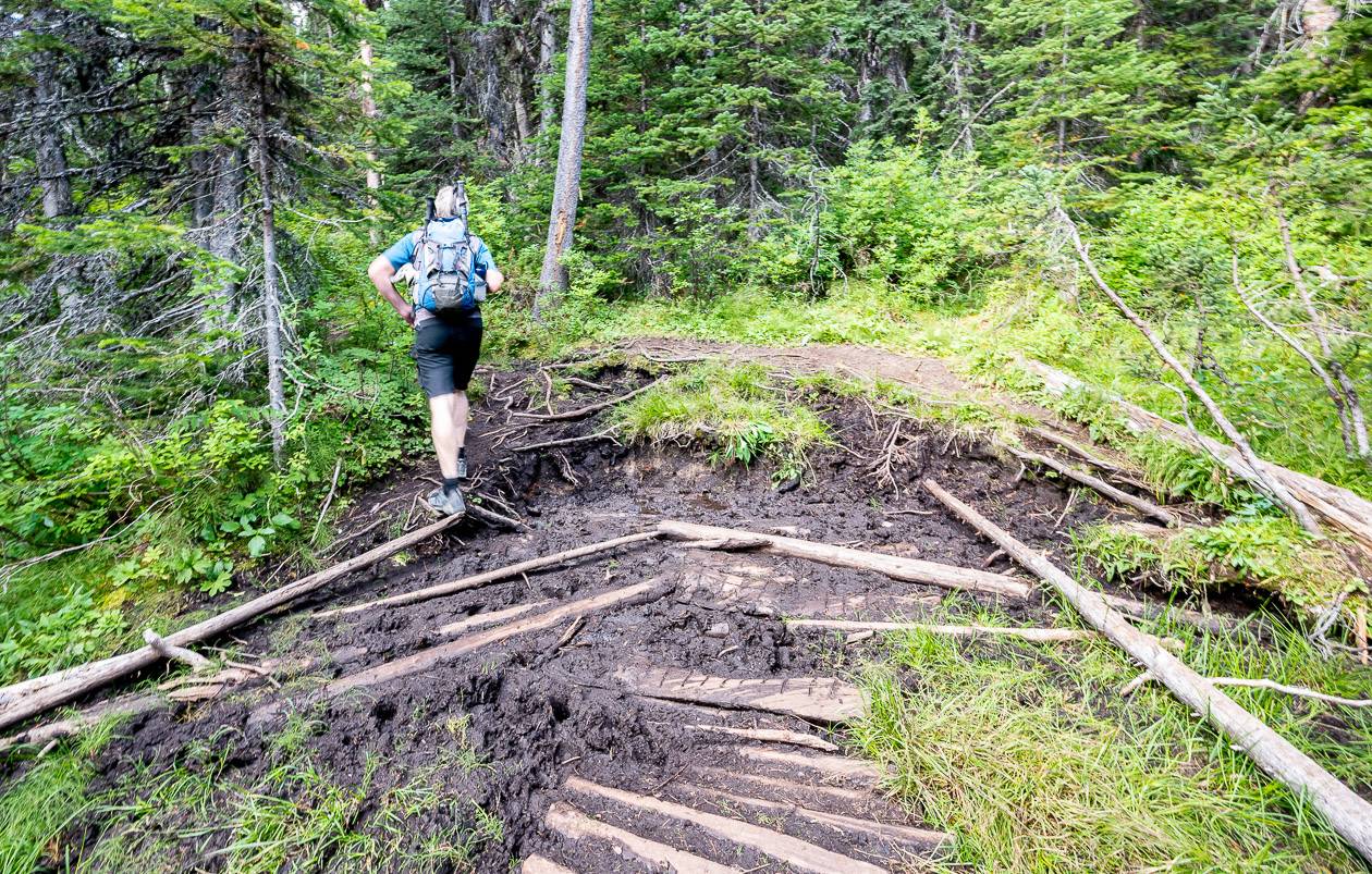
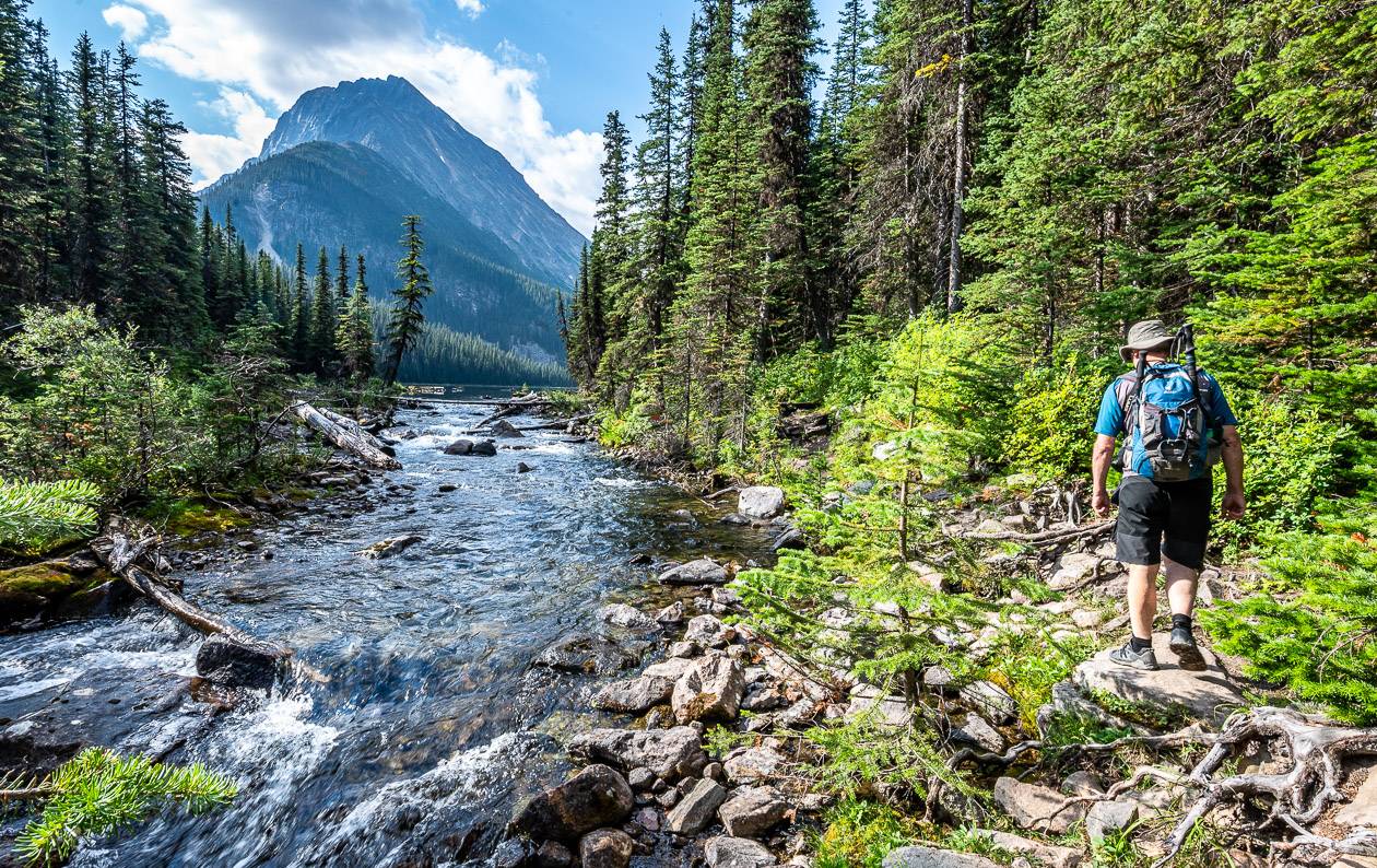
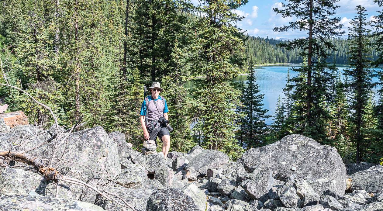
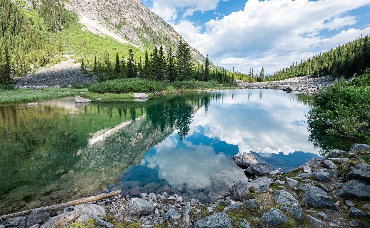
Hike the root-laced Geraldine Lakes trail as it weaves through the forest, dodging the numerous muddy sections where you can. Reach the first Geraldine Lake at 1.8 km. Admire Mount Fryatt and the view down the lake before continuing.
The trail stays on the west side of the lake to reach the south end of the lake. There are a couple of places where you can get down to the lake – something we did on the return to soak our feet and enjoy the view.
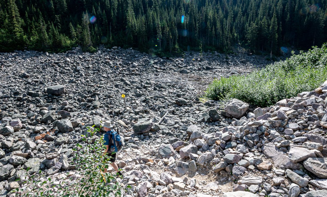
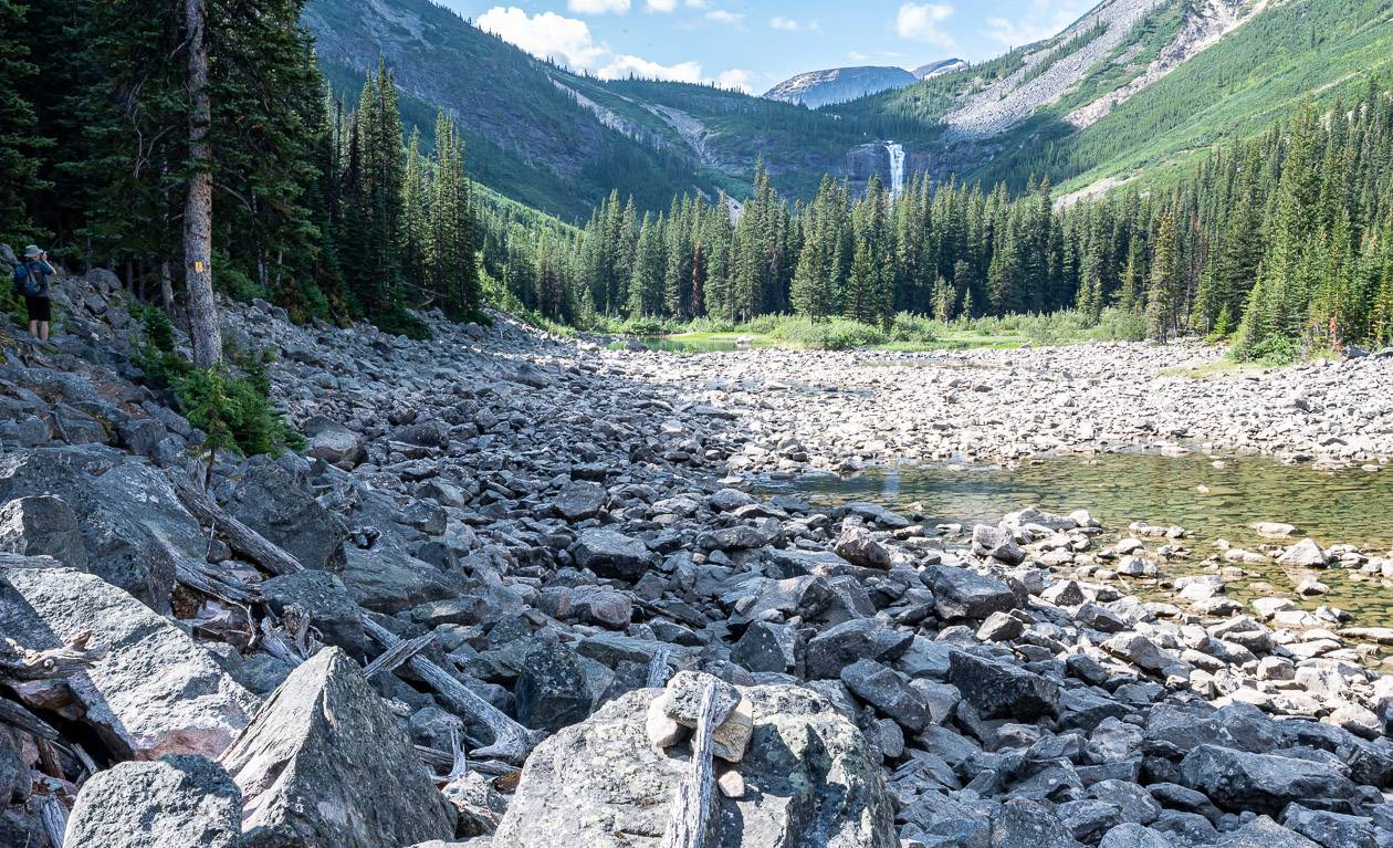
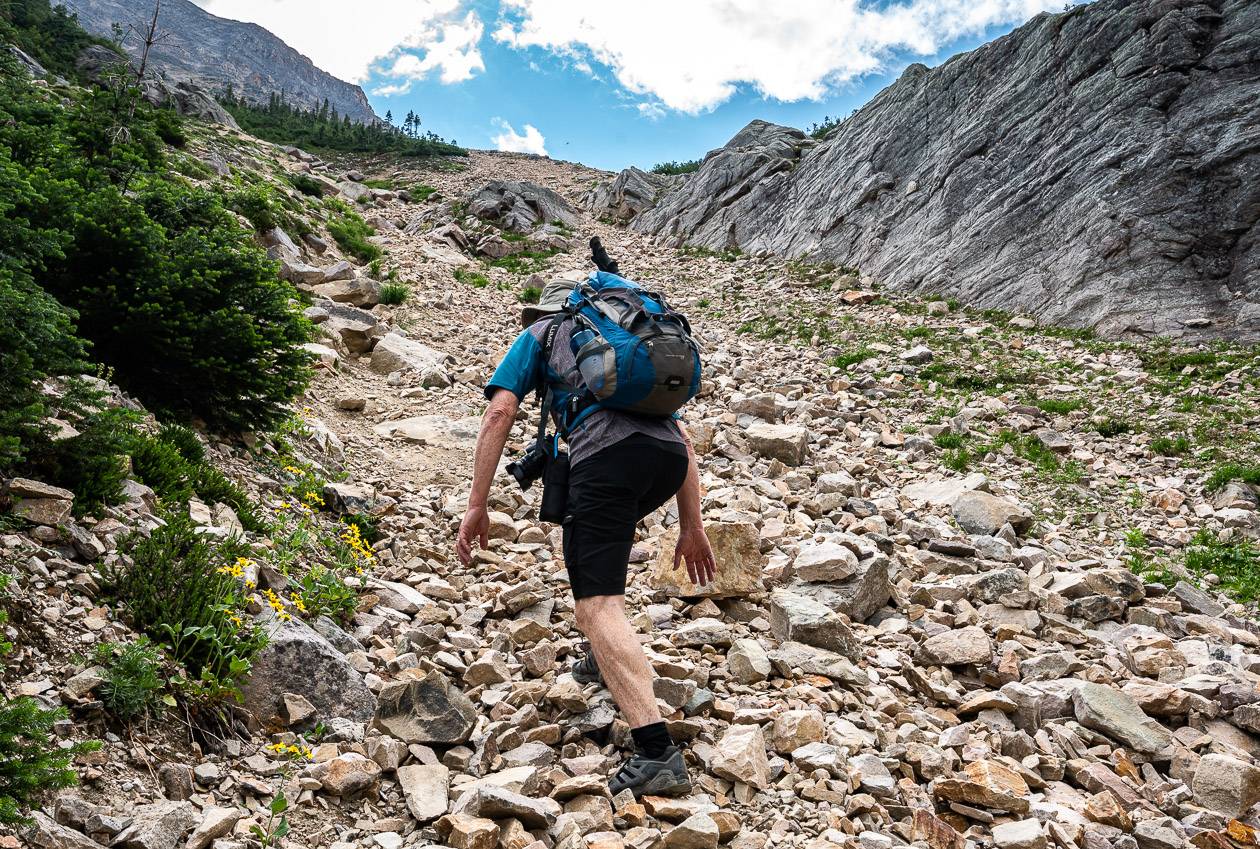
The level of difficulty rises after you reach the end of the first of the Geraldine Lakes. The trail gets rocky, narrow, and steep as you climb up beside a 90-metre waterfall that cascades down over a series of steps. Continue across a small boulder field – looking for cairns along the way.
Go left and keep an eye out for markers as you cross Geraldine Creek (hidden beneath boulders) to reach the far side and obvious trail in the forest. Continue past a couple of small tarns and into the trees, always heading in a southerly direction.
Exit at the end of the valley where you’ll get a good view of Geraldine Falls. Follow the Geraldine Lakes trail, and in short order go left and up VERY steeply on a tough section of the Geraldine Lakes trail – but at least you’ll get an amazing view.
It’s even harder coming down, so before you commit, you should know that you can get down. Hiking poles come in handy. Be careful that you don’t dislodge any rocks.
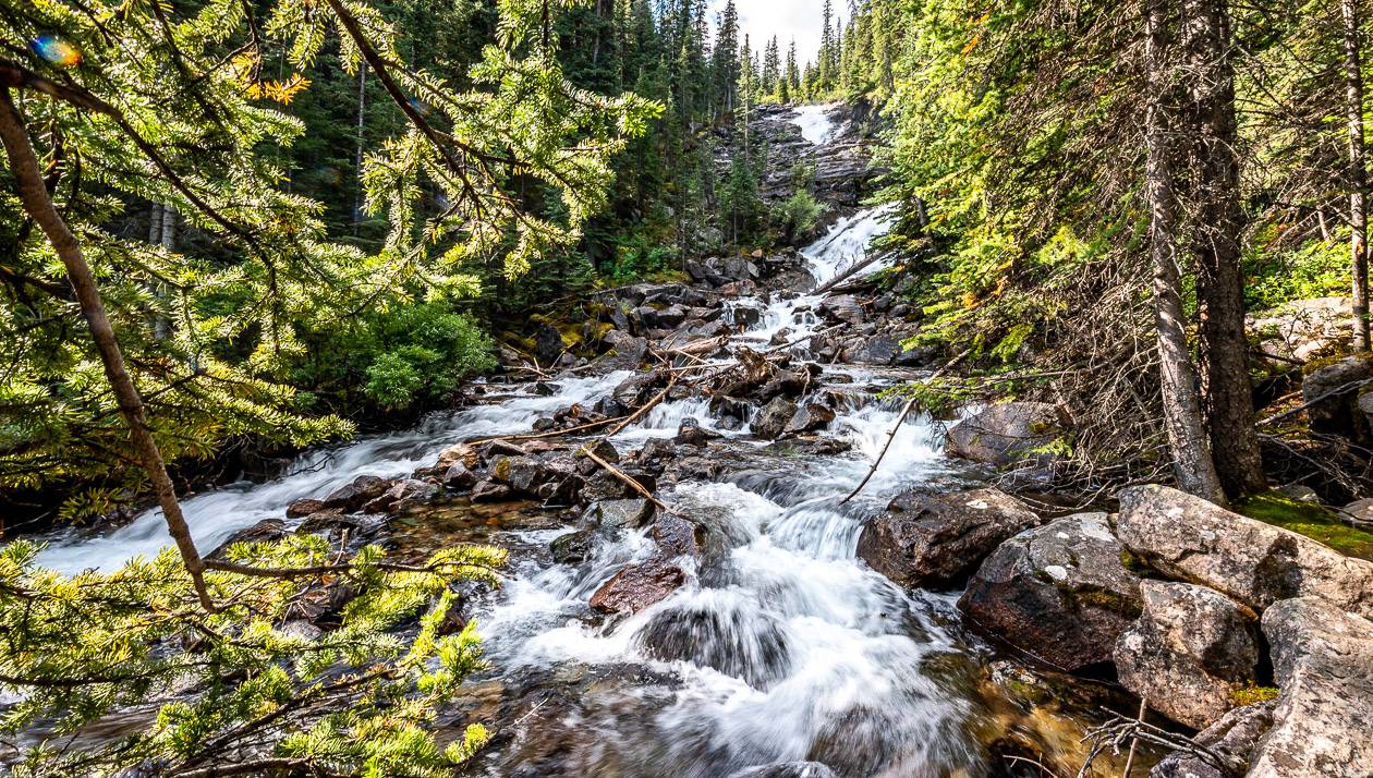
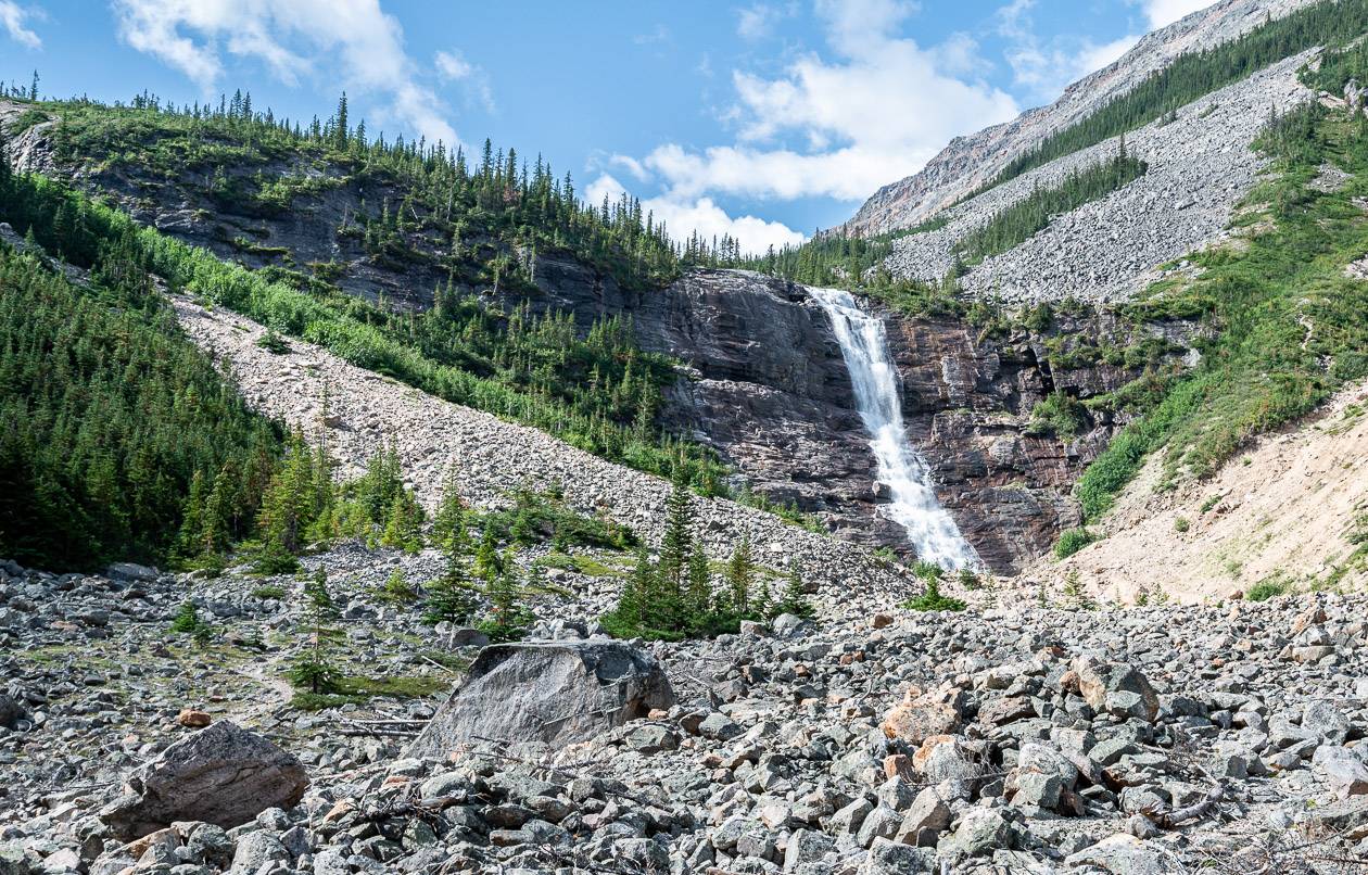
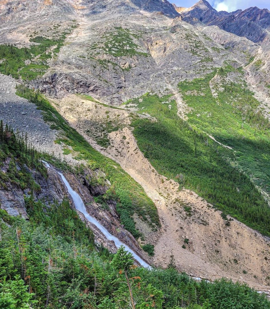
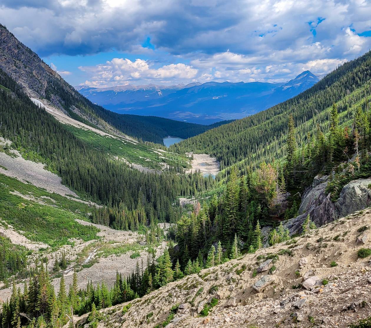
You’ll top out on a rocky crest above the waterfall – where you can enjoy a fantastic view down the valley to the First Geraldine Lake.
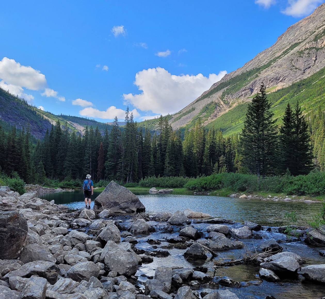
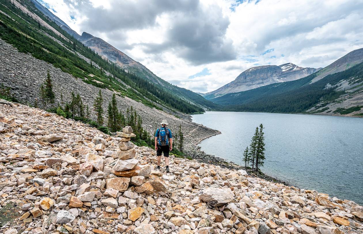
Turning around at the crest might be a good option if you’re not comfortable hiking across boulder fields. If you are, continue down on the well-trodden Geraldine Lakes trail towards the second and largest of the Geraldine Lakes.
The trail skirts the east shore of the lake, crossing a large boulder field – that is quite challenging, especially when wet as it gets super slick. When you’re through that, it’s a short walk to the campground at the end of the Second Geraldine Lake.
Allow 4 hours return if you stop at the crest above Geraldine Falls. I would allow another hour each way to hike to the campground and back to the crest.
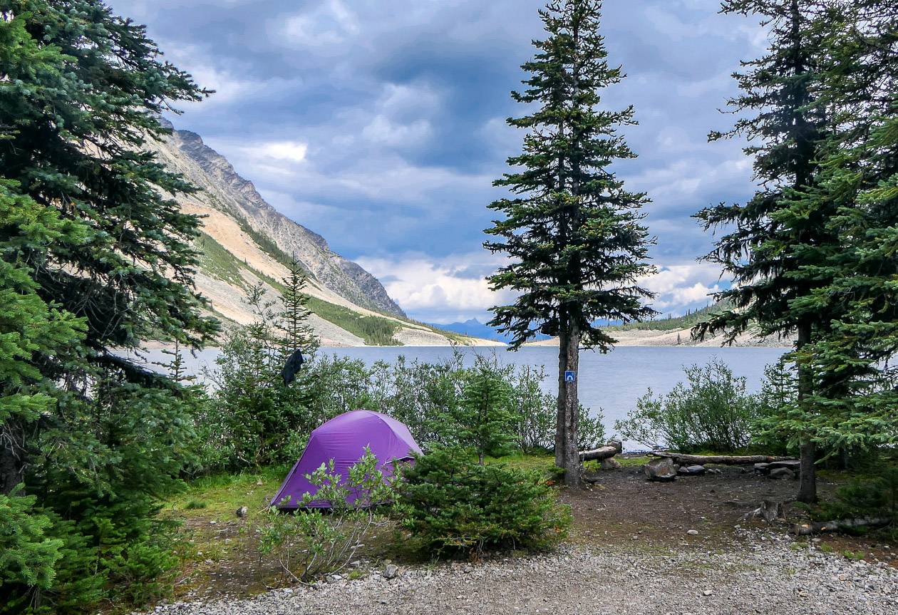
Camping at Geraldine Lakes
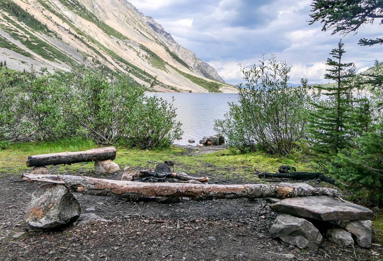
The campsite at the end of Second Geraldine Lake is in the woods by the river outlet with a bit of a view down the lake.
It’s a good place to book for a few nights if you’re interested in exploring the third and fourth Geraldine Lakes.
We passed a few hikers just going in for a night. I personally wouldn’t be so keen on carrying a big pack across the boulder field, but that’s just me.
Campfires aren’t allowed despite what you see in the photo. There are picnic tables, easy access to water and decent spots for camping.

Location map of the Geraldine Lakes hike
The map below is a rough guide only. The Geraldine Fire Road does not show up on Google maps, but it is very much there!
What to take on the hike
On the Geraldine Lakes hike a pair of collapsible hiking poles would come in handy on the descent off the steep section.
Carry a can of bear spray and know how to use it. It should be easily accessible via a bear spray holster or a clip at the front of your pack.
For lunch time breaks I recommend a soft blow-up cushion.
In summer a pocket guide to wildflowers is a great addition to any hike.
Don’t forget bug spray and a few energy bars.
Where to stay in Jasper
The Fairmont Jasper Park Lodge is in a beautiful location but it sure comes with a hefty price tag. However, you can count on loads of amenities and lots of activities either on their grounds or close by.
Another excellent choice is Bear Hill Lodge. And for easy access to a beautiful lake and all the activities around Pyramid Lake, head for Pyramid Lake Resort.
On the strip in town check out The Crimson Jasper adjacent to Terra, a restaurant offering delicious food.
Further reading on hikes in Jasper National Park
- Sulphur Skyline Trail hike, Jasper National Park
- Hiking the Skyline Trail in Jasper National Park
- Bald Hills Trail Hike, Jasper National Park
- Opal Hills Trail, Jasper National Park
- Tonquin Valley Hiking Guide – What You Need to Know
Click on the photo to bookmark to your Pinterest boards.

Awesome post, thanks for taking the time to do this! Very well laid out 🙂