Hunlen Falls – Canada’s 3rd Highest Waterfall
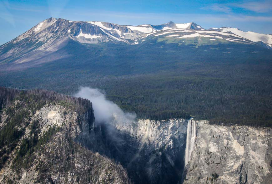
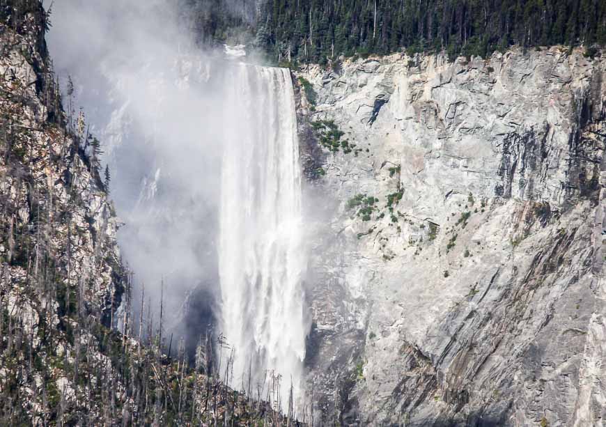
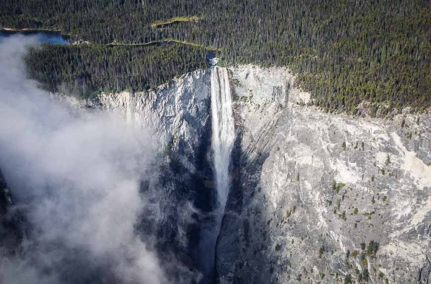
Breathtaking is the only word that can remotely describe the beauty of Hunlen Falls in remote Tweedsmuir Provincial Park in the West Chilcotin area of British Columbia. It’s Canada’s third highest waterfall but only a handful of people have the pleasure of seeing it every year.
Would you like to save this?
This post includes some affiliate links. If you make a qualifying purchase through one of these links, I will receive a small percentage of the sale at no extra cost to you. Thank you very much for your support.
Almost no one has ever heard of Hunlen Falls – and nor do they realize that these waterfalls are Canada’s third highest – plunging 1,316 feet (401 m). In fact, they are the highest waterfalls in Canada IF you measure as a continuous unbroken drop.
For comparison’s sake consider Niagara Falls. It turns out they plunge a measly 51 m (167 feet) – give or take a few feet depending if you’re on the American or Canadian side. Granted their volume is considerably greater.
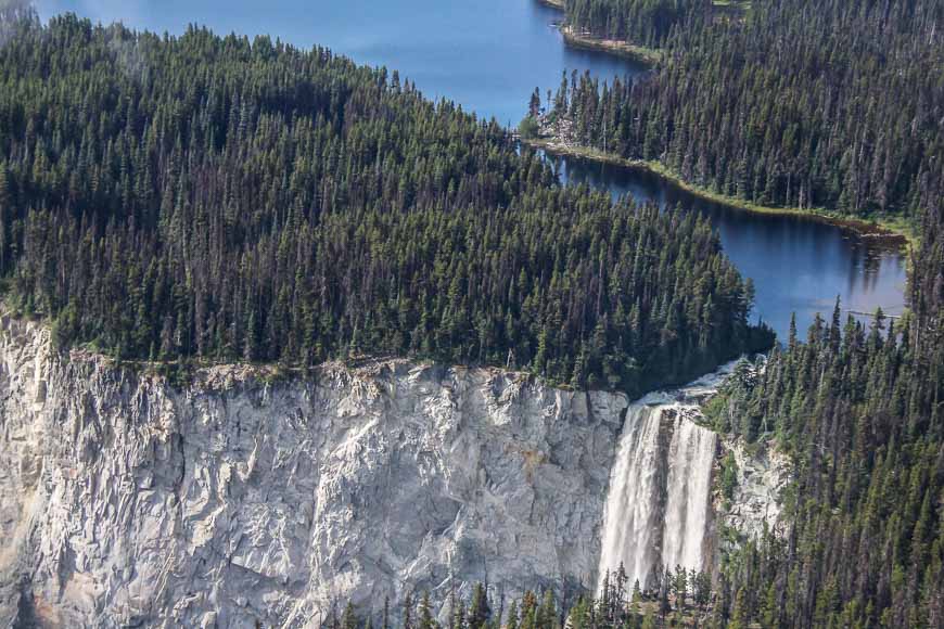
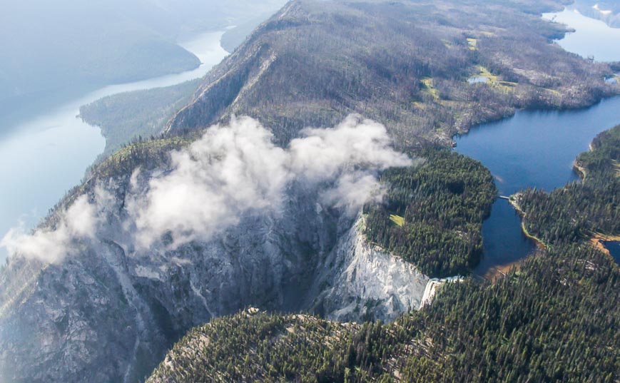
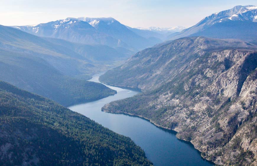
The best way to see Hunlen Falls is via floatplane
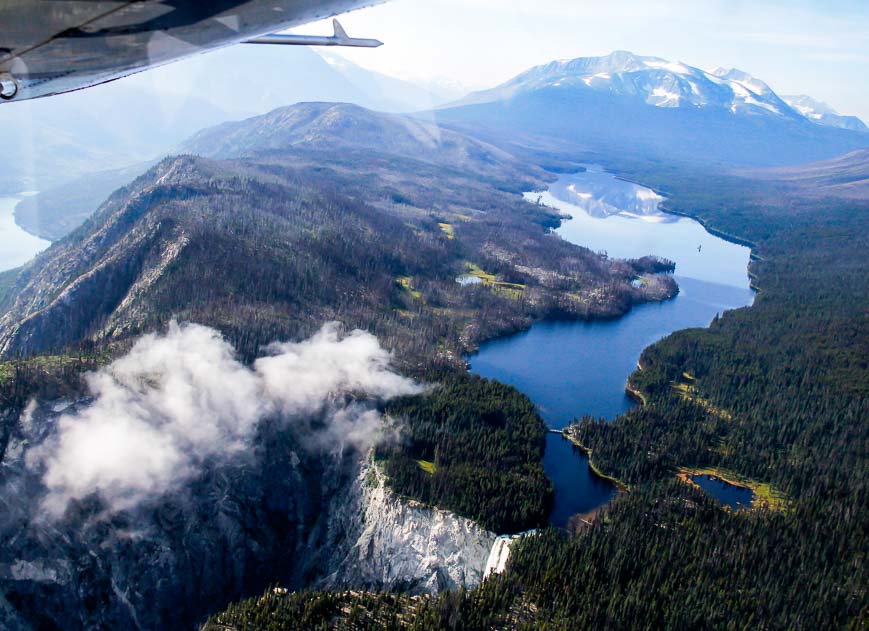
It’s a 20-minute flight to Hunlen Falls from Nimpo Lake – the float plane capital of British Columbia. If you have time, you can land on Turner Lake and take the one-km trail to the lookout. In hindsight, I wish we’d one that.
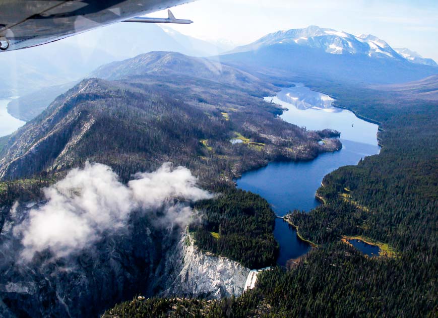
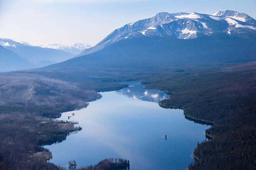
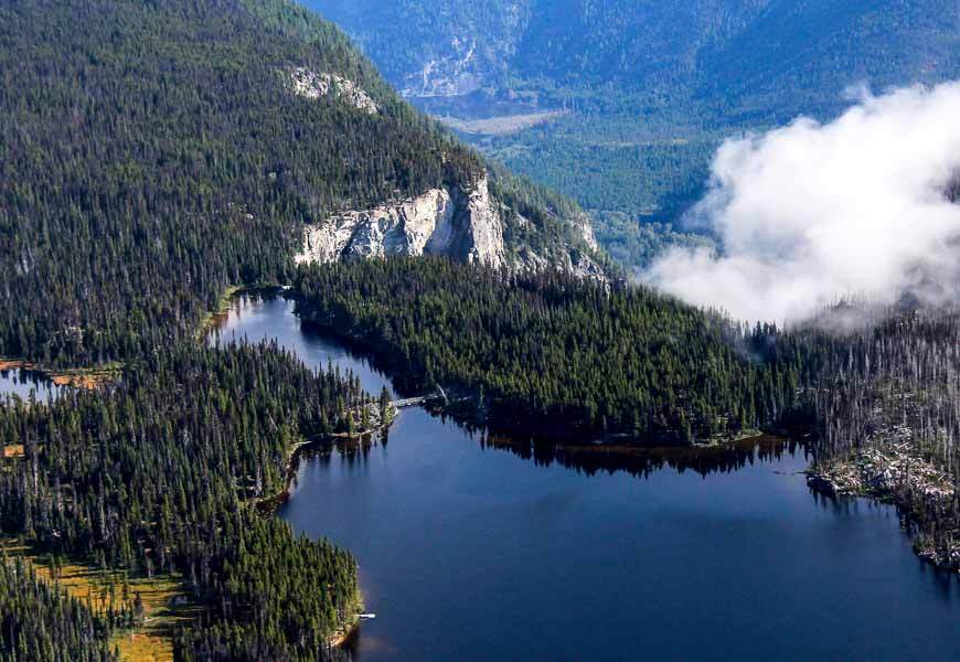
If you hike to Hunlen Falls here’s what you need to know
Alternatively you can hike to Hunlen Falls. But take a look at the photos and can see how heavily treed the area is. That means there isn’t much in the way of a view until you reach the falls. That’s not my favourite type of hiking.
Read: The 10 Hiking Essentials Everyone Should Carry
The trail to Hunlen Falls is 16.4 km one way with a vertical gain of 800 m (2,625 feet). It’s a great trail if you like counting switchbacks. There are 78 of them.
Plan to take 6 – 9 hours one way, so unless you’re a super-fast hiker, you’ll have to backpack into Turner Lake and spend the night. Backcountry fees apply – usually $5 per person per night in cash.
The trail starts at the parking lot from an old tote road 12 km in from Highway 20. You need a 4 X 4 vehicle to access it.
Stillwater Lake, 4 km in from the trailhead, is the last source of drinking water before you reach Turner Lake. Fill your water bottles here.
There may be a lot of trees down, especially because of deadfalls from a pine bark beetle infestation.
The area around Hunlen Falls and the Turner Lakes is famous for its grizzly and black bears. In fact, Tweedsmuir Park recommends hiking the first 3 km of the trail between late morning and early afternoon to avoid them.
From Turner Lake you can access several days’ worth of high alpine hiking including the Panorama Loop Trails and the trail to Ptarmigan Lake. Be sure to bring a good map and compass or GPS. I’d also recommend a Garmin InReach Mini should you have an emergency. As you may have guessed this hike is rated difficult.
For more information visit the Tweedsmuir Provincial Park website.
Further reading about things to do in British Columbia
- 25+ Top Things to Do on Vancouver Island
- 5 Outstanding BC Kayak Trips You’ll Want to Do
- 3 of the Best Canoe Routes in British Columbia
- 20 Things to Do Along Highway 20 in British Columbia
- A Stay at Atnarko Retreat on Charlotte Lake in the Chilcotin
Click on the photo to bookmark to your Pinterest boards.
Wow, this hiking trip to the falls looks super adventurous! I personally prefer seeing nature in ways more like this, untouched, like a hidden treasure and you have to get to know it yourself, like there aren’t thousands of touristic photos of it everywhere 🙂 Your pics look stunning!
Hope to be trying out this trip soon. Thank you for the article.!
We are planning to complete this hike next week. We will have an SUV but it’s not 4×4. Will we have an issue getting to the parking lot?
@Jonathon I don’t actually know where the trailhead is to the parking lot or what shape the road is in but I do know people hike in regularly and even canoe the lake so hopefully access is not an issue. Why don’t you email or tweet to Tweedsmuir Provincial Park to get updated info.
Worked at Tweedsmuir 35 yrs ago at the young age of 16! Flew into Turner Lk. Spent time with John Turner, amazing!. Canoed the chain of lakes with all our gear to upkeep campsites and trails for portages. 10 days, then back to Turner lake for a hike down beside the falls to see their original homestead! Amazing history here! We hiked out all the way down to BC Parks Headquarters, which is after you pass the parking lot and then out on the highway and a few more Km! 12 females, some U.S. Running when we saw the road, knowing we were home! LONG HIKE! aWESoME ExPERiENCe!! Would love to go back…in a float plane!
@Rhona What a lovely story. Can you imagine anyone being allowed to work there at 16 – but what backbone and memories it built. I love that part of the world.
We stayed in a cabin on Turner Lake in 1988. The son of Ralph Edwards owned the cabin. He was an interesting man. We canoed down the lake and hiked to the top of the falls. Very impressive. Don’t go near the edge if you get the weebie geebies.
@Galen What an interesting comment. That’s one heck of a drop so I would be a long ways from the edge.
Wow, Leigh, I didn’t realize you had come back out this way. I’m glad you got to see Hunlen Falls. Well done on the photos. They’re stunning!
Hope you don’t mind but I would like to post your link on my blog and the Facebook page again. My visitors need to see your photos.
Have you considered a hike into the Itcha Ilgatchuz Ranges? I think you would be really impressed with that country as well. All old volcanic stuff.
Someday I hope to meet you!
Jane
@Jane I didn’t come back out – I wish – but I did very much enjoy Hunlen Falls last year. And yes I’d love to hike in the Itcha Ilgatchuz range.
I hiked from the main Hwy to Hunlen falls in 1995, solo.
It remains the single best solo wilderness trip I’ve yet made. And actually some of the scenery was amazing on foot. I have photos somewhere but they are pre-digital! Thanks for this reminder!
Nick
@Nick It is truly spectacular country. I absolutely loved our hike in the Rainbow Range. Did you have a chance to do that one?
Super
@Ilham Thank you.
I have never heard of Hunlen falls myself, it is breathtakingly beautiful and the images are so serene. It takes me to a whole new world, being an art collector myself these images are a great piece of art.
Thanks Liza.
Wow truly breathtaking I must say. I stay in Atlanta and have never heard of Hunlen Falls. I never knew that such a beautiful place exist in Canada and would like to visit this place someday. Thanks for such lovely photos.
@Henry Thanks for stopping by.
Leigh, each post you’ve shared shows us another gorgeous site in Western Canada. I’ve run out of adjectives. Hulen Falls looks like a postcard. And crazy as it might sound, ten years in Canada and I never heard of it until now.
@Marcia You’re by no means alone not hearing about Hunlen Falls. Because it’s remote it’s off the proverbial tourist trail. I bet more Europeans – especially the Swiss and Germans have been to them compared to Canadians.
I haven’t heard of this park or seen these waterfalls before, but WOW, they sure are gorgeous! I’d love to see them for myself someday.
@Michael Sounds like we need to get you to Canada!!
Incredible…the pic of Turner Lake is mind boggling…
@Deej Isn’t that one incredibly beautiful area. I couldn’t get over it either.
Absolutely beautiful. Breathtaking!
@Susan Aren’t they though!!
Another beautiful BC spot. Is there anything but? How great wouldn’t it be to glide silently above it!
@Sophie Now that’s one outrageously cool and scary idea!
Hi Leigh:
That waterfall looks absolutely incredible! I love waterfalls!
I am from BC (Northern Vancouver Island) but I haven’t seen this waterfall yet. Hopefully one day soon I will. 🙂
Kevin
@Kevin So all you have to do is take the 10 or so hour ferry to Bella Coola, drive the gnarly Highway 20 and then either hike or float plane it in from there. No problem!! Hope you get there one day.
Ouch. Avoid this recommended 10-hr ferry ride — simply fly ‘Pacific Coastal’ to Bella Coola airport, to take 1/10 the time.
@Jay Flying is wonderful if you’re pressed for time but sometimes its about the journey – and it can be a treat to slow down and enjoy the sights you see from BC Ferries.
Okay, these photos may get me in a float plane — with my eyes open — yet. Another beautiful post, Leigh.
@Jackie If it’s a calm day you may be surprised at how much you like seeing an area from the air. It’s also fun to see where you’ve been on foot or by car in the context of the bigger picture.
I have not heard of Hunlen Falls or Tweedsmuir Provincial Park but I want to visit now. I like how you’ve introduced us to these Canadian gems and beautiful scenery. Love that reflection shot!
@Mary It was a first time visit for me too and I certainly loved what I saw. Would like to see the grizzly spectacle feasting on salmon in September one year too – from the safety of a boat.
Great shots. A waterfall is a feature that makes a hike awesome. But as an easy hiker, I don’t think I would care to hike the 16 kms, what with the bears.
@Michael That hike doesn’t have any appeal for me either!
Are you shocked to know that I’ve never heard of them? Didn’t think so, but your pictures from the plane are awesome! A little more water and I’m pretty sure everybody would know where Hunlen Falls is.
@Steve It wasn’t that long ago that I first heard of them. You’re right – Niagara gets all the glory because of the width and volume but I still can’t get over the beauty of the area around the Hunlen Falls.