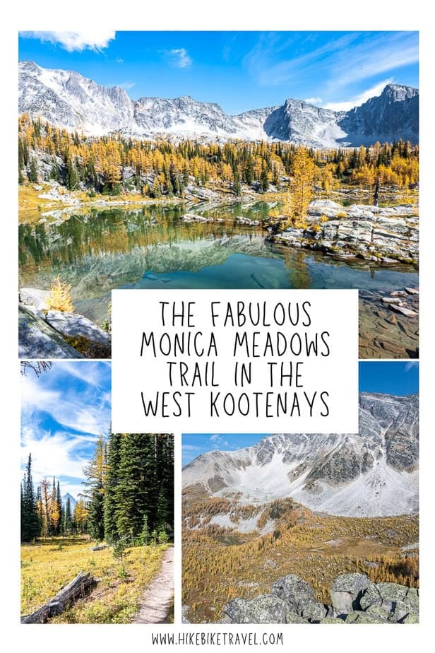
Monica Meadows Trail Guide
For at least six or seven years, the Monica Meadows trail in the Purcell Range sat high on my hiking wish list. I didn’t know much about it, only that it was said to be an unforgettable, very beautiful hike.
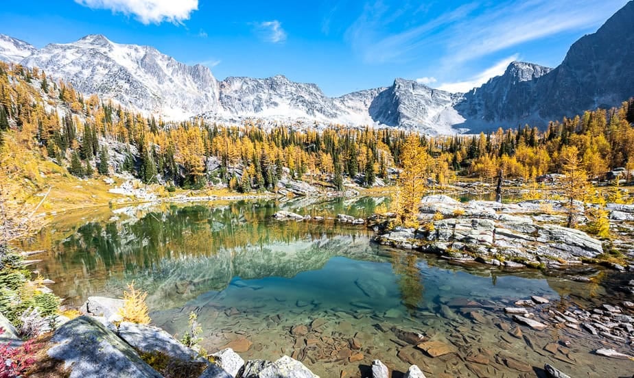
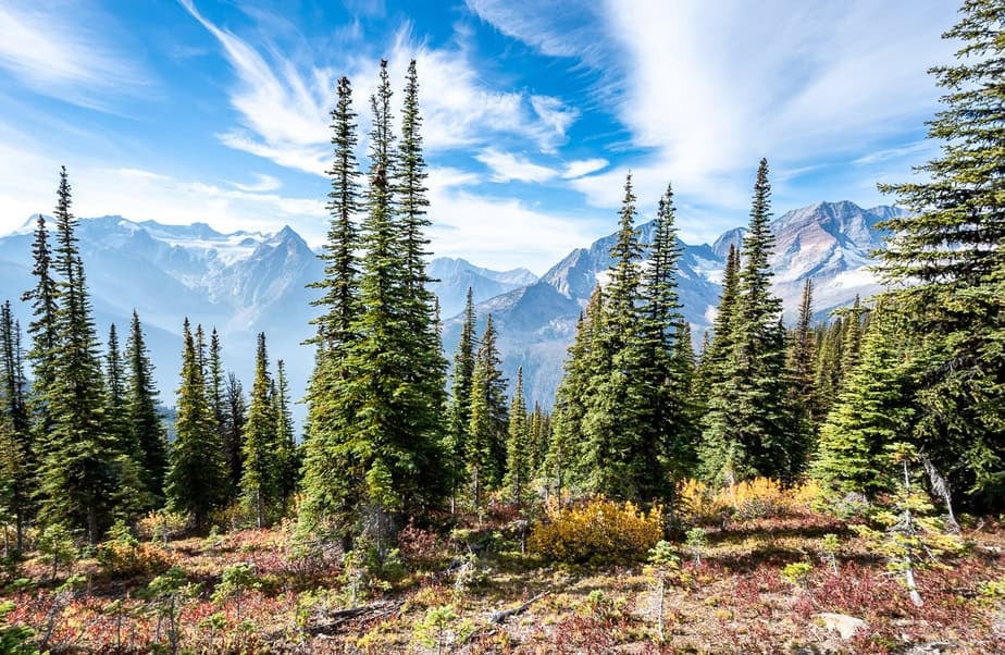
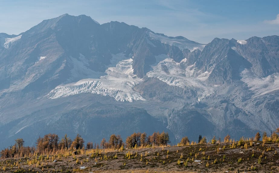
Beautiful is an understatement. The Monica Meadows trail, especially in larch season at the end of September is mind-blowing. Beauty is everywhere – in the meadows, around the lakes, along the ridge, and over to the glaciers that make up the Macbeth Icefield. Even as the trail switchbacks up to the meadows, there’s magic in the understory.
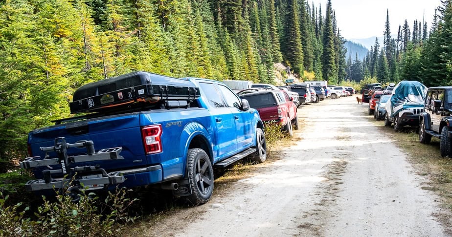
The downside is that the hike is popular – even though it starts at the end of a sometimes gnarly 40-kilometre drive on a forest service road – 90 minutes to two hours from Kaslo. If you live in the Nelson – Kaslo – New Denver corridor you can do Monica Meadows as a day hike. Everyone else should consider making it into at a two-day trip or more, especially with all the good hiking nearby.
This post includes some affiliate links. If you make a qualifying purchase through one of these links, I will receive a small percentage of the sale at no extra cost to you. Thank you very much for your support.
Would you like to save this?
Driving instructions to the trailhead
I really stressed about getting to the Monica Meadows trailhead. Going solo, I knew the 40 km approach on forest service roads would be long and rough. I made it, but chose not to tackle the final 3.5 steep, gnarly kilometres. I was prepared to hike the extra distance (and elevation) to spare myself any grief. In the end, I lucked out with a hitchhike both up and down and while I probably could have driven it, I have zero regrets that I didn’t.
Overall, the Glacier Forest Service Road (FSR) is in good shape. There are a couple of narrow places where I was thankful a car wasn’t coming in the other direction and a few deeper drainage ditches, primarily around bridges as you got higher. The road was incredibly dusty when I drove it – so visibility can be an issue if you’re following a vehicle .
A minivan made it to the top, so some 2WD vehicles can handle the road. You’ll need to decide if yours is one of them. Be sure to gas up in Kaslo before you drive up.
Kaslo to Argenta Road turnoff
From Kaslo drive north on Highway 31 passing through Lardeau. In another 6.1 km turn right (east) onto Argenta Road and set your odometer to zero. In half a kilometre cross a bridge. At 1.2 km continue straight through a 4-way intersection and then almost immediately cross a bridge over Hamill Creek. Continue on Duncan Lakes Road, passing a turnoff to Glacier Creek campground at 11.3 km.
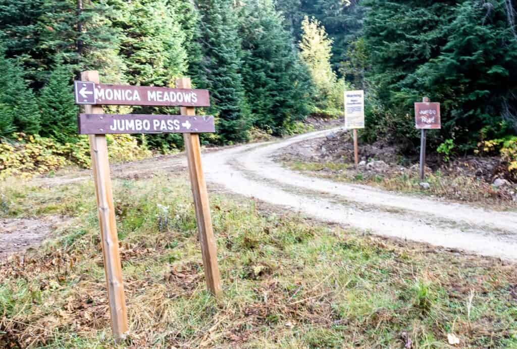
A right onto Glacier Creek Forest Service Road (FSR)
At 12 km go right on signed Glacier Creek FSR (see picture below). Pass a signed fork for the MacBeth Icefield trailhead at 22.5 km, continuing straight.
Left turn to Monica Meadows at intersection with Jumbo Pass
At 36 km reach another signed junction and stay left for Monica Meadows. The next 1.5 km is a bit rougher but very doable. There is a large parking area at the bottom of the final 3.5 km stretch of road to Monica Meadows. That’s where I parked my car. There is also a sign warning that the road ahead is very rough.
It’s slower going the last 3.5 km with more drainage ditches and steep switchbacks. Reach the Monica Meadows trailhead at 41.4 km. The elevation here is 1,810 metres or 5,938 feet.
Be a good person
I chatted with a couple on the ridge above Monica Meadows and they told me that they and countless others were held up because of a very slow driving mini van. There is no excuse for that as there are loads of places along the access road to pull over and let someone pass. Please do it. It will take just a few seconds and save everyone a whole lot of frustration. I personally hate having people on my tail – and make it a practice to pull over.
This advice from a reader with regards to driving the road
” I think it’s important to stress the preparedness needed to drive to these places for folks used to hiking in national parks and Kananaskis. Remote backcountry, logging roads with industrial traffic (radios highly recommended), prepared for flat tires, trees over road, and other things that can happen when you are a long way from civilization and cell phone service, not to mention the confidence and skill needed to drive many of these roads. Just some things to consider before the larch crowd starts flocking out here.”

Location map
Monica Meadows trail summary
Distance: 10 km return
Elevation gain: 653 metres or 2,142 feet
Time needed: 4 – 5 hours depending on how many lakes you visit and how much time you spend enjoying the stunning scenery.
Level of difficulty: Moderate. I saw lots of families doing it with kids as young as about 6 or 7.
Best time to hike: Mid-July after the snow has melted to late-September. Wildflowers put on their best display from mid-July to mid-August, while late September dazzles with golden larches.
Dogs: Allowed. Most people did not have them on a leash, but since it’s a fragile environment please leash your dog.
Wildlife: This is grizzly bear country, so make noise and carry easy to access bear spray. I use a bear spray holster so I don’t set it off accidentally.
Don’t forget: Pack the hiking essentials and practice the seven Leave No Trace principles – especially important in this fragile environment. Be sure to pack out everything you pack in and let someone know where you’re going and when you plan to be back.
Map: I use Organic Maps – a free offline hiking app. The paper map is Duncan Lake 82K/7. Order from a specialty map or outdoor store.
Backcountry camping: Yes. See below for more information.
Monica Meadows hike description
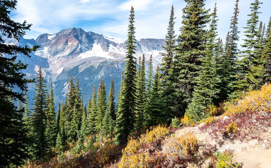
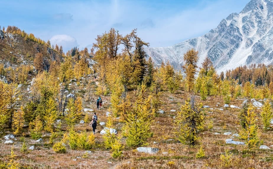
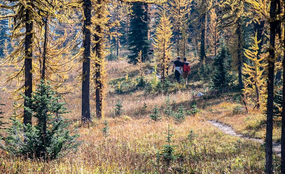
The Monica Meadows trail starts off steeply from the north end of the parking lot. Climb seven switchbacks gaining 400 metres (1,312 feet). They start off long and shorten as you get closer to the shoulder. Along the way admire dramatic views of the Horseshoe Glacier.
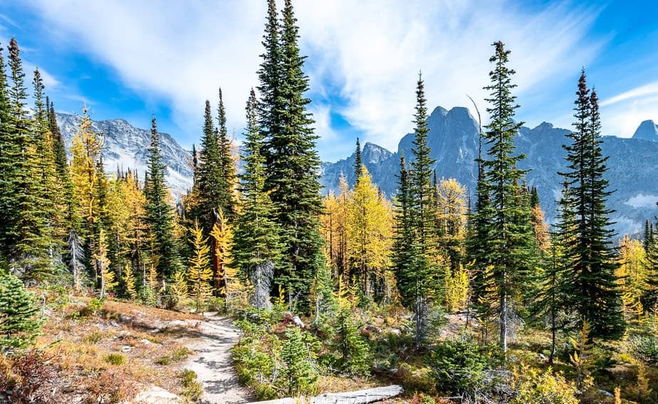
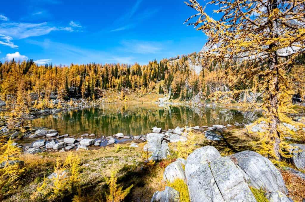
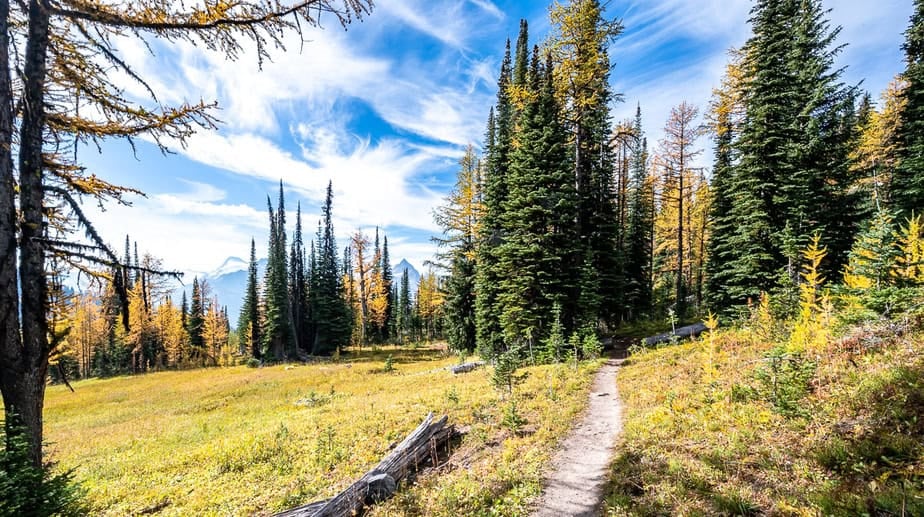
The hiking gets easier as you continue around the shoulder to reach a basin at 2.3 km, roughly an hour up from the parking lot. You’re into the good stuff immediately if its larch you’re after. They’re everywhere.
Look out for a signed junction at 2.7 km that leads to the backcountry campground. There is a pit toilet there if you need to use one.
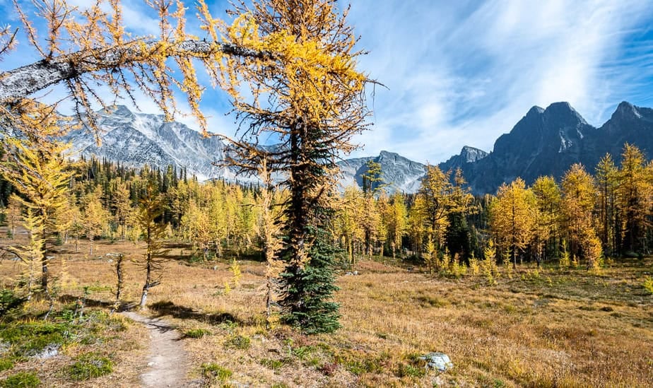
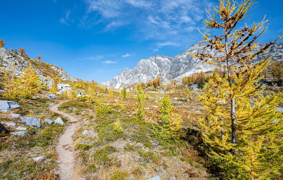
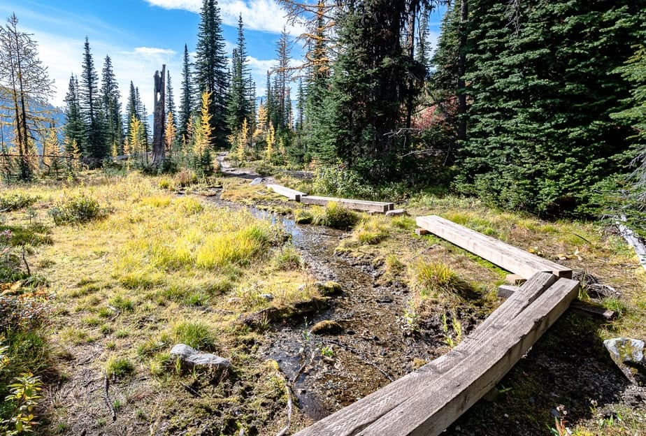
Continue on logs through the wet, very fragile subalpine meadows. After another 15 minutes of hiking reach the alpine zone and Monica Meadows.
You can do one of two things. Head immediately for the ridge or take off on a smaller trail to the lakes. There is a small cairn at the intersection.
Side trip to the lakes
I chose to visit the lakes first though I didn’t go all the way to the end.
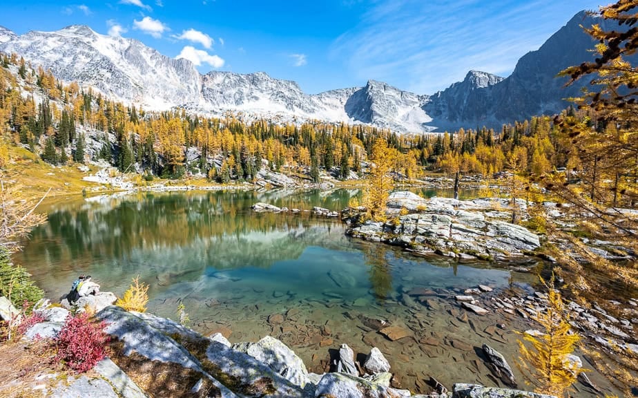
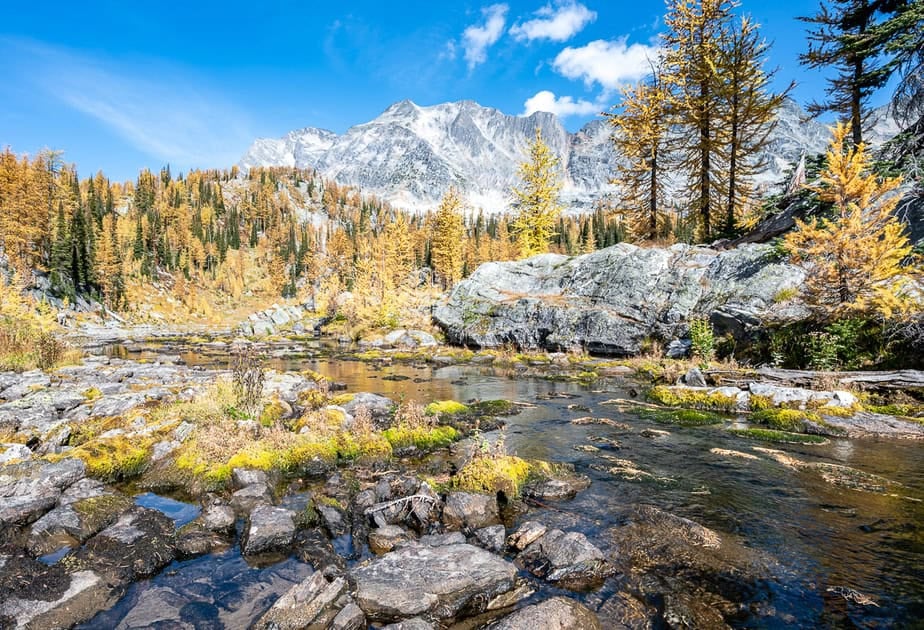
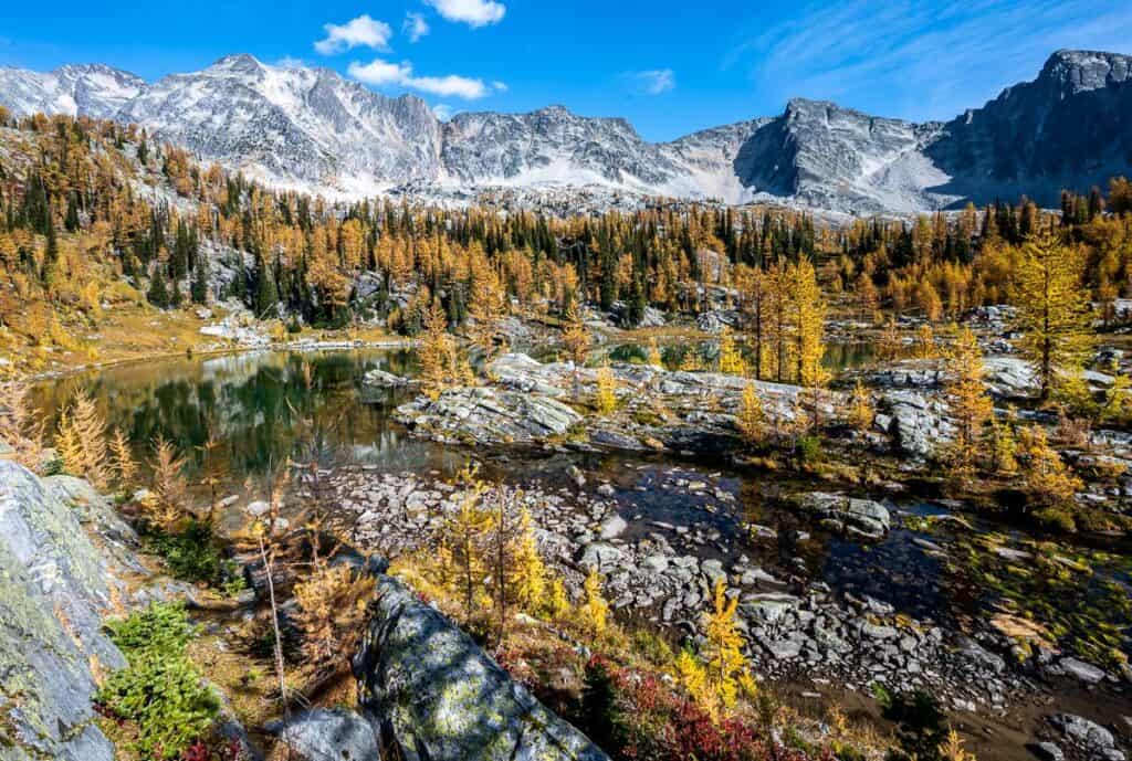
The trail is easy to follow to the lakes – with much of it on rocks. In about seven minutes you’ll reach the first lake. It will stop you dead in your tracks – whether it be because of August wildflowers or September larches.
You can continue to two more lakes deeper in the basin and closer to Mt. Amon Ra. You’ll have to rock hop across a stream to get to the second lake. If you’ve got the time, plan to continue to the end of the trail. Simply retrace your steps to the main trail and either head back to the trailhead or go right and up to the ridgecrest.

Head to the ridgecrest
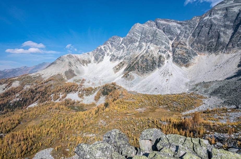
After retracing your steps to the main trail turn right and start climbing gradually, passing a small tarn in short order. The final section of trail is steep but not difficult to negotiate.
Continue out to a set of rocks at the top of the ridge to admire the view. You can see Mount Lady MacBeth, Mount Macbeth and the Horseshoe Glacier.
The trail runs across the spine of the ridge from which there are views to the east of Mt.Amon Ra, Osiri and Mt. Isis – where those with good eyes can pick out a small natural arch.

A word of caution exploring the meadows
Monica Meadows are sensitive and easily damaged. To minimize the impact of your visit stick to the trail especially the wooden beams in the wet areas. If the trail disappears, try to stick to rocks and dirt. As a last resort walk on the quick-to-recover grasses and flowers rather than the low-lying heather you see around.
There were a lot of off-leash dogs on the day I hiked up to Monica Meadows. Rather than let them run loose, keep them leashed and on the trail.
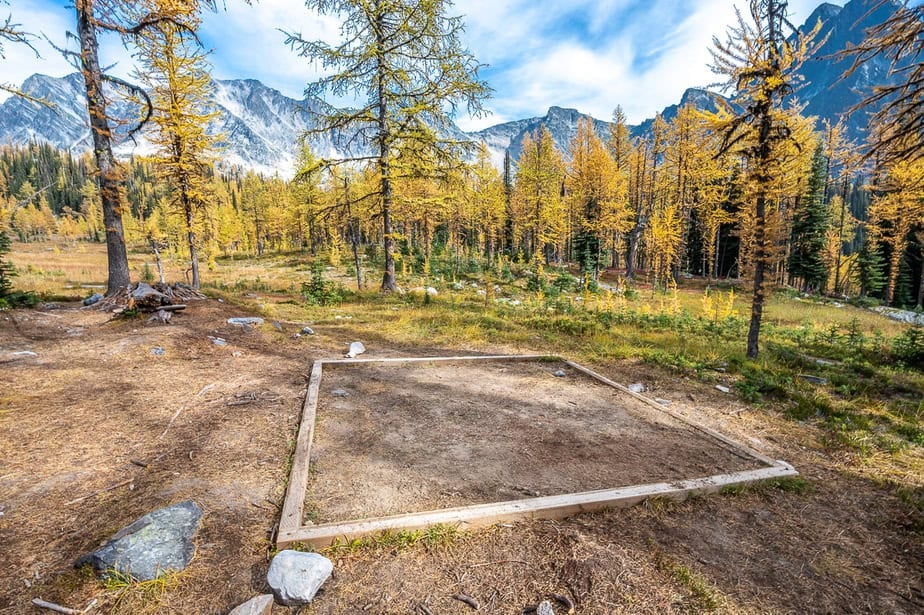
Camping in Monica Meadows
Reach the turnoff to the campground 2.7 km from the trailhead. It took me one hour to get here.
Backcountry camping is permitted up at Monica Meadows. There are four pads like the one pictured below, a throne-style open air toilet and rough benches around a fire pit. Tread lightly as this is a delicate area.
Reservations are not required and camping is first come, first served.
Where to stay before the hike
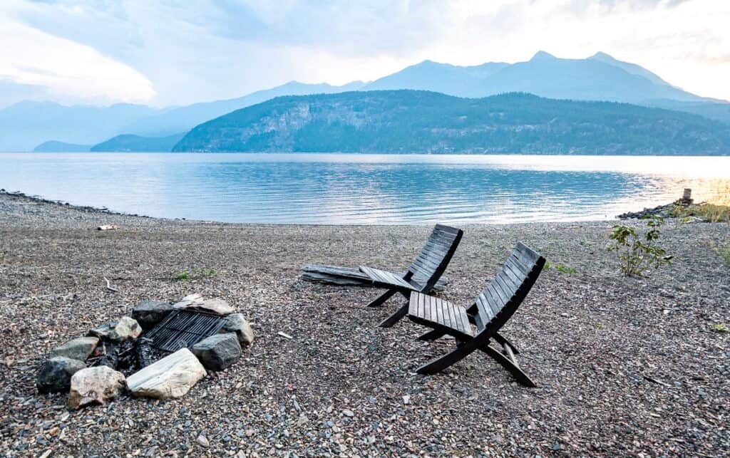
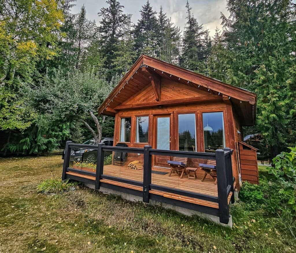
I was fortunate to stay just outside of Kaslo at Wing Creek Resort. I had a cabin with amazing sunrise views over Kootenay Lake. If you’re up for a 10-minute walk to the water you can have a swim and enjoy their beautiful private beach.
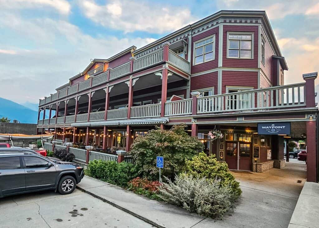
Another option would be the highly rated Kaslo Hotel on the main street. It’s got a friendly and very good onsite restaurant.
If you’d rather camp, visit Glacier Creek Regional Park for first come first served option at $15 per night.
Thank you to Nelson and Kootenay Lake Tourism for hosting my stay in the area.
More hikes in the Kootenays you might enjoy
- Gwillim Lakes Hike in Valhalla Provincial Park
- Old Glory Mountain Hike Near Rossland, BC
- Abbott Ridge Trail in Glacier National Park, BC
- The Stunning Hike to the Kokanee Glacier Cabin
- Glacier Crest Trail, Glacier National Park, BC
Click on the photo to bookmark to your Pinterest boards.