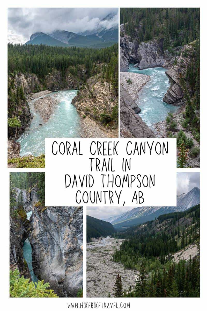
Coral Creek Canyon Hike near Abraham Lake
If you’re looking for a scenic half day adventure you’d do well to choose the Cline River Canyon and Coral Creek Canyon hike with easy access from the David Thompson Highway.
It’s a beautiful area close to Abraham Lake that isn’t quite on par with Maligne Canyon in Jasper National Park – but it sees a fraction of the people, so it’s a very peaceful experience. On a Sunday, we didn’t see a soul on the entire Coral Creek Canyon hike!
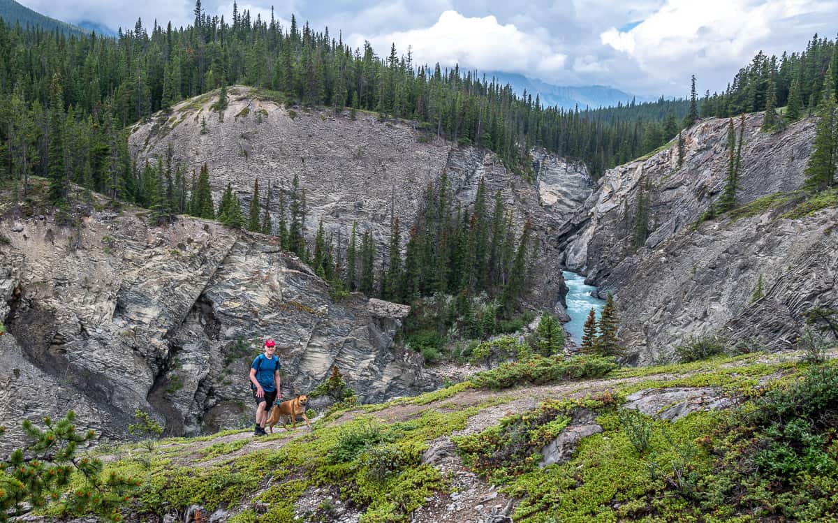
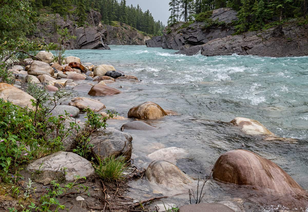
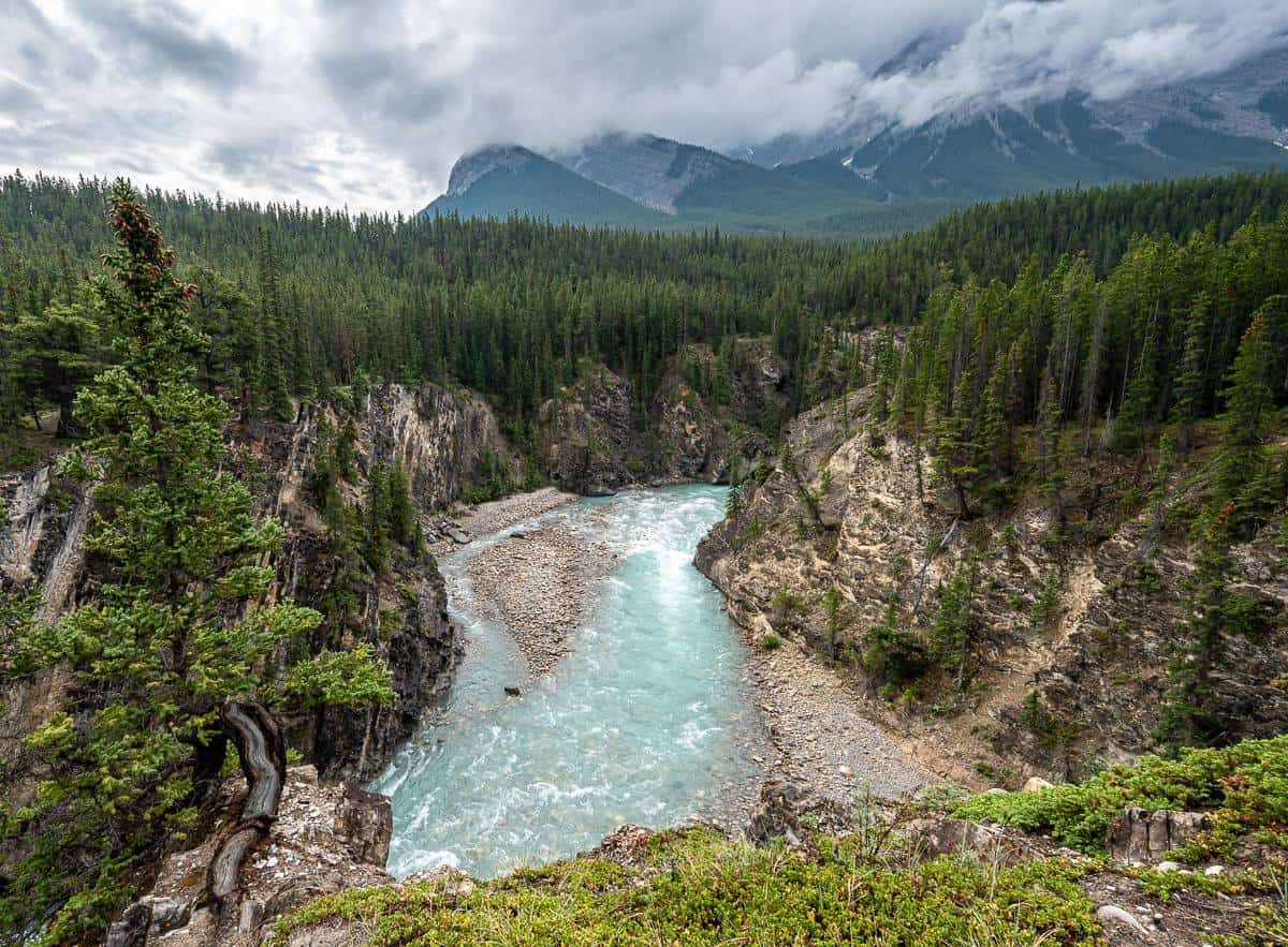
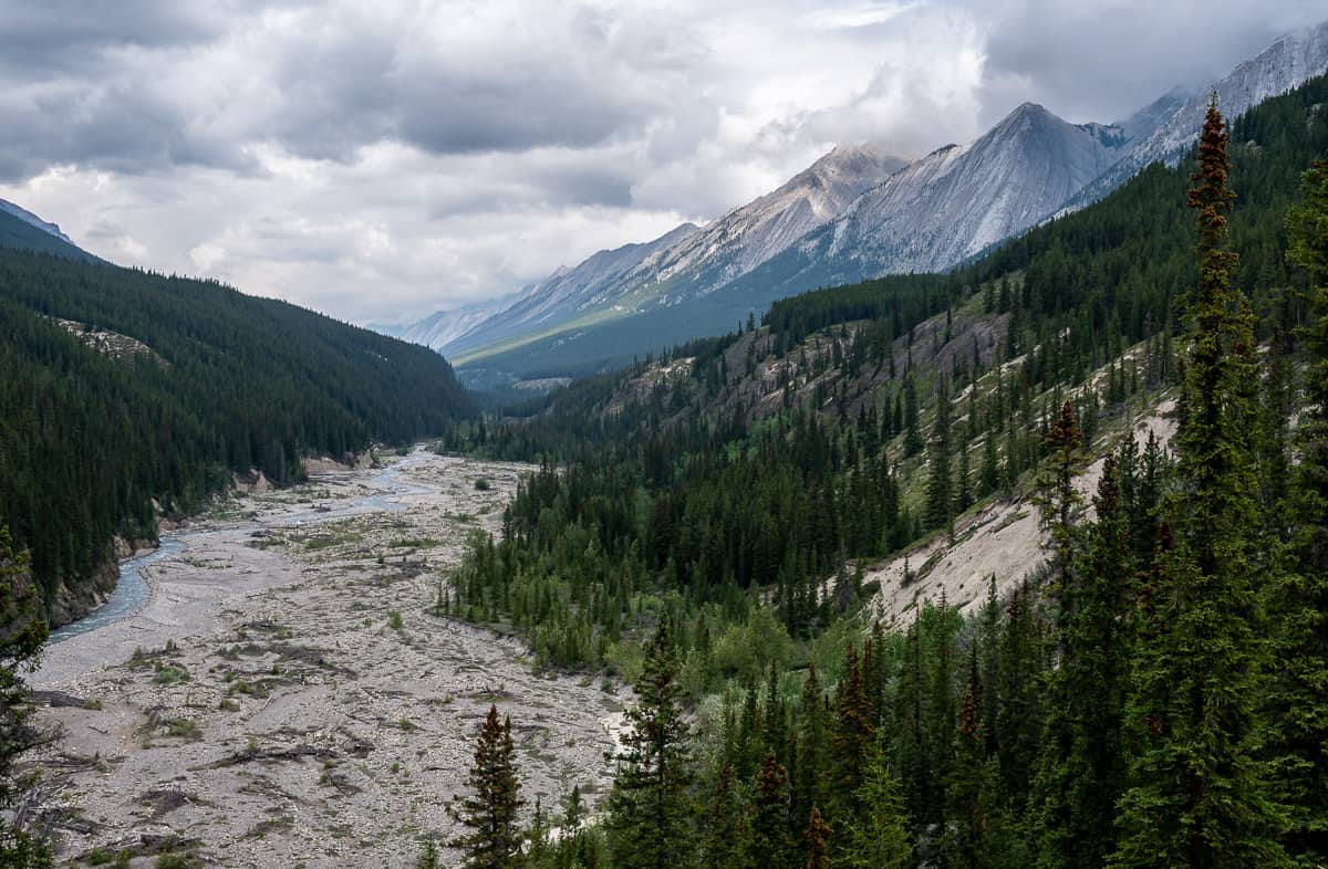
The turquoise-coloured Cline River is the star of the hike – and the higher the canyon walls get, the more drama you’ll discover. Coral Creek doesn’t offer the drama of the Cline River, but it’s still picturesque and the views up the valley are lovely.
For a half day hike, it checks all the boxes – exercise, beauty, fun with a touch of danger (so stay back from the canyon edge), and quiet compared to trails in Banff, Jasper and Kananaskis.
This post includes some affiliate links. If you make a qualifying purchase through one of these links, I will receive a small percentage of the sale at no extra cost to you. Thank you very much for your support.
Would you like to save this?
Coral Creek Canyon hike details
Distance: 7.7 km (4.8 miles) roundtrip – with the option to walk further up the Coral River or do a full day hike up Coral Ridge
Elevation gain: Approximately 155 m (509 feet).
Level of difficulty: Easy to moderate. People scared of heights will want to stay well back from the cliff edge. Keep young kids very close by.
Type of trail: Lollipop or loop – your choice.
Best time to hike: April through September or early October.
Time needed: 2.5 – 4 hours, depending on how many stops you make (so much great scenery) and how far you continue on a trail parallel to the Coral Creek.
Trailhead: Coral Creek Trail parking area – immediately north of the Cline River Bridge.
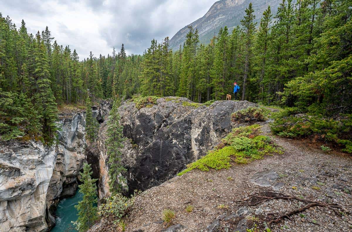
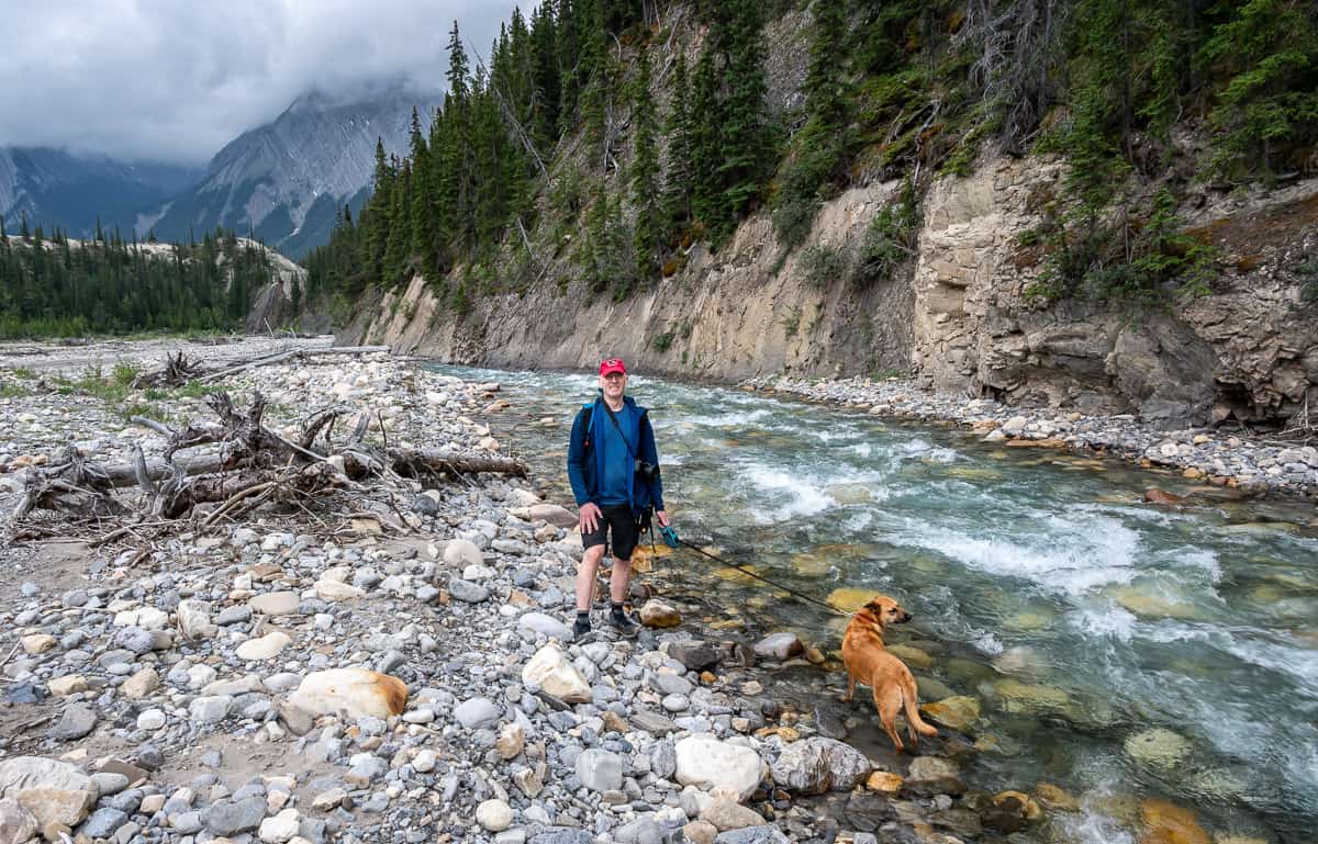
Dogs allowed: Yes – and keep them on a leash along the clifftop trail.
Bears: Don’t forget the bear spray as you’re traveling through bear country. I like to carry it in a bear spray holster so I don’t set it off accidentally.
Weather: Check the weather forecast before you go.
Don’t forget: Be sure to pack the hiking essentials and let someone know where you are going.
Safety: Take responsibility for your own safety.
Coral Creek Canyon trailhead location
If you’re traveling from Saskatchewan River Crossing, drive east on Highway 11 for 42 km. Turn left immediately after the Cline River Bridge into a large parking lot with washrooms and picnic tables. From Nordegg, drive 47 km south to the signed parking lot on your right, just before the Cline River Bridge.

Coral Creek Canyon hike description
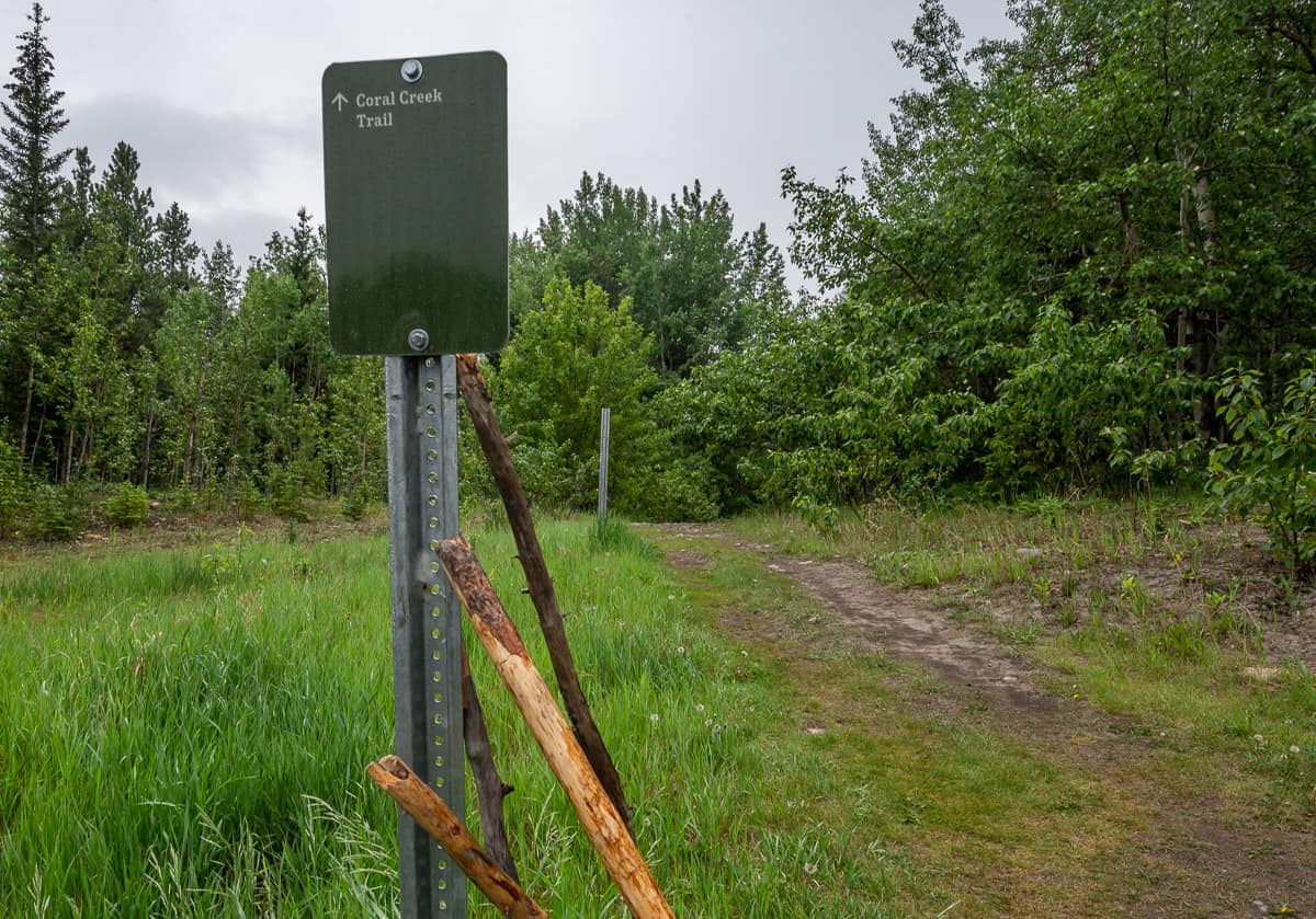
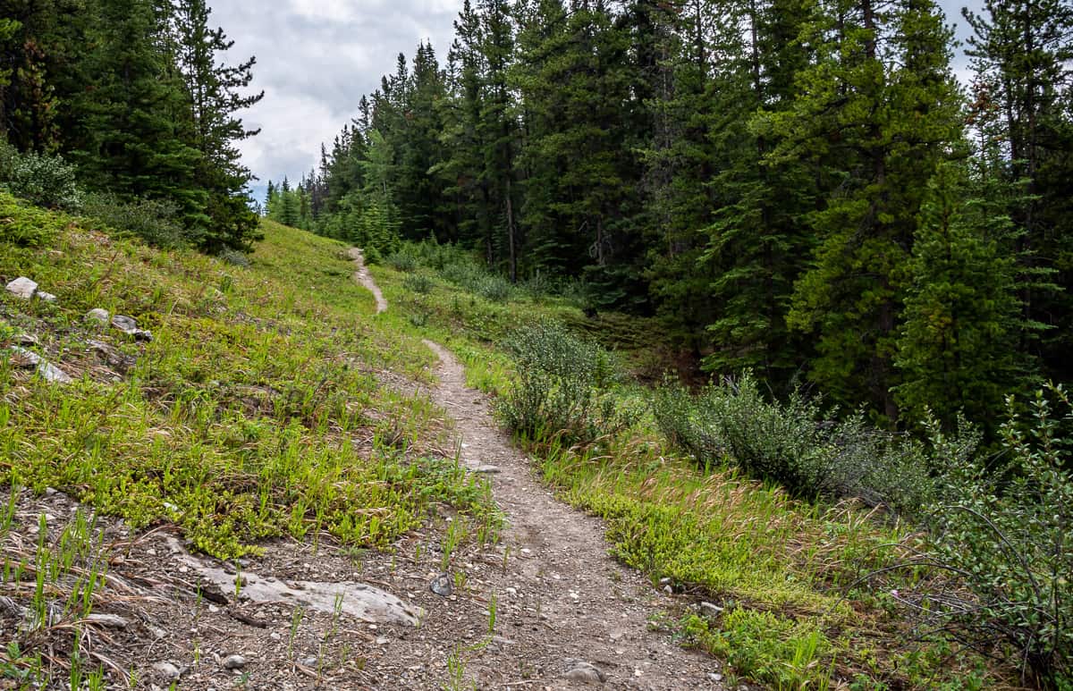
From the Coral Creek Trail parking area look for the signed trail heading southwest. Take it and in short order (under 75 m) cross a small stream on a new bridge. The trail climbs gently and then branches – with the larger trail on the right used for horses.
If you do the Coral Canyon trail as a loop hike you will return here in several hours. But for now, look for narrower trail heading steeply down to the left into the trees towards the Cline River. From the parking lot to this point, it will take you at most 10 minutes.
Continue hiking through the woods for a few hundred metres to reach a T-junction with the Cline River. Turn right and hike upstream on a trail that skirts the edge of the embankment above the Cline River.
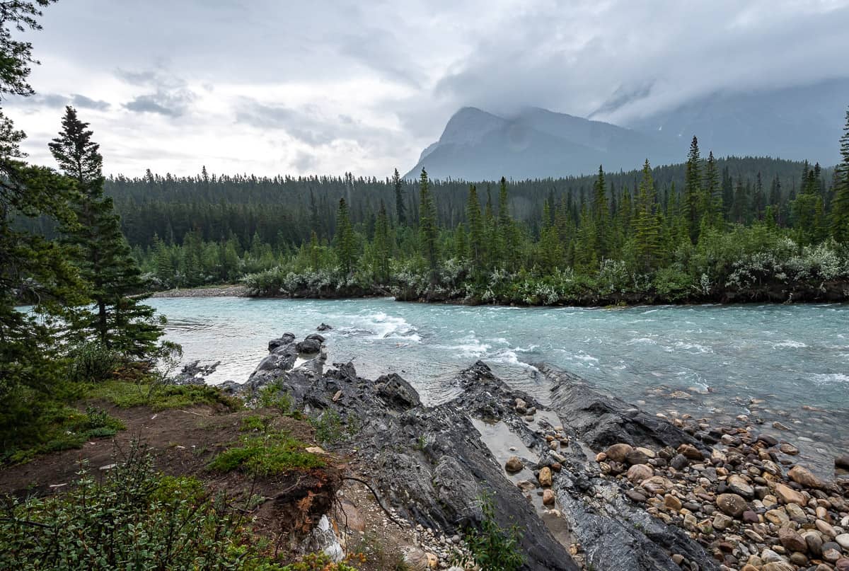
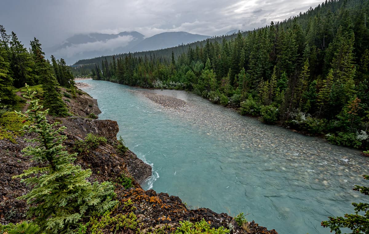
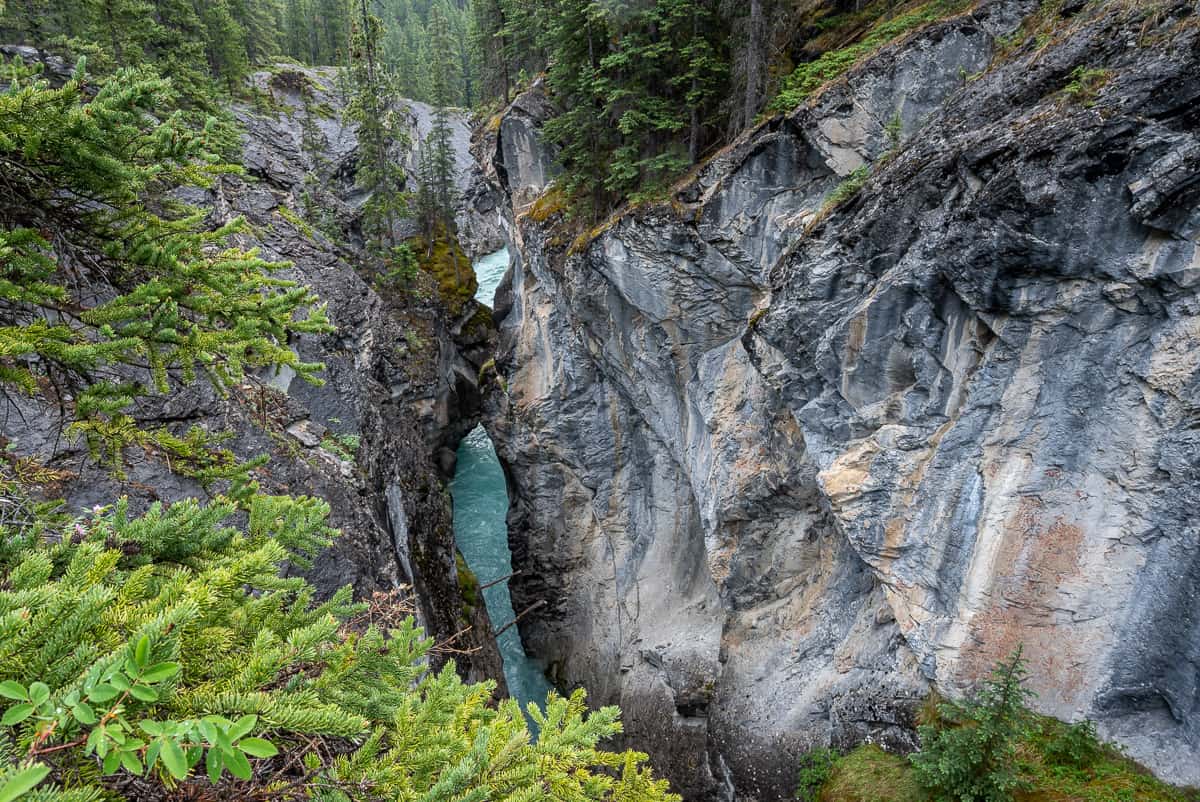
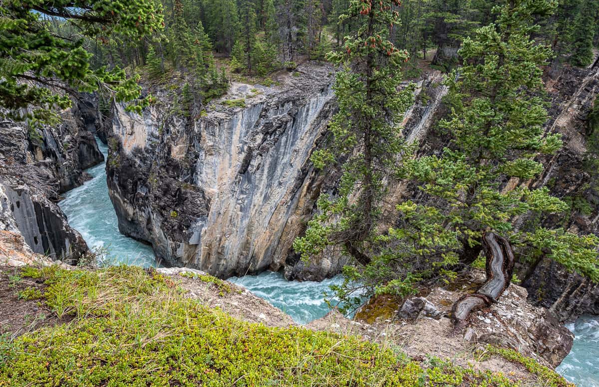
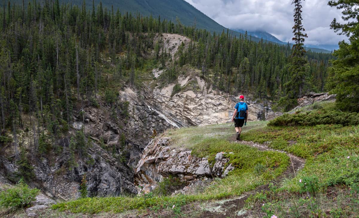
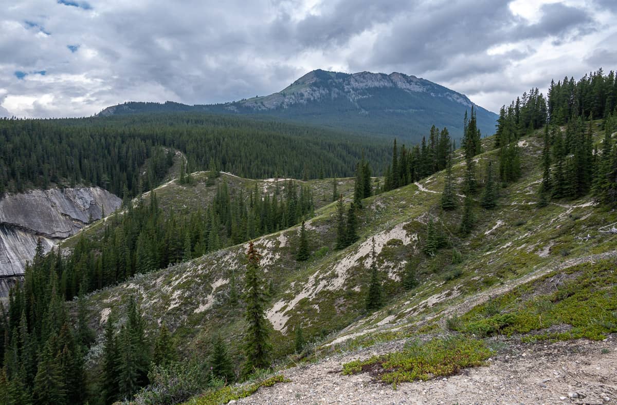
Continue hiking up the Cline River as it the scenery gets more spectacular as the size of the canyon walls grows. Look down at the broiling rapids – both a frightening and awe-inspiring sight. Stay well back from the edge.
Weave your way up the Cline River for at least another 30 minutes, depending on how many overlooks you visit, periodically going into the woods and around corners to get yet another marvelous vista.


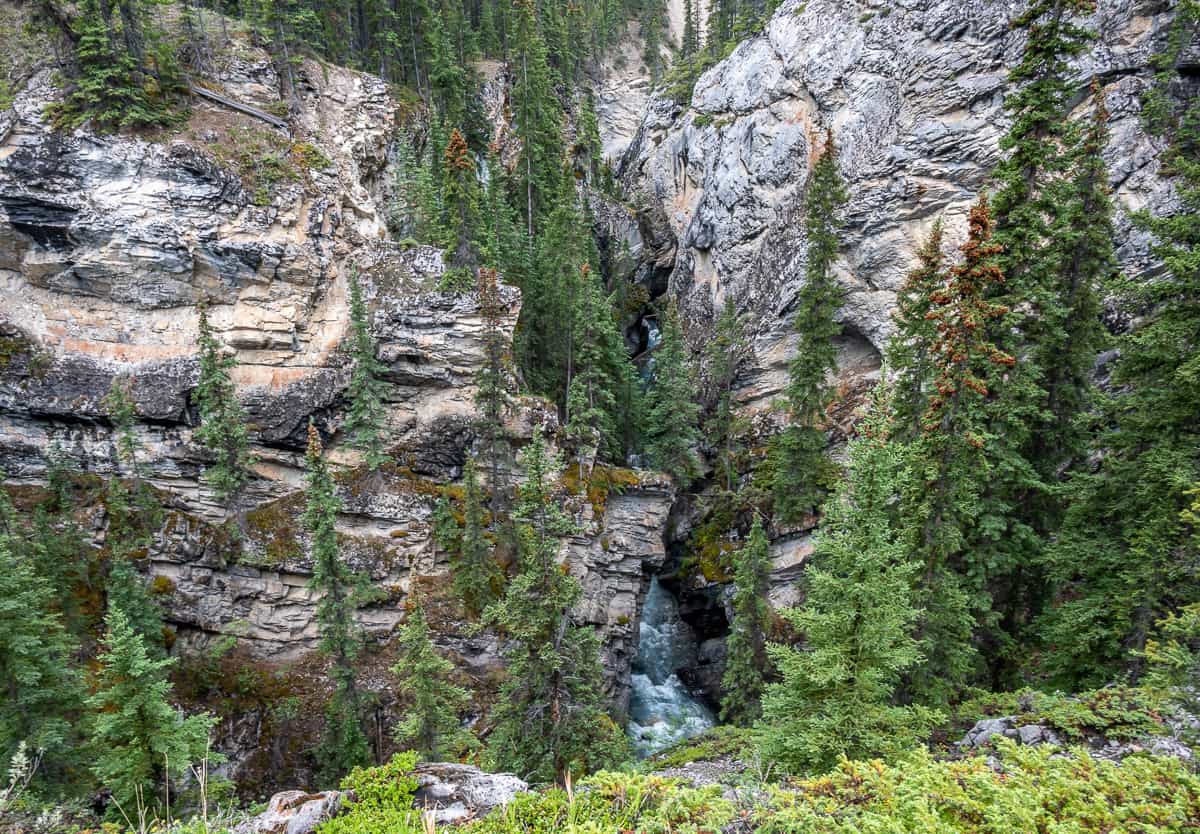
When you eventually leave the Cline River behind, you’ll end up on a short trail through the woods that lands you at another T-junction. Go left and in about 75 metres you’ll break out into an open area showcasing the Coral Creek Gorge scenery.
As you hike past the start of the Coral Creek Canyon, you’ll end up making a sharp right-hand turn onto a trail that becomes much wider as it is meant to be shared with horses coming up from McKenzie’s Trails West.
You’ll see one large sign saying Coral Creek – and a wide horse trail heading back towards the parking lot. This is where you want to come back to on the hike out from Coral Creek Canyon.
A little further up the trail reach another skinnier trail on your right. It will also take you back to the horse trail on the way out, but it’s got more up and down and is much narrower.
It’s about a kilometre to reach the viewpoint overlooking the Coral Creek Gorge from where you first see it. You can stay high on the main trail and then drop down on the obvious trail or crosscut on yet another trail to reach the viewpoint – all very obvious when you’ve got boots on the ground.
e found it windy out at the overlook, so we backtracked to the trees to enjoy our lunch.

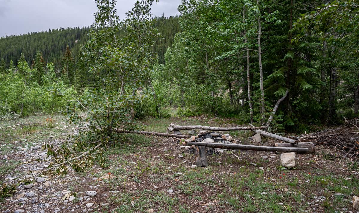
After you’ve enjoyed your lunch with a view head back to the main trail. Turn left and continue hiking on the Coral Creek trail through the forest – past a turnoff to Coral Ridge – a full day hike/scramble – all the way down to a campsite overlooking Coral Creek.
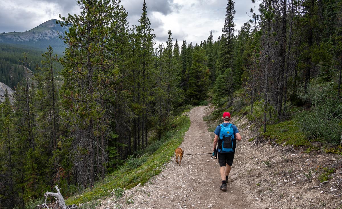
To return to the trailhead, retrace your steps to the horse trail sporting the large sign that says Coral Creek. Turn left and follow the wide trail all the way back to the parking lot, giving any horses you see the right of way.
It’s not nearly so interesting as the hike up Cline River Canyon, so you should be back at the car once you start on this section of horse trail within 30 – 40 minutes.

Where to stay in Nordegg
Check out Okt Häus in Nordegg – a large home with five bedrooms that is perfect for a bigger group. It comes with a hot tub and fire pit.
Expanse Cottages not far from town is a good option too. Units come with a fire pit, kitchenette, living room and more.
Interested in more hikes and activities that aren’t too far away?
- The Hike to Siffleur Falls in David Thompson Country
- Best Hikes Along the Icefields Parkway
- Sunset Pass – Sunset Lookout Hike, Icefields Parkway
- Biking Banff to Jasper – A Complete Guide
- Everything You Need to Know About Camping on the Icefields Parkway
Click on the photo to bookmark to your Pinterest boards.