Siffleur Falls Hike in David Thompson Country
Sometimes it’s the adventures you don’t plan that turn out to be highly memorable. The Siffleur Falls hike in David Thompson Country was one such adventure. It was totally unplanned – and even in early March, a highly worthwhile hike. It’s one the classic hikes to do in the area.
John and I had other ideas for the day but because of my wimpiness when it comes to driving on deserted, snow-covered roads, we chose to return to Calgary via Lake Louise and Banff instead of Rocky Mountain House – where we’d spent a delightful couple of nights.
And that’s how we ended up on Highway 11 – and saw the highway sign for the Siffleur Falls hike. We needed a break and voila – a wonderful way to stretch our legs and discover a new trail.
Siffleur Falls hike summary
Distance: 7.0 km or 4.3 miles return to the first waterfall. The second falls viewpoint is at 5.9 km (3.7 mi), and the third falls at 6.5 km (4.0 mi).
Elevation gain: 70 m or 230 feet.
Level of difficulty: Easy and family-friendly but keep an eye on kids close to Siffleur Falls.
Time needed: Allow 2 – 2.5 hours to do the return hike to Siffleur Falls.
Dogs: Permitted on a leash.
Map: The map for the Siffleur Falls hike is 83C/1 Whiterabbit Creek. I’d also recommend Organic Maps – an offline hiking app.
Bears: This is bear country so don’t forget easy to access bear spray.
Don’t forget: Let someone know where you are hiking and always carry the hiking essentials.
Would you like to save this?
This post includes some affiliate links. If you make a qualifying purchase through one of these links, I will receive a small percentage of the sale at no extra cost to you. Thank you very much for your support.
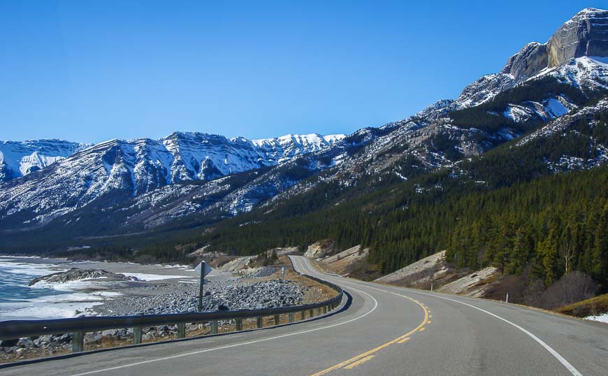
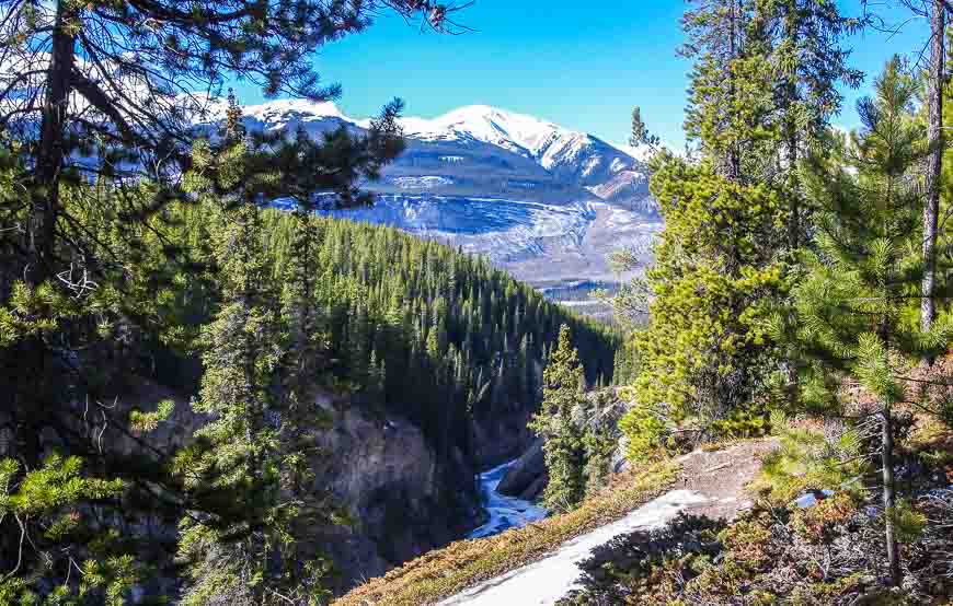
Superb scenery in David Thompson Country
I’d driven this section of highway years ago on the way to Aurum Lodge, but I must have been too busy chatting in the car to have noticed the scenery. It’s almost Icefields Parkway kind of spectacular!
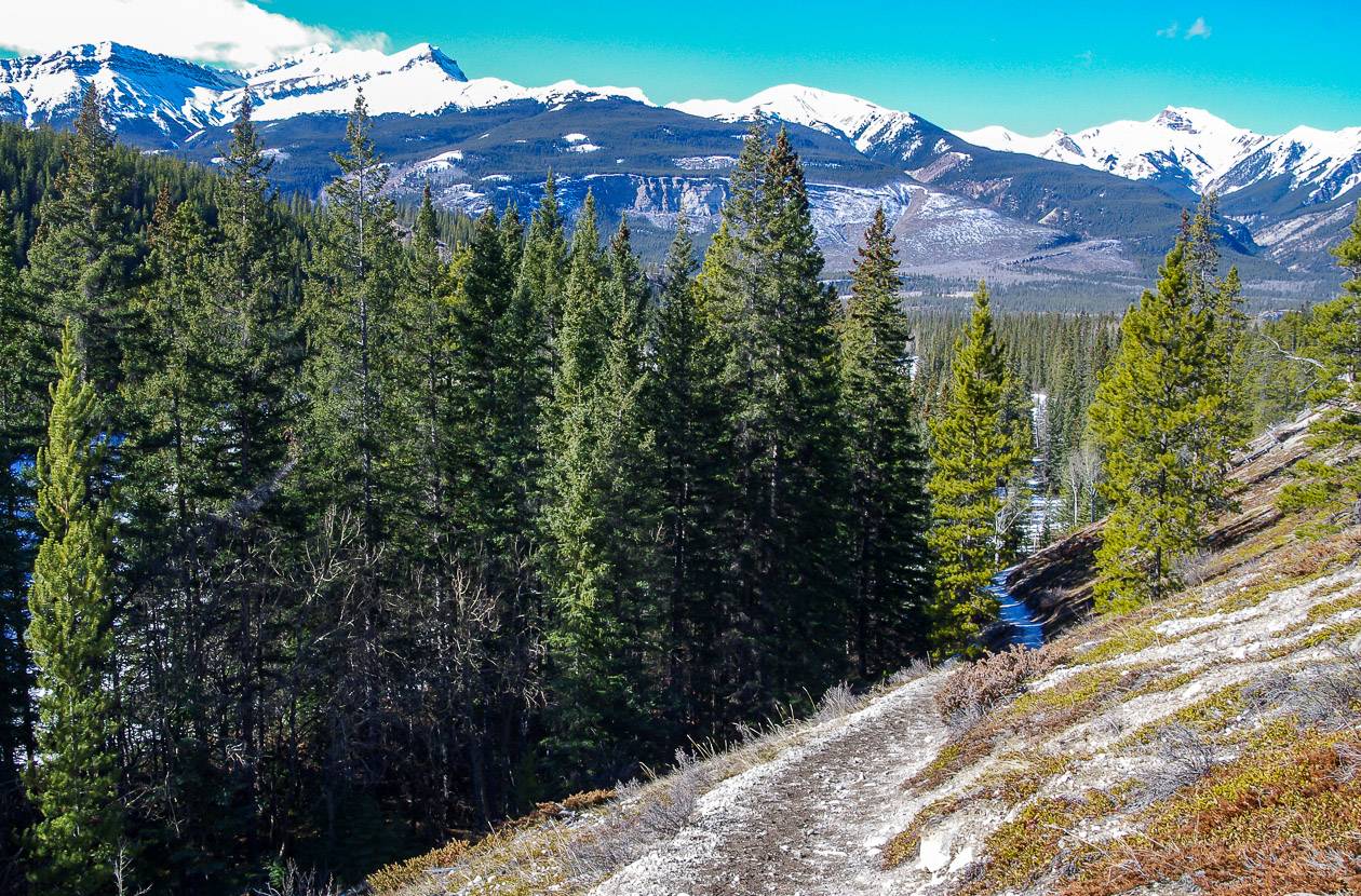
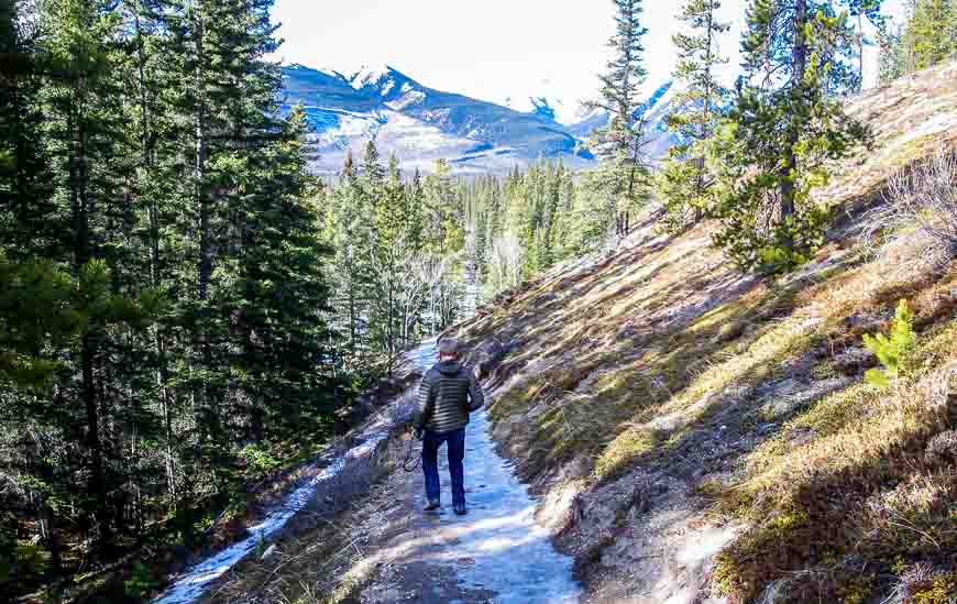
The trailhead to Siffleur Falls on the south side of the highway is well marked. I never did see any information about the length of the trail but perhaps I wasn’t looking in the right spot.
I originally thought the Siffleur Falls hike would be a 15-minute sort of hike. It certainly was not.
Where is the Siffleur Falls hike trailhead?
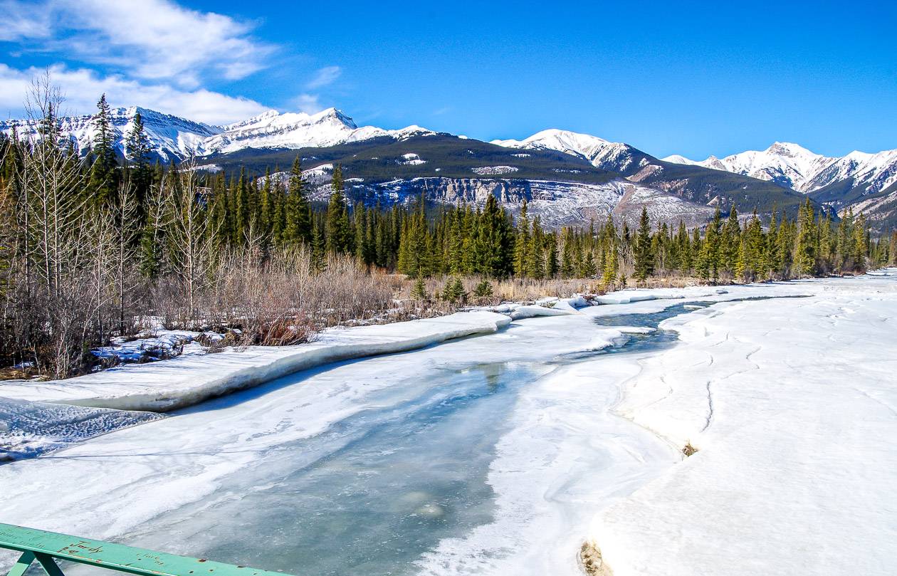
The trailhead to Siffleur Falls is accessed from Highway 11 at the Siffleur Falls Staging Area near the south end of Abraham Lake just off a scenic section of the David Thompson Highway.
It is 65 km west of Nordegg and 22 km east of Saskatchewan River Crossing. There is an outhouse at the staging area.
Siffleur Falls hike description
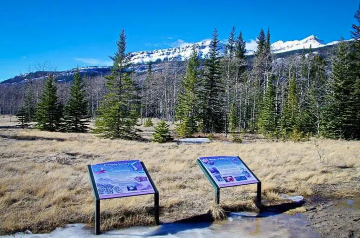
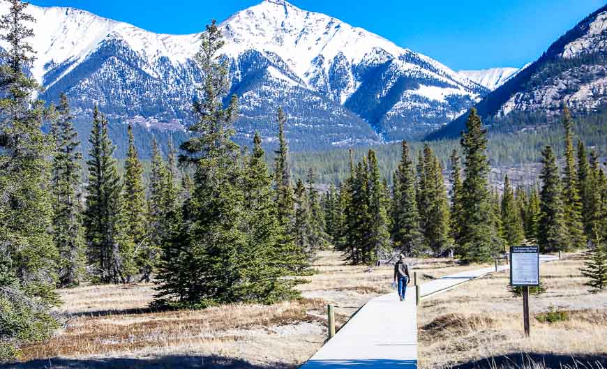
The Siffleur Falls hike starts in the Kootenay Plains Ecological Reserve. Look for interpretive panels and learn something about the region, particularly its history, the wildlife, the early inhabitants, and the effect glaciers had on forming the valley.
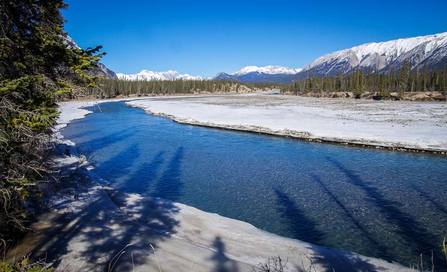
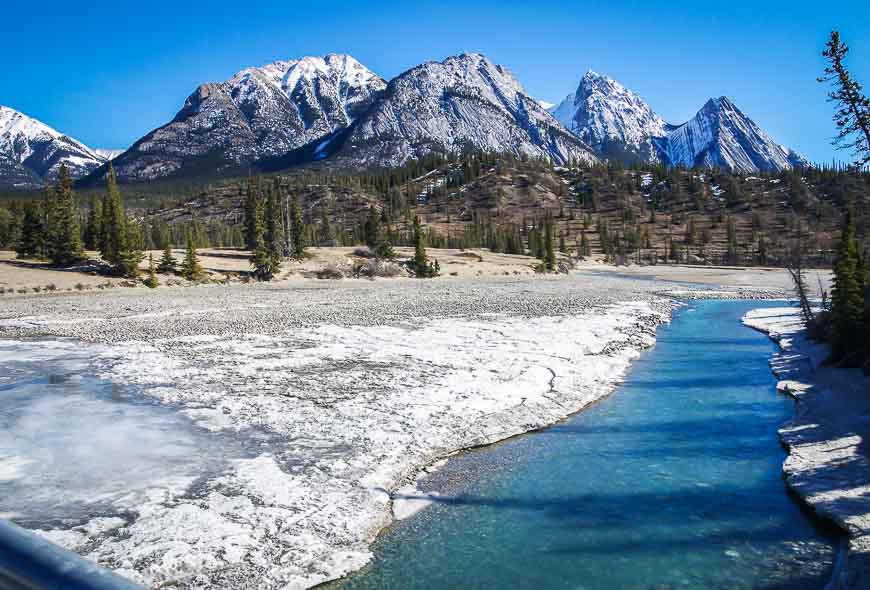
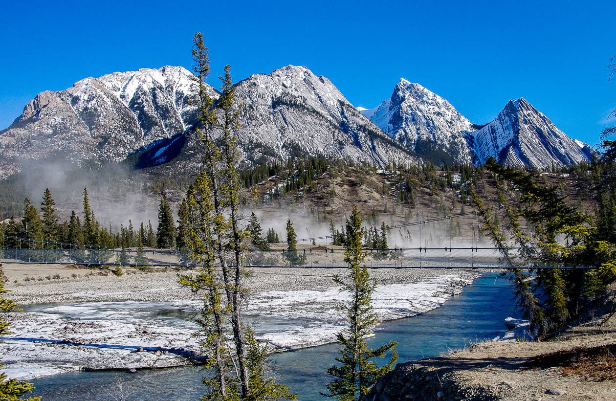
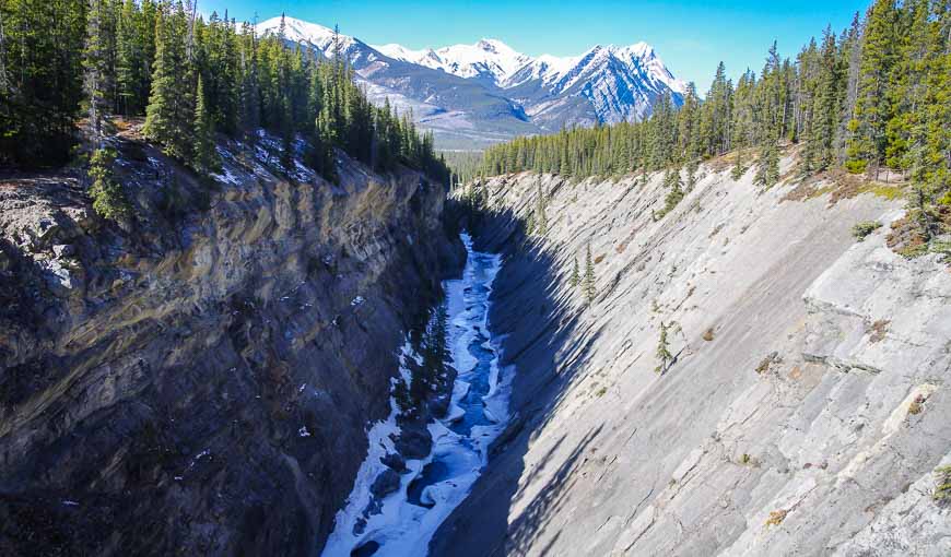
Hike parallel to the river enjoying views up and down the length of the North Saskatchewan River.
Cross the suspension bridge over the river to reach a boardwalk in a pretty meadow. The boardwalk was built to protect the area that is incredibly sensitive to wind erosion.
There’s a good chance you’ll see a lot of dust flying around as the wind has quite a reputation here. Carry a scarf or buff to hold over your nose if it is a windy day.
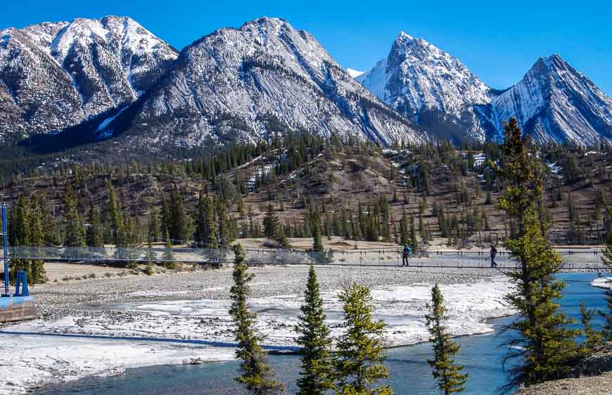
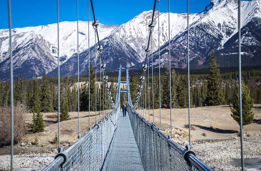
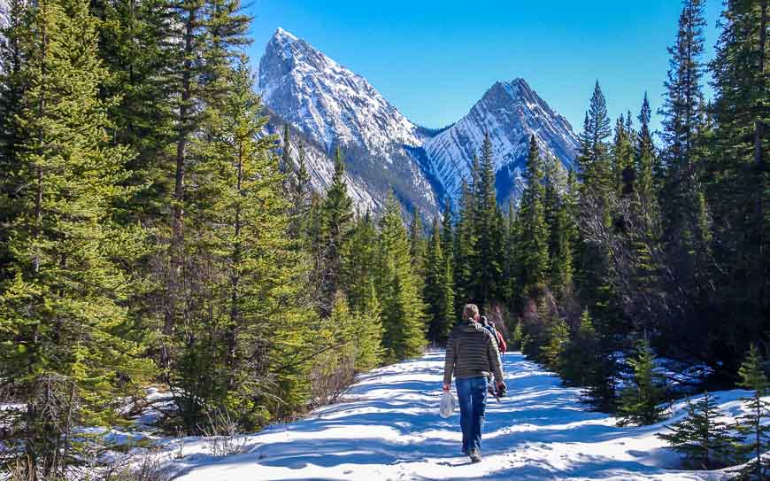
At the end of the boardwalk, continue along a trail to reach the Siffleur River Bridge at the 1.8 km mark. After you’ve crossed the bridge you’ll come to a junction.
Go right for the Siffleur Falls trail. It can be muddy or icy in sections depending on when you hike. Had we known the state of the trail, I would also have taken microspikes with me – those grippers you attach to your shoes or boots to make walking easier. You can buy microspikes via MEC.
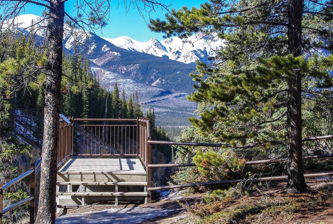
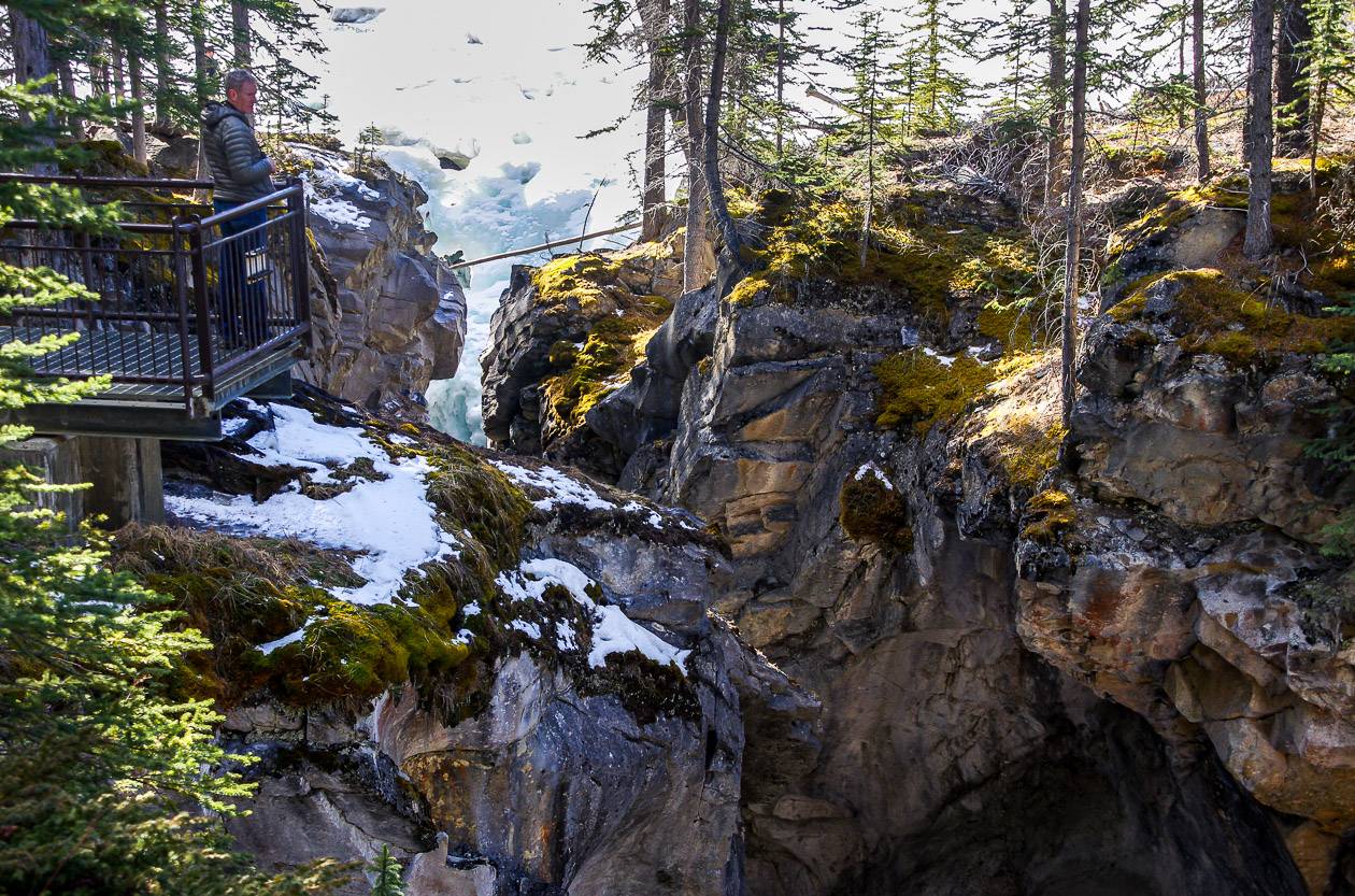
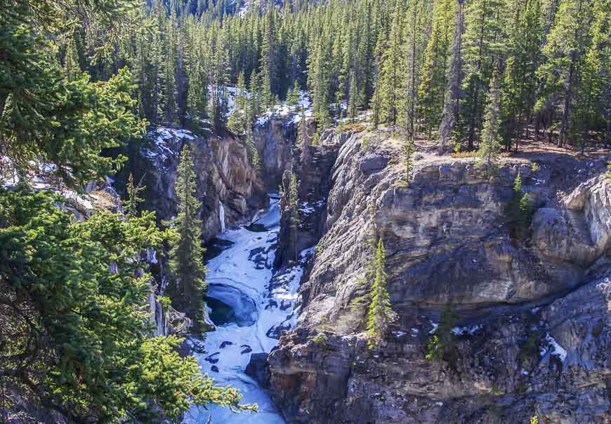
Reach the Canyon Viewpoint at 3.2 km and then Siffleur Falls at 3.5 km.
When you start getting into the canyon section, exercise caution, especially if you’re hiking with kids or dogs. Over the years, there have been accidents and people have died.
What does siffleur mean?
When we arrived at the gorge area, a sign explained where the name Siffleur originated. In French, siffleur is the word for whistling.
I guess there are (or were) a lot of hoary marmots in the area. Known for their particularly loud whistling, Sir James Hector in 1858 decided to name Siffleur Mountain and Siffleur Falls after the marmots.
John and I went only as far as the first set of waterfalls on the Siffleur Falls hike though there are two more waterfalls and a small, primitive campsite at the final set of falls.
This would be a delightful hike to do again in the summer. To see the water roaring through the gorge would be quite the sight.
Until all the snow melts, exercise extreme caution on the sections of icy trail that are adjacent to any drop-offs.
Location map of the Siffleur Falls trailhead
What to take on the Siffleur Falls hike
Apart from the usual hiking essentials, consider taking a pair of poles– especially if it’s snowy or icy.
Carry water and some hiking snacks like protein bars.
A buff could come in really handy if its dusty or windy.
David Thompson Country hikes
- Allstones Lake Hike (+ Allstones Ridge)
- Coral Creek Canyon Hike in David Thompson Country
- Nordegg, Alberta – An Undiscovered Gem in the Canadian Rockies
Check out these hikes in Jasper National Park
- 5 Stunning Hikes to do along the Icefields Parkway
- Bald Hills Trail Hike, Jasper National Park
- Geraldine Lakes Hike, Jasper National Park
In Banff National Park you might like one of these hikes
- An Outstanding Hike to the Summit of Fairview Mountain
- Cascade Amphitheatre Hike, Banff National Park
- A Hike to Bourgeau Lake and Harvey Pass
Click on the photo to bookmark to your Pinterest boards.


Spectacular views, Leigh! Too bad you didn’t have your ‘icers’ to explore more but this is a sumptuous intro. Hope you return and show us its spring or summer views. Love that bridge!
(PS: Read this initially on my phone via the Google app and tried twice to leave a comment but it kept telling me I needed to download Java since your site doesn’t accept spam. I was sure I’d left a comment using my phone before but I can’t recall if I did it thru Google.)
@Marcia This is an area I will definitely be exploring further. I’ll ask my computer guy about your issue commenting. Thanks so much for taking the time to do it.
That hike looks so beautiful. Canada is such a beautiful place. That is the longest suspension bridge I’ve seen. The hike would be beautiful when the wildflowers are out.
@Jan Wildflowers, flowing rivers, more trails in the area – lots of reason to return.