19 BEST Stops on the Icefields Parkway
The Columbia Icefields Parkway stretches for 232 km (144 miles) between Lake Louise and Jasper, Alberta. It’s one of the prettiest drives in Canada – and indeed the world. While you can knock it off comfortably in three to four hours, that doesn’t allow for any stops. At a minimum, take the day to drive the Icefields Parkway – but if you’ve got a week, then you’ll have time to get out and explore some of the gorgeous mountains on foot.
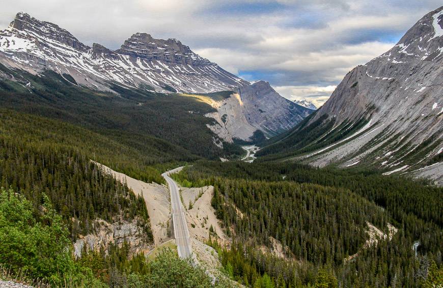
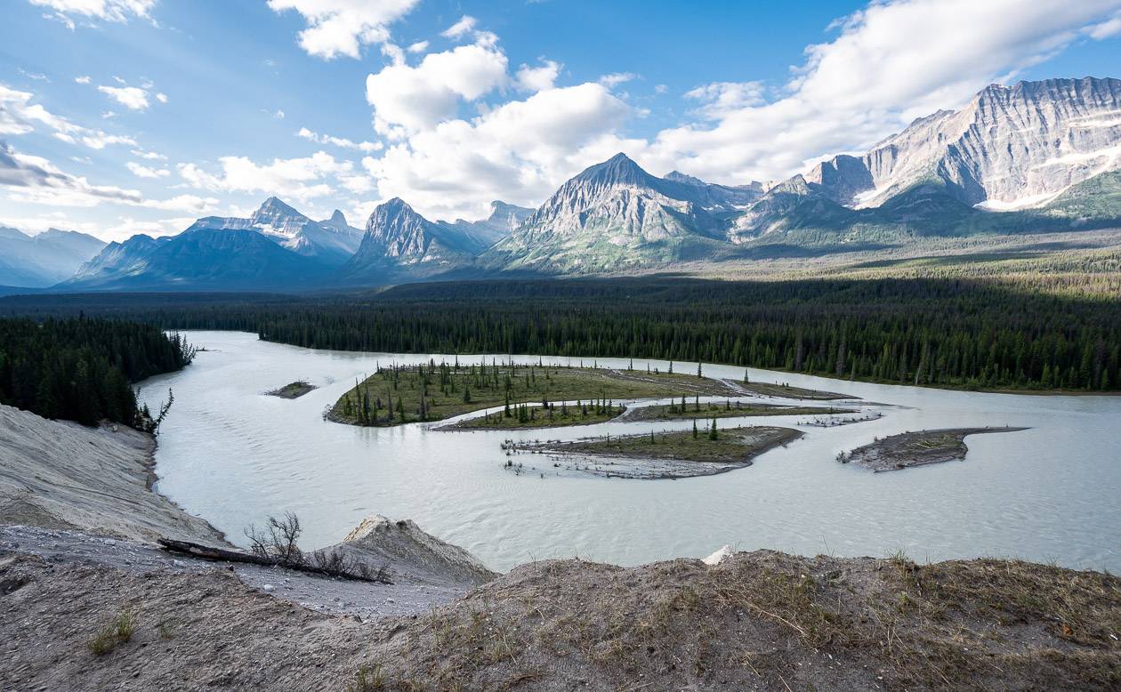
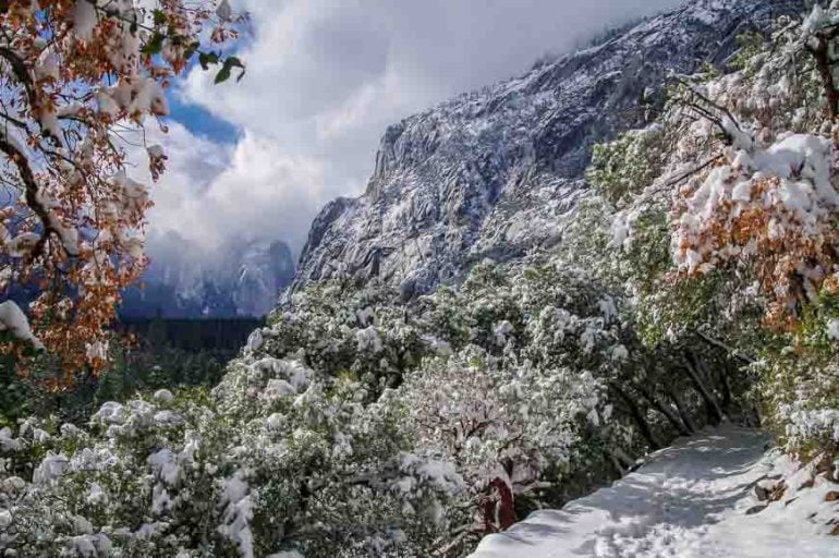
Along the Icefields Parkway you’ll see stunning, turquoise-coloured lakes, glacier-rimmed mountains, the Bow River, far-reaching mountain vistas, wildlife and waterfalls. There are many scenic pullouts – but be careful in summer crossing busy lanes of traffic.
If you love a good bike ride with some epic hills, consider experiencing the Icefields Parkway from the seat of your bike. Start in Banff, Lake Louise, or Jasper.
Would you like to save this?
This post includes some affiliate links. If you make a qualifying purchase through one of these links, I will receive a small percentage of the sale at no extra cost to you. Thank you for your support.
Icefields Parkway summary
Distance: The Icefields Parkway is 232 km or 144 miles long.
Permit: You need a Parks Canada Pass to drive the parkway. Your best bet is the Discovery Pass, good for a year at over 80 parks and national historic sites.
Time needed: You can drive the Icefields Parkway in as little as three hours, but if you want to make any stops allow a day.
Direction: There is no one direction that is better than another to drive.
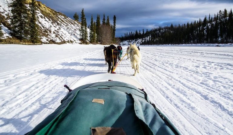
Winter: You can drive the Icefields Parkway in winter (see blog info at the bottom of the post) but it can be a harrowing drive especially if it’s snowing.
Cell service: Don’t count on any cell service along the length of the parkway.
Accommodation: There are some accommodation options as noted at the bottom of the post. You’ll find lots of choice in Lake Louise and Jasper but along the parkway there are only four hotel/motel options and a handful of hostels.
Camping: There are lots of campgrounds along the Icefields Parkway – and some are first come, first served.
Where to eat: There are a few restaurants along the Icefields Parkway though I highly recommend stocking up in Jasper or Lake Louise as prices – as you’ll see are on the high side. There is a food court at the Discovery Centre at Jasper National Park Icefield Information Centre and a café and convenience store at Saskatchewan River Crossing. You can also buy meals and snacks at Sunwapta Falls Rocky Mountain Lodge.
Gas: There is only one place to buy gas on the Icefields Parkway – at Saskatchewan River Crossing. You can also fill up in Lake Louise or Jasper.
Best time to drive: The best time of year to drive the parkway is after the snow goes in spring and before it arrives in fall. Summer can be lovely but frustrating as it gets busy and you can get stuck behind slow moving RV’s for long periods.
Best time of day to drive: Early in the morning and after dinner when there are fewer vehicles on the road.
Tours: There are tours you can do, but renting a car offers more flexibility.
Location map of the 19 best stops on the Icefields Parkway
- Click on the three dots to the left of the square in the top right hand corner to email a copy of the map.
Herbert Lake stop on the Icefields Parkway
Time needed: 10 minutes
Activity: Short hike or swim
Herbert Lake, just 7 km north of Lake Louise, is a beautiful lake where on a peaceful morning or evening you can capture mirror-like reflections of Mount Temple. It’s also a place for a quick swim, should you be exploring on a hot summer’s day.

Hector Lake, 23 km north of Lake Louise on the Icefields Parkway
Time needed: 10 minutes for the viewpoint or 1.5 – 2 hours for an out and back hike
Activity: Viewpoint or hike
Hector Lake is the second largest lake, after Lake Minnewanka in Banff National Park but the largest natural lake in the park. The lake is named after James Hector who accompanied the Palliser Expedition as a surgeon and geologist.
There is a 5 km roundtrip hike to Hector Lake – and a campsite on the far side of the Bow River. Only cross the river when it’s safe to do so. You can reserve the campsite online.
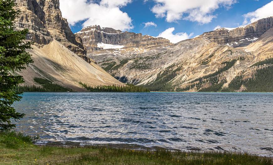
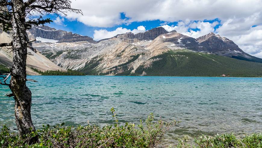
Bow Lake on the Icefields Parkway
Time needed: 15 minutes for the views/picnic
Attraction: Roadside views and an option to hike two different trails
Gorgeous Bow Lake is best viewed from the lookout on the northwest shore of the lake or from the Crowfoot Glacier Viewpoint. And there is also an area with picnic tables, accessed just slightly south from the highway pullout.
If you drive down the road at the north end of the lake you’ll reach The Lodge at Bow Lake (formerly Num-Ti-Jah Lodge), a place you can’t miss with its bright red roof. You can spend the night here, enjoy dinner or pick up a snack at the Bow Lake Café.
There is also some excellent hiking that starts by the lodge. Head out on the Bow Glacier Trail. At the large limestone boulder spanning the gorge you have the option to hike to Bow Hut (14.8 km round trip hike) or Bow Glacier Falls – a 9 km round-trip hike.
If you head for the hut, there are some creeks to cross. I’d highly recommend water shoes and a pair of hiking poles.

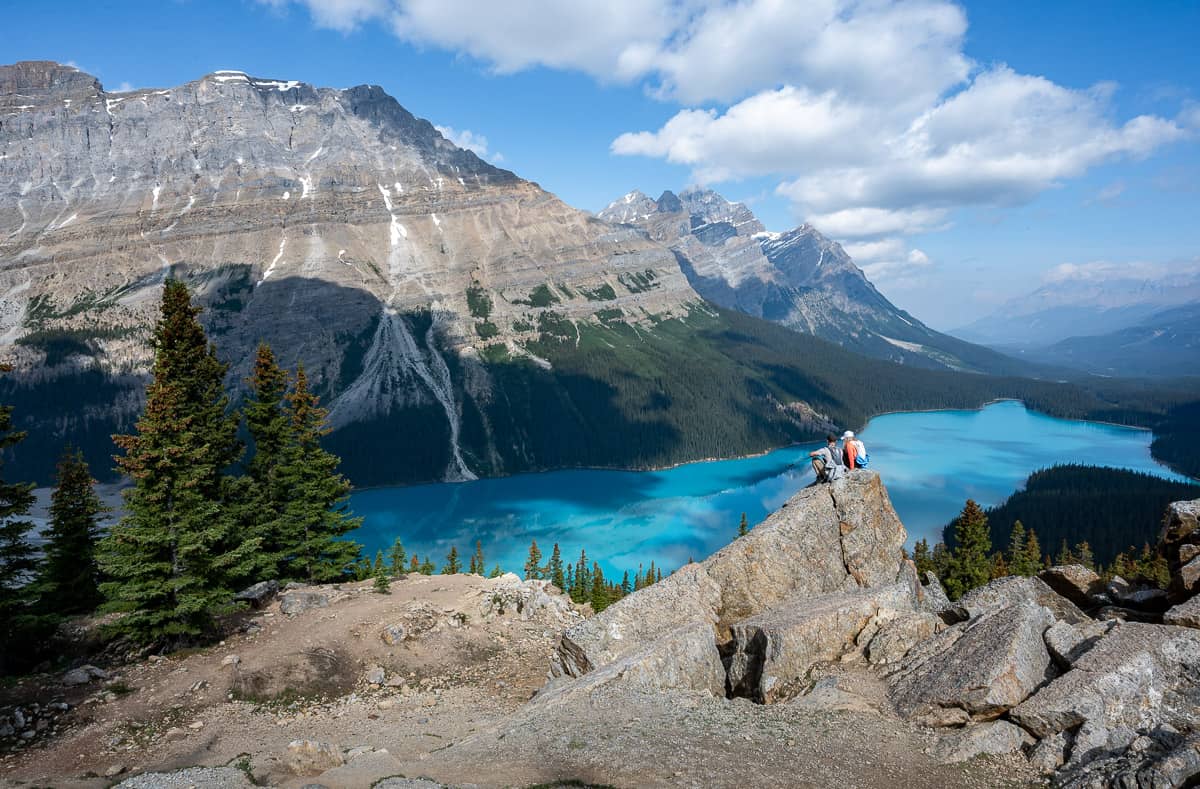
Peyto Lake
Time needed: 30 minutes
Activity: Short walk to a viewpoint
The melt from Peyto Glacier feeds stunning turquoise coloured Peyto Lake, located at the Bow Summit, the highest point on the parkway at 2088 m above sea level.
There has been a paved trail to a viewing deck overlooking the lake and Mistaya River Valley. The area was rehabilitated and finished in 2021 with the addition of more parking, new washrooms, rerouting of trails and expansion of the viewing platform.
Waterfowl Lakes – great for camping and hiking
Time needed: 10 minutes for viewing but 3 – 4 hours if you do a hike
Activity: Roadside viewing or one of two hikes
The Waterfowl Lakes, located 60 km north of Lake Louise, can be seen from the Icefields Parkway. They are a great spot for camping and photography – at least when the water is calm. Their beautiful colour is a function of the glacial silt from the Peyto Glacier.
At the southwest end of the campground, you’ll find the trailhead for the Cirque Lake and Cephren Lake hikes. It’s 7.7 km return to Cephren Lake, 8.8 km return for Cirque Lake or 13.2 km return for both. Allow four hours to hike to both lakes. Reportedly these are muddy hikes – and Cirque Lake is the prettier of the two.

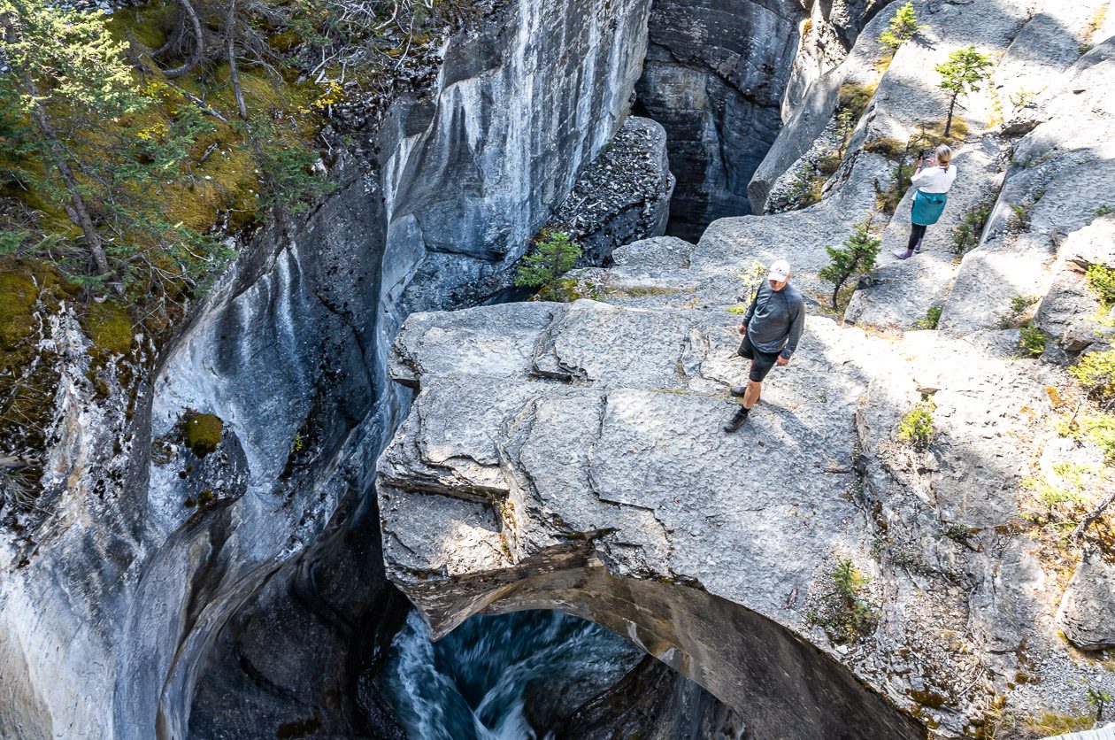
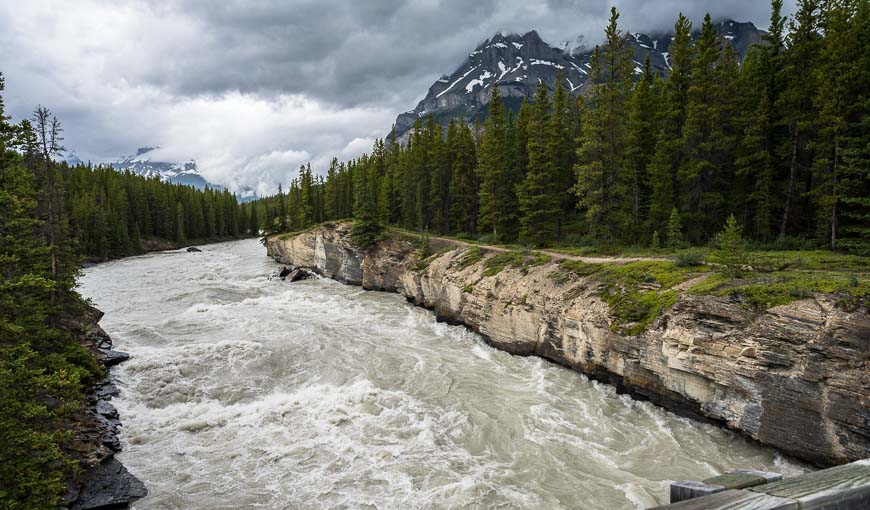
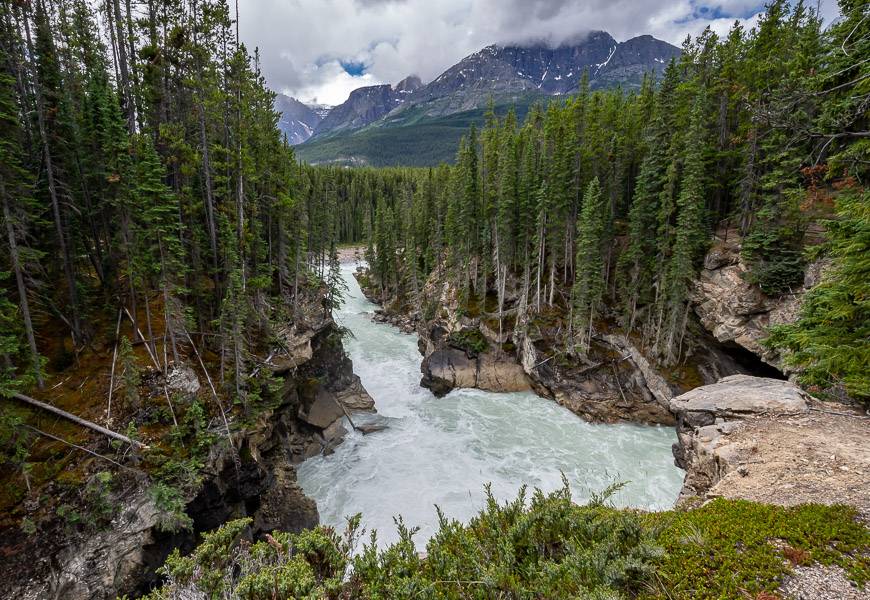
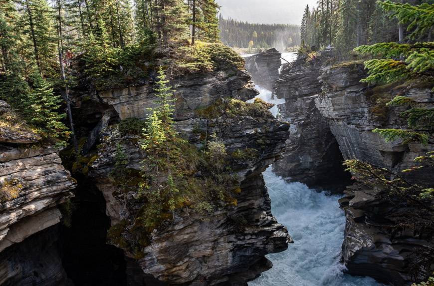
Mistaya Canyon – a scenic stop on the Icefields Parkway
Time needed: 30 – 45 minutes
Activity: Short hike
It’s a 1.0 km return hike on an abandoned road to visit Mistaya Canyon. There is an elevation loss and gain of 35 m and footing is pebbly and difficult in places. Allow about 30 – 45 minutes, especially if you are a photographer.
Once at the bridge, admire the deep narrow gorge and marvel at how the power of the Mistaya River has eroded the limestone, making it very smooth over time. You can continue over the bridge to access the 10.4 km return hike to Sarbach Lookout. Also, many visitors go down to the rocks as the area around the canyon isn’t fenced. This isn’t recommended as it is potentially hazardous.
Fun fact: Just 2.5 miles down from the Mistaya Canyon, the Mistaya River joins the North Saskatchewan River.
Saskatchewan River Crossing
Time needed: Visible from the car
Saskatchewan River Crossing is located at the junction of Highway 93 and 11. It sits at the confluence of three rivers – the North Saskatchewan with the Howse and Mistaya Rivers.
This is the only place to fill up with gas before you head north to Jasper, 154 km distant. There is also a restaurant, gift shop and a hotel called The Crossing Resort.
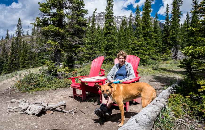
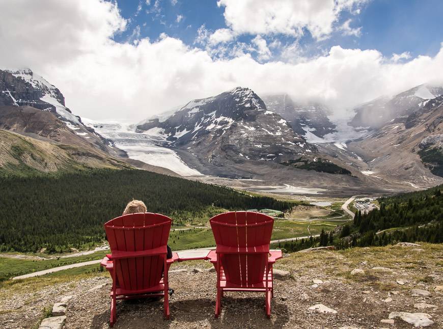
Howse River Overlook – and a Parks Canada red chair opportunity
Time needed: 40 – 75 minutes depending on how long you hike
Activity: Easy hike
Drive the Icefields Parkway 1 km north from where the David Thompson Highway intersects the Saskatchewan River Crossing and look for the signed Glacier Lake trailhead on the west side of the parkway.
Hike the easy trail towards Glacier Lake, reaching the bridge across the North Saskatchewan River at the 1.1 km point. It’s a sight to be seen in itself, especially when it’s flooding. Reach the Howse River Overlook at 2.2 km and enjoy the view from the red chairs. The area has historical significance as David Thompson, a surveyor, explorer, and fur trader camped here back in 1807.
If you’re looking for a long but easy day hike, try the hike to Glacier Lake.

Sunset Lookout
Time needed: 3 – 3.5 hours
Activity: Hiking – moderate to hard depending on how much you hike
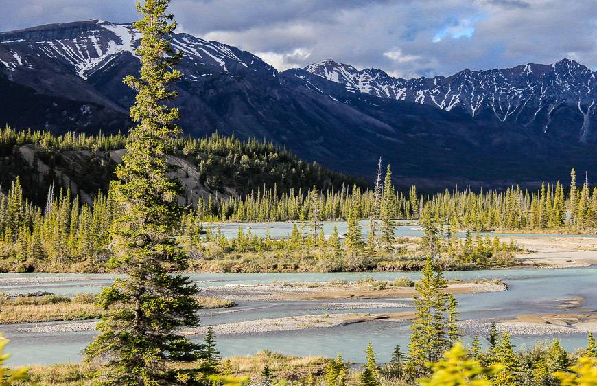
Most people driving the parkway don’t stop to do the 9.0 km return hike to Sunset Lookout. But if you’re a good hiker and don’t mind a steep trail (it climbs 553 m or 1,814 feet), then you will be rewarded with magnificent views of northern Banff National Park, the Icefields Parkway snaking below, and the sight of beautiful, braided channels of the North Saskatchewan and Alexandra Rivers.

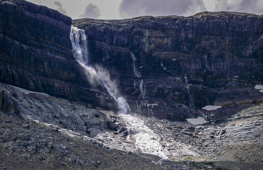
Weeping Wall
Time needed: 5 minutes
Activity: Roadside attraction
Drive 26.8 km north of Saskatchewan River Crossing or 22.5 km south of the Columbia Icefields Centre to see the Weeping Wall. It’s even more beautiful in winter when its frozen – and is considered to be one of the top ice climbs in the world.
There is a pullout to see the water dropping more than 100 m from Cirrus Mountain. Catch the sun at just the right angle at the end of the day and you’ll see a rainbow.

Panther and Bridal Veil Falls
Time needed: 25 minutes
Activity: Short hike
Bridal Veil Falls are located at the big bend on the Icefields Parkway, 36 km north of Saskatchewan River Crossing and 2.2 km south of the turnoff to Parker Ridge. The water originates on the Huntington Glacier and eventually ends up in the North Saskatchewan River.
Panther Falls can be visited in conjunction with Bridal Veil Falls, but you’ll have to hike there on a sometimes slippery trail so exercise caution. They are more stunning than the Bridal Veil Falls.

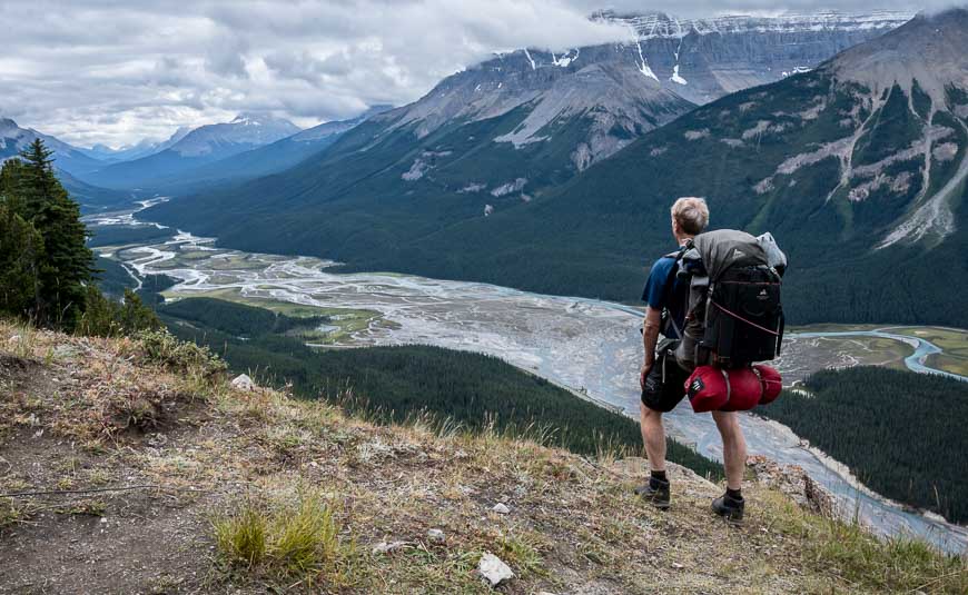
Parker Ridge hike
Time needed: 90 minutes to two hours
Activity: Easy hike
The Parker Ridge hike is one the must do ones along the Icefields Parkway. Views open on the hike within five minutes of starting out. The hike is just 4.8 km return so you can knock it off in 90 minutes and still have time to gape at the Saskatchewan Glacier. This is a family-friendly hike.
There is a large, signed parking lot for the Parker Ridge hike, 41 km north of Saskatchewan River Crossing and 8.6 km south of the Columbia Icefield Discovery Centre.
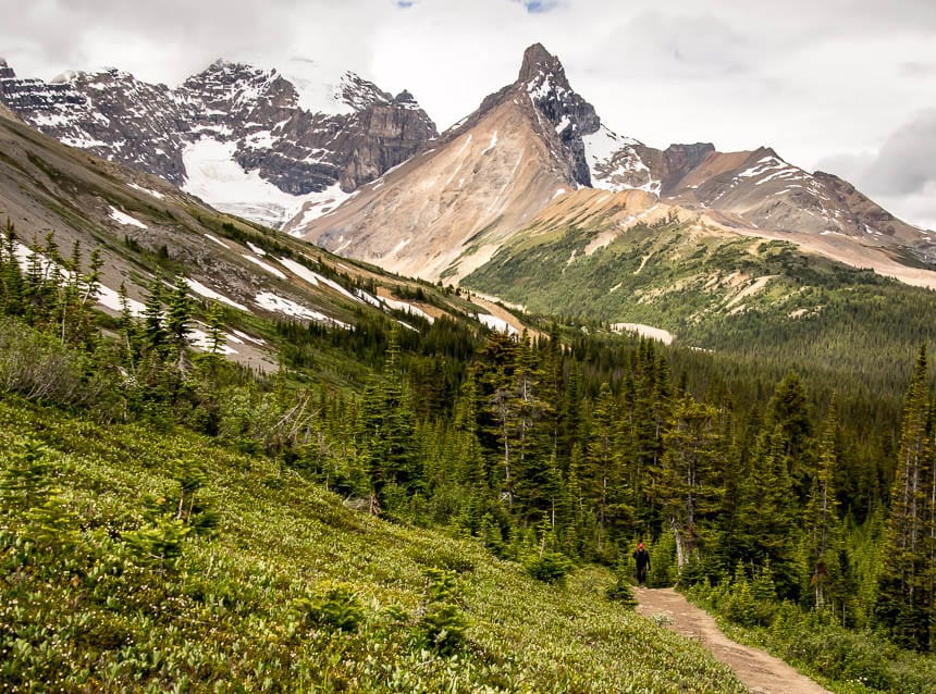
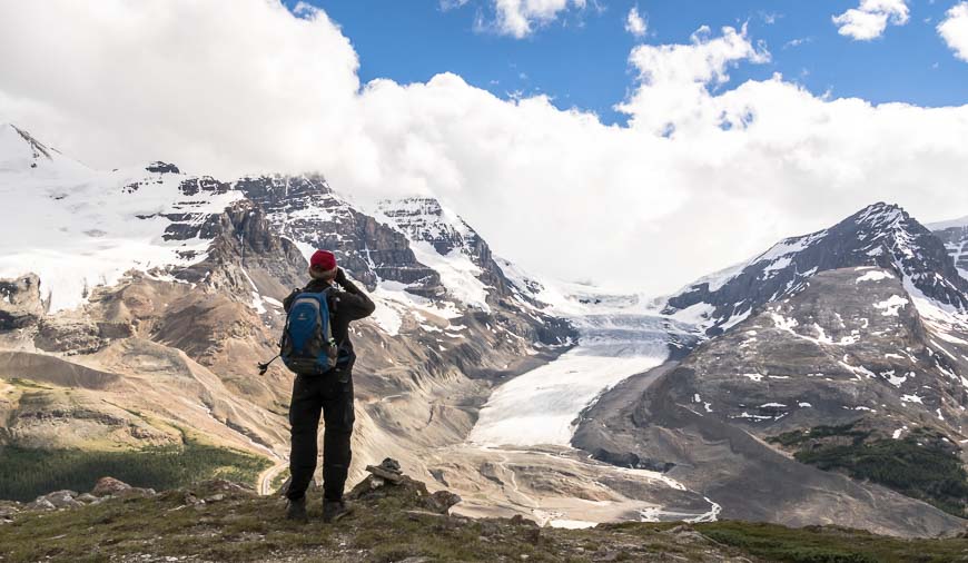
Wilcox Pass red chair moment
Time needed: An hour, more if you keep going
Activity: Hike with a view
Start the hike to Wilcox Pass just 2.8 km south of the Columbia Icefield Discovery Centre. You don’t have to hike all the way to the pass, merely up the steepest section of trail to get the standout view of the Columbia Icefield from the red chairs. Although it’s steep, most kids six and over should be able to handle the hike.
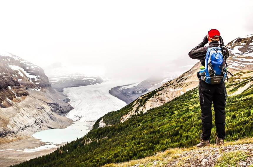
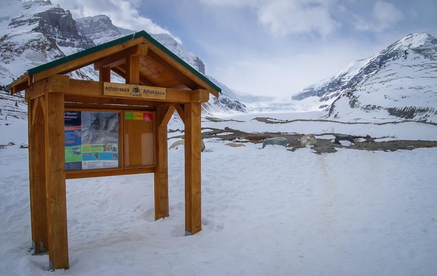
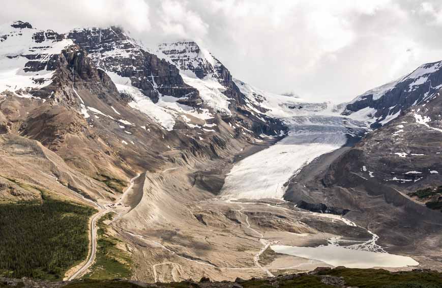
Columbia Icefield – the most famous stop on the Icefields Parkway
Time needed: 10 minutes to several hours depending if you hike or do a tour
Experience: Photography, hike or Columbia Icefield guided experience
It seems that almost everyone stops at the Columbia Icefield on a pretty, sunny day so the crowds can be intense. If you can ever visit in the off-season, you might just have the area to yourself.
The Icefields are home to 30 glaciers ringed by 11 mountains, including the highest one in Alberta, Mount Columbia. Meltwater from the Icefields feeds the Columbia, Athabasca and Saskatchewan Rivers.
There are tours here but you can do a self-guided walk. You can also camp in the area or stay at The Glacier View Lodge.
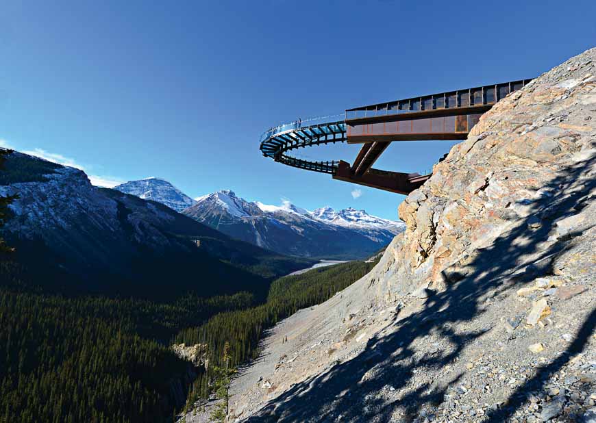
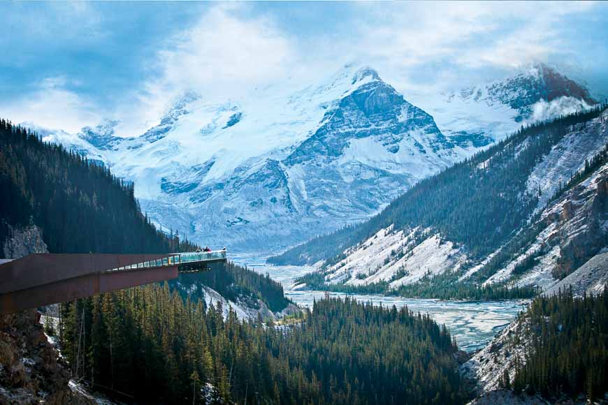
Glacier Skywalk
Time needed: 2.5 – 3 hours round trip
Activity: A skywalk
Walk the glass-floored Glacier Skywalk on a cliff-edge walkway that takes you to a platform overlooking a 918 foot drop. There are glass panels to keep you safe, but you might still get an adrenaline rush or a case of the willies once you’re there. Needless to say, the views down the valley are incredible. (Regular prices are $45 per adult in 2025.)
Get to the Skywalk via a shuttle run by Pursuit. It’s all part of the cost of admission. The actual Skywalk is a short drive north of the Columbia Icefields Discovery Centre.
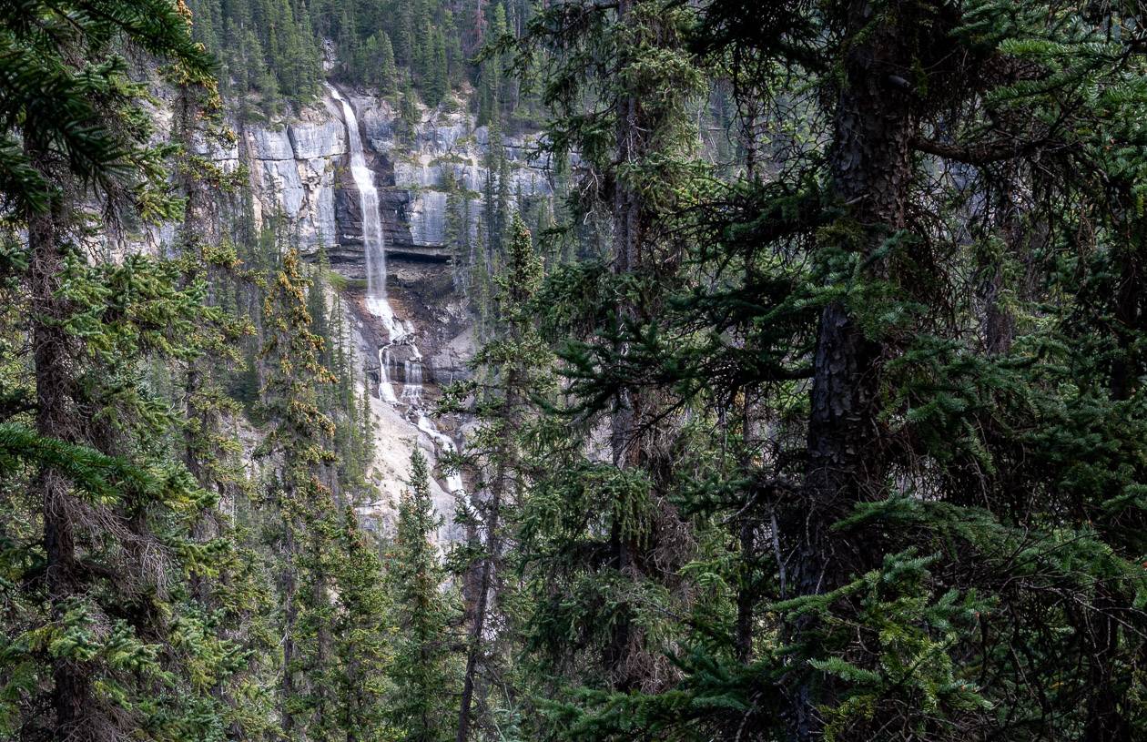
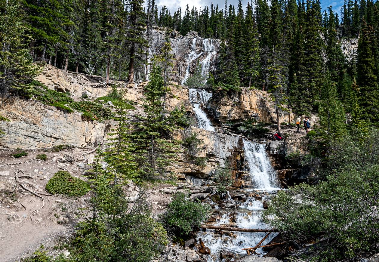
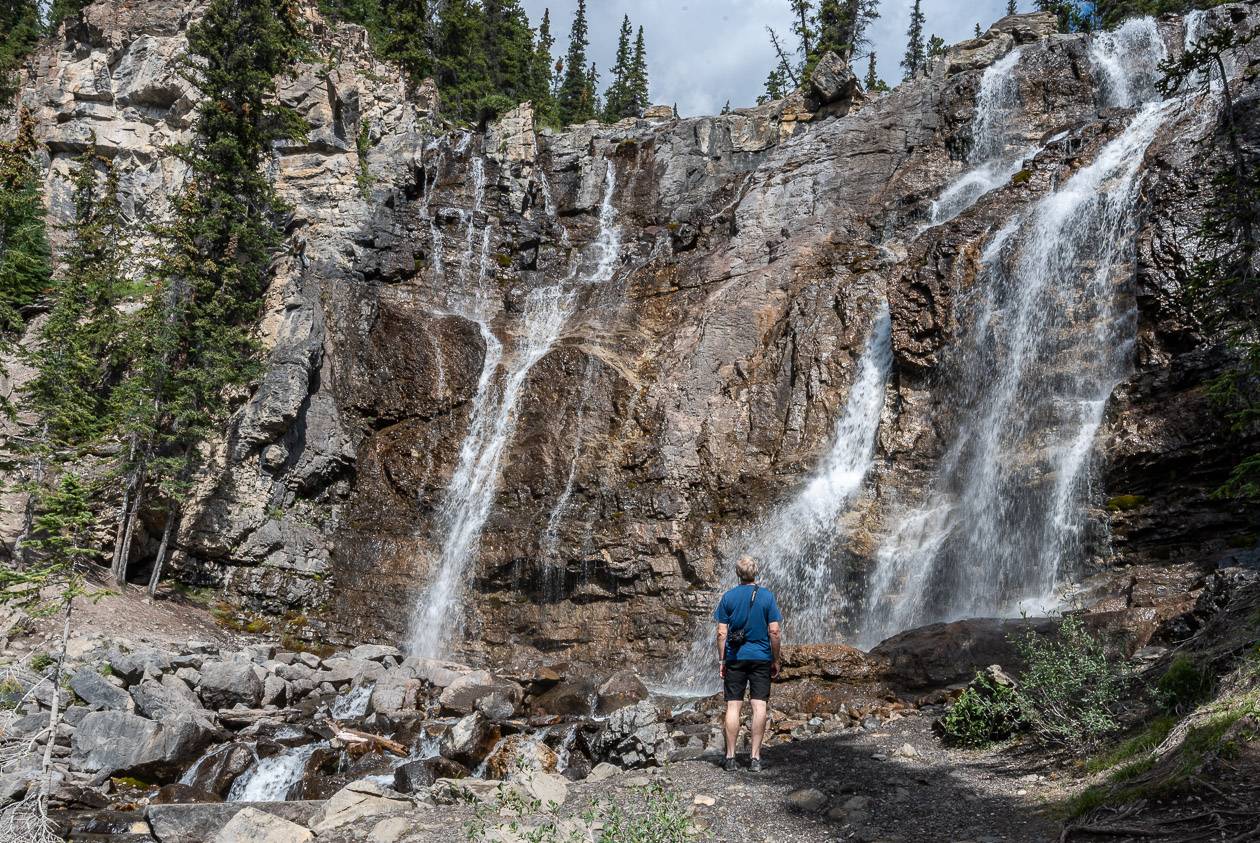
Tangle Creek Falls
Time needed: 10 – 30 minutes
Activity: Short hike beside the highway
Thirty five metre high Tangle Creek Falls is located 7 km north of the Columbia Icefield Discovery Centre on the east side of the highway. Parking is on the opposite side of the road. The falls are literally right beside the highway. Allow 10 – 20 minutes to visit one of the most photographed waterfalls in Jasper National Park.
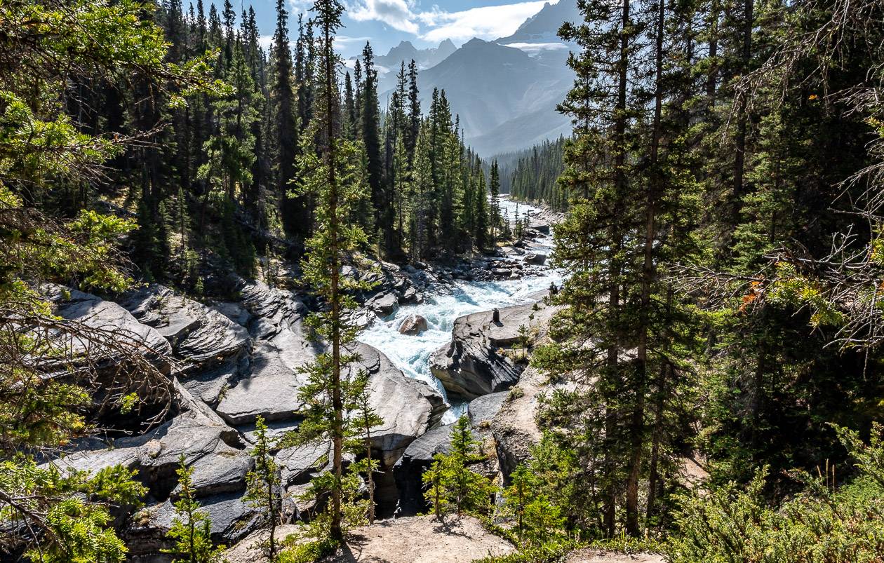
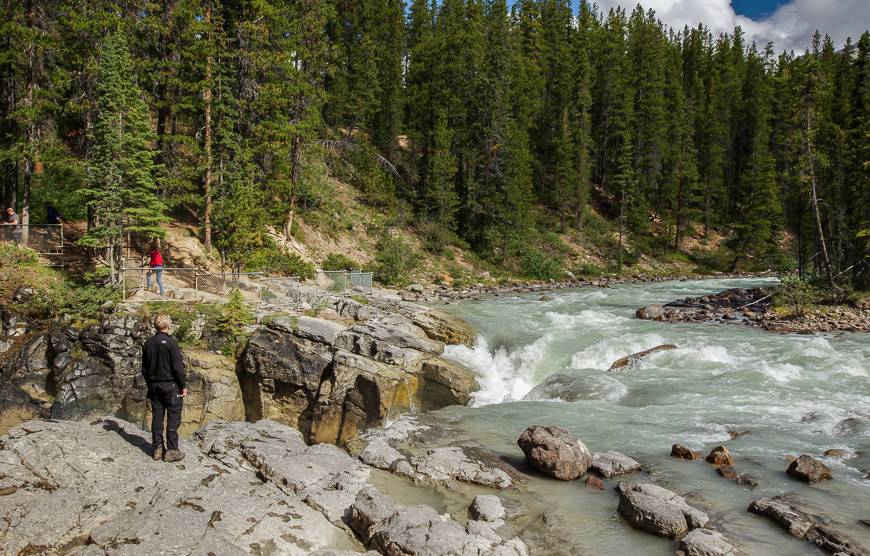
Sunwapta Falls – a stunning hike along the Icefields Parkway
Time needed: 25 minutes – 90 minutes
Activity: Short hike with option of making it longer
You’ll find Sunwapta Falls 179 km north of Lake Louise and 56 km southeast of Jasper.
The Athabasca Glacier feeds Sunwapta Falls – made up of an upper and lower sets of waterfalls. The upper falls are extremely easy to access from the parking lot – and as such tend to be very busy. Their drop-off is 18 m – which is especially impressive when you’re standing on the bridge looking over the narrow cleft the water is forced through.
Continue on an easy trail through lodgepole pine forest for 2 km to reach Lower Sunwapta Falls. Almost no one bothers to hike this section, so you may even have the falls to yourself.
The peak season to visit the falls is in late spring and early summer during runoff from snow melt.

Kerkeslin Goat Lick
Time needed: 10 minutes
Activity: Roadside attraction looking for goats.
If you want to see mountain goats, be sure to check out the goat lick on the Icefields Parkway. It’s located about 15 minutes north of the Sunwapta Falls stop, near a sign with an image of a goat that warns you to slow down. Mountain goats congregate here to lick the mineral rich silt deposit. In fact, they apparently lick so much of it that their droppings are white instead of black.

Athabasca Falls – one of the most popular stops on the Icefields Parkway
Time needed: 30 minutes
Activity: Short hike and photography
Athabasca Falls is an incredible sight in any season despite the fact the drop is only 23 m. But what the falls lack in vertical drop, they make up for in power. Looking down into a frothing, swirling mass of water is a breathtaking sight.
The falls are perennially busy so if you’re trying to avoid the crowds, visit first thing in the morning or late in the day. There are lots of trails and viewing platforms around the falls. Allow a solid hour to get the most out of the area.
Where to stay on the Icefields Parkway
If you’re looking for a roof over your head the following are some of the options.
Lake Louise
The Post Hotel and Spa is lovely but it’s in the village and not on the lake. The food is superb.
The Fairmont Chateau Lake Louise enjoys the best views of the lake though it comes with a price.
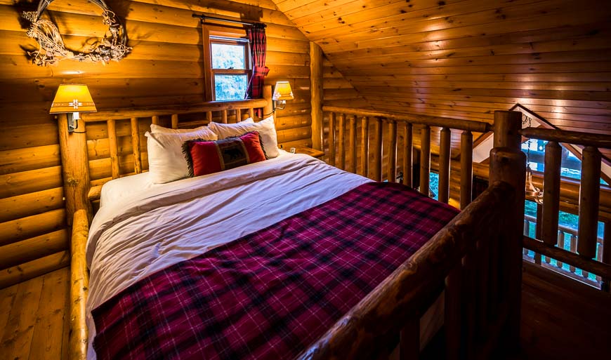
Baker Creek by Basecamp offers cozy log cabins. There is also an affordable hostel option in Lake Louise.
Saskatchewan River Crossing accommodation
Before you reach Saskatchewan River Crossing there is the option of the Mosquito Creek hostel. The Rampart Creek Wilderness Hostel is just north of Saskatchewan River Crossing. Your final hostel option is Hilda Creek Wilderness Hostel, 42 km north of Saskatchewan River Crossing.
The Crossing Resort, a motel is a good choice if you want to explore the David Thompson Highway.
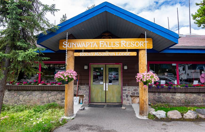
Sunwapta Falls accommodation
Spend a night or two at the Sunwapta Falls Rocky Mountain Lodge about 100 kilometres north of Saskatchewan River Crossing right on the Icefields Parkway if you want a good base for exploring the area.
The Athabasca Falls Hostel was destroyed in the 2024 Jasper fire but is being rebuilt.
Jasper accommodation
For a great location with a price to match choose the Fairmont Jasper Park Lodge.
I like the look of The Crimson Jasper though I have never stayed here.
If you want to be on a lake with lots of activities the Pyramid Lake Resort would be an excellent option. But for a main street location in Jasper I think Whistler’s Inn is a great choice.
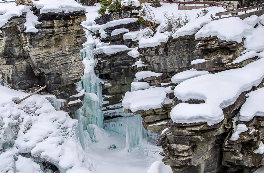
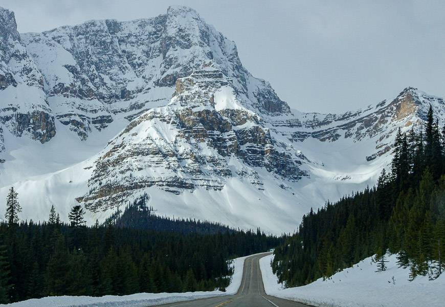
Driving the Icefields Parkway in winter
The Icefields Parkway in winter is beautiful but it can be tough and dangerous to drive. Go prepared so you can survive the winter drive – knowing that cell service is virtually non-existent, and help can be a long time coming.
If you’re still keen to drive it, try to choose a sunny day without any snow in the forecast. Late spring is a great time to see the snowy covered mountains, without the crowds.
A side trip worth doing from the parkway
From the Icefields Parkway at Saskatchewan River Crossing you can pick up Highway 11, the David Thompson Highway. It’s absolutely beautiful, and there’s lots of camping (mostly first come, first served) and hiking opportunities. In the winter you can check out the fabulous Abraham Lake bubbles.
You might like: Nordegg Alberta – An Undiscovered Gem in the Rockies
Click on the photo to bookmark to your Pinterest boards.

Love reading your informative post, It is really helpful to make plans to visit several places around Canada’s outdoor activities.
Thanks for your lovely comment.