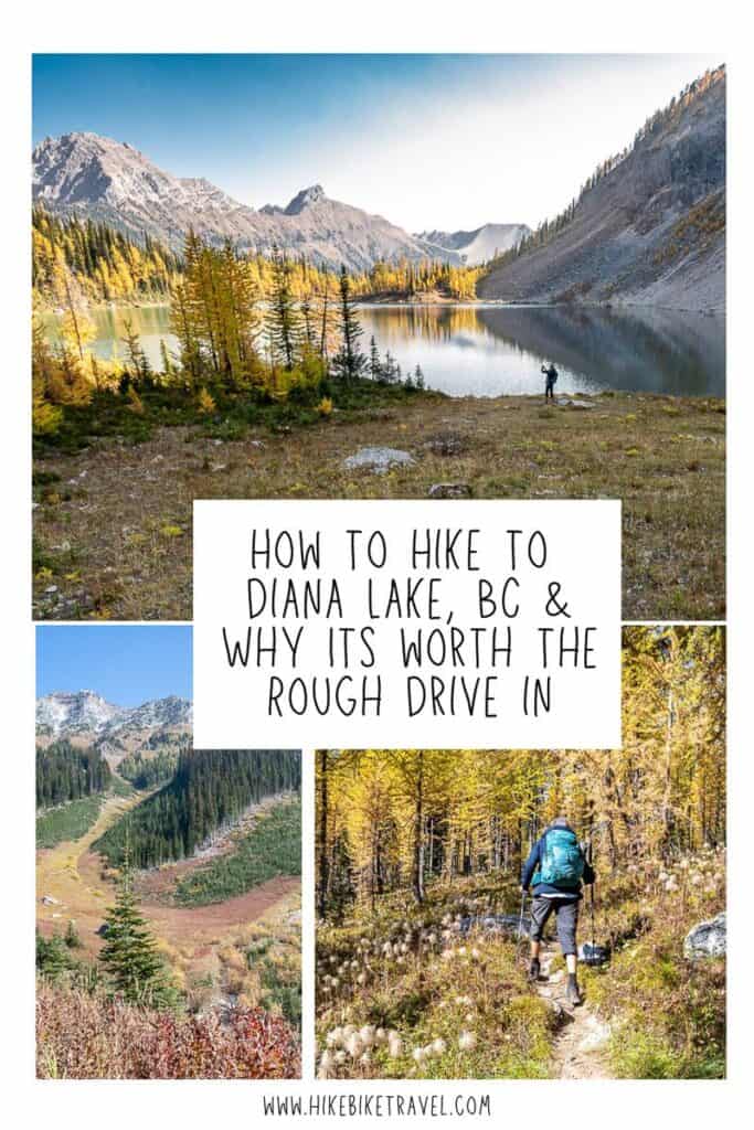
Diana Lake Hike in BC & Why It’s Worth the Drive
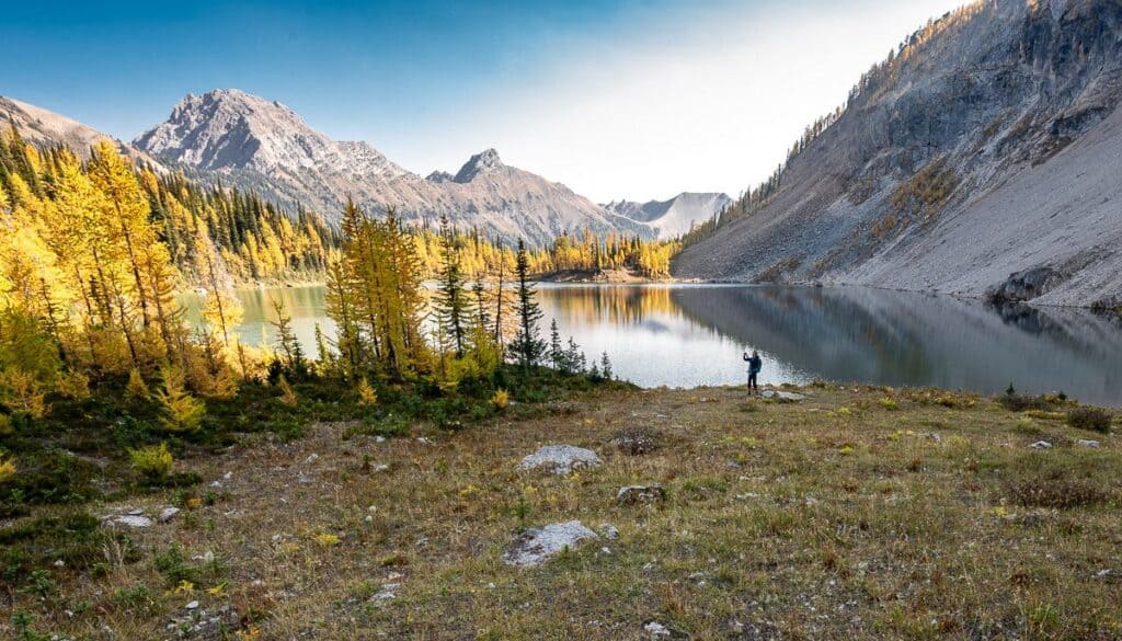
When I started out on the Diana Lake hike, I had larches (and grizzly bears) on my mind. I’d seen photos, so I knew the area would be magnificent in larch season – but I was a nervous as I’d heard the forest service access road could be rough. The big surprise – the road was way better than I expected, and turquoise-coloured Diana Lake is a beauty.
Diana Lake is in a pristine wilderness area outside the western boundary of Kootenay National Park. The closest town is Radium, though Diana Lake can also be done as a day hike from Golden.
What do you get on the Diana Lake hike? A teahouse with mountain views serving fresh baked goods and hot drinks, beautiful meadows, wildflowers, forests teeming with golden larches in the fall, and the chance to climb the Judge – the tallest peak in the area. A frigid swim in the lake might be the proverbial icing on the cake for some of you!
The hike to Diana Lake is a moderate one in my books. It’s 6 km each way with 675 metres of elevation gain. Grizzlies are frequently in the area, so it’s a good idea to make lots of noise and carry bear spray.
This post includes some affiliate links. If you make a qualifying purchase through one of these links, I will receive a small percentage of the sale at no extra cost to you. I very much appreciate your support.
Would you like to save this?
How to get to the Diana Lake trailhead
Diana Lake Lodge recommends a moderately high clearance vehicle. I drove our Subaru Outback and had no problems. In summer 2025, workers graded the road and fixed the problem areas.
From Golden
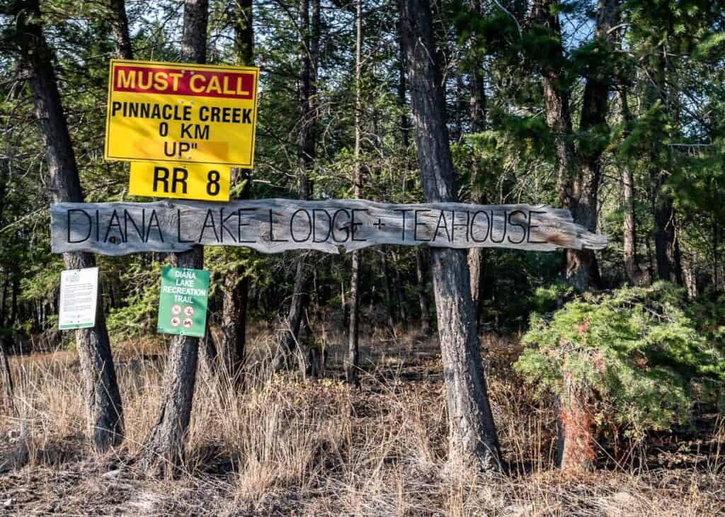
Drive south from the Kicking Horse Bridge in Golden on Highway 95 for 85 km. Turn left onto Kindersley-Pinnacle Forest Service Road. Fortunately, it is signed. It’s the same exit used by Luxor Corrals Trail Rides. In very short order you’ll see a big Diana Lake Lodge sign as pictured below at the side of the road.
Reset your odometer when you turn onto the Kindersley-Pinnacle Forest Service Road (FSR). The Diana Lake trailhead is 24 km down at the end of the Pinnacle Creek Forest Service Road.
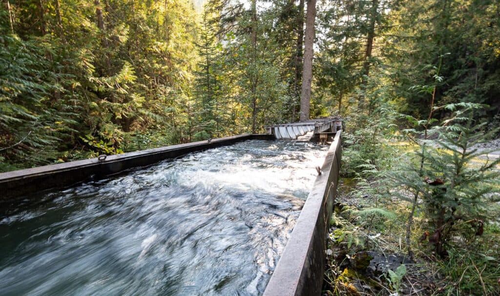
- Stay on this dirt road passing the Edgewater Irrigation Flume which started with flowing water in 1913. Now 93 landowners in the Vermillion Irrigation District within the Edgewater area are supplied with water from mid-May until Mid-October.
- At KM 7 stay left at the fork to continue onto the Pinnacle FSR. (The right fork is the Kindersley FSR).
- Always keep to the main road and avoid turning off on any small branches. Look for small Diana Lake Lodge signs near intersections to keep you on track. I was surprised at how many of them I saw.
- Most of the dirt road is in good condition. The last few kilometres are a bit narrower and bumpier.
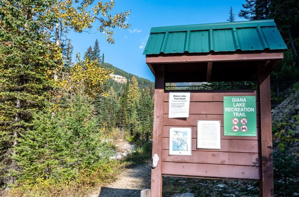
- The trailhead for the Diana Lake hike is located at the far end of the Pinnacle Creek FSR. Map coordinates are 50.86548, -116.23177. You’ll find a basic trail map – but no washrooms.
From Radium Hot Springs
Head north on Highway 95 for 17.5 km, measured from the roundabout in Radium. Turn right onto the signed Kindersley-Pinnacle Forest Service Road. Follow the rest of the directions listed above under Golden.
Limited parking
There is limited parking at the trailhead with room for 7 – 10 vehicles. Please be considerate when parking, and don’t waste any space. Also, be sure other vehicles can turn around. If you’re planning to hike with a group. I’d highly encourage you to carpool. Avoid weekends if possible.
A word of caution
Both Kindersley Pinnacle and Pinnacle Creek are active forest service roads. On weekdays especially, drive cautiously – and always give logging trucks and large vehicles the right of way,
Location map of the Diana Lake hike
Diana Lake Hike details
Distance: 12 km (7.5 miles) return to Diana Lake Lodge
Elevation gain: 675 m (2,214 feet) to the lodge
Time needed: 5 – 7 hours depending on your hiking speed plus additional time hanging out by Diana Lake
Trail traffic: Usually quiet
Level of difficulty: Moderate.
Dogs: Permitted but keep them on a leash
Wildlife: This is grizzly bear country so know what to do if you see a bear. And be sure to carry easy to access bear spray.
Don’t forget: Always pack the 10 hiking essentials. The Diana Lake hike takes you through fragile meadows. Tread lightly and practice the seven Leave No Trace principles.
Backcountry camping: Yes, but limited, rustic, and first come, first served.
Elevation at Diana Lake: 2,140 m or 7,021 feet
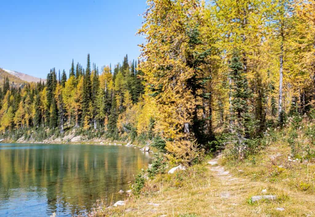
Best time to hike: Mid-July until early-October (wildflowers in summer and larches in late September and early October)
Diana Lake hike description
The trail to Diana Lake is classified as a Hiking and Horse Trail. Bikes are not permitted.
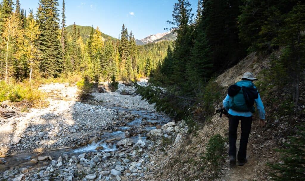
From the trail kiosk hike along a narrow, somewhat slippery/dodgy path above a dirt bank and descend to the creek as soon as you can. Follow the creek up to a metal bridge and cross it. Turn right onto an inactive logging road and follow it for 800 metres.
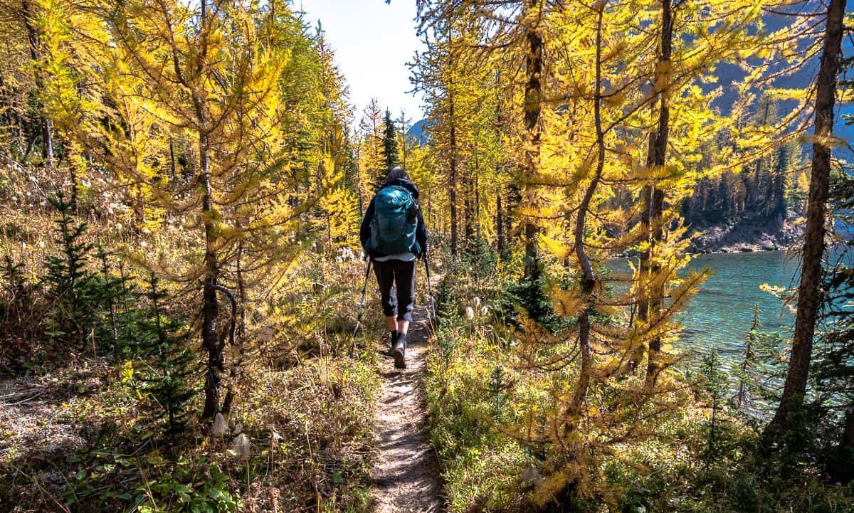
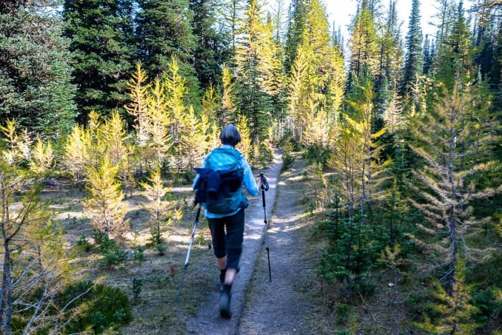
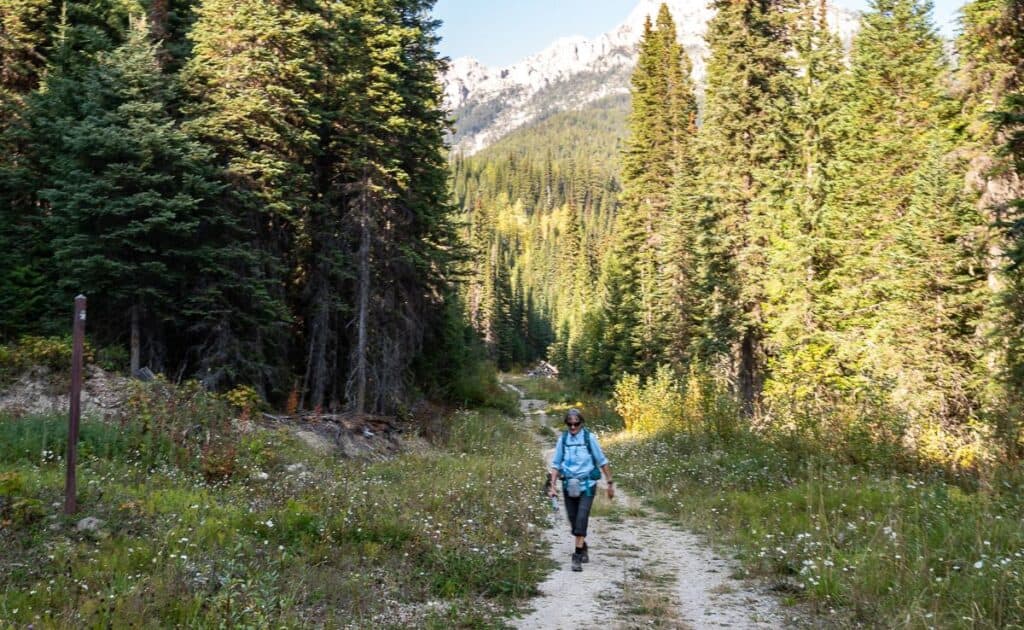
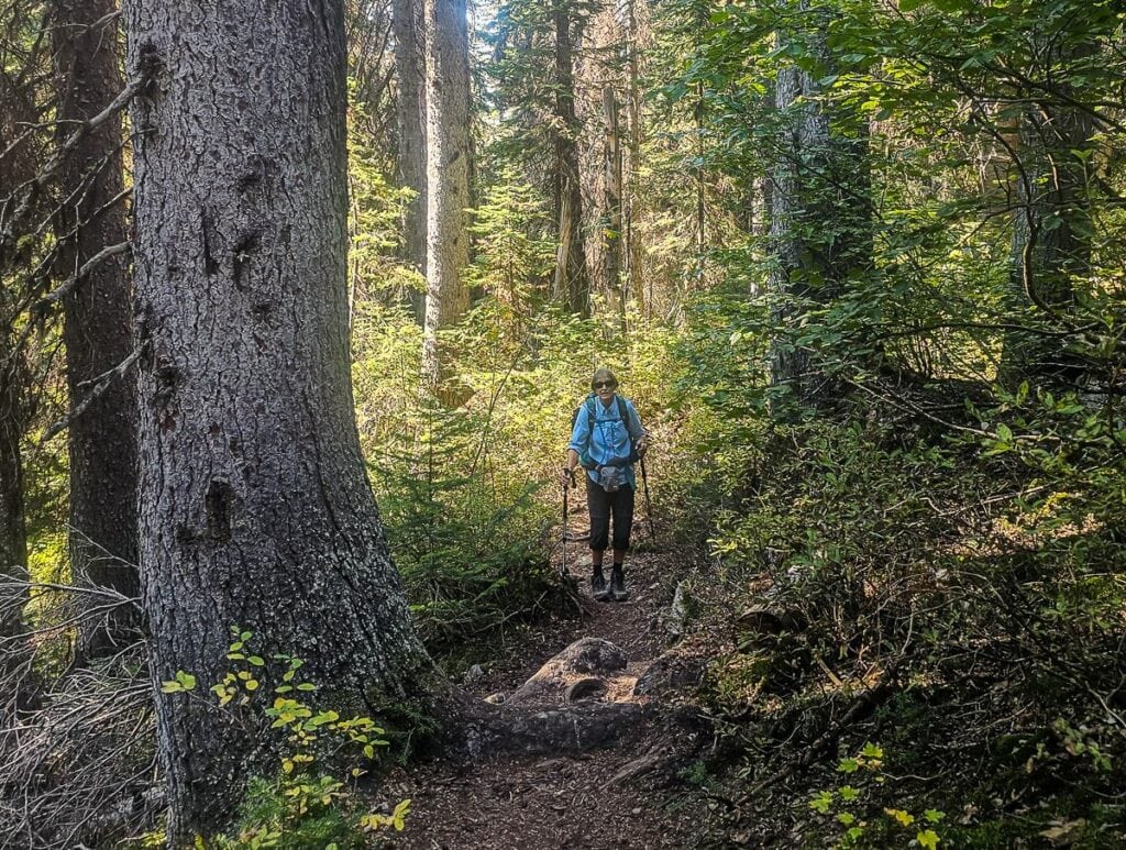
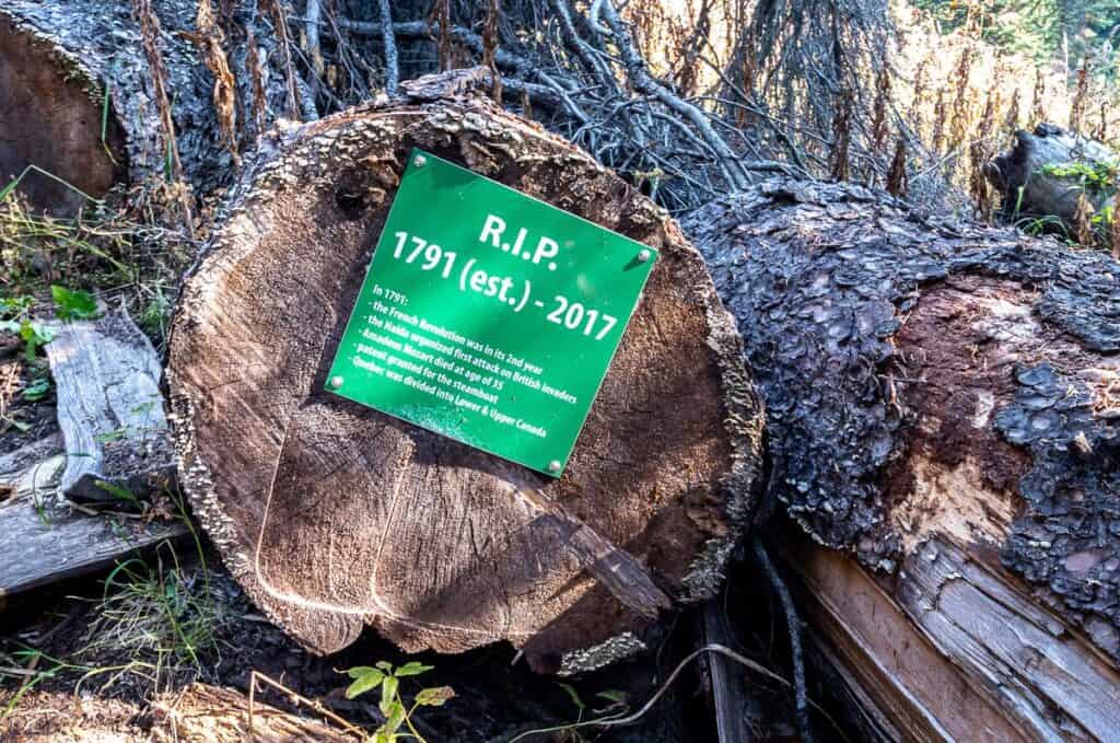
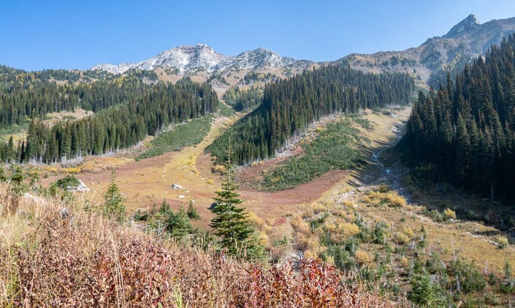
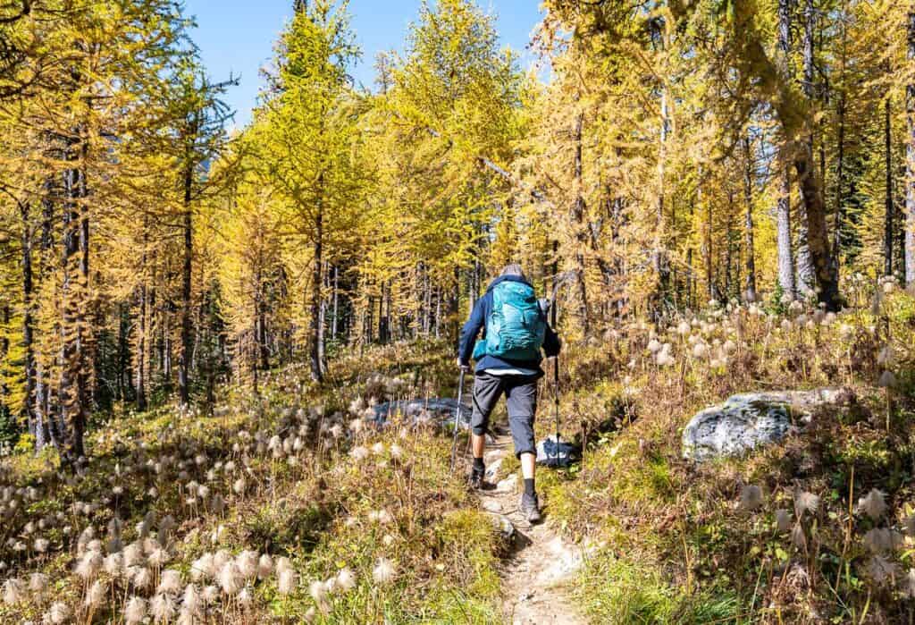
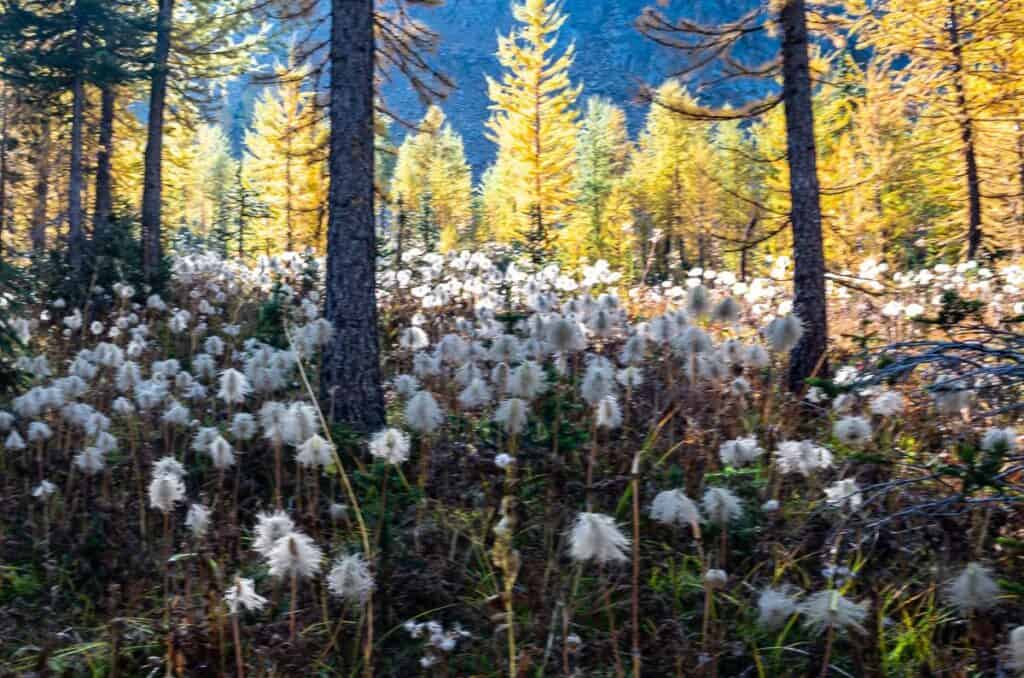
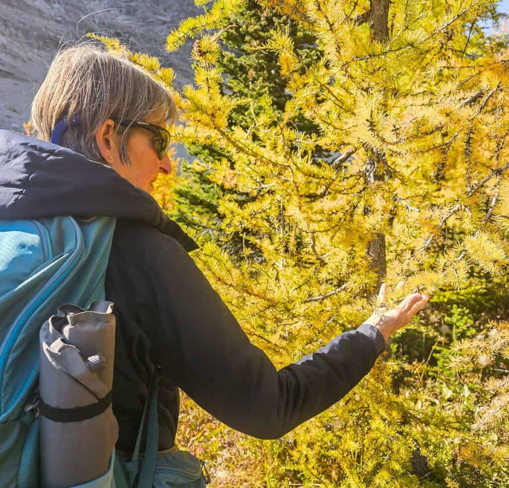
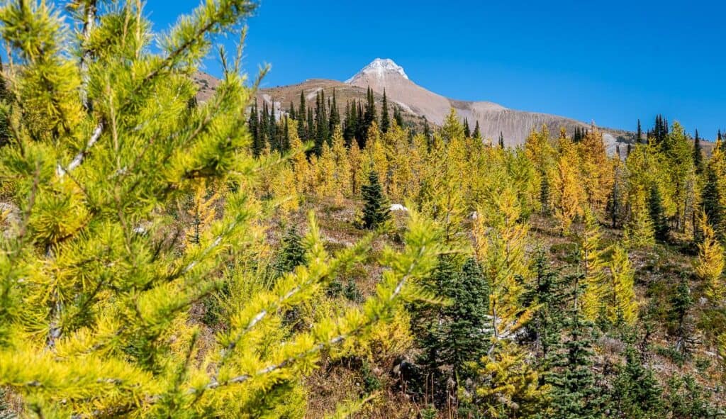
At the sign for Diana Lake, turn right onto a single track. This is where the real climbing begins. Much of the next hour is in the forest, but there are places with open mountain slopes, some that are a riot of red, orange and yellow in fall. One downed tree we saw was well over 200 years old.
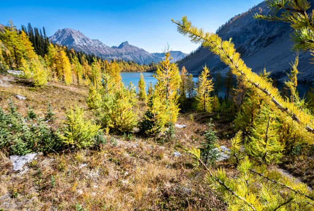
On the hike up to Diana Lake, cross Pinnacle Creek three more times. The trail begins to open around 4.8 km. Larch trees make an appearance as does the Judge, the highest summit in the area that tops out at 2,752 metres.

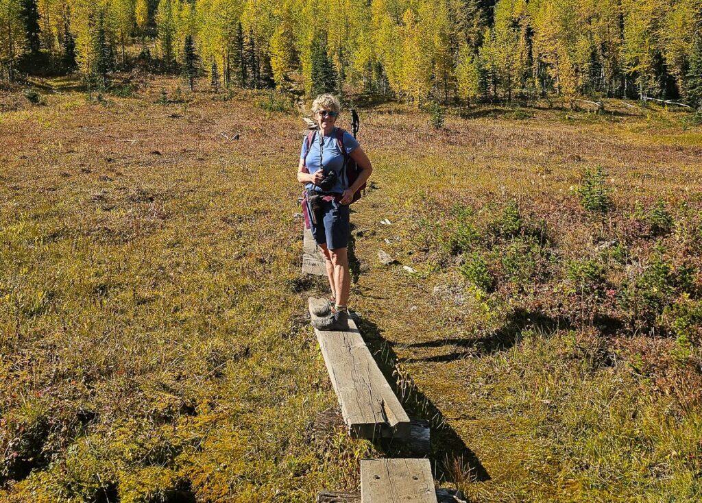
Hike through delicate sub-alpine meadows on wooden boards as you continue to climb and weave towards Diana Lake. It’s a beautiful, almost magical section of the hike.
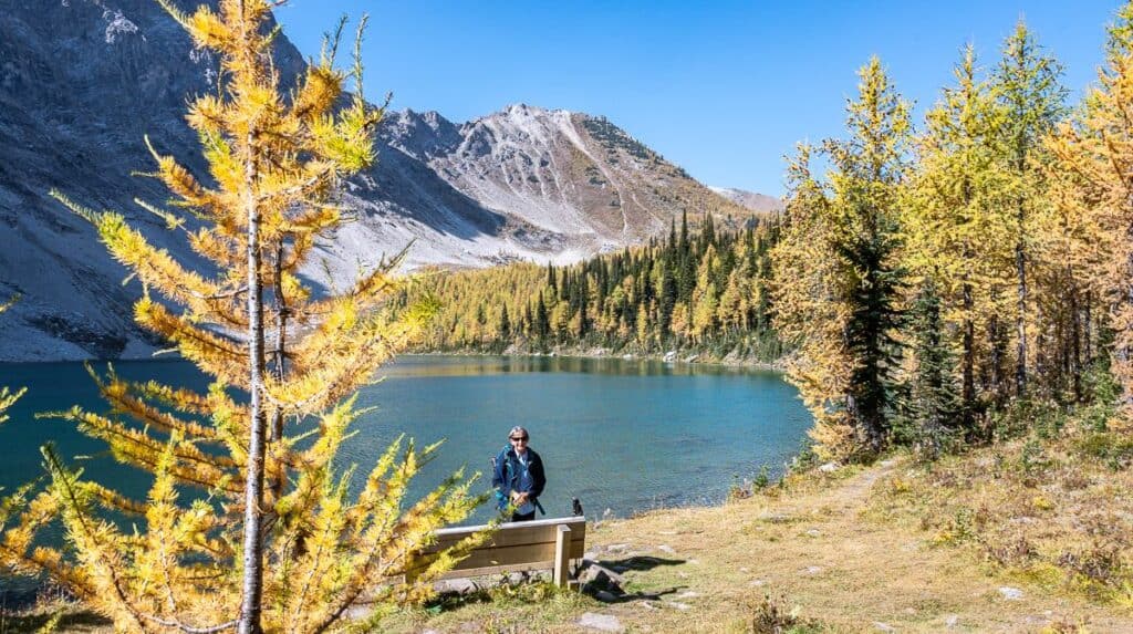
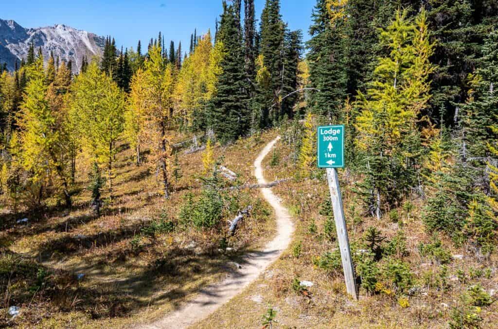
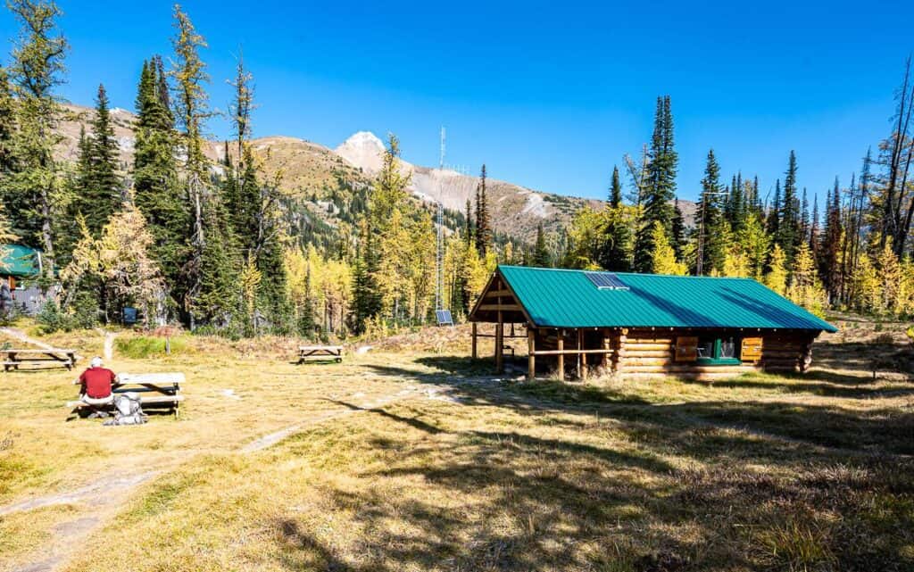
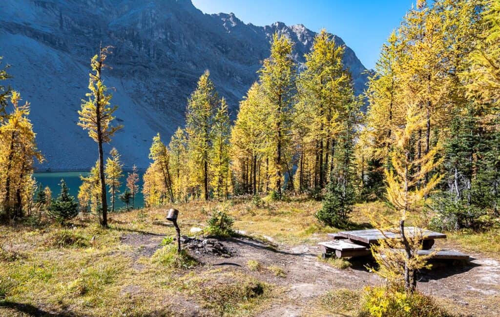
In no time you’ll reach Diana Lake – where there’s a well-placed bench to enjoy a view of the area. After lunch we visited Diana Lake Lodge and then continued above the lake for better views.
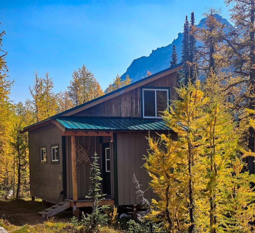
Diana Lake Lodge (Pinnacle Meadows Backcountry Cabin in 2026)
Since 1956, a small cabin (presently the dining room and kitchen) stood on a private piece of land a short hike up from Diana Lake. For many years it and The Bunkhouse operated as the Diana Lake Lodge. In January 2025 new owners, Drew and Emilie, took over. Going forward it will be called Pinnacle Meadows Backcountry Cabin, as Emilie explained, ‘the word lodge felt too grand for what it really is.”
The cabin is accessible one of two ways – via a short route up from the campsite area or via a hike along Diana Lake and then a hike up to the meadow.
Starting in 2026 overnight stays at the bunkhouse will be self-catered. You’ll still have a roof over your head, a comfortable bed, a hot outdoor shower, a composting toilet, and an incredible backdrop for whatever you plan do.
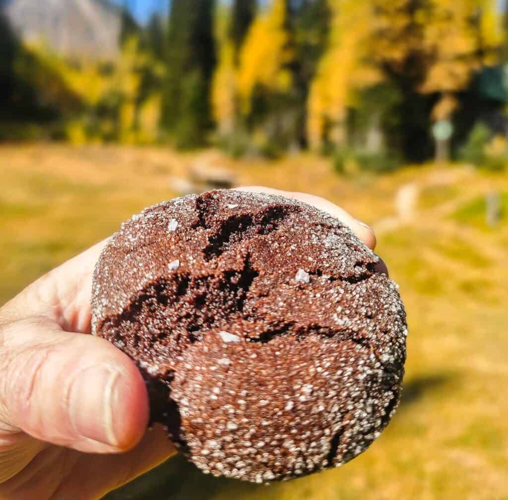
On a Thursday to Monday basis, soup with crackers ($9) or focaccia ($14), tea and coffee ($4) along with fresh baked goods ($4 – $6), will be available for sale – cash or card.


The hike to The Judge
One of the premier add-ons from Diana Lake Lodge takes you to the highest peak in the area – the Judge. You need an early start from the trailhead if you want to do this as it adds 8 km and approximately 550 m of elevation gain. Allow at least three hours to do it.
The trail heads first to Whitetail Pass and then makes a turn to the southeast and follows a ridge. The reportedly delightful ridge walk ends with a scramble up the last couple of hundred metres. From the top you can see the Kootenay River Valley and as far away as Mount Assiniboine.
Backcountry camping at Diana Lake
There is a free, very pretty, first come, first served backcountry campsite just up from Diana Lake. It’s small. A maximum of three tents would fit in the area. It does come with a picnic table and a throne type of outhouse – but no bear lockers. Don’t forget either an Ursack (bear resistant bag) or be prepared to hang your food.
The area around the user-maintained campsite is fragile, so if you camp here at the end of your hike to Diana Lake, tread lightly. It’s an ideal spot to spend the night, allowing time to hike the Judge and explore more of the area, especially later in the season when daylight starts to wane.
If you get to the campsite, and someone has already set up, you’ll likely need to retreat. It’s going to be more of a problem on a sunny weekend – but you should know that there is no guarantee of a camping spot.
More great hikes you’ll love
- Floe Lake Hike & Camping Guide
- Monica Meadows Trail Guide
- Things to Do in the Columbia Valley, BC & Nearby
- Best Fall Hikes Near Golden, BC
- 8 Easy Invermere Area Hikes
Click on the photo to bookmark to your Pinterest boards.