The Invermere area in BC’s Columbia Valley is an outdoor lover’s dream, especially when it comes to hiking – with much of it accessible year round. There are a wide variety of easy Invermere area hikes from short walks in meadows in Kootenay National Park, to a fabulous wetlands walk, to one that takes you to the top of some hoodoos with wonderful Columbia Valley views.
Join me as I showcase the best the Columbia Valley has to offer when it comes to easy Invermere area hikes. And if you’ve got suggestions of ones I missed, please be sure to let me know in the comments.
This post includes some affiliate links. If you make a qualifying purchase through one of these links, I will receive a small percentage of the sale at no extra cost to you. Thank you very much for your support.

Invermere hikes summary
Permits: If you hike in Kootenay National Park you will need a national park pass which can be purchased at the gate or online.
Dogs: Dogs are allowed on all trails to the best of my knowledge but must be on a leash. Take extra water for them if it’s a hot summer day.
Maps: Organic Maps, an offline hiking app is a great resource, especially on these Invermere hikes.
Weather: Check the weather forecast before you go so that you’re properly attired.
Don’t forget: Let someone know where you’re hiking, practice Leave No Trace principles and carry the hiking essentials – even on these short, easy Invermere hikes.
Location map (approximate) of the Invermere hikes
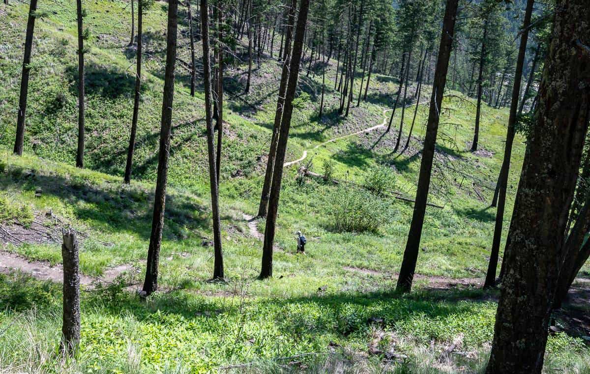
Wilmer Wetlands Trail
Distance: 3.7 km loop
Elevation gain/loss: 100 m
Time needed: 1 – 2 hours, depending on if you are a birder.
Trailhead location: From Invermere drive north towards Panorama Ski Resort. Turn right right onto Westside Road after crossing the river to reach Wilmer. Follow it for 2 km past Wilmer to reach a signed trailhead and parking on the right.
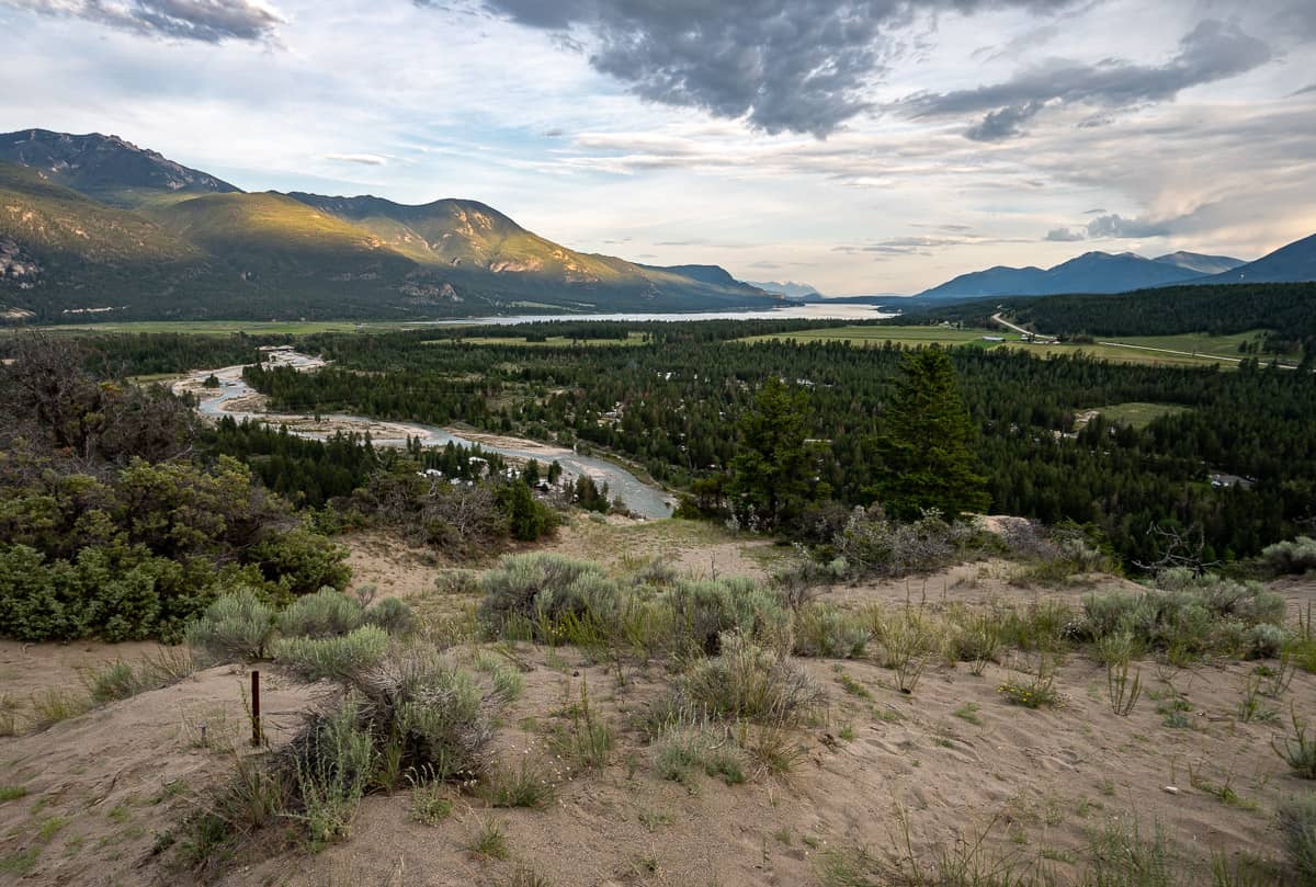
Description: The Wilmer Wetlands Trail – just a 15-minute drive from Invermere, is part of the Columbia Wetlands – one of the largest intact wetlands in North America. It’s one of the top Invermere hikes for birders. Hiking here in spring is amazing as tens of thousands of birds migrate through the area.
There are several trails leading from the parking lot down towards the wetlands. You can do a 3.7 km circuit or simply an out and back hike, depending on how much time you have.
Look for a bench with a view over the wetlands. Be prepared for some fun, hilly sections on narrow trails. They might be slippery if wet.


Old Coach Trail
Distance: Up to 9 km one way but you can just go as far as you like and retrace your steps.
Elevation gain: 130 m or 427 feet
Time needed: 1 – 5 hours depending on how far you hike.
Trailhead location: From Radium drive south for 5 km on Highway 93/95 to reach a large gravel parking lot.
Description: The out-and-back Old Coach trail is a multi-use walking and cycling trail that parallels the Columbia River on a benchland, between Radium Hot Springs and Dry Gulch.
Enjoy panoramic views of the Columbia Wetlands along one of the more popular Invermere hikes. Plan to get an early start in summer as the trail can get hot.
Look for interpretive signage along the trail describing the historic the route that was used by Model T’s back in the 1920’s.

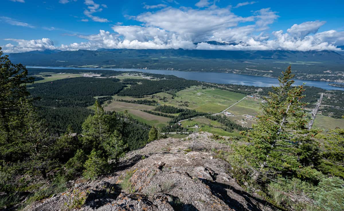
Mount Swansea Tower Loop hike – one of the Invermere hikes with a great view
Distance: 6.0 km loop hike
Elevation gain/loss: Approximately 350 m
Time needed: 2 – 2.5 hours so you can enjoy the view at the top
Trailhead location: Take the Windermere Loop Road east off Highway 93/95. Follow it towards the Winderdome Resort. Turn left 150 m after the turnoff to Winderdome Resort, then left on Westroc Mine Road and right on Swansea Mountain Road. You’ll see a parking lot immediately on your right.
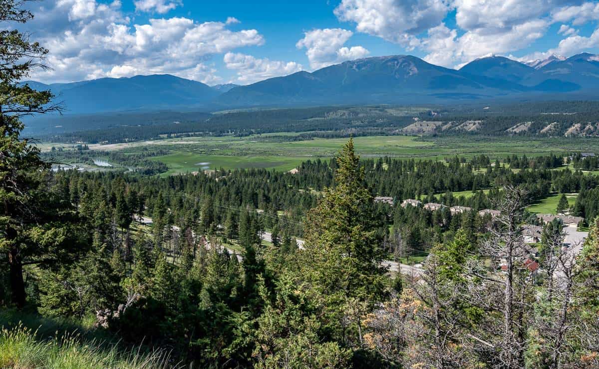
Description: It’s a gentle climb through the forest on a maze of trails to the Mount Swansea Tower. Once you top out, enjoy far-reaching views of the Columbia Valley, Windermere Lake, and the Purcell Mountain range to the west.
If you have more juice in the legs, you can continue from the overlook and hike the Mount Swansea Double Peak Loop, but you’ll need the better part of a day to do this.


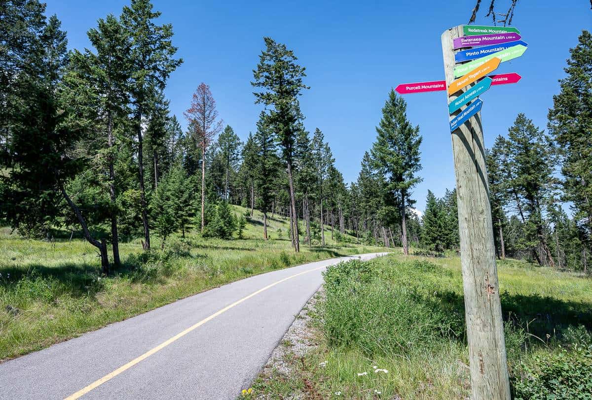
Westside Legacy Trail
Distance: Highly variable. It’s 25 km one way so plan on an out and back hike or arrange a shuttle for a pickup along the Westside Legacy Trail.
Elevation gain/loss: Highly variable but beware as there is a surprising amount of elevation loss and gain.
Time needed: As long as you want.
Access: Before you head out check the map of the Westside Legacy Trail for parking locations.
Description: Pick a parking area and head out hiking in any direction – but be prepared to share the trail, especially with bikers.
There are 7 picnic areas along the trail and lots of benches. One of the picnic areas would make a great destination, so again check out the map to decide where you want to hike. At the southern end of the trail, you could combine it with a hike on the Hoodoos Trail.
Read about my Westside Trail cycling experience.
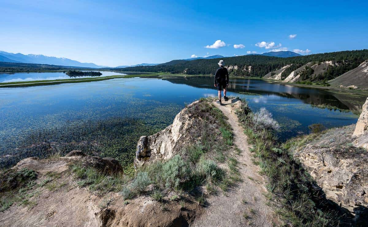
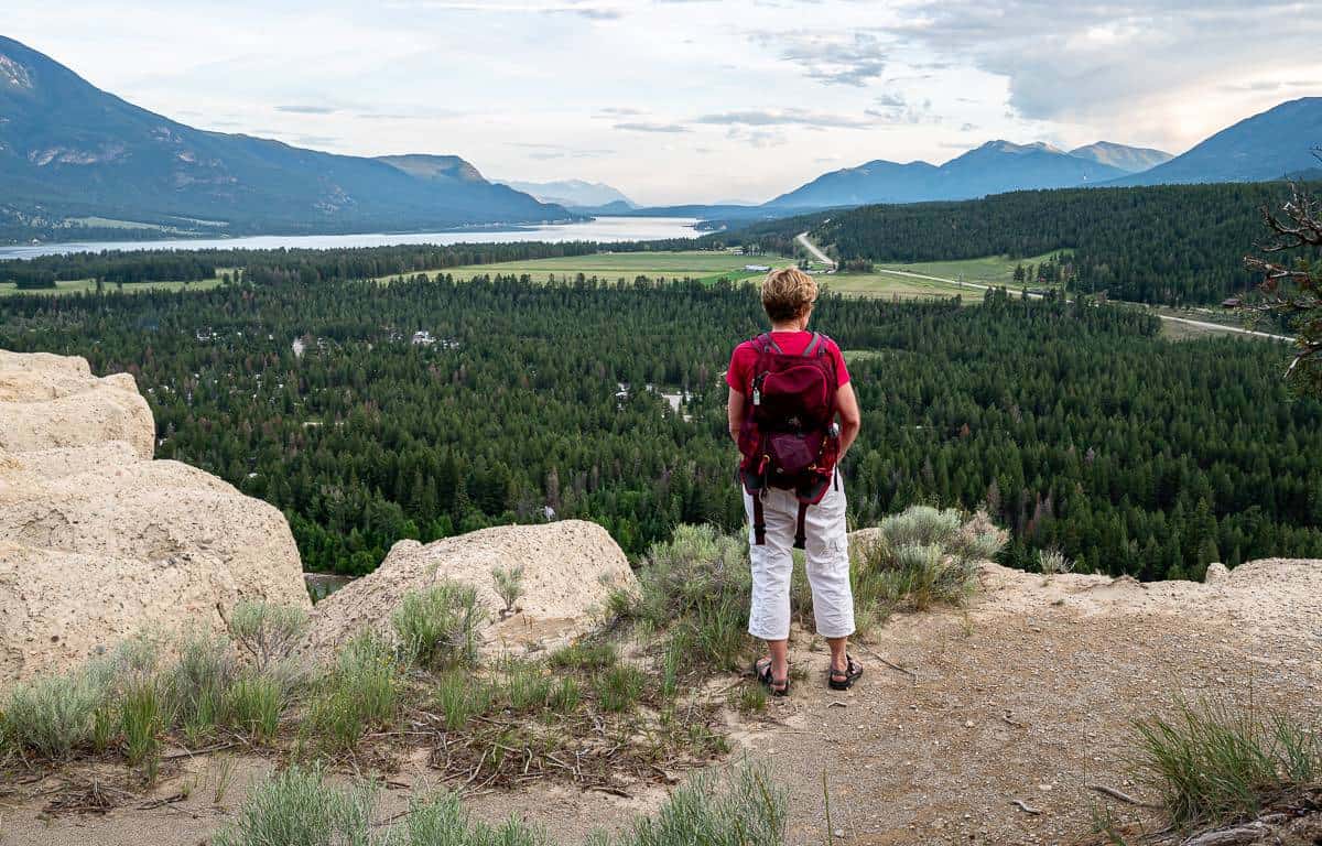
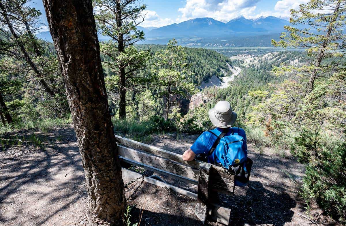
The Hoodoos Trail – one of the rewarding Invermere area hikes
Distance: 3.0 km out and back hike
Elevation gain/loss: +/-120m
Time needed: 1 – 1.5 hours.
Trailhead location: From the junction of 13th Street and 13th Avenue in Invermere drive south via the Westside Road for 24.7 km. The parking lot is on the right or west side of the road.
Description: The Hoodoos Trail south of Invermere is a short, easy 3.0 km out and back hike through a pretty forest that ends on top of the hoodoos, a notable landmark you can’t miss when you’re driving Highway 93/95 south of Fairmont Hot Springs (and it’s worth seeing them from ground level too).
We did it as an after-dinner hike in the summer when there wasn’t another person around, but I understand you can hike it in winter too – as long as you take microspikes. It’s one of the fun Invermere hikes as its not often you can hike to the top of a hoodoo.
From the scenic lookout enjoy panoramic view of the Columbia Valley, Columbia Lake, and nearby mountains including both De Smet and Fairmont located to the southeast. Exercise caution at the top as there is a dropoff and the rock is crumbly in places.
Invermere area hikes in southern Kootenay National Park
Redstreak Restoration Trail – the easiest of the Invermere area hikes
Distance: 1 km
Elevation gain/loss: +/-25 m
Time needed: 20 – 30 minutes.
Access: Take the first right after the entrance to the Redstreak Campground.
Description: The easy but rewarding hike on the Redstreak Restoration trail over delivers in the scenery department. The name of the trail reflects the fact that the meadows were reborn in the wake of a prescribed burn, but it sure doesn’t speak to the beauty of the trail.
The one km loop hike takes you through wildflower-filled meadows where you might see bighorn sheep grazing. We saw none – but we did see plenty of birds – and only a few other people. It’s a quick one, but I highly recommend you do it.

Valleyview Trail
Distance: 2.6 km return
Elevation gain: 130 m or 427 feet
Time needed: 45 minutes – 1 hour.
Trailhead location: 3 options – the parking area 1 km before the Redstreak Campground entrance, Redstreak Campground entrance, 2.5 km east of Radium Hot Springs or behind the Kootenay National Park Visitor Centre.
Description: Hike this steep trail from the Village of Radium Hot Springs to Redstreak Campground if you’re after a quick workout that ends (or starts) with a panoramic view of the Columbia Valley. At the top there are picnic tables with a view.
Keep an eye out for bighorn sheep – but always give them a wide berth.
Sinclair Canyon and Juniper Trail – one of the wonderful Invermere area hikes
Distance: 5.2 km out and back hike
Elevation gain/loss: +350m/-260m
Time needed: 2 – 3 hours depending on your pace.
Trailhead location: Look for a parking lot just inside the west gate of Kootenay National Park, though there is the option to park at the main parking lot for the Radium Hot Springs Pool.
Description: The scenic Juniper – Sinclair Canyon trail close to the Village of Radium Hot Springs is an excellent choice.
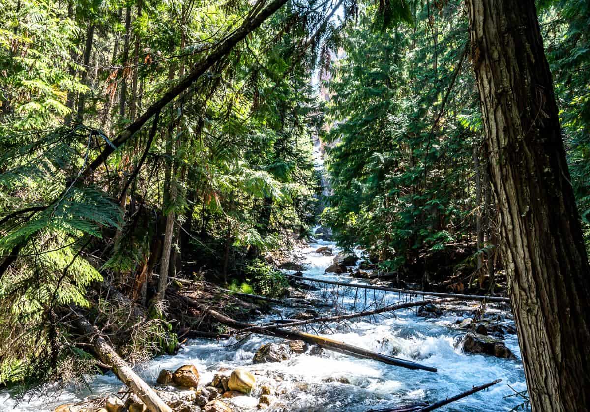
Start by descending steeply through a Douglas fir forest to reach cool and shady Sinclair Canyon. Take a short side trip to get a glimpse of Sinclair Falls – as it’s hard to get close.
From the canyon, cross a footbridge and hike up through dry country along the west rim of Sinclair Canyon.
As you climb higher, the Columbia Valley views come into sight as does the Redwall Fault and the Purcell Mountains to the west. There’s also a great view looking down at the highway that runs through Kootenay National Park.
On top weave through lovely stretches of open forest all the way to Radium Hot Springs. Retrace your steps to return.
Keep an eye out for bighorn sheep as they frequent the area.
Where to stay in the Invermere area
There are three centres in the Invermere area where you’ll find lodging – Radium Hot Springs, Fairmont Hot Springs and in Invermere itself.
Invermere
Headwaters Lodge at Eagle Ranch Resort– rated superb, boasts an onsite restaurant, and an onsite bike rental.
The Copper Point Resortis a great choice if you want to have everything at your fingertips like pools, a spa and onsite dining. It’s only a 6-minute drive away from downtown Invermere.
Fairmont Hot Springs
If you want to be close to the Fairmont Hot Springs, book theFairmont Hot Springs Resort– rated good.
TheResidences at Fairmont Ridgeoffer fully furnished apartments with a kitchen if you’re interested in cooking. You’ll have to walk 10 minutes to reach the hot springs.
Other options near Radium Hot Springs
The Inn on Canyon– rated fabulous, is an adult-oriented boutique hotel that serves breakfast. It’s only a 5-minute drive to the hot springs in Radium.
Bighorn Meadows Resort– also rated fabulous, features suites with full kitchen facilities and an outdoor pool with a hot tub. I’ve stayed here and quite enjoyed my stay.

Interested in exploring more of the Kootenays?
- The Stunning Hike to the Kokanee Glacier Cabin
- 11 Things to Do in Summer in Revelstoke
- Heather Mountain Lodge BC – The Summer Experience
- Glacier Crest Trail – Glacier National Park, BC
- Things to Do in Rossland, BC If You Have 3 Days
Click on the photo to bookmark to your Pinterest boards.
