Nut Point Trail Hike Near La Ronge, SK
I didn’t know what to expect when I planned the Nut Point Trail hike in Lac La Ronge Provincial Park, Saskatchewan. As it turns out, the strenuous hike (if you do it return in a day) follows a densely treed and rocky peninsula to its tip.
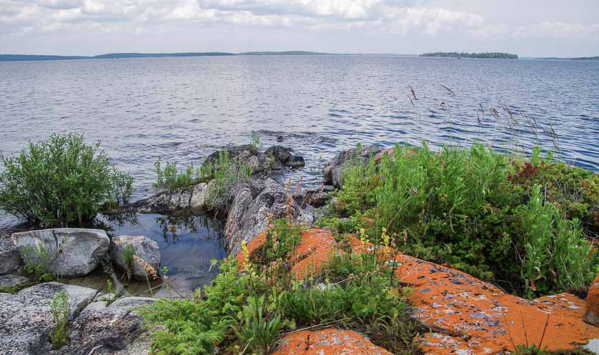
At the end of the trail, rocks jut out into Lac La Ronge, Saskatchewan’s fourth largest lake located in fabulous Canadian Shield country.
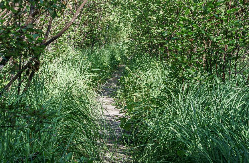
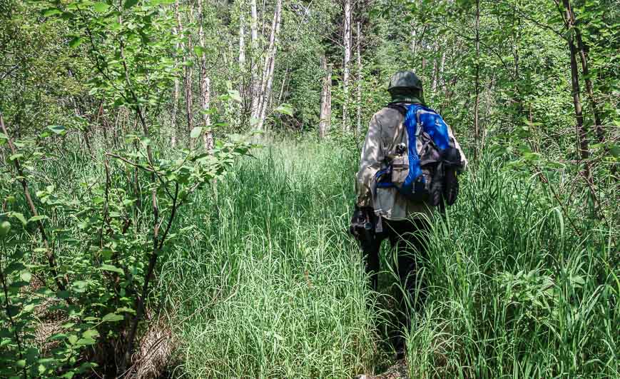
There are a few wet, marshy sections, and for most of the trail, you only get a peek-a-boo views of Lac La Ronge. You have to reach the end of the trail for the magic to unfold.
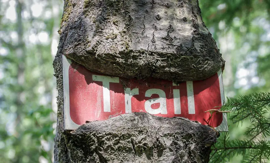
The Nut Point trail is located just a few kilometres east of La Ronge off Highway 2. Look for signage for the Nut Point Campground near the Shell gas station. The trail starts from the campground.
Update: Read that the first part of the hike was affected by the 2025 fire but the second part of the hike from the Nut Portage to the end is okay.
This post includes some affiliate links. If you make a qualifying purchase through one of these links, I will receive a small percentage of the sale at no extra cost to you. Thank you very much for your support.
Would you like to save this?
Nut Point trail hike summary
Permit: A valid park entry is required for all provincial parks in Saskatchewan. It’s $11/day or $42/week. Seniors are free if they show ID.
Why do it: Enjoy fantastic Canadian Shield scenery – and rocks that are almost 4.3 billion years old. It’s one of my favourite landscapes to experience in Canada. John and I spent an hour at the far end of the Nut Point trail but it wasn’t nearly enough. Take my advice on this one and backpack in for a night or two. When you see how pretty the campsites are, you’ll understand why.
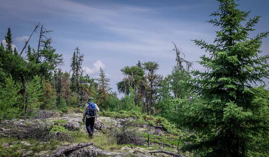
Distance: The Nut Point trail is 15 km (9.3 miles) long one way. It’s best enjoyed as a backpacking trip. I tell you that from experience as I did hike 30 km (18.6 miles) in one rather longish, buggy day.
Elevation: There isn’t a lot of elevation gain but there’s plenty of up and down over the length of the Nut Point trail.
Time needed: Allow 4 – 6 hours to get to Nut Point and up to 12 hours to do the return hike, depending on your pace.
Swimming: You can enjoy a cold swim at the end of the trail.
Don’t forget: Insect repellent and bug protection is important in the height of the summer.
Backcountry camping: There are no fees for backcountry camping in Lac La Ronge Provincial Park. Plan to bearproof your food if you camp at the end of the trail. Don’t forget a carabiner and a length of rope. A waterproof bag for your food is helpful too.
Trailhead camping: You can camp right by the Nut Point trailhead in the Nut Point Campground. It is open May long weekend to Labour Day. Visit the Saskatchewan Parks website to book. Reservations open on April 9, 2024.
Bears: Take bear spray that is easy to access.
Don’t forget: Tell someone where you are going and always pack the hiking essentials.
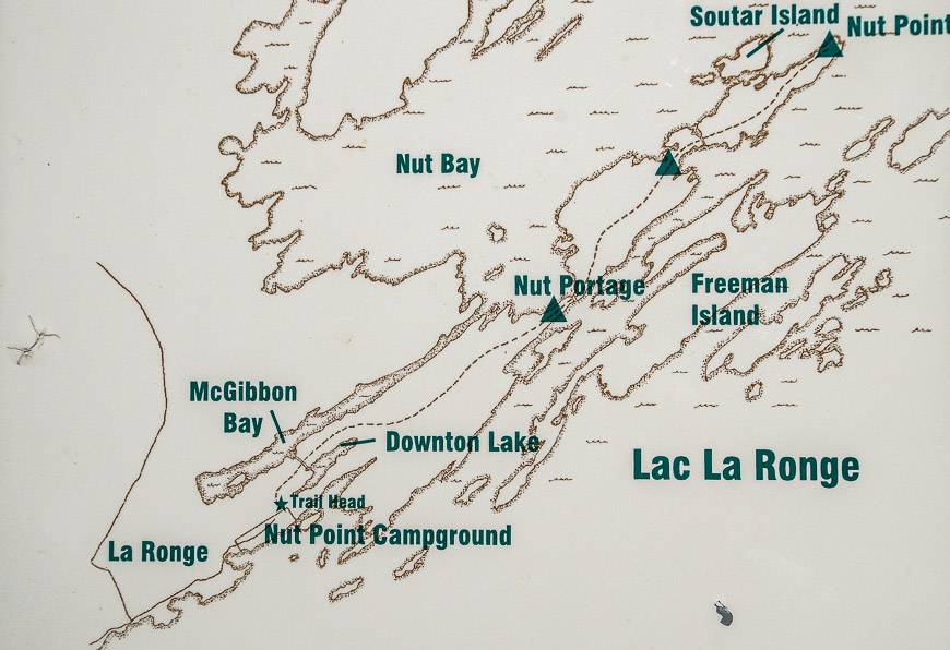
Location map of the Nut Point Trail hike
Nut Point Trail hike details
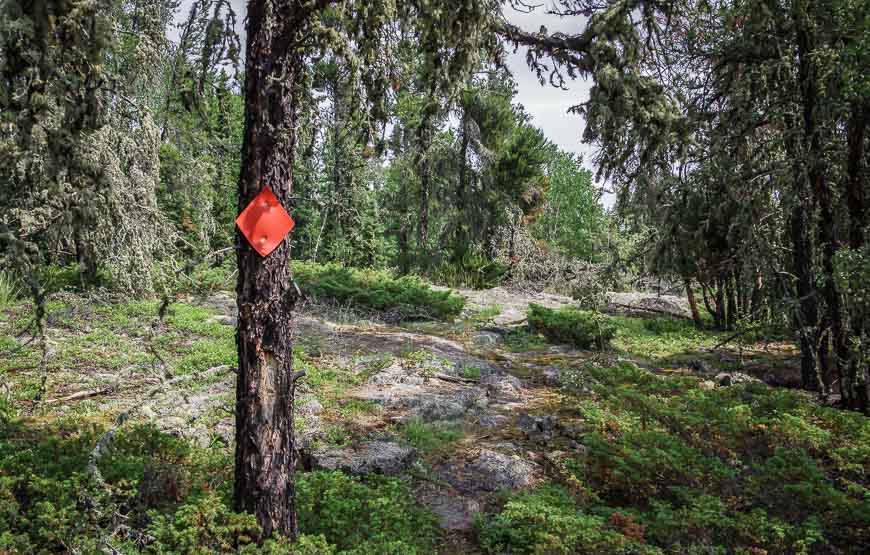
The first half of the trail – the part that takes you to the Nut Portage – is in pretty decent shape.
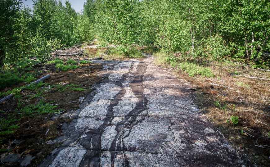
There are regular markers and much of the 7.5 km of trail follows granite ridges through the Boreal forest. Although you get periodic views of Lac la Ronge, the lake is actually hard to access here so be sure to carry enough water.
The easiest place to refill your water bottles is at Nut Portage. Pack the Katadyn BeFree water bottle that packs down to nothing.
Within a kilometre of the start of the trail, you pass through a section of forest that was burnt in the 1999 Mallard Fire. That fire took out century old black spruce trees – and the new growth is quite different.
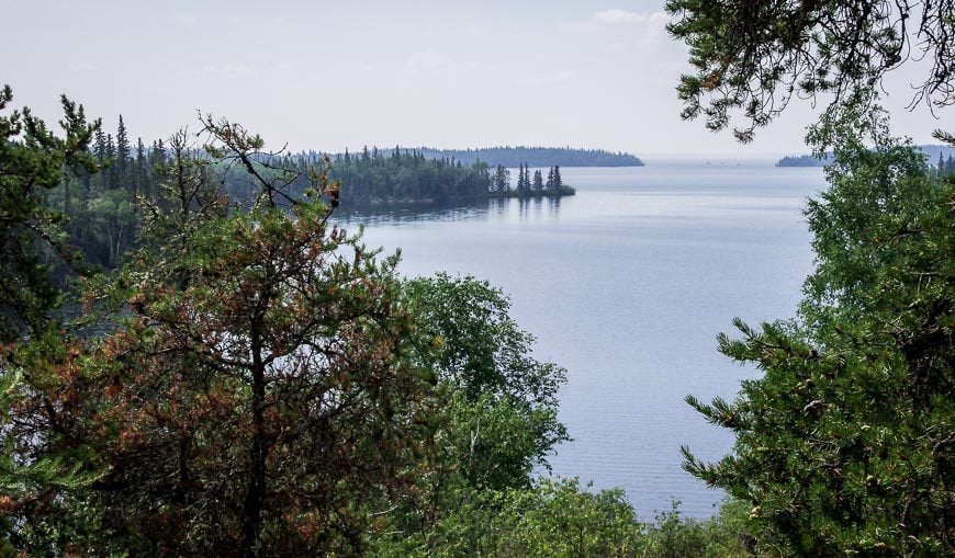
At about the 5 km mark we got our first expansive views of Lac La Ronge. It drains northeast into the Churchill River and makes its way eventually to empty into Hudson’s Bay.
Much of the lake is park and what is particularly lovely about it, apart from the Canadian Shield scenery, are the 1,305 islands in the lake, making it a paddling paradise as well.
In Lac la Ronge Provincial Park there are actually over 100 lakes, and 30 documented canoe routes!
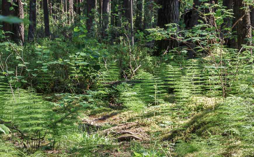
For the next few kilometres after the halfway point, the trail markedly deteriorated. It was disappointing to see as it wouldn’t take many days to get rid of the dead-fall and throw up a few more markers.
This trail is very pretty and deserves to be kept in better shape.
Nut Portage area
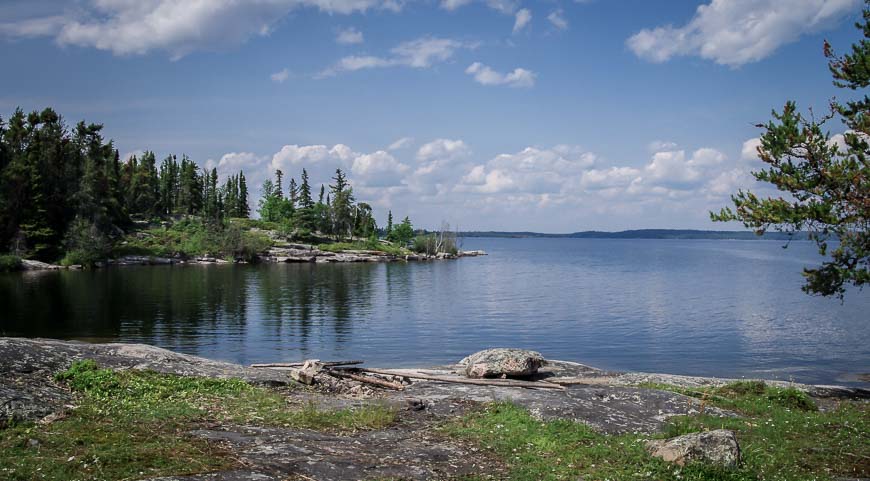
When we reached the Nut Portage, we mistakenly thought the peninsula continued to narrow. But it did quite the opposite and ended up ballooning in width.
So many times on the last part of the hike, we thought the end was in sight – just to be fooled again. At least if you’re canoeing, the short Nut Portage saves you 15 km of paddling.
Be prepared for bugs
The day before we hiked here, we had done a hike to Grey Owl’s Cabin in Prince Albert National Park. To say the bugs were a problem would be a major understatement.
In coming to the Nut Point Trail, I was worried that we would have another full day of bugs.
But fortunately that wasn’t the case. For most of the day we kept a head-net on, but having said that, they really weren’t bad.
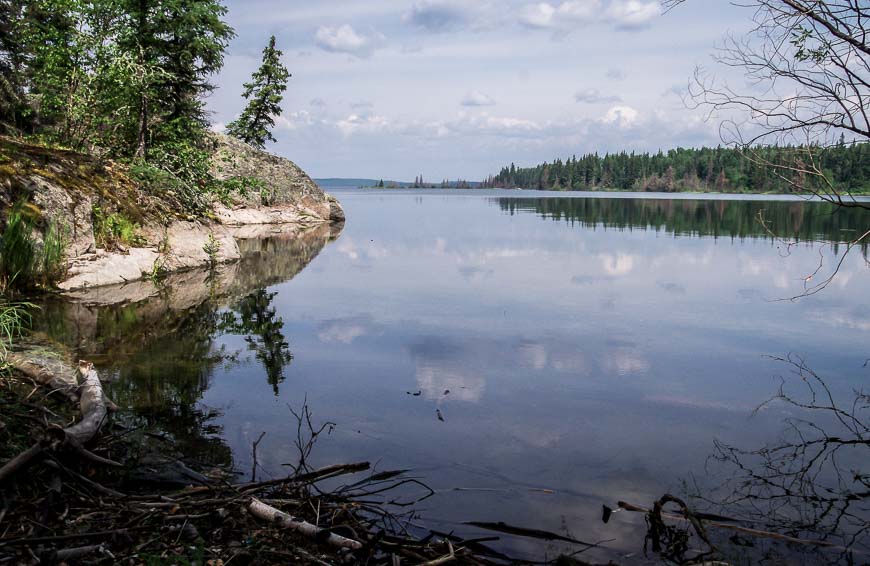
The end of the Nut Point Trail
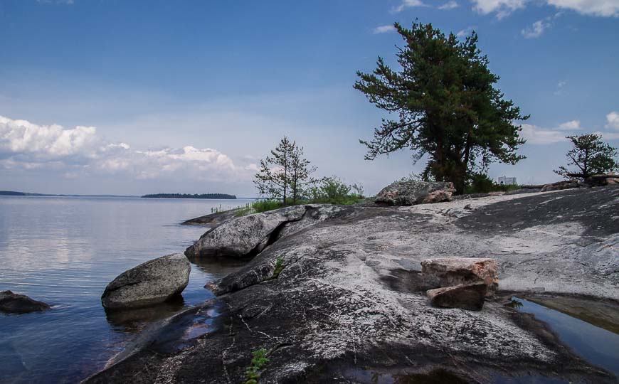
When we reached the end of the trail after four hours of hiking we were both thrilled and blown away by the scene in front of us. Classic, almost Georgian Bay like scenery, with granite rock and windswept pines greeted us.
It’s a gorgeous area to camp for a few nights. Views are expansive, the swimming is excellent – if still a little cold – and the feeling at least on a weekday was that we had the entire park to ourselves.
A few things you’ll want to take on the Nut Point Trail
Do not think of hiking in this part of Saskatchewan in July without a bug jacket and a head net. I guarantee you’ll enjoy the outdoors way much more.
And don’t forget the insect repellent. I’d recommend repellent that has some DEET in it. You might not need that in the city but you need it here.
What I take on every hike
I like something comfortable to sit on at lunch time. It can be your mitts on a warm spring day but in summer I swear by my almost weightless seat cushion.
I like using hiking poles. Invest in a good pair that are collapsible, preferably made of carbon because of their weightless quality.
No matter how the day starts I always carry rain gear. And I find a ball cap or brim hat with a chin strap invaluable in the rain or on a hot, in your face sunny day.
I always pack a buff-a multi-purpose piece of cloth with lots of uses as it takes up almost no room.
Have you ever hiked this trail or done a canoe trip through Lac La Ronge Provincial Park?
Further reading on what to do in Saskatchewan
- Reindeer Lake Canoe Trip in Saskatchewan
- Hiking the Boreal Trail in Saskatchewan
- 12 Fun and Unique Places to Visit in Saskatchewan
- Canoeing the Churchill River – Trout Lake to Missinipe
- A Stay at Historic Reesor Ranch in Saskatchewan
Click on the photo to bookmark to your Pinterest boards.


Trail condition update: I live in La Ronge and I can tell you first hand that a group of local volunteers cleared the trail in the Fall 2015/Spring 2016 and it is now in tip-top shape!
@Heather That’s great news as it really is a lovely trail.
Your pictures bring back memories from the many runs done out to the point and back. I’m sorry to hear that the markings aren’t as good as they once were along the trail. Part of my life up in LaRonge was putting up the markers on that trail. A friend claimed I put up too many, saying I marked it in brale but somebody still got lost that summer anyway. I’m hoping it survived the fires this summer. Grasslands is awesome! I see you have been out on the Boreal Trail in Meadow Lake Provincial Park. It’s my next trip. Any advice?
@Russ The Boreal Trail still needed some work last summer with markings but maybe by now it’s been done. We had no bugs in late June but if it’s anything like Prince Albert NP you will need a bug jacket and head net. The swimming should be excellent. Enjoy the hike or backpack if that’s what you end up doing. There are some truly lovely sites.
When living in La Ronge, I used to like running the first part of this trail with my two dogs after work and the berry picking season later in the summer is fantastic! You can find great swimming spots along the way and often never see another soul.
@Shannon We never saw a soul and took advantage of swimming at the end of the hike. The lakes of Saskatchewan have gotten into my blood and am already planning another trip.
I really need to get out there, so many great hikes. The view over the lake is amazing and yes the views from the campsite are just stunning
I hate to see a good hiking trail go into disrepair. Perhaps this post will bring awareness to the need for a maintenance crew to go out there and get busy.
@Ted I couldn’t agree with you more. It would be a great job for some highschool or college age kids – and the sooner it’s put back into shape the more use it will likely get.
No, I have never been but absolutely sign me up for the canoeing part of it! Though I don’t mean a high end exertion type of trip. I want to cruise slowly and stop at a few of those islands and check them out. Sorry, I’ve done my share of bugs outdoors in my lifetime. I’ve earned the right to not have to deal with them anymore LOL!!
I came across your blog via Maple Leaf Country and am quickly finding myself looking forward to your posts! It’s amazing how much this area looks similar to Georgian Bay, as you said. Thanks for posting.
@Jordan Thank you so much for your wonderful comment. I’ll be posting whenever I have WiFi. I’m out of range off and on all summer.
For fear of sounding redundant, these are stunning photos. Again, I am happy you did the hike for me!
@Jackie Not too many people I know of like to do 30 km hikes in a day but loved the reward at the end & what a treat to swim in a freshwater lake.
I planned on backpacking that one time, but changed my plans around due to weather and also parks-people telling me the trail hadn’t been cleared yet that spring. Went to Grasslands National Park instead and that was glorious. 😉
@Hank I don’t think the trail has been properly cleared still – but it’s really pretty easy to follow. Grasslands is also fantastic but what a contrast in landscapes.