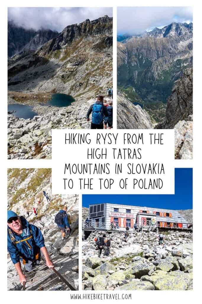
Hiking Rysy from Slovakia to Reach the Top of Poland
I’ve been lucky to stand on a few of the world’s high points including Kilimanjaro, Kosciuszko, and Snowdon – a rare privilege and one I don’t take for granted. While in the High Tatras Mountains of Slovakia there was an opportunity to spend a day hiking Rysy – the highest mountain peak in Poland. Access to the summit is very doable from the Slovakian side of the mountain – but it’s a challenging hike from the Polish side with a start in Zakopane.
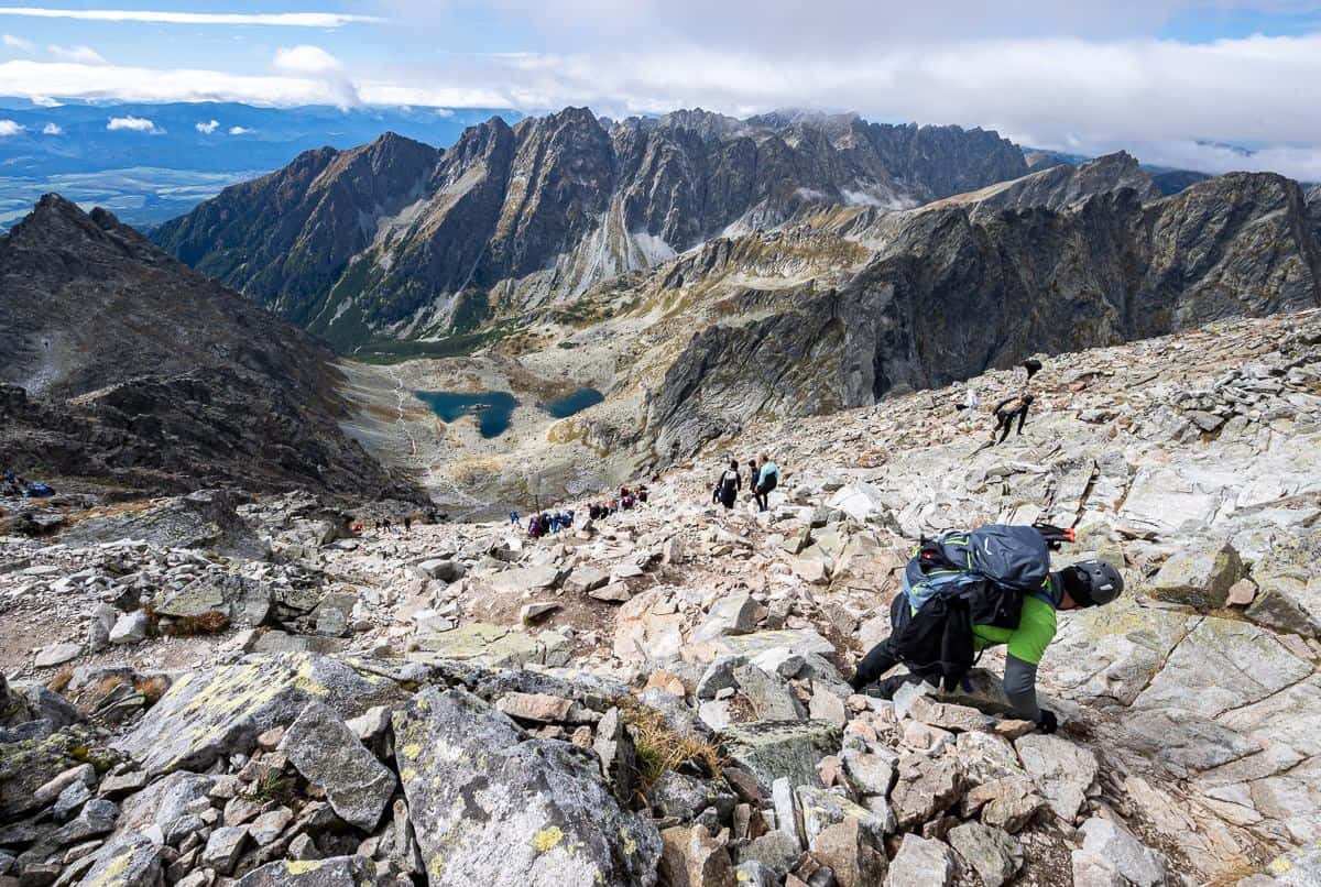
Rysy is not a high mountain peak by world standards – topping out at just 2,499 metres (8,199 feet) where there’s plenty of oxygen and no real hardship involved. But it’s no walk in the park either – despite the phenomenal number of hikers we saw. From Štrbské pleso, where we started, it’s a 21-kilometre return hike with approximately 1,370 m (4,495 feet) of elevation gain. Regardless of the hundreds of hikers we saw, it was a great mountain to climb. I just prefer fewer people and bottlenecks.
This post includes some affiliate links. If you make a qualifying purchase through one of these links, I will receive a small percentage of the sale at no extra cost to you. I very much appreciate your support.
Would you like to save this?
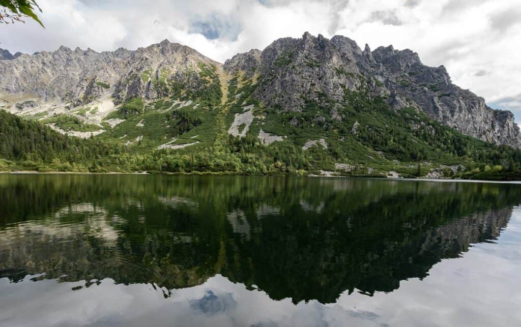
Rsys location among the High Tatras Mountain peaks
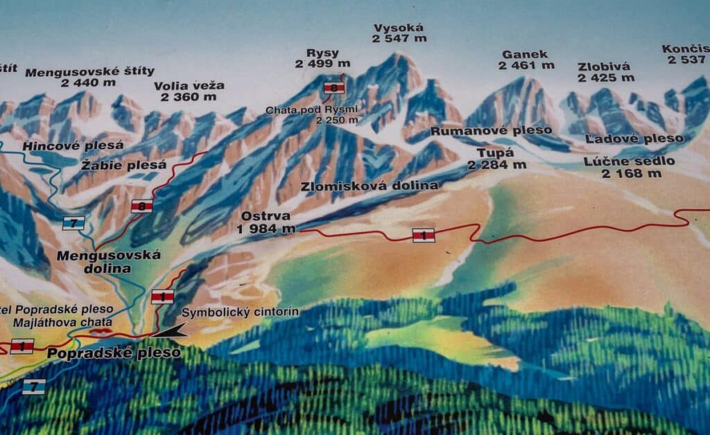
Location map for hiking Rysy
Rysy hiking summary
Distance: Approximately 21 km (13 miles) return from Štrbské pleso
Elevation gain: Approximately 1,370 m (4,495 feet)
Time needed: 8 – 10 hours return. Start very early in summer to avoid afternoon thunderstorms.
Difficulty: Hard because of the elevation gain and distance
Rysy summit height: The highest point in Poland is the middle peak at 2,499 metres though the main Rysy summit is at 2503 metres.
Permits: None required
Best time to hike: Only open from June 1 – October 31st but choose a good weather window whenever you hike it, especially if there is any snow on the ground. Thunderstorms are a common occurrence in summer – and you don’t want to get caught up high!
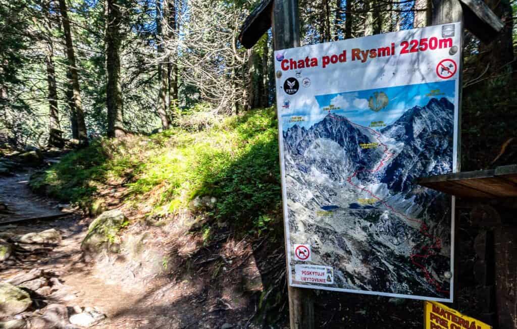
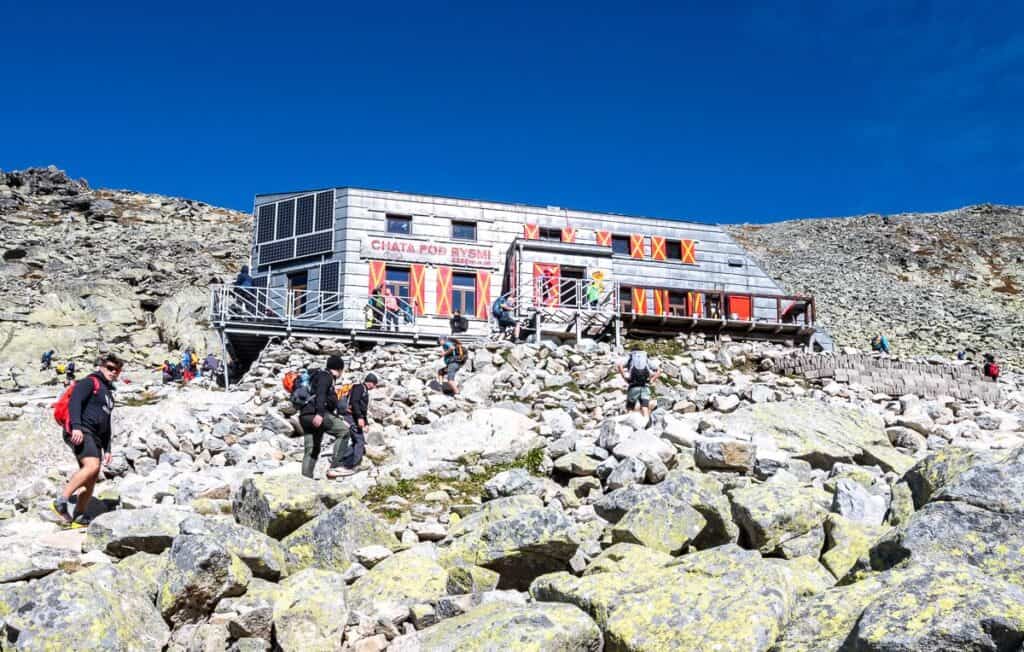
Mountain huts: There is a mountain hut where you can purchase food at Popradské pleso and at Chata pod Rysmi, located approximately at 2,250 metres and 45 minutes away from the Rysy summit. You can overnight at Chata pod Rysmi.
Don’t forget: Pack the hiking essentials. Be sure to practice Leave No Trace principles – including telling someone where you’re hiking and when you plan to be back. And please, pack out your toilet paper!!!
Rysy hiking description
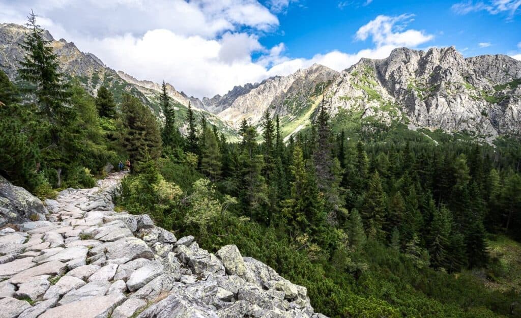
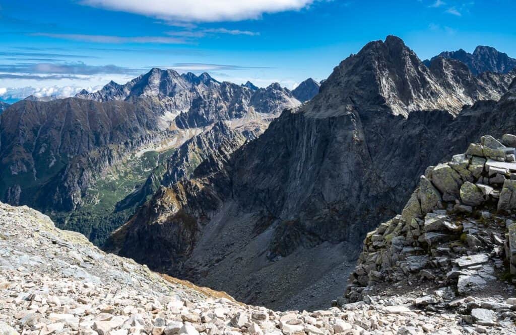
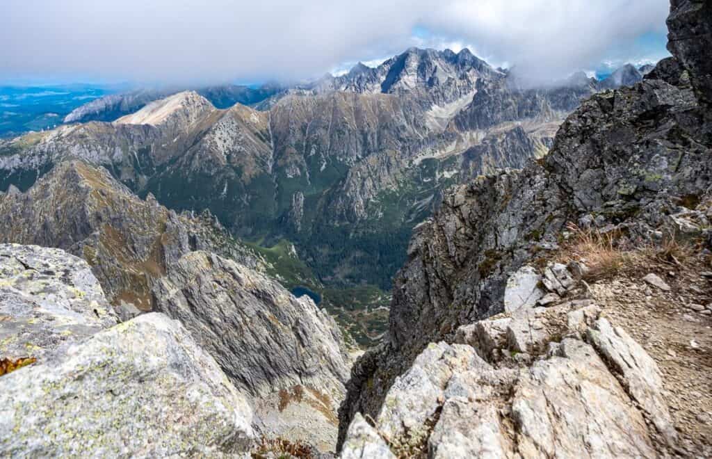
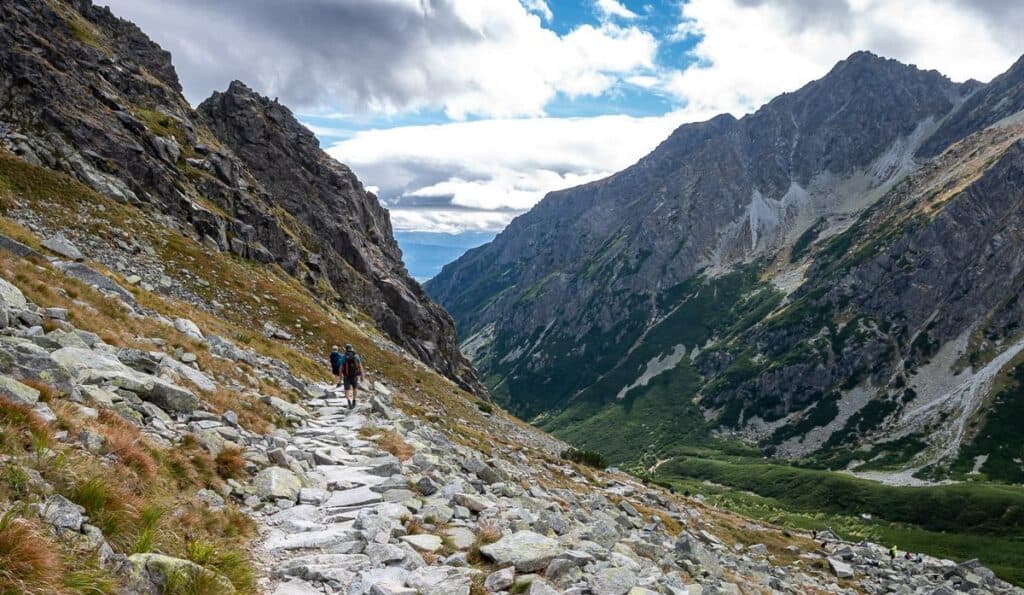
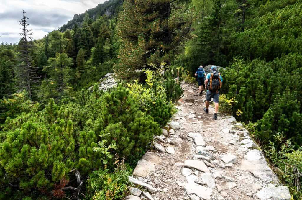
Hiking Rysy makes for a memorable day, offering a wonderful sense of accomplishment when you reach the highest point in Poland. The route itself is pretty – even spectacular in places, as it threads past crystal-clear alpine lakes, through lush meadows, and over lively streams, with rugged mountain views and a touch of exposure to get your attention.
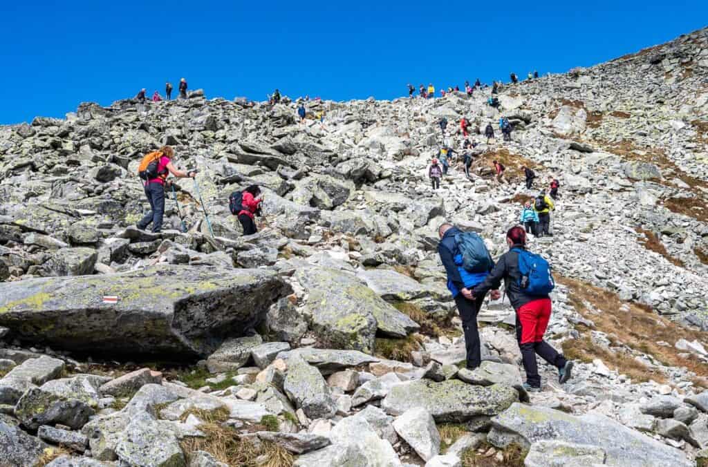
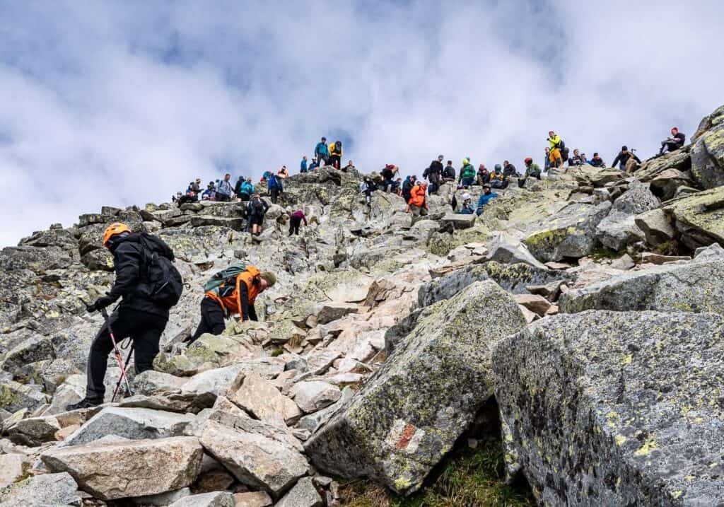
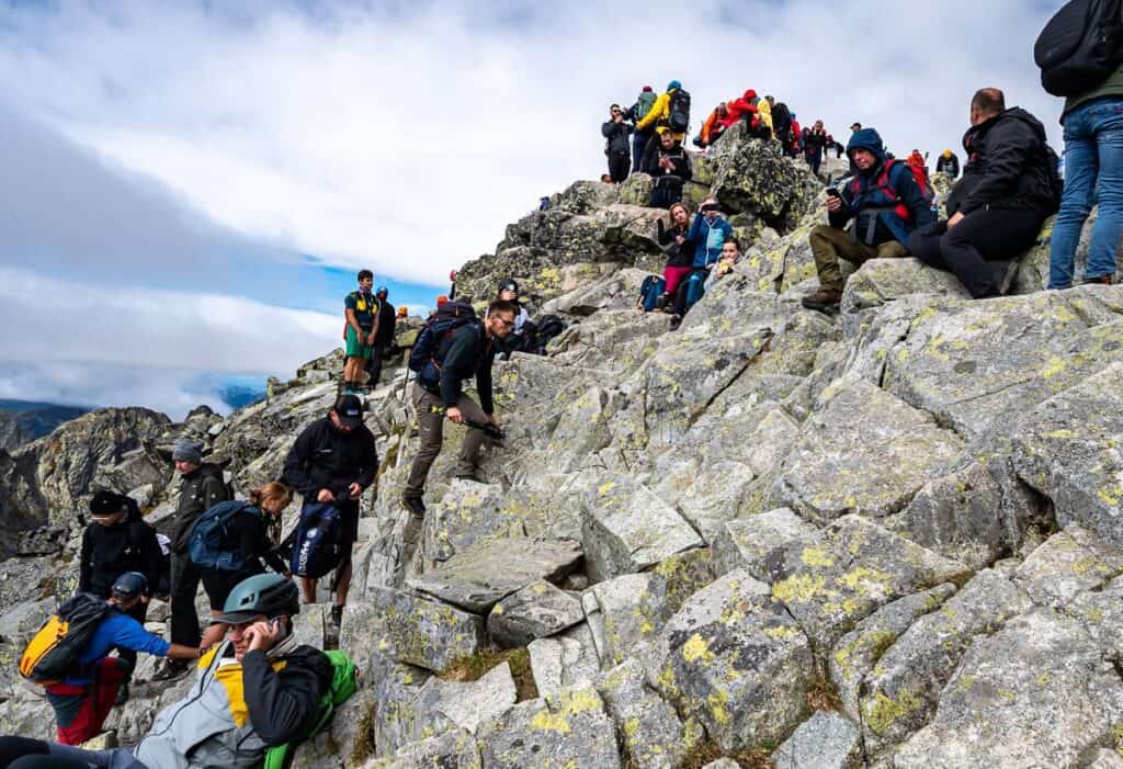
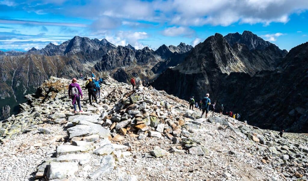
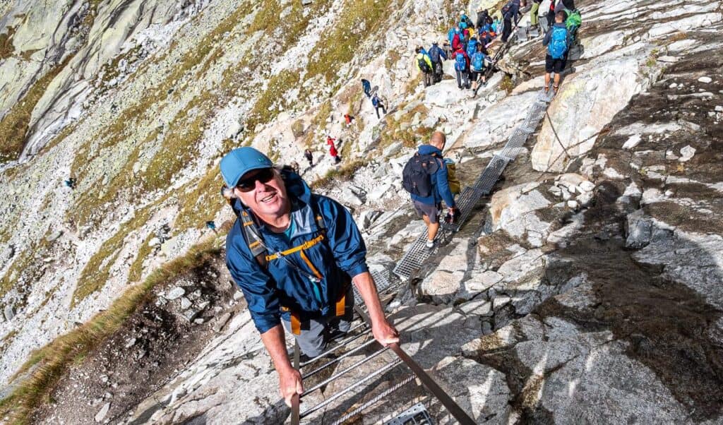
The downside – way too many people. This is the busiest hike I’ve been on in my life. I thought many of the hikes around Lake Louise in Canada, especially the hike to Lake Agnes Teahouse were busy, but nothing compares to what I experienced in Slovakia.
I wondered if the number of people hiking Rysy was an anomaly – as it was a Monday of a long weekend in September – so I’m sure that didn’t help. But a Slovakian man I spoke with (and he spoke good English) said these crowds are now normal. It wouldn’t be so bad, if people pulled over and let you by. But rarely did that happen over the length of the hike – and the three of us are fast hikers. At times, it was an exercise in frustration.
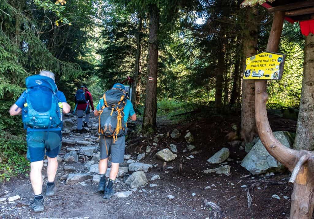
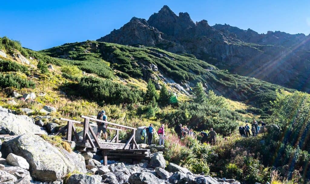
Štrbské pleso to Popradské pleso
Distance /elevation: 4.1 km/ +272 metres (892 feet)
You have a choice of two trails from Štrbské pleso to get to Popradské pleso. We took the one closest to our hotel which was by the first parking lot (GPS coordinates
49.12416, 20.06555) on the way up to the ski hill. You can also start hiking towards Rysy with a start by the Vysoké Tatry Poprad Pleso Train Station.
It’s a steady climb though not a steep one to Popradské pleso. At a good pace with no stops, it took us about an hour. We didn’t go down Popradské pleso (the lake) – saving it instead for the end of the day. This part of the trail is either rooty or rocky, so hiking boots with good ankle support and some cushioning are important.
There’s a restaurant and a hotel by Popradské pleso. It’s a good place to get a cup of coffee at the beginning of the day or a beer at the end.
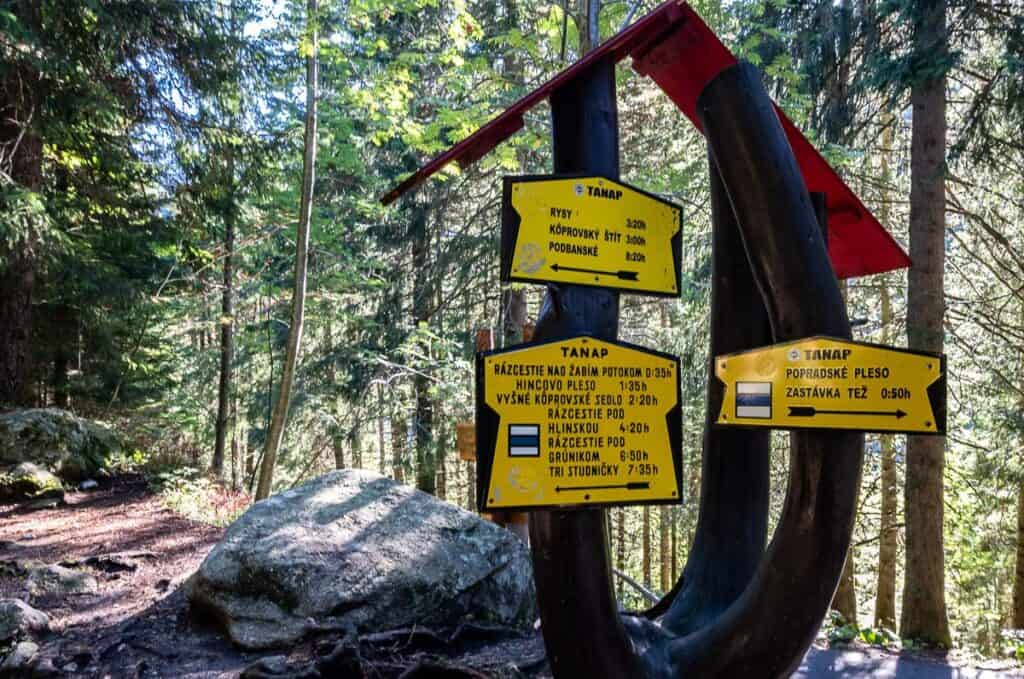
Popradské pleso to Nad Žabim Potokom
Distance/elevation: 1.2 km one way + 124 m (407 feet) elevation gain
Want to be helpful? If you’re able to carry 5 – 10 kg worth of supplies from the shelter at the intersection with the trail coming up from Popradské pleso, you will get a free cup of caj, a Slovakian type of tea, once you reach the hut. And better yet, you will have done a good deed.
For the next 30 minutes or so follow the blue trail towards Nad Žabim Potokom and the Mengusovská Valley. You’re mostly in the trees on this section.
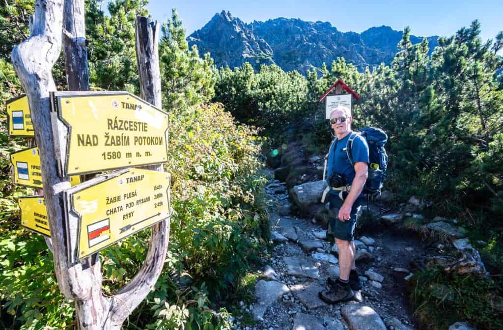
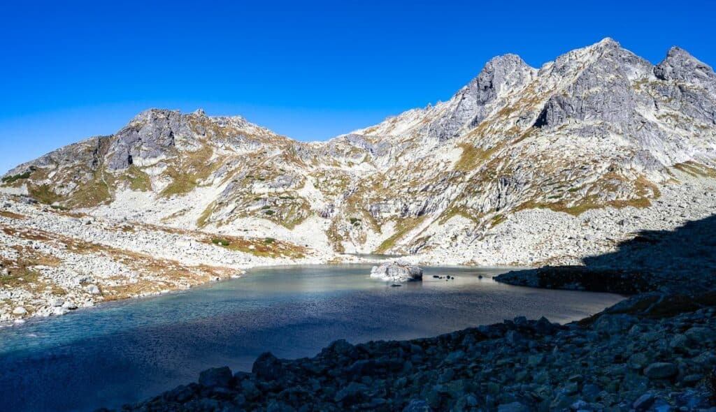
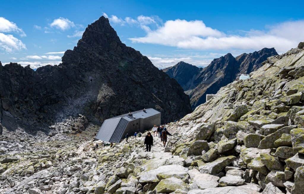
Nad Žabim Potokom to Chata pod Rysmi
Distance/elevation: 3.5 km + 670 m (2,198 feet)
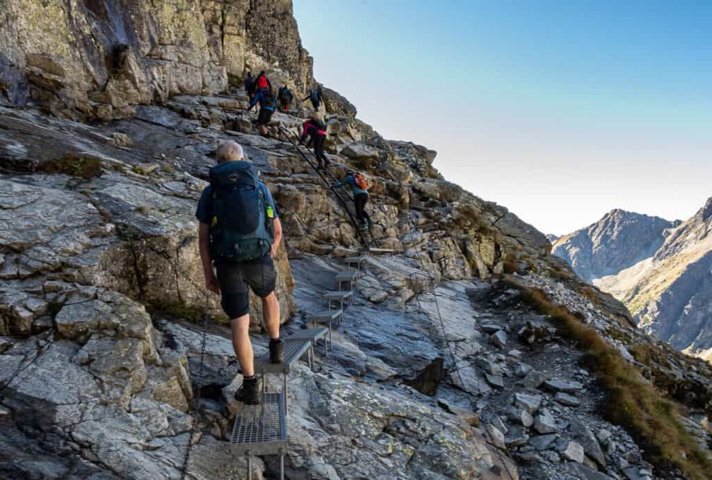
At the intersection seen in the photo above, turn right and follow the red trail to Chata pod Rysy.
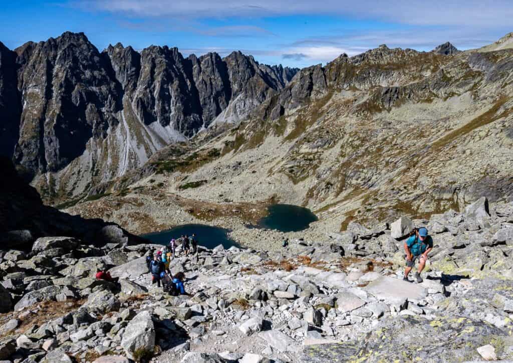
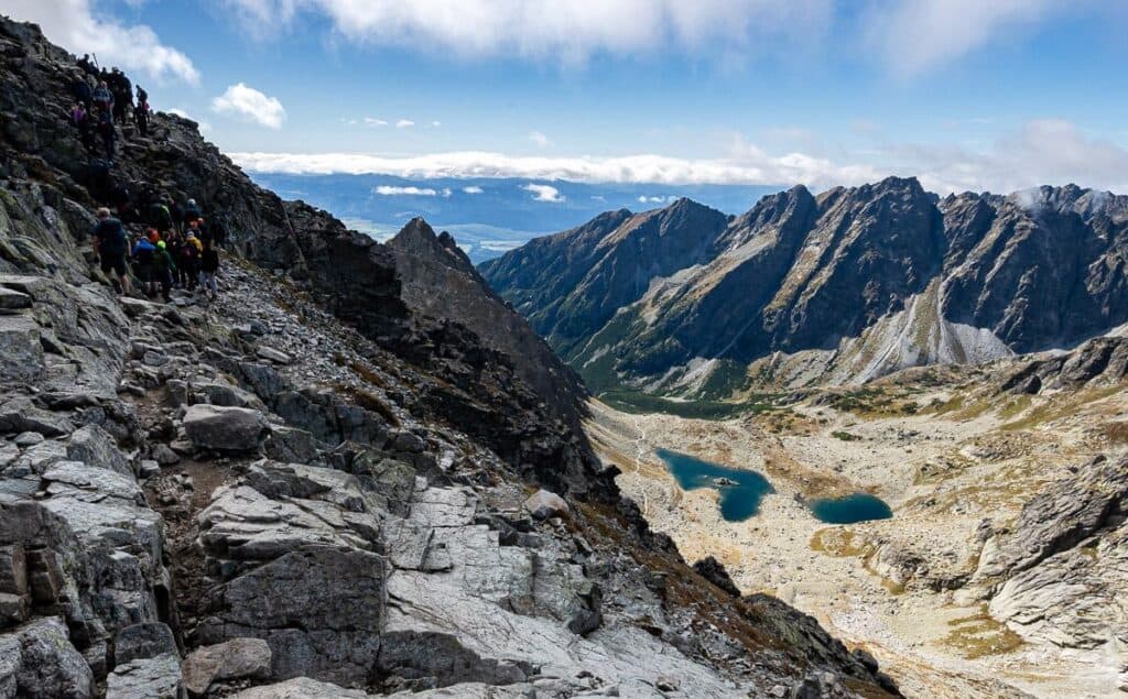
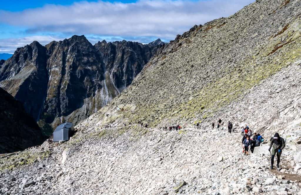
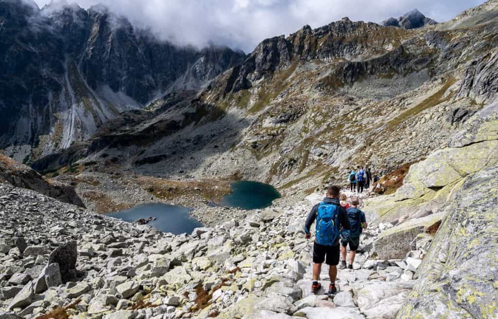
Cross a roaring stream on a footbridge and then switchback up towards the twin lakes of Veľké Žabie pleso and Malé Žabie pleso. It was chilly hiking in this section as we were in the shade for quite some time in September.
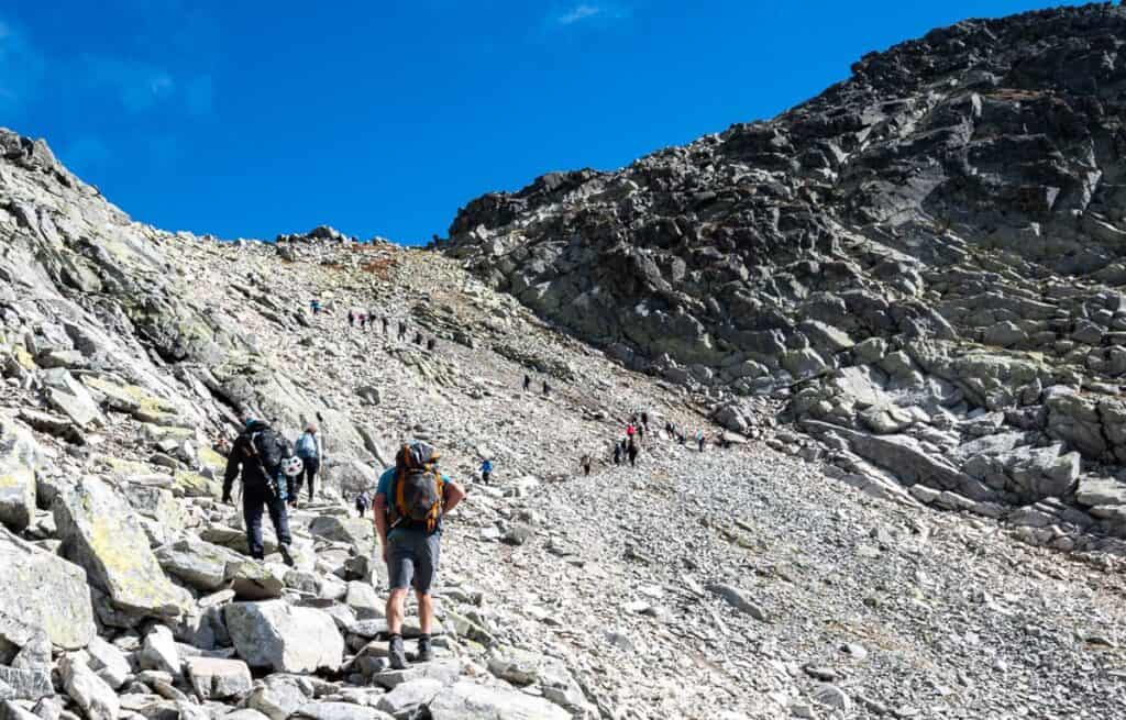
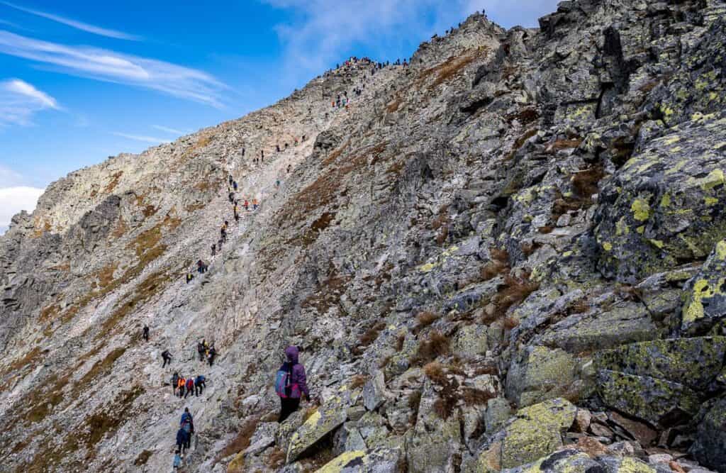
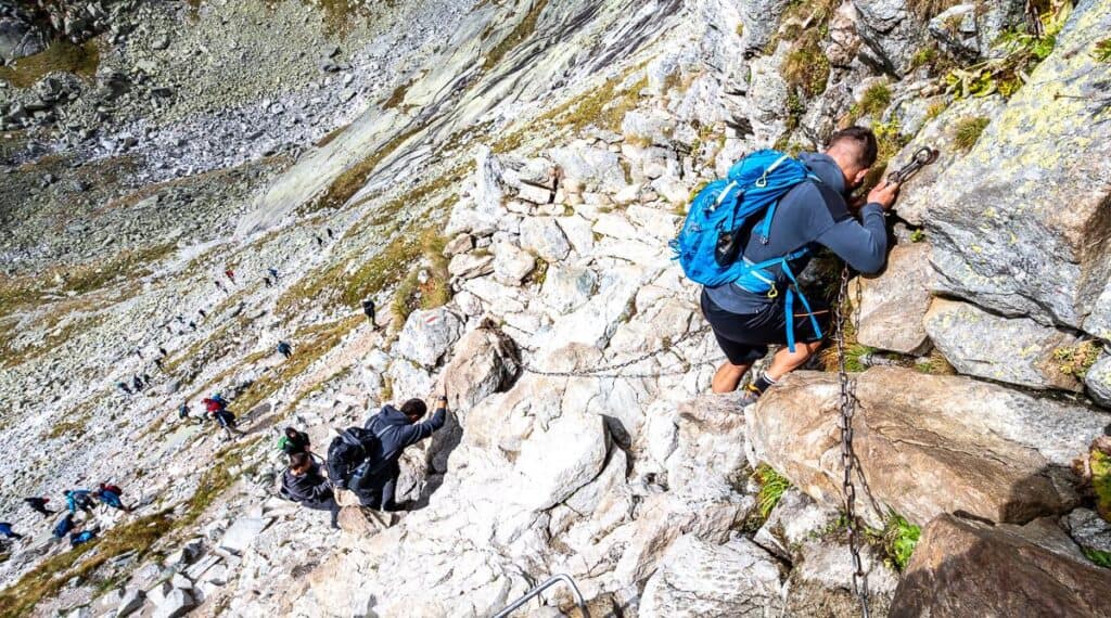
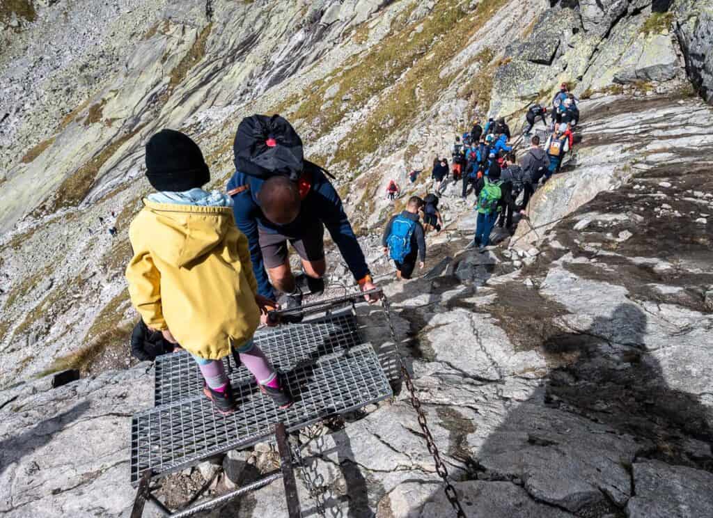
Just above the lakes you’ll reach the exposed section of the Rysy hiking trail complete with chains, metal foot bridges and ladders. Take your time through here and hold onto the chains as you climb up this part of the mountain. It’s not that steep, but it can feel a bit precarious, especially when people are trying to pass in the other direction.
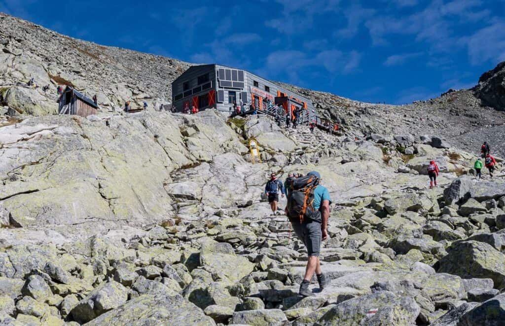
From the chain section it’s straightforward hiking all the way to Chata pod Rysmi – the highest hut in the High Tatra Mountains. It holds 14 people on the upper level – and is open from June 15 – October 31. If you spend the night, you’ll be able to catch the sunrise from Rysy.
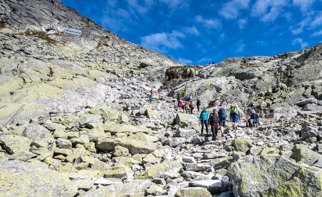
Hiking Rysy: Chata pod Rysmi to Rysy
Distance/elevation: 0.9 km + 249 m (816 feet) of elevation gain
It takes most people 45 minutes to an hour to finish hiking Rysy. It may depend on how many groups of slower hikers you’re behind, as sometimes there is nowhere to pass.
The hiking is steeper in places – but it’s only the last 10 -15 minutes where there is a wee bit of scrambling and minor exposure. It’s good blocky rock with excellent handholds, so most people won’t have any issues.
The biggest problem was the number of people spread out across the top of Rysy. I was hoping people would tag the mountain and then retreat a little to make way for others heading up. But that didn’t happen.
There are three peaks at the top of Rysy and it’s the middle peak that is the highest one in Poland. When we summited, it was a look over the edge and descend as there was literally no room.
The descent off Rysy
Plan to do and out and back hike. If you go later in the season get an early start so you’re not hiking down in the dark. Even with a headlamp, it would be tough going in spots.
We found the hiking to be less busy once we got through the chains section. And the final stretch back to Štrbské pleso was positively quiet in comparison to the rest of the day.
Hiking Rysy was a cool thing to do – but I wish I’d been mentally prepared for the crowds.
Where to stay nearby
Štrbské pleso
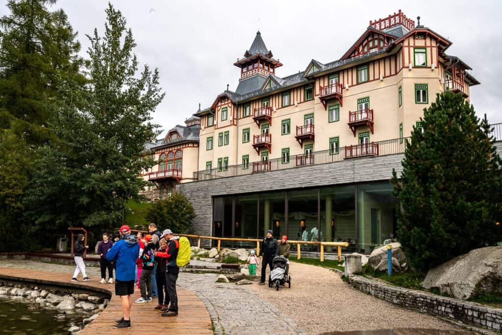
Hotel Panorama Resort – We stayed here for three nights. An excellent breakfast is included. Their spa with a hot tub, sauna, steam room can also be booked free of charge. Front staff are very helpful. Rooms are fine – nothing special but roomy. They do keep free beer and drinks in the room’s mini-fridge.
Hotel CROCUS, rated superb offers spacious rooms with a balcony and a kitchenette – just a half kilometre from the lake.
Grand Hotel Kempinski High Tatras comes with quite a price tag, but it’s location overlooking the lake is second to none. There’s a lovely trail around the lake, boats to rent and plenty of bird life to observe.
Penzión Pleso rated wonderful, is a mid-range hotel.
Popradské pleso
Horský Hotel Popradské Pleso overlooks the lake and is rated superb. It’s an hour’s hike from Štrbské pleso so not accessible by car.
More hikes in Europe you’ll love
- Kungsleden Trail Guide: Abisko to Nikkaluokta – a fabulous week long backpacking trip above the Arctic Circle in Sweden – with huts and saunas
- A Guide to Hiking the Fisherman’s Trail in Portugal – option to hike for up to 12 days staying at B&B’s or small hotels along the route
- Hiking La Gomera – A One Week Itinerary – hiking on one of the quieter Canary Islands
- The Best Part of Hiking the GR221 in Mallorca – a great multi-day hike from mid-February to mid-May – and again from late September until mid-November.
Click on the photo to bookmark to your Pinterest boards.