Hiking La Gomera – A One Week Itinerary
Hiking in La Gomera exceeded my expectations. The bar was set high as I’d first heard about La Gomera from a book author who writes about the best hikes in the Canadian Rockies. I trust his opinion, but the island wasn’t quite what I expected. It was better.
The hiking in La Gomera is varied and beautiful and over the seven hikes we did, I would say that if you’re not going up, you’re going down. I certainly hadn’t expected it to be as hilly as it was.
There’s a fantastic amount of elevation gain and loss (1,700 metres one day) on most of the hikes, but what really struck me was how different all the hikes were, even if they were geographically close to each other.
The vegetation is fantastic on La Gomera with everything from cacti to lush forest, palm trees and pine trees and the best preserved Laurel forest in the world.
There weren’t a lot of wildflowers blooming in January, but the locals people take great pride in their gardens, so I found all the towns to be very colourful especially with cascading bougainvillea and honeysuckle over doors and along walls.
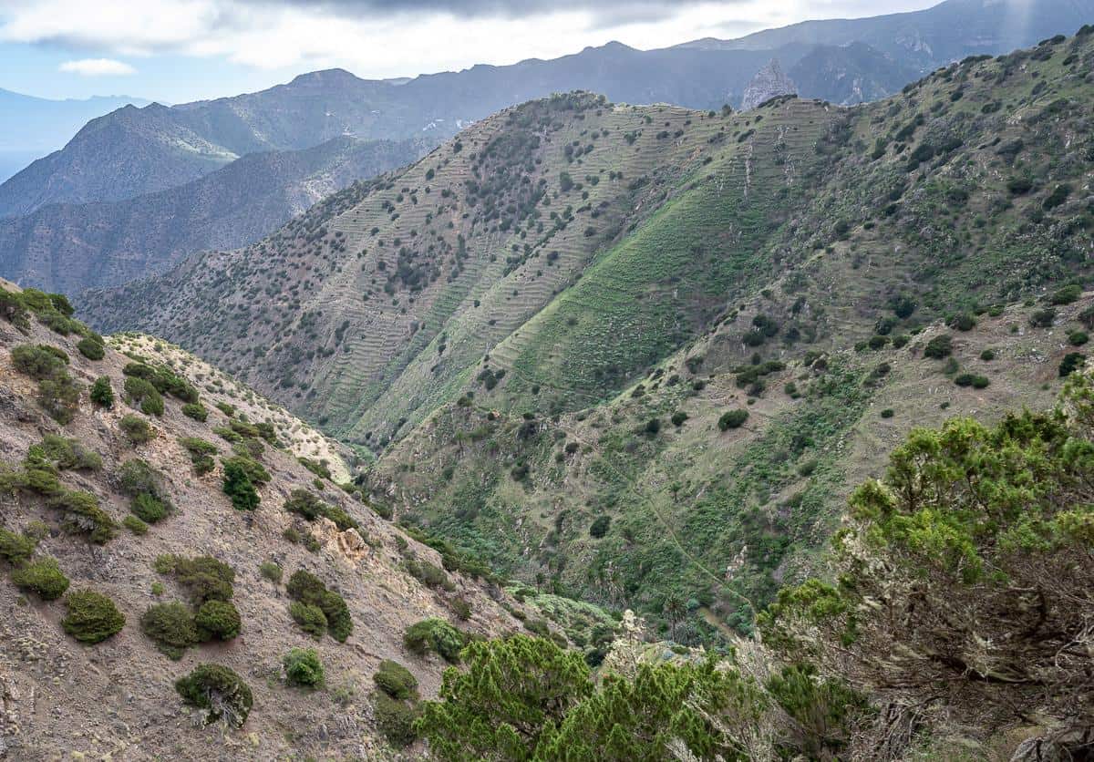
La Gomera is a circular, deeply incised island filled with barrancos or steep gorges – so count on some airy hiking at times. Garajonay National Park, a UNESCO site, sits in the middle of the island at an elevation of 1,500 m. The park is usually shrouded in cloud and mist, the perfect growing conditions for the laurisilva or Laurel forests, which are relics of old rain forests. There are trails in the park, but on this trip, we only got a taste of what it has to offer.
You might also like – A One Week Hiking Itinerary on Gran Canaria, Canary Islands
This post includes some affiliate links. If you make a qualifying purchase through one of these links, I will receive a small percentage of the sale at no extra cost to you. Thank you very much for your support.
Would you like to save this?
Where is La Gomera?
The Canary Islands which are part of Spain, are at the southernmost point in Europe.
La Gomera is one of the seven main Canary Islands located off the southern coast of Morocco. It lies 35 km west of Tenerife, the largest and most populous of the Canary Islands.

Getting to La Gomera
There is an airport on La Gomera that is used for inter-island travel. If you want to travel to mainland Europe from La Gomera it’s best to fly out of Tenerife.
We had flown into Tenerife from Lisbon (about a 2.5 hour flight), overnighted at the delightful La Finquita – Adeje (away from the heavily touristed areas) and then taken the one-hour ferry ride the next morning from Tenerife to La Gomera. There are two companies offering services – Fred Olsen and Naviera Armas.
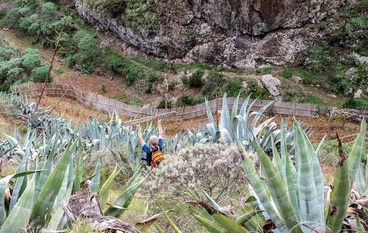
You dock in San Sebastian on La Gomera. From there it’s about an hour’s taxi ride to Vallehermoso. – our starting point for hiking in La Gomera.

Why travel to La Gomera to hike?
When it’s winter in the northern hemisphere, you’d do well to choose a hiking trip to La Gomera. Even in mid-January you can be out on the trails in shorts and t-shirts – and occasionally a fleece if the calima – a dusty wind is blowing across from Africa.
The island of La Gomera is home to 600 km of interconnected trails. What better way to explore this small island paradise than on foot. Unlike many of the day hikes in Canada I’ve done, you never have to worry about bears or other wild animals.
We only saw a few bugs and never needed to pull out the bug spray.
There’s lots of trail signage and between hiking apps and a good topographical map, you should be able to navigate quite easily.
We both found the island to be safe, friendly, and well off the tourist path that plagues other islands in the Canaries.

When is the best time for a hiking trip in La Gomera?
La Gomera is considered to be a year-round destination for hikers. However, there are so many great hikes and treks around the world that you can only do in the summer that I think La Gomera is best visited and hiked during the winter, spring, and fall. The island also gets more rain in winter (and it’s not much) and so it’s greener than it would be in summer.
January and February are the coldest months on La Gomera – but as a Calgarian I think cold is relative. Temperatures are usually in the 17-19°C/ 63-66°F range – which is very comfortable for hiking. We found that the temperatures climbed into the low 20ºC’s most days in January. You will notice a big difference in temperature between the coast and the higher elevation villages.

Useful info for your La Gomera hiking trip
Timing: Count on 3 – 4 kph if the trail is flat and in good shape. If there is elevation involved budget for 10 minutes more for every 100 m of climbing (called Naismith’s Rule).
Let someone know where you’re hiking: Tell the person at the front desk of your hotel where you plan to hike and when you think you’ll be back. You could also email or let a family member know what your itinerary looks like every day, should something untoward happen.
Maps: La Gomera & El Hierro Tour and Trail Maps (1:35,000)
Guidebook: Walking on La Gomera and El Hierro and La Gomera
Carry lots of water: Carry lots of water, especially on days when you’re not hiking through any towns. It’s dry on La Gomera and with all the exertion you’ll be thirsty.
Dogs: Give dogs a wide berth, but never run from them or turn your back on them. We saw lots of dogs chained up or in yards and fortunately none gave us any trouble.
Bees: We saw a lot of bees including some massive ones. If you’re allergic to them, be sure to carry your EpiPen and some Benadryl.
Local emergency: In Spain dial 112.
ATM’s: Available in San Sebastián, Vallehermoso, and Hermigua. I would suggest carrying some cash for use in small centres.
Taxi on La Gomera: Dulce Maria Herrera is really good, and she’ll accept reservations. Her number is 0034 606 682 333. There are local buses and taxis in the towns around the island as well.

Hiking in La Gomera one week hiking itinerary
Described below is our one-week hiking itinerary on La Gomera. There are lots of permutations to this – and if you plan to go self-guided, I’d recommend a guidebook. Every one of the hikes described below was good to excellent. All involved some road walking, usually minor, on generally quiet roads.
We liked to be hiking by 9 AM so we have lots of time to enjoy the landscape at an unhurried pace. We got in the habit after the first day of a daily midafternoon ice cream break. We found all the pubs on the island had ice cream bars.
The hiking description I’ve provided is vague, but if you are seriously interested in following our route, email me via the contact form on my website and I can give you detailed instructions. We did find the trails on Organic Maps, so it wouldn’t be hard to figure out the routes.
We booked our trip with Inn Travel out of the UK. There are numerous hiking-themed companies offering self-guided tours on La Gomera. The following is a company I like as well that offers La Gomera hiking tours.
Check out this 8-day, self-guided La Gomera hiking tour offered by 10 Adventures.
Day one hiking on La Gomera – Vallehermoso to the Enchantress Lake
Where to stay
Hotel Triana – Plan on three nights here so you can do a selection of hikes in the area. Very friendly, decent breakfast, inner courtyard and comfortable but not fancy rooms. It’s only a 5-minute walk to the town square and several restaurants.
Hotel Anaterve located on a hill in Vallehermoso would be another solid choice.
Hiking description
Distance: 5.8 km lollipop hike
Time needed: 2 hr 15 minutes
Elevation gain/loss: +/- 300 m
Level of difficulty: Easy
Head up out of Vallehermoso past colourful houses to reach the Lomo Pelado Ridge. Pass two barrancos (valleys) to reach a beautiful view over the Enchantress Lake. Hike clockwise around the lake, noting all the birds. Return by a quiet road to Vallehermoso passing colourful gardens along the way.
Hiking highlights
- The flowers are prolific and stunning. You can see how much pride the local people take in their gardens. The view of the lake and the dam are fantastic and will open your eyes to the hilliness of the island.
Hiking low points
- Walking on a road is never as much fun as a trail but on La Gomera Island as we found out, you need to on every one of the hikes, though sometimes for only a short section.


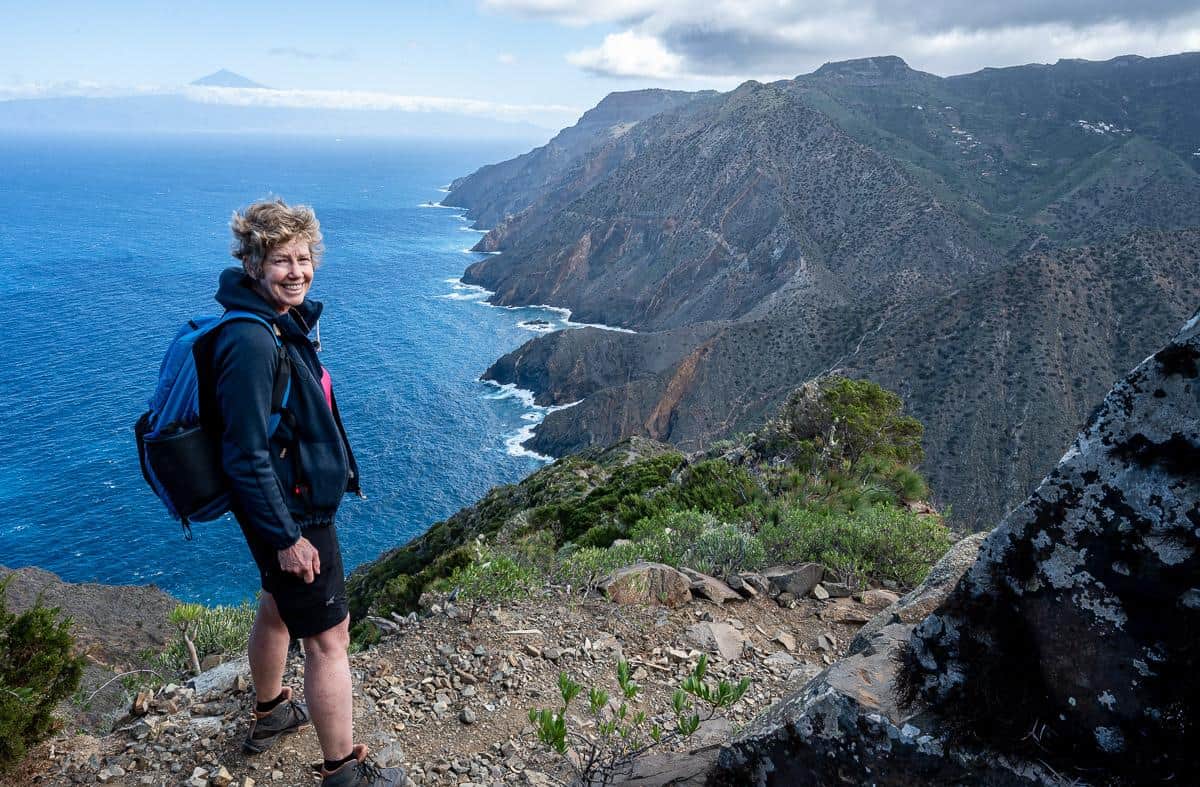
Day two hiking on La Gomera – Vallehermoso to Punta Alcalac and Playa de Vallehermoso
Hiking description
Distance: 13.6 km
Time needed: About 5 hours
Elevation gain/loss: +/– 800 m
Level of difficulty: Moderate
This was our first big day of hiking La Gomera – and what a scenic hike it is. You do have to walk the road through Vallehermoso to reach the Botanical Gardens. From there it’s a climb up to the saddle of Lomo de San Pedro. Then it’s a descent through the terraces of Barranco de Los Gauches, more ups and downs to the barranco and a final steep ascent to reach a wide trail.
From there you turn right on a red dirt road walking along with gentle ups and downs for about 2.5 km to reach the mirador or viewpoint on the Punta Alcalá. There are great views around here, along with a couple of picnic tables.
After lunch descend steeply for 500 m though mostly on a trail that offers good footing to reach the road. Turn left and walk down the road to visit the beach, appreciating it is not a good place for a swim. In the warmer seasons, there is a pool.
You can follow the road for about 2 km back into Vallehermoso. There is also an option to follow paths through farmer’s fields via a trail 1 km up from the beach that is signposted on the left to Vallehormosa via the GR131.
Hiking highlights: Interesting geology with lava bombs at the top of the ridge. Wonderful views of town as you climb. The viewpoint at Punta Alcalá is a wonderful place for lunch.
Hiking low points:
- Road walking at the end of the day is never a lot of fun, though you can detour into the fields and parallel the road for some time.


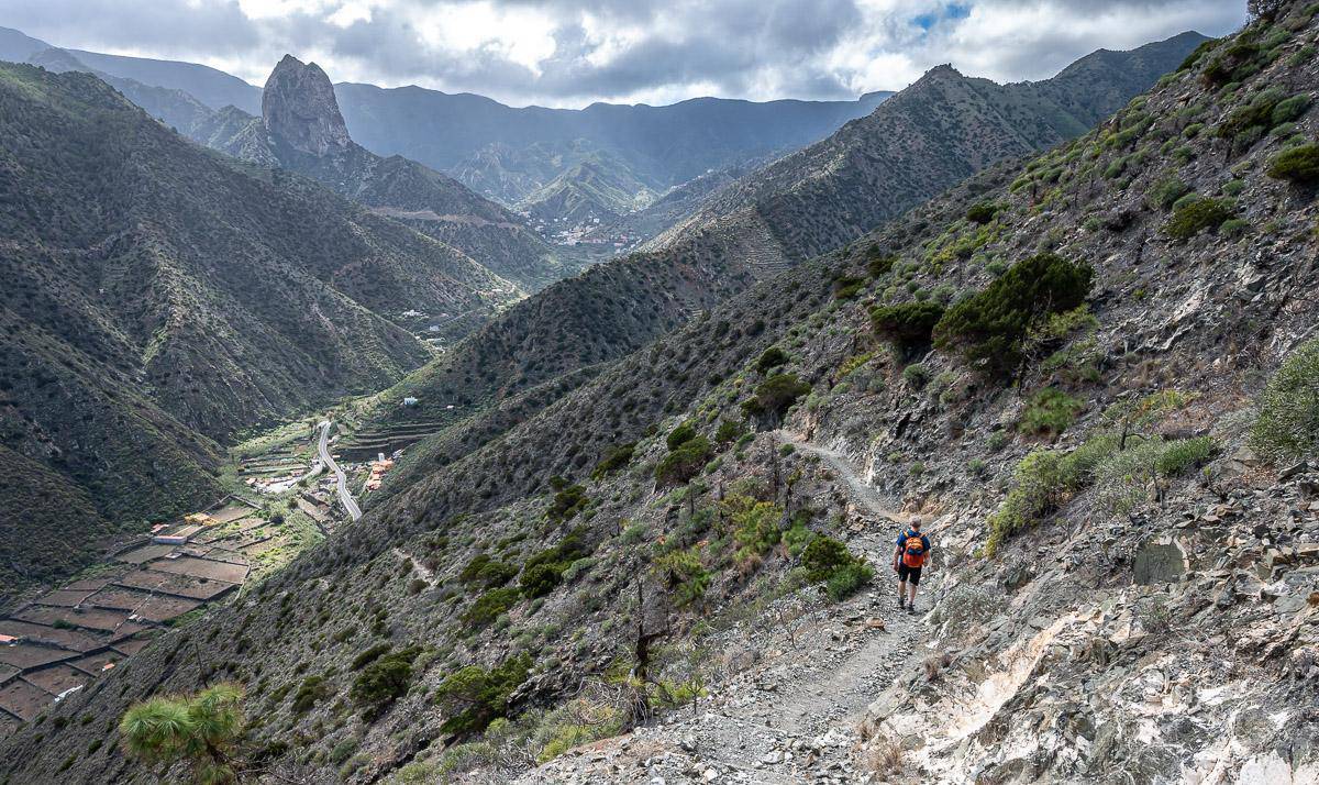

Day three hiking from Vallehermoso to the Chorros de Epina
Hiking description
Distance: 16.2 km
Time needed: 6 – 6.5 hours
Elevation gain/loss: +/– 940 m (3,084 feet)
Level of difficulty: Moderate to hard depending on how much you hike.
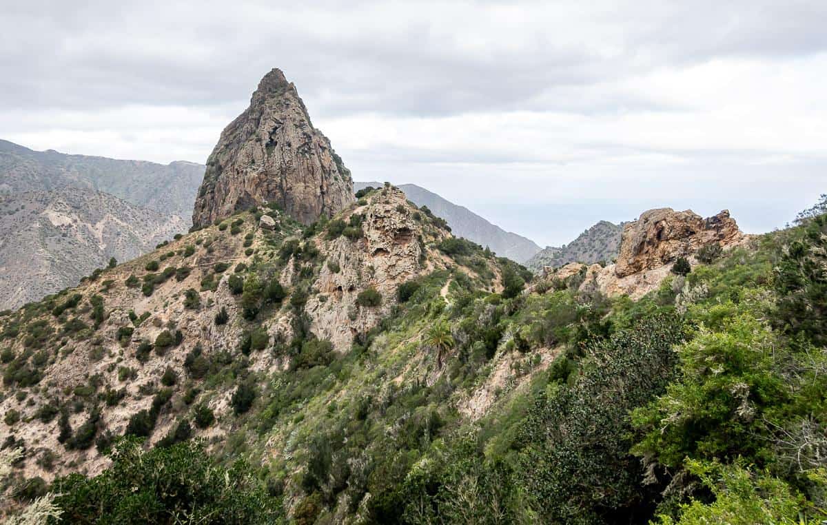
The hike starts out climbing Barranco de la Era Nueva starting at the cemetery in town. The views across the valley to Roque Cano are excellent! At the top you traverse the northwest coast with lots of ocean views.
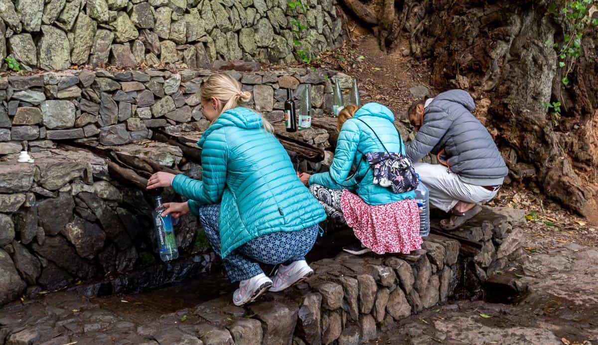
Climb to the fountains at the Chorros de Epina from the colourful town of Epina – where legend has it that you will wed before the year is out if you drink from the springs – but it must be done in the correct order. Women drink from even numbered springs, men from odd numbered. Women become witches if they drink from the odd numbered springs.
The final section of the day is a forest and ridge descent on the Camino Lomo de Los Cochinos that is extremely lovely. We enjoyed views of the Enchantress Lake circuit before making our way down on the backside of the ridge towards the cemetery. From there it was a quick walk back into town.
Hiking highlights:
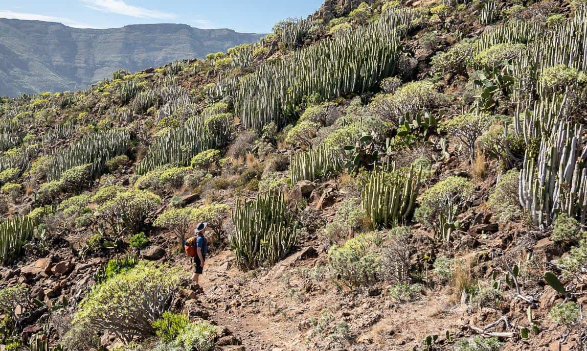
- Huge variety in the types of vegetation – some of it primeval looking.
- Lots of up and down on several barrancos with excellent ocean views.
- Fantastic ridge walking back to Vallehermoso.
Hiking low points
- At the top of the first climb you follow a dirt road for several kilometres. On windy days it’s very exposed, so this was the coldest part of our hike.


Day four hiking in La Gomera – Vallehermoso to Hermigua
Where to stay
Hotel Rural Casa Los Herrera or Hotel Rural Villa de Hermigua.
Hiking description
Distance: 18.2 km
Time needed: 6.5 hours minimum
Elevation gain/loss: +1,380m/-1,455 m
Level of difficulty: Hard because of the length and elevation.
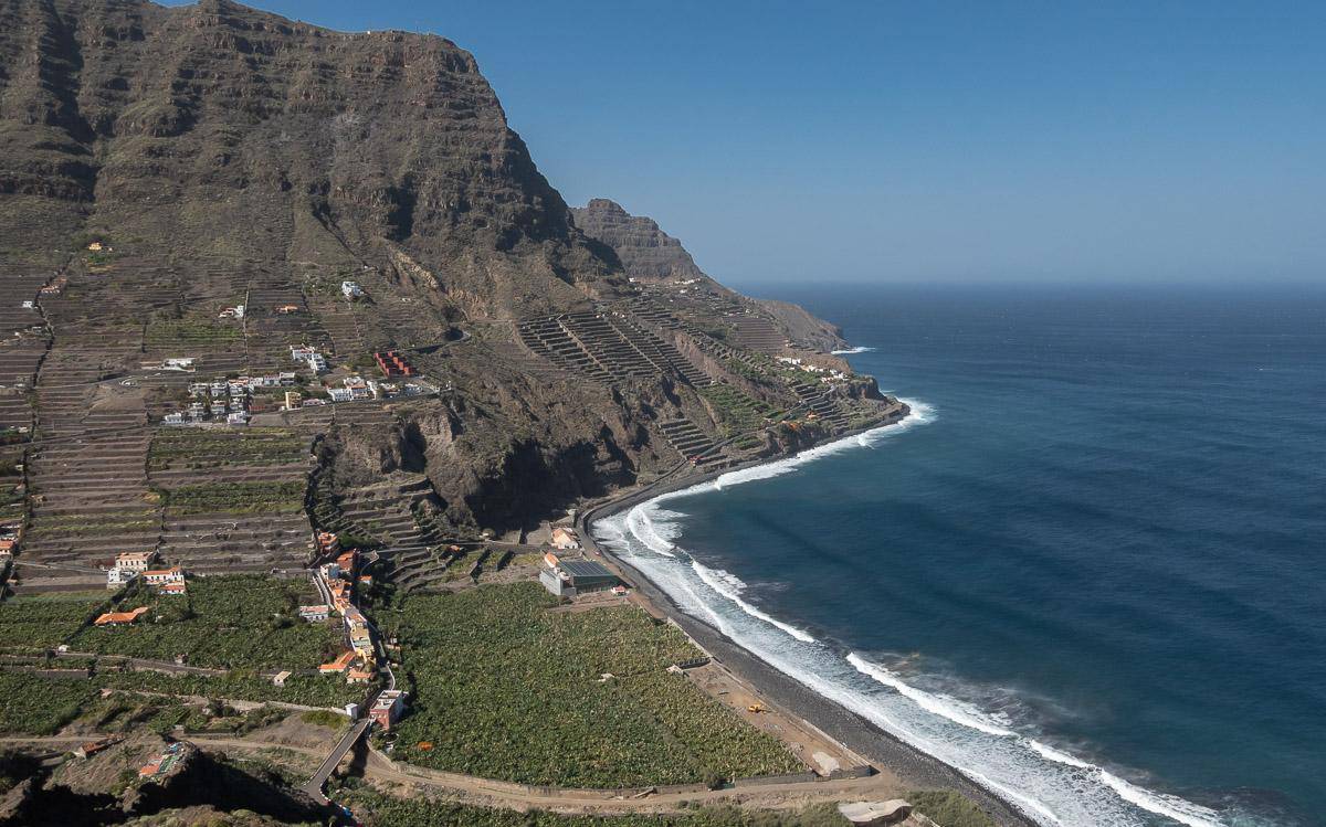
Today’s hike was one of the best. It started off heading up to the iconic Roque El Cano with views back over Vallehermoso. Then we made our way to the reservoir before climbing again and enjoying a stop at the Visitor Centre at Juego de Bolas – a garden featuring endemic plants.
There was a fantastic bit of walking on red dirt as we steeply began a descent to Agulo. This section with all the repeating hills was one of my favourites while hiking La Gomera. After an ice cream break in Agulo, the trail steepened yet again to spit us out on a road a kilometre up from the beach. Then it was a 1.7 walk up the road to our accommodation in Hermigua. (This is a condensed version of about 5 pages of hiking directions!)
Hiking highlights:
- Except for the last 30 minutes walking into Hermigua, the hike was a standout.
- Beautiful views, incredible trail building, a quick visit to Agulo – the best-preserved traditional village on the island, and a sense of satisfaction from descending one of the steepest sets of stairs I’ve ever laid eyes on.


Day five hiking in la Gomera – A day hike around Hermigua to the beach at La Caleta
Hiking description
Distance: 11.3 km
Time needed: Allow about 4.5 hours.
Elevation gain/loss: +/- 630 m
Level of difficulty: Moderate
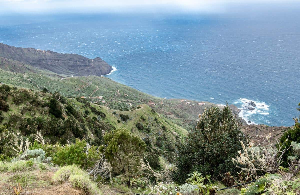
Retrace your steps heading back down the road for about a kilometre. By the DISA gas station, turn right down steep steps to get to the bottom of the barranco. At the iron bridge (don’t cross it) turn left and walk down the trail towards the ocean.
Pass a playground after about 700 m, and turn up to get on the road. You’ll see signage and again at a palm tree pictured below. Hike steeply up the trail to the road at the top and turn right.
Continue walking for several km, keeping an eye out for sign posts with El Palmar. At the one showing El Moralito 0.6k and El Palmar 3.1k go left down the path. We got confused through here but basically you’re descending on a trail to a couple of houses and following it around and then up to another signpost which you can see when climbing. When you get to the top of that ridge go left following any signposts that say La Caleta.
Enjoy beautiful ridge walking before a scree filled descent. Turn left before you reach the footbridge and follow the path, staying left for La Caleta. In short order it’s fenced because of the dropoff. Reach a viewpoint of the beach and the sea, and then continue on the path to a road. (It’s an 800 m one way detour down the road to the beach.)
To head back to Hermigua turn left up the road and follow it for about 29 minutes to the top to complete the loop. You’ll be back in familiar territory. Retrace your steps from there to the hotel.
Hiking highlights:
- Absolutely loved all the off-road hiking, especially the superbly scenic sections along the coast. We didn’t see another hiker.
Hiking low points:
- There is an out and back section through Hermigua that isn’t as interesting on the return.
- Lots of road walking at the top of the first climb (though never saw a car) as well as road walking up from the beach area.


Day six hiking from Hermigua to San Sebastian
Where to stay
Parador de la Gomera with it’s wonderful view over the ocean or Hotel Torre del Conde in the centre of San Sebastián.
Hiking description
Distance: 9.7 km
Time needed: 3.5 hours minimum
Elevation gain/loss: +390m/-760m
Level of difficulty: Easier side of moderate.
You will likely need to arrange a taxi to get dropped off to the right of Mirador A. Lazcano at the east end of the tunnel on the GM-1. There is a car park there and the trailhead on the north side of the road.
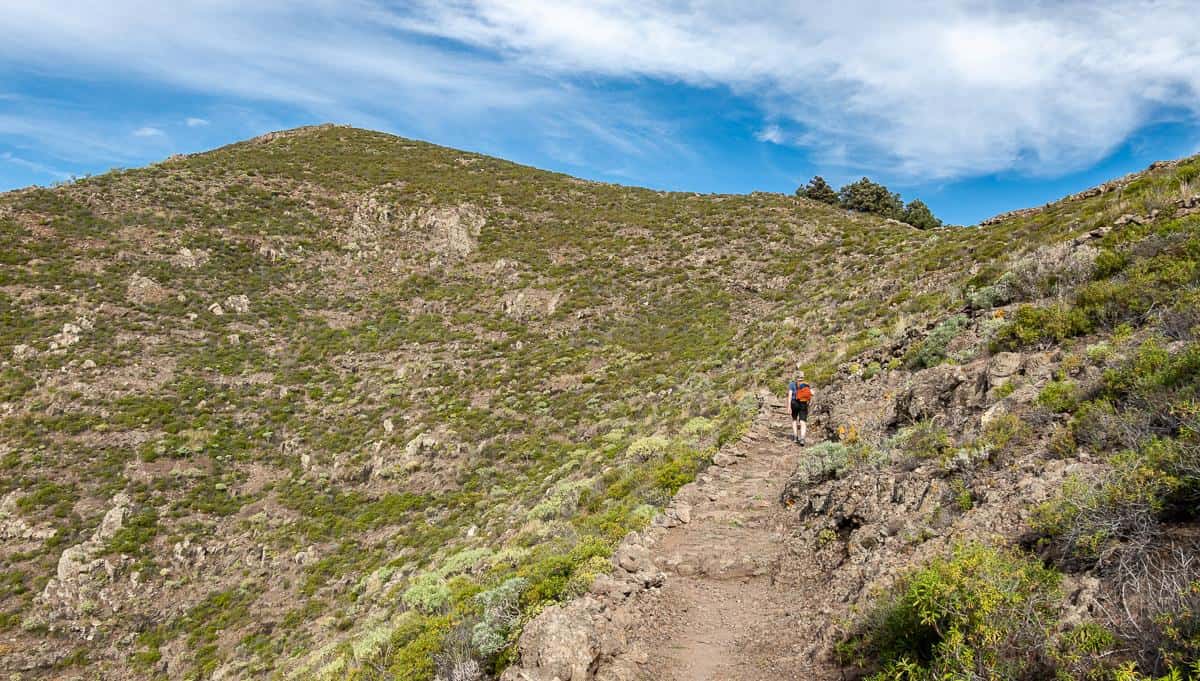
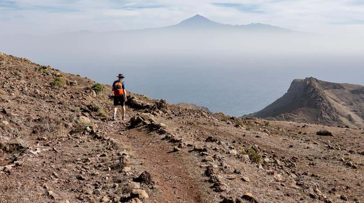
Hike up the track to a ridge, 260 m above the road. Once on the ridge turn right. The track follows the ridge of Lomo de Las Nieves on the GR 132 all the way to San Sebastián. On the ridge enjoy spectacular views over to Tenerife. There’s a lot of variety underfoot and in the types of vegetation, so I found this hike to be particularly enjoyable.
You will walk right by the wind turbines. Shortly after you’re on the road into town. If you’re staying at the Parador, ignore any signs pointing left. The road eventually runs right to the Parador. If you’re staying in town, there are steep stairways with green railings that signify that they are for the public. Find one of those and go down to the main square in town. It’s also a short walk to the ferry terminal, should you be heading for Tenerife immediately.
Hiking highlights
- Beautiful section of hiking through unusual vegetation. An all-round delightful hike save for the final 1.5 km on the road into San Sebastián, though at least it’s colourful.


Day seven hiking – San Sebastian to Playa de la Guancha
Hiking description
Distance: 10.2 km
Time needed: 4 hours
Elevation gain/loss: +/- 480 m
Level of difficulty: Easy
If I lived in San Sebastián, I would be a regular hiker on the trail to the Playa de la Guancha. The hike isn’t as pretty as many on La Gomera, but it has its charms with a long stretch of ocean views – and the possibility of a swim at the end of the hike depending on ocean conditions. It was the busiest hike by far of any we’d done on the island – and most hikers seemed to be locals.
Unfortunately the trail is blocked at the end of the beach fronting San Sebastián, so you have to start behind the ENDESA plant. It looks very rundown with garbage scattered near the start of the signed trail but it gets better very fast.
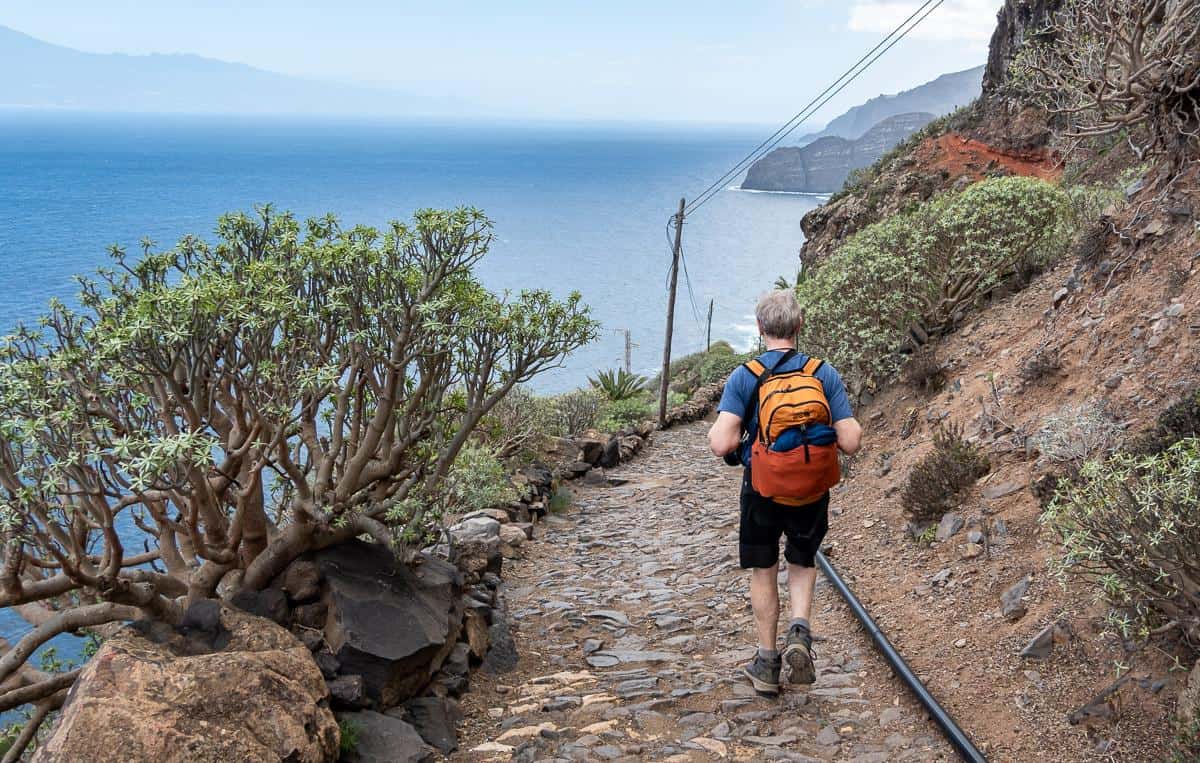
Start climbing immediately staying left on Lomo del Higueral. Get to the top of an exposed headland where the winds can be bad. Continue for about a km descending to the floor of the barranco and then climbing again after 1 km. In no time you’ll see your destination down below. (See the photo of John below.) Descend 120 m weaving down through the barranco to reach stony steps. Turn left and follow the trail to the ocean. To return, simply retrace your steps.
Hiking highlights
- Surprisingly beautiful along the coastal path and the views as you drop down to Playa de la Guancha are superb.
Hiking low points
- It’s not a pretty hike getting out of San Sebastián as you need to bypass the ENDESA plant as there’s no access from the beach.


La Gomera hiking map – approximate locations of our hikes
More hikes in Europe you might enjoy
- Preikestolen Hike (Pulpit Rock) above Lysefjord, Norway
- The Fabulous Mannen Hike in Norway’s Lofoten Islands
- Kungsleden Trail Guide: Abisko to Nikkaluokta, Sweden
- The Best Part of Hiking the GR221 in Mallorca
- The Eagles Path Hike in the Polish Tatra Mountains
Click on the photo to bookmark to your Pinterest boards.