Hiking on Gran Canaria was better than I expected. However, what I didn’t realize before we visited was what a popular and busy island it is. Las Palmas, the capital of Gran Canaria, has a population of almost 400,000 and it’s a favoured cruise ship destination. Fortunately, on arrival we headed immediately to Cruz de Tejeda in the north – where there are lots of small towns and villages but no big centres. Agaete, a port and the biggest town we visited is home to only 5,500 people.
Although the hiking is varied and often very beautiful, I don’t think it’s quite as good as hiking on La Gomera. If I only had a week, I’d recommend La Gomera, but with two weeks, Gran Canaria is a fine choice.
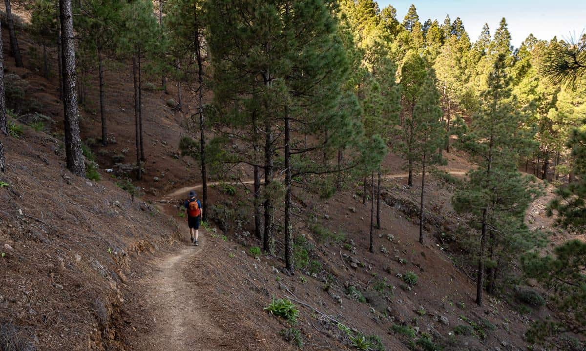
Again, there is a lot of elevation gain and descent in a variety of landscapes. We walked through more beautiful pine forest on this island than we did on La Gomera but save for the last day’s hike, we never had ocean views.
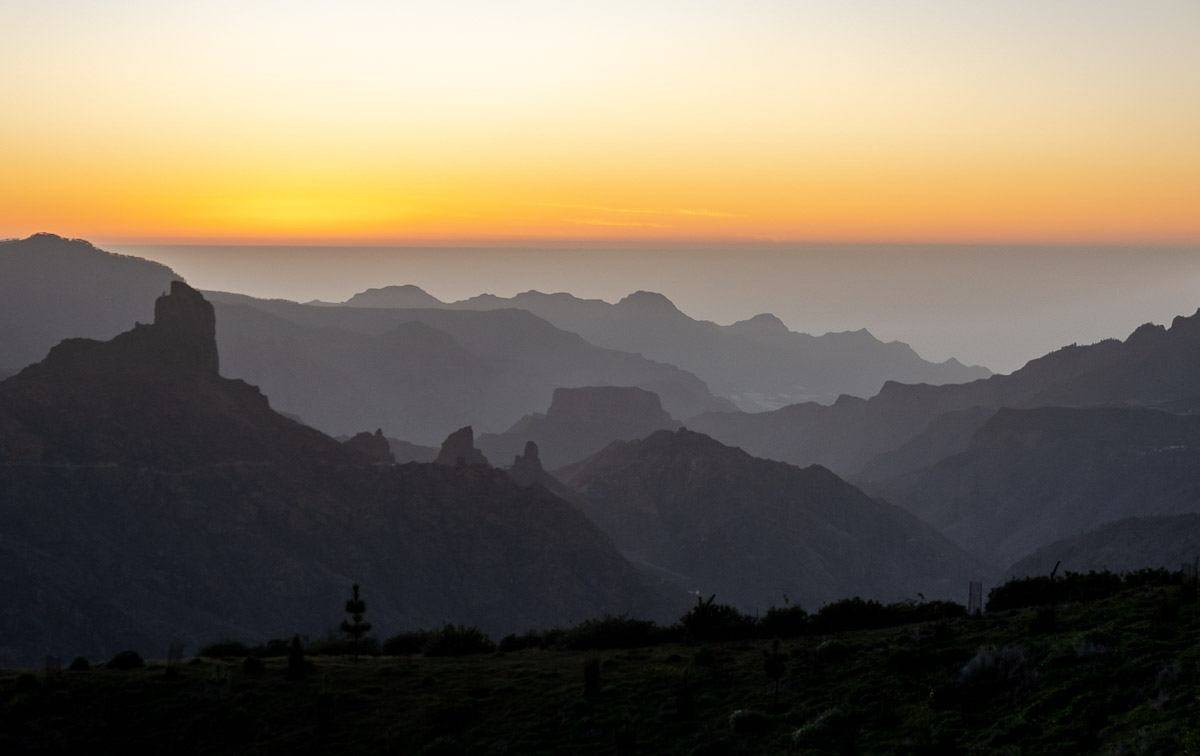
On the upside we enjoyed a phenomenal ridge walk, a superb descent past houses built into the mountain and a beautiful eucalyptus forest. And every night we were rewarded with a stunning sunset from our perch at the Parador Cruz de Tejeda. Gran Canaria is most definitely a worthy hiking destination.
This post includes some affiliate links. If you make a qualifying purchase through one of these links, I will receive a small percentage of the sale at no extra cost to you. Thank you very much for your support.
Where is Gran Canaria?
Gran Canaria is the third largest of the seven Canary Islands, located off the southern coast of Morocco. The island lies east and a little south of Tenerife. The port of Agaete is 69 km from Tenerife, and the port of Las Palmas de Gran Canaria is 94 km.
The island is 210 km off the coast of West Africa and 1,250 km from the Spanish mainland. It’s almost a 4.5-hour flight from London and a 2 – 2.5 hour flight from Lisbon.
Getting to Gran Canaria
You can take a ferry or a plane to Gran Canaria.
Ferries
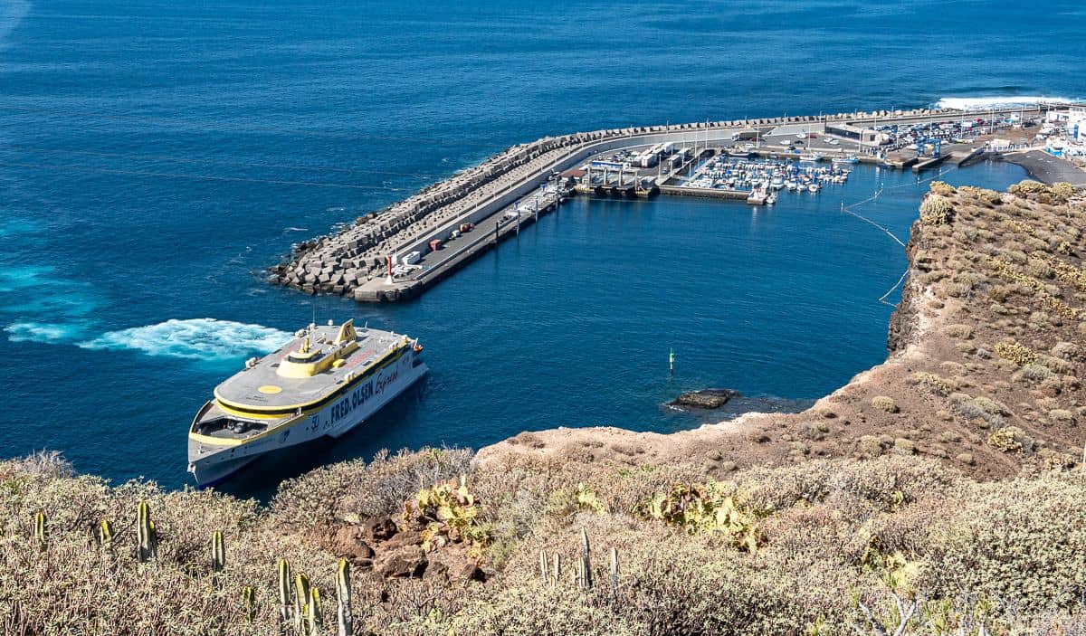
There are two ports on Gran Canaria for ferries – Las Palmas (or Puerto de la Luz) and Agaete (or Puerto de las Nieves) in the northwest. The port of La Palmas serves mainland Spain from Huelva and Cádiz.
The Port of Las Palmas, about five kilometres from the city centre, also serves the following Canary Islands – Tenerife, Fuerteventura, La Gomera, La Graciosa, Lanzarote, and La Palma.
The ferry operators include Fred Olsen and Naviara Armas.
Flights to Gran Canaria
Between islands book a flight of Binter to arrive at Las Palmas Gran Canaria Airport. Canaryfly is another option.
There are loads of airlines flying directly to Gran Canaria from Europe including TAP (Air Portugal), Ryanair, Iberia, easyJet, Norwegian and more.
Best time to hike in Gran Canaria
Gran Canaria is a year-round destination for hikers. Seasonal average temperatures are 18 – 24°C, though in the north it’s slightly cooler and damper.
We did all our Gran Canaria hiking on the northern part of the island, often above 1,000 metres. You do need to go prepared with some warm clothes and layers as weather can change rapidly and visibility can be poor, though we had none of that in late January.
Useful info for a Gran Canaria hiking trip
Timing: Count on 3 – 4 kph if the trail is flat and in good shape. If there is elevation involved budget for 10 minutes more for every 100 m of climbing (called Naismith’s Rule).
Let someone know where you’re hiking: Tell the person at the front desk of your hotel where you plan to hike and when you think you’ll be back. You could also email or let a family member know what your itinerary looks like every day, should something untoward happen.
Maps:Gran Canaria Hiking and Biking Map
Guidebook:Walking on Gran Canariaby Cicerone
Weather forecast: Spanish Meteorological Office
Carry lots of water: Carry lots of water, especially on days when you’re not hiking through any towns. It’s dry on Gran Canaria and with all the exertion of hiking, you’ll be thirsty.
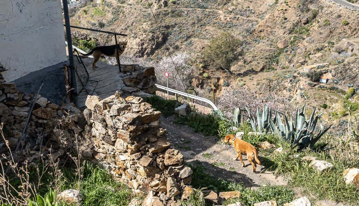
Dogs: Give dogs a wide berth. Never run from them or turn your back on them. We saw lots of dogs chained up or in yards and fortunately none gave us any trouble.
Bees: We didn’t see as many bees hiking on Gran Canaria as we did hiking La Gomera for a week, but if you’re allergic to them, be sure to carry your EpiPen and some Benadryl.
Local emergency: In Spain dial 112.
ATM’s: You’ll find them in Agaete and Tejeda.
Taxi on Gran Canaria: Taxi Oscar (0034 639375 329) and Socom Taxi are good choices.
One week hiking on Gran Canaria itinerary
Described below is our one-week hiking itinerary on Gran Canaria. There are lots of permutations to what we did – so if you plan to go self-guided, pick up a guidebook. Every one of the hikes described below was good to excellent, with my favourite being the hike from Fontanales to Agaete and the last day’s hike. All involved some road walking, usually minor, on mostly quiet roads.
Most days we would be hiking by 9 AM so we had lots of time to enjoy the landscape at an unhurried pace. We got in the habit after the first day of a daily midafternoon ice cream break.
If you are seriously interested in following our Gran Canaria hiking itinerary, email me via the contact form on my website and I can give you detailed instructions on some of the hikes. We did find the trails on Organic Maps, so it wouldn’t be hard to figure out the routes.
We booked our trip with Inn Travel out of the UK. There are numerous hiking-themed companies offering self-guided tours on Gran Canaria. The following is a Calgary based company I like as well that offers hiking tours.
Check out this 8-day, self-guidedGran Canaria hiking touroffered by 10 Adventures.

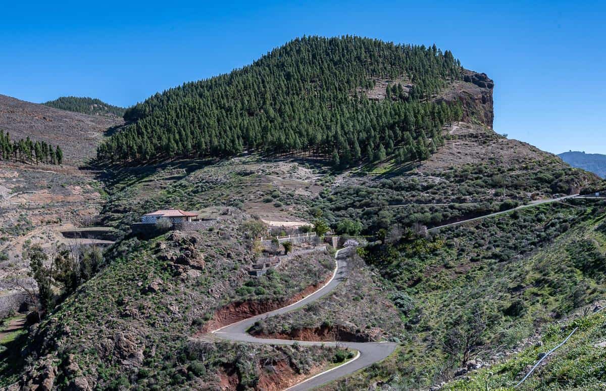
Day one hiking Gran Canaria: Cruz de Tejeda to Artenera
Where to stay:Parador Cruz de Tejeda
Distance: 14 km return
Time needed: Approximately 5.5 hours plus time in the cave village
Elevation gain/loss: +250m/-515m (one way)
Level of difficulty: Moderate
Hiking description
Outside the Parador Cruz de Tejeda there are countless hiking options. We did three day hikes leaving from the Parador.
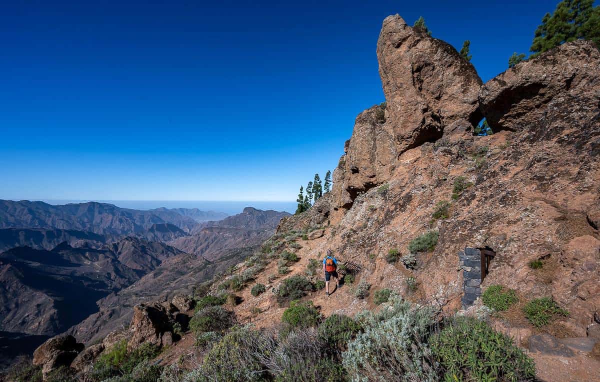
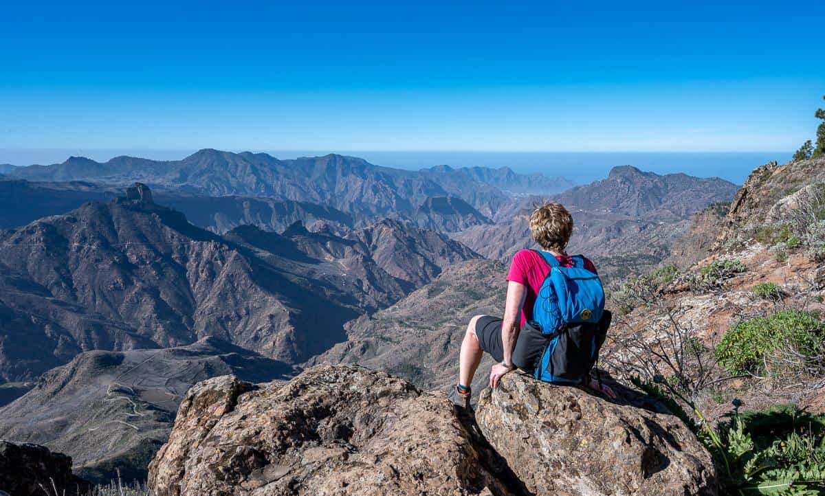
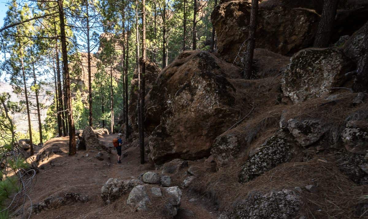
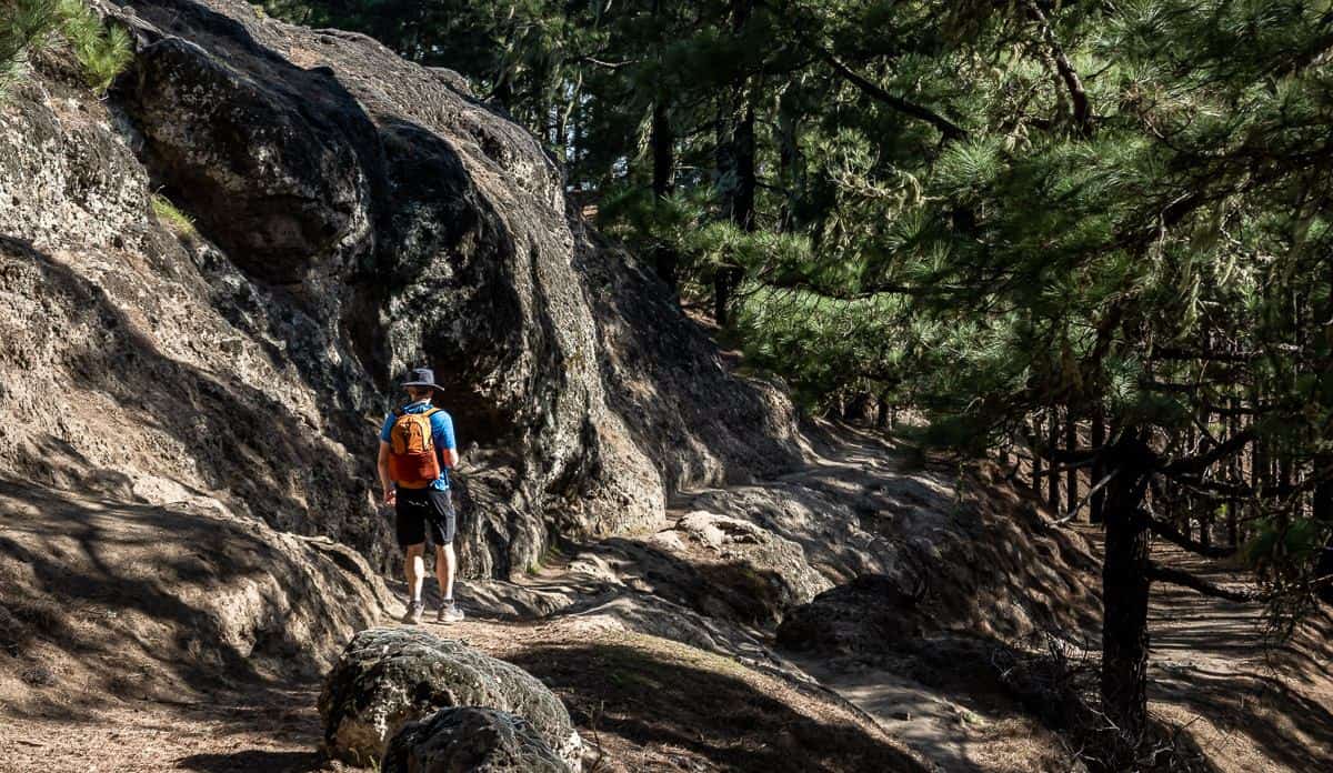
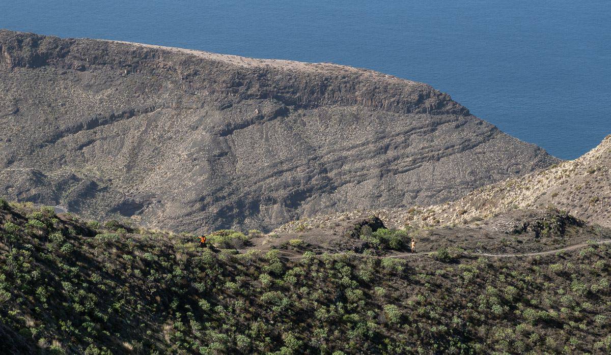
On the first day we took off behind the Parador and followed an impressive ridge winding in and out of pine forest to the cave village of Artenera. The ridge walk above the Caldera de Tejeda was described by the writer Miguel de Unamuno as a “petrified tempest” and a “tremendous commotion of the bowels of the earth.” It offers impressive views over the Tejeda de Barranco.
The pine forest is filled with massive pinecones and pine needles that are so thick at times that the walking is slippery. It’s also tinder dry!
One of the highlights of this hike are the Cuevas de Caballero – a group of seven ceremonial caves used by the ancient Canarii more than 500 years ago. One is natural and six were excavated. Wall etchings suggest that the caves were likely used to invoke rain and fertility rites. Today most of the caves are blocked off by bars, but you can look in.
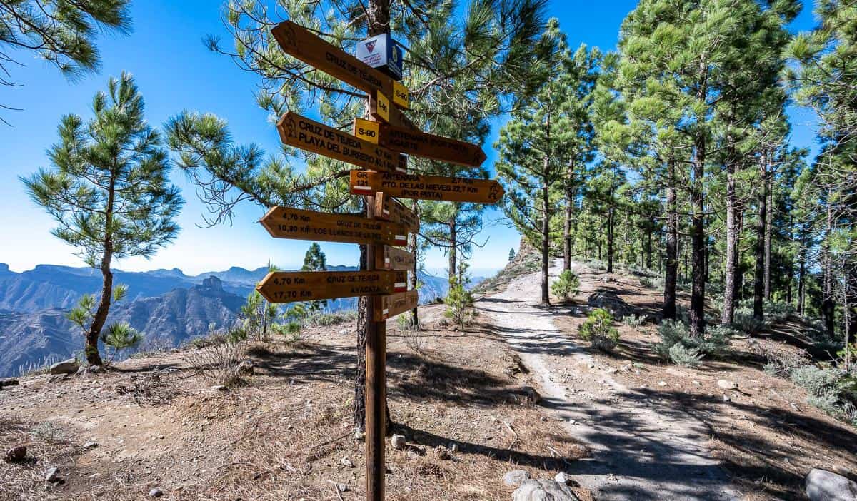
Signage is good on the hike to Artenera and at one point you’ll see that you have an option to descend steeply along the ridge or take a winding and less steep forest track. We opted to descend on the forest trail and return via the steep path.
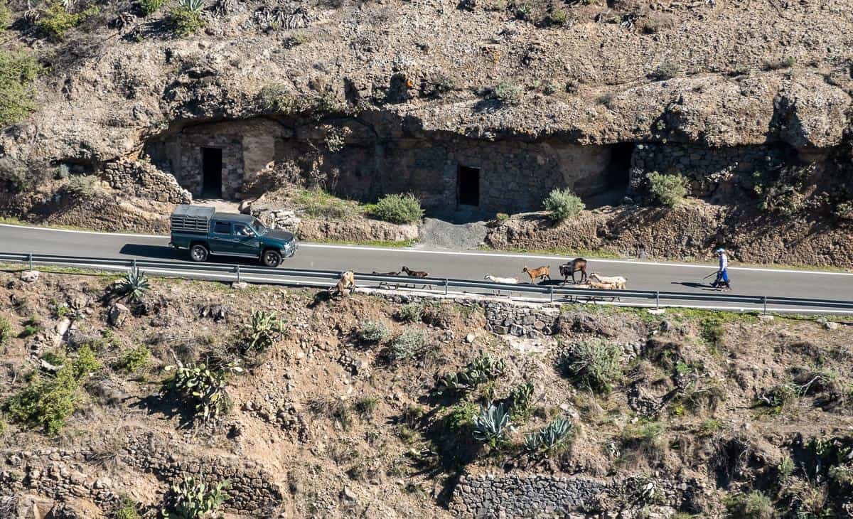
There is some road and asphalt walking to get down to the pretty village of Artenera. From above we watched as a goat farmer moved his herd onto the road – though the cars we could see, couldn’t see the goats till the last few seconds. Fortunately, they stopped in time, and we didn’t witness any carnage.
In Artenera there are many restaurants around the pretty plaza, a grocery store and lots of benches for sitting and enjoying your lunch. There is a cave house museum if you’re interested and the Mirador del Corazon de Jesús.
To return, retrace your steps. The only thing we did differently was to hike up steeply along the ridge trail starting from the low point. I highly recommend it for the views.


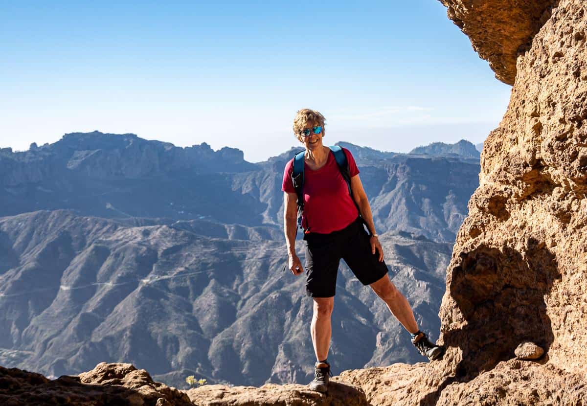
Day two hiking: Cruz de Tejeda to Roque Nublo
Distance: 12.8 km with a 10-minute taxi ride to the start to beat the crowds.
Time needed: Approximately 5 hours.
Elevation gain/loss: +660m/-835m
Level of difficulty: Moderate
Hiking description
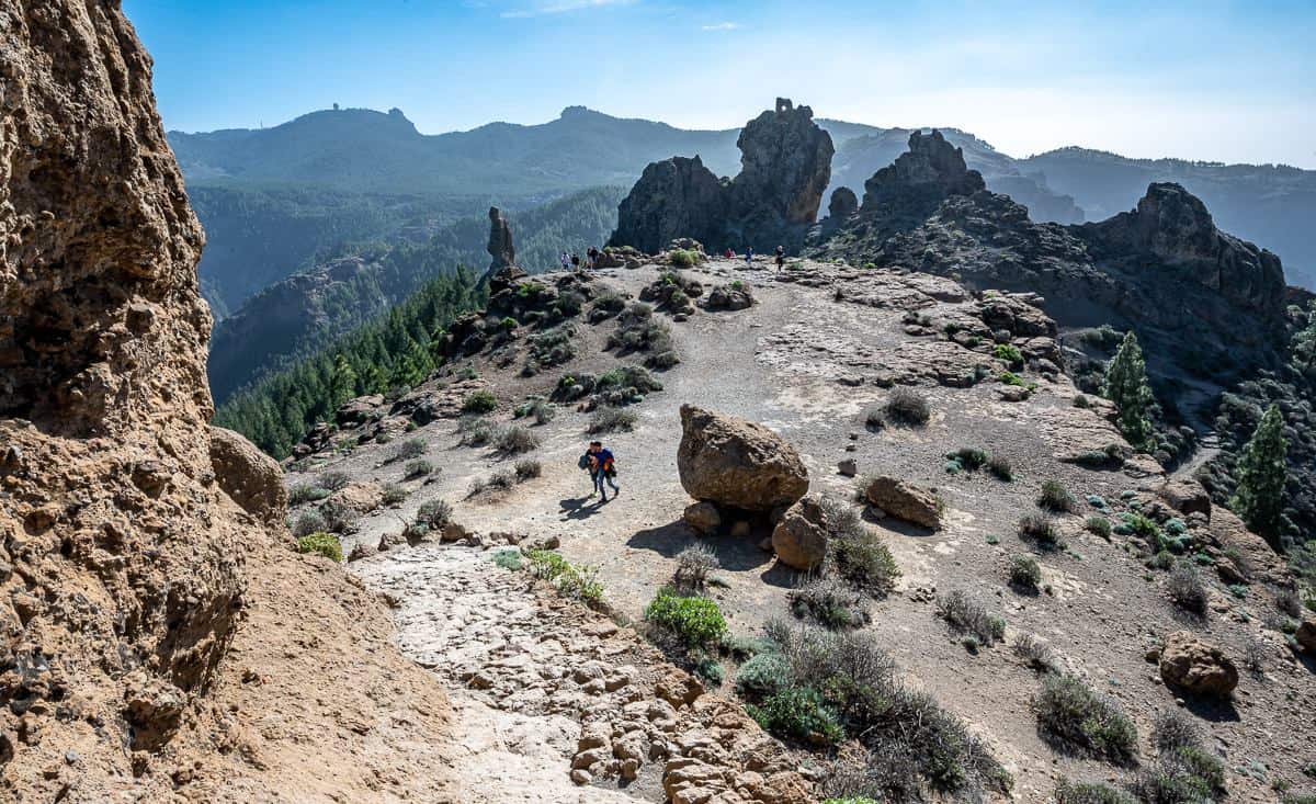
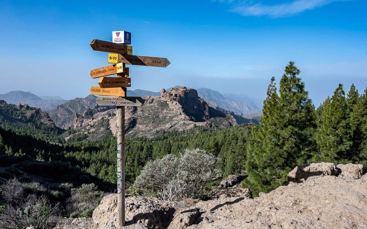
After getting dropped of at the Llanos de la Pez picnic area we hiked for about an hour through pine forests (great signage everywhere), dropping down to cross a dam – Embalse de Los Hornos. From there we made our way to La Goleta – a car park and snack shack before hiking up to Roque Nublo. At the car park we started running into people – though in nowhere near the numbers we saw on the descent.
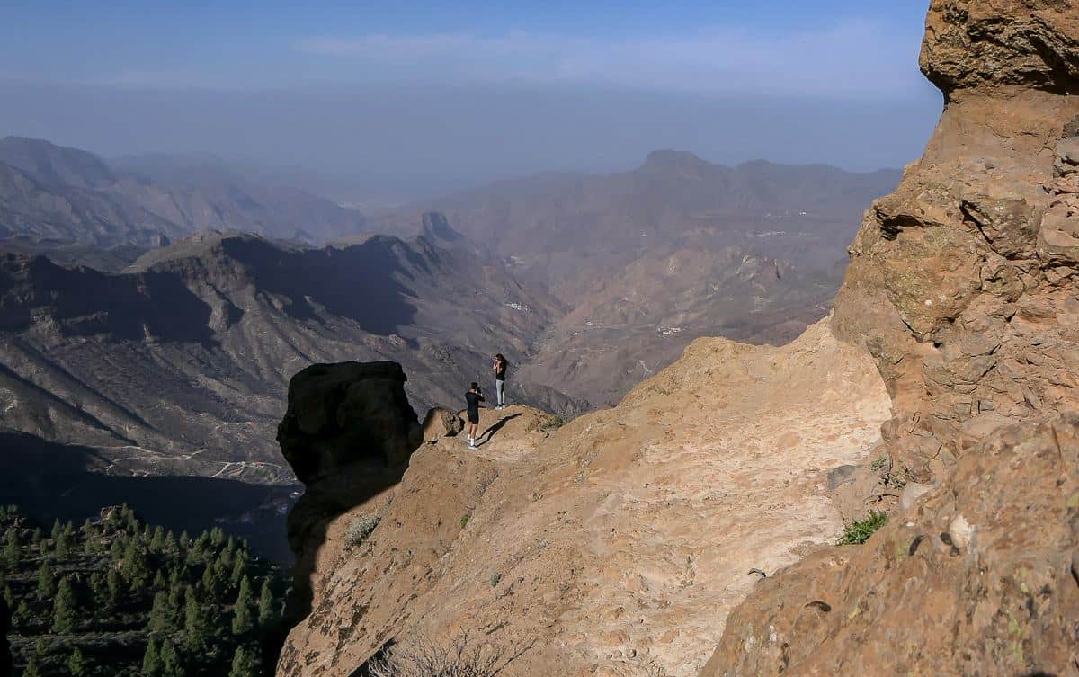
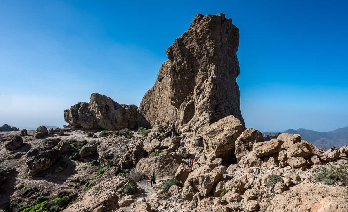
Roque Nublo, a 67-metre-high basalt needle is a popular place for rock climbers and the iconic summit you see from afar. It is equally impressive up close. To the left of it is the frog, a small squat rock and further again to the left is the monk – El Fraile in Spanish.
After about 75 minutes of hiking, you reach the broad summit plateau. The difference between 9:45 AM and 10:45 AM was striking with the number of people around. Plan to get here early!!
Roque Nublo is very photogenic. It’s possible to walk around the rock though I wouldn’t recommend it. We saw a couple who climbed over boulders to get the shot. I went a short distance and decided to turn back as the rock was full of slippery pebbles and one fall and you’d be off a cliff. No thanks.
We spent a good 45 minutes poking about, and taking in the view before retracing our steps to a signpost showing La Culata, Tejeda.
The return to Cruz de Tejeda involved a steep descent at times, on a mix of pine needles, dirt path, and pebbles. One section was full of monster-sized boulders interspersed with beautiful pine trees.
When you reach the outskirts of La Culeta, there is some quiet road walking first steeply down, and then steeply up. It was very pretty in late January as the almond trees were flowering.
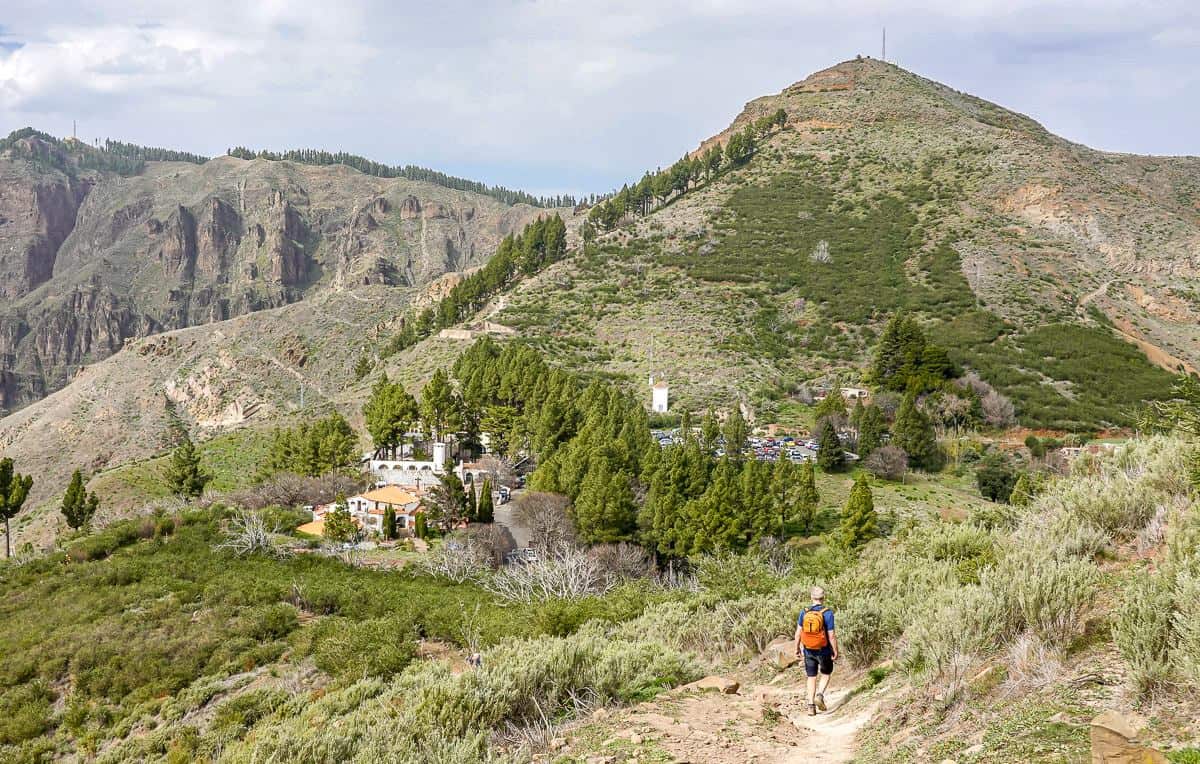
At the top of the steep asphalt road the gradient eases as you contour around the valley, passing natural springs. After roughly 4 hours of hiking reach the Degollada de Bercerra – offering superb views of Roque Nublo Rural Park. Then it’s an easy hike on a busier trail to reach the Cruz de Tejeda.


Day three hiking on Gran Canaria: Cruz de Tejeda to the Village of Tejeda
Distance: 8.4 km as a loop
Time needed: 3.5 – 4 hours
Elevation gain/loss: +/- 640 m
Level of difficulty: Moderate
Hiking description
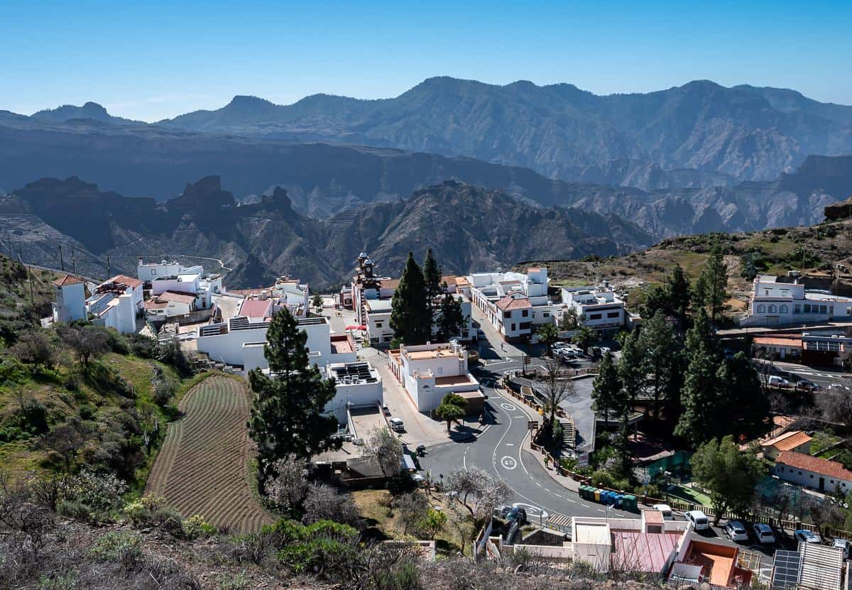
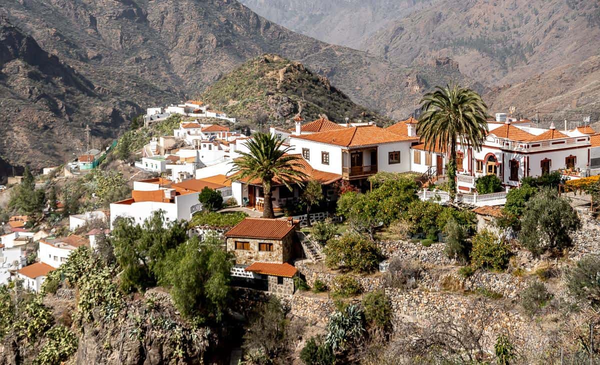
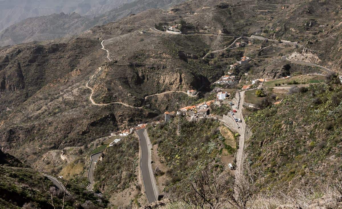
The hike to the picturesque village of Tejeda follows a gentle trail through the panoramic Tejeda Valley. It’s the best hike of any we did for food, especially baked goods. Dulceria Nublo, known for its almond pastries, is the most famous bakery on the island though we found Dulces de Tejeda to be equally good – and we tried pastries from both. We could smell the bakeries on the descent into the village!
The hike leaves the Parador crossing the GC15 road several times on the descent to Tejeda. You end up on trails traversing orchards of mostly dead almond trees and cacti. The good news is the views across the Tejeda Valley are quite splendid. On clear days you can easily see Mount Teide on Tenerife.
After only 75 minutes reach Tejeda. Reportedly this village is clear and sunny because it avoids trade winds that affect the northern side of Gran Canaria. From the town centre you can look out over orange and almond trees – which are at their peak for blooms in late January and early February.
Tejeda is a great spot for lunch though we just enjoyed pastries and coffee. Reportedly Asador Grill Hemingway, with excellent views from its terrace, is the place to go for meat. Texada serves typical Canarian food in an innovative and modern way and Cueva de la Tea is perfect for delicious local food like fried aubergines.
The return to the Parador was quite an interesting walk with great views as we followed signposts with the following names – La Degollada Cruz de Tejeda, La Crucitas, Cruz de Tejeda and El Roncon de Abajo, Cruz de Tejeda.
Some of the hiking on Gran Canaria felt like we were going into someone’s backyard but then out of nowhere a way forward would appear. We stuck to paths with green railings indicating public use for some time. The final part of the trail climbs steeply for over a kilometre to emerge right below the Parador. We made a beeline at the end for a cold drink and ice cream.


Day four hiking Gran Canaria: Cruz de Tejeda to Fontanales
Where to stay: One night atCabañas Valle Verde.
Distance: 15.1 km
Time needed: 5.5 – 6 hours
Elevation gain/loss: +675m/-1190 m
Level of difficulty: Moderate
Hiking description
After an easy climb out of Cruz de Tejeda descend through a beautiful open pine forest where you can’t miss the sound of woodpeckers. After about 90 minutes pass Tierras Blancas lavaderos – one of the many washing areas you pass while hiking on Gran Canaria.
Water is a scarce resource on the island. These washing areas were built by water-rich communities, as part of the conditions in providing water to communities without. The idea was that local people had the right to use the water for laundry, domestic and husbandry needs.
Visit the Mirador de Unamuno before continuing through the hamlet of Lanzarote. Reach the red earth track of Calle El Lomo – one of my favourite sections of any hiking on Gran Canaria. The track passes by reams of wildflowers and a small eucalyptus forest. It’s stunning for about 1.5 km. At 7.7 km arrive at Mirador de Zamora.
The next stop via country roads and trails is the town of Valleseco. Then there is a steep climb that ends at Barranco de la Virgen. After you cross the barranco – a sweat-inducing exercise in the heat, you descend gradually to Fontanales. On the way there you’ll pass colourful houses and yards full of wildflowers.
There isn’t much to Fontanales, a town known for its pine, chestnut, and walnut trees in addition to queso de flor – a rich creamy cheese made locally. There aren’t a lot of choices on where to stay. Cabañas Valle Verde is very basic but the family running it is lovely. We showed up and were immediately handed a glass of fresh squeezed orange juice – and again at breakfast. What a treat!


Day five hiking: Fontanales to Agaete
Where to stay:Hotel Rural Finca Las Longuerasfor two nights
Distance: 14.5 km + 2 km if you don’t descend the steep barranco
Time needed: 6 hours
Elevation gain/loss: +675m/-1520 m
Level of difficulty: Hard because of the steep descent.
Hiking description
It’s a wonderful hike from Fontanales to Agaete that includes some walking on mostly quiet roads though the final 700 m to the hotel is busier.
After leaving the road near Fontanales, hike on a beautiful trail through a forest of pine trees followed by a lovely section through rounded hills filled with sheep. Next up is 2.5 km of hiking on a quiet country lane where you’ll see signage for local cheese makers. They are a bit out of the way to visit on foot considering the distance you walk today.
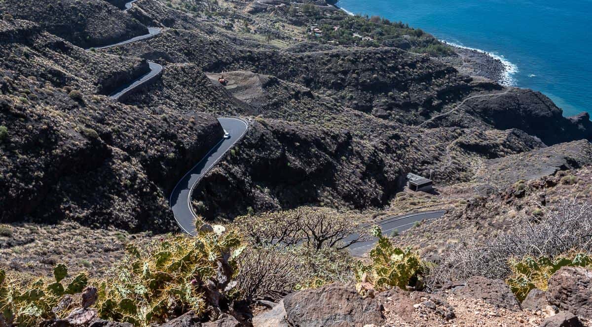
After passing a bar where you can get lunch (Bar Antonio Pinocha) continue walking downhill heading for Presa Los Pérez and El Hornillo. When you see a steep path signposted El Sao and Agaete you can begin a very steep descent, though it’s potentially dangerous if wet, or continue on the road for another 2 km which is what we did. The views from the road out to Agaete and the ocean are spectacular.
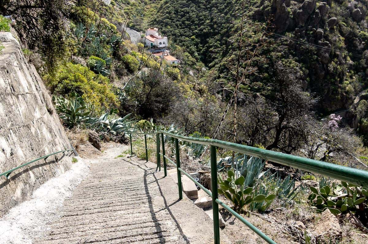
At the yellow and orange house pictured several photos below begin a steep but fabulous descent, sometimes on stone steps past houses built into the mountain. Much of this part of the hike is in the shade.
Part way down passRefugio El Hornillo– a place you can simply get a cold beverage or meal but also one where you can spend the night. What a place to do that!!!
In no time you meet up with the steep trail that descends through the barranco and then the road that will take you to Agaete. You’re on an off the road from here to the hotel.
We stopped at Bar La Palma for a much-needed sugar boost via an ice cream bar. (You’ll hike back here tomorrow to start the hike up Montana Bibique.) From the bar we followed chequered pavement to a road. After a further 700 m of walking on a sometimes-busy road we dropped down on a cobbled path to reach an alleyway leading to the hard-to-miss pink Las Longueras guest house. You can see it from a distance.
This is a lovely place but don’t expect fancy rooms. It’s got a big pool surrounded by orange trees and a really good breakfast out on a patio. I was very happy to have a few nights here.


Day six hiking Agaete to Montana Bibique and Puerto de Las Nieves
Distance: 14.1 km
Time needed: 5.25 – 6 hours
Elevation gain/loss: +/- 690 m
Level of difficulty: Moderate but some airier sections.
Hiking description
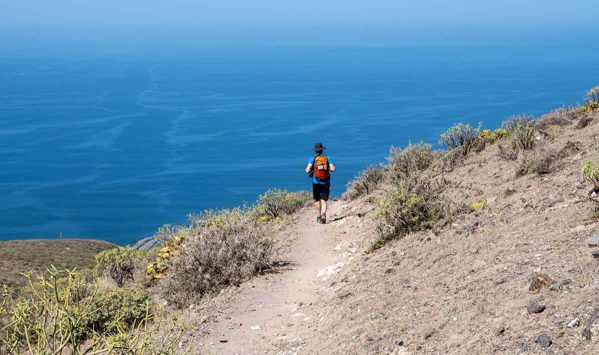
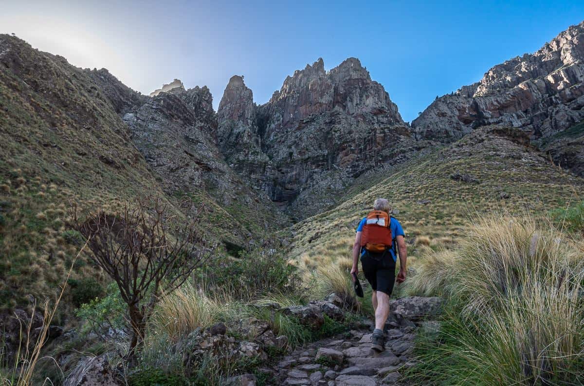
Today is a grand day of hiking on Gran Canaria even if it starts off with a road walk. You must retrace your steps from the hotel to San Pedro. From there it’s a good climb and a scenic one up Montaña Bibique, at the edge of Tamabada National Park. You pass below the Caves of the Ancients where troglodytes lived, Gran Canaria’s first known inhabitants.
The trail levels out once you reach the top and follows a vertiginous ridge to the cliff top above Puerto de Nieves that some people might not feel comfortable on – though trust me, the trail is plenty wide. Check out my Instagram reel so you can see what it’s like to hike. I absolutely loved this section, especially all the grand views along the northwest coast of the island.
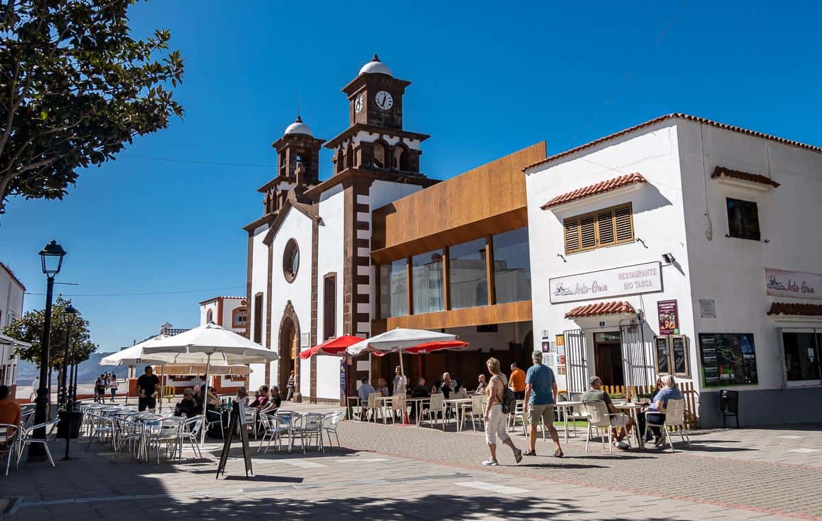
Puerto de Las Nieves, known for its white cottages, is also a good lunch destination if you’re after seafood. You’ll feel like you’re in Greece with all the blue and white buildings.
After a look around the town including the beach, you have the option of hailing a taxi for a 10-minute journey back to the hotel or hiking about 3.5 km back to the hotel via a trail that more or less parallels the highway. The Barranco de Agaete riverbed will be on your left on the final approach to the hotel.
It was a hot day of hiking for us, so what a treat to cool off in the hotel’s beautiful pool. For dinner I highly recommend Ragu Agaete, a restaurant with delicious food on the waterfront. Taxi Oscar can get you there.


Hiking map showing approximate Gran Canaria hiking locations
More hikes in Europe to try
- Munkebu Hut Hike + Munken, Lofoten Islands
- Reinebringen Hike, Lofoten Islands: A Complete Guide
- The Fabulous Mannen Hike in Norway’s Lofoten Islands
- Kungsleden Trail Guide: Abisko to Nikkaluokta, Sweden
- The Best Part of Hiking the GR221 in Mallorca
Click on the photo to bookmark to your Pinterest boards.
