A Guide to Backpacking the North Coast Trail on Vancouver Island
If you’ve already backpacked the West Coast Trail and Juan de Fuca Trail and you’re looking for a challenge then the North Coast Trail is the next obvious one to do – though at some point I’d also recommend you backpack the Nootka Island Trail accessed from Gold River.
The North Coast Trail is harder than the West Coast Trail but it’s not nearly as busy – and no reservations are required other than for the boat shuttle. You can nix the shuttle if you’re trying to save money and do and out and back hike, though I wouldn’t recommend it. However, you could do a “North Coast Trail taster” and hike from the parking lot to the Irony Creek campsite and back.
You’ll be treated to some of the best campsites on Vancouver Island (Irony Creek on Shuttleworth Bight and Nissen Bight), pristine white beaches, very few people, exceptional sunsets, and lots of wildlife including sea otters, whales, black bears, possibly wolves and seabirds.
Mud, roots, rain, ropes galore, and uneven beach walking is all part of the experience too – but a great one especially if you’re lucky with mostly dry conditions – as we were.
May 2025 update: The trail is closed temporarily between Shushartie Bay and the trail junction south of Nissen Bight as BC Parks assesses and repairs the winter storm damage. Check BC Parks website before planning a trip.
This post includes some affiliate links. If you make a qualifying purchase through one of these links, I will receive a small percentage of the sale at no extra cost to you. Thank you very much for your support.

Would you like to save this?

North Coast Trail overview
Distance: 43 km one way but most people hike 58 km and combine the North Coast Trail with the Cape Scott Trail to end at the San Josef trailhead. There is an option to get a boat shuttle at Fisherman’s Bay that will let you bypass the hike back to the parking lot – and the drive out.
Time needed: 5 – 8 days including time to visit the Cape Scott Lighthouse and spend a night at San Josef Bay.
Difficulty level: Challenging. I’d recommend that you have lots of coastal hiking experience like the Juan de Fuca Trail and Nootka Trail before you attempt the North Coast Trail.
Dogs: Not permitted because of the high wolf concentration. It would also be very hard to get them down off the cable car tower.
Wildlife: Black bear, wolves and even a cougar might be seen on this wilderness backpacking trip. Carry easy to access bear spray. Know what to do if you meet a bear or a wolf.
Fires: Check for fire bans before you go. Fires if allowed should be made below the high tide line or in metal rings.
Trail highlights: Shuttleworth Bight (by the Irony Creek campsite), Nissen Bight, west coast beaches, cable car crossings, salmon spawning in the Nahwitti River, beautiful forest with old-growth trees, sunsets.
Know before you go: Visit Destination BC’s Know Before You Go page. When conditions change rapidly related to wildfires or severe weather, it pays to check out Drive BC, BC Wildfire Service, and Emergency Info BC. It would be a good idea to download and allow notifications from Alertable, an app which delivers geographically relevant updates. Hello BC also offers lots of useful planning information for visiting the province.


North Coast Trail trip planner
Have a look at the distances on the chart below, keeping in mind that much of the hiking is very slow going. This will aid you in deciding how many days you want to hike. Don’t forget to factor in the 14.2 km hike from the Nissen Bight campsite to the Cape Scott trailhead. It’s not officially part of the North Coast Trail, but you need to hike it to get out – unless you take the boat shuttle back to Port Hardy – and it’s pricey!
All campsites have potable water (see section near the end of the blog), bear-proof lockers and pit toilets with toilet paper. Some have tent pads in the forest where others are simply flat sections of beach above the high tide line.
| 0 km | Shushartie Bay TH and campground |
| 8.1 km | Skinner Creek campground |
| 11.0 km | Nahwitti River campground |
| 14.5 km | Tripod Beach unofficial campsite (+ tidal obstacle) |
| 16.0 km | Cape Sutil campground |
| 23.8 km | Irony Creek campground |
| 29.0 km | Wolftrack Beach unofficial campsite |
| 35.6 km | Laura Creek campground |
| 43.1 km | Nissen Bight campground |
Maps of the North Coast Trail
Be sure to have an offline hiking app like Organic Maps on your phone before you head out.
I always carry a paper map too. Pick up a copy of John Baldwin’s 1:50,000 North Coast Trail map and/or the map put out by Wildcoast. Paper maps are very useful for showing the campsites, water sources, cable car locations, headlands – and overall, just putting the trail in perspective in a larger format. I will say that the trail is easy to follow, and never did we have navigation issues, save for discovering a minor headland that couldn’t be bypassed at high tide

Permits and preparation for the North Coast Trail
Permits
You will need a backcountry camping permit from BC Parks. (Click on Backcountry and then Backcountry Registration.) You can register and pay online before you show up in Port Hardy. Be sure to carry printed copies in case your phone doesn’t work. The cost is $10 per person per night. At the trailhead you can also purchase permits – with cash only.
Leave No Trace Principles
On this remote wilderness hike you will be backpacking through a pristine landscape. I think we all want to keep it that way. Please familiarize yourself with the seven Leave No Trace principles including respect wildlife, leave what you find, and dispose of waste properly.
Season and weather
The best months to do the North Coast Trail hike are June to September. Weather is unpredictable on northern Vancouver Island, so you need to be prepared for sudden weather changes especially related to hard rain and thick fog. Count your blessings for every sunny day you get!
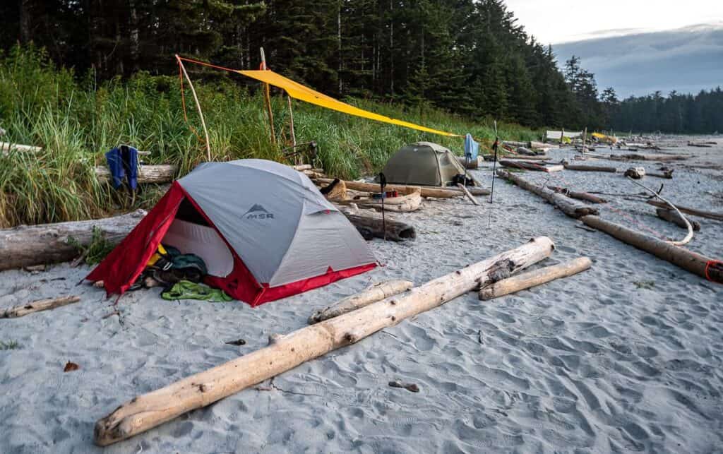
I would highly recommend that you carry a tarp (and enough rope) to put over your tent in case it rains really hard and another tarp (perhaps shared with friends) – that you can sit under to cook, eat and relax.
Fitness preparation
Make no mistake. The North Coast Trail remote wilderness hike is tough. You need to be able to climb up and down muddy hills, scramble over boulders, ascend and descend steep hills with ropes – while having a pack on your back.
Not only is the hike strenuous, but most of it is on rough, unforgiving terrain. Try to get another backpacking trip or two under your belt beforehand. Your body will thank you! We did the Northover Traverse multi-day hike in Alberta the week before and it really helped to toughen me up.

North Coast Trail hiking tips and challenges
Mud and steep terrain
Take your time when the hiking gets tricky on the North Coast Trail, especially when crossing slippery rocks or logs. On the ropes don’t be rushed, especially on the hike to Cape Sutil when some sections are very steep.
Use hiking poles to test for water depth in mud holes and to help keep your balance.
Weather Challenges
Be prepared for truly awful weather while backpacking the North Coast Trail. Layer up, keep warm clothes in a dry bag and change into them once you get to camp. Wear waterproof hiking boots and gaiters to keep your feet dry. And put up a tarp in the trees on a windy day o stay warm.

Gear and packing list
Essential gear for the North Coast Trail
Good waterproof gear is a must! Take waterproof pants, a waterproof coat with a hood and a ball cap to keep the rain off your face.
Well broken in waterproof hiking boots are very important. I’d also recommend a pair of leg gaiters as you’ll get very muddy.
Collapsible trekking poles and bear spray in a bear spray holster are a must.
A communication device like a Garmin InReach Mini 2 is essential if there is an emergency.
Clothing
Pack moisture-wicking base layers (I like merino wool as it won’t smell after a week), a warm insulating layer and a waterproof outer layer.
On this hike I took two t-shirts, one long-sleeved merino wool shirt, a warm fleece jacket, a lightweight but warm down jacket and full rain gear.
Camping gear
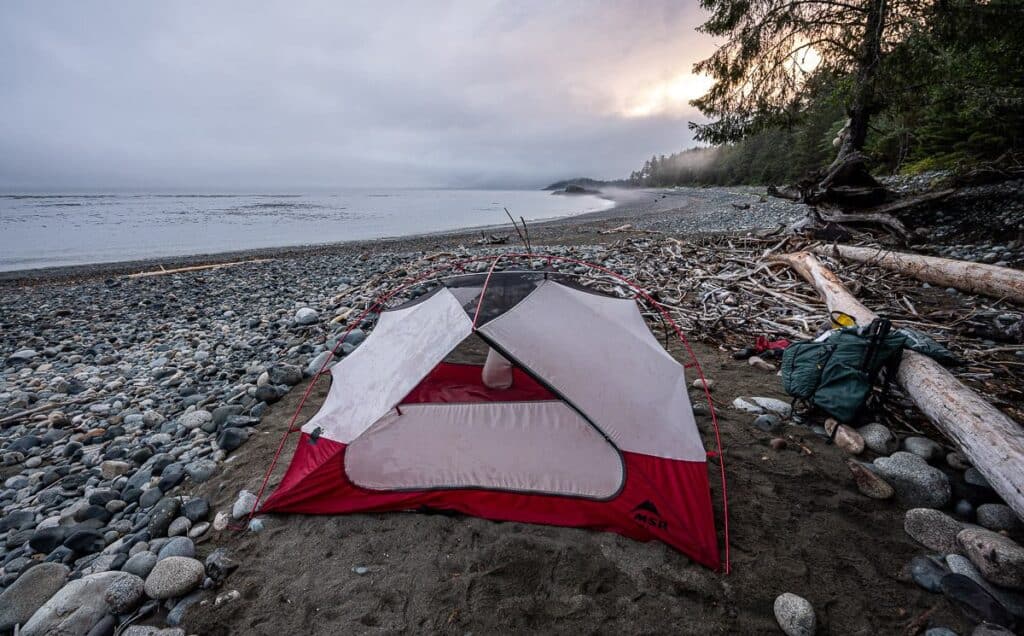
We love our MSR tent and have the 3-person version so we have some room inside. We slept for a week in the two-person MSR tent on our Kluane National Park backpacking trip and found it way too cozy. I’d rather carry the extra weight.
Sleeping bags are very personal. The lightest one that is still very warm that I’ve got is the MEC Aphelion down sleeping bag. It only has a half zipper, but it packs down into nothing.
A lightweight camping stove with fuel cannisters seems to be the norm these days though we still like our MSR WhisperLite stove.
Food and water
Don’t forget to pack a water filter or water purification tablets. Some of the water sources along the North Coast Trail aren’t the best tasting. See below for water sources along the length of the trail.
Food should be calorie dense but lightweight. If you’re buying pre-packaged meals, check out how many calories they offer per serving. I also recommend taking mixed nuts, jerky, protein bars and chocolate for snacks.
North Coast Trail logistics and navigating
How to get to Port Hardy and Cape Scott Provincial Park
Cape Scott Provincial Park is at the northern tip of Vancouver Island. The closest town of any size to the park is Port Hardy, a 4-hour drive north of Nanaimo via Highway 19.
By ferry
BC Ferries run to Nanaimo from both Horseshoe Bay and Tsawwassen on the mainland. You can rent cars in Nanaimo, Campbell River and Comox.
By car
From Port Hardy to the trailhead in the Cape Scott parking lot, it’s a rough 67-km drive on dirt roads (that are notoriously muddy) via the village of Holberg. If you’ve forgotten fuel or food, visit the Holberg Pitstop. It’s also got an onsite liquor store.
By air
You can also fly to Port Hardy via Pacific Coastal Airlines from Vancouver, Powell River, Comox, Victoria and Kelowna – but not all flights are direct.
Transportation options to the trailhead
The easiest way to hike the North Coast Trail one way is with a boat shuttle to the start of the trail and a van pick up at the end of the trail. Book in advance with Cape Scott Water Taxi (Note that you can park your car on their property in Port Hardy for a fee.)
You don’t have to start at Shushartie Bay, the official start of the North Coast Trail. You can choose other start points including Cape Sutil, thereby bypassing the two hardest hiking days on the trail. Chat with the helpful owners to determine the best dropoff location for you.
Note that there is a minimum of four hikers to run the shuttle. Prices are $150 +GST per person plus tax for the boat shuttle in 2025 to Shushartie Bay.
You can also organize a van pickup in the Cape Scott parking lot. It leaves daily and should be booked at the same time you book the water taxi. The cost in 2024 is $125 +GST per person.

Trail sections and campsites
Day 1: Shushartie Bay trailhead to Nahwitti River campsite
Distance: 11.0 km
I was dreading the first day on the North Coast Trail as I had heard from my son-in-law how muddy and hard it was. My expectations were so low that I enjoyed much of the day, especially the boardwalk sections through grassy meadows and upland bog.
With a 7 AM boat shuttle, we were at the Shushartie Bay trailhead by 8 AM. I gave thanks that we weren’t planning a night here as the campsites were dark, and in the woods, not how I would want to start or end the trip.
You will find a map and tide tables on a bulletin board as well as a place to pay if you haven’t already at the trailhead. From there take about 15 steps and then head straight up with the help of a rope. I was out of breath within a few minutes of starting, but fortunately it got much better. You’ll pass the campsite in short order too. The first kilometre involves lots of climbing with the help of fixed ropes.
After the first kilometre the grade eases and the hiking going forward is easier (the term is relative on the NCT!) as you alternate between lovely boardwalks and muddy sections. It was far drier than most years when we hiked it the third week of August 2024.
At 2.5 km you reach the high point of the entire North Coast Trail at 245 m. It’s generally downhill from here all the way to Skinner Creek. There is one marker along the way to look for – marking the halfway point to the campground.
To get to the Skinner Creek campground you must take off your pack or crawl on your hands and knees under a giant log to get to the mouth of the river – where great flocks of seabirds fill the air. Continue on the beach for up to a kilometre if the tides are less than 2.8 m. If the tide is higher, as it was for us, climb steeply from the beach with the help of ropes to meet the bypass trail.
After a kilometre of muddy forest walking reach a gravel beach. Continue for a short distance to reach the campground. After dinner we spotted a lone black bear in the estuary feeding. We also marveled at the salmon spawning in the Nahwitti River.



Day 2: Nahwitti River campsite to Cape Sutil campsite
Distance: 5 km
You’d think a 5 km day backpacking on this remote wilderness hike would be a snap. But this is one hard day with lots of up and down, some steep and gnarly rope sections and a tidal obstacle at Tripod Beach you need to account for.
We hit the trail by 7:50 AM and by 8:30 AM had crossed the Nahwitti River by cable car. The sweat poured off our faces over the next few hours as we climbed up and down to reach the last set of 200 stairs called Long Leg Hill that descend to Tripod Beach. It was named for a rock in the shape of a tripod.
The major tidal obstacle on the North Coast Trail are the rocks at the west end of Tripod Beach. The are only passable at tides below 2.8m.
After a long break it was rope section after rope section, including some that were quite difficult as they were close to vertical. This is one of the hardest sections backpacking the North Coast Trail!
Once on the beach at Cape Sutil, we enjoyed a restful day relaxing, going for a quick swim and napping in the sun. At low tide be sure to check the crevices near the rocks at the western end of the beach.


Day 3: Cape Sutil to Irony Creek campsite
Distance: 7.8 km
We didn’t get going till 9:30 AM which was a welcome change after a lot of early starts. We had to first cross a peninsula which was very muddy from the night before. There was a rhythm to the hiking – follow a rough trail inland to steep gravel pocket beaches strewn with massive pieces of driftwood in a cove and repeat.
Near the 22 km point on the North Coast Trail, it was time for some beach walking. It was tough going in places as the beach was steep, so walking was very uneven.
About three beaches shy of Irony Creek Beach, the tide was up, so the regular route was unavailable. We had to climb up and down rock and time the waves to get around a small headland, yet there is no mention on the map.
There are several water sources on the way to Irony Creek that aren’t shown on the map – so fill up when you come across one.
We camped part way down the beach, some distance from the bear boxes. We thoroughly enjoyed our campsite and the spectacular sunsets over Shuttleworth Bight. I think this is the best campsite on the trail though Nissen Bight and Nels Bight come a close second.



Day 4: Irony Creek campsite to Laura Creek campsite
Distance: 11.8 km
After a beautiful beach and forest walk, we took the cable car across Stranby River. That was followed by not-too-difficult beach walking – and then a repeat of the day before, rocky beaches punctuated by headlands, but the hiking wasn’t difficult.
After passing Christiansen Point, it was an afternoon of rocky beach walking near high tide, some of which was difficult because the beaches were very steep.
We crossed Laura Creek and found a nice campsite a short walk away. The beach here is very rocky at low tide with lots of tide pools. It was one of the places where we saw whales blowing off in the distance. The forest campsite is about a 6-minute walk away. It wasn’t where I would want to camp.


Day 5: Laura Creek Campsite to Nissen Bight campsite
Distance: 7.5 km
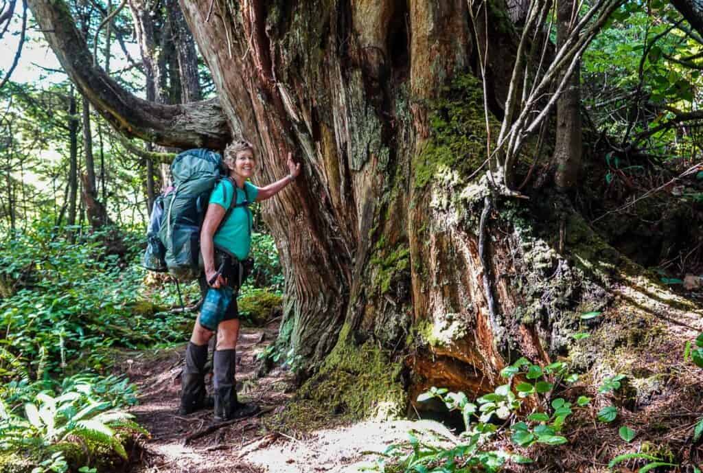
We headed off by 9 AM on yet another sunny day – a bit of a miracle on the North Coast Trail. It took three hours to get to Nissen Bight, named after a Danish settler Nels C. Nissen, because much of the trail was in great shape with excellent boardwalks.
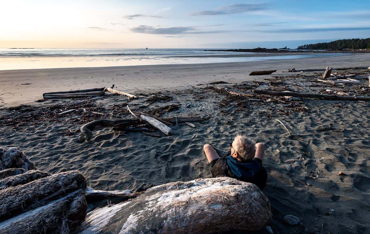
What a change to be hiking quickly. By 12:30 we’d found a nice log on Nissen beach to enjoy lunch with a view. There are two campsites at either end of the beach. You can’t go wrong here! So ends the formal North Coast Trail!


On to Nels Bight
We elected to camp at Nels Bight instead of the quieter Nissen Bight as we had budgeted a full day to do the hike to the Cape Scott Lighthouse.
It’s 5.7 km from the western end of the beach at Nissen Bight to Nels Bight. We didn’t want to have to add that distance to the 11 km out and back hike to Cape Scott – and we liked the idea of being at the same campsite for two nights.
It was easy walking to Bels Bight and as a bonus we ran into Mike from MB Guiding – the fellow you want to book with if you’d prefer a guided North Coast Trail hike.

Water sources on the North Coast Trail
There are reliable water sources at all campsites on the North Coast Trail – but not all are equal. Don’t forget it rains a lot at the tip of Vancouver Island so you can always try to collect rainwater.
Shushartie Bay campground – None!! If you’re coming by boat shuttle, pack in water. There’s an inland bog 1.5 km up the trail where you can find water in an emergency.
Skinner Creek campground – Skinner Creek is the source, but avoid any water contaminated by the seabirds – and avoid salt water by collecting above the high tide line.
Nahwitti River campground – You have to go along ways up the Nahwitter River to avoid the brackish water, especially if you’re refilling at high tide! The water we collected here definitely had a brackish taste to it.
Tripod Beach unofficial campground – Get drinking water from a tiny creek.
Cape Sutil campground – You’ll see a sign saying water part way down the beach. Follow a trail to a collection pool pictured below.
Irony Creek campground – Collect from Irony Creek.
Wolftrack Beach unofficial campground – Collect from a nearby small stream.
Laura Creek campground – Collect water from Laura Creek. Most of you will camp nearby so it’s quick to get. If you camp in the woods on the tent platforms, you’ll have about a 1 km out and back walk to get it.
Nissen Bight campground – The water source is from a creek in the forest at the east end of the beach, about a km away from where you’ll probably camp. If you’re finishing the North Coast Trail and plan to spend the night here, save yourself 2 km of walking and fill up before heading looking for a campsite. You will find signage directing you to the source.
Nels Bight campground – Though not officially part of the North Coast Trail, we elected to stay here for two nights, so we had a shorter distance to hike to the Cape Scott Lighthouse. It is a hike to get water – located at the southeast end of the beach. There is signage directing you to the water source which can apparently run dry in summer. But it wasn’t a problem for us.

Wildlife and safety considerations
Wildlife encounters
There is a high probability that you will see wildlife on the North Coast Trail hike, especially black bears. We saw six in total and just missed a mama black bear and her three cubs near the Cape Scott Lighthouse.
We basically walked by the black bears on the beach – making noise and giving them lots of warning. They were disinterested in us – but very interested in eating something in the seaweed.
We saw wolf tracks – lots of them at one spot, but never sighted one. We know there are cougars around, but again we came up short.
We did see numerous sea otters on the first two hiking days as well as whales way offshore. Keep an eye out for river otters too.

Bear safety
Be bear aware and know how to stay safe in bear country. Always carry easy to access bear spray and know how to use it. Be sure all your food is put away in bear boxes – available at all campsites. If you see fresh bear scat, make lots of noise. Remember your voice works much better than bear bells.


Tides and Coastal Hazards
On the North Coast Trail there is one major tidal obstacle at Tripod Beach on route to Cape Sutil. If you don’t pass at low to mid tides, you’ll have to wait six hours.
Our timing was such that we needed to camp at the Nahwitti River Campsite the first night, so we could get to Tripod Beach just after Km 15 before the tide blocked our way. Be sure you know ahead of time when low tide is. Carry tide tables and know how to use them. You will find them tacked to an information board at every campsite.
Use Cape Scott – 08790 tide tables. Check the 7-day and hourly prediction tide predictions and heights of high and low water.
Be careful walking in tidal zones. Look for rogue waves, and slippery rocks. Respect the ocean as it can turn nasty on a dime.
First aid and emergency plans
Interestingly, there are more experienced hikers on the North Coast Trail – especially as compared to the West Coast Trail – so there are fewer accidents.
Still, you should carry a decent-sized first aid kit for a trip of this length – and be able to deal with blisters, sprains and cuts. One item that is useful in your first aid kit is Crazy Glue for small, clean cuts. Mayo Clinic warns that there could be infections or scarring but I have spoken with an emergency room doctor and a coast guard medic who both recommend it under the right circumstance.
For blister care check out these products:
- Leukotape – This came highly recommended to me by a fellow who was hiking the whole of the Great Divide Trail in Alberta and BC.
- KT Blister Tape – Several hikers I have chatted with recently have come to love this tape for blisters. I also recommend KT Tape – an athletic tape that I’ve used for foot support on long hikes.
- Compeed – I discovered this Band Aid-like product when I was hiking the Cumbria Way in England and ended up with massive blisters after getting wet feet. I always pack it on multi-day hikes – and I find it speeds up the healing process too. Pricey but worth it.
Where to stay in and near Port Hardy
For a B&B: Check out the exceptionally rated Telco House B&B.
For cabins: Visit Port Hardy Cabins – rated superb. I also very much like Ecoscape Cabins, just a few minutes’ drive from Port Hardy.
Hostel: The North Coast Trail Backpackers Hostel is rated as very good.
More multi-day hiking trips you might enjoy
- 10+ Must Do Backpacking Trips in Kananaskis Country
- La Cloche Silhouette Trail in Ontario – A Complete Guide
- Sawback Trail Hike: Johnston Creek to Baker Lake in Banff NP
- 10 Wildly Scenic Backpacking Trips in Canada
- Coast to Coast – Canada’s Long Distance Hiking Trails
Click on the photo to bookmark to your Pinterest boards.

