The one hike you’ll read about if you start researching “best hikes in Norway’s Lofoten Islands” is the Reinebringen hike.
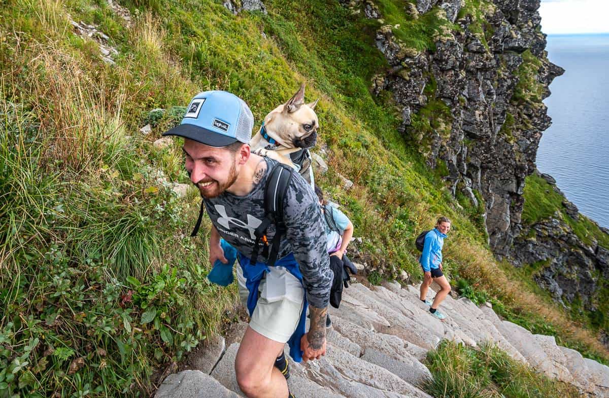
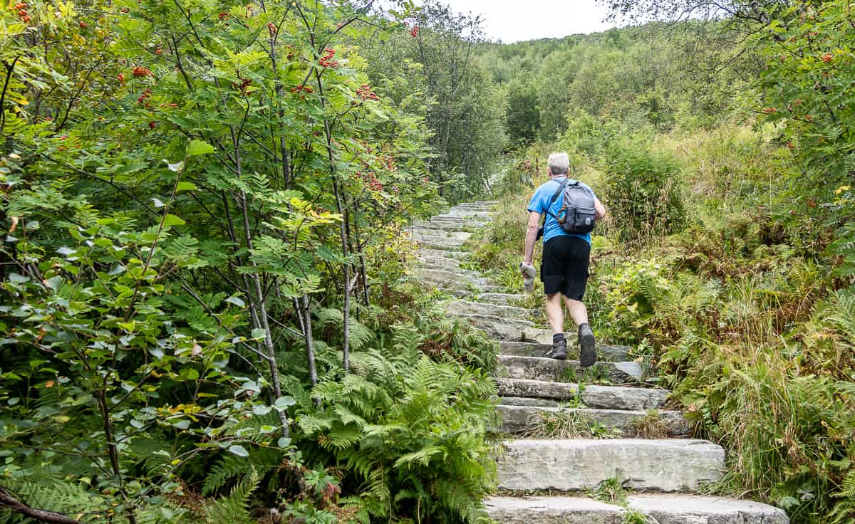
It’s a steep hike on beautifully built steps, thanks to a team of Sherpas from Nepal. Over the past 18 years, paths and stairways in over 100 locations across Norway have benefited from reconstruction thanks to the Sherpa’s expertise in difficult terrain.
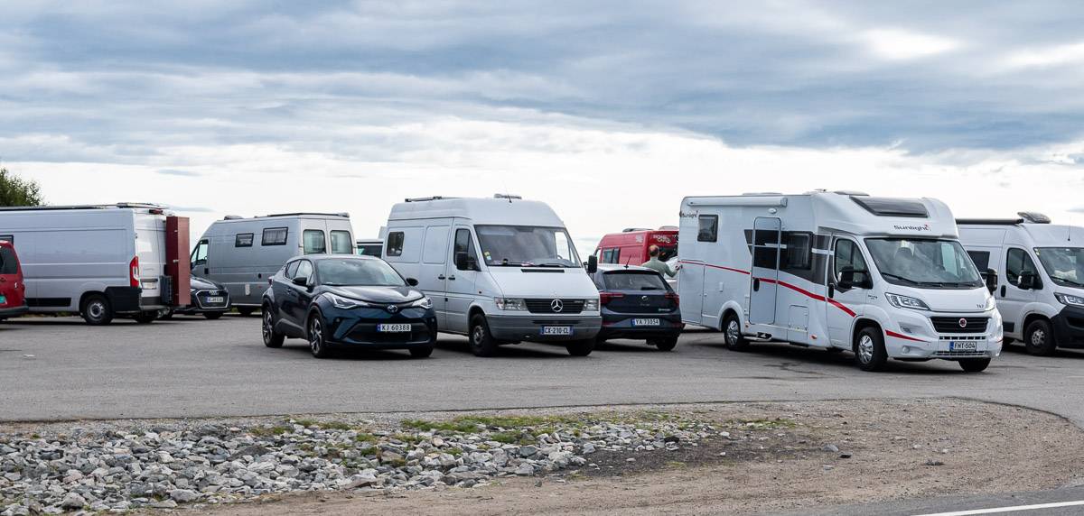
The crux of the Reinebringen hike isn’t the steep trail – but nabbing a parking spot – and that’s what put me off.
I’m not usually a fan of crowded hikes, so this one wasn’t at the top of my wish list over our week-long hiking trip in the Lofoten Islands. However, on an uninspiring late summer day, I said to John that if there was a parking space at one of the parking lots as we drove past Reine, that it would be a sign we should stop and hike it.
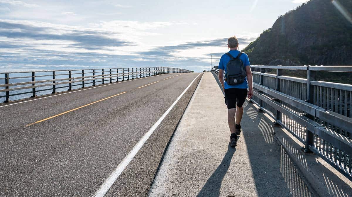
We were driving a very small rental car – and there was one tiny parking spot available sandwiched between two camper vans at the parking lot before the Ramsvik Tunnel as you drive north towards Reine, so we grabbed it.
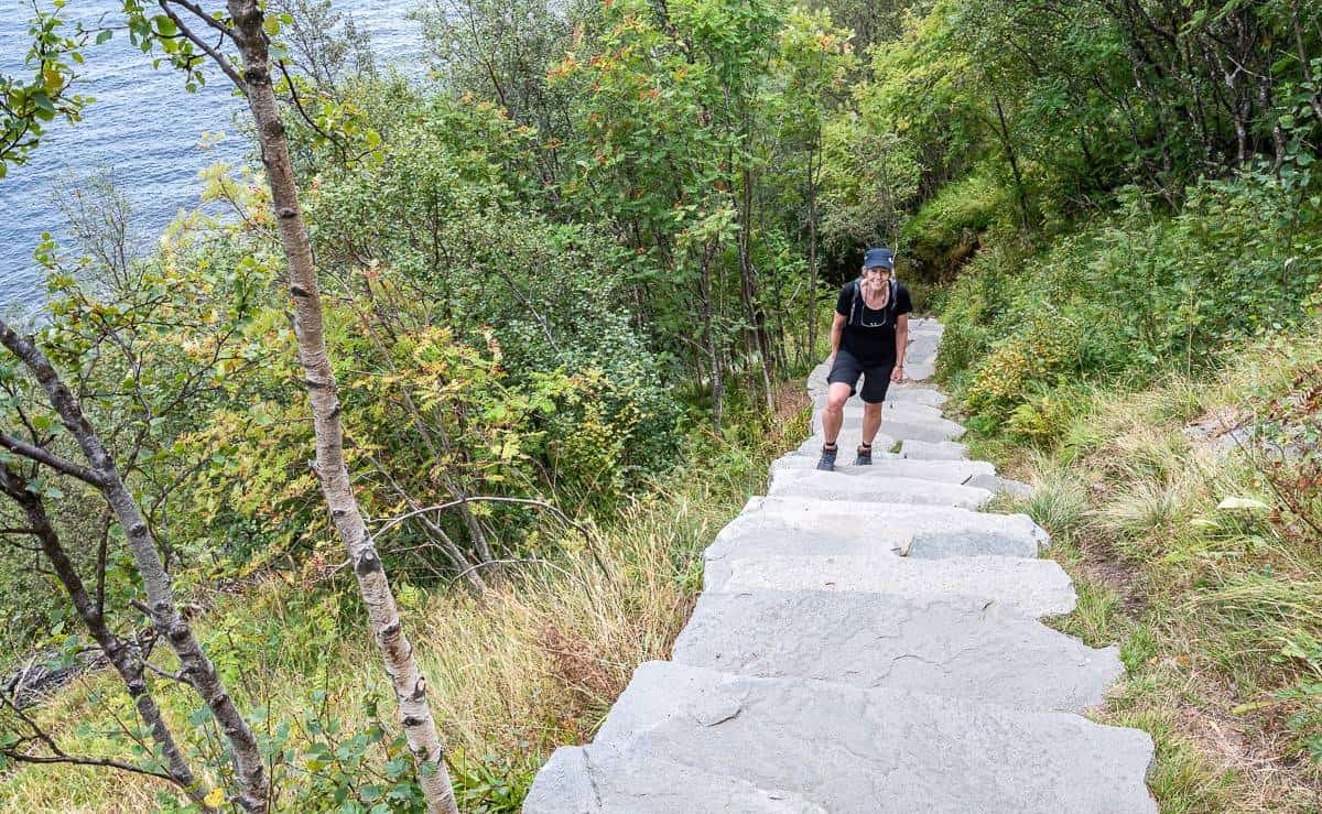
From there it was a 1.3 km walk along the highway to reach the trailhead. There was more walking on the highway than there was on the hike – but so be it.
Was it worth the stop? You bet. Read on for all the details.
Also, if you want a real sense of just how steep the Reinebringen hike is, be sure to watch my reel on Instagram.
Recommended reading: 7-Day Lofoten Islands Itinerary With A Hiking Focus
This post includes some affiliate links. If you make a qualifying purchase through one of these links, I will receive a small percentage of the sale at no extra cost to you. Thank you very much for your support.

Where to park for the Reinbringen hike
Reinebringen is located southwest of the village of Reine – with the stairs starting on the western side of the Ramsvik tunnel along an old road.
There are four places where you can park for the Reinebringen hike. Some are free while others like the ones in town charge a fee. Count on 40 – 50 NOK an hour.
From the first three parking lots described simply follow the trail by the highway towards Reinebringen. When you get close to the Ramsvik Tunnel, look for a hiking trail to the left. Follow this old road/hiking path until you see signage pointing to the steps up Reinebringen.
For the last parking lot, cross the E10, hike across the bridge, then cross the E10 again and climb over the barrier. Follow the trail to the tunnel and the obvious trailhead.
Reinehalsen Parking
The Reinehalsen parking area is the one that is closest to the Reinebringen hike trailhead – but it’s still an 800 metre walk along the highway. The parking lot also serves those people who have come to admire the scenery and take pictures from the Reinehalsen Viewpoint. It’s located north of the Ramsvik Tunnel.
If you drive south on the E10 towards Reine, the parking lot is on your left by the turn into town. If you’re driving north, it’s about 800 m after you exit the Ramsvik Tunnel. It’s not very big, so it fills very quickly in peak season. It’s supposed to be a short-term parking spot – so if you do elect to park here, don’t stay longer than four hours.
Reine Village parking
There is a larger parking lot near the village center in Reine, that costs 50 NOK per hour or 150 NOK per day for a car, and more if you have a camper van.
Pay for a full day so you’re not rushing on the hike. There is an advantage to this parking location – in that you can wander around the pretty town of Reine before or after and get something to eat and drink.
Paid parking in Reine’s outer harbour
This parking lot is 1.8 km from the trailhead – so it’s not ideal, but it might be your only option in summer. Follow signs with the letter “P” after you turn into Reine to find it. You need to walk through town to get onto the trail beside the E10. Budget 40 NOK per hour for parking.
Djupfjord viewpoint
We parked at the Djupfjord viewpoint, immediately before the Djupfordbrua (bridge) as we drove north towards Reine. This is the largest of the parking lots and it’s free.

Location map of parking and the trailhead for the Reinbringen hike
Reinebringen hike summary
Distance: 1.1 km (0.7 miles) one way
Elevation gain: 448 m or 1,470 feet
Number of steps: 1,978
Difficulty: Easy if you hike a lot and moderate if you don’t. Some of you will find it very hard if you have never hiked straight up on an airy-feeling trail.
Time needed: 1.5 – 3.5 hours round-trip depending on your level of fitness and how much time you spend on the top.
Dogs: Allowed, but keep them on a leash
Camping: None allowed on Reinebringen as of summer 2021.
Read: The Lofoten Islands are busy. Be kind and respectful of the local population. Read the Lofoten Code of Contact.
Before you go: Be sure to pack the hiking essentials, even on a beautiful, warm sunny day. Practice Leave No Trace principles, stay on the trail – and please be respectful of others.
Best time to do the Reinebringen hike
Hiking is usually safe and good on Reinebringen from late May until early October.
In April and early May as well as in the last half of October and November the Reinebringen hike can be dangerous depending on the conditions. Use common sense before you head out and don’t be afraid to turn around.
From late November until the end of March hiking is dangerous because of possible rockfall and avalanches. The stairs are usually very icy too. Do not take chances.
Avoid the Reinebringen hike under wet conditions in the summer months. You won’t get a view – and really that’s the main reason to do the hike. Also, the stairs could be slippery and when they end at the top, there’s a muddy path to the best viewpoint.
To prevent erosion on the dirt trail, stick to the dry weather. You’ll find that there are lots of other hikes on the Lofoten Islands that offer an exceptional experience.

Reinebringen hike description
During peak season you’ll find a host at the Reinebringen trailhead, so if you have any questions ask away. They speak English too.
There’s a good trail map at the trailhead – not that you need it, but I always recommend taking a picture anyway.
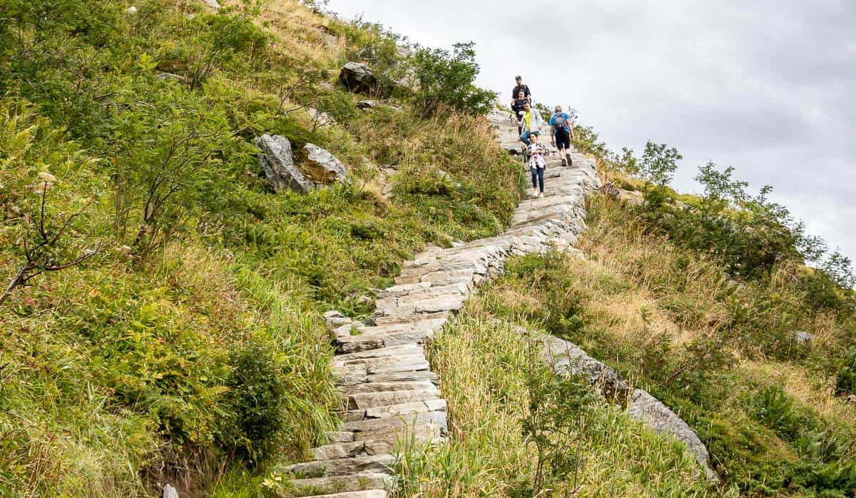
There will be no route-finding issues hiking up Reinebringen – though you will probably be breathing hard and some of you might find the trail too airy for your taste.
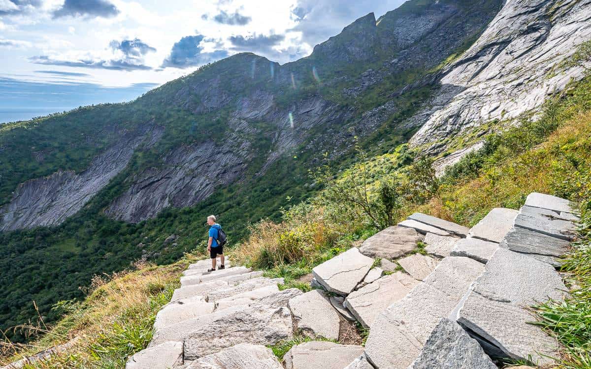
What I liked about the Reinebringen hike is that they added numerous stone benches, so it’s easy to step off the main trail and catch your breath. If you don’t want to go to the top, you could hike part way and enjoy the view, and your companions could pick you up on the way down.
The Reinebringen hike is one where you simply put one foot in front of the other to get to the top – kind of like Vancouver’s Grouse Grind and Stawamus Chief in Squamish, BC. I think this one is prettier and more dramatic – and I love the fact you get views in short order.
The hike is more accessible since the Sherpa stairs were completed in summer 2021. I found the first 350 steps or so of the trail had less of a rise – and then things got a little tougher.
The stairs take you right to the summit ridge, but to get the best views, you still need to climb up a dirt trail a short distance.
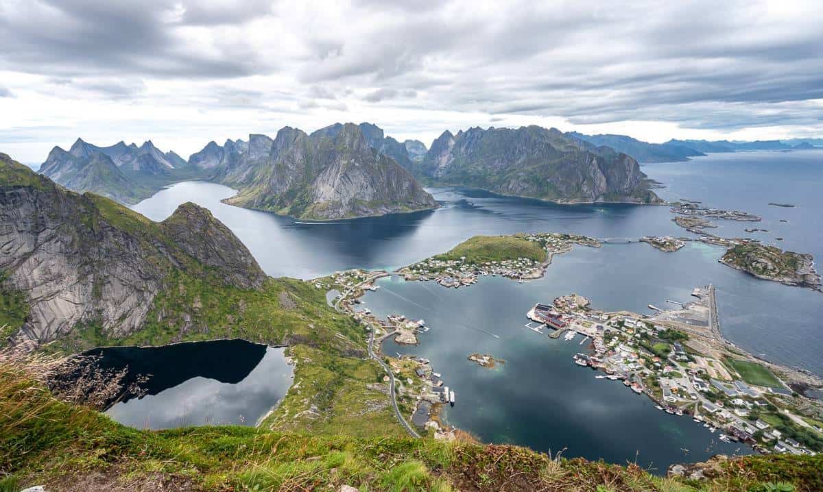
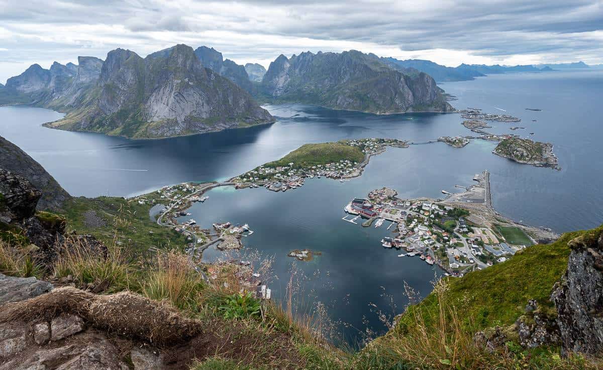
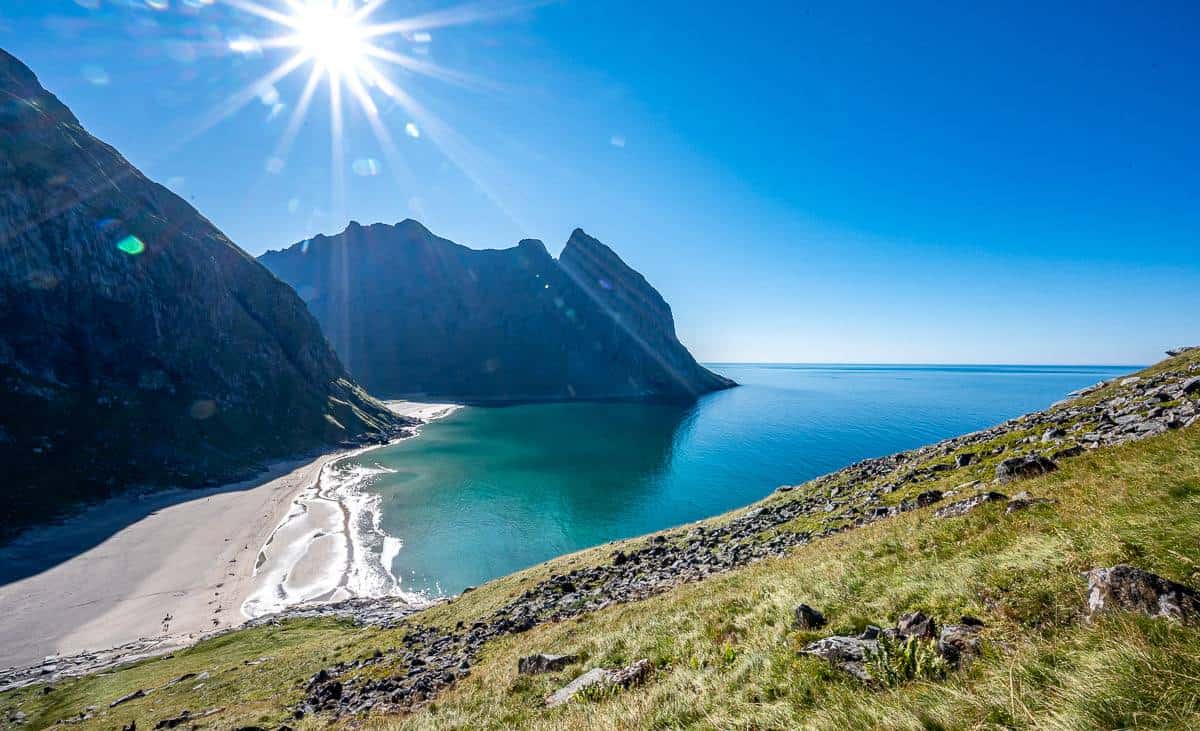
Once you get to the high point – take a breather, sit back and soak in the views. They are exceptional and some of the best you’ll find in Norway.
Enjoy a view of the Vestfjord along with the fishing villages of Reine and Hamnøy. The vista at the top puts the geography of the Lofoten Islands in perspective – and you can see why so many tunnels are needed.
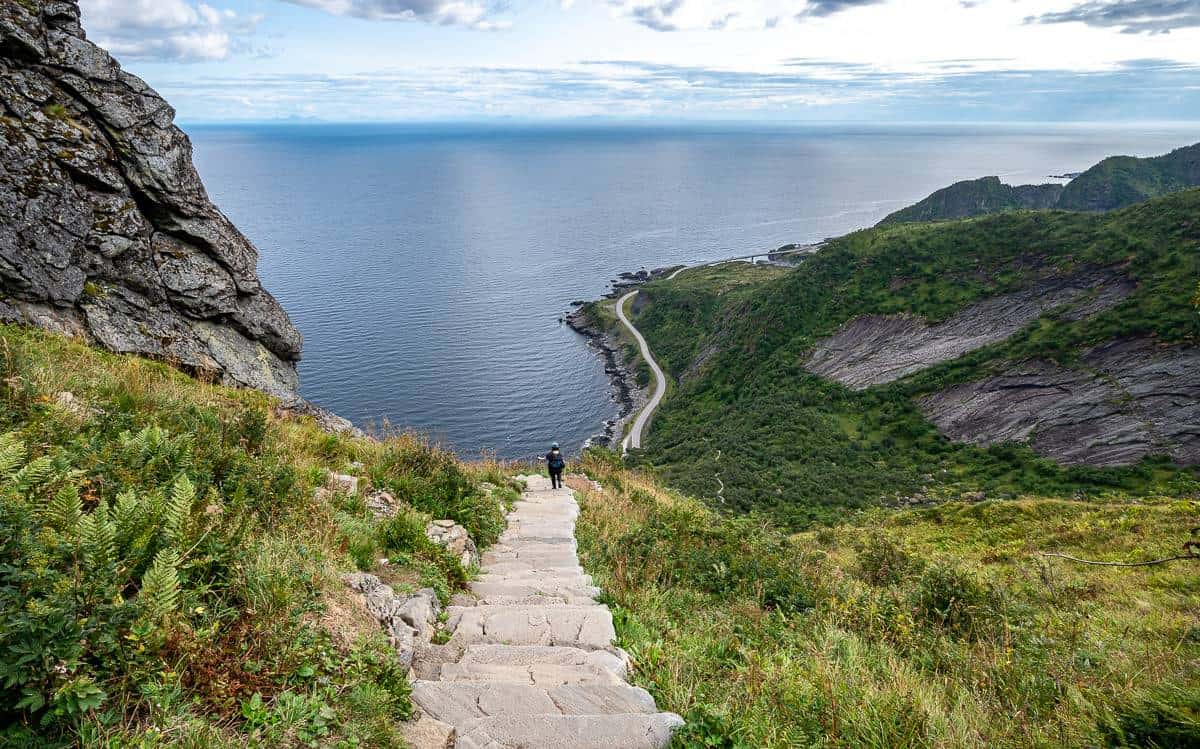
The true summit of Reinebringen
You can see a narrow trail heading steeply up to the true summit of Reinebringen. The trail is narrow with exposure and requires scrambling. If you don’t have the skill set, give it a pass.
If you do, enjoy even better views the higher you go. Only go as far as you feel comfortable. Retrace your steps to join the rest of the hikers on the descent. I understand there is an option to go down the backside of the mountain but I know nothing more than that.


Getting back to the parking lots
You do need to cross the E10 a couple of times if you park at the Djupfjord viewpoint – at least to be able to walk safely.
Obviously, be careful and just wait for cars to pass. I preferred to stay on the ocean side of the barrier as it was way safer – and then to walk on the sidewalk across the bridge.

Final thoughts on the hike
I’m very happy we found a parking place and decided to do the Reinebringen hike.
Even though it’s busy – it’s rewarding as the views simply erupt when you get to the top. That combined with a certain camaraderie you don’t find on other hikes makes it a winner. Plus, I love the endorphin high you get hiking hard and fast.
Where to stay in the area
Reine
Reine is the closest town and a good base for lots of hikes in the area. Top picks, all rated superb include the following.
Sakrisøy Rorbueris just 3.5 km from Reine. There is an antiques shop and summer cafe onsite. The hiking trail is just 4 km away.
The Manor Houseoffers a garden, shared lounge and terrace at good prices by Norwegian standards.
Reinefjorden Sjøhushas a great location. All units have a kitchen, and some have either a terrace or patio with sea or mountain views.
Holmen Lofotenis rated superb. It comes with an onsite restaurant and bar.
Sakrisøy
Close to Reine isOlstind in Sakrisøy– rated exceptional
Å
In Å there is less choice – but it’s a cute area to stay in at the bottom of the Lofoten Islands with some nice hikes nearby and a bakery that’s been there over 100 years using an old wood oven.
There is a hostel – theLofoten Å HI hostel– that is rated very good.
Å Rorbuer by Classic Norway Hotelsoffers traditional Norwegian fisherman’s cabins and is rated very good.
More hikes and things to do in Norway and Europe you might enjoy
Visiting Norway for the first time? Read Attractions in Norway for the First Time Visitor.
If you’re in southern Norway check out the Preikestolen hike – also called Pulpit Rock.
The Lofoten Islands are noted for their outstanding hikes. For a short hike that delivers 360 degree views, do the Offersøykammen hike. You only need two hours.
The first hike we did in the Lofoten Islands – Ryten Hike and Kvalvika Beach, was a combo of beach and mountain peak and one of the top hikes to do.
If you’re after a full day hike don’t miss the Munkebu Hut hike and hike up North Munken Peak for some of the best views on the Lofoten Islands.
Are if you love a good multi-day hiking trips, but you like to stay in hotels, check out the Via Alpina in Switzerland . It offers fabulous scenery, one heck of a daily workout and creature comforts at night.
If you like biking, have a look at this cycling trip in the South Bohemian region of Czechia.
Click on the photo to bookmark to your Pinterest boards.
