Kungsleden Trail Guide: Abisko to Nikkaluokta
The Kungsleden Trail – also called The King’s Trail, stretches for over 400 kilometres in northern Sweden from Abisko in the north to Hemavan in the south over five contiguous but distinct sections. The most popular section – the magnificent 103 km segment from Abisko to Nikkaluokta is the focus of this blog.
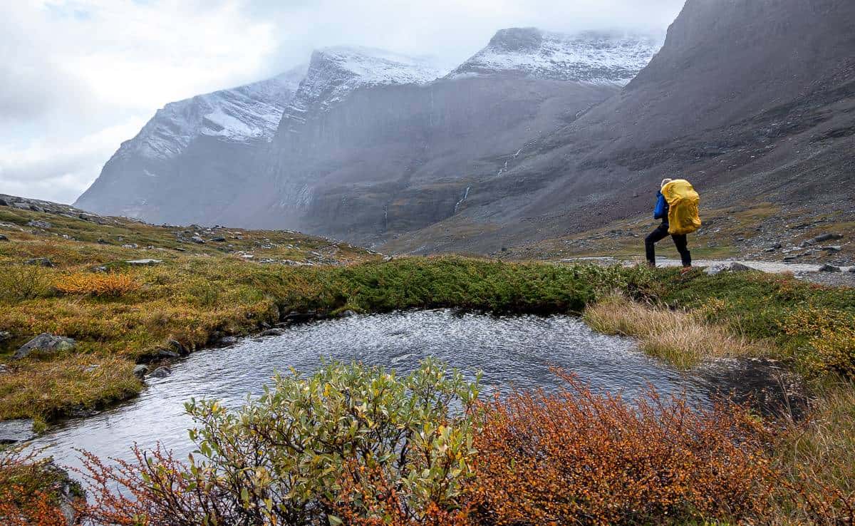
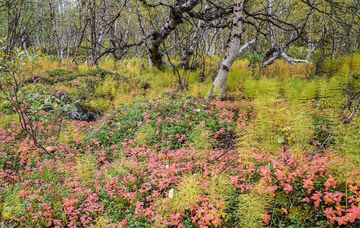
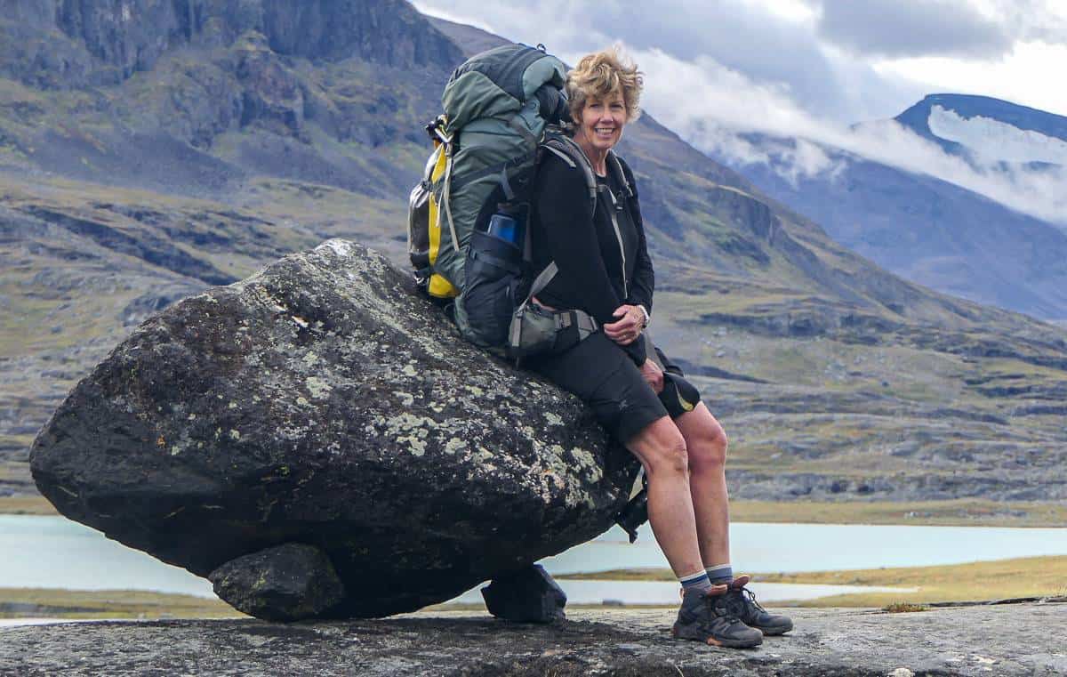
Over six days in early September John and I hiked through an awe-inspiring landscape above the Arctic Circle that has been the long-time home of the reindeer-herding Sámi people. The well-marked trail traverses a landscape dotted with lakes and rivers and resplendent with birch forests, open fells, and wetlands. The mountains are omnipresent – some days more than others.
Along the route there is the option to spend a night at Swedish Tourist Association (STF) manned huts (some with saunas) or simply wild camp – either close to the huts or anywhere you like, providing it’s not in Abisko National Park. Camping is free and no permits are required to hike the Kungsleden Trail. The logistics for getting to the start or end of the trail are straightforward – though from Canada it didn’t always seem that way.
This is a world-class wilderness hike that will appeal to a broad spectrum of people – from first time backpackers to friends, couples, and solo travelers, particularly solo female hikers. We met many solo females who loved the trail – for all the usual reasons, but also because it felt safe. If you’re staying in the huts, caretakers will look out for you, so while traveling solo, you won’t feel alone.
John and I camped and stayed in huts – scoring bunks on arrival – and I’m so glad we did. We met the loveliest people from all over the world – and fun discussions around the table added to an already memorable trip.
Check out my Instagram reel to see some of the highlights on this section of the Kungsleden Trail.
This post includes some affiliate links. If you make a qualifying purchase through one of these links, I will receive a small percentage of the sale at no extra cost to you. Thank you very much for your support.

Would you like to save this?
Best time of year to hike the Kungsleden Trail
You can hike the Kungsleden Trail between July and September. The peak season is July for the number of people on the trail but also for beautiful wildflowers and annoying mosquitoes. Your best chance of good weather is in July and early August but if you want to avoid the bugs – and enjoy the fall colours, then I’d recommend early September. The number of people on the trail drops off the later in September you go.
However, huts close by the end of September. And unless you get lucky with the weather, you may find that there’s snow on the trail, especially at higher elevations as the month progresses.

Getting to the start and end points on the northern section of the Kungsleden Trail
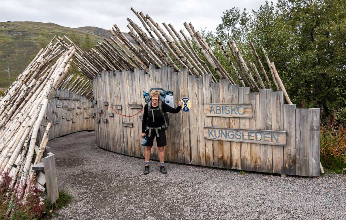
You can start at either end of the northern section of the Kungsleden Trail. There is no right or wrong, better, or worse. We started in Abisko and walked south. That worked for us because we were coming from northern Norway, but if you’re coming from southern Sweden, you could do either.
Flights
You can easily fly to Kiruna from Stockholm and then catch the bus to Nikkaluokta.
We had flown into the Harstad/Narvik Airport in northern Norway to hike the Lofoten Islands. From the airport you can take a bus to Narvik and a train to the Abisko Turistation.
How to get to Kiruna or the STF Turistation in Abisko by train
If you want to start in Nikkaluokta (by way of Kiruna) or from the STF Turistation in Abisko, you can take a night train with sleeper cars from Stockholm – or other points across Sweden but that will probably involve some train changes.
If you’re coming from Narvik, Norway it’s a quick 90-minute train trip to the STF Turistation in Abisko and there are three trains a day.
You can also get to Kiruna from Narvik. Book online on the Swedish train website.
How to get to Nikkaluokta from Kiruna by bus
If you opt to start hiking in the south, then you need to get from Kiruna to Nikkaluokta. There is a bus from the airport, railway station, bus station, and Scandic Hotel. They release their schedule in early January. You can book online.
How to get to Kiruna from Nikkaluokta at the end of the hike
When you finish hiking the Kungsleden Trail in Nikkaluokta, the only thing you’ll really need to know is what time the bus leaves – as you can purchase a ticket right there and then. Perhaps in the summer when it’s busy, you’d want to purchase one online beforehand, but in September there is lots of room to simply walk on.
There were two buses – one that went to the airport and bus station and the other to the railway station – so just make sure you catch the right one.
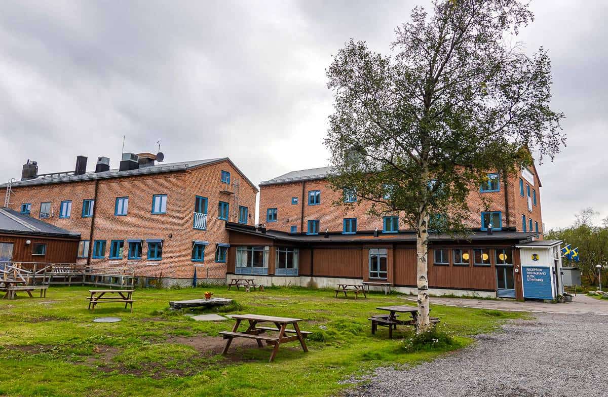
We spent the night in Kiruna at Camp Ripan before flying out. We were able to walk from the bus stop in Kiruna to the hotel in about 15 minutes. Their onsite restaurant serves excellent meals. Breakfast is included.
Private transfer services for the Kungsleden Trail
When we stayed at STF Turistation in Abisko I noticed some flyers offers private transportation. I can’t speak to any of them, but they would be an option.
Kiruna Private Guides – offers a transfer from Abisko to Kiruna (train, city or airport) and can accommodate 1-3 people for $1850 SEK or 4-6 people ($2450 SEK) in a vehicle. If you have more people, contact them via email at info@kirunaprivateguides.com. Their phone number is 46 (0) 76 447 05 11.
Abisko Taxi & Bus – You can email abisko-taxi-bus@hotmail.com or call +46 70 559 2220. It looks like they can take you from Abisko to Norway, Kiruna, Riksgränsen and Björkliden.
Where to stay on the Kungsleden Trail
When you hike the Kungsleden Trail you have three options when it comes to accommodation – huts, camping, or a combination of the two. You can book the huts online ahead of time (and if you’re booking four plus huts, it’s worth joining STF for the discounts.) Your membership is good for a year, and you can join a few days before you go – just be sure to have your membership number on hand.
Most people plan the following route when staying in huts. If you’re not in a hut, you can camp anywhere for free – save for Abisko National Park, so there is more flexibility.
It’s a short day from Alesjoure to Tjäktja – as is the next stage from Tjäktja to Sälka. We – like many others – elected to combine the two into one long 25 km hiking day. That’s not for everyone, but I’m glad we did it.
The hut at Tjäktja is small, so if you want to stay there, be sure to reserve well in advance.
- Day 1: Abisko to Abiskojaure
- Day 2: Abiskojaure to Alesjoure
- Day 3: Alesjoure to Tjäktja
- Day 4: Tjäktja to Sälka
- Day 5: Sälka to Singi
- Day 6: Singi to Kebnekaise
- Day 7: Kebnekaise to Nikkaluokta and onwards – though there is overnight accommodation available in the village of Nikkaluokta.
Can you stay in a hut without a reservation?
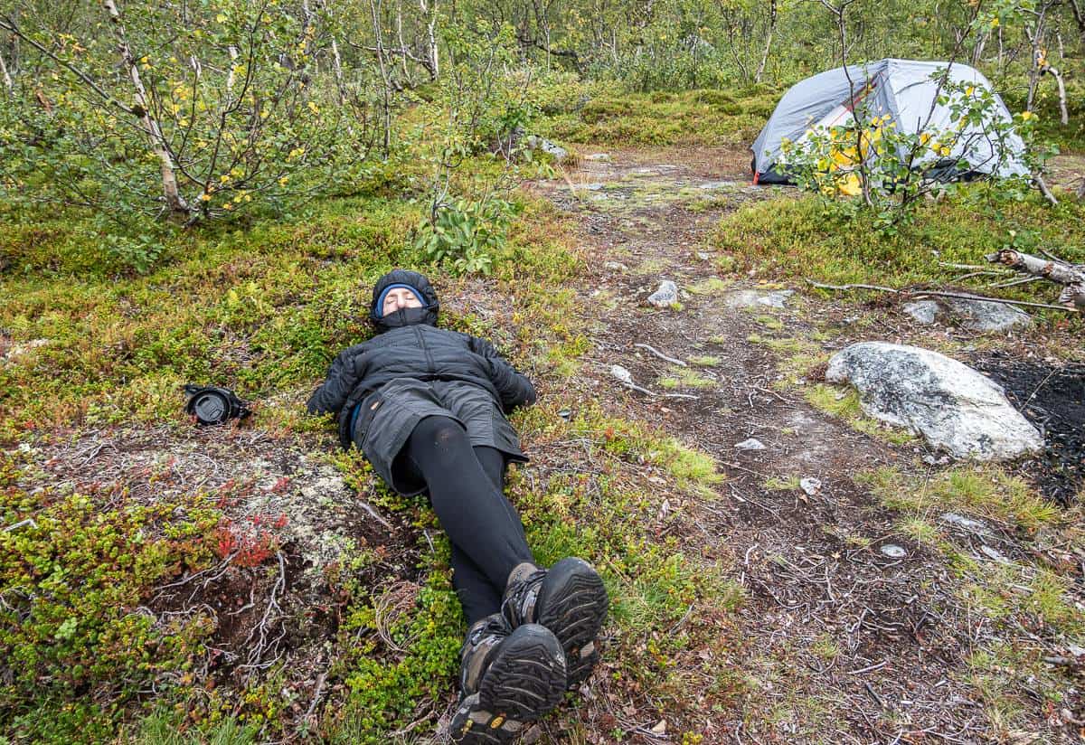
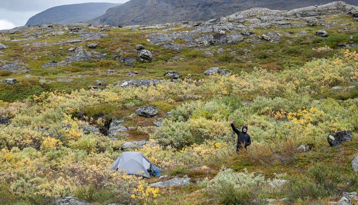
If you didn’t make a hut reservation, and we did not, you can still stay in a hut, though you might be sleeping on a mattress on the floor. They don’t turn anyone away! We had two days with some rain and big winds, so we elected to stay in Sälka and Singi. I’m so glad we did – not just because of the weather – but because we had so much fun with the people we met.
Don’t forget your credit card as cash is not well liked in Sweden.
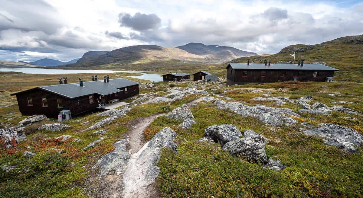
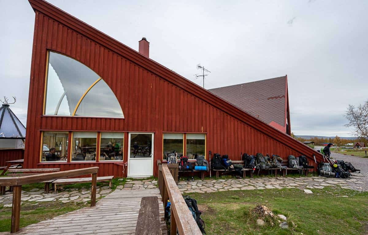
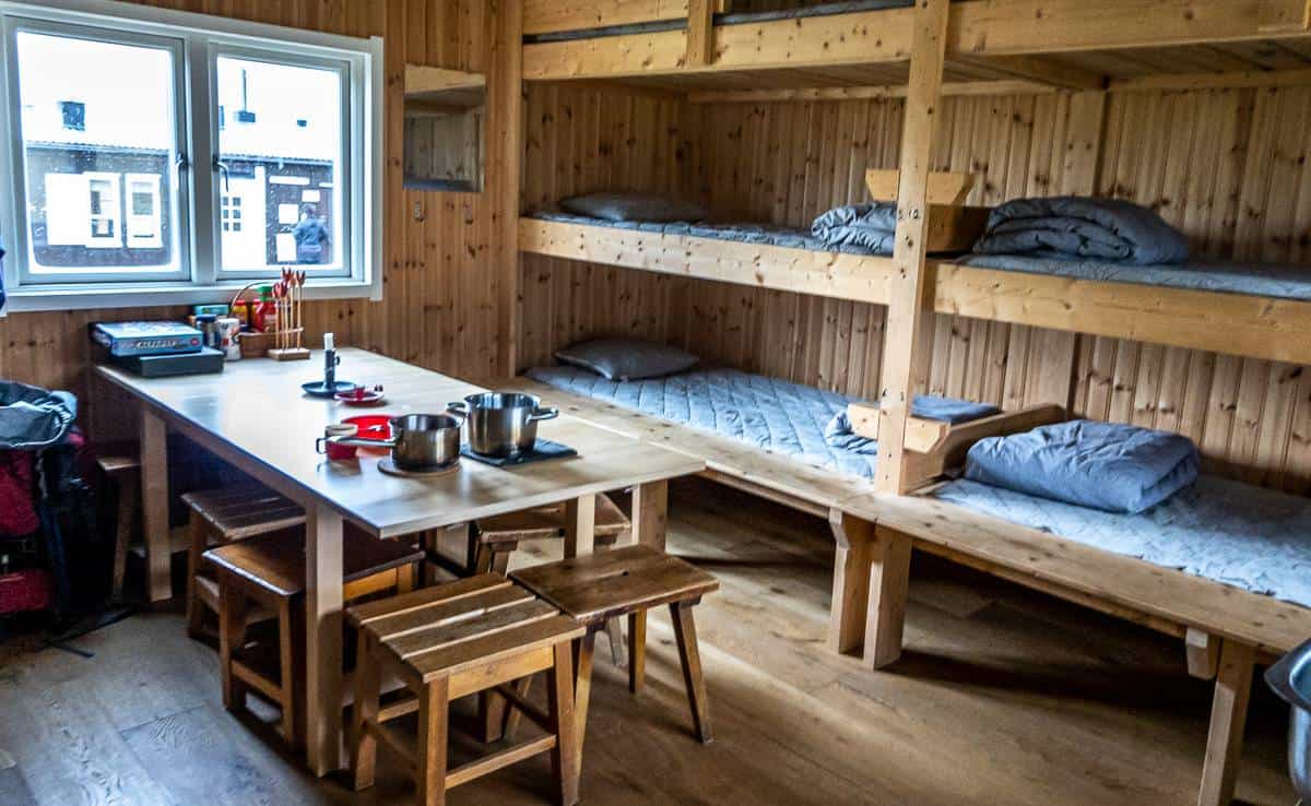
What are the huts on the Kungsleden Trail like?
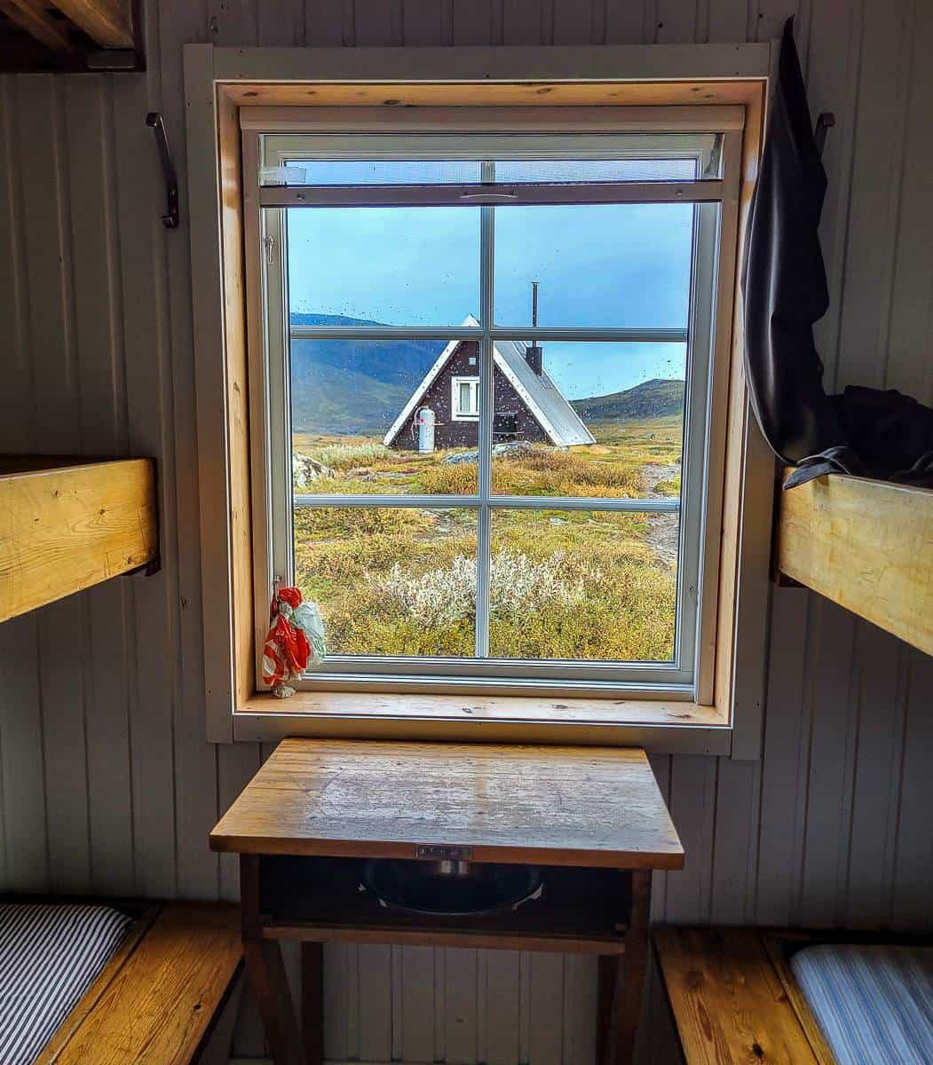
Every hut is a little bit different. All come with roomy bunkbeds so you can pile a whole lot of stuff on them and then put your pack somewhere else out of the way. However, some huts have triple layer bunk beds, so if you’re someone who needs to pee in the middle of the night, you will not want to be up there. They can be quite awkward to access in the daylight, and even tougher to get out of in the darkness.
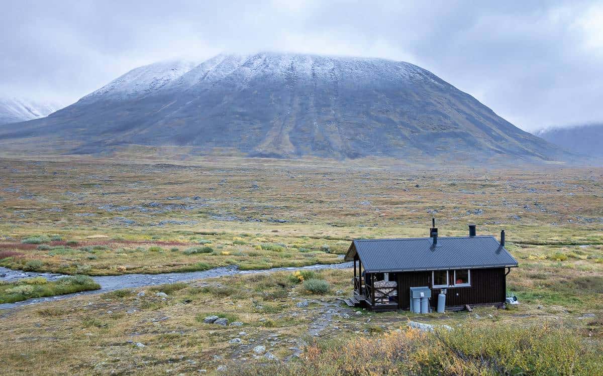
There are cooking facilities in the hut, so you don’t need do bring cooking gear or fuel. Outhouses are usually a short walk away. Some huts sell food – and on occasion beer. If you’re lucky, your hut will come with a sauna.
There was a sauna at Sälka – located beside an icy river. While I didn’t use it many did – rotating between heat and ice-cold water over 45 minutes. The saunas offer times for men only, women only, and mixed. Don’t bother packing your bathing suit.
Location map of the northern section of the Kungsleden Trail
- Click on the three dots in the top right hand corner to email a copy of the map.
Kungsleden Trail route description
The northernmost section of the Kungsleden Trail is the most popular one, so if it’s solitude you’re after, choose one of the other sections of the trail. All are much less busy than the Abisko to Nikkaluokta section.
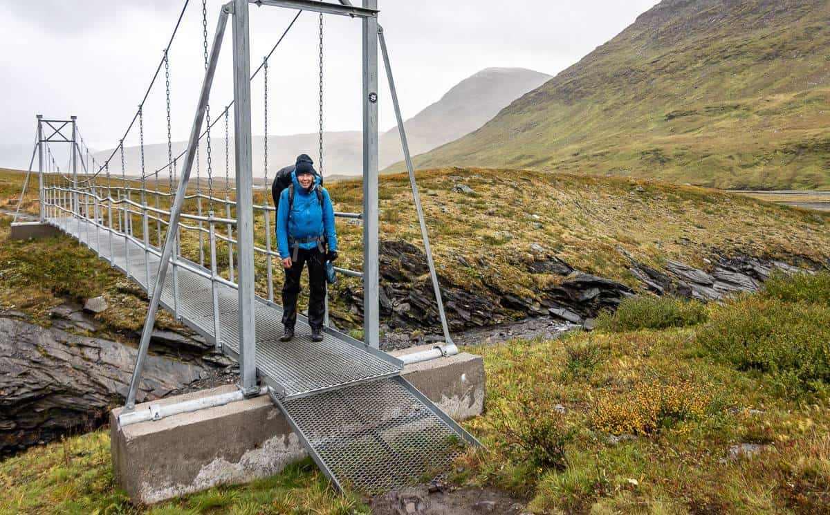
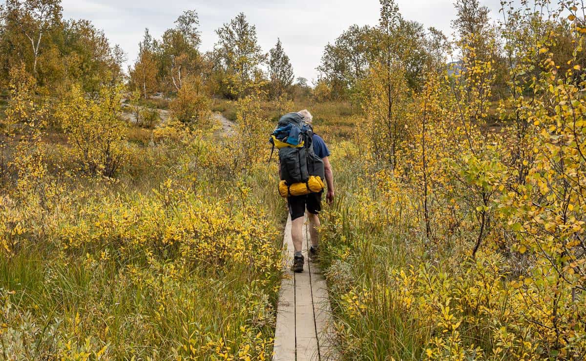
The trail is well marked and easy to follow. Any major river or body of water has a bridge.
Described below are the six hiking days we did. We combined days three and four into one long 25 – 26 km day. I didn’t track elevation as it usually wasn’t that much.
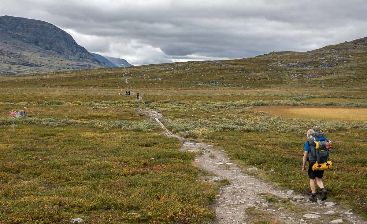
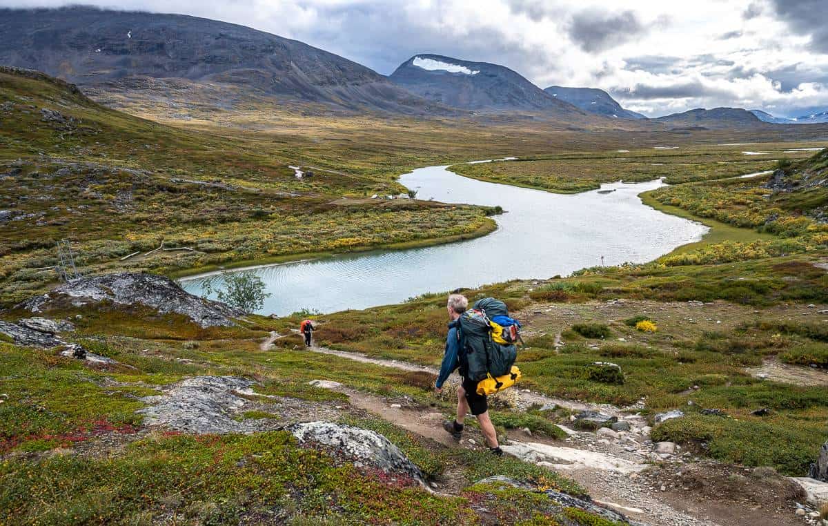
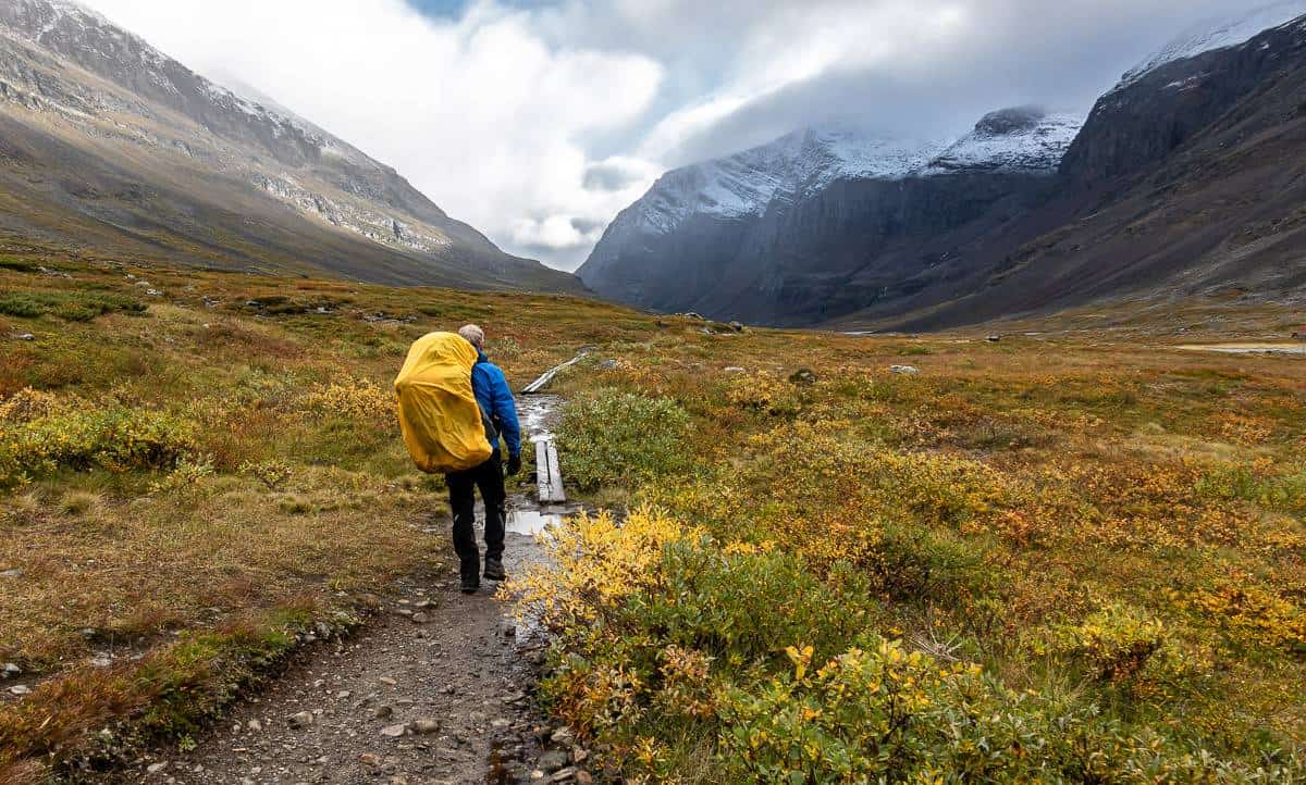
Day 1: STF Turistation in Abisko to Abiskojaure
Distance: 14 km
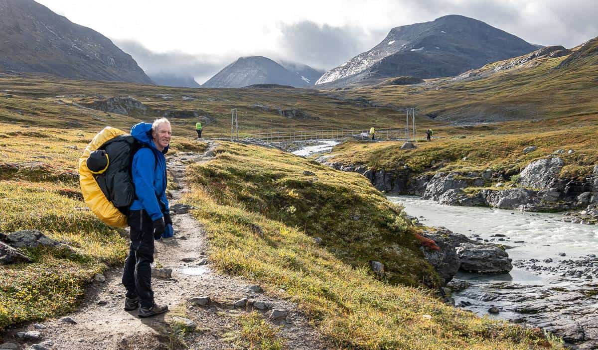
We started hiking under overcast skies – but the walking was easy, and the fall colours were starting. I loved the beauty of the canyon and the river right off the bat along with bursts of yellow birch in the woods and mushrooms galore. They are one thing you can pick in Abisko National Park!
This part of the trail follows the river and then Lake Ábeskojávri. Bikers are allowed on this section, but we only saw a couple of them. You’ll see the mountain hut near the end of the lake – but on the far side, reached by a bridge. If you want to camp you must continue past the turnoff to the hut for about another kilometre until you’re out of the park. Start climbing to reach a bridge over a good-sized river. There are campsites scattered throughout the forest on either side of it.


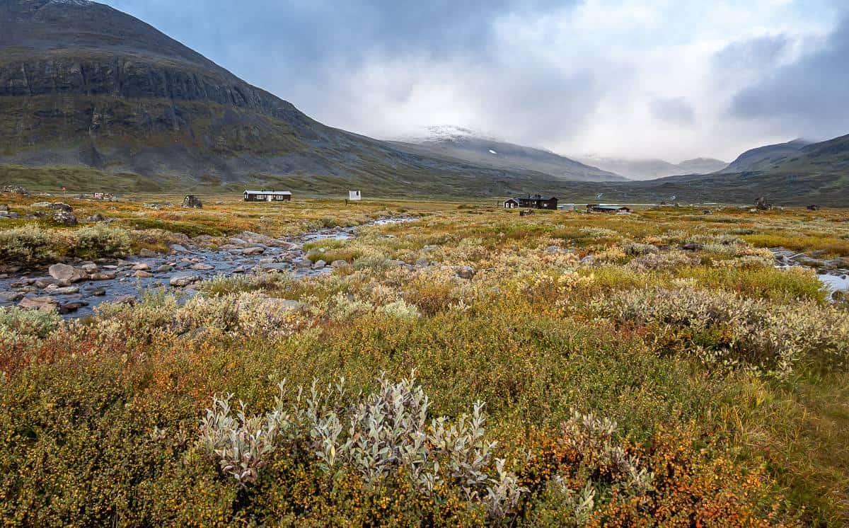
Day 2: Abiskojaure to Alesjaure
Distance: 21 km
Elevation gain/loss: +430m/-150m
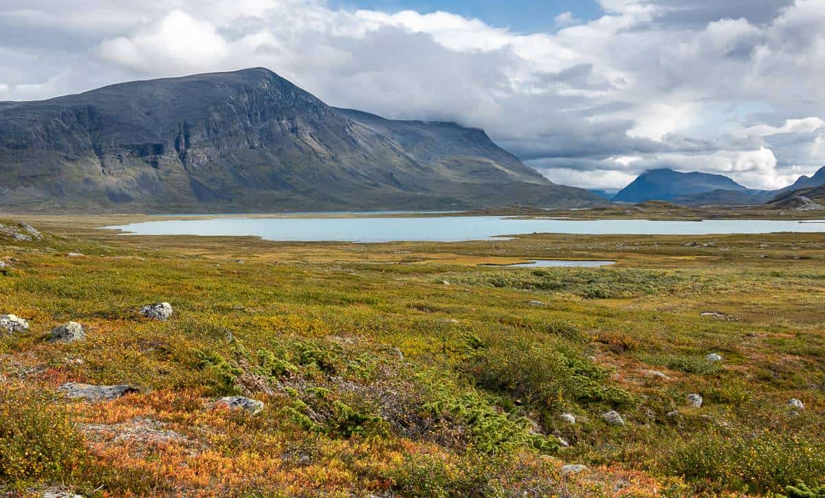
On our second day we finally had some uphill to a pass, but it was all very gradual. Most of the day we spent hiking either in sight of or alongside a large beautiful turquoise-coloured lake. There were large boulders scattered in places within sight of the lake that made a good place out of the wind for lunch. In summer there is a boat (it stopped running August 28th) you can take that would knock off about 4 km – but the hiking isn’t hard, just long.
The Alesjaure hut is a nice one – and a good place to grab a cold beer. If you’re camping, you’ll have to continue past the hut to find camping spots. There are a few before the river, but most people camped on the far side. I counted 19 tents in the area.

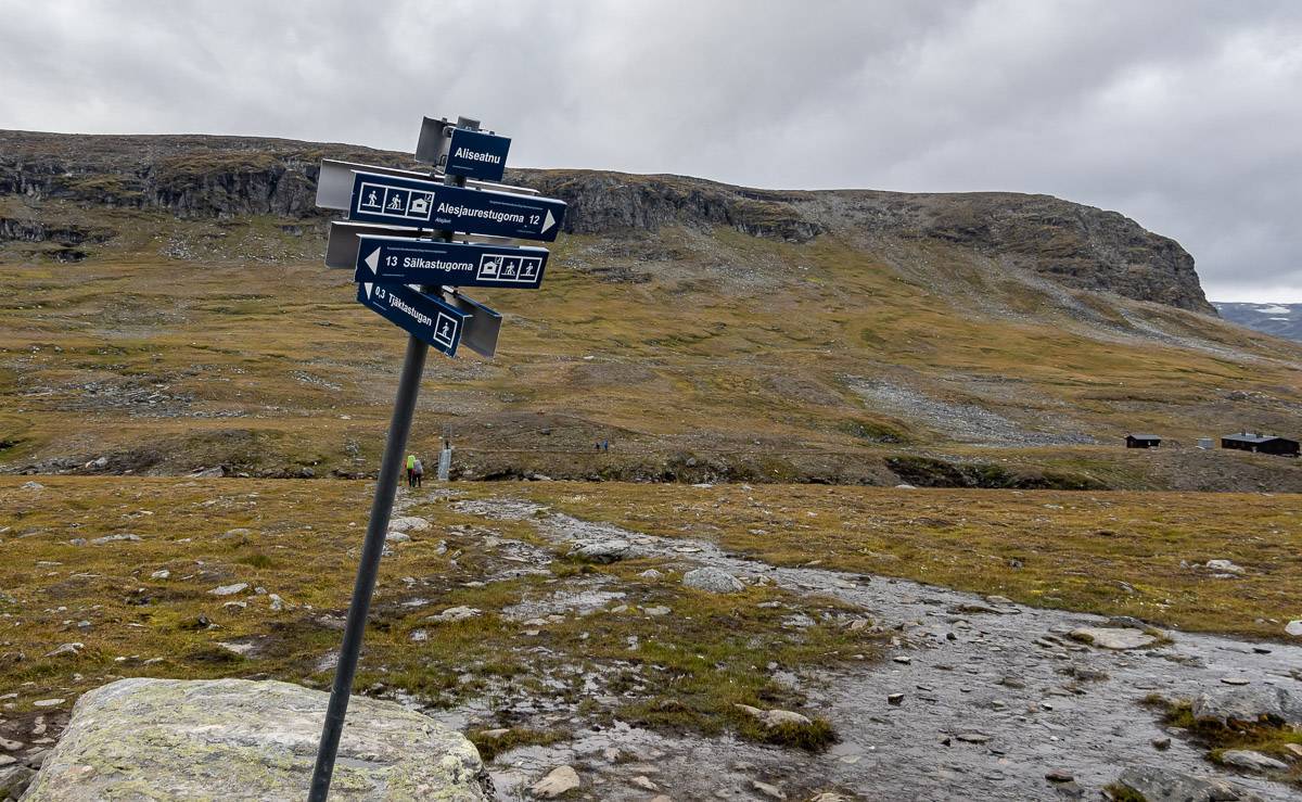
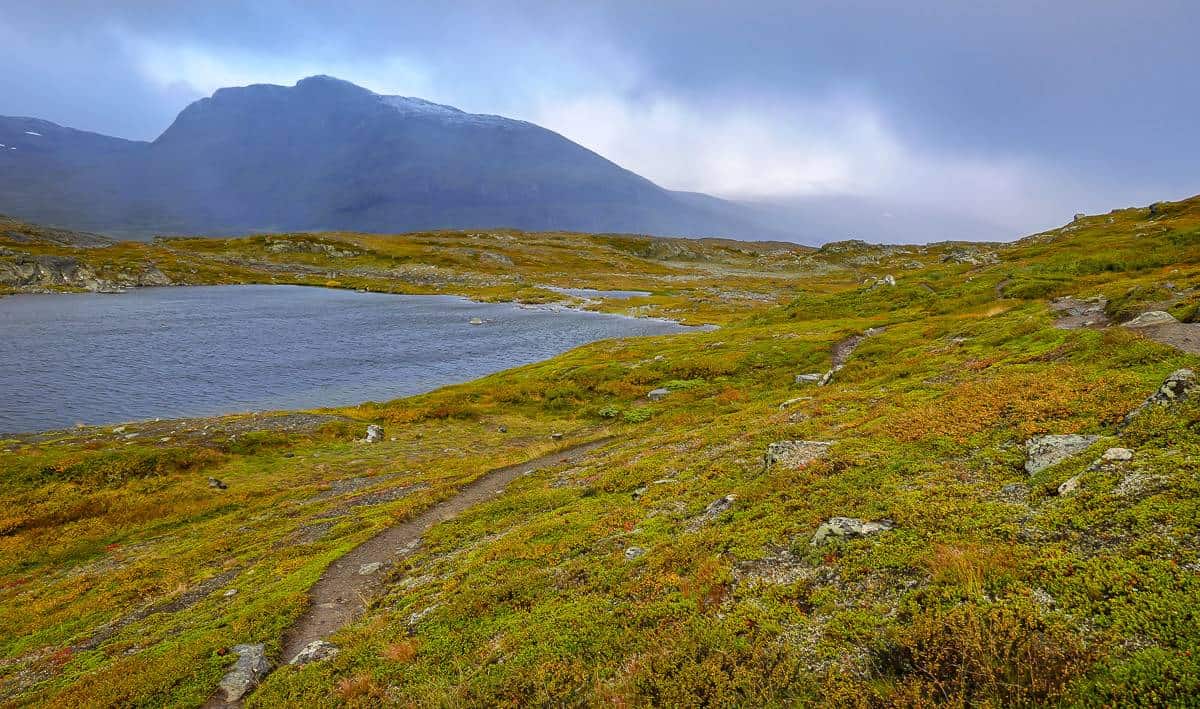
Day 3: Alesjaure to Tjäktja
Distance: 13 km
Elevation gain/loss: +375m/-160m
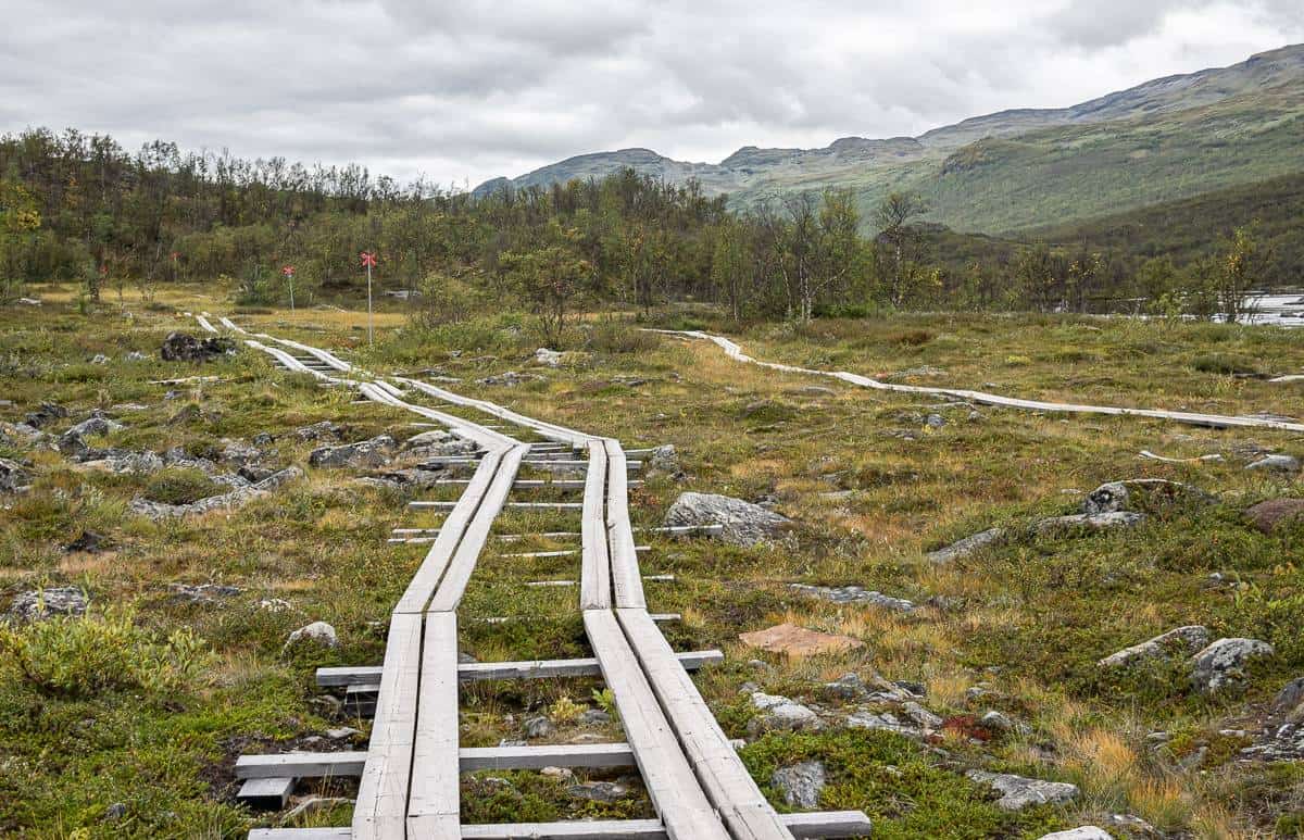
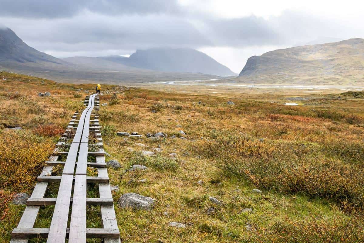
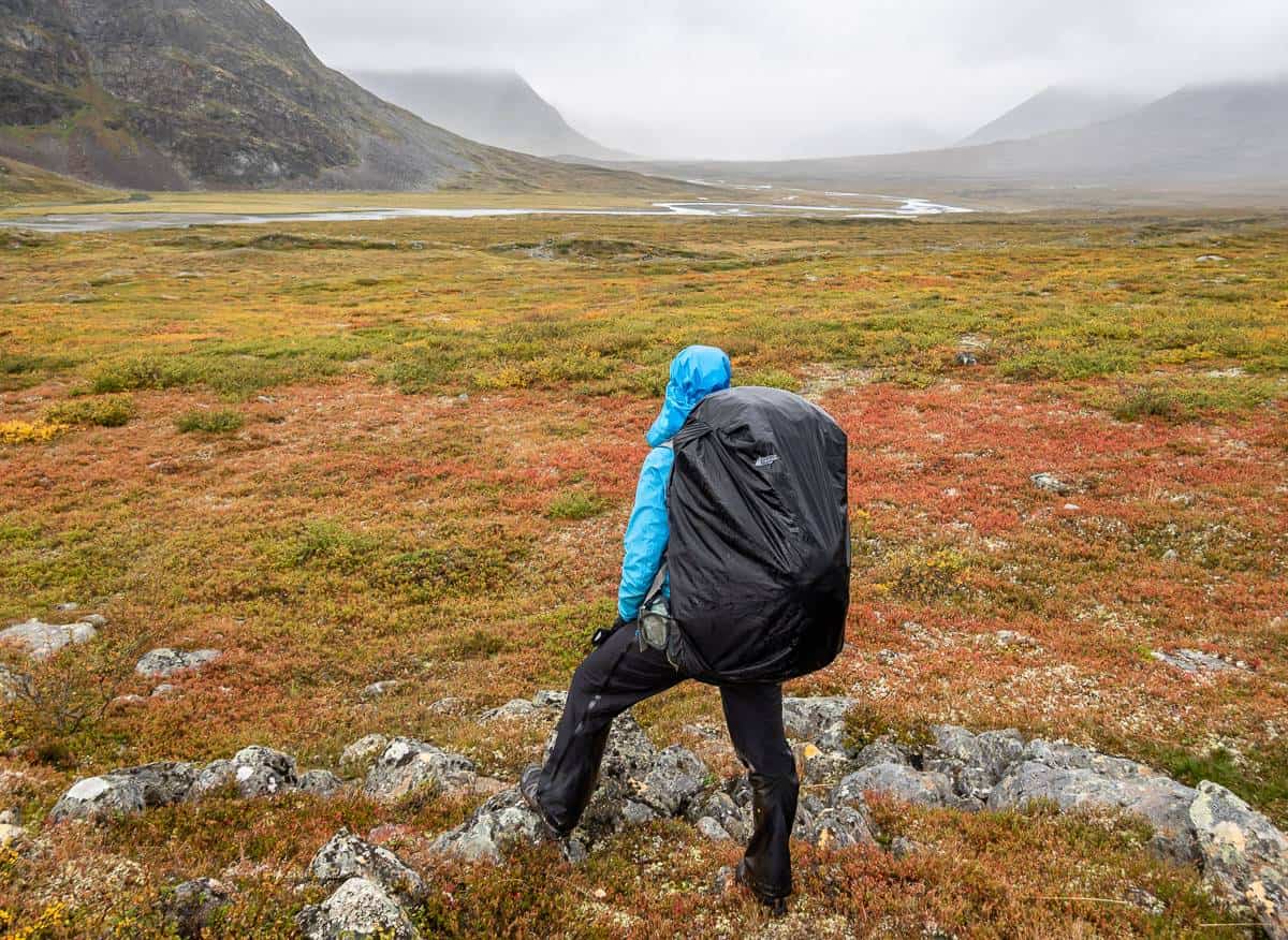
The section to Tjäktja is all up, though much of it is gradual. Count on walking on long stretches of wooden planks and on lots of nasty rocks. This part wasn’t always fun, especially because it was very windy with on and off rain.
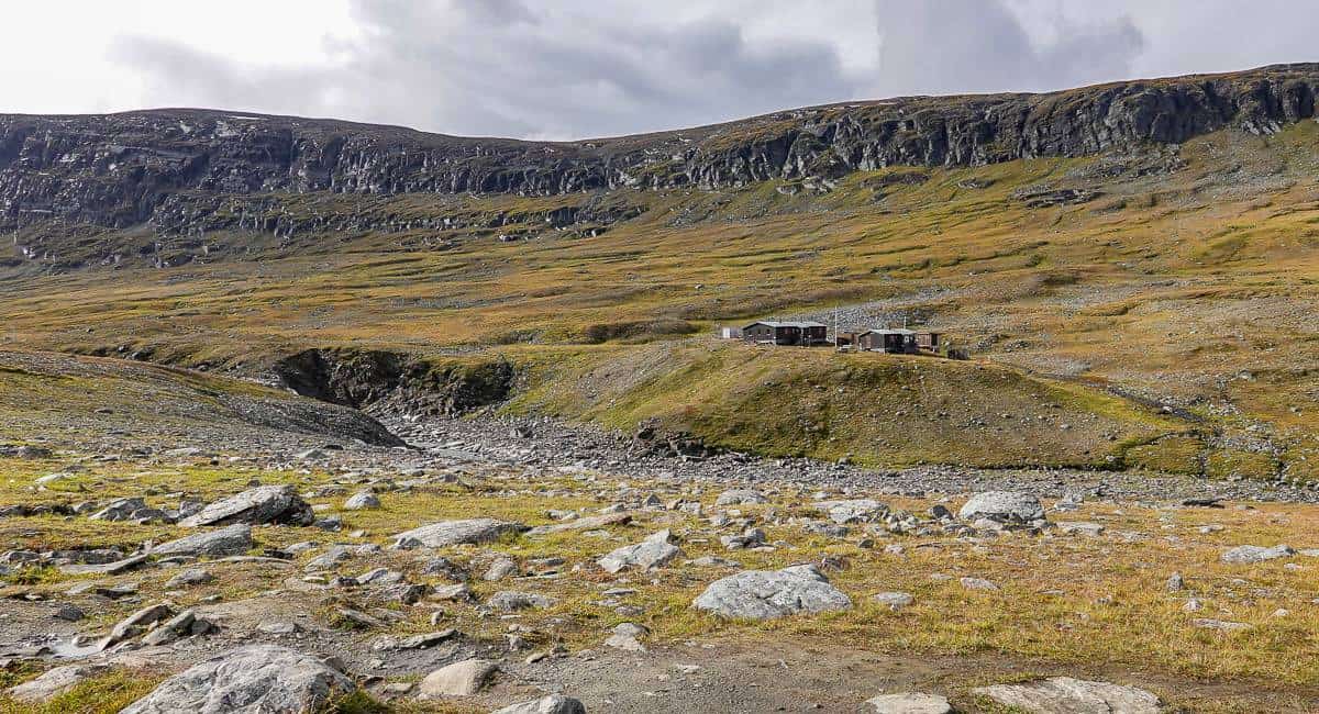
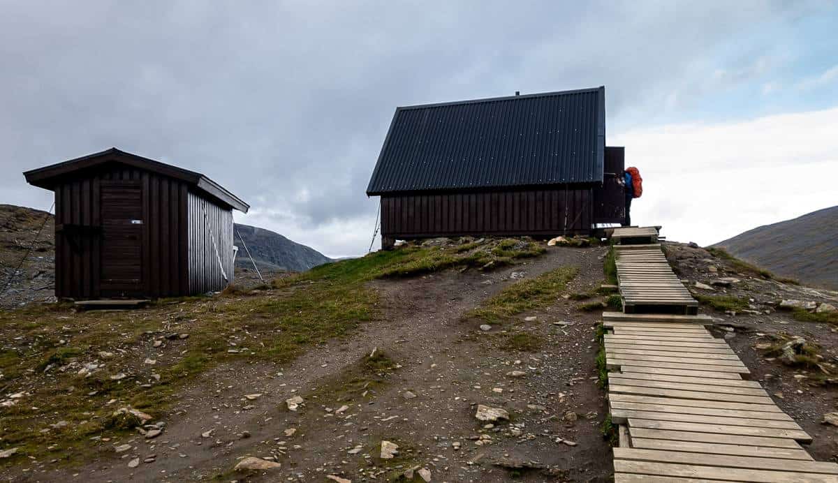
You must cross the river to get to the mountain huts. This is a small one with no store, so go prepared. We really didn’t see any great spots for camping as we got close to the hut on the main trail – but we didn’t see what there was for camping right beside it.
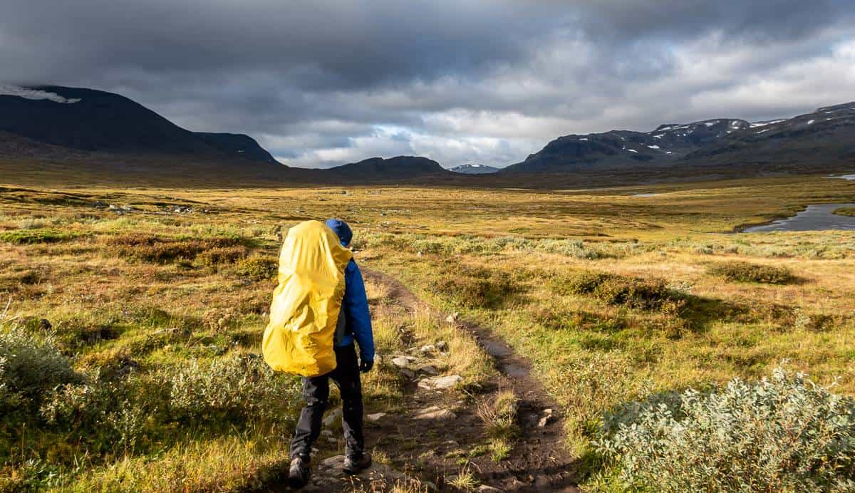
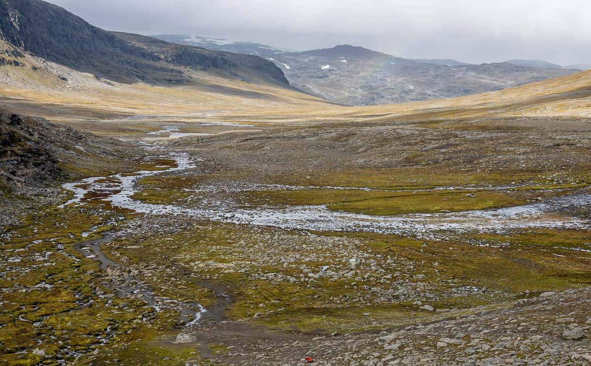
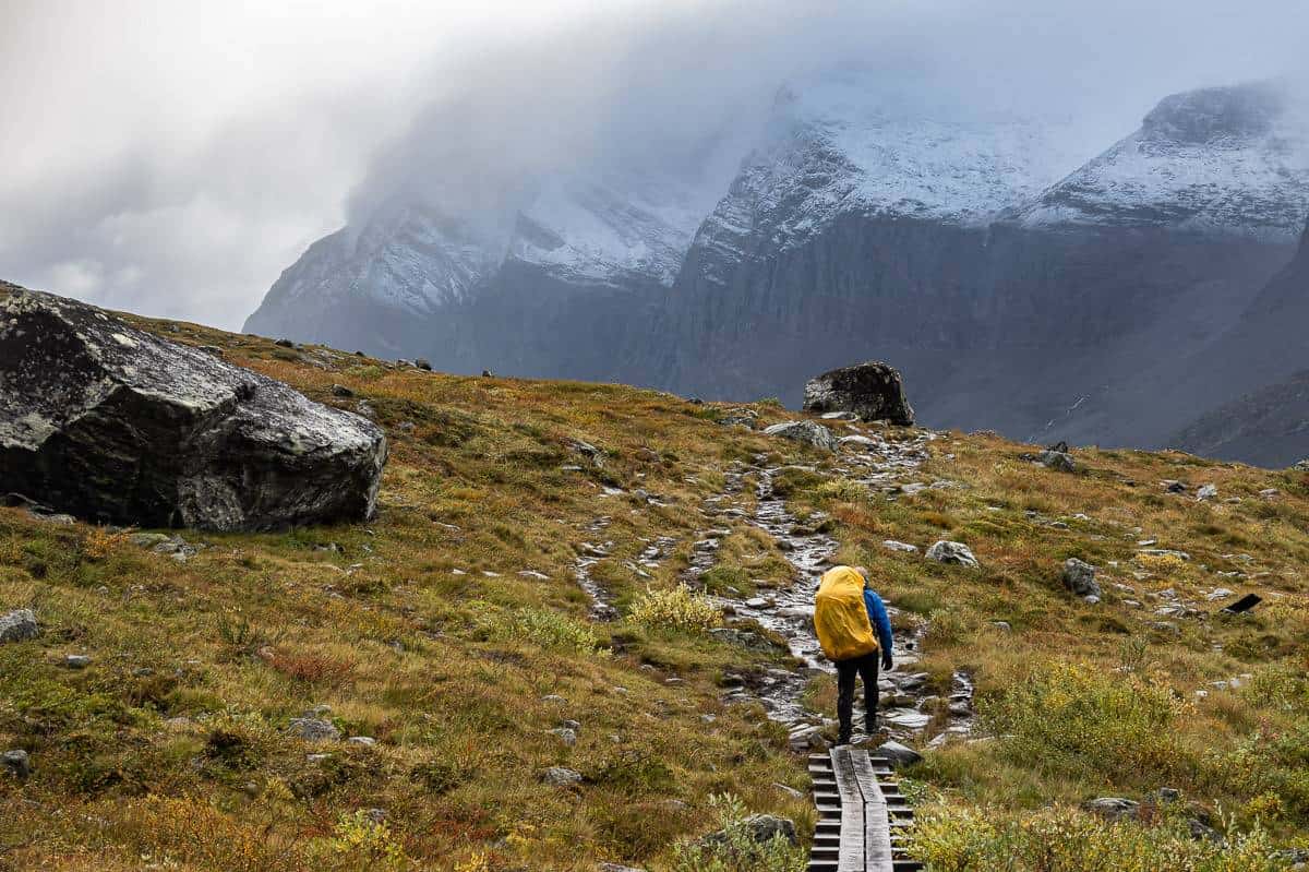
Day 4: Tjäktja to Sälka
Distance: 13 km
Elevation gain/loss: +105m/-240 m
From the turnoff to Täktja there is a long steady climb up to Täktja Pass as you can see in the photo below. It’s not difficult but you do have to watch your footing on the boardwalks as not all planks are in good shape. At the top of the pass are bathrooms and a lovely warming hut.
The far side of the pass down to Sälka was slower going. Just down from the pass is a “meditation place” – something we saw on each daily section of the hike. It’s a nice touch.
There was lots of rock hopping broken up by boardwalks. We were contemplating camping, but there wasn’t much that was appealing, especially with strong winds. We ended up getting the last two beds for 1000 SK – about $Cdn126 – and that’s with a membership, so beds don’t come cheaply. But on cold, windy nights they are worth every penny, and we did have a whole lot of fun with our cabin mates.

Day 5: Sälka to Singi
Distance: 12 km
Elevation gain/loss: +105m/-240m
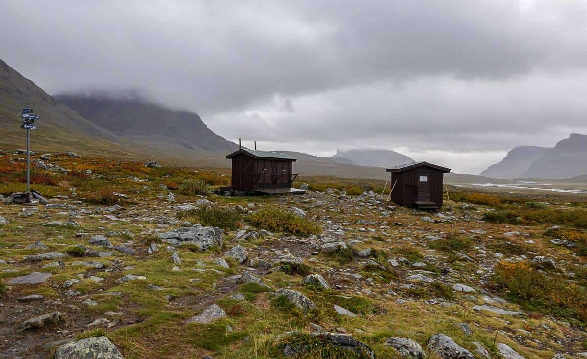
This was an easy day- just four hours of hiking which is a good thing as it was another wet and windy one. There were sections of rocky trail, but nothing like the day before. Five kilometres shy of Singi is a warming hut – which is well worth a stop if it’s cold. A stop also provides a chance to meet people and share information about the trail.
We arrived around at the hut for a late lunch and paid a fee to come in, dry off and use the stove to make tea. We had inquired about beds again – and all were taken. Fortunately, the caretaker did figure out something eventually – and we ended up with the same group as the night before which was a huge bonus. There is no sauna at this hut.

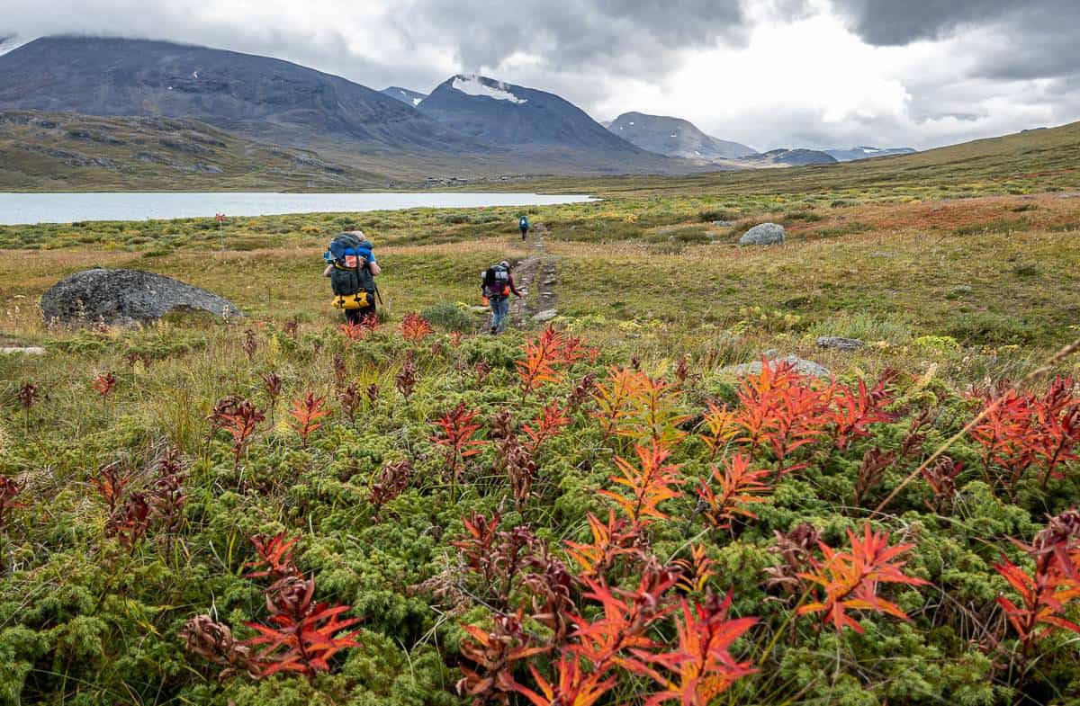
Day 6: Singi to Kebnekaise Mountain Station
Distance: 14 km
Elevation gain/loss: +210m/-250m
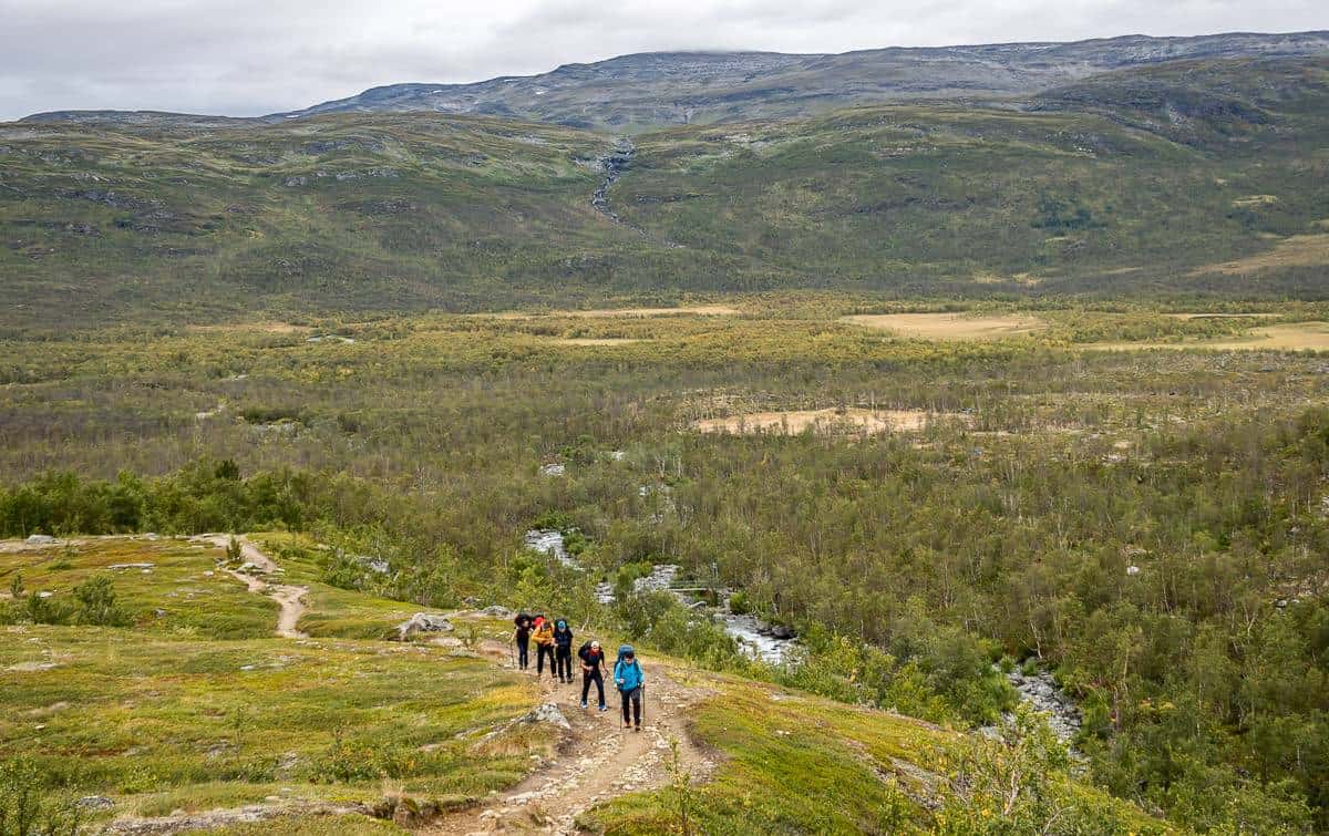
The weather forecast predicted huge winds – and we had them for much of the hike, but not quite to the degree that was forecast. Still, there were many times that we had to stop, plant our feet, and wait for the “blow” to pass.
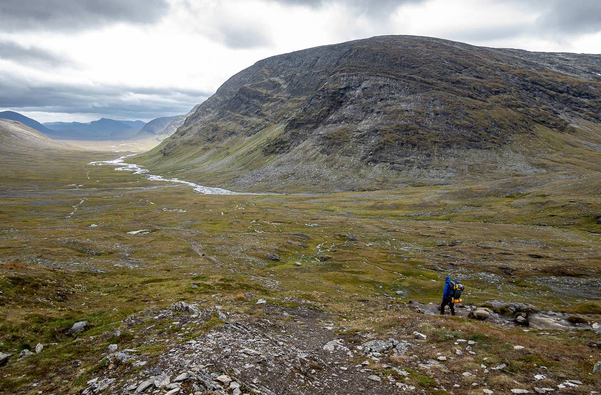
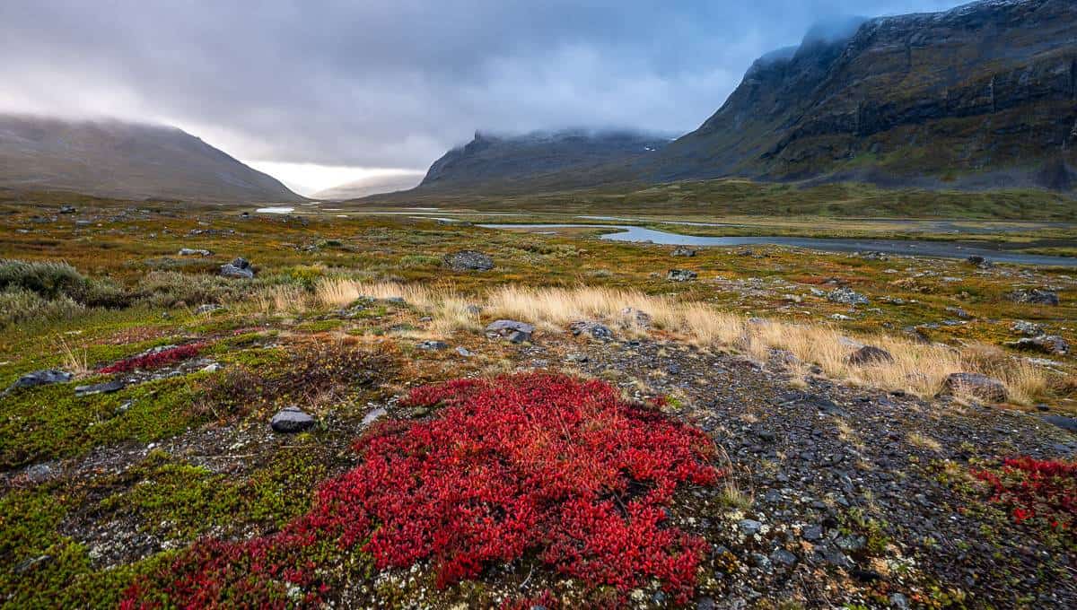
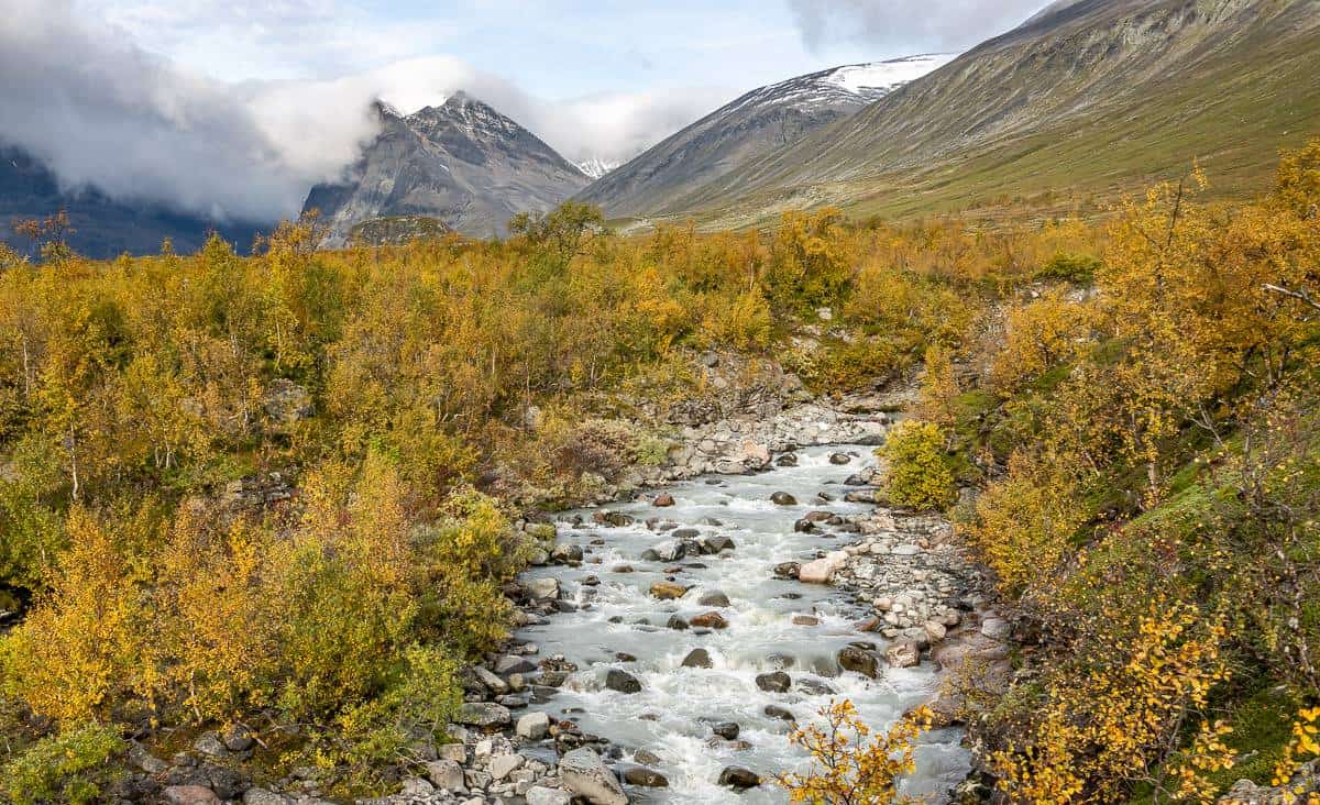
Hiking today was grand especially with all the fall colours. The first few kilometres are gradual as you hike up to Lassajaure lake and on towards the valley. The views through here were some of the best over the week. Continue through the narrow part of Laddjuvagge Valley with its spectacular scenery, especially so with fresh snow on the mountains.
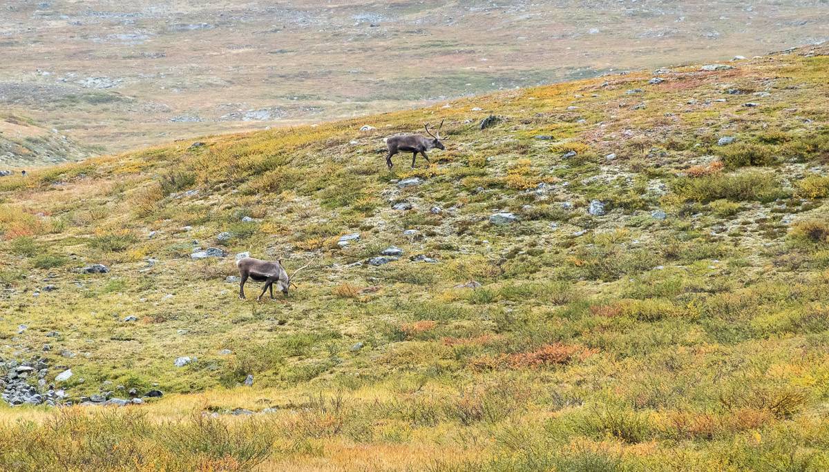
The landscape opens up for the final kilometres. It’s equally grand – because of reindeer sightings and fall colours. I
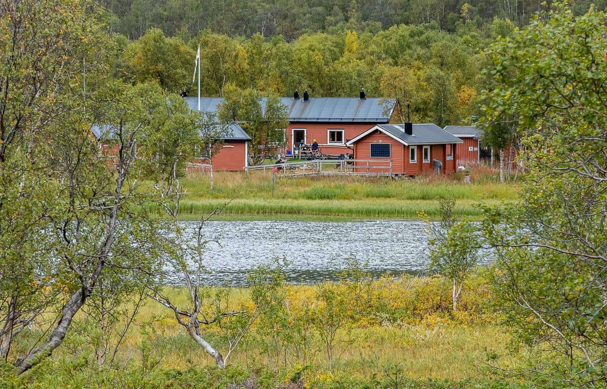
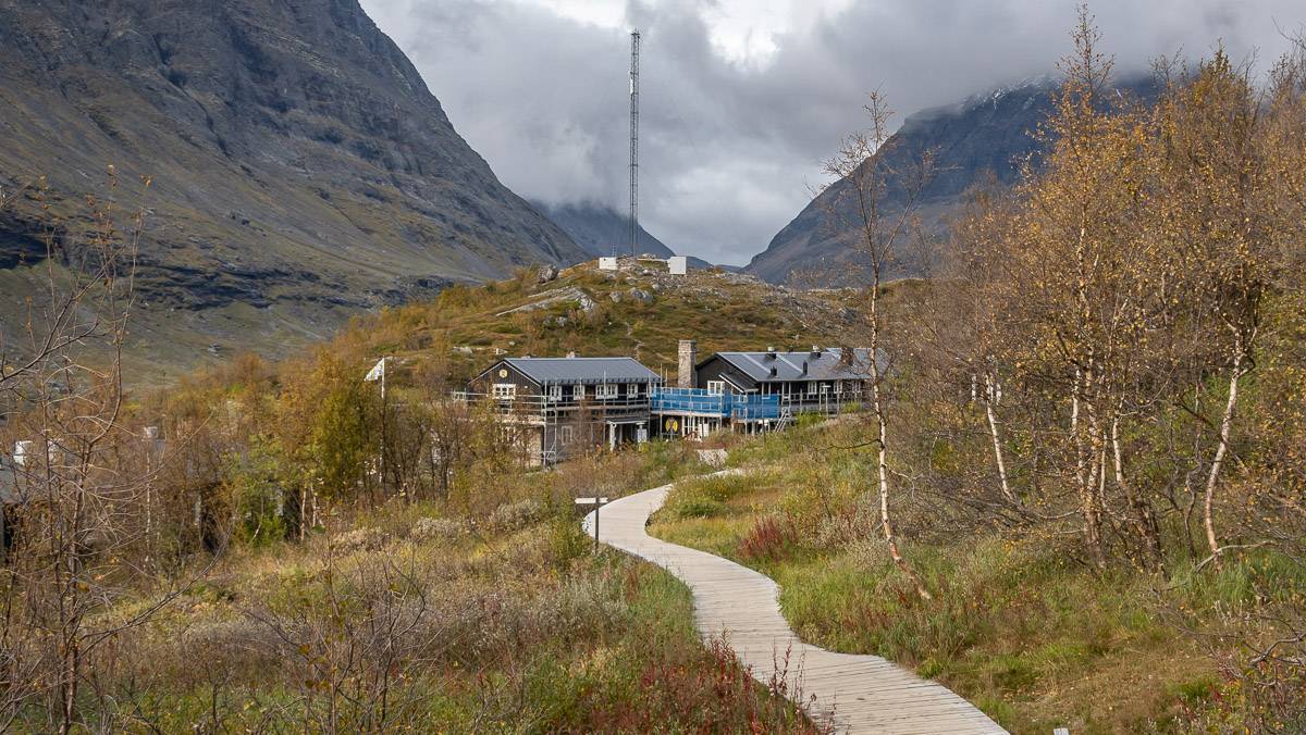
In no time we arrive at Kebnekaise Mountain Station – a large hotel with a lovely dining room (make reservations beforehand). We booked a night here, but it is expensive if you get a private room, and they are simple with no private bathroom. However, the food is very good and it’s fun chatting with your seat mates. They also offer dorm rooms.
There is lots of camping if you continue towards Nikkaluokta and beyond. The further you go, the more private it is.

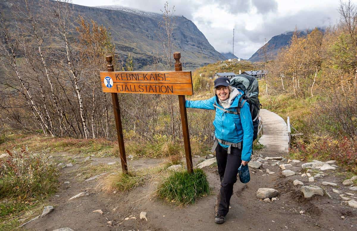
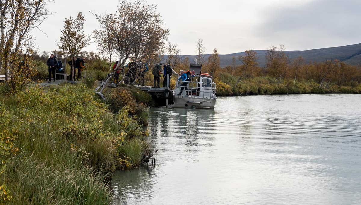
Day 7: Kebnekaise Mountain Station to Nikkaluokta
Distance: 19 km

Tips for hiking the Kungsleden Trail
Respect
Always show respect should you be lucky enough to cross paths with the Sami people. They look after the reindeer you see on the Kungsleden Trail.
Please Leave No Trace. If you can’t find a bathroom, dig a hole and bury your waste. Pack out toilet paper.
Hiking app
The hiking app that people love for the Kungsleden Trail is called Naturkartan. Type in Kungsleden Trail and all sections of the trail will pop up.
Camping
Campers – take a tent that can handle rain and wind. Pack all gear in waterproof bags. Nights can be cold especially beginning in late August.
Dogs
We met many dogs – all on leash, on the trail. Most cabins can accommodate dogs (and most provide cozy dog blankets) but read through this section on the STF website on dogs before you decide to take them.
Maps
The map for this part of the Kungsleden Trail is Kebnekaise and it’s at a scale of 1:50,000 or 2 cm = 1 km. We were able to purchase one at the shop at the STF Turistation in Abisko.
Boats
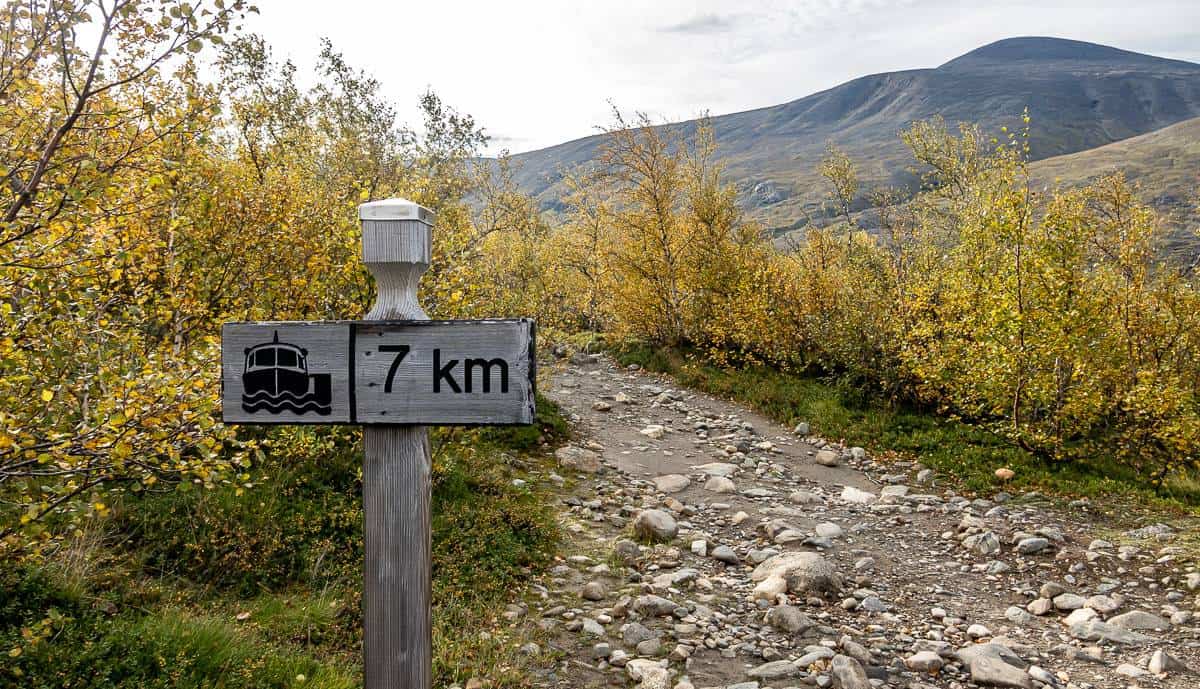
There are a couple of opportunities where you can opt for a boat ride for a price. One boat is available to shave off up to about 4 km near Alesjoure. The other one – Båttrafiken – is between Kebnekaise Mountain Station and Nikkaluokta. There are three times in each direction and the price in 2023 was 450 SEK per adult.
Detours
Popular detours include Tarfala on a postcard perfect glacial lake along with Nallo, Vistas, and Unna Allakasin the Alesjaure-Tjaktja area. There is also the option to climb Kebnekaise, but don’t underestimate this mountain.
Weather
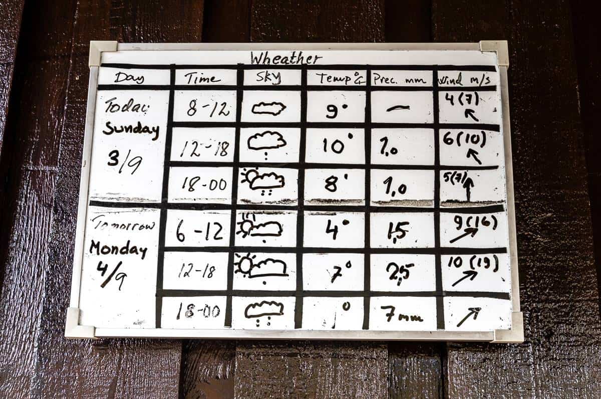
At every hut the caretaker puts up a weather forecast, so you can plan accordingly.
What should you do about food on the trail?
If you’re staying in the huts
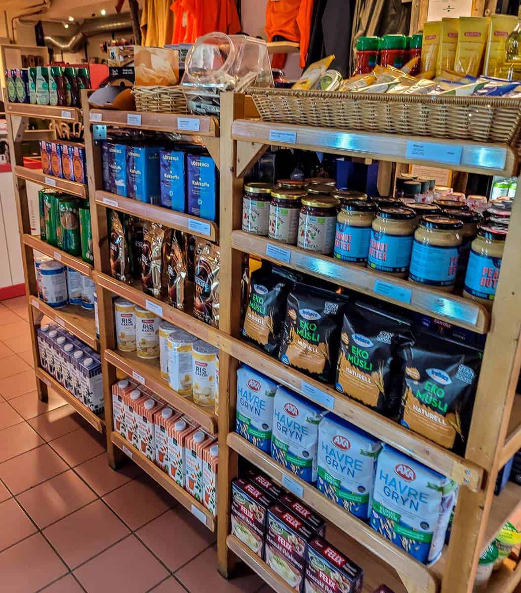
Although you can purchase food in the huts, there isn’t always a lot of choice. The larger huts usually have more to offer. By the end of the season, the variety will be limited, so I would recommend carrying most of your food. Purchase freeze dried or dehydrated food to minimize your pack weight. Variety and texture are important and so are the calories.
Get an idea of what the huts stock before you go.
If you’re camping
STF Turistation has a larger selection of food than most – and they have Primus gas canisters of varying sizes, as well as spirit alcohol for stoves. You can also buy some fuel and food at the store in Nikkaluokta and at Kebnekaise.
At both Kebnekaise and STF Turistation, you can purchase wine and beer for drinking on the premises.
Can you drink the water?
John and I treated all the water we drank, but I think we were in the minority. Most people were drinking straight from streams and lakes. If you want to err on the side of caution, bring water purification tablets or a filter.
Wildlife on the trail
The only wildlife we saw on the Kungsleden Trail was reindeer. But even that was a thrill. Other possibilities include lemming, fox, moose, wolverine and very rarely bears.
What to take on the Kungsleden Trail
Camping equipment
- Tent with a rain fly and extra rope to tie down in high winds.
- A portable stove, fuel and lighters.
- Warm sleeping bag rated to -10°C at least and a sleeping pad.
- Cooking utensils, mug, plate, and pot.
Clothing
- Rain gear – jacket and pants
- Down jacket
- Mid layer like a fleece
- Merino wool tops and long underwear bottoms
- Shorts and pants
- Underwear
- Sun hat, warm hat and mitts
- Hiking boots
- Sandals or camp shoes
- Merino wool socks
- A t-shirt or two
- Camp clothes to change into
Miscellaneous
- Backpack and pack cover
- Guidebook – Trekking the Kungsleden – The King’s Trail Through Northern Sweden
- Cell phone and charger for photos/hiking apps
- Toiletries
- Quick dry towel
- Headlamp
- The hiking essentials
- Hiking poles (I never used mine)
- E-reader
- Compression sacks for packing
- Sunglasses and reading glasses

Interested in more hikes in Europe?
Switzerland
The Via Alpina is a fabulous experience. My 5-day hike took me on the prettiest section of the Via Alpina trail in Switzerland.
The Tour du Mont Blanc hike also travels through France and Italy.
Norway’s Lofoten Islands
The following hikes in the Lofoten Islands are usually done as day hikes, though there are options to camp on a couple of them.
- 7-Day Lofoten Islands Itinerary With A Hiking Focus
- Reinebringen Hike, Lofoten Islands: A Complete Guide
- Munkebu Hut Hike + Munken, Lofoten Islands
- Offersøykammen Hike in Norway’s Lofoten Islands
- Ryten Hike and Kvalvika Beach, Lofoten Islands
Mallorca, Spain
- A Stunning Day Hike to the Alaro Castle in Mallorca
- The Best Part of Hiking the GR221 in Mallorca
- Hiking the GR221: Estellencs to Valldemossa
Canary Islands, Spain
Click on the photo to bookmark to your Pinterest boards.


Thank you for all this great info! We are from Canada and heading to do this exact trek for the start of August. After reading your page, I feel a lot more comfortable with what to expect since we will be camping.
I have a question: Do they accept credit cards at the huts or should we bring cash?
Thanks!
@Maryssa In the Abisko-Kebnekaise region the following huts accept credit cards – Abiskojaure, Alesjaure, Tjäktja, Sälka and Singi.
These huts accept Euros – Abiskojaure, Alesjaure, Tjäktja, Sälka, Singi and all the rest accept Swedish Kroner.
Thanks for creating this great guide! Also from Canada, have just returned home after an amazing adventure on the Kungsleden (Abisko southbound). It’s set up so well for hikers – my partner and I were constantly wishing we had something similar (hut to hut hiking) in Canada. I highly recommend the cabins – and booking well in advance – and skipping all the extra weight of tent, sleeping bag, and stove – you won’t need them. All you need is a cotton bag liner as the huts have pillows and blankets. Kebnekaise is a bit jarring after days on the trail, but the side trip up the mountain is well worth it.
I love that trail and one day would like to start in the south and do the rest of it. I’m happy you had a good time.
How do people choose between Abisko to Vakkotavare vs Abikso to Nikkaluokta? Going to Nikkaluokta involves 2 days of hiking not on the actual Kungsleden anymore, right? Is that route just prettier than Vakkotavare? It sounds like there are public transportation options from either endpoint, and both routes would take about the same amount of time. I don’t know how to choose!
Hi Claire, Sorry it took me so long. I have the map in front of me and I’ll be damned if I can find Vakkotavare. I think it must be south of Singi on the Kungsleden as you correctly point out. My guess is that is the route you would take if you were continuing south. But most people hike out to Kebnekaise Station and then Nikkaluokta as it makes a great 6-7 day trip and the logistics are such that it’s easy to catch a bus from Nikkaluokta to the train stain or airport in Kiruna. If you’re heading out for a longer hike on the Kungsleden then yes go to Vakkotavare. Otherwise exit at Nikkaluokta. There is also the option to climb Kebnekaise from the Kebnekaise Station – something I wish I’d allowed a day to do.