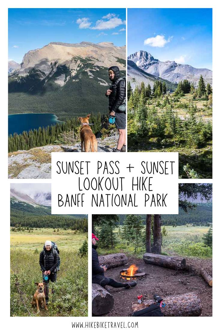
Sunset Pass & Sunset Lookout Hike, Icefields Parkway
I discovered the Sunset Pass hike and Sunset Lookout hike accessed from the Icefields Parkway in Banff National Park completely by chance. I was researching campgrounds to stay in that are a short hike in from the trailhead.
Without looking into the details too much, the Norman Lake Campground (No5) on the way to Sunshine Pass seemed like a good choice as it is approximately 4 kilometres from the parking lot. But to get there you have an elevation gain of approximately 530 metres.
The Norman Lake Campground is a great choice – but not for the reasons I was looking for.
Initially I had hoped to spend the night in a campsite on or close to the Icefields Parkway – while on route to do a multi-day hike in the Tonquin Valley, as I was trying to avoid a 5 AM start time from Calgary. I decided to book the Norman Lake campsite anyway over an August weekend so we could do the wonderful combination of the Sunset Pass hike and Sunset Lookout hike.
Would you like to save this?
Sunset Pass plus Sunset Lookout hike summary
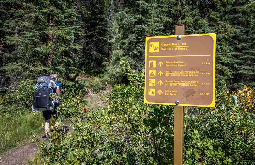
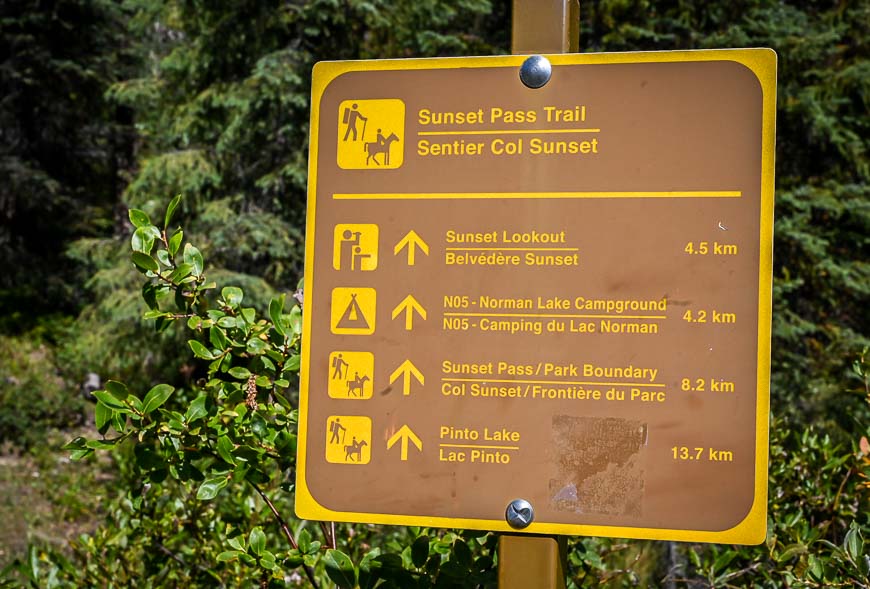
Distance from trailhead to Norman Lake Campground: 4.2 km one way
Distance from Norman Lake campground to Sunset Pass: 4.0 km (2.5 miles) one way plus an additional 3.2 km roundtrip (2.0 miles) if you include a side trip to Sunset Lookout.
Elevation gain: 725 m or 2,380 feet to Sunset Pass + 201 m or 659 feet to Sunset Lookout. Total elevation gain on both hikes is about 926 m or 3,038 feet.
Level of difficulty: As a day hike moderate to hard only because of the length. If you do it as a backpack, it’s a moderate hike.
Time to the Norman Lake Campground: Count on a solid 60 – 90 minutes of huffing and puffing – at a decent pace to reach the top of the major hill before the grade moderates on the final 0.4 km to Norman Lake. We hiked to the Norman Lake campground in 75 minutes.
Time to Sunset Pass from the Norman Lake Campground: The return hike to Sunset Pass from the Norman Lake campground took us about 2.5 hours with time spent wandering around the pass and refueling. It took us just under an hour on the descent to the parking lot from the junction at the 2.9 km mark. All told, as a day hiker, I would count on 6 – 7.5 hours to do both Sunset Pass and Lookout. We were a bit slower because of backpacks.
Best time to do the Sunset Pass hike: July until September
Permit: You will need a national park pass to drive in Banff National Park. They can be purchased at the gate, in the town of Banff, at the entrance to the Icefields Parkway and online.
Lots of switchbacks: The hike is steep for the first 2.9 km to the turnoff to Sunset Lookout – but even so, it’s not as steep as most of the Kananaskis hikes I do along Highway 40. And the 35 plus switchbacks help to moderate the grade.
Type of hike: The Sunset Pass hike can be done as a longer day hike or as an overnight backpacking trip with a stay at the Norman Lake Campground.
Backcountry campsite permits: You must reserve campsites, if you’re planning to camp. You can do that online here. It’s competitive to get the day you want, so hop online as soon as reservations open on January 27, 2025 at 8 AM MT. There is a reservation fee plus a campground fee.
Bears: Carry a can of bear spray that is accessible. Keep it in a bear spray holster so you don’t set it off accidentally, which happens a lot. You can rent bear spray in Lake Louise at Wilson Mountain Sports in the Samson Mall. Bear spray usually costs between $40 and $50 a can and cannot be taken on planes.
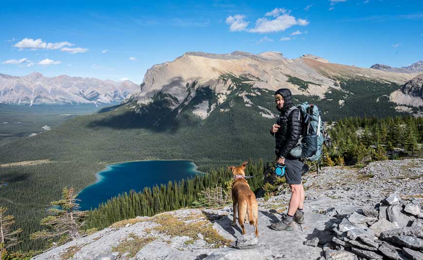
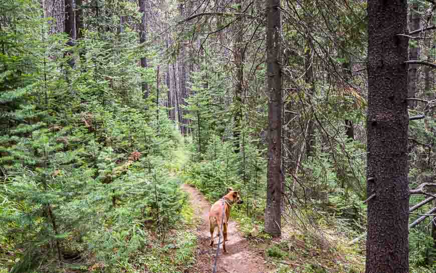
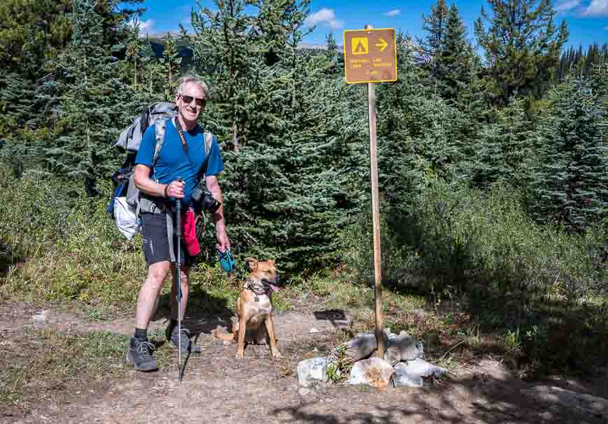
Dogs: Allowed on the Sunset Pass hike if they’re leashed.
Recommended reading: Camping for Beginners – What You Need to Know
This post includes some affiliate links. If you make a purchase via one of these links, I will receive a small commission at no extra cost to you. Thank you very much for your support.
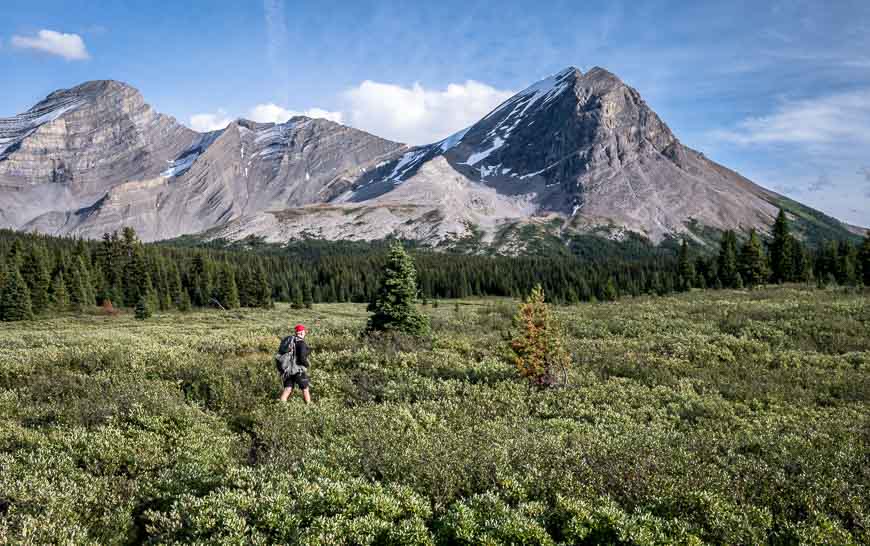
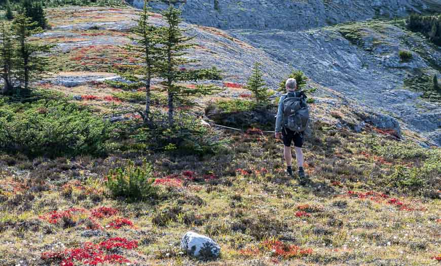
The route to the Sunset Lookout hike turnoff
Steep trails usually keep the crowds at bay. The hike to Sunset Lookout was no exception. We saw a few groups hiking down but the parking lot on a Sunday held at most 10 cars – a far cry from what you see in the Banff – Lake Louise corridor.
Leave the parking lot on a moderate grade trail that will try to trip you up with all the exposed roots. When the trail starts to steepen and the roots disappear, you can start counting switchbacks.
When you get to 35 you know you’re almost through the worst of it.
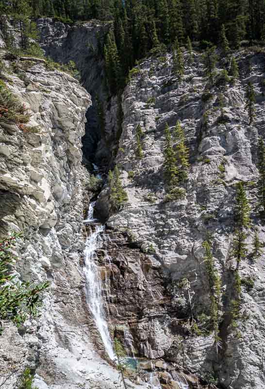
Early on in the Sunset Lookout hike you’ll hear running water. Our dog must have been getting thirsty as she started to tug hard on her leash. But that running water is Norman Creek Falls – and it’s not easily accessible from the trail.
Take one of the side trails, with the higher one – a few switchbacks later – being the prettier one to enjoy views of the canyon.
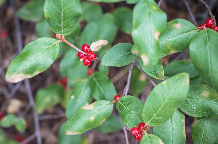
Along this section of trail look out for buffaloberries – a favourite food of black and grizzly bears.
According to the Biosphere Institute, a grizzly can chomp through over 100,000 berries in a day! Keep a close eye out for bears and your bear spray close at hand. Despite the fact that grizzlies reportedly use this trail, we didn’t so much as see any bear scat over the two days of camping and hiking in the area.
When you get to the top of the last switchback in a clearing, head left onto the Sunset Lookout Trail. See below for the description.
On the ground advice: If you are planning to hike to Sunset Pass and Sunset Lookout in a day, do the Sunset Pass hike first.
It alone is 16.4 km with an elevation gain of 727 m. That way you can see how much energy you have left when you get to the Sunset Lookout trail – as it requires another 3.2 km of hiking with an elevation gain in the order of 200 m.
The Sunset Lookout hike
The Sunset Lookout hike starts at the junction of the trail to Sunset Pass, 2.9 km up from the parking lot and trailhead. It’s signed and very obvious.
The trail to the lookout takes you through thick sub-alpine forest, climbing 183 metres (600 feet) over 1.6 km. There is little in the way of views until you reach the airy lookout, though there are occasional patches of wildflowers.
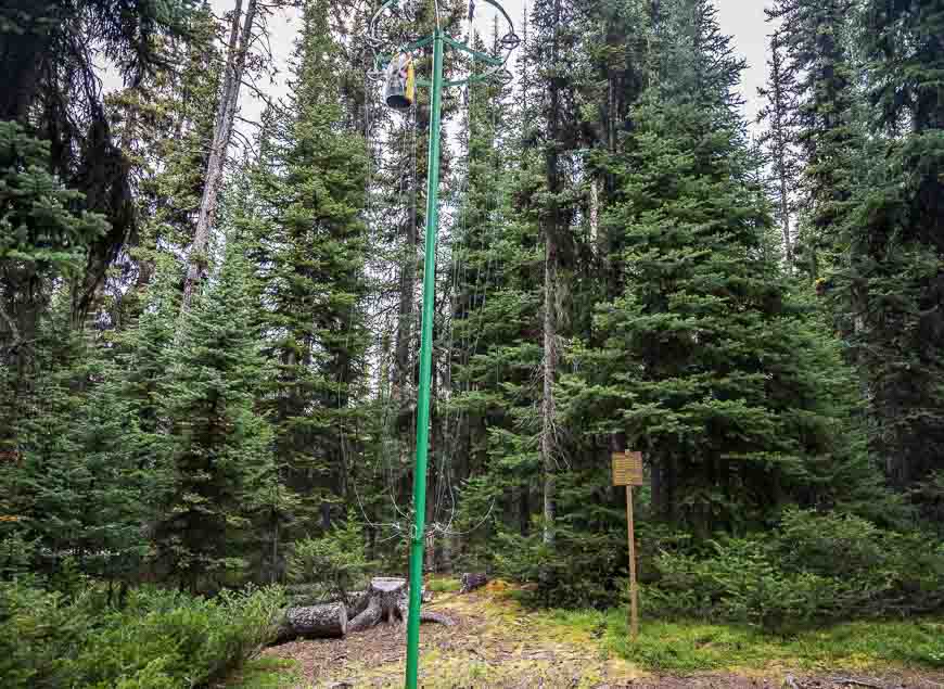
When you get close to Sunset Lookout, the trail angles west and descends on a steep slope. At the lookout you’ll find pieces of concrete and lightning conductor cables, the only remains of Sunset Lookout. It was built in 1943 and stayed in operation until 1978.
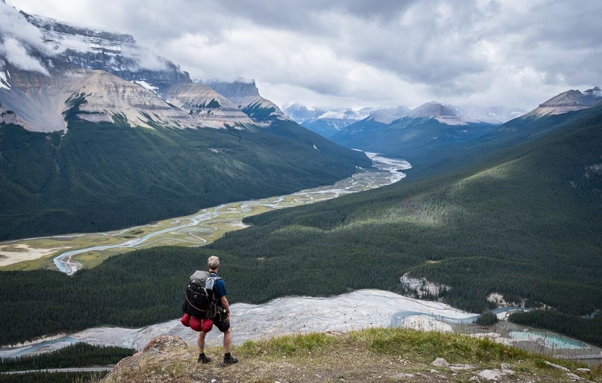
At the lookout the views are compelling both up and down the Icefields Parkway. Admire Mt. Saskatchewan rising to 3342 m at the southeast edge of the Icefields.
The confluence of the Alexandra River with the North Saskatchewan River is particularly beautiful.
The Graveyard Flats pictured below are quite a sight. Reportedly these flats offered the Native people some of the best camping in the upper North Saskatchewan Valley. It is also where they would dress their kills.
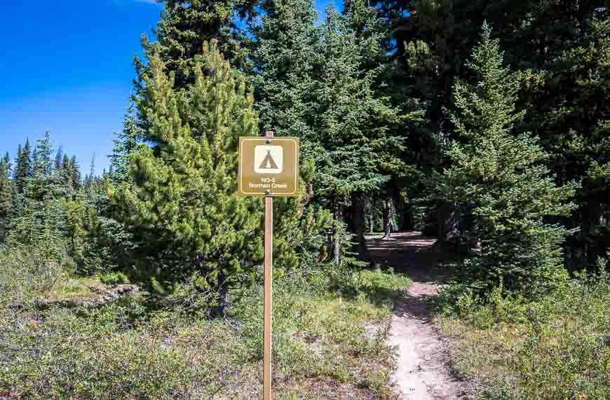
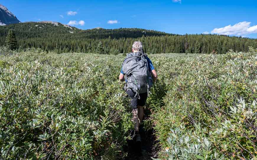
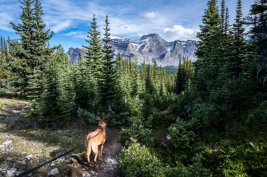
The hike to the Norman Lake Campground
It doesn’t take long to hike from the junction of the Sunset Lookout Trail to the Norman Lake Campground. It’s only 0.7 km (give or take a tenth of a kilometre or two) with the last half of it being flat.
Cross Norman Creek on the way to the campground via a couple of substantial planks. You can see the campground from the bridge off in the trees at the edge of extensive meadows.
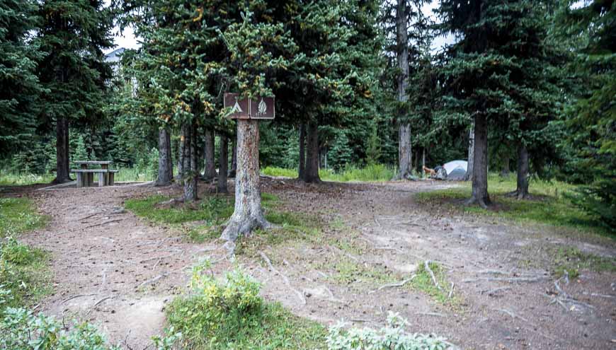
The Norman Lake (or Creek) Campground in Banff National Park
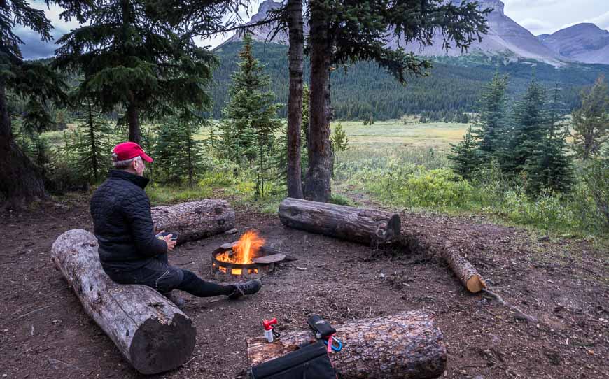
We spent one chilly but lovely night in the Norman Lake (sometimes called Norman Creek) Campground.
We set up our tent and hung our food when we first arrived and then continued to Sunset Pass with a far lighter pack.
On our return to the campground at about 6 PM, there wasn’t another soul around despite the fact that when we made reservations, it showed that four out of five of the campsites were booked. A bonus for us!
The Norman Lake campsite is one of the nicer ones I’ve visited in Banff National Park. The five tenting sites are spread apart – so there’s a sense of privacy.
A couple of wooden tables away from the campsites are well-situated for cooking. The fire ring – with a small stack of firewood, was a welcome addition on a cold night.
There is also a privy and water is available about 50 metres away from Norman Creek.
You can book a campsite online here. In 2025, reservations open on January 27 at 8 AM MT.
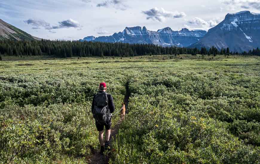
Norman Lake Campground to Sunset Pass hike
To continue to Sunset Pass, take a left just after the fire pit in the campground.
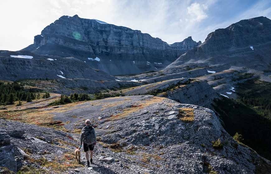
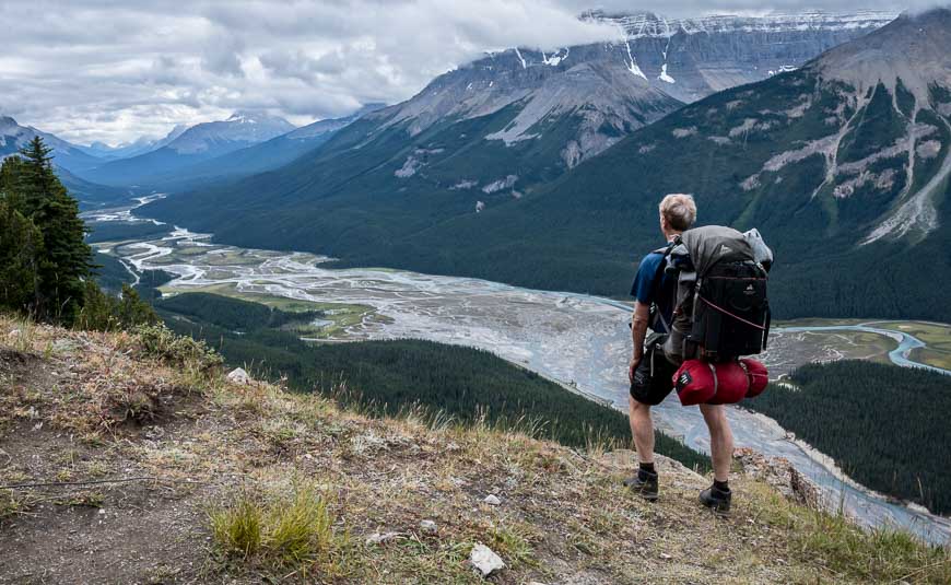
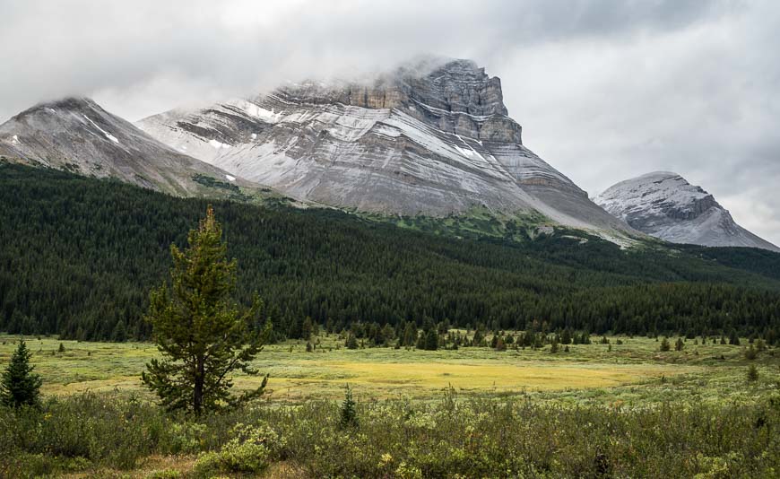
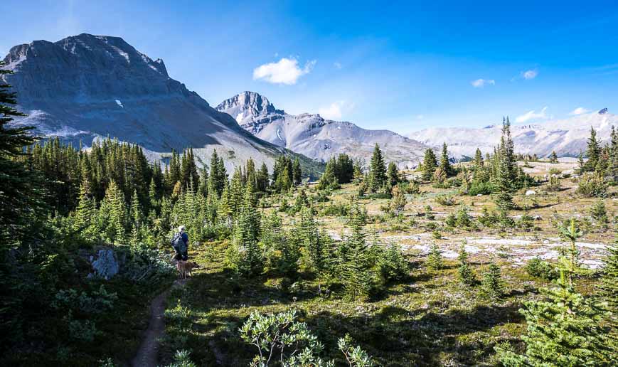
Follow the trail as it skirts the edge of a large meadow for several kilometres. In view for much of the time will be Mt. Coleman, topping out at 3,135 m. (The following morning it was dusted with fresh snow.)
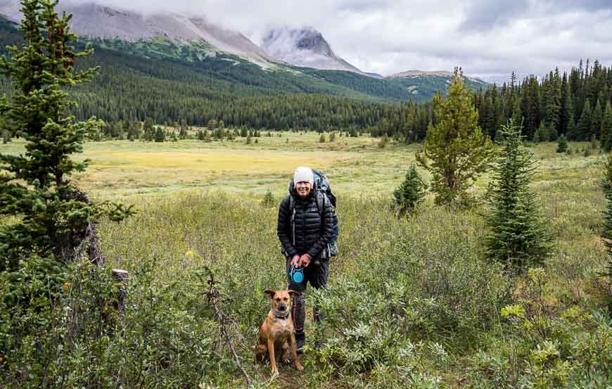
On the trail, there will be times when you’re walking through willows that are shoulder high. In these sections we made lots of noise, just in case there was a bear around.
Look behind occasionally – to get your bearings and to admire 3,260 m Mt. Wilson, named for an early explorer in the Canadian Rockies. Apparently its amphitheatres are wild and scenic – and quite the spot for experienced ice climbers.
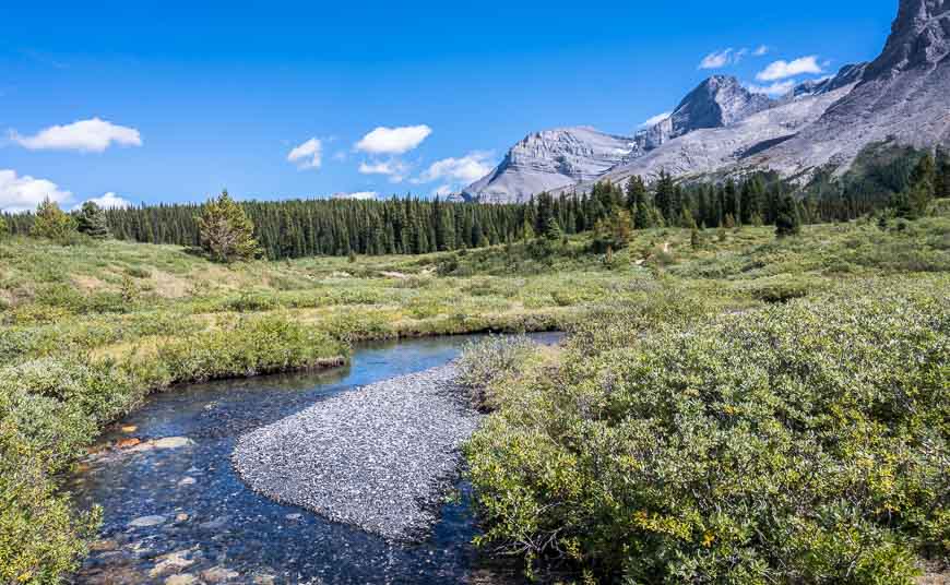
You do have to rock hop across Norman Creek at one point, but in late August the water isn’t running very high. It’s a good place to fill your water bottles if you’re starting to run low.
At the northeast end of the meadow follow the trail as it enters the trees. Start climbing, gaining a total of 193 m of elevation from the campground. Reach the Banff National Park boundary after 20-25 minutes. It is marked by a sign. Continuing, you enter the White Goat Wilderness.
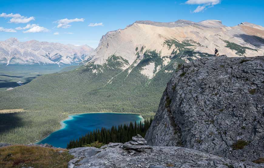
Once we broke out of the trees, we wandered off trail, eventually finding a short trail to a rock cairn overlooking gorgeous turquoise-coloured Pinto Lake – named for a troublesome packhorse from an 1893 expedition led by A. P. Coleman.
The views here are superb – and what makes the Sunset Pass hike so worthwhile. Admire the headwaters of the Cline River – and what looks like untouched wilderness. Have a wander around but unless you’re planning to camp at Pinto Lake, do not descend to the lake as part of a day trip as it will add another 10 km and 415 m of elevation gain.
Camping at Pinto Lake in the White Goat Wilderness Area
You can random camp near Pinto Lake – with no reservations needed. We saw about 10 people returning after a night there, so it’s a more popular spot than I would have guessed, at least on a summer weekend.
Alberta Parks does recommend that you let someone know your plans before you head into the White Goat Wilderness Area.
If you’re hiking the Great Divide Trail in this part of Alberta, you’ll end up hiking right by Pinto Lake.
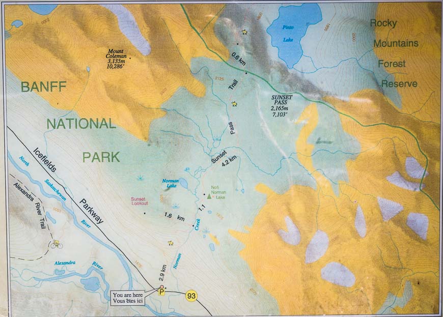
Where is Sunset Pass and Sunset Lookout?
This is one trailhead that isn’t marked on Highway 93. You’ll find it here on Google maps.
If you’re coming from the south on the Icefields Parkway, zero your odometer in Saskatchewan River Crossing and drive north from the junction with Highway 11 for 16.4 km. The parking lot is on the east side of the highway at the bottom of a hill.
From the Columbia Icefield Discovery Centre drive south for 32.9 km. Turn left (east) into the parking lot.
What to take on the Sunset Pass hike
If you’re planning to camp, especially later in the season take a pair of gloves and a down jacket with a hood.
Enjoying dinner by a fire is a wonderful way to experience the Norman Lake Campground on a cold night. Don’t forget the firestarter.
You’ll need to treat your water to be on the safe side. I like the Pristine Water Purification System. I am seeing a lot more people in campgrounds using gravity filters like this one.
The Gem Trek – Bow Lake and Saskatchewan Crossing Map is the one to have.
Where to stay before or after the hike
Lake Louise is a good place to spend the night before your backpacking trip though there are also hosteling and camping options along the Icefields Parkway and some don’t need reservations.
You might want to check out the Mosquito Creek Hostel or the Lake Louise Alpine Centre.
There are several hotels in Lake Louise Village including the Lake Louise Inn and the Mountaineer Lodge.
Further reading on backpacking trips in Banff Jasper National Parks
- Sawback Trail Hike: Johnston Creek to Baker Lake
- A 3 Day Backpacking Trip that Includes Egypt Lake
- Best Hikes in Banff: North Molar Pass and Fish Lakes
- The Glacier Lake Hike in Banff National Park
- Tonquin Valley Hiking Guide – What You Need to Know
Click on the photo to bookmark to your Pinterest boards.


Hey! How long exactly does it take to hike to the Norman Creek camground?
@Mike We got to the Norman Lake CG in 75 minutes hiking at a good clip. It’s only 4.2 km and all the switchbacks make the going easier.
Hi Leigh, thanks for the detailed descriptions and amazing photos! Do you know if you have to pay for parking at this trailhead? And was it OK to leave your car there for a few nights? Thank you 🙂
@Liz Its free to park and no problem leaving your car. But you will need to show your Parks Canada pass in the window of the car.
Gotcha, thanks so much Leigh! hoping to add this to my summer bucket list 🙂
This is a great description, thanks! Wonderful, helpful photos, too. But for a Canadian hiking in Alberta, why support Amazon, instead of the *local* distributor, Maptown, Calgary: https://www.maptown.com/
@HYL My audience is international and not just from Calgary. And as much as I like Maptown myself (and personally support them) my blog takes a lot of time, energy and money to run and I’m just trying to help pay my bills.
@Sue The switchbacks really did make it an easier experience. I feel like I’m in shape now after a summer of steep hikes!
Leigh I started huffing and puffing reading the phrase ’35 switchbacks’! Gorgeous scenery but I’m thinking this type of hike would not be for your beginner back country hiker? Wonderful to have it pretty much to yourselves and not to have any signs of bears. Always a bonus.