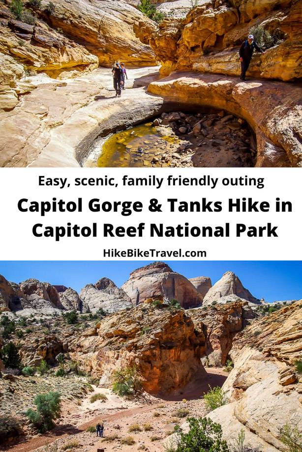
Capitol Gorge Hike, Capitol Reef National Park
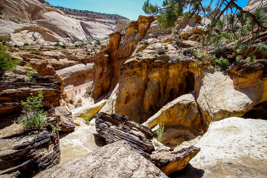
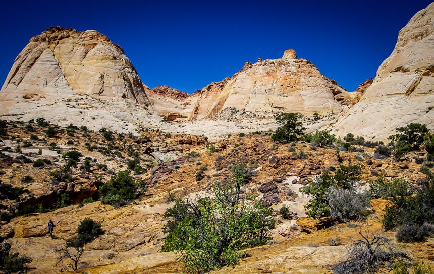
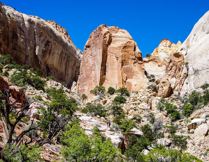
The Capitol Gorge hike in Capitol Reef National Park is a popular one. It features a scenic canyon, rock art, water tanks (naturally formed potholes), a narrows and even some historical relics.
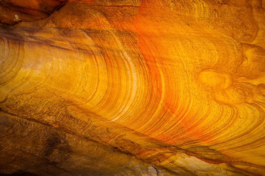
You can knock the hike to Capitol Gorge off in an hour if you really want to, ideally late in the afternoon when the light is at its best and the area glows golden. It’s just a two mile round trip hike to the Tanks with an elevation gain and loss of 80 feet.
Interestingly, the Capitol Gorge route was the main one through the park until 1964 when Highway 64 was constructed. The Capitol Gorge hike takes visitors past Petroglyph panels, a pioneer register, and the famous water tanks. Another name for the water tanks is potholes or waterpockets.
This post includes some affiliate links. If you make a qualifying purchase through one of these links, I will receive a small percentage of the sale at no extra cost to you. Thank you very much for your support.
Capitol Gorge hike summary
Access: The Capitol Gorge hike is easy to access from the Capitol Reef National Park Visitor Centre. And the drive itself is spectacular.
Distance: Hike from 0.5 miles to 6 miles round trip, depending if you just want to see the Pioneer Registry or you’re up for a hike to the Golden Throne.
Elevation gain/loss: +/- 80 feet
Time needed: Allow 1 – 3 hours depending on how far you hike.
Level of difficulty: Easy
Best time to go: The Capitol Gorge hike can be done year-round.
Dogs: Permitted on a leash, but pack out their poop.
Don’t forget: This is a desert environment so pack more water than you think you’ll need. Even though it’s a short hike, be sure to carry the hiking essentials.
Petroglyphs: Take photos but please don’t touch.
Would you like to save this?
Capitol Gorge hike description
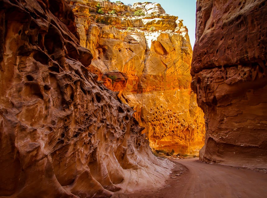
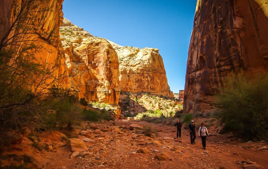
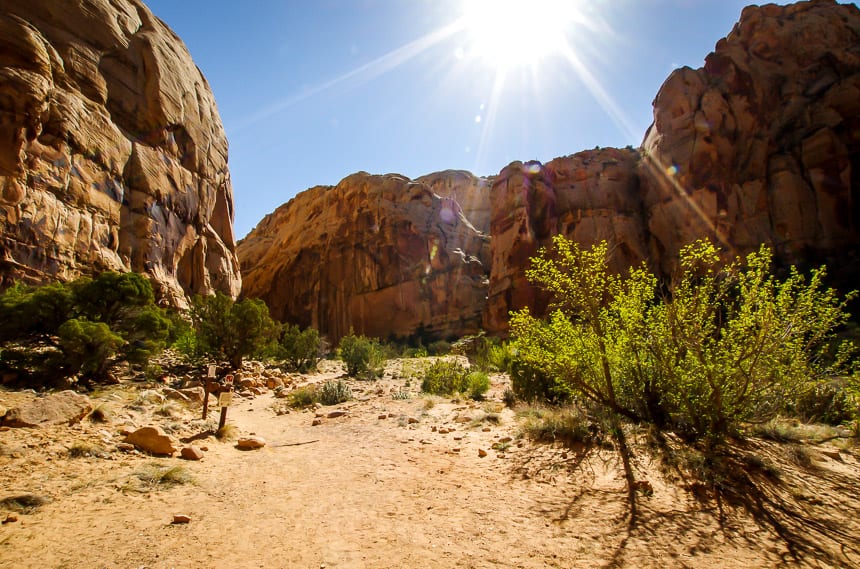
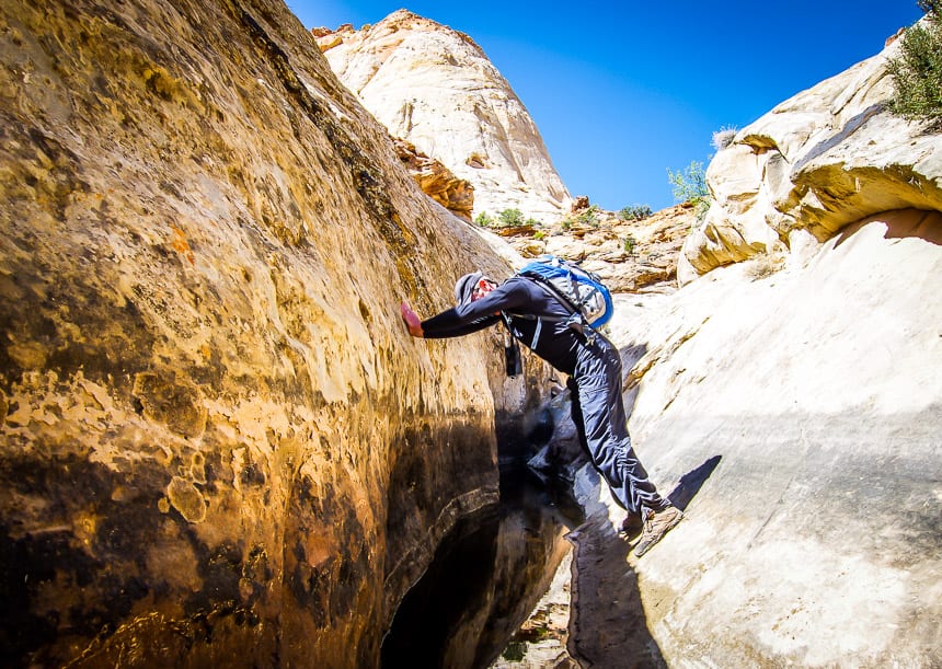
The Capitol Gorge hike starts off following a wash – with canyon walls rising steeply at times. They provide some shade in the heat of the day and are very welcome.
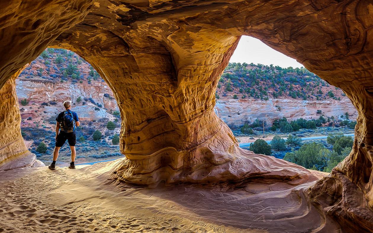
At the 0.6 mile mark you reach a pioneer registry with a heap of names carved in the rock in the 1800’s and early 1900’s.
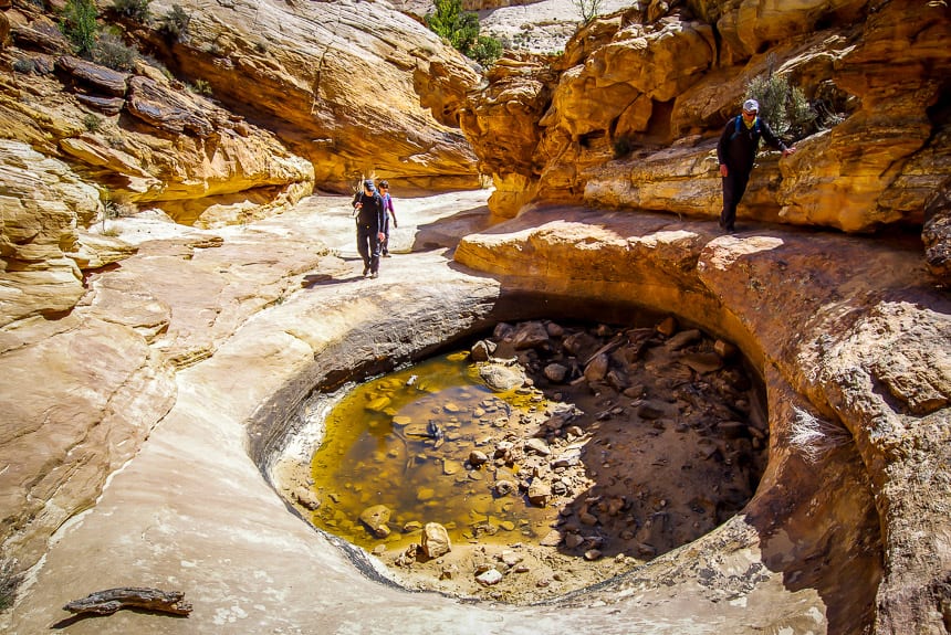
Shortly after passing the Pioneer Registry look for signage to the Tanks pointing to the left (north) and then continue up a rocky, steep trail for just 0.2 miles. Unless the “tanks” are full of water they are a tad underwhelming but there’s nothing underwhelming about the landscape.
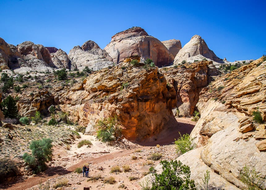
For better views and some fun playing on the rocks continue up past the Tanks until you’ve had enough. Retrace your steps. I think the Capitol Gorge – Tanks hike offers a lot of visual interest considering its length.
Options from the far end of the Capitol Gorge hike
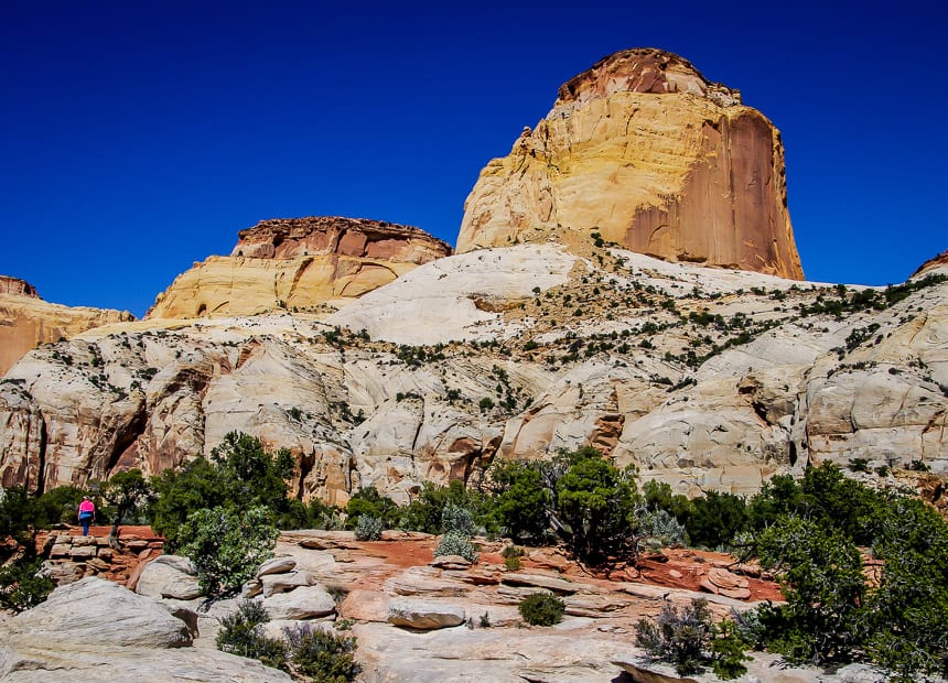
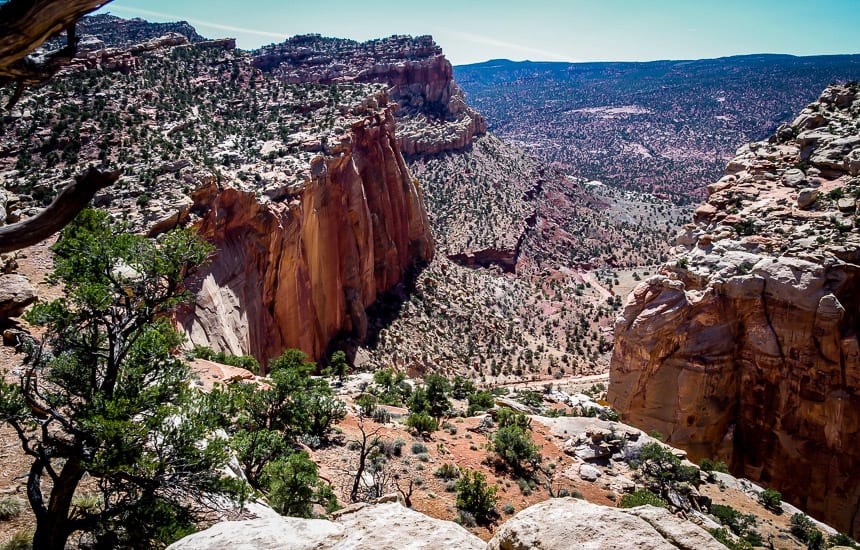
At the canyon’s east end, surefooted hikers can continue up to the Golden Throne via a steep trail with switchbacks.
That gets you near the top of the Waterpocket Fold – where views are magnificent. That adds another four miles return along with 730 feet of elevation gain. Only consider it if you’ve come prepared with lots of water, food and sun protection. Late afternoon is best if you’re a photographer.
Here’s a look at the visual treat that’s in store for you on the Capitol Gorge hike.

Finding the Capitol Gorge hike trailhead
To get to the Capitol Gorge hike trailhead (which is also used to access the Golden Throne Trail) drive 4.5 miles south along Scenic Drive from the Capitol Reef Visitor Centre until it turns into dirt covered Capitol Gorge Road. Continue another 2.4 miles to a parking lot. The drive itself is spectacular.
Map of the trailhead location
- Click on the three dots in the top right hand corner to email a copy of the map.
Where to stay near Capitol Reef National Park
Torrey is the closest town with roofed accommodation options. Some places to consider include the following:
- Capitol Reef Resort is at the entrance to the park and features an outdoor pool and hot tub
- Red Sands Hotel would be another good option. It features an indoor pool and hot tub.
More ideas if you love hiking in Utah
I could spend weeks in Utah hiking. It’s one of my favourite places on the planet. One book stands out as a guide that I highly recommend – Utah Canyon Country by Craig and Kathy Copeland.
Try some of these Utah hikes across some of the national and state parks.
Arches National Park and nearby
- A Sunset Hike to Balanced Rock, Arches National Park
- The Devil’s Garden Trail in Arches National Park
Canyonlands National Park
Capitol Reef National Park
- The Chimney Rock Trail, Capitol Reef National Park
- The Navajo Knobs Hike in Capitol Reef National Park
St. George – Kanab area
- Best Hikes in Snow Canyon State Park
- Coyote Buttes South – A Great Alternative to the Wave
- Moqui Caverns – Kanab Sand Caves
- Best Hikes Near Kanab, Utah
Click on the photo to bookmark to your Pinterest boards.


Leigh,
I too love Utah – it is a spectacular place to hike. But given recent developments there, I have absolutely no interest in returning anytime soon:
https://www.outsideonline.com/2155931/outdoor-industry-pushes-back-against-utah
In fact, the actions and rhetoric of the current political regime in the US have lead me to look elsewhere for my travel plans. And I am not alone:
https://www.nytimes.com/2017/02/20/travel/after-travel-ban-declining-interest-trips-to-united-states.html
So a suggestion: fewer articles about the US, and a lot more about Canada, Mexico, pretty much anywhere else. As Canadians, we can vote with our travel dollars.
Regards,
Kevin.
@Kevin I hate the politics of the US as much as I suspect you do. But there is a reality here – and that is I have family and friends in the US – all who hate Trump with a passion. So I will not stop visiting as Trump himself could give a damn if there are fewer tourists and there are lots of people who benefit from me visiting – both Trump and non-Trump supporters. As Canadians we have a lot at stake with Trump in power. But he’s not the only leader and the US is not the only country with politics I don’t agree with. How many people are willing to boycott other countries? How about Israel with Palestine, China and human rights, Norway slaughtering whales.. Seriously there are so few countries out there that have a perfect record. And we as Canadians don’t have much to be proud of when it comes to how we’ve treated native peoples. So it’s a sticky issue and I think everyone has to decide for themselves what is right or wrong for them.
Having said all that I will definitely be thinking outside the box about where I want to travel for longer trips. And already next year I am thinking about hiking in Malloraca in February versus Arizona.
Just as an FYI, today’s post is from a trip to Utah two years ago that I never got around to writing.
Thanks for the links. I didn’t know about Utah’s position – and yet it’s a landscape that calls me back – not the government. Weird times we live in.