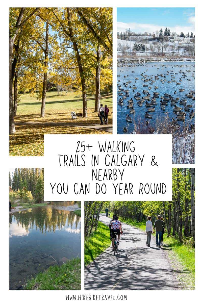
25+ Walking Trails in Calgary & Nearby
It took me over a decade of living in Calgary to get out of the rut of doing the same walking trails in Calgary. I have no problem going to Kananaskis or Banff National Park and hiking a different mountain every weekend, but somehow in my naïveté, I discounted what the Calgary walking trails might have to offer.
One look at a map of Calgary and you can see that it’s laced with parks. Some of these parks – like Nose Hill and Fish Creek offer many days worth of glorious hikes, but there are countless other walking trails in Calgary that merit a visit. My personal preference are the wilder walking trails in Calgary. I’d rather not see houses or hear any street noise, but that unfortunately is unrealistic.
Still, there are many walking trails that are an absolute delight that I plan to visit in all seasons. Read on for some hiking inspiration in Calgary. I hope you have as much fun discovering the city on two feet as I did.
This post includes some affiliate links. If you make a qualifying purchase through one of these links, I will receive a small percentage of the sale at no extra cost to you. Thank you very much for your support.

Would you like to save this?
My favourite 5 walking trails in Calgary
- Weaselhead Flats in North Glenmore Park – because it’s rarely busy and it feels wilder.
- Nose Hill Park – because there’s so much to explore and my dog can run free most of the time.
- Inglewood Bird Sanctuary – for a nature reboot in the city.
- Dale Hodges Park and Bowmont Natural Area because of the variety you experience, the boardwalks and easy access to Bow River.
- Ann and Sandy Cross Conservation Area at the south edge of Calgary for grand vistas, lots of trails to choose from and wildlife.
What to take on the walking trails in Calgary
I haven’t provided detailed, step-by-step hiking descriptions, so I’d suggest downloading an app like Organic Maps. Most of the walking trails in Calgary are straightforward – but when you get into neighbourhoods you’ve never visited before, it’s easy to get turned around.
Dress in layers, especially when it’s cold. You’ll heat up quickly on some of these hikes, but also cool down just as fast in the face of biting winds. I’d recommend a neck warmer or a buff.
Almost all of the walking trails in Calgary can be hiked year-round. Exceptions are after a big snowstorm. In winter and during the spring thaw I highly recommend carrying microspikes and a pair of collapsible hiking poles. If it’s snowy, a pair of leg gaiters is also helpful.
I found some trails in Calgary, particularly in the west, were very clay-like underfoot. On wet days I found myself with an inch or more of clay clinging to my hiking boots. You might want to bring another pair of shoes for the drive home.
For even more ideas, especially for neighbourhood walks, pick up a copy of Lori Beattie’s Calgary’s Best Walks – 45 Urban Jaunts and Nature Strolls.
If you’re a solo walker, you might feel safer with a Garmin InReach. Most of the time you’ll have cell service, but occasionally you won’t.
Location map of the walking trails in Calgary
If you don’t have a car, check Calgary Transit for options on getting to the walks.
- Click on the dots in the righthand corner of the map to email a copy.
Safety on Calgary’s trails
It’s always a good idea to let someone know where you are hiking – and when you plan to be out. Accidents can happen even on easy Calgary walking trails. I always recommend carrying the hiking essentials, just in case.
Wildlife
Most of the wildlife I see on the walking trails in Calgary is non-threatening – like the squirrels and beavers along the Bow and Elbow Rivers. I have come across a bobcat – which was a thrill, but it didn’t hang around.
The moose pictured below was seen on the Twelve Mile Coulee Trail. While their eyesight is terrible, their hearing and speed is first rate. Give them space. (It suddenly appeared about 40 feet away from us!)
Up in Nose Hill Park I regularly see coyotes. One time my husband and I were followed by a pack of five coyotes (at some distance), so we didn’t waste any time changing course, especially as we had two dogs with us.
Deer are also a common sight on the wilder trails – and very occasionally you might see a bear. I’d recommend carrying bear spray for peace of mind.


Walking trails in Calgary – southwest
1. Sandy Beach, River and Riverdale Parks
Starting point/parking: Sandy Beach Park, Riverdale Avenue off leash park, or along 14A Street.
Facilities: Seasonal bathrooms.
Distance: Minimum 4 km but highly variable depending on where you park and if you head into Britannia for coffee. If you do the walk as a loop that includes a neighbourhood walk along Sifton Blvd., up 8th St and then to 29th Ave by the Glencoe Club it could be closer to 8 km.
Difficulty: Easy.
Public transportation: Bus access points along the route.
Season: Year round. Wear icers in winter and spring as the trails down to Sandy Beach Park get very slippery.
Stroller friendly: Yes
Cafes: Mongram Cafe in Britannia and at 4814 16th Street SW in Altadore.
Dogs: Yes, on a leash except for the off-leash part of River Park and Riverdale Park.
Highlights: This is one of my favourite urban walking trails in Calgary. Often I’ll park in the Riverdale Avenue off leash park and start by heading towards Sandy Beach. On a hot summer’s day this is a good place to dip your toes in the water.
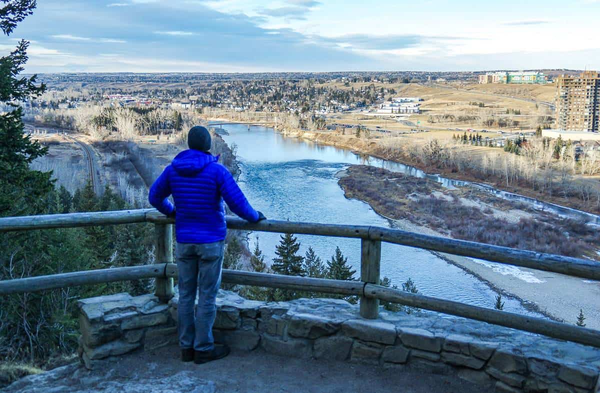
Look for a set of earthen stairs and climb them to reach the River Park escarpment. Enjoy excellent views of the Elbow River and Calgary’s downtown skyline. You can also see the trail heading up to Britannia – if you choose to end with a coffee shop stop. River Park is about a kilometre long, so if you do and out and back, and retrace your steps with a stop in Britannia, you’ll be at the 4 km mark.
To lengthen the walk, head for Sifton Boulevard and take it to Elbow Park School. Go north on any street to reach 29th Avenue and the Glencoe Club. Weave back through the neighbourhood, crossing the Riverdale Bridge, continuing past beautiful homes on Riverdale Avenue to reach your car.

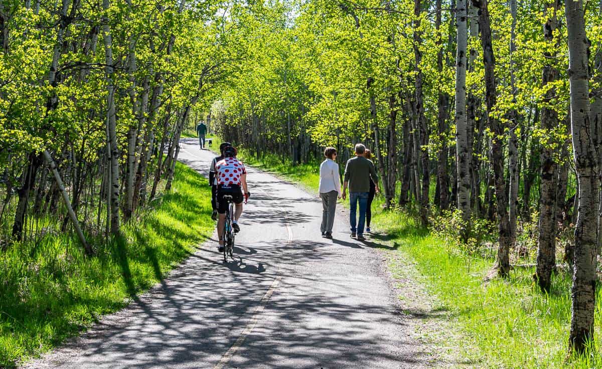
2. Elbow River Pathhway – one of my go to walking trails in Calgary
Starting point/parking: Good parking at Stanley Park, Lindsay Park, and on streets in neighbourhoods near the Riverdale Avenue Footbridge.
Facilities: Seasonal washrooms, picnic tables, benches.
Distance: Approximately 17.2 km return from the Elbow River Traverse to the bridge at Sandy Beach but easy to do an out and back section.
Difficulty: Moderate, only because of the length if you do the whole thing.
Public transportation: Bus access at points along the route.
Season: Year-round. Can get icy in winter, so microspikes can come in handy.
Stroller friendly: Yes
Cafes: Gravity Cafe in Inglewood and Bells Cafe at 1515 34 Ave SW.
Dogs: Yes, on a leash but beware of cyclists.
Highlights: The Elbow River Pathway is a pretty urban trail that follows the Elbow River from the confluence of the Bow River to Sandy Park. Along the route you’ll encounter footbridges, parks, a section of high-end homes along Riverdale Avenue, and some stellar views of the Saddledome. I often see beavers swimming in the Elbow River – and there’s usually lots of birdlife along the route.

3. Douglas Fir Trail in Edworthy Park
Starting point/parking: Edworthy Park South parking lot.
Facilities: Washrooms at the trailhead, picnic tables, benches, fire pits, playground.
Distance: 5.8 km round trip
Difficulty: Easy
Public transportation: Bus access at points along the walk.
Season: Best in spring, summer and fall. Closed in winter because of hazards.
Cafe: Angels Cafe – enjoy their patio by the Bow River.
Stroller friendly: No
Dogs: Yes, on a leash.
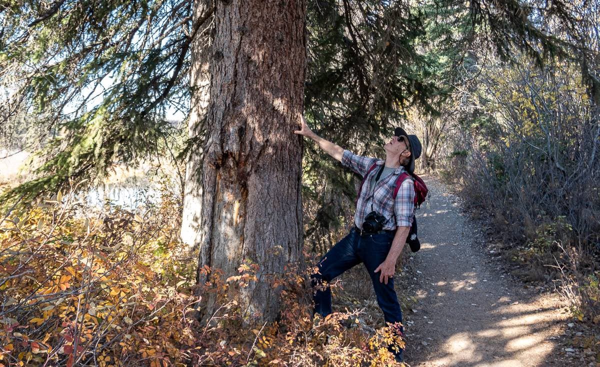
Highlights: If you want to hike in the presence of 400-year-old trees, head for the Douglas Fir trail, home to one of the most easterly stands of Douglas Firs. Pick up the Douglas Fir trail from the parking lot, stopping to read interpretive signage along the way. You may need a breather once you reach the Douglas Fir Trail Platform – so it’s a good time to snap a few pictures. The trail continues to undulate through steep terrain, featuring frequently crossing over tree roots and offering numerous stair-climbing sections.
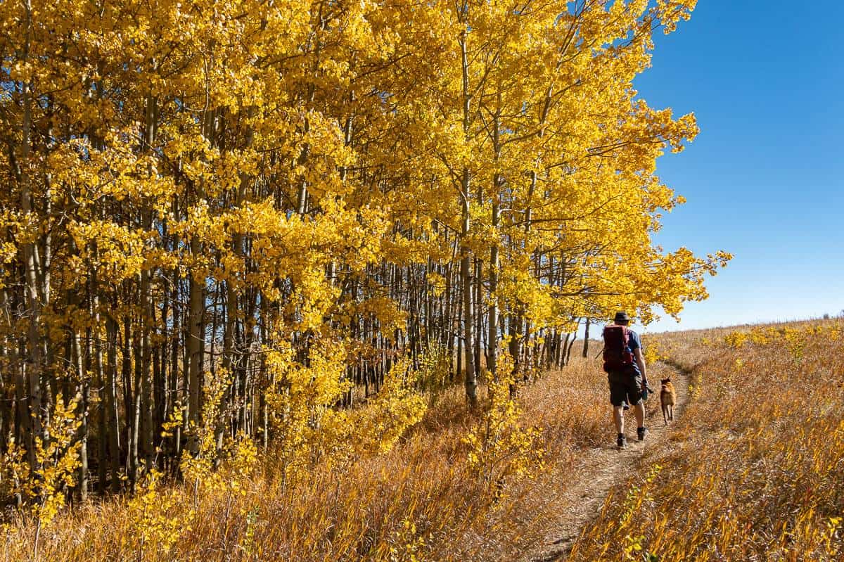
4. Weaselhead Flats Park – North Glenmore Park – one of the wilder walking trails in Calgary
Starting point/parking: Weaselhead parking lot at 66th Avenue and 37th Street SW in North Glenmore Park.
Facilities: Porta Potty at the Weaselhead parking lot.
Distance: Approximately 6.5 km return.
Difficulty: Easy
Public transportation: There is bus access to the Weaselhead parking lot in Lakeview.
Season: Year round, but can be slippery and muddy from November to late April. After a rain there are lots of large puddles.
Stroller friendly: Doable in a pinch but wouldn’t recommend.
Cafes: None close by.
Dogs: Not permitted on any of the Weaselhead Trails.
Highlights: To reach Weaselhead Flats Park you must walk to it via North Glenmore Park or the Jackrabbit Trail, described below. No matter how you get there, you’re in for a treat. It’s one of the top walking trails in Calgary for nature lovers.
Enter the Weaselhead Flats area after crossing the bridge over the Elbow River. You’ll find signage with a map of the trails – along with interpretive signs once you get walking. I’d recommend the Oxbow Trail that follows a section of the Elbow River. It’s peaceful and full of bird song. Look for paddlers on the river as well as fisherman.
This is one of the walking trails in Calgary where there’s a high probability of seeing wildlife, especially at dawn and dusk. Bears, coyotes, moose, and deer are occasionally seen, so stay alert. The one animal we saw was a muskrat – which was still a thrill.
5. Jackrabbit Trail, South Glenmore Park – one of the quietest walking trails in Calgary
Starting point/parking: South Glenmore Park at the intersection of 90th Avenue and 24th Street SW
Facilities: Seasonal bathrooms and a playground by the parking lot.
Distance: 7.2 km
Difficulty: Easy to moderate depending how you handle hills
Public transportation: Bus access along 90th Ave SW.
Season: Year round but take icers in the colder months as it can get slippery.
Stroller friendly: No
Dogs: Not permitted!!!
Cafes: The closest one is Good Earth Coffeehouse at Glenmore Landing.
Highlights: Interestingly, you won’t find any signage in fall 2023, that you are on the Jackrabbit Trail until you reach Weaselhead Flats – and then you’ll see signage with maps.
There are a maze of trails parallel and north of the Glenmore Pathway. John and I elected to walk beside the Glenmore Reservoir on a trail that was very good for about a kilometre. When it died, we headed into the woods and picked up the formal Jackrabbit Trail. It weaves up and down hills through the trees between the Glenmore Pathway and the Glenmore Reservoir. As you approach Weaselhead Natural Environmental Park, the trail gets wider. ‘
There is an upper and lower Jackrabbit Trail, so you can do the walk as a loop. You can also cross the paved Rotary Mattamy Greenway and continue onto either the Oxbow Trail or the Weaselhead Trail, if you’re looking for a longer walk.


6. Griffiths Wood, Discovery Ridge
Starting point/parking: The end of Discover Ridge Link SW.
Facilities: Bathrooms available year-round at the trailhead.
Distance: Variable but up to 6.9 km on the Perimeter Loop Trail.
Difficulty: Easy and flat.
Public transportation: Bus access to Discovery Ridge.
Season: Year round.
Stroller friendly: Yes, if you stick to the main trails.
Dogs: Yes, on a leash.
Cafe: Wonder Donuts
Highlights: The best way to explore the park is on the 6.9 km Perimeter Loop Trail but this is also a park where you can just follow your nose and see where it takes you. There are a mix of paved and unpaved walking trails throughout the park. A couple of hours will be enough for most people. You will find trail maps at major intersections.
In the summer, I always head for the Elbow River – as there are rocky beaches where the dogs can jump in and cool off. Humans too by the look of things. Don’t forget your binoculars as there is also lots of bird life, especially in the spring.

7. RiverWalk: Peace Bridge Loop to George C. King Bridge
Starting point/parking: Paid parking at the Eau Claire Market and street parking in the area – but free on Sundays.
Facilities: Bathrooms in the Simmons Building.
Distance: Approximately 4.8 km return.
Difficulty: Easy
Public transportation: Bus access at points along the walk plus C-train access to Bridgeland Station.
Season: Year round. Can be lovely in the evening.
Stroller friendly: Yes
Dogs: Yes on a leash but not a great idea on a busy weekend because of the number of people.
Cafe: Sidewalk Citizen Bakery – for breakfast, lunch, and pastries.
Highlights: The western part of Calgary’s RiverWalk is a delight. Start walking anywhere along the route, stopping to admire art installations, birds gathered on the Bow River, and your fellow walkers. Don’t miss a stop at the photogenic Peace Bridge (lovely at night) or at Sidewalk Citizen Cafe for their decadent sticky buns.

8. Prince’s Island Park
Starting point/parking: There are parking lots and parking meters on Eau Clair Street and between 2nd Avenue SW and Eau Claire Avenue SW from 4th Street SW to 7th Street SW.
Facilities: Seasonal water fountains, washrooms, picnic areas and outdoor skating on the lagoon.
Distance: Variable. The island is about 1 km long so count on 2 km and more if you do loops plus additional for walking to a parking spot.
Difficulty: Easy.
Public transportation: Bus access at points along the walk.
Season: Year-round.
Dogs: Allowed on leash.
Restaurant: The River Cafe is located on Prince’s Island. The ambiance is wonderful and the food delicious. A great spot for weekend brunch.
Highlights: For a short stroll in downtown Calgary, Prince’s Island Park ticks off all the boxes. It’s location on the Bow River is a beauty – with access via the Bow River Pathway and bridges at either end of the island. Downtown Calgary is a short walk away, so its perfect for out of towners.
While you won’t likely get your heart rate up as you stroll the tree-lined paths of Prince’s Island Park, you will enjoy a car free outing. Learn a few things too, thanks to some interpretive signage at the east end of the park. Stop to admire the ponds and the Calgary Skyline. Go for a skate on the lagoon if you visit in winter.

9. Glenmore Reservoir Trail
Starting point/parking: Numerous parking lots, especially along North Glenmore Park Road.
Facilities: Seasonal and year round bathrooms in North and South Glenmore Park.
Distance: 15 km on the short route and 16.5 km if you include the loop around Glenmore Dam. You could also do and out and back loop.
Difficulty: Easy for regular walkers. Moderate for those not used to the distance.
Public transportation: Bus access at points along the route.
Season: Year round though shaded sections can get icy in winter so I’d recommend microspikes.
Stroller friendly: Yes
Dogs: Allowed on leash.
Cafe: Good Earth Coffeehouse in Glenmore Landing.
Highlights: Over the length of the Glenmore Reservoir trail you’ll find lots to love. You can walk it in any direction – and you can choose between the multi-use paved trail or some of the dirt trails like the Jack Rabbit Trail that get close to the water.
Starting from North Glenmore Park, where you can enjoy mountain views from the top of the bluffs, head counterclockwise, descending a steep hill towards the Weaselhead Flats area. Cross the bridge – looking for kayakers in summer, and head around what was once a large beaver pond. Climb a steep hill
10. Bow Valley Ranch Loop, Fish Creek Provincial Park
Starting point/parking: Bow Valley Ranch
Facilities: Bathrooms at the trailhead and benches.
Distance: 8 km loop
Difficulty: Easy, save for the one climb up from Annie’s Cafe.
Public transportation: Bus access plus a C-Train to Fish Creek Station.
Season: Year round.
Stroller friendly: Yes
Dogs: Yes, on leash.
Cafe: Annie’s Cafe is at the beginning and end of the walk.
Highlights: From Annie’s Cafe climb the hill on the paved path towards the escarpment. Continue along the escarpment, enjoying views over Fish Creek Park, until you reach Canyon Meadows Drive. Descend the hill, crossing Bridge #9, and continue south back towards the cafe on a mix of paved and dirt trails.
11. Votier Flats, Fish Creek Provincial Park
Starting point/parking: South end of Elbow Drive in the Votier Flats parking lot or the parking lots for Bebo Grove, and Shannon Terrace.
Facilities: Washrooms, picnic tables, benches.
Distance: 6.2 km return to Bebo Grove or 12 km if you do and out and back loop heading west to Shannon Terrace.
Difficulty: Easy.
Public transportation: Bus and C-Train options.
Season: Year round but can be icy in the winter. Pack microspikes.
Cafe: Annie’s Cafe in Fish Creek Provincial Park
Stroller friendly: Yes.
Dogs: Yes, on a leash.
Highlights: From Votier Flats head east, crossing four bridges through a forest of balsam and poplar on the way towards Bebo Grove.
I like to mix it up by walking on a mix of paved and dirt trails. I find the dirt trails are quieter and you don’t have to watch out as much for cyclists. I love the trail that takes you down along the river and the sandstone cliffs, nesting spots for peregrine and prairie falcons.
Between the 5th and 6th bridge there’s a set of stairs leading to a trail with a view. Take them up – if just for the view and return to the paved trail – though you can continue on this narrow dirt trail all the way to the Marshall Springs area.
Walk around the storm pond at Bebo Grove and retrace your steps to return or continue along Fish Creek to reach Shannon Terrace. Keep an eye out for beavers in the creek and deer making unexpected appearances along the trail.

12. Strathcona and Aspen Ravines
Starting point/parking: Free parking on Christie Park Manor SW
Facilities: None on the trails.
Distance: 6.5 km round trip as an out and back walk
Difficulty: Easy
Public transportation: Bus access at points along the walk plus C-Train possible.
Season: Year-round.
Stroller friendly: Yes, though it might be bumpy along the boardwalk and there will be a short section of gravely trail at the end of it.
Dogs: Allowed on a leash.
Cafe: Good Earth Coffeehouse, 555 Strathcona Blvd. SW. It’s a two block detour from Strathcona Ravine to get here.
Highlights: Within the communities of Strathcona and Aspen you’ll find Strathcona Ravines Park, a narrow ribbon of green that makes you feel far removed from a city, especially when you see deer within minutes of starting a hike. Most of the hike is on asphalt save for the odd-side trail and the wooden boardwalk at the western end of the Strathcona Ravine. It crosses a seasonal stream, so be prepared for muddy dogs in the spring.
To continue into the Aspen Ravine you have to climb up a small hill at the end of the boardwalk to reach Strathcona Boulevard. Go right and then left, crossing a major intersection to stay on Strathcona Drive.
Walk down the equivalent of one large block, past a couple of cul de sacs and look for a trail leading into the ravine. This part of the hike doesn’t feel as wild as you pass a lot of backyards. Follow it to the end and retrace your steps to the parking lot.

Walking Trails in Calgary – Southeast
13. Inglewood Bird Sanctuary
Starting point/parking: 2425 9th Avenue SE, Calgary
Facilities: Bathrooms
Distance: Approximately 2.5 km of trails within the bird sanctuary.
Difficulty: Easy and no hills.
Public transportation: Bus access at various points along the route.
Season: Year-round but best for birds during the spring and fall migration. In spring expect to see songbirds and shorebirds along the Bow River and in fall the warblers come through.
Cafe: Post walk, check out one of the cafes along 9th or 17th Avenue SE like Good News Coffee or head to the Blackfoot Truckstop Diner – a Calgary classic.
Stroller-friendly: There is a pathway that is both wheelchair and stroller friendly.
Dogs: Not permitted.
Highlights: The Inglewood Bird Sanctuary offers some of the finest walking trails in Calgary – and though close to downtown, it feels a world away. The Inglewood Bird Sanctuary became a Federal Migratory Bird Sanctuary in 1929. Since then over 270 species have been sighted, with 53 types nesting on site. In addition, 21 types of mammals call the sanctuary home. Visit the Nature Centre (check their hours before you visit) to learn what’s recently been sighted.
Even though the Nature Centre may not be open, you can walk the trails here from sunrise to sunset year round. Meander through the woods, up and down sloughs and along a section of the Bow River. It’s a wonderful place to commune with nature, picnic, and get a little exercise. Kids will love the place.

14. Carburn Park and Beaverdam Flats
Starting point/parking: 67 Riverview Drive SE
Facilities: Year round washrooms at Carburn Park in addition to benches and picnic tables.
Distance: 2.4 km loop around the ponds with an option to make it into an 8.5 km out and back walk to Beaverdam Flats.
Difficulty: Easy and flat.
Public transportation: Bus access to Riverbend and Lynndale.
Season: Year round. In winter you can skate on the ponds in Carburn Park.
Stroller friendly: Yes
Dogs: Permitted on leash.
Cafe: None nearby.
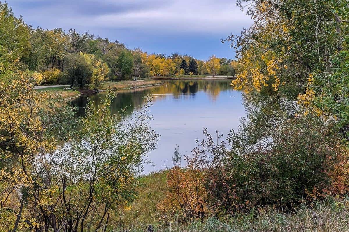
Highlights: For an easy walk do the 2.4 km loop around two man-made ponds in Carburn Park. They’re in a pretty setting surrounded by trees and shrubs including chokecherry and buffaloberry. Keep an eye out for white pelicans and bald eagles on your walk.
To continue to Beaverdam Flats, simply walk north towards Glenmore Trail – and then up the escarpment to the Lynwood neighbourhood. Find a bench, sit back and enjoy both Rocky Mountain and downtown Calgary views.
To continue to Beaverdam Flats, keep walking to reach a trail that descends to the Bow River. Explore side trails in the Beaverdam Flats area before retracing your steps to Carburn Park.
From Carburn Park, it’s less than a kilometre to reach Sue Higgins Park on foot via the Eric Harvie Bridge. It sports a giant off-leash area for dogs along the Bow River and a series of interconnected walking trails on the west side of the Bow River.
15. Elliston Park
Starting point/parking: 17th Ave SE and 60th St. SE
Facilities: Seasonal washrooms (mid-May to mid-October), playground, water fountains
Stroller friendly: Yes
Distance: 3.4 km loop
Difficulty: Easy and good for families – a bit rough for strollers.
Public transportation: Bus access.
Season: Year-round.
Stroller friendly: Yes
Dogs: Yes – and part of the trail is off-leash.
Cafe: Head to nearby 17h Ave SE – a hotbed of international eateries and shops. Sign up for the Around the World Food Tour that’s been going for over 20 years and spans 35 blocks.
Highlights: Enjoy a easy walk around the circumference of Elliston Lake, a storm water drainage lake – and not one you’d want to dip a body part in. There are plenty of dirt paths that weave through the park amongst the trees planted on hillsides. There is some road noise, but it’s still an easy place to get lost in your thoughts as you watch the birds in action. Kids will love the playground post walk.

16. Pearce Estate Park – Bow River Pathway – Inglewood Neighbourhood
Starting point/parking: Look for a large parking lot at the north end of 17A Street SE.
Facilities: Seasonal washrooms, playground, picnic tables, barbecue grills, Sam Livingston Fish Hatchery, Bow Habitat Visitor Centre, A catch and release kids (no bait) from May 1 – September 30th.
Distance: About 4.6 km from the Pearce Estate parking lot, around the wetlands, past Harvie Passage Lookout, along the Bow River Trail, detour to Good News Coffee and back.
Difficulty: Easy.
Public transportation: Bus access at various points along the route.
Season: Year round.
Stroller friendly: Yes though trails are a mix of paved and gravel.
Dogs: Permitted on a leash.
Cafes: Lots of choice in the Inglewood neighbourhood along 9th Ave. SE like Analog Coffee Inglewood at 1139 9th Ave. SE.
Highlights: The constructed wetlands area and the trails running through the park are beautiful and ideal for kids. There is interpretive signage around the ponds and the walking here is fun and easy.
Wander down to the Bow River, admiring the kayakers in summer as they paddle through Harvie Passage. Continue walking beside the Bow River, going under the CPR Train Bridge and then turning south on 15th Street SE – if you’re after some coffee. After a break, either retrace your steps or walk through the Inglewood neighbourhood back to the Bow River Trail and into Pearce Estate Park.

Walking Trails in Calgary – Northeast
17. RiverWalk East – St. Patrick’s Island Loop
Starting point/parking: New Street SE or along 15th Street SE
Facilities: Washrooms on St. Patrick’s Island, playground, fire pit, benches, picnic tables, colourful cafe tables.
Distance: 3.0 km loop with options to increase the distance by continuing on the RiverWalk west or taking the Bow River Trail east.
Difficulty: Easy
Public transportation: Bus access at various points along the route plus a C-Train at Bridgeland Station.
Season: Year-round.
Cafes: Phil & Sebastian Coffee Roasters in the Simmons building
Stroller friendly: Yes
Dogs: Yes, on a leash.
Highlights: One of the top walking trails in Calgary starts in the Inglewood neighbourhood and leads you on a paved pathway across the Elbow River and then alongside the Bow River to St. Patrick’s Island. Look out for interesting urban art installations before stopping in for coffee in the Simmons Building – or continue across the George C. King Bridge to walk the trails on St. Patrick’s Island.
The island, located at the confluence of the Elbow and Bow Rivers is a delight. Wander 1.6 km of trails, check out their architecturally interesting benches, stop by the beach for a superb view of downtown Calgary, and check out the fire pit at the top of a steep set of stairs.
If you like loop walks, continue to the eastern end of the island and pick up the pathway that leads over the Zoo Bridge back to where you parked your car in the Inglewood neighbourhood.
Walking Trails in Calgary – Northwest
18. Confederation Park – Capitol Hill
Starting point/parking: There are a couple of parking areas in the park plus easy access from surrounding neighbourhoods. I started at the 30th Avenue and 7th St NW parking lot. There is also one at 3009 10th Street NW and another across the street on the west side of 10th Street NW.
Facilities: Year round washrooms close to the parking area, drinking fountains, playgrounds, and picnic spots.
Distance: Up to 7.8 km as a loop.
Difficulty: Easy
Public transportation: Bus access at various points along the route.
Season: Year round.
Dogs: Permitted on a leash.
Cafe: Weeds Cafe, 1903 20th Ave. NW
Highlights: Confederation Park is one of Calgary’s urban parks. Multi-use paved trails generally run east west in a crescent shape with 10th Avenue bisecting the park. The park borders four neighbourhoods – Mount Pleasant, Capitol Hill, Collingwood and Highland Park.
You can start walking from anywhere that’s convenient for you, whether it be on a neighbourhood street or a formal parking lot. I particularly love the open feel and the big trees as the eastern end of the park, so that’s where I started.
Walk west (there are tunnels under 10th Street and 14th Street) past duck-filled ponds to the southern boundary of the Confederation Park Gold Course. Continue, crossing 19th Street to reach Canmore Park, a small but wilder feeling park with signs warning of coyotes.
Then either retrace your steps to your starting point or explore the neighbourhoods south of Confederation Park and the golf course. If you get to the corner of 18th Street and 21st Avenue, you’ll only be two blocks away from Weeds Cafe.

19. Nose Hill Park North
Starting point/parking: The parking lot at the corner of Shaganappi Trail and Edgemont Blvd. NW.
Facilities: Washrooms
Distance: Highly variable but up to 7.5 km.
Difficulty: Easy
Public transportation: Bus access into communities near the park.
Season: Year round.
Stroller friendly: No
Dogs: Yes – and there are off leash areas on the walk.
Cafes: Friends Cafe, 45 Edenwold Dr NW #104
Highlights: Nose Hill Park, the highest point in Calgary, is huge. It’s easy to get turned around even with all the signage, so pay attention to landmarks.
This hike starts near the high point of Nose Hill Park. Follow trails high on the plateau, walking across the width of the park in one direction, and returning on the most northerly of trails in the other. You’ll walk through the bottom of coulees, a good place to be on a windy day, and then back up on the plateau, where you get mountain views to the west and airport views to the east.
There are countless permutations to the walk – if you take some of the lesser trails. I like to walk where the wind blows me, but I also love a good loop walk. This one accomplishes that. I highly recommend taking a photo of the trails at the start of your hike, so you can follow your progress, and adjust the walk accordingly.
20. South Nose Hill Park
Starting point/parking: Parking lot at 14th Street and 64th Avenue
Facilities: None, save for some benches along the trails. Carry lots of water in summer – and extra for dogs.
Distance: Up to 10 km
Difficulty: Easy
Public transportation: Bus access into communities near the park.
Season: Year round.
Cafes: The Bullet Coffee House
Stroller friendly: No
Dogs: Yes – and there are off leash areas on the walk.
Highlights: I frequently hike the southern section of Nose Hill Park, and while I have a loop I like to do, I change it up according to the conditions. On the south side of the park you always start with a climb – but on top you’re rewarded with great views.
If you want a 10 km walk, climb to the top of the plateau, walk east across the park towards the junction of John Laurie Blvd. and Shaganappi Trail. Descend into a coulee, climb back up to the plateau and walk across the middle section of the park. There are lots of smaller trails through here I like to take.
In spring and early summer, look for the intermittent pond especially if you have a dog. They’ll love it. Don’t miss a walk past the Nose Hill Siksikaitsitapi Medicine Wheel or the Big Rocks Viewpoint. From up here there are particularly good views of Calgary’s downtown.


21. Edgmont Hills and Ravines
Starting point/parking: At the Edgemont Playground parking on Edgemont Drive NW.
Facilities: None.
Distance: Up to 10.6 km if you walk the Egmont Hills and Egmont Park Ravine to the wetland and back.
Difficulty: Easy to moderate, depending on how much you hike.
Public transportation: Bus access at a variety of points along the walk.
Season: Year round.
Stroller friendly: No.
Dogs: Allowed. Lots of off-leash opportunities.
Cafe: Friends Cafe at 45 Edenwold Drive NW, for sandwiches, soups, and homemade baked goods.
Highlights: Walk up Edgemont Hill NW to a paved trail on your left. Walk past 12 houses, turn right and in half a block reach the open space. You can pick up a trail almost immediately that will crisscross the hill. This is very much an urban walk as you’ll see lots of houses at the edges of the open space. You’ll get great
Stay high, continuing on the trail as it heads northeast behind some homes. Descend to and cross Edgemont Boulevard and continue on the path into the Edgemont Park Ravines. This is a multi-use park with paved trails and playground’s. Most of the walking is flat, so you can make good time heading for the wetlands beside Edgebrook Boulevard. After looking for birds, retrace your steps to the parking lot.

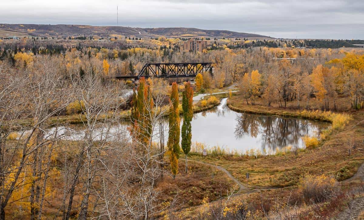
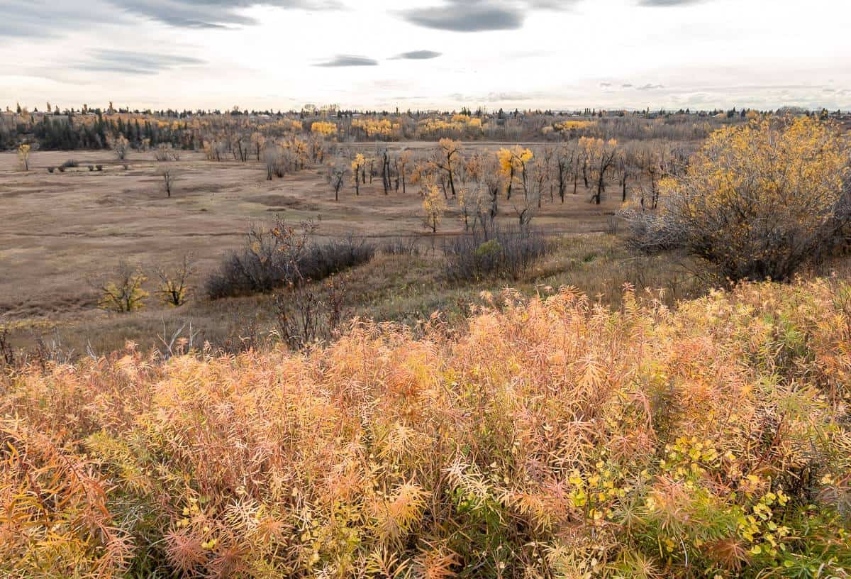
22. Dale Hodges Park and Bowmont Environmental Park
Starting point/parking: Parking lot on 52nd Street (one way going west) just west of Home Road.
Facilities: Porta potty at the trailhead. Lots of benches, picnic tables and garbage cans along the walk.
Distance: 7.3 km
Difficulty: Easy to moderate if you opt to hike the hills.
Public transportation: Bus access.
Season: Year round.
Stroller friendly: Only on the section beside the Bow River and the boardwalks in Dale Hodges Park.
Dogs: Yes – and part of the walk is off leash.
Cafe: Fringe Coffee on Bowness Road.
Highlights: One of the top walking trails in Calgary has to be the Bowmont Park – Dale Hodges Park loop. I can’t believe it took me over a decade of living here to do it. Put this one at the top of your list. In Dale Hodges Park, old gravel pits have been converted into a wetland area with ponds connected by boardwalks. During the spring migration this would be a magical place to visit with all the bird life.
From the parking lot start out on a paved multi-use trail. In no time reach Dale Hodges Park. Meander on the boardwalks before picking up the trail closest to the Bow River.
It ultimately connects to the trails around the Waterfall Valley south of the Silver Springs neighbourhood but to do the loop turn right passing Nautilus Pond. Climb up the escarpment, enjoying wonderful views of the area as the trail dips and rises. Descend the slope to return to the parking lot.

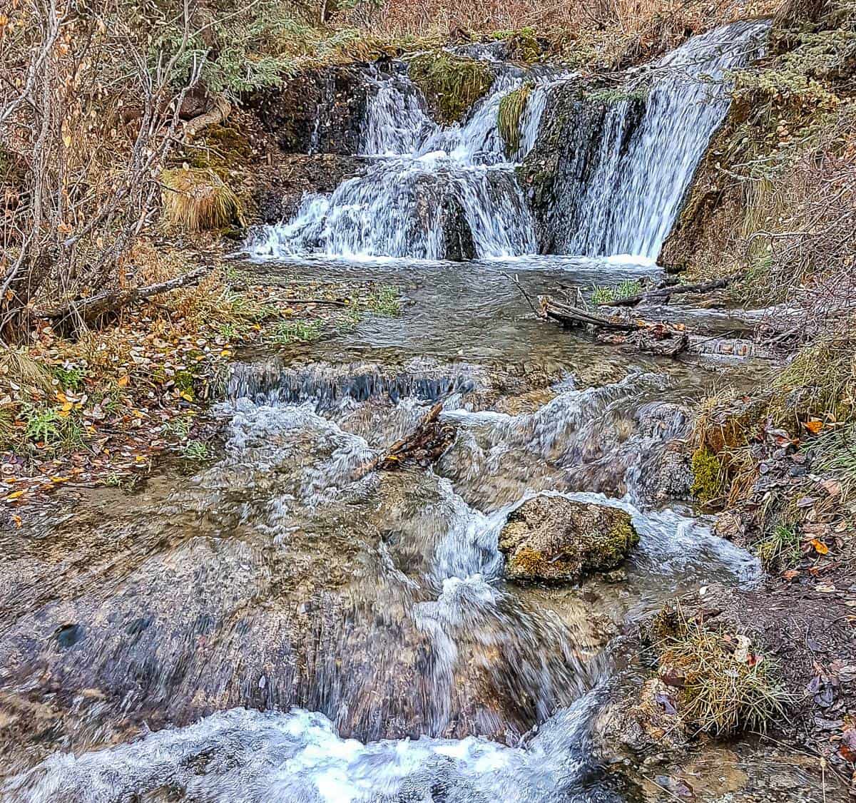
23. Bowmont Park West – Waterfall Valley – one of my favourite walking trails in Calgary
Starting point/parking: The parking lot is at the corner of 85th Street NW and 51 Avenue Northwest.
Facilities: There are benches and viewpoints with benches along the escarpment.
Distance: Approximately 5 km. Head out on the dirt trails to Waterfall Valley and back on the paved multi-use trail for a beautiful loop walk.
Difficulty: Moderate, especially on the dirt trails. Many are steep and are full of clay – so very slippery when wet. The clay clumps onto your shoes as well.
Public transportation: Bus access to Silver Springs.
Season: Year-round. Look for wildflowers in spring and summer, gorgeous fall colours on the hillsides in autumn and frozen waterfalls in Waterfall Valley in winter. Don’t forget icers and poles in winter.
Restaurants: No cafes but Angel’s Drive In at 8607 43rd Ave. NW offers burgers, shakes and fries.
Dogs: Allowed on and off leash. Look for signage showing location of off-leash areas.
Highlights: This is one of my new favourite hikes – because of the ponds, Bow River views, varying vantage points from woods to walking high on the escarpment, and also down by the Bow River. The Waterfall Valley makes a great destination – but it’s also easy to add mileage and continue east along the trails beside the Bow River.
There are lots of trails in the area, some on wooden boardwalks, so get into explore mode and see where they take you. When you’re up high, it’s easy to pick out trails you want to take.

24. Twelve-Mile Coulee Natural Environmental Park
Starting point/parking: The official parking lot (see map) off Tuscany Blvd. NW, near the Scenic Acres Link.
Facilities: None though there are garbage cans.
Cafes/Restaurants: The closest ones are Angel’s Drive In and Cadence Coffee.
Distance: 5.5 km return
Difficulty: Moderate. Slippery pea gravel underfoot at times and some hills.
Public transportation: Bus access to Tuscany plus the Tuscany LRT is about a 20-minute walk away.
Season: Late March until November. When the trail is wet, it’s very slick. Take icers and poles if you choose to hike it in winter.
Dogs: Allowed on leash.
Highlights: Twelve-Mile Coulee, located about 12 miles from Fort Calgary (and hence it’s name from Calgary’s stagecoach days) offers a beautiful wooded walk in a coulee, paralleling the suburban neighbourhood of Tuscany. There will be times you see homes, so don’t expect to be completely immersed in nature here.
Sometimes there are options to hike a trail near the top of the coulee – in which case you’ll enjoy great vistas over to Calgary Olympic Park. Or you can creek hop down at the bottom of the coulee, looking for deer – and even moose. There is some interesting plant life along the trail including red-osier dogwood, trembling aspens and numerous native plants of the prairies. In fall, Twelve Mile Coulee puts on a magnificent display of colour.

25. Botanical Gardens of Silver Springs
Starting point/parking: 37 Silver Springs Drive NW
Facilities: Water fountains in season and lots of benches.
Distance: 2.8 km out and back but can be lengthened to include the walking trails in Bowmont Park
Difficulty: Easy
Public transportation: Bus access.
Season: Year round. Each season has its beauty – even in winter when the garden is decorated.
Dogs: There are off leash dog walking areas throughout the gardens.
Highlights: Explore over a kilometre of individual gardens, created by volunteers beginning in 2006. Gardens are linked by easy walking trails through the woods, past sports fields and along a walled garden separating a busy road from the walking trail. Dogs (under control) are able to run freely for a long stretch. On the fall day I visited the trail was busy with friendly locals and their dogs.
The highlight for me was the colourful Wall Garden – a long narrow stretch at the north end of the botanical gardens that has been beautified – and now instead of looking simply at an ugly wall, there are masses of colourful flowers and shrubs including dahlias, Joe Pye Weed, hollyhocks, Sedum Autumn Joy, asters, hydrangeas any way more.
I think the Botanical Gardens of Silver Springs are a great place to get ideas for your own garden. Look for Rose, Edible Fruit, Peony, LoH2O, Shakespeare, Half Moon, Sunflower Gardens and more. I found the Labyrinth Garden near the end of my walk – and could see the appeal as a place for quiet contemplation while walking the circular paths.

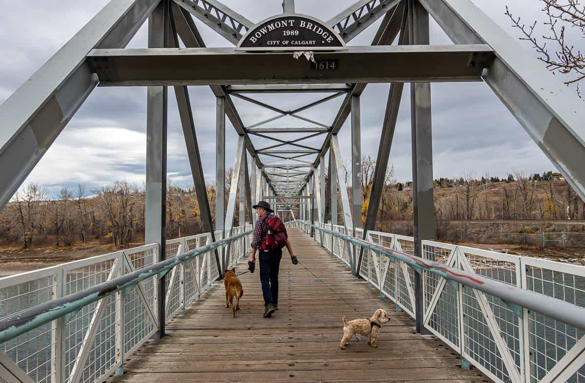
26. Baker Park and Bowness Park Loop
Starting point/parking: 9333 Scenic Bow Road NW for a Baker Park start.
Facilities: Washrooms, picnic tables, benches, playground, disc golf.
Distance: 5.6 km loop
Difficulty: Easy – mostly flat.
Public transportation: Bus access at many points along the walk.
Season: Year-round.
Cafes/restaurant: Seasons of Bowness Park Grab & Go Market
Stroller friendly: Yes
Dogs: Yes, and there are of-leash areas on the north side of the Bowmont Bridge.
Highlights: We started in Baker Park, the former home of the Central Alberta Sanatorium. Have a wander around to look at the trees in the park, some of the 1,800 that were planted to alleviate the dusty conditions at the time. The head off in either direction towards Bowness Park. We went left at first and crossed the pedestrian bridge over the Bow River. There was a constant hum of traffic and construction noise, so this wasn’t my favourite part.
There is the option after crossing the bridge of climbing a trail up towards Valley Ridge, but with all the noise and heavy equipment around, we gave it a pass.
It’s pleasant walking along the Bow River in Bowness Park, admiring birds and paddlers. When you reach the 85th Street bridge you have an option of going up and across. But don’t. The eastern end of the trail, starts to feel wilder, and the foot traffic thins out. When you reach the end of the trail you’ll have to head up through a neighbourhood, but just for a block.
Cross the bridge pictured below to reach Bowmont Park and an off-leash section. Continue west through the park, under 85th Street bridge to return to your parking spot. There is the option to continue east towards Waterfall Valley.
Walking trails close to Calgary
There are walking trails close to Calgary I thought should be included. If you live in South Calgary, the Ann and Sandy Cross Conservation area is very close by. And for those of you in North Calgary, it’s a short drive to both Glenbow Ranch and Big Hill Springs Provincial Park.
27. Glenbow Ranch Provincial Park
Starting point/parking: At the end of Glenbow Road, accessed from Highway 1A. It’s just under 3 km from the highway.
Facilities: Visitor centre and bathroom at the trailhead.
Distance: Highly variable but there are 30 km of paved and dirt trails.
Difficulty: Easy to moderate, depending on how many hills you hike.
Public transportation: None.
Season: Year-round. In winter take microspikes if it’s been warm and snowshoes after a fresh snow. Winds can be fierce.
Dogs: Allowed on leash.
Cafe/Ice Cream: On hot days head for Mackay’s Ice Cream in Cochrane. If it’s a caffeine fix you need, visit Cochrane Coffee Traders.
Highlights: Glenbow Ranch Provincial Park is a wonderful destination to experience the beauty of the foothills of the Canadian Rockies. The park is home to lots of wildlife including deer, coyotes, elk, badgers, weasels and even cougars. In the summer months there are swaths of wildflowers and great bird life. Cattle still roam here too as it’s a working ranch.
Most people start out on the Glenbow Trail, with its pretty Rocky Mountain views. I think the Tiger Lily Loop is a great one to start on – because there are usually fewer people and it takes you down through a beautiful forested section to the Bowbend Junction.
From there you can head west and pass a pretty pond that often has a lot of duck action. Keep going west and you eventually get some exceptional foothill and mountain views.
I also love the Bow River loop as there’s a lovely section along the Bow River. There is no right or wrong way to hike in the park. Go where the wind blows you. Duck into the aspen-filled coulees on cold or windy days and enjoy expansive views from the rolling grasslands.
28. Big Hill Springs Provincial Park
Starting point/parking: From Highway AB-1A west of Calgary look for signage. It’s about 16.5 km from Highway 1A via Highway 766N, west on 567 and south on Big Hills Springs Trail/Range Road 34A.
Facilities: Pit toilets, garbage cans and picnic tables.
Distance: 2.4 km
Difficulty: Easy
Public transportation: None.
Season: Year-round but very busy on weekends. Muddy trails in spring especially.
Stroller-friendly: No – too many stairs.
Dogs: Yes, on a leash.
Cafe: See Glenbow Ranch information above.
Highlights: This is a kid-friendly hike with its waterfalls, springs, and tufa formations. Enjoy multiple trails through a forest of aspens with only one main hill to climb.
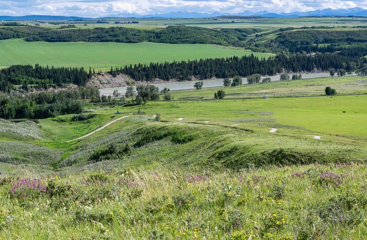
29. Ann and Sandy Cross Conservation Area – one of the less well known walking trails close to Calgary
Starting point/parking: 20 – 194001 160 St W, Foothills
Cost: $10 for parking. Annual passes area are $120. All proceeds support habitat conservation and help maintain the trails.
Facilities: Bathrooms at the trailhead and at a few locations along the trails. Bicycles are not permitted.
Distance: Variable depending on what trails you hike.
Difficulty: Easy to moderate depending on what trails you do. There are hills.
Public transportation: None.
Season: Year round. There’s good snowshoeing in winter, but cross-country skiing is not permitted.
Stroller friendly: No – not permitted.
Dogs: Not permitted.
Cafes: Priddis View & Brew Bistro – closed Mondays and Tuesdays.
Highlights: Approximately 20 km of trails weave through the conservation area on five main trails ranging from the 2.2 km Mountain Lookout trail to the 8.6 km Paradise Trail with five hills. Download a map on their website.
The property is truly beautiful. Some of the property was farmed and ranched but there are still large areas of native fescue grassland, primarily on the untouched rolling hills. Aspen stands cover almost 50% of the property – so the land is a study in lime green in spring, and yellow in fall. Most of the rest of the land is pastures of introduced Brome grasses from the days it was farmed. Over 400 types of plants have been recorded here.
The 4.6 km Fescue Trail is a great choice. It offers superb views of the Rockies front range, and the skyline of downtown Calgary. In spring and early summer, the rolling hills are dotted with wildflowers.
For all hikes bring water as none is available on the trails. There are no garbage cans, so plan to pack out what you pack in. There is wildlife in the conservation area, so carry bear spray and look for elk, deer and even cougars.

Final thoughts on Calgary’s walking trails
I will continue to add to this blog – mostly because I’m having so much fun exploring my city – and discovering new walking trails. My dog loves it too – and what a bonus that the majority of the walking trails in Calgary and nearby are dog-friendly!
Interested in what else you can do in Calgary?
I highly recommend the book 111 Places in Calgary That You Must Not Miss.
If you want some random and interesting facts about Calgary read 39 Interesting Facts About Calgary.
For those of you who love day trips, here are 25 from Calgary.
I’ve got you covered if you’re looking for 20+ fun things to do in Calgary.
Here’s a guide on how to have fun outside in Calgary in winter.
If you’re into snowshoeing, you might like 7 places to snowshoe within 2 hours of Calgary.
Click on the photo to bookmark to your Pinterest boards.