Best Hikes in Kanab Utah and Nearby
If you love exploring new country, head for Kanab, Utah in the southern part of the state and use it as a base for many days worth of incomparable hiking. The town offers quick access to Zion and Bryce Canyon National Parks, several state parks, stunning desert landscapes, caves, unique geologic formations, sand dunes, slot canyons, arches, hoodoos, the famous Wave hike, along with interesting desert vegetation and wildlife. Described are eight of the best hikes in the Kanab, Utah area – along with suggestions for a few more we didn’t have time for on this trip.
This post includes some affiliate links. If you make a qualifying purchase through one of these links, I will receive a small percentage of the sale at no extra cost to you. Thank you very much for your support.
Safety precautions when you’re doing the best hikes in Kanab
Slot canyons: Slot canyons are dangerous places to be caught in if there is rain in the forecast. Backpacker Magazine calls Buckskin Gulch one of the 10 most dangerous hikes in America – though no one has died yet, but the threat is there every time there is a storm in the forecast. Avoid visiting if there is any rain forecast in the area.
Cell service: Don’t count on any cell service on most of the hikes in the Kanab area.
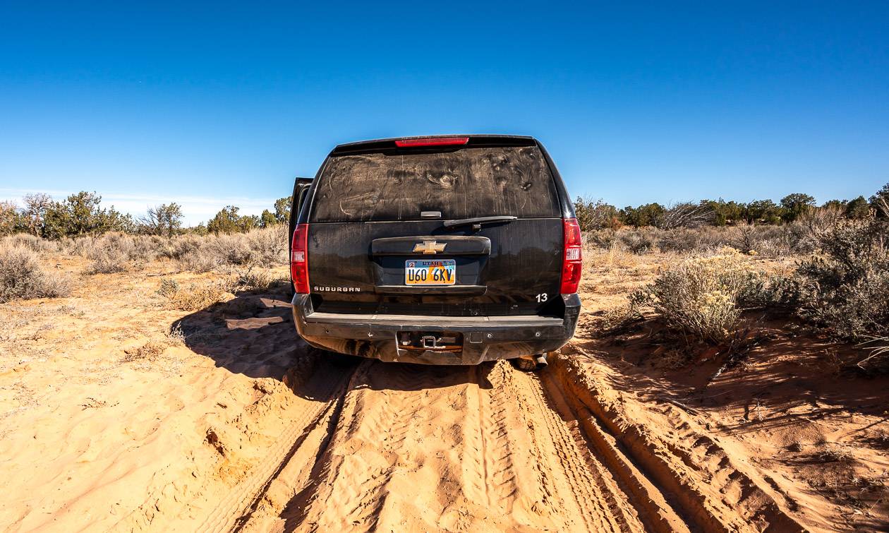
Driving: Access roads can become impassable after rain or snow. If you don’t have a high clearance AWD vehicle, you may get stuck in sand or leave a bumper behind in a wash. Explain that to your car rental company.
Guided/self guided hikes: Guided hikes are the safest way to go, especially if you’re not a regular hiker. You’ll learn a lot and it’s a good way to build your confidence in a wilderness setting. Book any number of the best hikes in Kanab with one of the local tour companies. Go self-guided only if you have lots of experience and are well prepared.
Would you like to save this?
What is the best time to visit Kanab?
The best hikes in Kanab should ideally be done in spring (March – May) or in fall (September to November) if you want pleasant hiking conditions with daytime highs in the 65 -75ºF range.
Summers should be avoided because of extreme heat – and safety issues. Winter can be a lovely time to hike, but snow is possible, and some roads become impassable with snow.
Location map of the best hikes in Kanab, Utah
- Click on the three dots in the top right-hand corner to email a copy of the map to yourself.
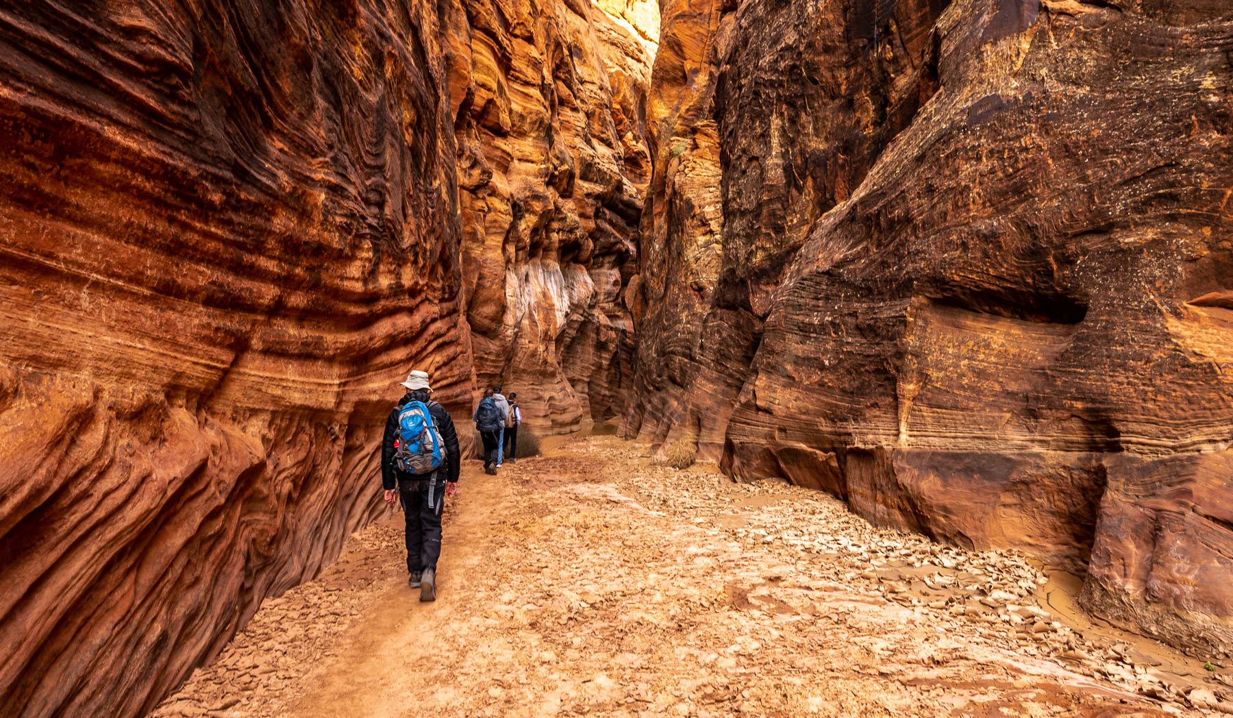
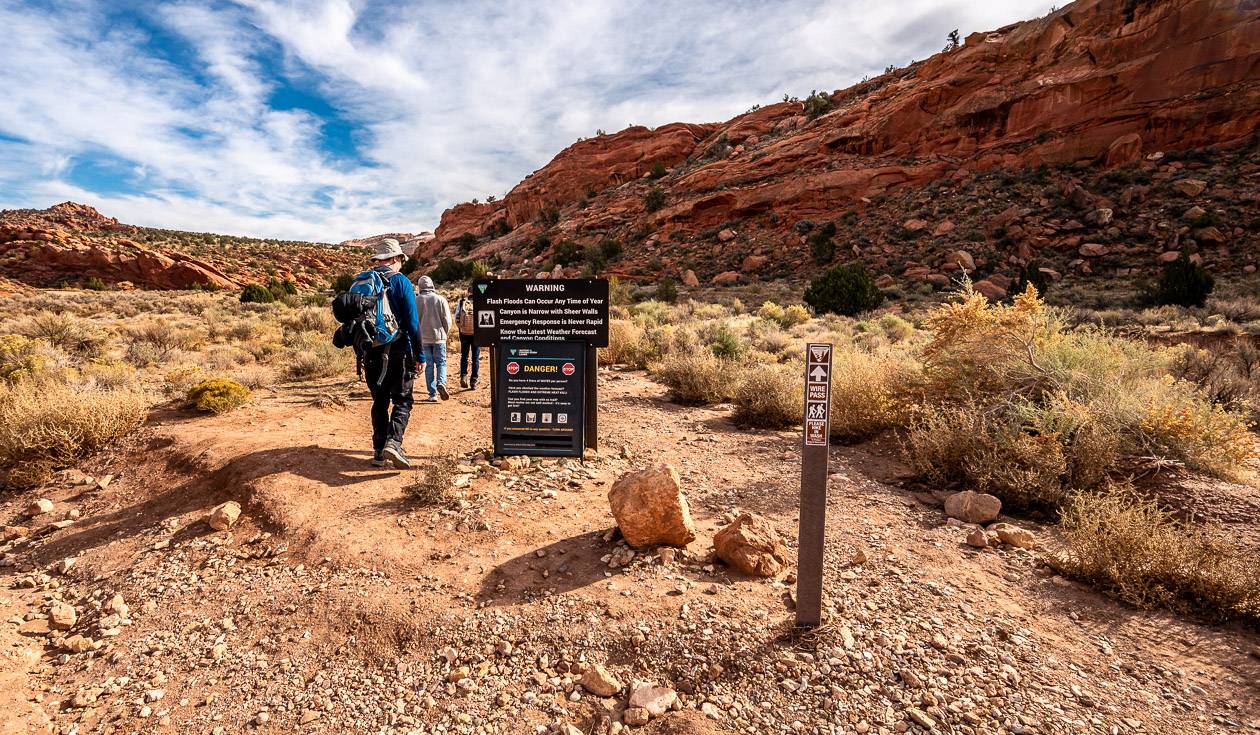
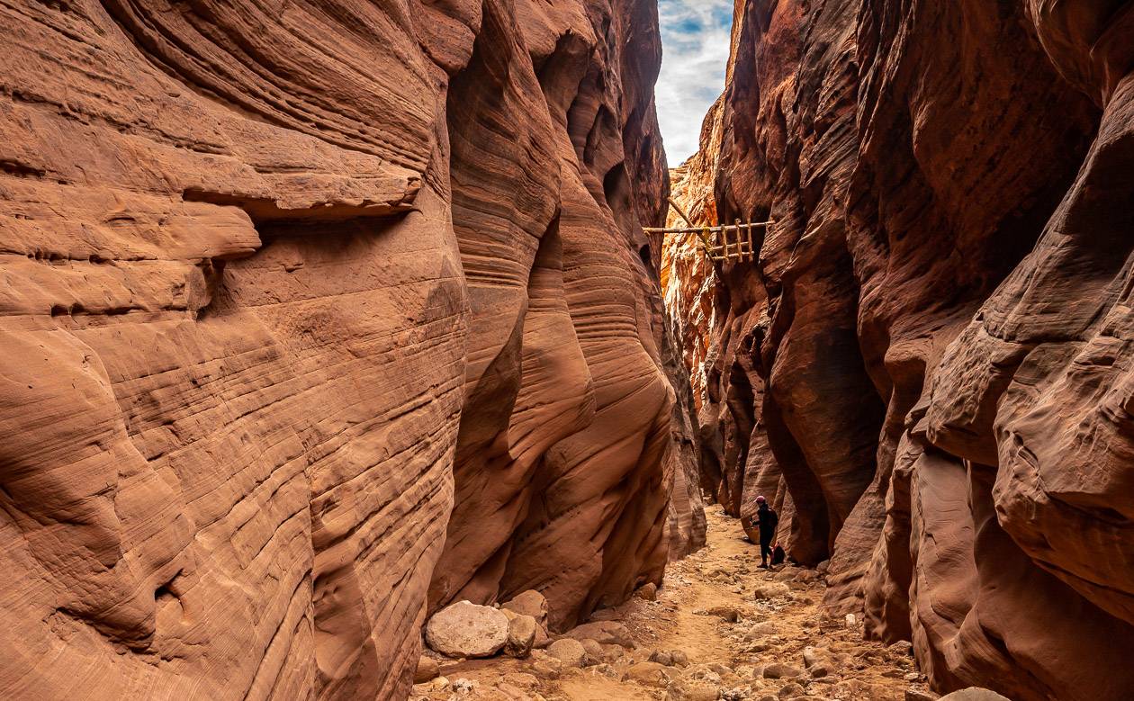
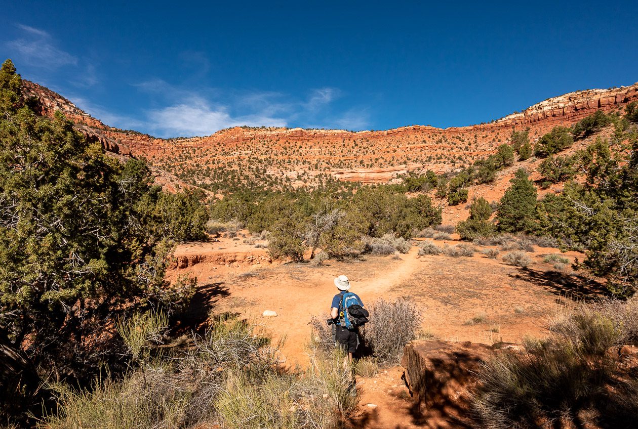
Wire Pass to Buckskin Gulch hike – one of the top hikes in Kanab
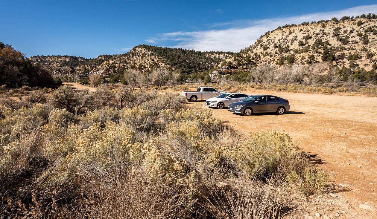
Trailhead location: To reach the Wire Pass trailhead drive 37 miles east from Kanab on Highway 89. Turn right onto Cockscomb/House Valley Road and follow it for about 8 miles to reach the large parking lot.
Difficulty in accessing trailhead: A high clearance AWD vehicle is recommended. Lots of people drive their regular cars, but many have issues. Your call.
Length of hike: 1.8 miles one way to the junction of Wire Pass and Buckskin Gulch. Continue right for another mile or so depending on conditions. Total mileage return is approximately 5.6 miles.
Elevation gain: Minimal
Time needed: 3 -4 hours
Difficulty: Easy
Fees or permits required: There is a Buckskin Gulch day use permit required which you can purchase online. It’s $6 per person and per dog.
Distance from Kanab: 60 minutes
Buckskin Gulch is one of Utah’s famous slot canyons with the title as the longest continuous slot canyon in the world. Most people do the Wire Pass to Buckskin Gulch hike rather than the full day Buckskin Gulch hike because it’s easy, takes only about three hours, and it’s very beautiful.
Avoid the canyon if there is a hint of rain in the forecast. In fact, you might want to check in with the people at the Bureau of Land Management Kanab Field Office for a detailed weather forecast.
Over the length of the hike, look up in awe at soaring canyon walls, check out the petroglyphs, climb down a 10-foot ladder, look for the “Queen in the rock”, and have fun walking through the slot canyons.


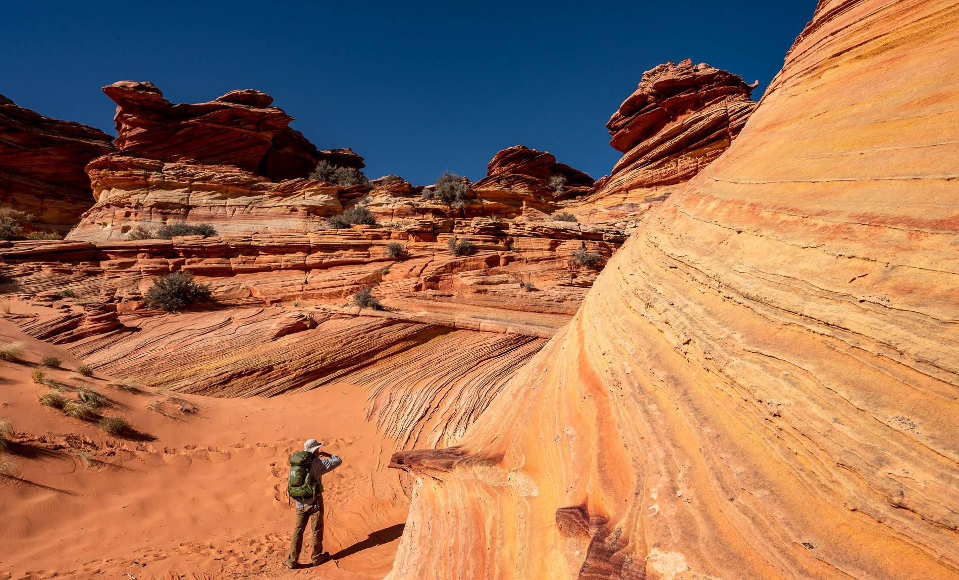
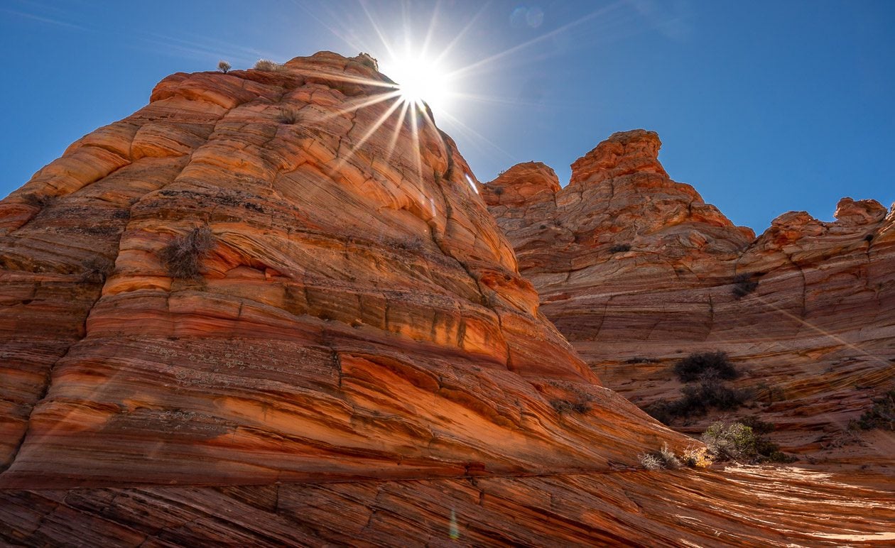
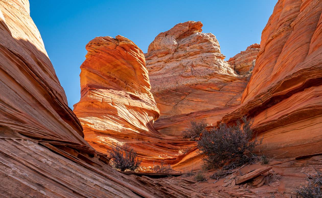
Coyote Buttes South
Trailhead location: The trailhead is actually in Arizona. Read my South Coyote Buttes blog for a full description along with how to get permits.
Difficulty in accessing trailhead: Difficult. A high clearance 4X4 vehicle is highly recommended.
Length of hike: A minimum of 3 – 4 miles if you only visit the Cottonwood area.
Elevation gain: Minimal but up to a few hundred feet depending on where you hike.
Time needed: 3 – 4 hours to explore the area from the Cottonwood trailhead.
Difficulty: Moderate
Fees or permits required: $9 non-refundable reservation fee plus a non-refundable recreation fee of $5.00 per person and per dog. Everyone, no matter what their age, must be included in the permit. Count on at least $US200 (+tip) per person if you go guided. There are 20 spots drawn daily for the lottery.
Distance from Kanab: 2 hours and 15 minutes to drive between 70 and 73 miles! Much of the drive is slow going on sandy off-the-beaten path roads.
The Coyote Buttes South area is a must visit area in the Paria Canyon-Vermilion Cliffs Wilderness. Even though it’s time consuming, difficult, and potentially expensive to visit, it’s well worth it – on par with the Wave, according to our guides who work in this back yard all year long.
Coyote Buttes South is like no other place on the planet I have visited. The hiking is easy but unique, otherworldly even at times, full of colour and incredible rocks that have some interesting stories to tell.
It covers a large area so there’s a lot to see in 3 – 4 hours including fragile, paper thin layers of eroded rock, wave like formations, dinosaur tracks, multi-layered and colourful hills – along with some interesting vegetation. If you go guided, you’ll learn a lot!
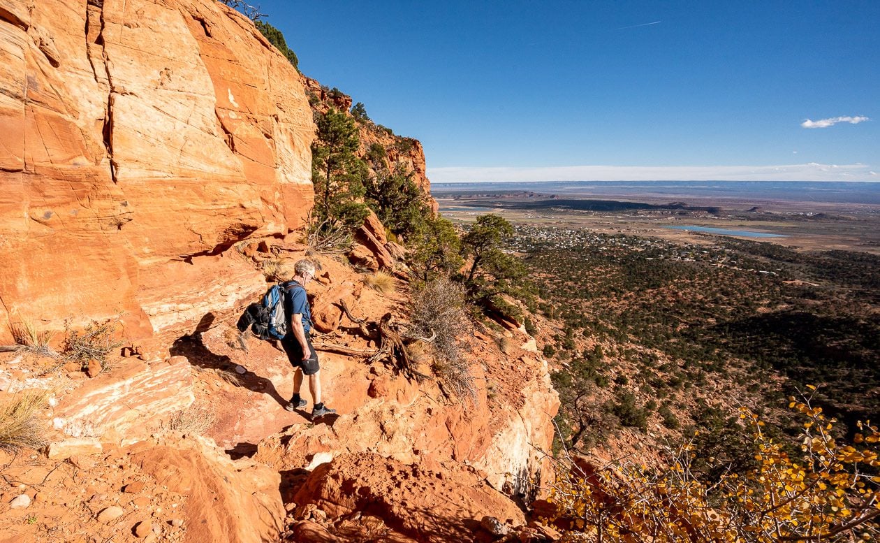
Bunting Hike
Trailhead location: From the Highway 89/Highway 89A intersection drive south on Highway 89A for 0.9 miles to Kanab Creek Drive. Turn right and follow it for 1.9 miles to Stansfield Drive. Turn right onto Stansfield Drive, and continue 0.2 miles to the trailhead, located on the right.
Difficulty in accessing trailhead: Easy – all paved.
Length of hike: 3 miles roundtrip plus an optional 2 miles round trip to the tip of the Bunting Spur. Add about a half mile return to see the dinosaur tracks via a side trail.
Elevation gain: Approximately 860 feet
Time needed: 2.5 – 4 hours depending how fast you climb steep rock
Difficulty: Moderate
Fees or permits required: Free
Distance from Kanab: 9 minutes
The Bunting hike is one of the outstanding hikes in Kanab if you want a workout with sweeping views of red rock mesas. It is accessed by driving through one of the neighbourhoods in Kanab,
The first mile of the hike is flat as you head for the Vermilion Cliffs. Reach an intersection after about 0.6 miles where, if you go left and hike about a quarter of a mile, you’ll see dinosaur tracks in the rock.
After a short visit, retrace your steps to the intersection and now take the right-hand trail. You’ll start climbing, steeply at times (don’t forget a sun hat, sunscreen, and lots of water) to reach another intersection before the top of the Vermilion Cliffs. Go right if you want to do the one-mile hike to the Bunting Spur Overlook or left to continue up the Vermilion Cliffs.
There are a few trails as we discovered as you get close to the top. We went right at one point until it looked to us like it was going to go around the mountain.
We bailed, retraced our steps, and took the other trail, climbing steeply again to reach the top of the Vermilion Cliffs and some panoramic views of the surrounding area. The red rock mesas would be stunning later in the day during the golden hour. We also enjoyed the scrubby vegetation, reminding of us of hikes we have done in Colorado.


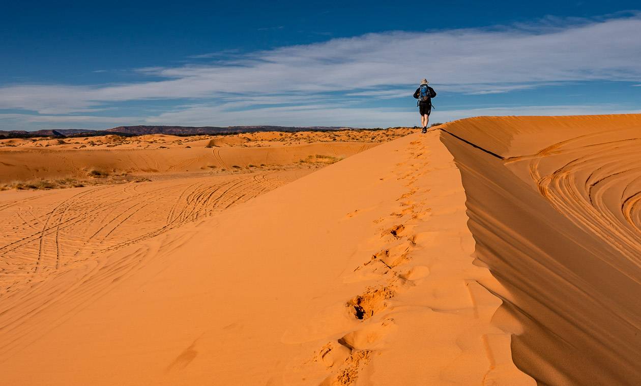
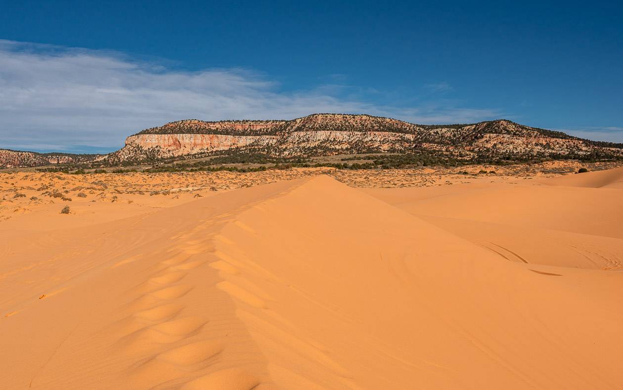
Coral Pink Sand Dunes State Park
Trailhead location: Start at the Visitor Centre in Coral Pink Sands State Park
Difficulty in accessing trailhead: Easy driving on asphalt.
Length of hike: Variable depending on how much exploring you want to do
Elevation gain: Up to 100 feet
Time needed: Allow 1 -3 hours depending on how much exploring you want to do.
Difficulty: Easy
Fees or permits required: There’s a $10 fee to enter Coral Pink Sands State Park.
Distance from Kanab: 28 minutes
If you want to feel like a kid again, head to Coral Pink Sand Dunes State Park, about a 30-minute drive west of Kanab. What you’ll find is 3,000 acres of wind-blown dunes made up of salmon-coloured sand that you can run, hike, jump, or sand-board in.
Go for the untracked sand dunes if you’re into exploring – but keep track of where you are, especially if you wander some distance from the Visitor Centre. Most people don’t go far. If it’s at all possible head for the dunes when the sun is setting, and you get the best light.
ATVs are allowed on some of the dunes, so we did our best to avoid them. Pick a weekday to visit and you won’t see as many of them.

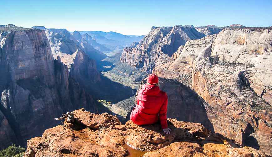
Observation Point – one of the best hikes in the Kanab area
Trailhead location: Start at the East Rim trail or the East Mesa Trail. The Weeping Rock trailhead is no longer an option.
Difficulty in accessing trailhead: Difficult access – a 4WD vehicle is required. East Zion Adventures offers a shuttle option.
Length of hike: 6.4 miles return from the East Mesa trailhead
Elevation gain: 750 feet
Time needed: 3 – 5 hours
Difficulty: Moderate
Fees or permits required: You will need to purchase a park pass for $US35 to enter Zion National Park. It’s good for a week.
Distance from Kanab: 45 minutes
The East Mesa trail is the easiest and most popular trail (now) to hike to Observation Point. In comparison to the hike that used to start at the Weeping Rock trailhead, the hike is much less of a leg burn and the scenery on the way up, less dramatic. But the result is the same – an incredible view from Observation Point including Zion Canyon and Angel’s Landing, sitting 1,000 feet below!
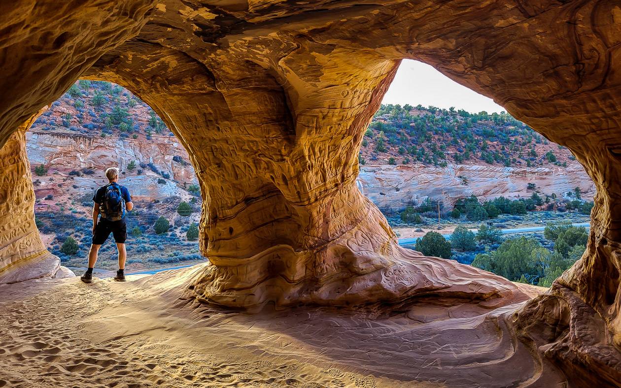
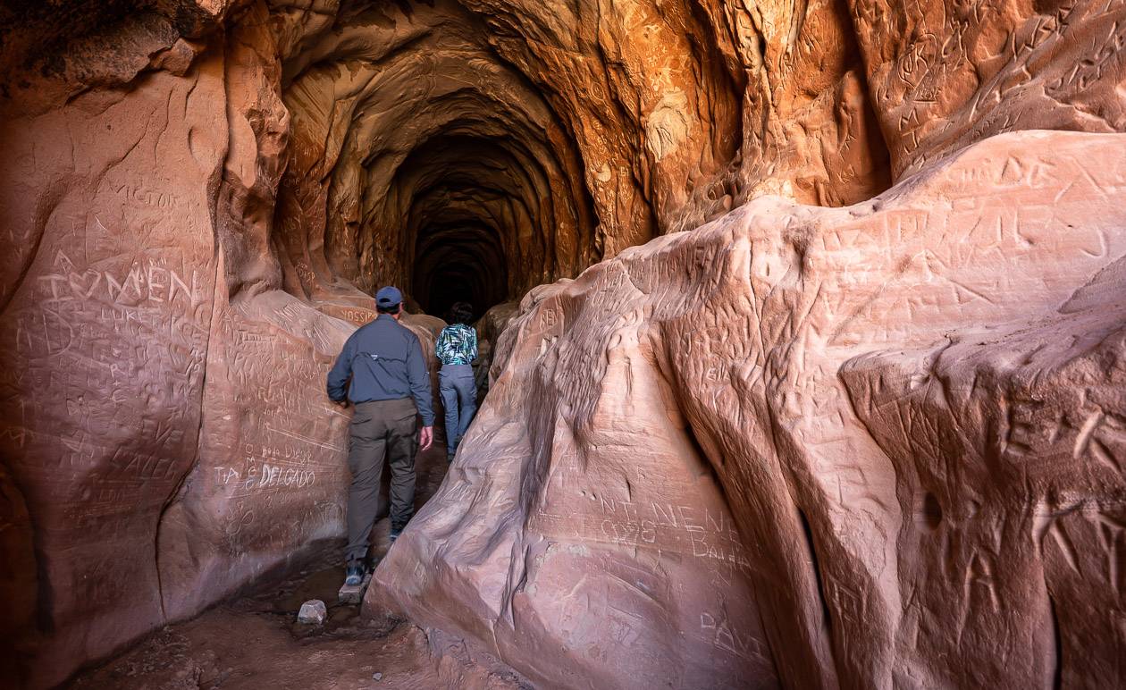
Kanab Sand Caves aka Moqui Caverns hike
Trailhead location: Located off Highway 89, 5.3 miles south of Kanab
Difficulty in accessing trailhead: Easy
Length of hike: Approximately 1.0-mile return
Elevation gain: 100 feet
Time needed: About an hour
Difficulty: Easy
Fees or permits required: None
Distance from Kanab: 7 minutes to the parking lot
One of the top hikes in Kanab is the quick hike up to the Moqui Caverns, also known as the Kanab Sand Caves. Although they are man-made, built in the 1970’s for mining sand that was used in glass making, they do offer captivating views from the cave windows overlooking the highway. Try to visit late in the day when the light on the caves almost makes them glow.
From the parking lot it’s a flat, easy walk to the point where you must climb up smooth rock – albeit with good traction – to a ramp of sorts that leads you to the caves.
The caves are about 300 feet long and are made up of rooms. At the very end of the last one, you may need the light from your phone to see anything. The amount of graffiti is astounding – so please don’t add any more.
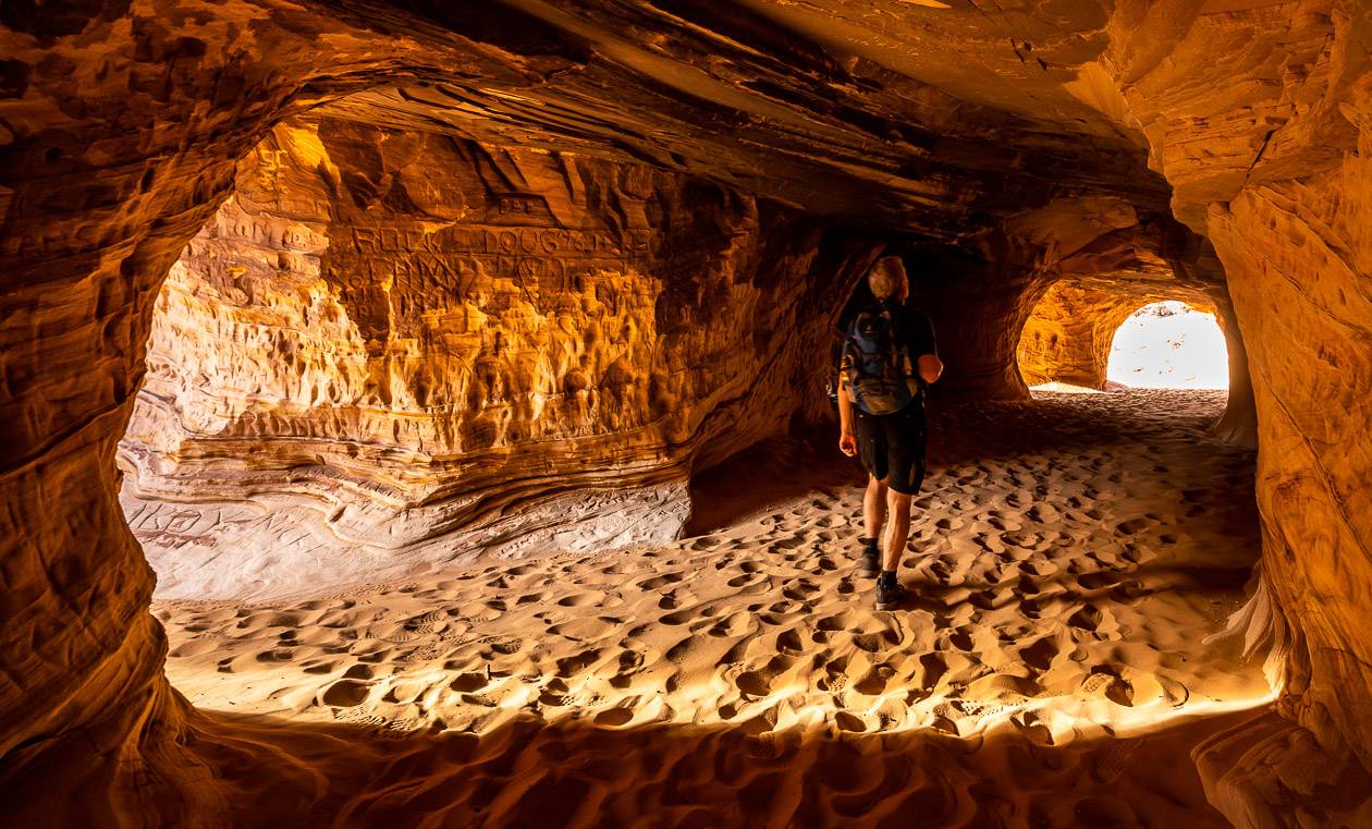
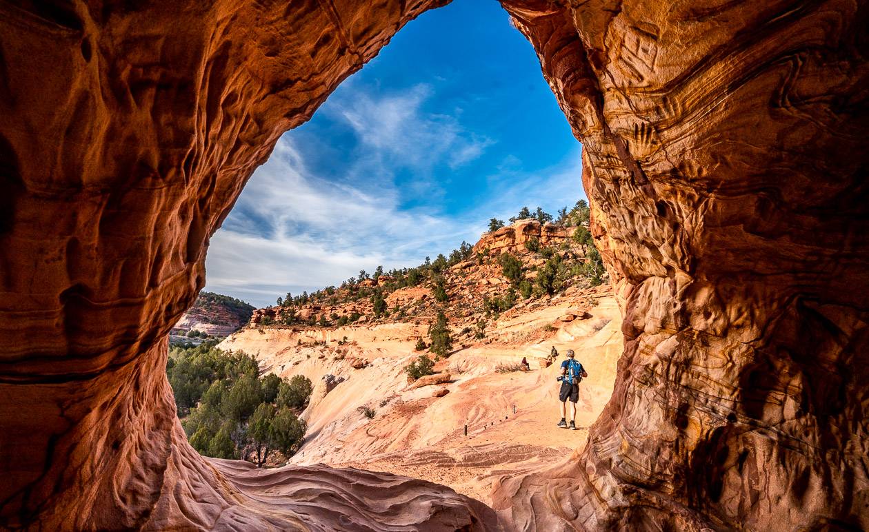
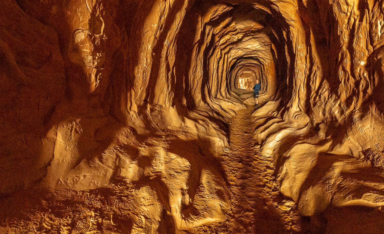
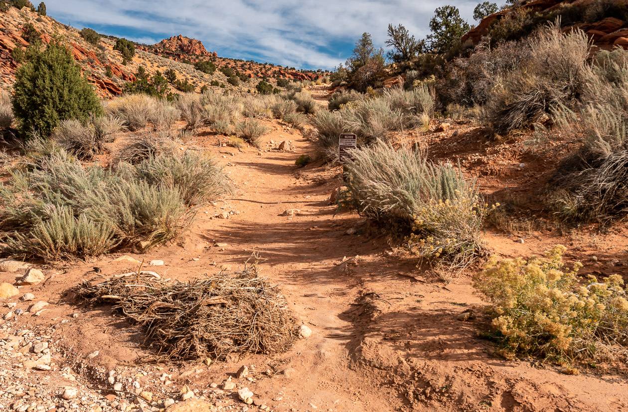
Belly of the Dragon hike
Trailhead location: An unmarked road off Highway 89 close to Mt. Carmel Junction
Difficulty in accessing trailhead: Easy – drive a short distance on a gravel road in any type of car.
Length of hike: Approximately 0.5 miles round trip with the option to hike a further 1.5 miles return after exiting the tunnel
Elevation gain: Negligible if you just to the belly part of the hike; up to 180 feet if you hike to the end of the trail.
Time needed: 15 – 30 minutes
Difficulty: Easy
Fees or permits required: None
Distance from Kanab: 22 minutes
If you like the idea of walking through a weirdly photogenic, man-made tunnel used to divert water under Highway 89, then I think you’ll enjoy the Belly of the Dragon hike. It’s an odd one for sure as its more of an attraction than a hike, but if you are close to Mt. Carmel Junction, west of Kanab, it’s worth 30 minutes of your time.
From the parking lot head towards the opening in the rock as you look towards the highway. It might be a bit hard for some people to climb down the five-foot abutment and then up the rocks in this section, but you’ll see an easier way to come at the opening when you’re on the ground.
The actual hike through the tunnel doesn’t take long – perhaps 5 -10 minutes, but footing is uneven inside, even slippery in places, and if you don’t have your phone’s light or a headlamp, you could easily lose your balance and hurt yourself. Use common sense in here.
You can walk through the tunnel at the far end and keep going up a dry creek bed for another 0.5 to – 0.75 miles but it’s not that interesting, and your time is better used on a more interesting hike.
If you’re a photographers will have some fun in the belly – and you could end up spending a lot of time in what looks like a giant intestine.
The big takeaway from the Belly of the Dragon was the sheer amount of graffiti. It’s disappointing to see how many people have defaced the rock.

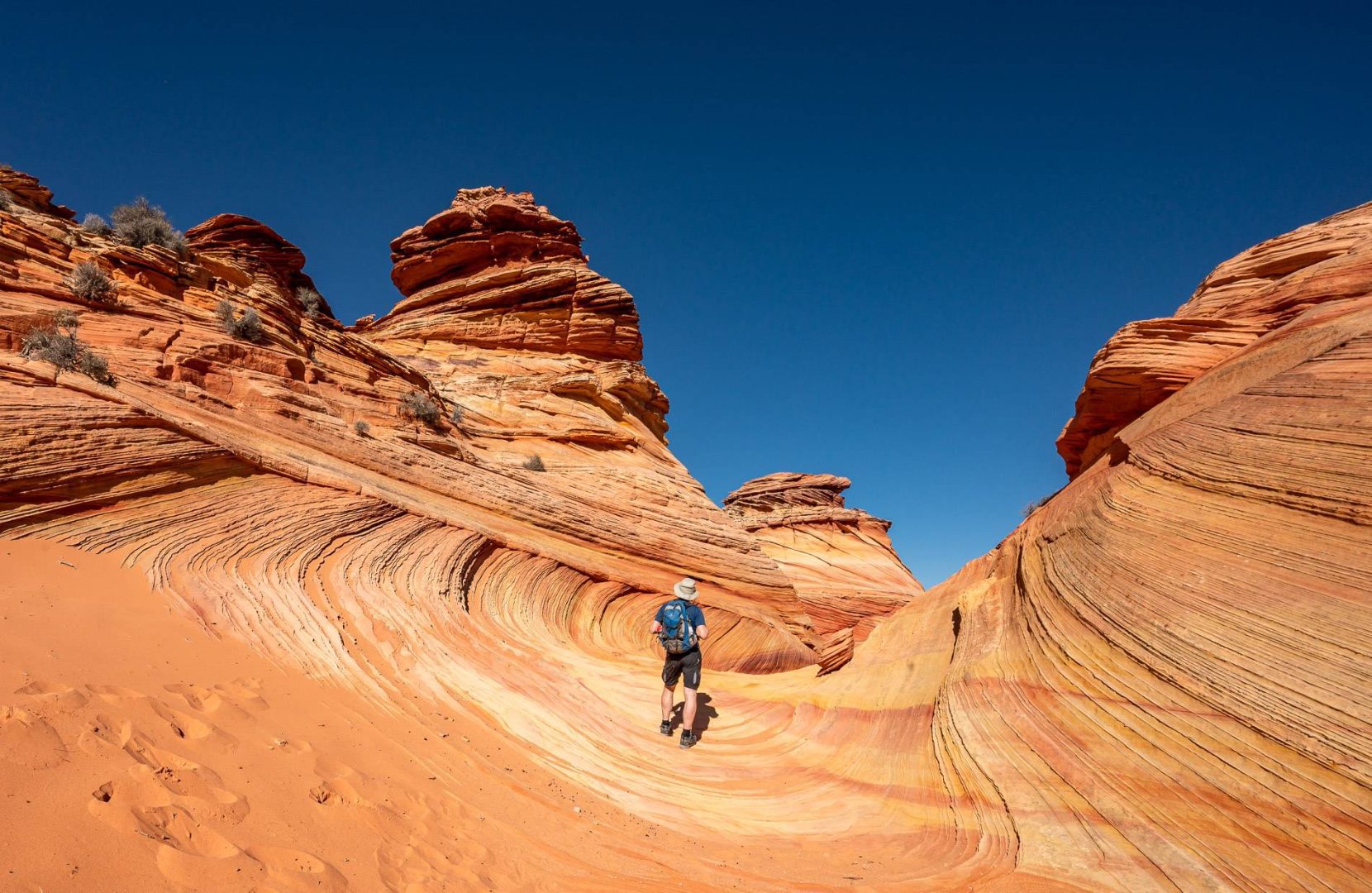
The Wave – one of the top hikes in Kanab but low odds of doing it
Trailhead location: Begin at the Wire Pass trailhead. It shares the same trailhead as the Wire Pass – Buckskin Gulch hike.
Difficulty in accessing trailhead: A high clearance AWD vehicle is recommended. Lots of people drive their regular cars, but many have issues. You decide if it’s worth the risk – which it definitely isn’t if the road is wet or snowy!
Length of hike: 6.4 miles
Elevation gain: Approximately 400 feet.
Time needed: 3 – 4 hours
Difficulty: Moderate
Fees or permits required: $9 non-refundable administrative fee plus a new daily lottery based on a geofence system (where you have to be in the specified area with a mobile phone) and that is $9 per try. There is still the option of the advance lottery system four months out. There is a recreation fee if selected of $7 per person and dog. The bottom line – lots of fees, poor chance of winning a spot, and a lot of do’s and don’ts once you’ve won eg. non-transferable, can’t change dates without forfeiting and more.
Distance from Kanab: 60 minutes
You’ve all seen photos of the Wave, but the chances of seeing it in person are getting slimmer every year as the number of people trying for permits continues to climb. If you’re one of the lucky few, you’ll enjoy wave-like rocks in crazy patterns that look otherworldly.
If you don’t go guided to the Wave, you may encounter route-finding difficulties as the trail is not marked. Be sure you download the route beforehand. Once at the Wave, photographers will be in heaven trying to capture movement in rocks that never move.

More suggestions on where to hike near Kanab
White Pocket – This hike is best done as a tour as you need a high clearance, 4WD vehicle to get to the trailhead for the all-day adventure. Explore a moonscape-like landscape filled with swirling, twisted multi-coloured rocks, many akin to the Wave – but you don’t need a permit.
Toadstools Hike – From Kanab drive east 45 miles to reach parking for the Toadstools. The family-friendly, 2-mile return hike will take you into a landscape of hoodoos and balancing rocks in a variety of shapes and colours. It can be done year-round and you only need a few hours to do the hike.
Dinosaur Tracks – For a short, 1-mile round trip hike, visit the Dinosaur Tracks year round. The trailhead for the sometimes steep and rocky hike is just 3 miles outside of Kanab. At the top of the trail look for the tracks of 3-toed dinosaurs in the large flat rocks.
Wahweap Hoodoos – Head to the Wahweap Hoodoos, about 55 miles east of Kanab. Over a 9-mile round trip hike, explore the hoodoos that come in all shapes and sizes. Two-wheel drive cars can drive most of the way to the trailhead.
Peekaboo Slot Canyon – Peekaboo Slot Canyon is a red and orange-hued canyon that’s been called “Antelope Canyon without the crowds.” A high clearance AWD vehicle is required (consider a guided tour) to visit Peekaboo Slot Canyon, located just nine miles north of Kanab.
The do’s and don’ts of hiking in a desert environment
I don’t like to be a preachy sort of do-gooder person, but I am blown away by how unprepared people are when they hike and the things they do outdoors. Please be considerate of your environment and go prepared on all these Kanab area hikes.
Don’t contribute to erosion: Stay on the trails. Cross-cutting causes erosion. In the desert environment, stick to rocks where possible and avoid cryptobiotic soil – see photo below illustrating the black crust overlain sand.
Leave no Trace: Practice Leave No Trace principles, packing out everything you packed in – apples cores and orange peels included.
Graffiti: Don’t vandalize rocks or pick flowers. Even in Buckskin Gulch, we saw where people had carved their initials. Not cool!
Be prepared: Go prepared to be self-reliant. Carry extra water and food along with the hiking essentials. Avoid hiking in the heat of a day.
Navigation: If you don’t know how to read a map, get a GPS or Garmin-InReach Mini and learn how to use it. I like Organic Maps for an offline hiking app.
Permits: Plan ahead so you can get permits or at least attempt to get permits for the Wave and Coyote Buttes South. Don’t try to sneak onto trails that require permits. Trails like the Wave are closely monitored, and you will be fined if caught without a permit.
Trail access: Access to many of the trails require a high clearance 4X4 vehicle. If you want to attempt driving rough, sometimes very sandy backroads, rethink your plan. Rental cars are likely not allowed on many of the roads and if you get stuck or lose a bumper you can expect to pay over $US700 – a very expensive tow.

Where to stay in Kanab and nearby
John and I spent one night at Canyon’s Boutique Hotel. It has a fantastic onsite restaurant called Sego.
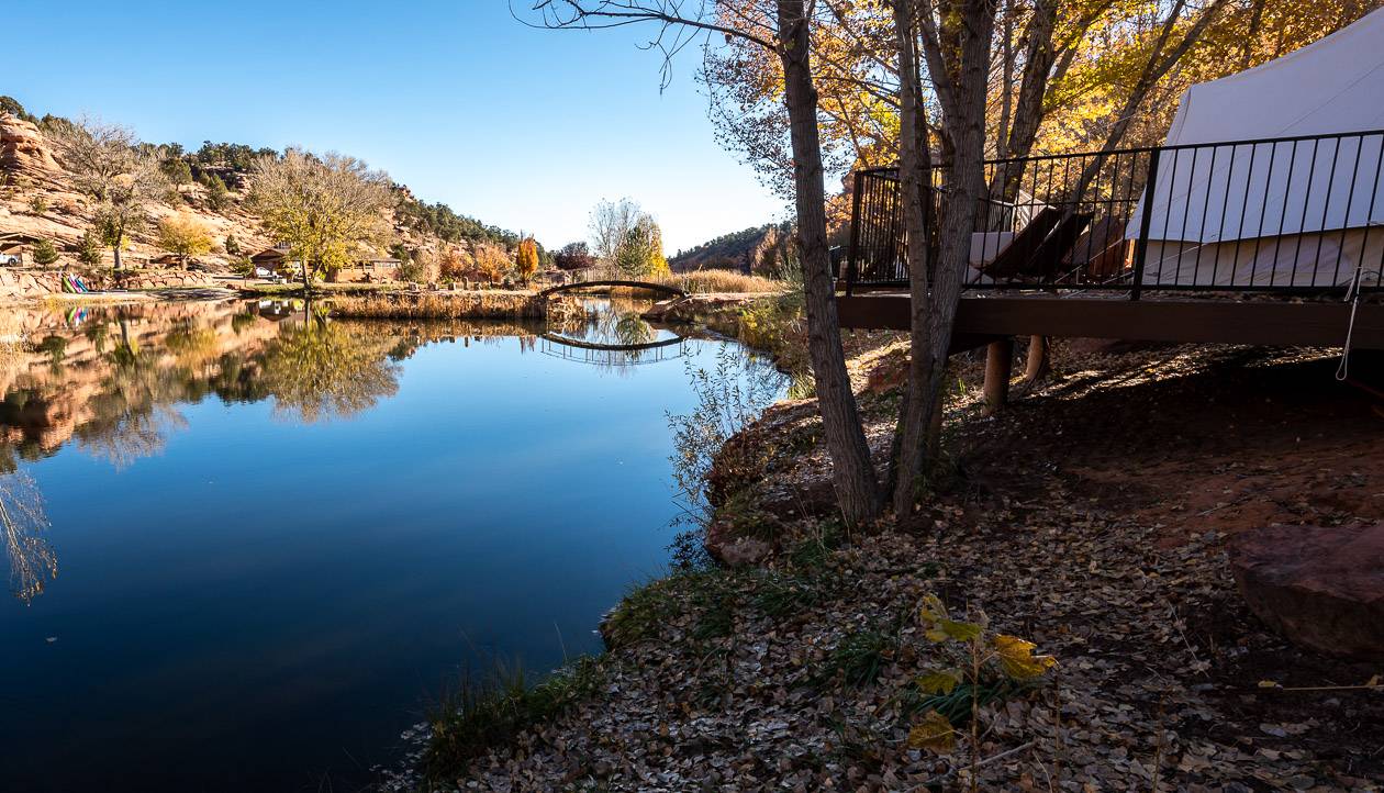
We spent another couple of nights at Cave Lakes Canyon Ranch. It offers glamping tents in a tranquil setting but there is no onsite restaurant so you will need to bring food, cutlery and plates or drive into Kanab.
If you’re on a camping budget, check out the Stateline Campground, located on the Utah – Arizona border. There are 8 campsites and it’s free.
Interested in spending more time in Utah?
If you’re planning to visit some of Utah’s famous national parks or the Moab area then I think you’ll find many of the following blogs helpful.
Arches National Park and the Moab area
- Devil’s Garden Trail – The Best Hike in Arches
- The Ultimate Itinerary for a Visit To Moab
- A Sunrise Visit to Dead Horse State Park in Utah
- Utah Road Trip: Sights Between Moab & Capitol Reef
- A Sunset Hike to Balanced Rock, Arches National Park
Capitol Reef National Park
- The Chimney Rock Trail, Capitol Reef National Park
- The Capitol Gorge Hike in Capitol Reef National Park
- The Navajo Knobs Hike in Capitol Reef National Park
A big thank you to Tourism Utah for hosting my stay. All thoughts and opinions are mine alone.
Click on the photo to bookmark to your Pinterest boards.