Biking the ‘Road to Nepal’ in South Calgary
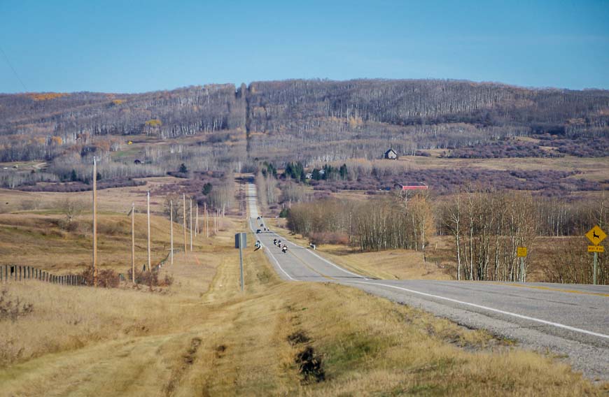
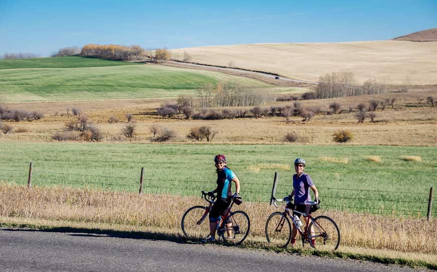
If you’ve never been to Calgary you might think that the city and surrounding area is flat because it’s so close to the prairies. But you’d be wrong. South of the city there is nothing but miles of rolling hills – some steep, others just long. The Road to Nepal takes you into beautiful rolling farm country. Those with stamina can explore even further on the Cowboy Trail and on any number of backroads.
Would you like to save this?
Where to start the Road to Nepal bike ride
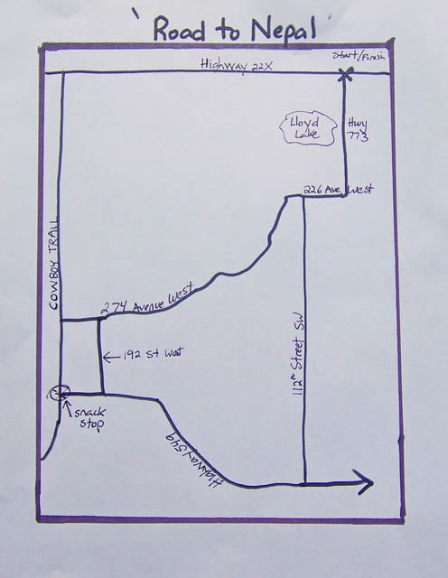
Starting at the junction of Highway 22X and Highway 773 begin the challenging ‘Road to Nepal.’ (It’s actually 37th Street SW on the north side of Highway 22X. Look for a big parking lot between the east and west lanes of Highway 22x.)
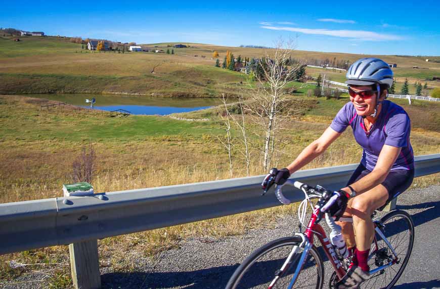
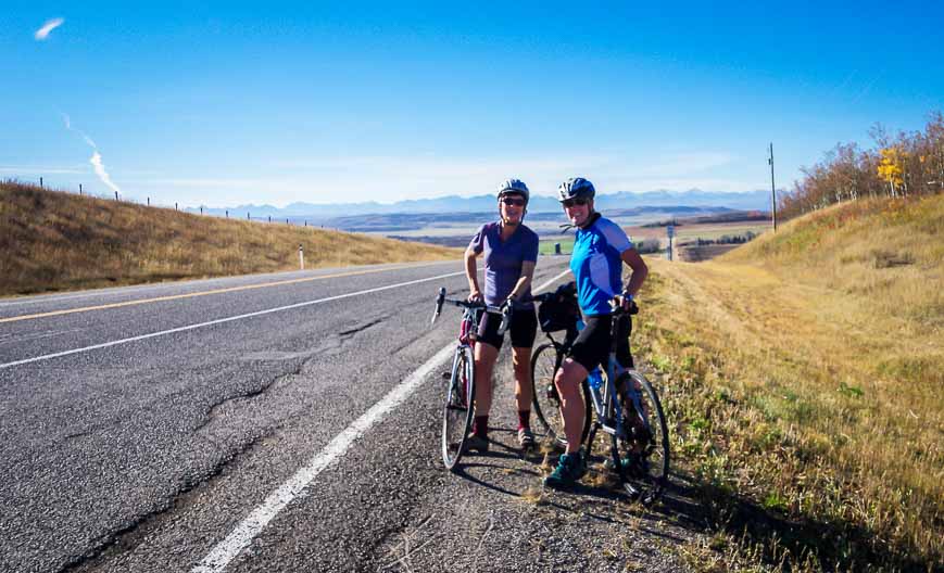
Over 55 kilometres you climb approximately 600 metres. Roads are reasonably quiet and most have a decent-sized shoulder. It’s very pretty – with pastoral scenes, mountain views and Calgary city views along the way. You also cycle a short stretch of the Cowboy Highway so it’s easy to add a café stop in Millarville.
For a half day outing that leaves you feeling like you’ve spent a full day on your bike you’d do well to choose this scenic bike ride.

Directions to ride the Road to Nepal
Allow about 2.5 hours at a moderate pace.
From the parking lot head south on Highway 773 until you reach 226 Avenue West.
Turn right onto 226 Ave West. Take the first left to do a clockwise loop onto the very straight and very hilly 112th St SW
Turn right on Highway 549. This section of highway is not as smooth and much busier. Continue until you reach the Cowboy Trail – Highway 22.
Turn right (north) and follow it until you reach 274 Avenue West. You’ll see signs for the Leighton Centre as well. Follow it northeast as it zigs and zags to regroup with the Highway 226 Avenue West intersection you passed at the start of the ride. Retrace your steps back to the car.


What are typical traffic levels like on a Saturday or Sunday morning?
@Rachel I rode on a Saurday afternoon and they were more than manageable – mostly light. With COVID I’m not entirely sure.
Just rode the route yesterday. The parking area is gone due to highway construction but there was ample parking just south of highway 22x. Minor detour to get there from the East due to road construction. Rode the route counter clockwise. Nice hills but the road surface from Granary Road to highway 549 is nearing replacement time.
@Rob Thank you for that updated information.Wonder when there will be any money in the budget to fix roads like these.
I live out on secondary highway 773/37th street – road to Nepal. I just thought I would mention that there are signs on the road saying single file and please share the road with other traffic. There are some bikers that do not do this travelling two or three abreast going overtop of these hills which can be very dangerous for them and inconsiderate to the other people that use the road. It is not just a biking road and people do live out here. I ride my bike occasionally out here too but people have lives, places to go and people to see so, please be considerate, move over when traffic is going by and try to be considerate to the other individuals that use this road. Thanks.
@JC I completely agree with you. I feel some riders almost seem to have a death wish and riding single file is a simple courtesy.
Some interesting place names here, Leigh – Cowboy Trail, Road to Nepal. Do you think they named it the Road to Nepal because of the hills?
@Marcia I am sure that’s why they named it. For a province that many people think of as being flat once out of the mountains, I think the hills south of the city would come as a big surprise.