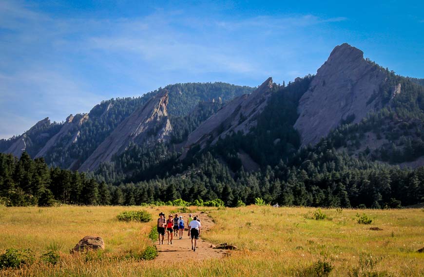
Boulder Flatirons Hike – My Fave in the City
There are some hikes I never get sick of no matter how many times I do them. The Boulder Flatirons hike – specifically between the first and second flatiron in Boulder, Colorado is a standout hike and one of my all-time favourites.
I’m guessing that I did it about 100 times when I lived in Boulder. I’d do it at all hours of the day in all weather.
The Boulder Flatirons hike is not an easy hike. And part of the hike was not on any map when I lived in the city. But don’t let that dissuade you. The hike offers first rate scenery, a great workout and on at least half the hike you’re likely to have the trail to yourself.
Would you like to save this?
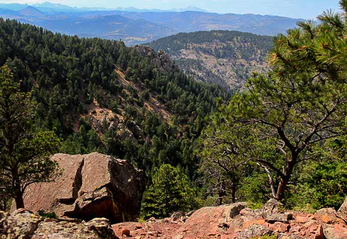
The Boulder Flatirons hike with a start at Gregory Canyon
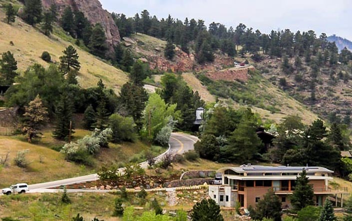
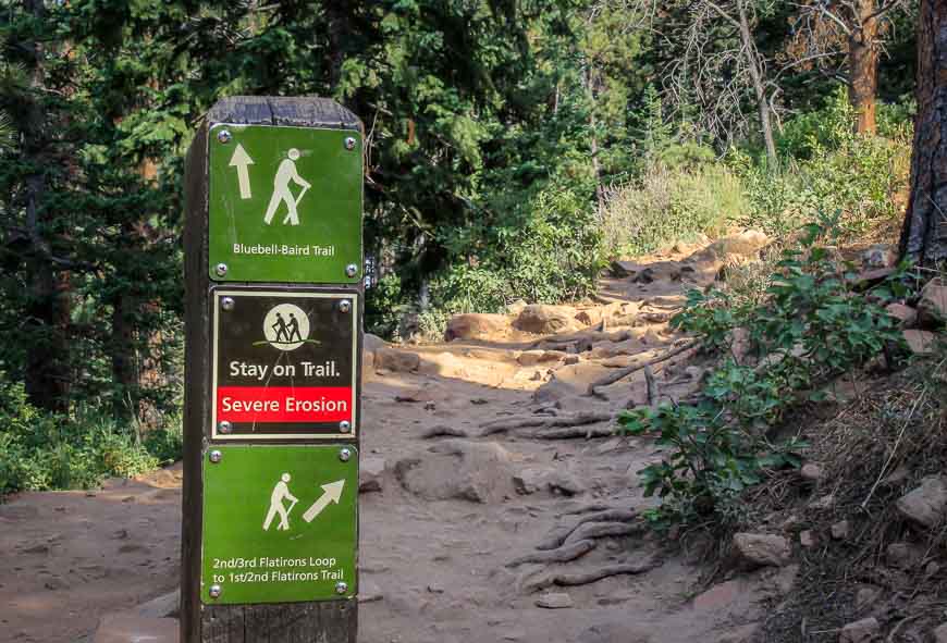
Let me walk you through the hike – beginning in Gregory Canyon at the far western end of Baseline Road, just before the road starts climbing Flagstaff Mountain. If you’ve started driving up Flagstaff Road you’ve missed the turnoff to Gregory Canyon.
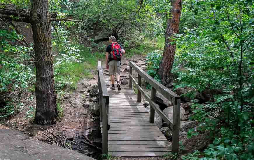
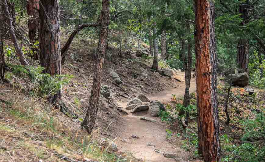
The Flatirons hike in Boulder starts off easily enough at the end of the Gregory Canyon parking lot. The first half mile or so has loads of poison ivy so it’s not worth venturing off the trail. I always wash my legs and hands well with soap and water the minute I get home just in case I’ve touched it.
At the first intersection take the trail to the left marked Saddle Rock Junction. You can’t miss it.
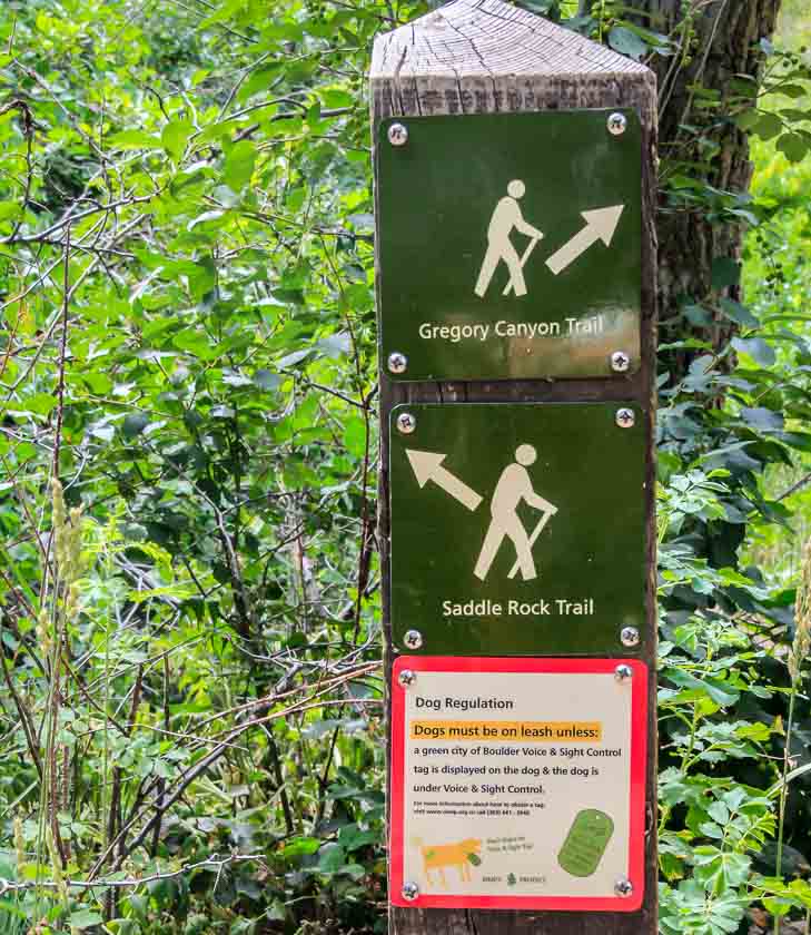
Stay on the Saddle Rock Trail
The trail climbs relentlessly. About a quarter of the way up you hit another junction. Keep to the right on the Saddle Rock Trail.
If you turn left, you’ll end up doing a loop and will be back at the parking lot in 15 minutes. Don’t wimp out here!
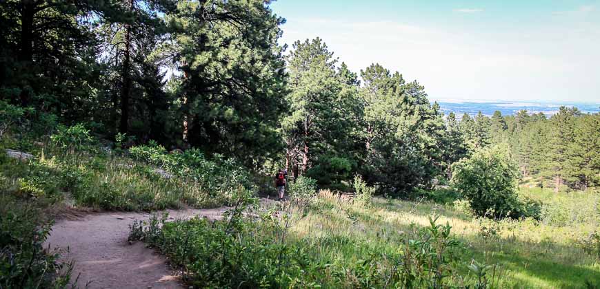
There’s a viewpoint about a third of the way up and then this section of the trail which stays shady which is much appreciated on a hot summer’s day.
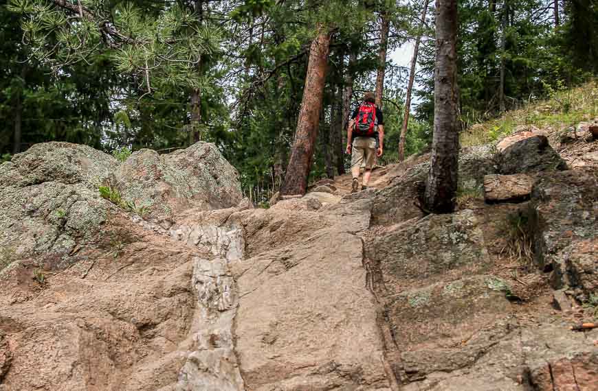
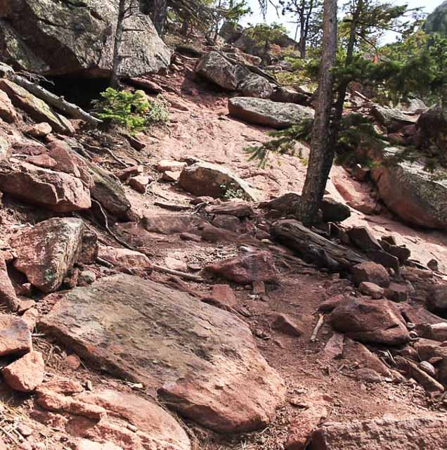
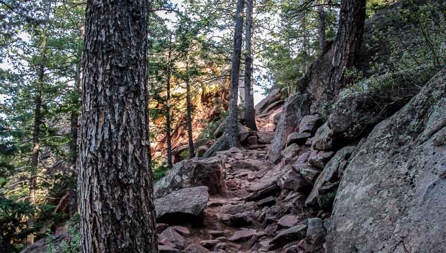
The challenging part of the route finding on the Boulder Flatirons hike
For three quarters of the trail the route is very easy to follow.
The slightly more challenging route finding section comes when you pass a marker pointing to the Saddle Rock Trail, with no other named trail on the marker.
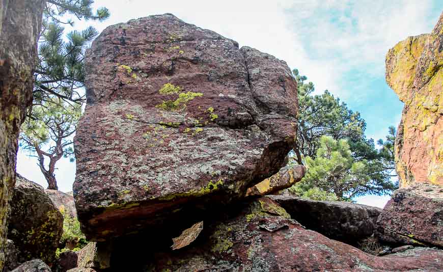
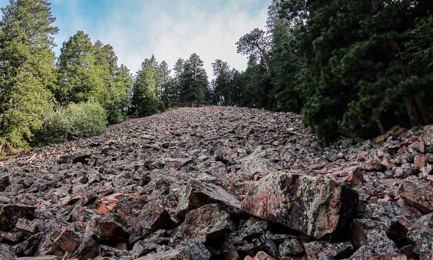
Stop. Look straight ahead. You can see a trail – they just haven’t named it. It’s not hard to follow but on occasion you need to look before you move as it’s a jumble of boulders and logs.
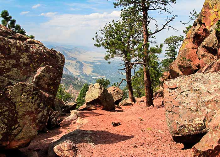
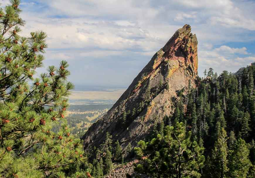
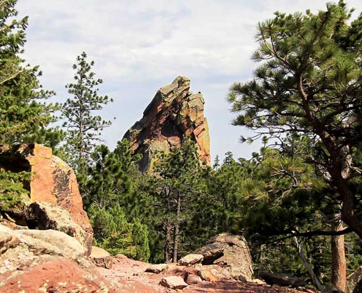
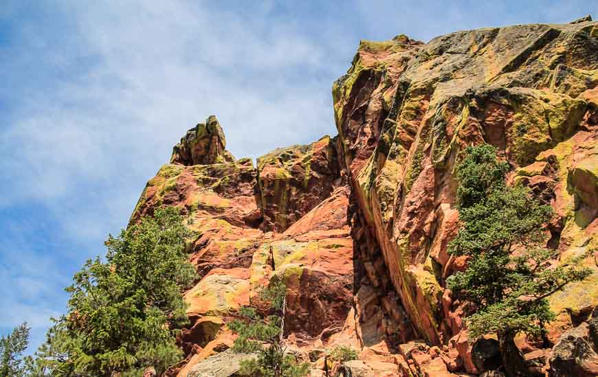
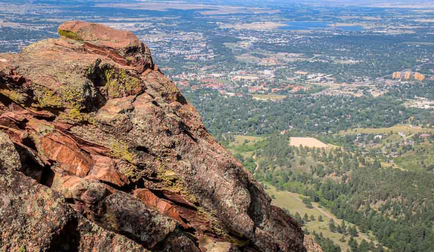
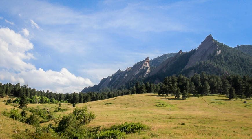
At the top of the trail wander around the jumble of boulders. Descend about fifty feet on the other side on an obvious trail, park yourself on a rock and admire the back views of the Third Flatiron.
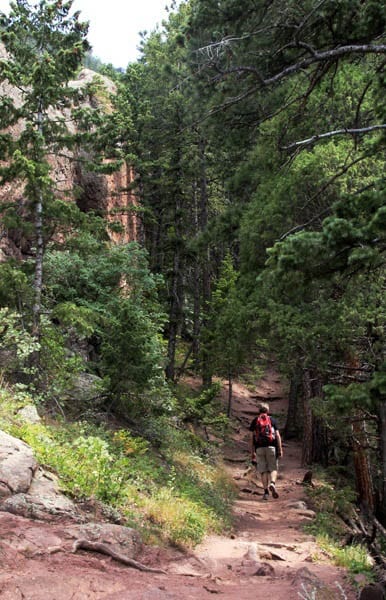
The descent between the First and Second Boulder Flatiron
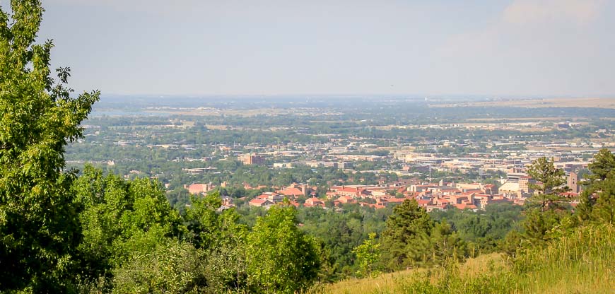
The trail down has a totally different feel to it. First off the city noise hits you as you hop over a rock and start the descent.
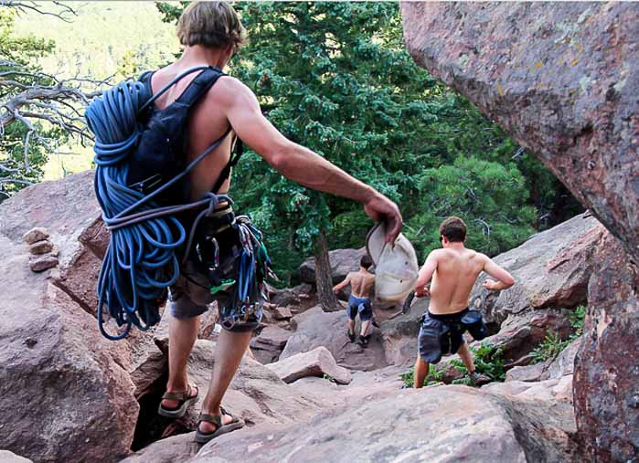
It’s an assault on the senses and it grates on me every time I do the Boulder Flatirons hike. From the saddle, head hike down on a badly eroded trail shared by climbers and hikers alike.
Do you dare peer over the edge?
There are a few points along the way where you can peer over the second flatiron. For some – it’s a holy shit moment as they look way, way down. The view to the First Flatiron feels a little airy too. But the trail is not. It’s a series of switchbacks.
Once past the boulder field you’re almost down. The walking gets positively easy at this point. If you end up at the ranger cottage and you parked at Gregory Canyon just walk back along the road – it’s only about 10 minutes away.
At the end of the Boulder Flatirons hike
If you’re hungry or thirsty at the end of the hike I highly recommend heading for the Chautauqua National Historic Landmark – specifically to the dining hall.
With a little luck you might score a table outside where you can appreciate the view of the Boulder Flatirons, while sipping a cold one.
Further reading on things to do in Colorado & Montana
- 5 of the Best Hikes Near Boulder, Colorado
- Hiking the Devil’s Thumb Bypass Trail near Boulder, Colorado
- What You Can Do in Grand Lake, Colorado
- What It’s Like to Visit Winter Park Ski Resort in Colorado
- Biking the Going-to-the-Sun Road in Glacier National Park
Click on the photo to bookmark to your Pinterest boards.


@Dan I’m going to email my husband and ask him to reply as he’ll be better!! Hopefully he can do it in the next day.
Went and hiked this trail this morning based on this nice report. Had no trouble getting to the top. At the sign where you go “off trail” there are some cairns that guide you to the to. I had to pause once or twice to scope the route but made it. I did have a question though.. I could not find the way down as you mentioned. I walked through the boulders at the top, looked up at the amazing back of one of the flatirons, (walking past it on hiker’s left) but could not find the eroded path to start down. Tried a few ways and just wasn’t sure (one was hikers left near the back of the large rock formation, another was more right, both heading in general direction of 3rd flatiron…). Being solo and not wanting to get mixed up I ended up going back down the way I came up but wondered if you could elaborate on how to find start of trail down from the top? Thanks!
-Dan
Spectacular!!!!
Beautiful shots Leigh and what a fantastic hike you took. As you noted above I do hope this area and others like it in Colorado escape the fire’s spread.
@Allison I sure hope the gorgeous trees around the Flatirons as viewed from the city don’t get damaged by fire. I’m sure they’re stressed already with the low water levels.
Your first photo of the third flatiron is so dramatic. It looks like a trail that is a little beyond a casual hiker with young children, like me, but those who put in that extra effort deserve extraordinary rewards.
Hopefully, the area will not be too damaged by the fire, though sometimes fires are beneficial to nature. Colorado is having such a difficult year, though.
It has been years since I’ve been to Boulder. (Grew up in Denver tho.) Your pics are amazing. And one of my Qs was going to be if the fires have hit this place that is one of your fave hiking areas. Saw your aside. Hoping they get it under control fast. You all have sure had one hell of a fire season. Awful. Hoping you and yours are not in danger of being in the flames way at all.
@Courtney I lived in Boulder years ago and just returned for a wedding. My friends tell me that there is still a fire behind the flatirons that is only 30% contained.
@Mette And one day I would like to get to Norway and Sweden to explore those mountains.
@Mary The flatirons are always a treat to look at and Boulder is well worth a visit. Unfortunately this summer it’s abnormally hot – day after day of mid 90’s temperatures, but at least it cools down at night.
@Cathy You had to go down that short but steep section. Toe holds have been chipped into the rock so it’s really not that hard.
I can see why its called Boulder. What a wonderful place to hike. It looks a bit like Norway or Sweden with a friendly climate.
That almost tired me out just reading this trail with you, Leigh. =) It looks like a beautiful trail to do except for all those poison ivy. Those flatirons look so majestic. I’ve never been to Boulder and have only been to Colorado during winter ski seasons but I would love to visit this great state in the summer one of these days.
That is some really thick poison ivy! That does look like a beautiful hike, though.
@Jessica One fellow said the best thing about the heat was that the poison ivy was wilting. The paths are wide enough that it’s easy to avoid though signs explaining what it is what would be helpful to the visitor.
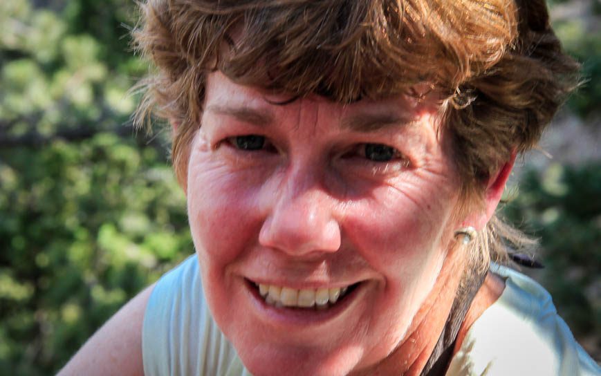
I love all that red rock and earth. Looks like a wonderful trail, but I’d definitely not join those guys on the steep rocks. Nice to see a pic of Ms. HikeBikeTravel, too. Well-deserving of a break at the top!
Colorado is so beautiful! I think I’d need something tall and cool after this hike 🙂 The red dirt and rocks really did contrast nicely with the green trees!
@Debbie Tall and cool is exactly what I had right after the hike.
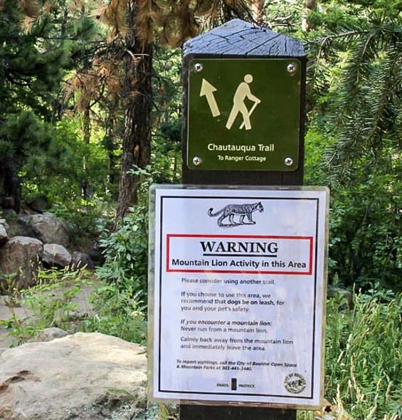
Gorgeous views but it looks like quite the strenuous hike! Have you ever actually seen a mountain lion while you were hiking? I’m afraid the possibility of running into one would prevent me from heading out!
@Lisa @Nancie I have hiked the hills and mountains around Boulder for over 10 years and have never seen a mountain lion.
Good walk through, Leigh, but I’m ready to take a nap! Sounds like a pretty arduous hike. Love the views though, especially looking down.
@Marcia It is an arduous hike – but it takes just over two hours in total so it’s pretty short and you feel most excellent after.
Looks beautiful! Except that really steep part it even looks doable 🙂 I really need to head to Colorado one if these days. How is summer? Still pretty hot?
Lovely shots Leigh, and this looks like a great hike. I think the mountain lion warning would freak me out!
WoW! Great photos and nice writing! You got me jealous with your adventure.