The Top of the Giant hike in Sleeping Giant Provincial Park rewards those who make the 11.2 km one way trek with outstanding views over Lake Superior. Despite its considerable length, there is only 290 metres (961 feet) of elevation gain and the first 8 km of the hike are dead flat so you can cover a lot of ground quickly.
The day we did the Top of the Giant hike did not look promising. It was raining hard when we woke in our tent though it looked even worse over “the Giant” so I rolled over and went back to sleep until 9 AM.
By then the rain had stopped but by the time we were ready to tackle the hike it was 11 AM. I figured we would be in for an eight hour day, not appreciating at the time that 16 of the 22.4 kilometres were dead easy.
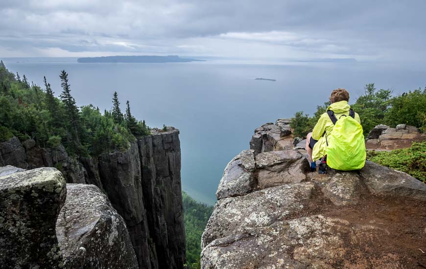
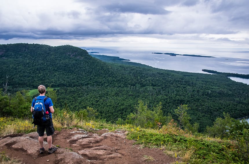
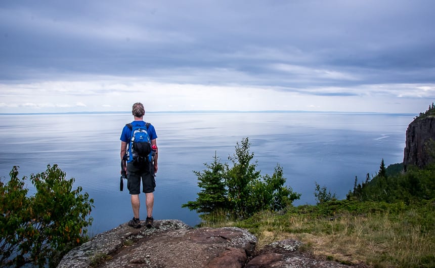
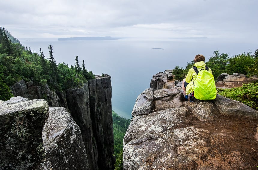
If you’ve made it to Sleeping Giant Provincial Park, I highly recommend you set aside enough time to do the Top of the Giant hike. From the top about 300 m or 1,000 feet above Lake Superior, you can see the the small islands in Lake Superior as well as the full length of Isle Royal across the water. The view of the cliffs from the crevice area is superb.
This post includes some affiliate links. If you make a qualifying purchase through one of these links, I will receive a small percentage of the sale at no extra cost to you. Thank you very much for your support.
Top of the Giant hike summary
Distance: 22.4 km (13.9 miles) round trip
Elevation gain: 290 m or 950 feet
Time needed: 6 – 8 hours, perhaps a little less if you bike to the start of the Talus Lake Trail. We did it in 6 hours with time for lunch on top and a 15-minute swim/break at Tee Harbour.
Difficulty: Moderately difficult only because of the distance.
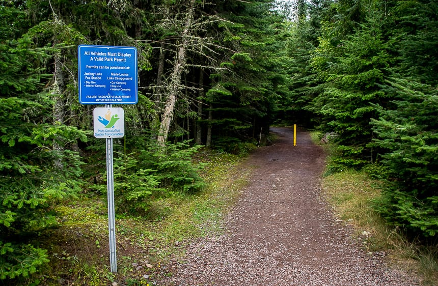
Permits: Sleeping Giant Provincial Park is a busy one, so if you want to guarantee a day use spot, you need to buy a daily vehicle permit. Permits can be bought online up to five days in advance of your trip beginning at 7:00 AM. If you’re camping your day use fee is included.
Fees: If you decide to wing it and just show up you at the park gate will need a vehicle permit. Buy your permit at the self-service station at the Joeboy Lake Trail parking lot on your way into the park. If the Visitor Centre is open, you can also purchase a permit there.
Dogs: Permitted on a leash.
Bears: There are black bears in the park so be bear aware and make noise. If you see any fresh bear scat, form a group and pull out your bear spray, just in case.
Cell phone: Don’t count on getting a signal in the park. Carry aGarmin InReachin case you have an emergency.
Map: There’s a trail map you can download of all the trails in Sleeping Giant Provincial Park.
Getting to the Top of the Giant hike trailhead
The top of the Giant hike is easily accessed from Thunder Bay. Drive east on Highway 17 for approximately 50 km to the Pass Lake Road/ Highway 587 South.
Turn right and continue for about 36 km. You’ll pass the turn off to the Marie Louise Lake Campground. In 3.2 km reach the South Kabeyun trailhead parking area. If you get to Silver Islet, you’ve gone too far.
Best time to hike the Top of the Giant
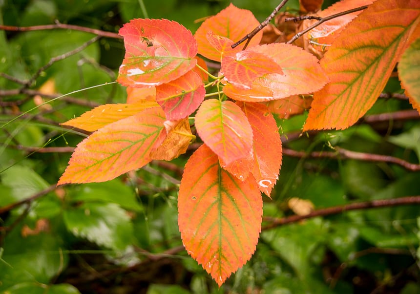
The ideal time to do the Top of the Giant hike is from June till September. If you go too early in the season you risk running into a lot of mud or even snow. Late June into early July can be buggy.
I think the fall in northern Ontario is ideal – no bugs, and not too hot.
Don’t forget theinsect repellentif the wind isn’t blowing.
Top of the Giant hike description
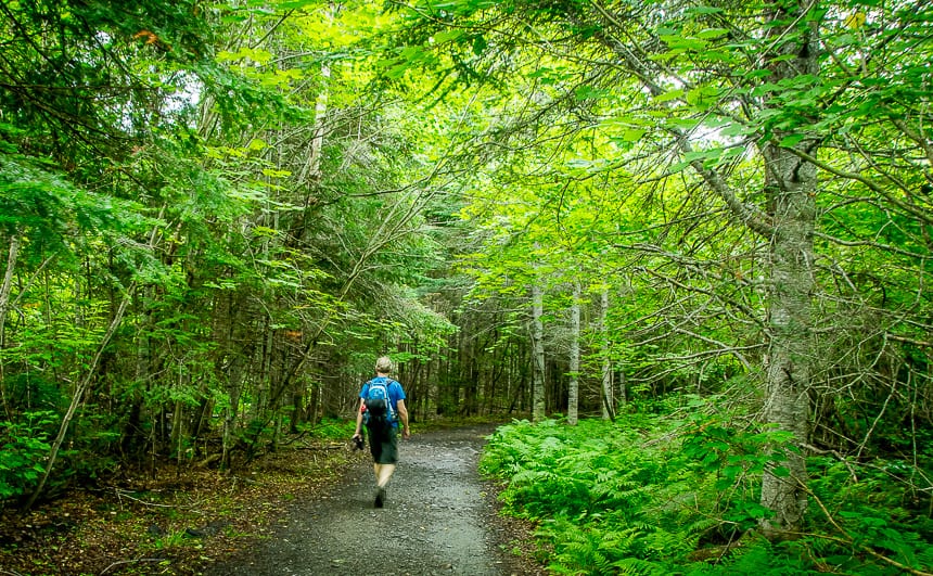
The hike starts at the Kabeyun South Trailhead along a forested trail off of Highway 587 near the Silver Islet Township. Mileage markers are placed at all important intersections so the trail is a snap to follow.
The pink trail marker has been replaced by blue trail markers – with mileage all spelt out.
Our first destination was Tee Harbour, 6.5 km away. We knocked that off in an hour – and that included a stop at a pretty backcountry campsite along the shores of Lake Superior. Since it had only taken an hour to do a quarter of the hike, I knew we could relax and worry less about the time.
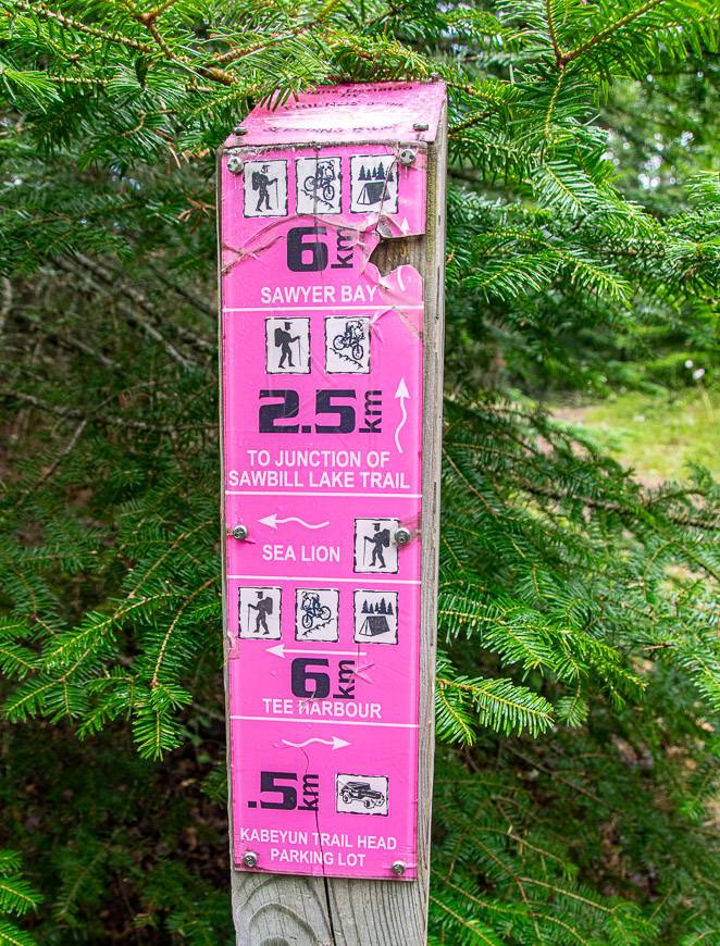
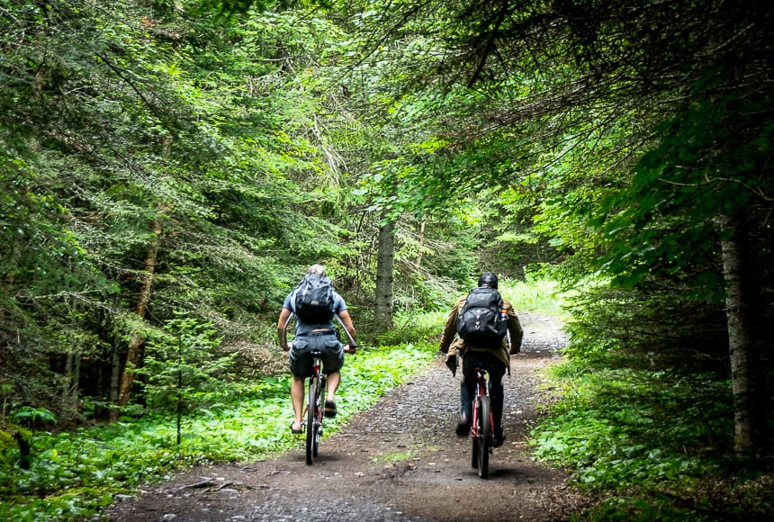
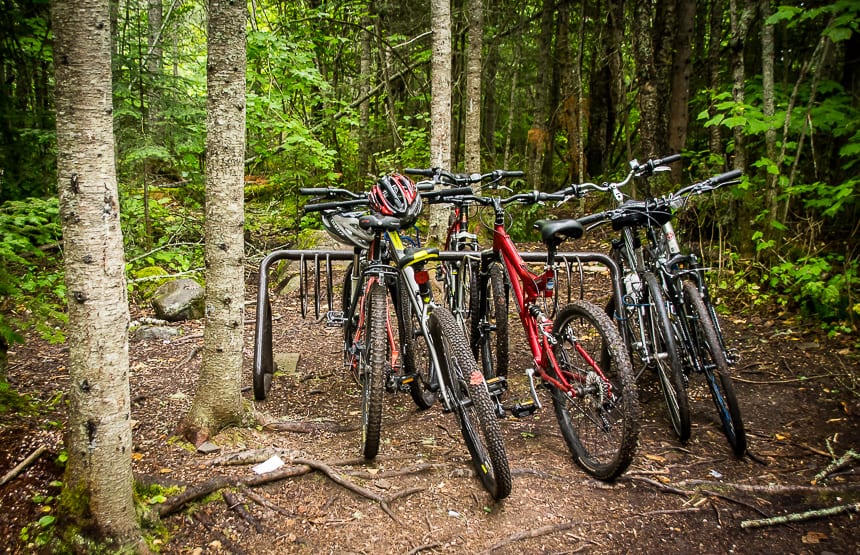
If you have access to a bike, cycle the first eight kilometres and then lock it up at the start of the Talus Lake Trail.
From Tee Harbour it’s pretty hiking for 1.5 km along the Kabeyun Trail to the Talus Lake Trail junction. This is where you leave bikes and start climbing though you’re a mere kilometre away from the Top of the Giant Trail junction.
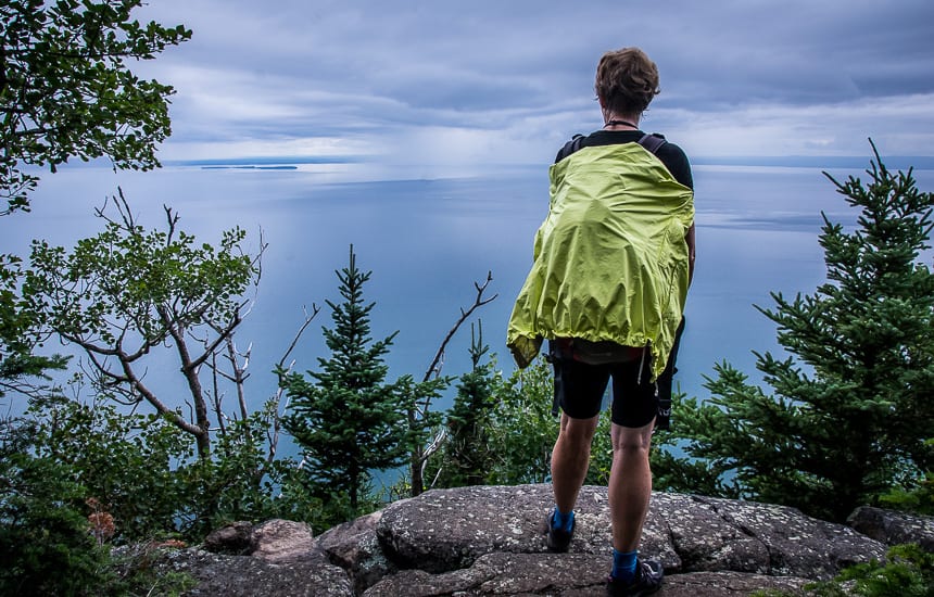
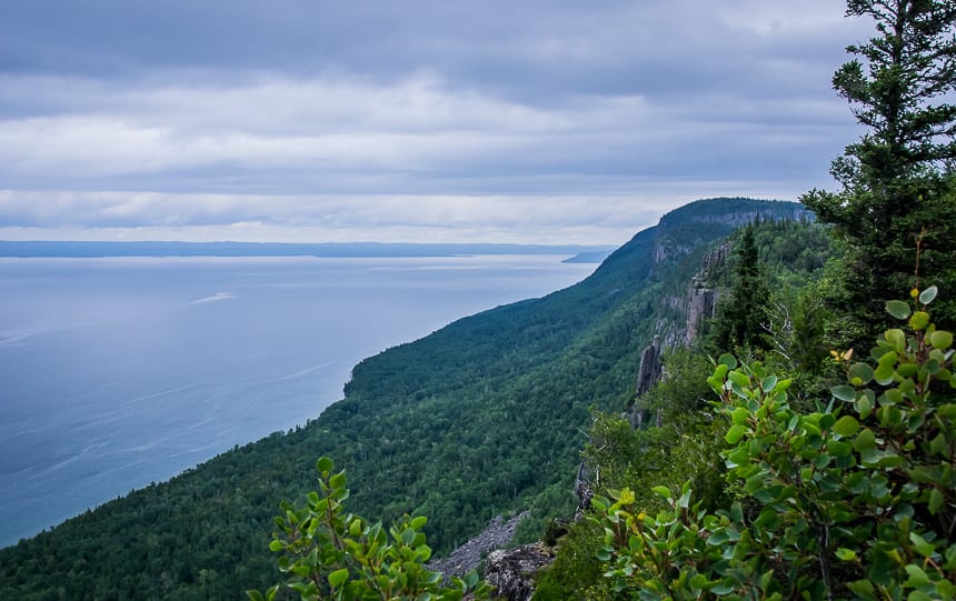
The climbing is steep in places and the trail narrows and becomes rougher underfoot. When you reach the Top of the Giant you are not at the highest point on the trail. That’s still about 45 minutes away. The name is a bit of a tease.

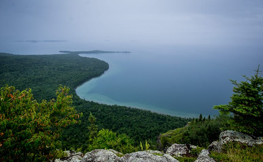
Enjoy superlative Lake Superior views
On the last two kilometres on the Top of the Giant hike, your conditioning program will be tested but still it shouldn’t take more than 40 – 60 minutes to reach the high point. Along the way there are some pretty spectacular views to keep you motivated.
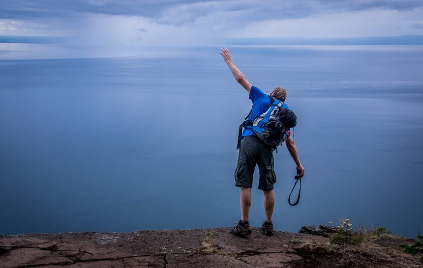
Go to the very end to get the airy view over the cliff. You’ll be at one of the highest points in Ontario overlooking the largest freshwater lake in the world – by area not volume.
Camping in Sleeping Giant Provincial Park
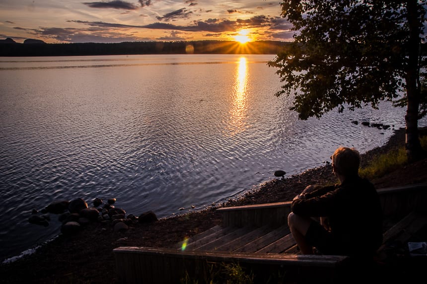
We camped for two nights in Sleeping Giant Provincial Park at the Marie Louise Lake campground. It was a good base to do the Top of the Giant hike. This campground has 200 sites! But if you want to camp just off the Kabeyun Trail, you have a couple of backcountry options too.
Backcountry camping
There are 27 backcountry campsites in the park with the bulk of them along the Kabeyun Trail.
Your best bet if you want to break the Top of the Giant hike into two days is to camp at Tee Harbour where you’ll find a beach and 10 campsites. It’s an easy 6 kilometre hike in from the South Kabeyun trailhead. You will need a backcountry camping permit for the zone, but within the zone, the campsites are first come, first served.
You could hike to the Tee Harbour campsite in the afternoon, camp overnight, hike to the summit with a day back the next morning, and then head back out. You could leave your food in the shared bear box on the summit hike.
Or you could hike to the campsite in the morning, put up your tent, hike to the summit and come back to the tent and enjoy a night on the beach before leaving the next morning.
Another camping option is the Lehtinen’s Bay Zone with three campsites, available on a first come first served basis – with a backcountry reservation. It offers great views even though it’s further away.
You’ll have to hike 7.4 km from the South Kabuyen Trailhead, so you’ll hike 700 m beyond the Talus Lake trail junction.
Make online reservations for both the backcountry and the Marie Louise Lake Campground.
Where to stay in Thunder Bay
If you’d prefer to stay overnight in Thunder Bay you’ll find plenty of options. The city is a 60 – 70 minute drive from Sleeping Giant Provincial Park.
I enjoyed a stay atDelta Hotels by Marriott Thunder Bay. Many of the rooms have water views and there are some nice walking trails nearby.
TheDays Inn– located right off the Trans-Canada Highway would be an affordable choice. It’s rated very good.
If you’d prefer a hostel, check outThe Haven Hostelrated superb. It features a shared lounge and a garden.
Further reading about hiking in northern Ontario
- A Trip to Kakabeka Falls near Thunder Bay
- The Hike to Agawa Falls in Northern Ontario
- A Challenging Hike on the Lake Superior Coastal Trail
- Hiking the Coastal Trail in Pukaskwa National Park
- Hiking the Nokomis Trail, Lake Superior Provincial Park
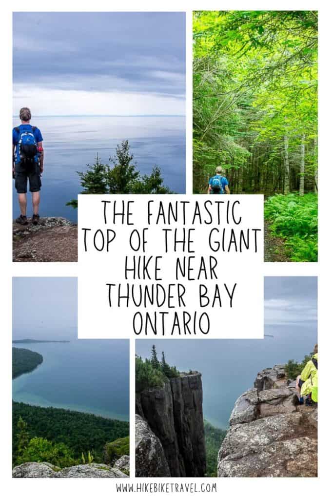
Click on the photo to bookmark to your Pinterest boards.
Thank you to Ontario Parks for the great campsite and to Ontario Travel for making this trip possible.